Transcription
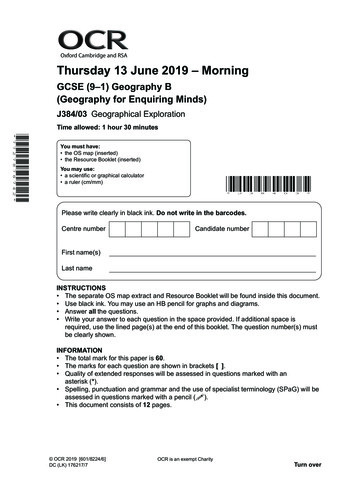
Oxford Cambridge and RSAThursday 13 June 2019 – MorningGCSE (9–1) Geography B(Geography for Enquiring Minds)J384/03 Geographical ExplorationTime allowed: 1 hour 30 minutes* 7 7 2 7 8 7 8 7 4 2 *You must have: the OS map (inserted) the Resource Booklet (inserted)You may use: a scientific or graphical calculator a ruler (cm/mm)*J38403*Please write clearly in black ink. Do not write in the barcodes.Centre numberCandidate numberFirst name(s) Last name INSTRUCTIONS The separate OS map extract and Resource Booklet will be found inside this document. Use black ink. You may use an HB pencil for graphs and diagrams. Answer all the questions. Write your answer to each question in the space provided. If additional space isrequired, use the lined page(s) at the end of this booklet. The question number(s) mustbe clearly shown.INFORMATION The total mark for this paper is 60. The marks for each question are shown in brackets [ ]. Quality of extended responses will be assessed in questions marked with anasterisk (*). Spelling, punctuation and grammar and the use of specialist terminology (SPaG) will beassessed in questions marked with a pencil ( ). This document consists of 12 pages. OCR 2019 [601/8224/6]DC (LK) 176217/7OCR is an exempt CharityTurn over
2Answer all the questions.1(a) Study Fig. 1 in the separate Resource Booklet, map of economic hubs and growth corridorsin England.(i)Explain what is meant by the term ‘economic hub’. [2](ii)How many growth corridors are shown on the map?.(iii)Calculate the distance between the economic hubs of Liverpool and Leeds. km(iv)[1][1]Using your own understanding, explain the pattern of core UK economic hubs. [3] OCR 2019
3(b) Study Fig. 2 in the separate Resource Booklet, data relating to selected economic hubs inEngland.(i)Using data from Fig. 2, calculate the difference between the total number of newbusinesses opening in Liverpool, Manchester and Leeds to those opening in London.Show your working.[2].(ii)Show the average cost of office space per square foot in London compared to Brightonas a ratio in its simplest form.London : Brighton[1]. : .(iii)Calculate the median number of new businesses opening in the economic hubs in 2016.Show your working.[2]. OCR 2019Turn over
4(c)A ‘start-up’ is a newly created company that is typically technology orientated andhas a high potential for growth. They can be very fast growing and often develop aninnovative product.Study Fig. 3 in the separate Resource Booklet, factors that affect the location of start-upbusinesses.Using Fig. 2, Fig. 3 and your own understanding, explain why economic hubs are goodlocations for new start-up businesses. [6] OCR 2019
52Study the OS map extract, a 1:50 000 scale map of Leeds.Leeds is a city in West Yorkshire and is an economic hub.(a) The village of Colton is east of Leeds city centre.Give the six figure grid reference for the picnic site located in Colton.[1].(b) Study Fig. 4 in the separate Resource Booklet, a Desire Line map showing where workers inLeeds city centre live. The map is based on the OS map extract of Leeds.(i)Using Fig. 4 and the OS map extract, which place do the largest number of workers inLeeds city centre commute from?[1].(ii)How could you adapt the Desire Line map to make it clearer?. [1](c)* Study Fig. 5 in the separate Resource Booklet, an extract from a property magazine featuringthree of the suburbs of Leeds.Some people choose to live in residential areas, often on the edge of cities, known assuburbs, and commute to work in Leeds city centre.Using evidence from the OS map extract, Figs 4 and 5 and your own understanding, discussthe reasons why people may choose to live in the suburbs but commute into the city centrefor work.[12]. OCR 2019Turn over
6. OCR 2019
73(a) Study Fig. 6 in the separate Resource Booklet, a fact file on the flooding of the River Aire inLeeds. The area covered by this map is highlighted on the OS map extract.(i)Give two pieces of evidence from the photographs that suggest the flooding on theSouth Bank in Leeds affected people. [2](ii)Study Fig. 7 in the separate Resource Booklet, a map showing some of the planneddevelopments on Leeds South Bank. The area covered by this map is highlighted on theOS map extract.Using one piece of evidence from Fig. 7, explain why the South Bank proposal would bebeneficial for Leeds. [3](iii)Suggest an alternative way of presenting the plan information shown in Fig. 7. [1] OCR 2019Turn over
8(b) Using Figs. 6 and 7 and your own understanding, explain why river basin management isneeded to overcome contemporary challenges that affect life in the city. [6] OCR 2019
94*Using the information in the separate Resource Booklet, the OS map extract and your ownunderstanding:1.Evaluate the economic and environmental sustainability of Leeds.2.Suggest one way in which Leeds can attempt to achieve greater long-term sustainability. [12]Spelling, punctuation and grammar and the use of specialist terminology ( ) [3]END OF QUESTION PAPER OCR 2019
10ADDITIONAL ANSWER SPACEIf additional space is required, you should use the following lined page(s). The question number(s)must be clearly shown in the margin(s). OCR 2019
11. OCR 2019
12.
2 Study the OS map extract, a 1:50 000 scale map of Leeds. Leeds is a city in West Yorkshire and is an economic hub. (a) The village of Colton is east of Leeds city centre. Give the six figure grid reference for the picnic site located in Colton. [1] (b) Study Fig. 4 in the separate Resource Booklet, a Desire Line map showing where workers in
