Transcription
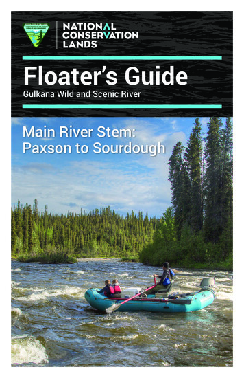
Floater’s GuideGulkana Wild and Scenic RiverMain River Stem:Paxson to Sourdough
LegendD E N ALGulkana Wild and ScenicRiver corridor boundaryRoadI HWYDelta WaysMP 21.5RiverRapidsCampgroundgl eTanBoat LaunchM a cl areivnRerALPN o r t h BranchSoutherTyoneRivBranc hHAN
Tangle LakesCampgroundRiv ersideeMP 21UpperTangleLakesMiDickeyLakeDENAHLIWYPaxsonMP 185.5to Summit LakeSwedeLakeddleFoPaxsonLakerkMP 175GUNM AIIVA RLKStartHereANABET HILLSPaxson onLakeH ARDSON HWRRICYWestEMEForkSourdough CreekCampgroundFishLakeMP 147End Hereto Glennallen1
Middl e ForPaxsonLakekPaxson LakeCampgroundMP 17512erR ivwN4RI6CanyonLakeKUL789GWe st F o rkFishLakeYANAREV5Canyon Rapids(Portage)H ARDSON HWMRICSTEflo3MAIOn the following pages youwill find 11 detailed rivermaps. The maps start atPaxson Lake Campgroundand end at SourdoughCreek Campground.Sourdough CreekCampground10MP 14711Legend for Maps 1-111-2 tents3-4 tents5-6 tents}Recommended campsites basedon number of tents each canaccommodate most comfortablyGulkana Wild and Scenic River corridor boundary1.520.3rightriver miles calculated from Paxson outletriver mile and location of campsite (river right or river left)
Using this guide to help planyour trip on the GulkanaThis floater’s guide is organized to helpyou better plan your Gulkana trip byrecommending and giving descriptionsof campsites along the river. You can usethis information to determine how fardownriver the next suitable campsite foryour group may be and Class I-III rapidlocations.If you are easily impacted by other users,the guide gives you options for campsitesjust before and after “bottleneck” areaslike the confluence of the Main Stem andthe Middle Fork and the portage areaaround Canyon Rapids.Please do not create new campsiteswithin the corridor. Newly created sitesare difficult to rehabilitate and can last formany years, impacting the wild characterof the river corridor.River managers are trying to encouragethe use of appropriate, sustainablecampsites along the river corridor. Byusing campsites appropriate for yourgroup size, you will be helping to limitfurther impacts to the site.Ask yourself . . . what size campsite willthe group require? what time of the dayis it? are we able to push onto the next site? if we don’t stop here,will there be more sitesavailable downriver orwill they all be taken? are we easily impactedby other users?Example: It is late in the day.You have just finished runningyour boats through CanyonRapids, where you had plannedon camping. There are severalother groups already camped atthe portage area. Upon lookingat the floater’s guide, you find acampsite that is just downriverfrom the portage that will allowyour group to camp in solitudewithout having to float muchfarther downstream.EddyCalm water that is created downstreamof an obstacle (rock or log) in the wateror from a bend in the river.Map scale and orientationeddyeddycutbankgravelbarAll maps are presented at a scale of 1:24,000or 1 inch equals 0.4 miles. They are orientatedriverto match the river bends and turns that you willleftexperience as you are traveling downstream. Anarrow on each map shows the direction of north.riverrightflow of river3
Keeping the banks and water of the Gulkana pristineEvery year, BLM river patrol crews clean up trash, toilet paper, and humanwaste from the banks of the Gulkana River. This garbage, left behindby river users, can alter the pristine nature of the river and negativelyimpact other users’ wilderness experience. Help maintainthe Gulkana Wild and Scenic River through the useof portable toilet systems and a pack it in, pack itout philosophy. A boater dump station is located atSourdough Creek Campground for your convenience.Responsible use of public land will ensure that you canenjoy a quality experience for years to come.Note: GPS locations of the campsites are listed next to each campsitedescription and are approximate and intended to serve as a generalreference only. GPS locations are listed using the following system anddatum:System: Latitude/Longitude in Degrees.Minutes.SecondsDatum: WGS 84Personal GPS units should be set to match this coordinate system anddatum for best results in locating campsites.Recommended campsites for river floaters0.2leftTaK’ ATS’ NA’ Cove N62.51.22, W145.36.55 High, upland campsite withgood views of the Paxson Lake outlet and surrounding hills. In Ahtna,TaK’ ATS’ NA’ means “Springwater Creek,” the place where the clearwaters of TaK’ ATS’ Bene’ or “Springwater Lake” become a flowing river.A traditional Ahtna trail crossed here and followed the Middle Forktoward Dickey Lake. Recommended group size: 6. Recommended numberof tents: 3.0.3rightHufman’s Haunt N62.51.25, W145.36.51 Nice, flat upland campingarea. Please respect private property located adjacent to this campsite.L.L. “Doc” Hufman hunted and trapped in the Middle Fork Gulkana areain the 1900’s. Recommended group size: 12. Recommended number oftents: 6.1.0rightWillow Run N62.51.15, W145.37.54 Open, upland campsite in thewillows with good river access for fishing. Recommended group size: 6.Recommended number of tents: 3.2.2left4Neeley Grove N62.51.03, W145.39.43 Shady campsite in a grove ofcottonwood trees. Look for a landing in a small eddy on river left.Tom Neeley ran freight sleds up the Middle Fork to the Valdez CreekMining District in the 1900’s. Recommended group size: 3. Recommendednumber of tents: 1.
Map 1, river miles 0 - 2.4Neeley Grove2.01.5River f l owThe first 3 miles of the MainStem of the Gulkana haveClass II rapids with frequentrocks and some tight turns. Atlow water levels, lining yourcraft may be necessary.1.0Willow Run0.5TaK’ ATS‘ NA’ CoveHufman’s HauntBLM\Dennis Green0.0It takes approximately 3-4 hours to rowfrom Paxson Lake Campground to theoutlet depending on wind.PaxsonLaketo Paxson LakeCampgroundN(approximately4.5 miles from outlet)5
2.6leftFrench Meadow N62.50.53, W145.40.14 Large, multiple use ATV and rivercampsite with many species of Alaska vegetation and wildflowers. Look foran opening on river left, just past a stand of willows and alder. Ben Frenchtrapped and prospected on the Middle Fork of the Gulkana around DickeyLake in the early 1900’s, selling his furs at the Meier’s Roadhouse duringthe summer months. Recommended group size: 12. Recommended number oftents: 6.2.7leftNitiniTAANI Camp N62.50.50, W145.40.11 NitiniTAANI in Ahtna means“End of Trail Camp.” The ridge across from this campsite is where Ahtnatravelers could turn towards Dickey Lake or continue north to villagesand camps along Paxson Lake’s shores. Shady, multiple use ATV andriver campsite in a stand of spruce trees. Recommended group size: 8.Recommended number of tents: 4.2.8islandMoore Island N62.50.48, W145.40.09 Look for the left channel once youreach the Middle Fork confluence to access this multiple use ATV andriver campsite. This campsite is located on an island; use portable rivertoilets. M.W. Slim Moore ran a trapline on the Middle Fork from 1927 to1938 and was recognized as the first professional hunting guide in the area.Recommended group size: 8. Recommended number of tents: 4.2.9rightMeier’s Roadhouse N62.50.44, W145.40.10 Campsite is suitable for largegroups and provides access to the Twelvemile Creek ATV trail. Firewoodis scarce; please do not cut live trees. Charles J. Meier built Meier’sRoadhouse in 1906 which was a popular starting point for the Middle ForkTrail that led to the Valdez Creek Mining District. The roadhouse couldaccomodate forty head of stock and more than 50 people. Recommendedgroup size: 12. Recommended number of tents: 6.3.2left3.3rightGillespie Gulch N62.50.31, W145.39.55 A nice stop just downstream ofthe Middle Fork confluence, located in a shady grove of spruce trees.Recommended group size: 4. Recommended number of tents: 2.Norwood’s Perch N62.50.25, W145.40.04 Shady campsite in a standof spruce with flat tent spots. Approach from the river can be difficult.Al Norwood was a trapper who helped to build the Dawson Cabin andwas known for his moonshine distilling. Recommended group size: 8.Recommended number of tents: 4.3.4leftDawson’s Cabin N62.50.22, W145.39.59 The trapper cabin at this locationwas built in the 1920’s by Barney Dawson and Al Norwood and was used formany years as a winter trapping shelter. Views of the Alphabet Hills can beseen to the west. Recommended group size: 8. Recommended number of tents: 4.4.1leftSquirrel Run N62.49.51, W145.39.54 Nice, secluded campsite nestled in astand of spruce trees. Recommended group size: 8. Recommended number oftents: 4.4.4leftGrassy Knoll N62.49.32, W145.39.59 Flat, grassy open campsite with easyriver access. Recommended group size: 8. Recommended number of tents: 4.4.8rightMonson’s Slough N62.49.13, W145.39.49 Shady campsite with good viewsof the river. This area may have been used by Dawson and Norwood ontheir trapline, as there used to be remnants of an old structure nearby.Recommended group size: 4. Recommended number of tents: 2.6
Map 2, river miles 1.5 - 5.55.5Active bald eaglenest. Please avoidstopping here.5.0Monson’s SloughThe area around the confluenceof the Main Stem and the MiddleFork is accessible by ATV. Pleasebe considerate of other users.4.5Grassy Knoll4.0RiverflowSquirrel RunDawson-Norwood Cabin3.5Dawson’s CabinNorwood’s PerchGillespie Gulch3.0Meier’s RoadhouseM idrkFodleMoore IslandNitiniTAANI Camp1.5Neeley Grove2.0lGuFrench Meadow2.5kanaRiverN7
The impacts of outside forces . . .Knowing various characteristics about a river will give you moreinformation to help plan the kind of river trip you would like to experience.Fourth of July, for example, is not a time to float the Gulkana if you aresearching for solitude. Runoff may be the time to float if you want biggerrapids and a quicker float. The graph below gives you a general idea ofwhat outside factors can impact your floating experience and at whattimes they would most likely occur. Variations are always possible.runoffRiver FlowLevelsVisitationLevels4th ofJulySalmonSeasonChinook andSockeye runsHuntingSeasonseasons openearly AugustMay6.0leftJuneJulyAugustSeptemberBeaver Flats N62.48.14, W145.39.22 Flat, gravel bar site suitable forlarge groups at low water. Recommended group size: 12. Recommendednumber of tents: 6.8.1islandCaribou Island N62.47.19, W145.38.08 Open gravel campsite with goodviews of the river. This campsite is located on an island; use portableriver toilets. Recommended group size: 8. Recommended number of tents: 4.9.6rightOwl Roost N62.46.54, W145.37.34 Hidden upland campsite locatedin stand of spruce. Look for a trail leading from the river into the trees.Owls frequent the blackened, burned area that was caused by a riveruser in 2004. Recommended group size: 4. Recommended number of tents: 2.10.2right8Sourdough Gene N62.46.39, W145.37.42 Sourdough Gene, a Nativeelder from Gakona Village, and his family subsisted all along theGulkana River during the 1920’s. Upland campsite nestled in sprucetrees with nice views of the river. Recommended group size: 8.Recommended number of tents: 4.
Map 3, river miles 5.5 - 11.011.010.5recentlyimpactedby fireSourdough Gene10.09.0Doc Hufman, L.A. Cauter, and Al Norwoodat Paxson Lake Cabin, July 1933 or 1934.Owl Roost9.58.5Caribou Island8.07.5Rirveflow7.06.5The results of a careless river user.Please be responsible with yourcampfires by containing them in afirepan. Fireworks are prohibited withinthe Gulkana Wild and Scenic RiverCorridor.6.0Beaver FlatsN5.59
12.4leftK’EY Camp N62.45.37, W145.35.38 Ahtna used K’ EY, “birch,” to makebaskets and containers. Upland campsite surrounded by dwarf willowand spruce. Recommended group size: 8. Recommended number of tents: 4.13.3islandPotty Island N62.45.22, W145.35.14 Popular island campsite namedfor an outhouse that was once located here. The outhouse wasremoved in 1997 to avoid water contamination. Campsites are found onboth ends of the island, use portable river toilets. Recommended groupsize: 12. Recommended number of tents: 6.13.4right15.6right15.9rightRiver Otter Slough N62.45.15, W145.35.16 Popular campsite formulti-party groups when other users camp at Potty Island. The site isrelatively flat and offers some shade cover under large spruce trees.Recommended group size: 4. Recommended number of tents: 2.Room with a View N62.44.09, W145.34.18 Site is located on top ofa small ridge overlooking the river. Not much shade, but offers greatviews of the meandering Gulkana. Recommended group size: 10.Recommended number of tents: 5.Sentinel Point N62.44.14, W145.33.54 Flat, open campsite with littleshade or tree cover. This is a good stop before the canyon, especially ifit is late in the day. Recommended group size: 4. Recommended numberof tents: 2.Bald and brassy . . . eagles along the GulkanaAs funding has been available, the BLM has conducted annual baldeagle productivity surveys within the Gulkana River watershed since1976. Through these surveys, theBLM has determined that nearly 100nesting territories exist within theGulkana River drainage; however,actual nest occupancy and fledglingproductivity rates vary from year toyear depending on various climaticand biological influences. Correlationof eagle productivity data, identifyingthe amount and types of recreationaluse along specific segments of theGulkana River and its tributaries,enables public land managers todetect trends in eagle productivityrelated to increased recreational useon this popular, road-accessible river.10
Map 4, river miles 11.0 - 16.016.0Sentinel PointRoom with a View15.515.014.5Immature bald eagles have to waitthree to four years to develop thewhite, head feathers that make themso identifiable.14.013.5River Otter SloughPotty Island13.012.5K‘ EYCamp12.0Rirve11.5flowN11.011
Fishing on the Gulkana12Alaska is the last greatstronghold for healthystocks of wild salmon.Your positive actions toprotect upland areas,riverbank vegetationand waterwayshelp sustain thistremendous naturalresource for ourselvesand future generations.USFWSKing Salmon (Chinook) Red Salmon (Sockeye) Grayling Rainbow Trout SteelheadHabitat is everything!Rainbow among reds.While enjoying Alaska’s abundance make sure you areinformed and aware of regulations specific to recreatingand fishing on the Gulkana.Before fishing the Gulkana, refer to AlaskaDepartment of Fish and Game regulationsfor allowable fishing techniques, limitsand permit requirements.Catch and release of fishA successful catch and release is one where the fish swims awayunharmed and lively into the current. Always remember: don’t tire the fish out with a long struggle hold the fish firmly but gently in the lower jaw not the gills, heador belly keep the fish submerged under water for the entire hookremoval and release processSelective harvestSelective harvest is harvesting only the fish you intend to use forfood and releasing the rest of your catch unharmed. This helpsto provide a diversity of fishing opportunities while assuring theconservation of Alaska’s stocks of fish.Learn more at the ADF&G Sport Fish Division Web sitehttp://www.adfg.alaska.gov/index.cfm?adfg divisions.sfmission
The dynamic gravel barGravel bars and islands change every year, depending on how the riverbreaks up and how the water level fluctuates throughout the season.These changes affect the surface area of the gravel bars and the sizeof the stones that are deposited on them. The durable surfaces of gravel bars make them ideal campsitesand camping on a gravel bar makes less of an impact than onfragile upland sites. A particular gravel bar may be ideal one season, and awfulthe next, due to spring breakup. The quality of the gravel barcampsites found in this guide will vary from year to year.Fire ring or trash can?90% of the garbage picked up on theGulkana NWSR is partially burned andpredominantly found in the fire rings.Small fires are not as hot as larger ones and donot allow for trash and aluminum to burn. Theresult is partially burned cans and garbageleft for the next river user to find. Using a firepan and being sure to pack out all garbage willhelp reduce the amount of litter on the banksof the Gulkana River.What doesn’tburn? glass bottles aluminum foil aluminum used towrap candy bars aluminum cans plastic bottles tin cans shell casings twist tiesFire pans, like the one shown right, providethe ambiance of a campfire without theimpacts. Because the fire pan must bepacked out, it encourages the properdisposal of all garbage in a trash baginstead of burning it. Ashes from a firepan should be packed out as well.13
yddteailSmoothLandingNaghiLENdenSpruce Hide-outLast Chance N62.43.40, W145.34.07 Laststop before the canyon. A good campsitefor smaller groups, especially late in the day.PortageRecommended group size: 6. RecommendedPeaknumber of tents: 3.portage Portage Peak N62.43.05, W145.35.06siteLocated at the top of and halfway throughthe portage, this campsite is small but in aconvenient location. Recommended groupsize: 4. Recommended number of tents: 2.anC16.7rightR a p id sMansfieldCamp BushFoot Tredo nkedystfiryn Lar tage TrailyolasPoCa nregisterstandportage NaghiLENden N62.43.00, W145.35.05siteportageNaghiLENden in Ahtna means “waterfalltake-out &staging areaplace.” Ahtna had to walk their skin boatsaround the rapids to transport game to17.5downriver villages. A small campsite thatserves as canyon overflow, not very privatebut will work in a pinch. Recommended group size: 4.Recommended number of tents: 2.portage Smooth Landing N62.42.59, W145.35.04 Larger campsite that serves assitethe primary take-out location for all canyon floaters. There is no privacy atthis site, but it is flat and can accommodate large groups. Recommendedgroup size: 10. Recommended number of tents: 5.portage Spruce Hide-out N62.42.59, W145.35.01 A secluded campsite nestled insitea stand of spruce; good shade cover and access to the Canyon Lake FootTrail. Recommended group size: 8. Recommended number of tents: 4.portage Mansfield Camp N62.42.57, W145.35.00 Located just beyond SprucesiteHide-out, this campsite offers the most privacy of the canyon sites. Namedafter Gregory L. Mansfield, Vietnam combat veteran who drowned inCanyon Rapids in 1988. “Boat Smart From The Start. Always Wear YourLife Jacket.” Recommended group size: 8. Recommended number of tents: 4.18.1Salmonberry Stash N62.42.53, W145.35.18 Located just downstream fromrightthe canyon, this gravel bar campsite is worth pushing on past the portage,especially if you want to avoid the crowds. Suitable for large groups.Recommended group size: 12. Recommended number of tents: 6.18.8left14Moose Rack Camp N62.42.33, W145.36.06 A gravel bar and uplandcampsite, reachable from the canyon in about a half hour’s float time.Flat tent pads with nice views of the river. Recommended group size: 12.Recommended number of tents: 6.
Map 5, river miles 16.0 - 20.020.0BLM/Dennis Green19.519.0Canyon Rapids at high water.There are Class IIrapids for about 8.5river miles beyondthe canyon.Moose Rack CampCanyonLake18.5Canyon(1m Lakile e Folon otg) Tra18.0Salmonberry StashilCanyon RapidsPortage(see detail)17.5er fR ivCanyon Rapids is a series ofrapids in a narrow channelof the river. They are ratedClass III-IV depending onwater levels. Scout therapids before running themto minimize risk.l ow17.0Last Chance16.5NRoom with a View16.015.515
20.7right22.2right23.2leftAlvin’s Bar N62.41.51, W145.38.37 Large, open campsite suitablefor the largest groups with interesting views of the river bluffs justdownstream. This site has numerous flat tent pads and easy accessto the river. Alvin Paxson built the Paxson Roadhouse in 1907 whichserved as a stopping point on the trail west across the Tangle Lakesregion towards the Valdez Creek Mining District. Recommended groupsize: 12. Recommended number of tents: 6.Sunny Bar N62.41.06, W145.40.19 Large, open gravel bar campsitethat changes character annually due to breakup. Although this site isa bit rocky, it is a good choice for larger groups when no other site canbe found to accommodate the number of people. Recommended groupsize: 10. Recommended number of tents: 5.Fireweed Flats N62.40.54, W145.41.52 Look for the landing in asmall eddy on river left. Shady campsite surrounded by spruce trees.Recommended group size: 6. Recommended number of tents: 3.Early September morning mist at Alvin’s Bar campsite. Late Augustand early September can be a relaxing time to float the Gulkana. Thecrisp mornings signal the end of the salmon runs and the associatedanglers. Aspen start to turn bright yellow and an occasional cariboumay put on a show by swimming across the river.16
23.5Map 6, river miles 20.0 - 24.0Fireweed Flats23.0The rapids just below the canyon are agreat place to teach river canoeing skills.22.5Sunny Bar22.0Average TemperaturesPaxson, Alaska374750443521.5wHigh mber53River floTemperatures are in degrees Fahrenheit21.0Alvin’s Bar20.5N20.017
24.8right28.0left29.0leftCottonwood Corner N62.40.10, W145.43.08 Located next to a standof cottonwood trees, this campsite has nice, flat tent pads and is agood break from the rapids. Recommended group size: 6. Recommendednumber of tents: 3.Long Bar N62.38.17, W145.43.12 Long gravel bar suitable for largergroups at low water. Recommended group size: 8. Recommended numberof tents: 4.Joe Secondchief N62.38.23, W145.43.03 Upland campsite in astand of spruce trees. Look for the eddy on river left just next to thecampsite. Named after an Ahtna trapper in the lower Gulkana Riverregion. Recommended group size: 12. Recommended number of tents: 6.History that travels along the riverbanksFor hundreds of years, Native Americans, trappers, prospectors, miners,freighters, and modern adventurers motivated by survival, wild game,furs, minerals, and pleasure have followed the course of the GulkanaRiver and its tributaries. Evidence from within the Gulkana Riverwatershed indicates that the Ahtna Athabaskans occupied the area atleast 1,500 years ago, with villages locatedat Bear Creek, Gulkana, and Paxson Lake.Miners penetrated the area en masse duringthe late nineteenth century after the Klondikegold rush of 1898, and after the discoveryof gold at Valdez Creek in the upper Susitnaregion in 1903.Neeley Trapper CabinPaxson Lodge184-Mile Trapper CabinDuring the gold rush era, roadhouses spreadthroughout the region, serving as valuablestaging points for miners and freighterstraveling along the West Fork and MiddleFork trails to reach the Valdez Creek MiningDistrict. Horse- drawn caravans and dogteams laden with mining equipment andsupplies followed the frozen Gulkana Riverinto the Upper Susitna drainage. Althoughthe Gulkana route to the mines practicallydisappeared upon the completion of theAlaska Railroad to Cantwell in 1919, the riverstill continues to provide access for modernday hunters, trappers, and river enthusiasts.
Map 7, river miles 24.0 - 29.529.529.028.5JoeSecondchief28.0Long Bar27.5erR ivflow27.026.526.025.525.0Bluffs and gravel bars line the riverbanksalong the lower stretch of the GulkanaRiver.Cottonwood Corner24.524.0N19
sham Bar N62.37.27, W145.42.01 Flat, open gravel bar. Thiscampsite receives substantial sunlight on sunny days. L.S. Wickershammined, trapped, and freighted in and out of the Valdez Creek MiningDistrict on the Denali Highway via the Gulkana River in 1916 and 1917.Recommended group size: 12. Recommended number of tents: 6.Stickwan Bar N62.37.16, W145.41.27 Large, open gravel bar area. Tentpads are screened from the river by small stands of willow, providingextra privacy. Named after a Native miner and trapper from GulkanaVillage. Recommended group size: 8. Recommended number of tents: 4.Tenas Pete Bluff N62.37.22, W145.40.45 Campsite is located acrossfrom a bluff. Look for the trail leading into the bushes, where you willfind nice tent pads on fine gravels. Named after a Native miner andtrapper who operated in the Gulkana River region. Recommended groupsize: 8. Recommended number of tents: 4.Monohan Flats N62.36.49, W145.39.28 Open upland area with an easygravel landing. Peter Monohan was commonly referred to as “one ofthe most reliable and best informed prospectors in Alaska” during theearly 1900’s and was one of the first men to discover gold at ValdezCreek. Recommended group size: 6. Recommended number of tents: 3.HwTSII K’AE N62.36.39, W145.39.17 Upland campsite nestled inspruce trees with a nice view of the river. This is the last site beforethe West Fork confluence. Recommended group size: 8. Recommendednumber of tents: 4.Multiple use - Multiple usersAround river mile 35, floaters can expect to see motorized craft travelingboth up and downstream. When you encounter a motorized craft,remember: motorized boats should becourteous of non-motorizedboats in narrow river sectionsand in rapids the wake of a motorized boatcan easily swamp a canoe a non-motorized boat shouldrow to one side to allow themotor boat to maneuverthrough the deeper channel20
Map 8, river miles 29.5 - 34.034.01900’s prospector,Peter MonohanHwTSII K’AE33.533.0Monohan FlatsHwTSII K’AE in Ahtnameans “Beaver DamPlace.” This was thelast place on the rivermany Ahtna wouldplace fish traps sincethey believed thatsalmon upstreamfrom this area didn’ttaste as good.32.532.031.5Tenas Pete Bluff31.0Stickwan Barer fR ivl ow30.5Wickersham BarHorace Wickersham, Anne, and L.S.Wickersham at Valdez Creek, Alaska.N30.021
Counting the Gulkana’s fishFor the last several years, the BLM has workedcooperatively with the Alaska Department ofFish and Game (ADF&G) to operate and managea fish counting tower on the Main Stem of theGulkana River. This work is to more accuratelyestimate the annual return of Chinook andsockeye salmon to the Gulkana. The information collected provides aclear picture of escapement numbers, the strength of returning salmonruns, and valuable data to fisheries biologists. The tower, shown belowoperates from June through mid-August, 24 hours a day, 7 days a week.Biologists count the fish as they pass over the light-colored tarp.EscapementThe number of fishallowed to escape capture,participate in spawning, andcomplete the life cycle. Thenumber is established byADF&G to achieve maximumsustained populations.36.8left37.1left22Nicklie Bar N62.34.35, W145.37.37 Large gravel bar campsite locatedjust upstream of the West Fork confluence. The character of this sitechanges annually due to breakup. Named after a Native trapper andminer in Valdez Creek. Recommended group size: 8. Recommendednumber of tents: 4.West Fork Confluence N62.34.27, W145.37.31 Large gravel barcampsite located at the West Fork confluence. There may be othergroups camped here, as it is a very popular stop for motorized usersand a great location for king salmon fishing. Camping is available inmultiple locations on the large gravel bar. Recommended group size: 12.Recommended number of tents: 6.
Map 9, river miles 34.0 - 38.038.037.5West ForkConfluence37.0Nicklie BarOle Nicklie and hischild36.536.0Rfish countingtowerriveflow35.535.034.5Ole Nicklie sledding supplies to Denali in the winter of 1934.N34.023
38.2leftTansey Bar N62.33.53, W145.36.23 Upland campsite with gravel barlanding. Look for a trail leading through the bushes into the trees.Jake Tansey, an Ahtna Native, pioneered a route from the headwatersof the Susitna River, up the Tyone River, and down the West Forkof the Gulkana River to Copper Center. Recommended group size: 8.Recommended number of tents: 4.38.6rightChinook Bar N62.33.59, W145.35.50 Large, grassy upland area easilyseen from the river. Recommended group size: 6. Recommended numberof tents: 3.39.0left40.8right42.0left42.3right24Hoyt Bar N62.33.42, W145.35.43 Upland campsite with gravel barlanding. Look for a trail leading through the bushes into the trees.Charles Levi Hoyt was a popular miner, trapper, and postmaster whoestablished the Gulkana Trading Post and Hotel in 1907 at Gulkana.Recommended group size: 8. Recommended number of tents: 4.Allen Bar N62.33.49, W145.33.59 Gravel bar campsite that changescharacter annually due to breakup. Lt. Henry Allen of the U.S. Armyexplored the Copper River region in 1885 and was probably one of thefirst white men to view the mouth of the Gulkana, which he namedTonkina. Recommended group size: 8. Recommended number of tents: 4.Hart Bar N62.33.12, W145.32.54 Upland and gravel bar campsite,suitable for larger groups. John Hart originally opened the SourdoughRoadhouse in 1903. Recommended group size: 12. Recommended numberof tents: 6.Yaeger Bar N62.33.13, W145.32.26 Last campsite before the take-outat Sourdough, has large gravel bar beach and good fishing access. Mrs.Nellie Yaeger, owner of the Sourdough Roadhouse between 1908 and1922, was well known for her good cooking and hospitality.Recommended group size: 12. Recommended number of tents: 6.Sourdough Roadhouse on the Valdez-Fairbanks Road with Mrs. N Yaeger asproprietor.
44.5PipelineMap 10, river miles 38.0 - 44.5Tranls-Aaska44.043.5Keeping your group sizebelow 12 people helps tomaintain the wild characterof the Gulkana River.43.0Other advantages of asmaller group size include:42.5 easier to find campsitesthat can accommodateyour groupYaeger Bar42.0 fewer people make lessnoise and are more likelyto see wildlifeHart Bar a smaller group has asmaller footprint on theland having less impacton the fragile riparianvegetationw41.5River flo smaller groups haveless of an impact on thewilderness experience ofother river users41.0Allen Bar40.539.0Jake Tansey and family inCantwell, late 1940’s39.540.0Hoyt BarChinook BarN38.5Tansey Bar38.025
rdSou SourdoughCreekMap 11, river miles 44.5 Campground- ipelineNf l ow44.5ranls-Aaska44.0“Move over, I was here first!”43.5- S
Recommended campsites for river floaters. TaK' ATS' NA' Cove. N62.51.22, W145.36.55 High, upland campsite with . good views of the Paxson Lake outlet and surrounding hills. In Ahtna, TaK' ATS' NA' means "Springwater Creek," the place where the clear waters of TaK' ATS' Bene' or "Springwater Lake" become a flowing river.