Transcription
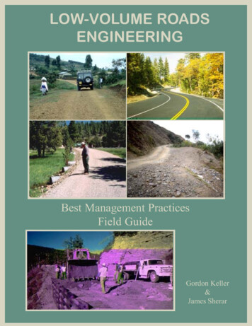
LOW-VOLUME ROADSENGINEERINGBest Management PracticesField GuideGordon Keller&James Sherar
Low-Volume RoadsEngineeringBest Management PracticesField GuideByGordon Keller, PEGeotechnical EngineerUSDA, Forest ServicePlumas National Forest, CaliforniaandJames Sherar, PELogging EngineerUSDA, Forest ServiceNational Forests of North CarolinaProduced forUS Agency for International Development (USAID)In Cooperation withUSDA, Forest Service, International Programs&Conservation Management Institute,Virginia Polytechnic Institute and State UniversityJuly 2003LOW-VOLUME ROADS BMPS: i
photo hereInformation contained in this document has been developed for the guidance of road builders,road managers, and resource specialists in most geographic areas to help build better, more costeffective roads, and roads that minimize adverse environmental impacts and protect water quality.The U.S. Department of Agriculture (USDA) or U.S. Agency for International Development(USAID) assumes no responsibility for the interpretation or use of this information. The use oftrade, firm, or corporation names is for the information and convenience of the reader. Such usedoes not constitute an official evaluation, conclusion, recommendation, endorsement, or approvalof any product or service to the exclusion of others that may be suitable.The U.S. Department of Agriculture and U.S. Agency for International Development prohibitdiscrimination in all their programs and activities on the basis of race, color, national origin, sex,religion, age, disability, political beliefs, sexual orientation, or marital or family status. (Not allprohibited bases apply to all programs.) Persons with disabilities who require alternative means forcommunication of program information (braille, large print, audiotape, etc.) should contact USDA’sTARGET Center at (202)-720-2600 (voice and TDD).To file a complaint of discrimination, write USDA, Director, Office of Civil Rights, Room 326W, Whitten Building, 1400 Independence Avenue, SW, Washington, D.C. 20250-9410, or call(202) 720-5964 (voice and TDD). USDA is an equal opportunity provider and employer.LOW-VOLUME ROADS BMPS: ii
LOW-VOLUME ROADS ENGINEERINGBest Management Practices Field GuideFOREWORDThe Conservation Management Institute (CMI) in the College of Natural Resources atVirginia Tech is dedicated to helping apply sound scientific principles to the managementof renewable natural resources around the world. Access is an important considerationin many settings — not only to facilitate utilization of natural resources, but also to enable peopleto reach markets for their products and health services. However, it is vital that roads constructed provide adequate access while following sound practices for environmental protectionwherever possible. Improperly constructed roads can negatively impact everything from terrestrial plant populations and soil conservation efforts to water quality and populations of aquaticorganisms in receiving waters.This manual was originally published in Spanish as “Practicas Mejoradas de CaminosForestales” by the U.S. Agency for International Development (USAID) for use throughoutLatin America, and has proven valuable in helping to protect forest-based resources. It becameclear that the practical advice offered in this manual could be of value to resource managersthroughout the world. So, to reach this broader audience and inspired by the original Spanishwork, CMI and the USDA Forest Service have collaborated to produce this updated version inEnglish. We hope that the materials presented here are useful to you.This project grew from our collaboration with Gerald Bauer, of the US Forest Service, onnatural resource education programs in Latin America. Mr. Bauer was a contributor to theoriginal manual and found the publication in great demand. This collaboration exemplifies ourinvolvement with USAID and the Forest Service on many natural resource projects. Weencourage you to contact USFS or CMI if we can be of assistance in your conservation efforts.Finally, we acknowledge the notable efforts of Julie McClafferty of CMI, who was instrumentalin preparing this manual for publication.B. R. Murphy, PhD., Director, CMI (murphybr@vt.edu)A.L. Hammett, PhD., Faculty Fellow, CMI and Coordinator of International Programs, Collegeof Natural Resources (himal@vt.edu)Gordon Keller, PE, Geotechnical Engineer, USFS (gkeller@fs.fed.us)James Sherar, PE, Logging Engineer, USFS (jrs4trees@aol.com)LOW-VOLUME ROADS BMPS: iii
LOW-VOLUME ROADS BMPS: iv
ACKNOWLEDGMENTSALARGE NUMBER OF INDIVIDUALS have been involved in the developmentof the MinimumImpact Low-Volume Roads Manual and this subsequent Low-Volume RoadsEngineering Best Management Practices Field Guide. These individuals have had thevision and commitment to preserving and enhancing the quality of our environment, while alsorecognizing the need for good roads. Futhermore, they recognize the planning, design, maintenance, and overall management necessary to have good roads. Funding for this project hasprincipally been provided by the US Agency for International Development (USAID), theGlobal Bureau, and the Forestry Team, with contributions from the USDA, Forest Service, Office of International Programs, the Pacific Southwest Region, and the PlumasNational Forest.The original Spanish version of this document was produced with the help of Ramon Alvarez,Roberto Medina, and Atilio Ortiz with USAID, Honduras. The authors are particularly grateful forthe support of Jerry Bauer, Alex Moad, and Michelle Zweede with the International Programsoffice of the U.S. Forest Service; Jim Padgett and Nelson Hernandez from the Washington Office,USFS; Scott Lampman, Paul DesRosiers, and Mike Benge with the U.S. Agency for InternationalDevelopment; and the steadfast support from our Plumas National Forest colleagues.The drawings presented in this document come from a variety of sources, as indicated, and mosthave been redrawn or adapted with the artistic talent of Jim Balkovek, Illustrator, and Paul Karr,a retired Forest Service Engineer. Scanning, labeling, and computer manipulation of figures for thisfield guide have been accomplished with the skill and patience of Lori Reynolds of ReynoldsGraphics in Quincy, California. Translation of portions of this Field Guide and the original Minimum Impact Low-Volume Roads Manual was skillfully accomplished by Alejandra Medina of theVirginia Tech Transportation Institute.A sincere thanks to the many professionals and laymen who gave their time in reviewing and editingthe document, as well as making valuable suggestions regarding the form and content of this FieldGuide. Particular thanks to Jill Herrick, U.S. Forest Service, for her valuable contributions andassistance with editing this guide, assistance with the Definition of Terms and References, andoverall content review, as well as to Michael Furniss, Charlie Carter, Jerry Short, Tim Dembosz,and Ozzie Cummins for their numerous suggestions and ideas on drainage and other issues. Thanksto Richard Wiest, author of “A Landowner’s Guide to Building Forest Access Roads”, for hisinspiration and ideas on format and layout. Other individuals involved in review and editing includeLeslie Lingley of Leslie Geological Services; Marty Mitchell of Clear Water West; Alfred Logiewith the International Programs office of the Federal Highway Administration (FHWA); MikeBenge and Eric Peterson with U. S. Agency for International Development; Dr John Metcalf fromLSU/PIARC World Roads Association; Dr. Francis Greulich, Forest Engineer at the University ofWashington; Dr. Allen Hathaway, Geologic Engineer at the University of Missouri-Rolla; DavidLOW-VOLUME ROADS BMPS: v
Orr, PE with the Cornell University Local Roads Program; Prof. Raymond Charles, University ofWest Indes; Art Klassen, Tropical Forestry Foundation; James Schenck and Wilson Castaneda,Cooperative Housing Foundation-Guatemala; Harold Tarver with Africare; Wes Fisher with TellusInstitute; and Sandra Wilson-Musser, Corky Lazzarino, Armando Garza, Gary Campbell, KenHeffner, Terry Benoit, Allen King, John Heibel, William Vischer, and Greg Watkins, U.S. ForestService employees dedicated to watershed protection and building good roads.Most of the photos used in this manual either belong to the authors, Gordon Keller and JamesSherar, or to Jerry Bauer, co-author on the “Minimum Impact Low-Volume Roads” Manual.Others belong to individuals as indicated on the specific photo. The retaining wall photo on thecover was provided by Michael Burke.Finally, the authors wish to give special thanks to Tom Hammett at Virginia Tech for his connections and facilitation of this project and Julie McClafferty of the Conservation Management Institute and Patty Fuller of Poplar Hill Studios in Blacksburg, Virginia, for their magic in layout andpublication of this guide and making it look the way it does. Last, and by no means least, a big hugto our wives, Jeanette and Julie, and families for their patience and support during this project!LOW-VOLUME ROADS BMPS: vi
PREFACETHE AUTHORS ARE GRATEFUL for the opportunity to develop this guide for the US Agency forInternational Development (USAID) with the cooperation of the USDA, the Forest Service,the Office of International Programs, and the International Programs Department at VirginiaPolytechnic Institute and State University. The original development of this Roads Best ManagementPractices (BMP) Field Guide was funded by USAID/Honduras, in support of their ForestryDevelopment Program (FDP) and their National Forestry School (ESNACIFOR). It has sincebeen revised and expanded to be consistent with and complement the training manual titled“Minimum Impact Low-Volume Roads” for roads work in developing regions.This Low-Volume Roads Engineering Best Management Practices Field Guide is intended toprovide an overview of the key planning, location, design, construction, and maintenance aspectsof roads that can cause adverse environmental impacts and to list key ways to prevent thoseimpacts. Best Management Practices are general techniques or design practices that, whenapplied and adapted to fit site specific conditions, will prevent or reduce pollution and maintainwater quality. BMPs for roads have been developed by many agencies since roads often have amajor adverse impact on water quality, and most of those impacts are preventable with goodengineering and management practices. Roads that are not well planned or located, not properlydesigned or constructed, not well maintained, or not made with durable materials often have negative effects on water quality and the environment.This Guide presents many of those desirable practices. Fortunately, most of these “Best Management Practices” are also sound engineering practices and ones that are cost-effective by preventing failures and reducing maintenance needs and repair costs. Also keep in mind that “best” isrelative and so appropriate practices depend to some degree upon the location or country, degreeof need for improvements, and upon local laws and regulations. Best practices are also constantlyevolving with time.This guide tries to address most basic roads issues in as simple a manner as possible. Complexissues should be addressed by experienced engineers and specialists. Included are key “DO’s”(RECOMMENDED PRACTICES) and “DON’Ts” (PRACTICES TO AVOID) in lowvolume roads activities, along with some relevant basic design information. These fundamentalpractices apply to roads worldwide and for a wide range of road uses and standards. Oftenrecommended practices have to be adapted to fit local conditions and available materials. Additional information on how to do the work is found in other Selected References, such as the“Minimum Impact Low-Volume Roads Manual”.LOW-VOLUME ROADS BMPS: vii
Most practices apply to a wide range of road standards, from native surfaced, single-lane roads todouble-lane paved roads. Desirable general practices include good road planning and location,performing environmental analysis, recognizing the need for positive surface drainage, ensuringadequately sized drainage crossing structures, using stable cut and fill slopes, using erosion controlmeasures, developing good materials sources, and reclaiming sites once work has been completed.Certain design practices, such as use of rolling dips, outsloped roads, or low-water stream crossings, are very cost-effective and practical but typically apply to low-volume, low-speed roadsbecause of safety concerns, vertical alignment issues, or unacceptable traffic delays. Other issues,such as the use of log stringer bridges, are very desirable for stream crossings in developingregions to avoid driving through the water, yet their use is now discouraged by some agencies,such as the U.S. Forest Service, because of their short design life and potentially unpredictableperformance. Thus the information presented herein must be considered in terms of local conditions, available materials, road standards, project or resource priorities, and then applied in amanner that is practical and safe.Local rules, agency policies or regulations, or laws may conflict with some of this information ormay include more specific information than that included herein. Thus, good judgment should beused in the application of the information presented in this guide, and local regulations and lawsshould be followed or modified as needed.You may reproduce or copy any portion of this Guide. However, please acknowledge this Guideas the source of information.Reproduction Of This Field Guide is Encouraged!DisclaimerThis Field Guide does not constitute a standard, specification, or regulation from or bound on anyprofessional group, agency, or political entity. It is intended only as a guide for good roads engineering and sound environmental management in developing countries based upon the professional judgment and experience of the authors.LOW-VOLUME ROADS BMPS: viii
LOW-VOLUME ROADS ENGINEERINGBest Management Practices Field GuideTABLE OF ition of TermsxiChapter 1Introduction1Chapter 2Environmental Analysis5Chapter 3Planning Issues and Special ApplicationsKey Road IssuesReducing Vulnerability of Roads to Natural DisastersStreamside Management ZonesTimber Harvesting11Chapter 4Low-Volume Roads EngineeringRoad PlanningRoad LocationRoad Survey, Design, and ConstructionRoad CostsRoad MaintenanceRoad Closure21Chapter 5Hydrology for Drainage Crossing Design37Chapter 6Tools for Hydraulic and Road Design43Chapter 7Drainage of Low-Volume RoadsRoadway Surface Drainage ControlControl at Inlets and Outlets of Cross-Drains and DitchesNatural Stream CrossingsWet Areas and Meadow Crossings, Use of Underdrains53LOW-VOLUME ROADS BMPS: ix
Chapter 8Culvert Use, Installation, and Sizing75Chapter 9Fords and Low-Water Crossings91Chapter 10Bridges97Chapter 11Slope Stabilization and Stability of Cuts and Fills103Chapter 12Roadway Materials and Material Sources115Chapter 13Erosion Control129Chapter 14Stabilization of Gullies141Selected ReferencesLOW-VOLUME ROADS BMPS: x147
DefinitionTermsDefinition of TermsDefinition of TermsDefinitionTermsArranged by Topic:Section ISection IISection IIISection IVSection VSection VISection VIIRoad ComponentsRoad Structural Section and MaterialsSurface DrainageCulverts and Drainage CrossingsFords and Low Water CrossingsErosion ControlMiscellaneous TermsixxiixiiixvxviixviiixxI. ROAD COMPONENTSFigure (I.1): Terms Used to Define Low-Volume RoadsLOW-VOLUME ROADS BMPS: xi
Figure (I.2) Terms Used to Define Low-Volume Roads (Cross-Section)Base Course - See Section II below.Berm - A ridge of rock, soil, or asphalt, typically along the outside edge of the road shoulder, used to controlsurface water. It directs surface runoff to specific locations where water can be removed from the road surfacewithout causing erosion.Buttress - A structure designed to resist lateral forces. It is typically constructed of large riprap rock, gabions,or drained soil to support the toe of a slope in an unstable area.Cross-Section - A drawing depicting a section of the road sliced across the whole width of the road (SeeFigure I.2 above). Can also apply to a stream, a slope, or a slide.Cut Slope (Back Slope or Cut Bank) - The artificial face or slope cut into soil or rock along the inside edgeof the road.Cut-and-fill - A method of road construction in which a road is built by cutting into the hillside and spreadingthe spoil materials in adjacent low spots and as compacted or side-cast fill slope material along the route. A“balanced cut-and-fill” utilizes all of the “cut” material to generate the “fill”. In a balanced cut-and-fill designthere is no excess waste material and there is no need for hauling additional fill material. Thus cost is minimized.Ditch (Side Drain) - A channel or shallow canal along the road intended to collect water from the road andadjacent land for transport to a suitable point of disposal. It is commonly along the inside edge of the road. Italso can be along the outside edge or along both sides of the road.End Haul - The removal and transportation of excavated material off-site to a stable waste area (rather thanplacing the fill material near the location of excavation).Embankment (Fill) - Excavated material placed on a prepared ground surface to construct the road subgradeand roadbed template.LOW-VOLUME ROADS BMPS: xii
Fill Slope (Embankment Slope) - The inclined slope extending from the outside edge of the road shoulder tothe toe (bottom) of the fill. This is the surface formed where material is deposited to build the road.Full Bench Cut and End Haul - A method of road construction in which a road is built entirely by cutting awaythe slope, and the excess material is hauled away (end hauled) to an off-site disposal area.Grade (Gradient) - The slope of the road along its alignment. This slope is expressed in percent - the ratio ofelevation change compared to distance traveled. For example, a 4% grade indicates a gain of 4 units ofmeasure in elevation for every 100 units of measure traveled.Low-Volume Road - A type of transportation system typically constructed to manage or extract resources fromrural or undeveloped areas. These unique systems are designed to accommodate low traffic volumes withpotentially extreme axle loads. They are commonly defined as having less than 400 ADT (Average Daily Traffic).Natural Ground (Original Ground Level) - The natural ground surface of the terrain that existed prior todisturbance and/or road construction.Plan View (Map View) - View seen when looking from the sky towards the ground. A drawing with this viewis similar to what a bird would see when flying over a road.Reinforced Fill - A fill that has been-provided with tensile reinforcement through frictional contact with thesurrounding soil for the purpose of greater stability and load carrying capacity. Reinforced fills are comprised ofsoil or rock material placed in layers with reinforcing elements to form slopes, walls, embankments, dams orother structures. The reinforcing elements range from simple vegetation to specialized products such as steelstrips, steel grids, polymeric geogrids and geotextiles.Retaining Structure - A structure designed to resist the lateral displacement of soil, water, or any other type ofmaterial. It is commonly used to support a roadway or gain road width on steep terrain. They are often constructed of gabions, reinforced concrete, timber cribs, or mechanically stabilized earth.Right-of-Way (ROW) - The strip of land over which facilities such as roads, railroads, or power lines are built.Legally, it is an easement that grants the right to pass over the land of another.Road Center Line - An imaginary line that runs longitudinally along the center of the road.Roadbed - Width of the road used by vehicles including the shoulders, measured at the top of subgrade.Roadway (Construction Limits or Formation Width) - Total horizontal width of land affected by the construction of the road, from the top of cut slope to the toe of fill or graded area.Side-Cast Fill - Excavated material pushed on a prepared or unprepared slope next to the excavation toconstruct the roadbed. The material is usually not compacted.Slope Ratio (Slope) - A way of expressing constructed slopes as a ratio of horizontal distance to vertical rise,such as 3:1 (3 m horizontal for every 1 m vertical rise or fall).Shoulder - The paved or unpaved strip along the edge of the traveled way of the road. An inside shoulder isadjacent to the cut slope. An outside shoulder is adjacent to an embankment slope.Subgrade - See Section II below.Surface Course (Surfacing) - See Section II below.LOW-VOLUME ROADS BMPS: xiii
Traveled Way (Carriageway) - That portion of the road constructed for use by moving vehicles includingtraffic lanes and turnouts (excluding shoulders).Through Cut - A road cut through a hill slope or, more commonly, a ridge, in which there is a cut slope on bothsides of the road.Through Fill - Opposite of a through cut, a through fill is a segment of road that is entirely composed of fillmaterial, with fill slopes on both sides of the road.II. ROAD STRUCTURAL SECTION AND MATERIALSFigure (II): Road Structural SectionBase Course (Base) - This is the main load-spreading layer of the traveled way. Base course material normallyconsists of crushed stone or gravel or of gravelly soils, decomposed rock, sands and sandy clays stabilized withcement, lime or bitumen.Borrow Pit (Borrow Site) - An area where excavation takes place to produce materials for earthwork, such asa fill material for embankments. It is typically a small area used to mine sand, gravel, rock, or soil without furtherprocessing.Quarry - A site where stone, riprap, aggregate, and other construction materials are extracted. The materialoften has to be excavated with ripping or blasting, and the material typically needs to be processed by crushingor screening to produce the desired gradation of aggregate.Raveling - A process where coarse material on the road surface comes loose and separated from the roadbedbecause of lack of binder or poor gradation of material. The term also applies to a slope where rock or coarsematerial comes loose and falls down the cut or fill slope.Sub-Base - This is the secondary load-spreading layer underlying the base. It normally consists of a materialthat has lower strength and durability than that used in the base, e.g. unprocessed natural gravel, gravel/sand orgravel/sand/clay.Subgrade - The surface of roadbed upon which sub base, base, or surface course are constructed. For roadswithout base course or surface course, this portion of the roadbed becomes the finished wearing surface. Thesubgrade is typically at the level of the in-place material.LOW-VOLUME ROADS BMPS: xiv
Surface Course (Surfacing) - The top layer of the road surface, also called the wearing course. Rock,cobblestone, crushed aggregate and paving, such as Bituminous Surface Treatments and Asphalt Concrete, aretypes of surfacing used to improve rider comfort, provide structural support, and weatherproof the road surfacefor wet season use.Washboarding (Corrugations) - A series of ridges and depressions across the road caused in soil and aggregate road surfaces by the lack of surface cohesion. This is typically a result of the loss of fines in the roadsurface caused by dry conditions or poorly graded material. These conditions worsen with excessive vehiclespeeds and high traffic volumes.Wearing Course (Wearing Surface) –The top layer of the road surface that is driven upon. It should bedurable, may have a high resistance to skidding, and it typically should be impervious to surface water. Wearingsurfaces may be the native soil, aggregate, seal coats, or asphalt.III. SURFACE DRAINAGEFigure (III.1): Road Surface DrainageArmor - Rocks or other material placed on headwalls, on soil, or in ditches to prevent water from eroding andundercutting or scouring the soil.Catch Water Ditch (Intercept Drain) - A flat-bottomed excavation or ditch located above a cut slope that isdesigned to intercept, collect and drain away surface runoff water before it goes over the cut slope, to protectthe cut slope and roadway from erosion.Check Dam (Scour Check, or Dike) - A small dam constructed in a gully or ditch to decrease flow velocity,minimize channel scour, and to trap sediment.Cross-Drain (X-Drain) - Installed or constructed structures such as culverts and rolling dips that move waterfrom one side of the road to the other.Crown - A crowned surface has the highest elevation at centerline (convex) and slopes down on both sides.Crown is used to facilitate draining water off a wide road surface.Debris - Organic material, rocks and sediment (leaves, brush, wood, rocks, rubble, etc.) often mixed, that isundesirable (in a channel or drainage structure).LOW-VOLUME ROADS BMPS: xv
Figure (III.2): Rolling Grade with Rock-Armored Rolling DipsDrainage Structure - A structure installed to control, divert, or move water off or across a road, including butnot limited to culverts, bridges, ditch drains, fords, and rolling dips.French Drain (Underdrain) - A buried trench, filled with coarse aggregate, and typically placed in the ditchline along the road, which acts to drain subsurface water from a wet area and discharge it a safe and stablelocation. French drains may use variable sizes of rock but do not have a drain pipe in the bottom of the trench.Inside/Outside - Reference to a feature on the inside of the road, which is typically the cutslope (back slope)side of the road/ Reference to a feature on the outside of a road, typically on the fill slope side.Inslope - The inside cross-slope of a road subgrade or surface, typically measured in percentage. Inslope isused to facilitate the draining of water from a road surface to an inside ditch. An insloped road has the highestpoint on the outside edge of the road and slopes downward to the ditch at the toe of the cut slope, along theinside edge of road.Lead-Off Ditches (Turnouts, Outside Ditch, or Mitre Drains) - Excavations designed to divert wateraway from the ditch and roadway (at a point where this doesn’t occur naturally) in order to reduce the volumeand velocity of roadside ditch water.Outslope - The outside cross-slope of a road subgrade or surface, typically measured in percentage. Outslopeis used to facilitate the draining of water from a road directly off the outside edge of the road. An outsloped roadhas the highest point on the uphill or inside of the road and slopes down to the outside edge of the road and thefill slope.Riprap - Well-graded, durable, large rock, ideally with fractured surfaces, sized to resist scour or movement bywater and installed to prevent erosion of native soil material.Rolling Dip (Dip, Broad-Based Dip) - A surface drainage structure, with a constructed break in the roadgrade, specifically designed to drain water from an inside ditch or across the road surface, while vehicles travelspeed is somewhat reduced (see lower photo on the cover of this Guide).Underdrain (Subsurface Drain) - A buried trench, filled with coarse aggregate, coarse sand, or gravel, andtypically placed in the ditch line along the road, which acts to drain subsurface water from a wet area anddischarge it a safe and stable location. Underdrains may use a uniform size of rock, be wrapped in geotextile,and have a perforated drain pipe in the bottom of the trench.LOW-VOLUME ROADS BMPS: xvi
Waterbar - A frequently spaced, constructed drainage device, using soil mounds in the road surface, thatinterrupt the flow of water and that diverts water off the road surface. They may be drivable by high clearancevehicles or impassable.IV. CULVERTS AND DRAINAGE CROSSINGSFigure (IV.1): Culvert ComponentsFigure (IV.2): Natural Drainage Crossing with a CulvertApron - An extension of the head wall structure built at ground or stream level and designed to protect thestream bottom from high flow velocities and to safely move water away from the drainage structure.Bankfull Width (Ordinary High Water Width) - The surface width of the stream measured at the bankfullstage. This flow, on average, has a recurrence interval of about 1.5 years. The bankfull stage is the dominantchannel-forming flow, and is typically identified as the normal upper limit of stream channel scour, below whichperennial vegetation does not occur.LOW-VOLUME ROADS BMPS: xvii
Bedload - Sediment or other material that slides, rolls, or bounces along the streambed or channel bottom dueto flowing water.Catch Basin - The excavated or constructed basin at the inlet of a culvert cross-drain pipe, used to store waterand direct it into the culvert pipe.Culvert - A drainage pipe, usually made of metal, concrete, or plastic, set beneath the road surface, to movewater from the inside of the road to the outside of the road, or under the road. Culverts are used to drainditches, springs, and streams that cross the road. The invert is the floor or the bottom of the structure at itsentrance.Drop Inlet - A masonry or concrete basin, or a vertical riser on a metal culvert inlet, usually of the same diameter as the culvert, and often slotted, to allow water to flow into the culvert as water flow rises around theoutside. Drop inlets are often used on ditch relief culverts where sediment or debris would plug the pipe. A dropinlet also helps control the elevation of the ditch.Flood Plain - A level or gently sloping area on either side of a river or stream active (main) channel that issubmerged at times during high water or periods of flooding. Silt and sand are deposited and accumulate in thisarea along the main channel.Freeboard - The additional height of a structure above design high water level to prevent overflow or overtopping. Also freeboard, at any given time, is th
practices apply to roads worldwide and for a wide range of road uses and standards. Often recommended practices have to be adapted to fit local conditions and available materials. Addi-tional information on how to do the work is found in other Selected References, such as the "Minimum Impact Low-Volume Roads Manual".