Transcription
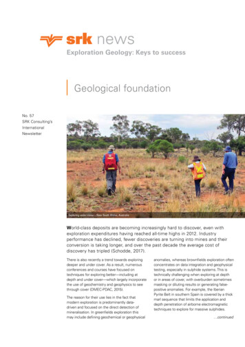
newsExploration Geology: Keys to successGeological foundationNo. 57SRK Consulting’sInternationalNewsletterExploring under cover – New South Wales, AustraliaWorld-class deposits are becoming increasingly hard to discover, even withexploration expenditures having reached all-time highs in 2012. Industryperformance has declined, fewer discoveries are turning into mines and theirconversion is taking longer, and over the past decade the average cost ofdiscovery has tripled (Schodde, 2017).There is also recently a trend towards exploringdeeper and under cover. As a result, numerousconferences and courses have focused ontechniques for exploring better—including atdepth and under cover—which largely incorporatethe use of geochemistry and geophysics to seethrough cover (DMEC-PDAC, 2015).The reason for their use lies in the fact thatmodern exploration is predominantly datadriven and focused on the direct detection ofmineralisation. In greenfields exploration thismay include defining geochemical or geophysicalanomalies, whereas brownfields exploration oftenconcentrates on data integration and geophysicaltesting, especially in sulphide systems. This istechnically challenging when exploring at depthor in areas of cover, with overburden sometimesmasking or diluting results or generating falsepositive anomalies. For example, the IberianPyrite Belt in southern Spain is covered by a thickmarl sequence that limits the application anddepth penetration of airborne electromagnetictechniques to explore for massive sulphides. continued
Geological foundation (continued)With the challenges of discoveringdeposits under cover and at depth,exploration success today dependson developing a strong understandingof a target area’s geology, structuralarchitecture, geodynamics, and potentialdeposit preservation from factualobservations, rather than relying solelyon data and direct detection. This mayinclude field observations of controllingstructures and using fault geometry andkinematics to define the geometry ofmineralisation (both in outcrop and drillcore) or the geological interpretation ofgeophysical data based on geologicalprinciples. Even when using moderntechniques for exploring, such as machinelearning, the fundamental foundationremains geological understanding, andcompanies focusing heavily on thisbenefit from higher discovery rates.JA M E S S I D D O R NDr James Siddorn,PGeo, PrincipalConsultant (StructuralGeology), has over 20years of experience inthe structural analysisof mineral deposits.He is an expert indeciphering depositscale controls on ore plunge in preciousand base metal deposits, the structuralinputs to geotechnical/hydrogeologicalstudies and mine seismicity and applied3D geological modelling. James alsoassists clients with strategy and technicalreviews for exploration and miningprojects worldwide, and has undertakenprojects in Europe; North, South andCentral America; Asia; and Africa. He hastaught more than 50 Applied StructuralGeology courses to over 2000 explorationand mining geologists and engineers.Sadly, many exploration companiespay little attention to understanding thegeology of their deposit or explorationarea, which is one of the fundamentalreasons for the overall decline indiscovery. Instead, these companiesoften only pursue understanding of thegeological controls on metal distributiononce things go wrong. The repercussionsof this include: Drilling more metres thanrequired due to not understandingmineralisation distribution/ore plunge, Truncation of an orebody by a faultthat was not predicted, and Significant changes in resourceestimation (tonnage and/or grade) dueto not understanding the geologicalcontrols on metal distribution.Every exploration project should focuson understanding the geological controlson grade distribution—whether primarycontrols, such as structures controllingthe formation of vein systems, orsecondary/overprinting disruption of amineral system, for example overprintingby a late stage, barren, low-temperaturehydrothermal system. Controls shouldthen be defined, for instance thedistribution of auriferous veining relatedto the movement on a fault systemcontrolling dilation, and directly appliedto exploration targeting, reconnaissancemapping, and drill planning.Taking the time to develop this in-depthunderstanding will always reduceexploration risk, increase discovery rates,save money, and accelerate projects intoproduction.James Siddorn: jsiddorn@srk.comJames Siddorn: jsiddorn@srk.comDrilling tungsten bearing pegmatites in northern Portugal2Geochemical exploration has seenmajor advances, mainly driven bytechnological breakthroughs aslaboratory and field equipment haveimproved -- but has our ability tointerpret the results kept up? I havemy doubts.The biggest advances in thelaboratory have been the maturingof ICP linked techniques for opticalemission and mass spectrometry.This produced significantly lowereddetection limits and simultaneousaccurate multi-element analyses.Advances in x-ray fluorescence (XRF)spectrometry took place mainlyin developing greatly improvedalgorithms for matrix corrections.The biggest advances in fieldequipment came about throughcontinuing improvements in theportable XRF, Infra-red and nearInfra-red spectrometry, and x-raydiffraction tools. Although thelatter method is used for mineralidentification, it is ideal in detectingthe alteration envelopes surroundingsome mineral deposits. The biggestchallenge with these tools lieswith the advertisers that depictthem as a revolver in the hands oftoday’s cowboy. However, if usedresponsibly, where the analysesare based on representative,appropriately prepared samples,such instruments can dramaticallyreduce turn-around time onsample analyses, rapid redirectionof sampling programmes, targetselection, and follow-up exploration.The huge advances in robustportable computing facilities,gridding software and the linkedgeographic location technology allcontribute to bringing geochemicalexploration into real-time.
Geochemical exploration: what istruly new?HENNIE THEARTHExploring for chromite in the Hidu Kush mountains, AsiaHowever, this is where the new hasstopped. The greatest challenge facingthe modern explorer is inadequatetraining and experience in processing andinterpreting ever increasing sets of dataand the operator’s limited understandingof sampling theory, geochemicalassociations and the chemical processesin the primary ore forming and secondaryweathering environments.For example, the plunge into multi-variatestatistics as new methods provideus with multi-element analyses at noadditional cost without considering: Differences in the nature of thedistributions of underlying populations; More than one population sampled; Auto correlation; The effect of closure; and That the software packages used donot indicate the error or weakness inthe results.It seems like the same cowboys are nowusing sophisticated statistical operationsand come to conclusions withoutconsidering the error or relevance of theunderlying assumptions. The fact is thatexploration for new discoveries becomesmore challenging since the targets are nolonger so easy to find.I believe that the new advancesdiscussed here are of huge significanceif coupled with advanced sampling,sample preparation and data processingmethods. Some of the historical methodsused need to be re-discovered.A few examples include: Considering the ease with whichmajor element analyses now becomeavailable, it is advocated to returnto the traditional normative mineralcalculations developed for majorelement geochemistry; Conduct alteration studies usingthe isocon diagram, the boxplot andvarious alteration index formulasdeveloped in the past; Introduce methods to separate outdifferent underlying populations in thedata at the earliest stage, if not, at theonset of the interpretation, using toolssuch as the Probability Plot procedureof Sinclair; and3ennie, a CorporateConsultant andPartner with SRKConsulting (SA) since2009, is a Geologistwith more than 35years of experience inexploration geology,economic geology,mineral valuation, exploration methodologyand mining geology. His expertise includesmetamorphosed and deformed basemetal sulphide deposits, and exploringfor base-, precious-, and ferrous-metalsand industrial minerals, using advancedgeochemical tools for detection. As aprofessor (2000–2008) Hennie taughtEconomic Geology and Mineral Evaluationand supervised post graduate studiesand published in both the scientific andtechnical press. He acts as an advisor togovernments and private companies.Hennie Theart: htheart@srk.co.za Calculate residuals for stream andsoil samples to eliminate the effectof scavenger processes in theweathering environment.Exploration geochemistry is at the dawnof a new day of discovery, and therole of the well-qualified, experiencedgeochemist is becoming even moreimportant.Hennie Theart: htheart@srk.co.za
Mapping in a connected worldJ A S O N B E LT R A NJason has over 17years of experiencein the GIS industry.His expertise in GISproject managementincludes implementingprocedures for digitalmap creation and bestpractices in GPS fieldmapping. Jason currently manages allGIS data within SRK Australia, developingsystems using ESRI’s ArcGIS Servertechnology to publish and share digitalmapping data across the organisation.He has experience in the design ofmaps for publicly released reports,and provides technical GIS supportand database administration for juniorminers. Jason also specialises in closurecost estimations and has experiencein designing geological maps usinganalytical GIS.Jason Beltran: jbeltran@srk.com.auSRK.IS WebAppTraditional paper maps are static andlimited to the size of the paper onwhich they are printed. There is alsothe difficulty in viewing the detail whenmaps portray a lot of information. Thesolution is either to split the map intoseparate sheets, or to remove some ofthe features, which lessens the map’svalue or usefulness.But in a digitally connected world,we can use smart devices – mobilephones and tablets – for collecting andsharing mapping data. Doing so meanswe can produce accurate digital mapscollaboratively more quickly, and withoutthe limitations of size and scale. SRKhas leveraged a customised in-housemapping portal using ArcGIS technologyinitially developed by ESRI – using ‘IS’for ‘information system’, it’s called SRK.IS (pronounced ‘circus’). SRK.IS workswith web apps that are customised fora particular client or project. Essentially,SRK.IS integrates digital data collectionin the field with a centralised database,making it possible to access maps andother geographical information in real4time and viewed by a variety of userssimultaneously.The advantage of SRK.IS is that itprovides different connection options,whether the data is collected in thefield, or viewed and/or edited in aclient’s office. Using ESRI’s ArcMap orArcPro, the data is transferred to mapsin the SRK.IS web app and publishedas a map service to SRK.IS, so userscan interact with the map service. Thelevel of accessibility is subject to themap service requirements and userpermission settings.For collecting data, SRK.IS connectsto a dedicated ESRI application calledCollector for ArcGIS, which works onAndroid, iOS and Windows mobiledevices. The data is customisedaccording to the requirements of themapping task, and data pre-fillingoptions can be activated to save timeand reduce exposure to human errorin data entry. Digital photos can beattached to a datapoint to automaticallygeoreference the location of each photo.
Machine learningMachine learning is a trendingbuzzword in all industries, includingmineral exploration. Complex modelshave been successfully implementedby large multinationals and smallstart-ups to sell targeted advertising,implement self-driving cars, or performautomatic trading.In mineral exploration, machine learningmodels are mainly used for 2D mineralprospectivity analysis and borehole datainterpretation. The value of machinelearning in these fields is recognised,and both mining and service companiesare adding machine learning totheir toolbox.Other promising uses for 3D modelling,ore characterisation or automaticgeological mapping from remotesensing data are being developed.Machine learning models have thepotential to radically change the wayexploration is being conducted fromgreenfield targeting to resourceestimation.Users can download mapsbeforehand, so data can be collectedin remote locations with no internetor mobile connection. Later, wheninternet connection is available, theoffline data can be synced to SRK.ISand integrated with existing data.The data on SRK.IS is accessedvia a portal, https://gis.srk.com.au,using a web browser, or by a directWebApp URL. The web browserinterface works like the GoogleEarth application – by togglingbetween different map layer options,users can control the geospatialinformation to view.Office-based ArcGIS administratorscan log in to the SRK.IS portal to viewmapping progress in real time. Thedata can be edited, and synced back tothe SRK.IS user in the field – reducingthe time lag involved in waiting untilthe map is produced before processingany edits, enabling faster map creationthan previously possible.However, algorithms are only as strongas the data that is fed to them. Asuccessful prospectivity map requiresextensive expert knowledge to selectthe right geological, geochemical orgeophysical variables that will be usedby the algorithm to predict the mineralpotential for a specific deposit type. Thiscritical step is often overlooked, butwhen poor data is fed to an algorithmthe predictive model will not provide asatisfying prediction, or worse, misleadthe targeting exercise.Machine learning should be considereda new tool for mineral exploration ratherthan a replacement for the standardexploration procedure. A state of theart implementation of a prospectivityalgorithm on an exploration dataset,backed-up by strong field knowledgeand deep deposit expertise can onlylead to successful decision making.Similarly, integrating borehole datato automatically interpret lithologies,Jason Beltran: jbeltran@srk.com.au5alteration and structures in boreholesshould not replace the logginggeologist, but be a support tool forquicker, more accurate and reproducibledrill core description and analysis.Using machine learning improvesdecision making in exploration andaccelerates the data integration andinterpretation process. However,algorithms and models should notbe used blindly as black boxes. Theyrequire upstream and downstreamsupervision by exploration experts whocan critically assess predictions andmake the right decision based on them.Antoine Caté: acate@srk.comA N T O I N E C AT EDr Antoine Catéis a structuralgeology consultantat SRK Toronto.He has 7 years ofboth academiaand industry fieldexperience, workingon gold and basemetal deposits. Antoine is an expertin the applications of data scienceand machine learning in geosciences,including applications for prospectivityanalysis. He was the leader of the teamthat was awarded the second placeat the Integra Gold Rush challenge in2016 and was involved in founding twocompanies involved in machine learningand the mining industry. Antoine’scurrent work at SRK includes structuralfield investigation, 3D modelling, andthe development of innovative toolsapplied to structural geology, andmineral exploration.Antoine Caté: acate@srk.com
Using the Mineral Systems Approachto increase exploration successIn an attempt to reduce the inherentrisk in mineral exploration, SRK, withtheir clients, continues to use innovativeand new technology, approaches andconcepts that assess the increasingamounts of geological data in the mosttime efficient manner. One approach thathas become increasingly accepted is theMineral Systems Approach to assessingprospectivity.The Mineral Systems Approach considersthe origin of deposits in the framework oflithospheric-scale processes from the timehonoured perspective of source, fluids,transport and traps. Applied to explorationstrategy, this approach allows for morepredictive models. Rather than matchingpatterns, knowledge of the underlyinggeological processes and tectonic settingcan be used to identify prospectivity.Furthermore, a Mineral Systems Approachcan broaden the scope of prospectivityindicators and therefore allows for earlier,more efficient fertility assessments.The five questions of mineral systemtheory are geodynamic history andsetting, architecture, fluid reservoirs,fluid pathways, and driving forces forD AV I D H O LW E L LDave is an AssociateExploration Geologistwith 15 years ofexperience in applyingeconomic researchto explorationapproaches. Hespecialises in usingmulti-scale datasetsto assess the genesis of magmatic andhydrothermal ore deposits, with a focus onmagmatic Ni-Cu-PGE, IOCG and orogenicgold systems. He is currently involved inseveral projects that apply Mineral Systemsphilosophy to identifying fertility indicatorsfor base and precious metal deposits.David Holwell:dholwell@srkexploration.comtransport and deposition. The questionswere formulated for hydrothermal mineralsystems but are equally applicable tomagmatic ores. Translating this theoryinto a useful tool for exploration involvesunderstanding how critical processesof the mineral system are reflected inthe geology, and using them to definetargeting criteria to detect elementsdirectly or by proxy.A good example is that of porphyryCu-Au-Mo deposits. Both the wellknown tectonic environment proximalto subduction zones within magmaticarcs, and the classic Lowell-Gilbert modelof propylitic-phyllic-potassic alterationare widely used to identify areas ofmineralisation. Thus, exploration focuseson identifying areas indicating alterationat the surface, on a scale of hundreds tothousands of metres. However, using aMineral Systems Approach considers therange of geological processes that occur toproduce a porphyry deposit. The sourcefluid-transport-sink pathway in this caseincludes mantle melting, magma transport,lower and upper crustal magma chambers,sulfide saturation and volatile exsolution.By understanding the signatures thatthese processes leave in the common andwidespread magmatic and volcanic rocksin arcs can mean a much broader range ofrocks can indicate a fertile system. Theseprocesses leave signatures in minerals likezircons and apatites, which are commonin most magmatic rocks, mineralised ornot. Thus, any magmatic rock in a districtcan help identify fertile or barren systemsas a proxy to the essential elements ofthe mineral system – and not just directevidence of mineralisation or alteration.At SRK, we are active in the continuedresearch of mineral systems and arecurrently involved in a large research projectfocused on these deposits (FAMOS: FromArc Magmas to Ore Systems); the projectaims to make exploration for porphyrydeposits cheaper, quicker and moreefficient. Applying the Mineral SystemsApproach is now becoming an increasinglyadvantageous tool for exploration across alldeposit types.David Holwell: dholwell@srkexploration.com6Navigating and meeting the listingrequirements for an Initial PublicOffering (IPO) can prove a dauntingtask. This is particularly true forexplorers considering a listing onstock-exchanges such as the SGX(Singapore) and HKEX (Hong Kong).To consider a listing, both the SGXand the HKEX require at least anIndicated Mineral Resource Estimateunder international reporting standards– JORC, NI 43-101 or SAMREC– substantiated in a CompetentPerson’s Report.SRK recently assisted two clients,exploring for vein-type tungstenmineralisation in Mongolia andfocusing on a magnetite skarn inMalaysia. SRK helped the clientsdevelop an exploration strategy fortheir assets in view of a smooth listingprocess. Both companies hold miningrights over known deposits with pastor current artisanal to small-scalemining, supported by historic, noncompliant resource estimates.
Optimising exploration strategies:fast-tracked listing for SE Asian exchangesB E RT D E WA E L EBWorking with the local exploration team at Ulaan Uul, MongoliaSRK’s first task was to conduct a review ofavailable data, supported by a site visit, toassess whether historical drilling data andsamples could form the basis of a MineralResource Estimate. At the magnetite skarnproject, core samples had been preserved,and recommended measures included relogging the core with selective re-samplingand twinning of key holes where sampleswere not available. This review alsoallowed SRK to identify possible by-productmineralisation that had not been consideredby previous explorers of the skarn. At thetungsten project, historical Russian surfacemapping and underground sampling datawere compiled, interpreted and comparedwith SRK field observations to ascertainexact location of the veins and associatedexploration work.SRK then prepared drilling programs thatwould support an indicated classification.3D geological models were developedfor each project from existing surfaceand drilling data to better constrainthe mineralised bodies. The tungstendeposits featured narrow or discontinuousmineralisation in 0.5 to 1.5 m wide quartzwolframite veins. The magnetite skarnconsisted of hectometre-sized magnetitelenses. 3D modelling allowed SRK todelineate the most prospective areas andformed the basis for drill planning. In alonger-term strategy, a broader regionalexploration program was developed toidentify additional potential.An important aspect of SRK’s assistanceconsisted in ensuring that best industrypractices were implemented, startingfrom the initial procurement of drillingand sampling equipment to ongoingmonitoring of data quality. Tailoredstandard operating procedures wereprepared and on-site training provided forthe rig and supervising geologists thatfocused on appropriate sampling andQA/QC. This particularly held true for thetungsten project, as deep drilling (400500 m) targeted coarse-grained tungstenmineralisation characterised by a strongnugget effect.7ert has over25 years ofstructural mappingexperience, includingundertakingsignificant projectsin Laos, Indonesia,Malaysia, Mongolia,and the Philippines.He has consulted on base metal andgold prospects, setting up and runningexploration programs and interpretingregional geological data. Bert hasconducted Independent TechnicalAssessments on various mineral assetsand he has developed both expertand data-driven exploration targetingsystems. Much of his work has includedon-the-job training of sampling teamsand mapping geologists using cuttingedge paperless mapping technologies.Bert De Waele: bdewaele@srk.com.auOn both projects, SRK’s experts inexploration, resource geology and projectevaluation contributed to training on-sitestaff, and the elaboration of tailored andeffective exploration strategies with a fasttracked IPO in mind.Bert De Waele: bdewaele@srk.com.au
The power of spectral remote sensingCHRIS BARRETTChris, MSc, CGeol,is a PrincipalExploration Geologistwith SRK Explorationand has 20 yearsof internationalexperience. Hehas worked ongeologically andgeographically diverse projects locatedin more than 40 countries and targeteda wide variety of mineral commodities.His proficiencies include the design,implementation and managementof exploration programmes, projectevaluation, the application of GIS andspectral remote sensing to mineralexploration, prospectivity assessmentand technical reporting.Chris Barrett:cbarrett@srkexploration.comExample of natural-colour, kaolinite and kaolinite intensity imagerySpectral remote sensing involves thecollection, processing, and interpretationof electromagnetic energy that isreflected or emitted from features on theEarth’s surface. The fundamental premiseis that different materials reflect and emitenergy at different wavelengths and canbe discerned accordingly.In mineral exploration, spectral imagerycan be used for a variety of applicationsthat include: Outcrop identification Lithological mapping Mineral/alteration mapping Structural mapping Geomorphological mapping Indicator mapping Logistical planning8Related applications include mine planningand environmental monitoring. Somesensors also collect stereo imagery thatenables the creation of elevation models.Outcrop identification spectral datacan be particularly effective wherethe type of mineralisation beingsought is associated with geologicalcharacteristics that are spectrallydistinct, such as a specific host rockor alteration type. Major deposit typeswith associated alteration featuresthat can be identified using spectralimagery include porphyry copper-gold,epithermal gold, orogenic gold, andvolcanogenic massive sulphides.Using spectral imagery in mineralexploration is associated withnumerous advantages that include:
Being able to consider large areascost-effectively; Providing an elevated vantage toidentify features less visible atground level; Being able to identify features notvisible to the human eye; Using data and imagery that is oftenreadily available “off-the-shelf”; Being able to acquire some types ofdata for free; Using a discrete and confidentialmeans of exploration; Not requiring permitting, and Having a very low environmentalimpact.Like other exploration methods, spectralremote sensing is associated with somelimitations. Fundamentally, it can onlydetect what is exposed at the surfaceand, consequently, anything obscuringthe features of interest (for example,cloud, snow/ice, vegetation, shadow,urbanisation) can hinder its effectiveness.SRK is experienced in all forms ofspectral analysis and retain the mostmodern and up-to-date remote sensingapproaches. SRK routinely acquires,processes and interprets spectralimagery to facilitate mineral exploration,particularly for remote geological andalteration mapping, assessing regionalprospectivity, area selection, and targetgeneration.9SRK recently completed a project inSaudi Arabia, targeting volcanogenicmassive sulphide (VMS) mineralisation,involving the selection, acquisition,processing and interpretation ofLandsat 8 and Sentinel 2 multispectraldata. The derived spectral data andimagery were used to facilitate remotelithological, structural, and mineral(iron oxide and clay) mapping, andin identifying targets. These targetswere subsequently verified on theground and resulted in identifying newmineralised zones.Chris Barrett:cbarrett@srkexploration.com
The continuity challenge: old gold inWest African deformed terranesW AY N E B A R N E T TWayne is a PrincipalConsultant with 20years of experience.He has been employedover 8 years as amining operationsbased geotechnicalengineer and appliedstructural geologist.Subsequently, Wayne performed asconsulting structural geology specialistin mining and exploration in Africa,North America, South America andAsia. He specialises in defining thestructural geology of mining projects toproperly characterise the rock mass forgeotechnical engineering applicationsfrom scoping to pre-feasibility studies, aswell as problem-solving in active miningoperations.Example of typical deformed quartz veins systems spatially associated with “old gold” mineralisation in West AfricaWayne Barnett: wbarnett@srk.comSIMON CRAGGSSimon is a SeniorStructural GeologyConsultant with over10 years of experiencein geological mappingand structural analysisof deformed terranesaround the world.He has collaboratedon exploration and mining projects fornumerous deposit types, geotechnicalstudies for underground and open pit mines,and research projects for the nuclear wastemanagement and hydrocarbon sectors.He specialises in detailed analysis offault/fracture and fluid flow mechanics inupper crustal settings. Simon is currentlycompleting a PhD on the structural andgeochronologic controls on Ag-Pb-Znvein development in the Keno Hill miningdistrict, Yukon.Simon Craggs: scraggs@srk.comExploration in highly deformed orogenicenvironments is challenging because ofthe potential for extensive deformationof the mineralised target zone. One ofthe key factors impacting the continuityof economic mineralisation is timing ofmineralisation relative to deformation.If gold mineralisation is relatively oldwith respect to the deformation, thenthe structural deformation patternsoverprinting the gold distribution needto be well understood for greenfield orbrownfields exploration, and resourcecharacterisation and exploitation onthe mines.Project experience by SRK in Liberia andthe Paleoproterozoic Birimian terranesof Burkina Faso between 2010 and 2018included at least 5 projects with goldmineralisation that clearly predates atleast two phases of penetrative, ductileor brittle-ductile deformation. The goldmineralisation on all these projectsis closely associated with quartz veinsystems and sulphides (such as pyrite,pyrrhotite, chalcopyrite, arsenopyrite),10and typically associated with magnetite,sericite alteration and sometimes moregeneral silicification. These systemswere most likely originally formed asorogenic gold deposits.The distribution of gold mineralisationon these projects has been structurallyinvestigated on all scales, from (i)regional airborne and ground magnetics,and soil sampling, to (ii) mine andoutcrop scale mapping and gradecontrol, and through (iii) drill core assay,mineralogical and textural observations.The early rock structural fabrics, thegold mineralisation and the associatedminerals including quartz veins, areisoclinally deformed (transposed) byan early deformation phase associatedwith a penetrative foliation. The patternsobserved at all scales include zones ofisoclinal folding, pinching and swelling,and stretching along high strain zonesand fold axes. These deposits have thensubsequently been folded by a secondand often third phase of deformation,creating a complex interference pattern.
Keno-Lightning project, YukonIn November 2016, Metallic MineralsCorp. commissioned SRK to conducta desktop and field structural geologyanalysis
Exploration Geology: Keys to success Geological foundation No. 57 SRK Consulting’s International Newsletter Exploring under cover – New South Wales, Australia. LEFT EDGE OF PHOTO AND COLUMN LEFT EDGE OF SIDEBAR BLOCK 2 Geological