Transcription
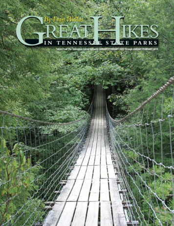
G HBy Fran WallasREATIKESI N T E N N E S S E E S TAT E PA R K STaken From The Tennessee Conservationist JANUARY/FEBRUARY 2005 Through JANUARY/FEBRUARY 2010
Department Colleagues and Friends Remember Fran Wallas (1952-2010)Fran had a lot of friends - friends of all sorts. The legalcrew, the hiking crew, the symphony crew, the trail buildingcrew - many circles. I was lucky enough to be on the lunchcrew. As attorney for Tennessee State Parks, Fran provided themost unique client - legal counsel relationship in the history ofsuch relationships. She absolutely loved parks, nature, the conservation effort and Tennessee State Parks, in particular. Ourbest interest was always in her heart and mind. Her passion,coupled with her absolute integrity, made her the ideal lawyerfor our organization. She knew what we were about andwhere we were trying to go. She always did her best to try andhelp us get there.Jack Gilpin, Tennessee State ParksFran was a Friend of Tennessee State Parks before it was even a concept as an organized group.She was a Friend ofthe Tennessee Trails Association.The Cumberland Trail Conference.The Tennessee Conservationist and many otherentities. On many occasions she and I worked out legalities involving a variety of projects regarding state parks. Her dedication to the preservation of the natural and wilderness areas of our state were constant and unflagging. She promoted thepurchase of these natural treasures through many sources and means. Her support and expertise was always availablewhen asked for. Always ready to help and make sure things were done right. She was also my Friend. It's difficult to thinkof not having Fran as a consultant, source of information, an inspiration, but most of all as my Friend.Fount Bertram, Friends of Edgar Evins and Tennessee State ParksI miss Fran every day. She was here when I arrived and here when Iwent home at night. I've never known so much energy and determination to make things happen. Fran was game for any adventure. She wasfearless. She was so petite, but such a big presence. We went to a rangertraining program, and while I was headed to bed, she was going out todo night time rappelling. Fran never doubted that she could make a difference in the world, and she did so in so many ways. It is my honor tobe her friend.Kim Kirk, TDEC Office of General CounselMy favorite memories of Fran are when I would bring my son to theoffice and she would drop everything and play with him. And it didn'tmatter how long he stayed! She would teach him about nature and lethim play with all the little frogs that she collected. I thank God for theprivilege of having known her and being able to call her my friend.Devin Wells, TDEC Office of General Counsel
January 5, 2011Our department and the community of explorers lost a sharp legal mind, stalwart champion for state parks and tireless trailbuilder with the death of Fran Wallas in October 2010. In Fran’s passing, the Tennessee Conservationist familyalso lost a dedicated and long-time contributor of appreciated hiking articles. From Jan/Feb 2005 through Nov/Dec2010, Fran authored a series of Great Hikes articles that shared her favorite Tennessee State Park trail experiences. In response to many requests and in honor of Fran, it is our pleasure to compile all 36 of these trail experiences in a onetime, limited edition printing of Great Hikes in Tennessee State Parks.Fran received the prestigious 2010 Bob Brown Lifetime Achievement Award from the Tennessee Trails Associationposthumously on November 13, 2010, at Paris Landing State Park. I believe this well-deserved honor aptly capturedFran’s impact on our state as a champion of its parks and trails; an author guiding visitors to its special places; and abuilder of the Cumberland Trail.Fran had a unique gift for bringing or gently leading others to experience nature. We hope this special issue of GreatHikes will introduce you to new outdoor adventures or remind you of an old friend you can meet back out on the trail.Jam es H .FykeCommissioner, Tennessee Department of Environment and ConservationIt is believed that Fran possibly knew every hiking trail in every TN state park. A few years ago my family spent aweekend at a Tennessee State Park, on Saturday afternoon my son and I decided to hike one of the park's trails. With map inhand, we began to follow the marked trail. However, after about an hour it began to dawn on us that we were possibly offthe trail and lost. We backtracked as best we could and eventually did make our way back to civilization. When I returned towork the following Monday, I saw Fran and told her about getting lost on a park trail. She asked me which park and whichtrail, and I told her. She asked "Did you come to a large tree where it was maybe a little bit confusing, like it seemed the trailcould lead off to the left, but you went straight instead?" I said I did recall that spot. She said, "Yeah, you should have goneleft. The markings are kind of faded, and if anybody gets lost on that trail, that's usually where it happens.” It is amazing shewas able to tell me exactly where we got lost!Greg Teeple, TDEC Office of General CounselAcknowledgementsThe Tennessee Department of Environment andConservation is grateful for the interest and support received from many individuals and locationsduring the production of this special issue of GreatHikes. We would like to specifically express ourappreciation for the following that made the project possible:David Wallas, Adam Wallas and Rebecca Arce:Fran’s childrenDr. David Goldenberg: Fran’s brotherLouise Zepp, Editor, The Tennessee ConservationistJeff Law, Art Director, The Tennessee ConservationistDouglas PrintingSpecial thanks to Shirley Ora for generously providing many photos of Fran out on the trail. Since1984, Shirley hiked thousands of miles together withFran across Tennessee and all over the world.
Intermediate Overnight Loop Trail at Mousetail Landing State Parkcenic views, a cedar glade,highly visible blue blazes incase of snow, and wellmaintained trail shelters makeMousetail Landing State Park’seight-mile IntermediateOvernight Loop Trail perfect for awinter hike.Mousetail Landing is near Linden onthe east bank of the Tennessee River.The trail offers a challenging backpacktrail or a moderate day hike for an experienced hiker.Dedicated park staff lovingly care forthis state park and make everything easy tofind. You will notice the carved trailheadsign “Eagle Point Backpacking Trail” onyour right along the main park road. Continue a little further to the visitor center/office parking.Registration is required for overnightcamping at either of the two shelters. If youare a day hiker, you may want to registerfor a river campsite or a wooded campsiteat the top of the hill near the park office.Campgrounds are open year round,but the shower and bathroom buildings areclosed in the winter.Take a “Mountain Bike Trail Map”from the kiosk. The map includes all ofthe park’s biking and hiking trails. Backpackers need to carry lots of water because there is no water at the shelters.You also need to be sure the water is protected so that it does not freeze. Thegood news is that you can leave your tentat home. The shelters will keep you dryand protected.SNow you are ready to hike fromthe office to the trailhead to beginyour wilderness adventure. Youenter Kelly Hollow along a creek.Your first surprise is that this hikehas a lot of steep ups and downsthrough the woods. The next surprise is that you come to broad areas offlat open fields. When you get to a field,just look straight across and you will seethe blaze and trail on the other side. Soonyou will start seeing some big cedar trees.There in the middle of this West Tennesseeforest, you will discover a Middle Tennessee type cedar glade.In about two miles, you reach the beginning of a loop. The trail to the rightleads to shelter one. The trail to the leftleads to shelter two. Both shelters are onlyabout a mile from this junction. Thewooden shelters are screened and havesleeping platforms for eight people. Sheltertwo is on a bluff with a scenic view of theTennessee River. This shelter is a wonderful place to watch sunset. Shelter one istucked in the woods and gives you a realfeel of wilderness. When you are ready tocomplete the loop, you will enjoy scenicviews of the creeks, river, and an occasionalwhite tail of a fleeing deer. Although thelast part of the trail is a repeat of the firstpart, you will have a chance to notice whatyou missed before. You will complete thehike and start thinking of seven people toinvite along the next time.For information, call the park at 731847-0841.1Fran WallasThe backpacking trail through the cedarglade at Mousetail Landing State Park.Below,left: A campsite near the TennesseeRiver at Mousetail Landing State Park.DirectionsFran WallasThe park is about halfway betweenNashville and Memphis. If you are comingfrom the east, take I- 40 to exit 143 and gosouth on Highway 13 to Linden. Turn rightand go west on Highway 412 to Highway438. If you are coming from the west, take I40 to exit 126 and go south on Highway 69.Turn left on Highway 412 and go east toHighway 438. Now that you have foundHighway 438, go about two miles, and youwill notice a sign with arrows pointing left tothe primitive camping area and boat rampand an arrow pointing straight ahead to themain park entrance. Day hikers may chooseto stop now to select a campsite along theTennessee River. If you are anxious to beginyour hike, don’t make that turn and continueuntil you get to the clearly marked entranceto the state park.
B e g i n n e r B a c k p a c k i n g H i k e t o H o r s e p o u n d Fa l l shike to Horsepound Falls atthe South CumberlandRecreation Area nearMonteagle is an adventure rewarded by two waterfalls, anoverlook, and a wonderful variety of wildflowers.You can hike the trail in a day, butyou will enjoy it more if you spend thenight at West Collins Campground.West Collins is one of the best beginner backpacking hikes. You reachthe campsite in less than a half-mile,but you feel like you are out in themiddle of a wilderness. You can dropyour pack, set up your tent, and fill upwater containers at the spring. If youhave forgotten anything essential in thecar, you can go back for the neededitem. You can even carry in a cooler.Remember, though, that there are noalcoholic beverages allowed in Tennessee State Parks.Now that you have settled in, you cangrab a fanny pack with water and food tostart your hike. The trails are well markedwith white blazes. Although the campsite isvery easy to reach, the hikes are rated moderately strenuous. Some new to hiking maywant to rest and enjoy the Rocky PointOverlook at the campground. Other hikerswanting a short hike will choose to go toSuter Falls less than a half-mile from thecampground. The trail leads to a beautifulrock bluff overhang beside the triple dropwaterfall. The area is a wonderful place toATerry BonhamHorsepound Falls in South Cumberland StateRecreation Area near Monteagle. Below: TheCollins River in South Cumberland State Recreation Area near Monteagle.DirectionsTerry BonhamFinding the trail is part of the fun. Takehighway 24 to the Pelham/Winchester exit 127.Follow highway 50 east toward Altamont forabout 11 miles as you wind up to the top of theCumberland Plateau. Make a right turn on highway 108 South and go about 10 miles to the community of Gruetli-Laager. Gruetli and Laager weretwo communities settled by the Swiss in the1860s and the city of Gruetli-Laager was formedin 1980, when the two communities joined together. You will notice a grocery store just in caseyou need some extra goodies for your backpacking trip. You will also notice a dairy bar for anemergency ice cream stop.After about another mile, you will see abrown sign for “Savage Gulf State Natural AreaCollins Gulf Access” with an arrow pointing to aleft turn onto 55th Avenue. Go straight on 55th Avenue for about two miles to the trailhead parkinglot. There is a kiosk with trail maps and a place toregister for your free campsite. As you face thekiosk, you will see a metal gate to your left at theentrance to the trail.picnic. Pick a boulder and dangleyour feet in the water.If you want a longer hike,you can wade across RockyMountain Creek below the fallsand continue on toward Horsepound Falls. The hike to Horsepound Falls is one of the best springwildflower hikes. When you start winding down towards the Collins River, youwill begin to notice the spring flowers.Each week the flowers get better. Thereare waves of white early spring flowerssuch as toothwort, chickweed, SpringBeauty and hepatica. The next week youmight see the mostly yellow colors ofTrout Lily, Dutchman’s Breeches andtrillium. Later in the spring you willenjoy the purples of Fringed Phacelia.After you descend to the lower partof the trail, you will have a choice ofquiet places by the Collins River. Thespur trail to Horsepound Falls is clearlymarked and blazed in blue. HorsepoundFalls is a good snack or lunch spot withlots of large flat rocks to sit on. If you decide to go less than a half a mile further,you can see Fall Creek cascade down themountain and completely disappear intoa sinkhole.In order to get back to the CollinsWest Campground, you need to retraceyour hike. You will notice that the hikeback is uphill all the way to the campground. You will be ready to rest at campand watch the sunset from the overlook.2
Rock Creek Segment of the Cumberland Trail Offers A Shady Hike for a Hot DayTlunch spot, don’t cross the bridgeand continue on the Rock Creekloop. You will climb out of thegorge on a series of switchbackswith beautiful rock outcroppings. At the top, turn right. Ashort walk brings you to anothersign leading you to the Leggett PointOverlook. This side trail has yellowblazes and ends at the overlook in twotenths of a mile. You may be luckyenough to see the rhododendrons inbloom all along the way. Take time toenjoy the beauty of this special place. Youmay even see a pair of eagles.When you get back to the main trail,turn right, and hike about 1.4 miles tocomplete the loop. As you hike back downinto the gorge, keep a lookout for an endangered species of plant called LargeFlowered Skullcap. Contrary to its name,this perennial herb in the mint family hasvery small but elaborate purple flowers.The trail had to be rerouted to protectthese plants. When you finish the loop, youshould recognize the sign and turn left onthe connector trail back to the lowerLeggett parking lot.Volunteers built this wonderful trail. Ifyou would like to help build connectingtrails, sign up for the “Big Dig.” You canvolunteer as much or as little as you wouldlike from May 22nd- June 25th. No experience is necessary. Detailed information isavailable on the Cumberland Trail Conference Web site www.cumberlandtrail.org/.Fran Wallashe chance to see eagles and theendangered plant LargeFlowered Skullcap areamong the attractions of a hikealong the Rock Creek Segment ofthe Cumberland Trail.The hike begins on a pavedhandicapped accessible trail at theparking lot. You will soon come to a signwith many hiking options. Choose thehike that works the best for you depending on when you want to eat, whetheryou want to play in the creek, or how faryou want to hike. The best picnic areasare the Rock Creek Overlook, theLeggett Point Overlook, and shady spotsbeside Rock Creek.For a pleasant six-mile day hike, takethe connector trail to the Rock Creek Loop.The trail is marked with white blazes. Youcan listen to Rock Creek most of the hike. Ifyou come back in the winter, you can seethe creek most of the hike.The connector trail ends at the looptrail in 1.2 miles. The sign says “Cumberland Trail” with arrows pointing tothe right and left. Take the trail to the leftto continue hiking in Rock Creek gorge.There are several chances to explore thecreek, cool your feet, and enjoy a scenicsnack. In about a mile, you will come to along bridge made out of natural trees. Ifyour stomach is growling at this point,you may want to go across the bridge totake a short detour to Rock Creek Overlook. If you can wait for an even better3Fran WallasBelow,left: Leggett Point Overlook is a perfect lunch spot. Below,right: Large Flowered-Skullcap blooms inMay. A population of the flower was protected when land was purchased for the Cumberland Trail.A scene of Rock Creek, next to the trail. There’snothing like cold water on a hot day.Volunteers Bill Leiper, second from right, andVeronica Greear, right, help build the CumberlandTrail.DirectionsDivision of Natural HeritageFran WallasDirections to the Rock Creek trailhead:From Hwy 40 take Hwy 111 South to Hwy 27and go east towards Dayton to the town of SaleCreek about 6.2 miles to Leggett Road. Turnleft on Leggett Road, a tiny intersection. (Youmay want to ask for directions to Leggett Roadat a service station in Sale Creek.) Drive about1.6 miles to a paved drive on the left that leadsto a large paved parking lot. You will see thesign for the Rock Creek Segment of the Cumberland Trail.
Fa l l C r e e k Fa l l s C a b l e Tr a i l - T h e S h o r t e s t H a rd H i k eFran Wallashe Cable Trail at Fall CreekFalls State Park nearPikeville is a wonderfulsummer hike. Rhododendronsshade the whole way. There isno poison ivy, and at the end ofyour hike is the cool stream.This trail also offers a chance tosee if you are part mountain goat. Haveyou ever wondered if you would likeTFran WallasAbove: The start of the Cable Trail at Fall CreekFalls State Park sends you over the edge intothe rhododendron. Right: Hiking up the CableTrail is a different experience than the hikedown.Directions4A look down to the end of the Cable Trail at Fall Creek Falls State Park.Fran WallasFrom Nashville take I-40 to exit 288 andtake Highway 111 South until you get toSpencer. Turn left on Highway 284 East andfollow the signs to Fall Creek Falls State Park.From Knoxville, take I-40 to Crossville to exit322 Peavine Road. Take a left off of the exitand turn right at the light on Highway 101.Take Highway 101 to Highway 30. Turn righton Highway 30. Drive until you get to the entrance to the park on the left. Once you havereached the park, follow the signs to the nature center and park in the picnic area. Trailmaps are available at the nature center and atthe inn.You may want to start off your hike bywalking towards the Nature Center, but takingthe first walkway to the right. At the end of thewalkway is a beautiful overlook. There is one,and if you are lucky, two waterfalls dependingon flow. Way down at the bottom beside thecreek, you will see your hike destination. Toget to the trailhead, walk back to Highway 284and turn left walking past the sign that says,“to 30. A short way up the road, you will seethe Cable Trail on your left.rock climbing? Now is your chanceto find out. At the beginning ofthe trail, you get the feeling ofgoing over the edge as you hangon to the cable and begin lowering yourself from rock to rock. Itis an adventure as you go from oneside of the cable to the other carefullychoosing your way down. The hikedown and back is less than half a mile.Although this hike is short, youmay want to allow several hours tofully enjoy it.Once at the bottom, there aremany places to explore. You maywant to choose a rock nearby forthat perfect picnic. Take off yourshoes and cool your feet in thecreek. For a special treat, bring abook, and read to the sound of thewaterfall.If you enjoy rock hopping, trywinding your way down the sideof the stream. Before you wanderdownstream, be sure to pile somerocks or leave a piece of clothing tohelp you find the trail when youreturn. In late summer, you maysee the trees on the bluff above justbeginning to turn their fall colors.The hike up is a totally different experience from the hikedown. You will get to know therocks really well as you look forfootholds and knobs to grab onto.When you reach the top, you willwant to take one more look back.Yes, you really did it.
Big Ridge State Park - A Haunted Hike For the Halloween SeasonIprograms are offered every Fridayand Saturday night in Octoberexcept for Halloween. Call thepark office for details.Continue past the cemetery,and a short connector trail willlead you from Ghost House Loopto Big Valley Trail, which is blazed inred. To complete the loop, turn left ontoBig Valley, then turn left on Dark HollowWest Trail.The Dark Hollow West Trail is nowa path, but used to be a county road. Youcan still see areas of old homesites. Before 1934 when TVA purchased the land,there were 95 houses, two schools andsix churches within the park boundary.For those who like to backpack, enjoy thebackcountry campsite on your right. Twoother backcountry campsites are alsoavailable, but you need to check on thecondition of the trails. You can tell yourown ghost stories and listen for Hutchinson’s horses riding down the road.Be sure to bring lots of water because the water source dries up duringparts of the year. The trail crosses abridge and stays along the edge of thelake back to the dam. Turn right, crossthe dam, and follow the trail back to theparking lot.For those who would like to take alonger steeper hike, from the intersectionof Big Valley Trail and Dark Hollow continue up Big Valley Trail all the way toIndian Rock. This side trip adds about5Luke Askinsn Maynardville, a trail in BigRidge State Park offers something for the Halloween season as it passes a reportedlyhaunted area. Ranger-led programs through the month of October feature spooky topics.This five mile moderately difficulthike begins on the Lake Trail. There aretwo side trails on this first half-milestretch. You will only want to take thesteep climb to the Loyston Overlook ifthe leaves have fallen so that you can geta view of the lake. Otherwise stay on themain trail to the dam built by the Civilian Conservation Corps in the late 1930s.You may want to stop here to enjoy theview of the lake and the fall colors. Although this was once farmland, the areahas become a forest of oak and hickory. Ifyou return in the winter, you may seeGolden and Bald Eagles and migratingwaterfowl.After you cross the dam, turn toyour right and continue on the LakeTrail. At the junction of the Lake Trailand Ghost House Loop, turn left andthen bear to your right. The eastern armof Ghost House Loop will take you toNorton Cemetery. You will find thesunken grave of Maston Hutchinson,who fought in the Civil War. Supposedlyhis home was haunted, and people haveheard eerie sounds in the area. You maywant to go to a ranger program to hearabout the strange occurrences. TheseThe Norton Cemetery is one of three historiccemeteries you pass on a hike on the Lake Trailand Ghost House Loop in Big Ridge State Park inMaynardville. Below: Trails in Big Ridge StatePark wind through hardwood forests. If you missthe fall colors, you will get to see the spectacular views through the winter.3.5 miles to your hike. Settlers used thisroute to take their corn to the NortonMill. The trail runs along the top of BigRidge. There are views in both directions and wonderful fall colors. Thereare also the remains of settlements fromthe 1800s and some very large oak trees.You need to backtrack to the Dark Hollow West junction.For information, call the Big RidgeState Park office at 1-800-471-5305.Geri ReynoldsDirectionsDirections to the Big Ridge trailhead: takeHighway 75 to exit 122. Take Highway 61 east.The brown state park signs will lead you to thepark entrance on the left. Follow the signs tothe office where you can pick up a trail map.Because of the pine beetle damage, you willneed to check at the office about the conditionof the trails. The office parking lot is a goodplace to leave your car for the day. Walk pastthe ball field to the end of the parking lot andfollow the road to the left. You will see thetrailhead on your right.
W e t l a n d s , W i l d e r n e s s a n d W i l d l i f e a t B i g H i l l Po n dt Big Hill Pond State Park inPocahontas, you don’t haveto hike very far from yourcar to sense that you are in avery special place.This is a park where you canfind solitude and the feel ofwilderness. When you explore the wetlands you may be lucky enough to spotan otter, muskrat, or mink. You will alsosee migrating birds in the late fall orearly winter. The trail begins at the edgeof the Travis McNatt Lake. Begin thehike on the trail to the right. This hike isabout five miles and is perfect for a shortwinter day.The trail follows the lake with scenicviews all along the way and crosses ashort boardwalk area on your left. Follow the trail blazes along the other sideof the lake until you get to a trail signleading to the Grassy Point shelter. Thisis a short detour. Depending on the timeof day, you may want to stop here for asnack, lunch, or stay in the shelter forthe night. The shelter sleeps six people.Back track to the trail and turn left.Continue on the trail until you get to anold roadbed/horse trail. There are bothwhite and red blazes on the trees. Turnleft and follow the road until you get to asite with signs that give you severalchoices. One sign leads to the tower andthe other sign leads “Back to Dam.” Thisis a good place to sit with your friends toFran WallasATake Highway 40 to Jackson and followHighway 45 south toward Corinth. Be careful tofollow all of the Highway 45 twists and turns.When you reach the town of Eastview, turnright, and go west on Highway 57 about 10miles to the entrance of the park. Drivestraight on the park entrance road until theroad ends at the lake. The trail begins at thelake edge to your right and left. Trail maps areavailable at the park office.Dismal Swamp at Big Hill Pond State Park in Pocahontas.Below: Travis McNatt Lake at Big Hill Pond State Park.Fran WallasDirections6Fran WallasBeech Trees, like this one along the trail atBig Hill Pond State Park in Pocahontas, areamong the last to lose their leaves in fall.decide which way to go or to waitfor friends who decide to hike tothe tower. The 70-foot tower iswell worth a side trip if you wantto get a bird’s eye view of thewhole area. The hike to the damgoes across the levee with scenicviews down the length of the lake.After crossing the levee, hike up thesteep hill to a gate and gravel parking.Turn left on the trail that is just behindthe gate. The trail winds for several milesthrough the woods. Follow the blazesuntil you come to a beautiful bridge.Cross the bridge and turn left to get backto the starting point of your hike. Checkwith the ranger and trail map to see howto extend the hike to make a larger loop.If you have more time and energy, youwill especially want to add the DismalSwamp section to your hike.
Pickett State Park’s Hidden Passage Trail is a Wonderful Winter Trekhen most of Tennessee haslost its greenery, inJamestown, Pickett StateParks’ Hidden Passage Trail islined with the green of laurel,huckleberry, teaberry, and rhododendron.There aren’t enough adjectives todescribe the beauty of this Civilian Conservation Corps built 10-mile loop trailthat winds through Pickett State Parkand State Forest.The trail starts at the Sheltowee Tracesign. Hidden Passage Trail is the southernend of the Sheltowee Trace National Recreation Trail that runs 278 miles throughKentucky’s Red River Gorge. Follow thetrail until you come to a split. Don’t takethe left turn to the group camp. Continuestraight ahead following the Hidden Passage sign and the blazes that are either greenmetal diamonds or green rounds with a silver hiker.The first fun stop is a bench built in asandstone hollow not big enough to becalled a cave or rock house. You may wantto keep hiking until you get to the grandrock houses further along the trail. Therock houses are great shelters from thewind on a cold day. Just at the bench thetrail turns right. Further along, you will notice a side trail on your right to Crystal Falls.The side trail is short and steep so be carefulif the rocks are iced over. The falls are beautiful anytime of the year so you may want towait for the thaw.WEach time the trail disappearsinto a rock house, you will follow ituntil it leaves the rock house onyour right. There are two wellmarked spur trails for interestingshort side trips. One goes to double falls and one goes to an old railroad tunnel that is now closed for safetyreasons. Because winter days are short andthe trail is long, you may want to save thespur trails for another day.About half way around the loop youcome to the Thompson Overlook. Thislarge sandstone bluff is a great place toenjoy the views in all directions. It is easy totake a wrong turn at this point. Don’t starthiking up the dirt road. The trail stays nearthe bluff and reenters the woods. If you doturn up the road, you will immediatelycome to a small wood sign that says, “trail.”The arrow will point back behind you.Turn around and look for the green diamond blaze.The trail winds through the woodsand leads to an open area under powerlines. Walk directly across the open grassyarea under the power lines until you getto the continuation of the trail on theother side. The trail eventually comes toa junction with a road and a sign leadingleft to Rock Creek. Instead you will turnto your right and follow the gravel roadpast the volleyball net in the group camp.The gravel road ends in a paved road thatgoes behind the group camp buildings.Continue until you get to a Hidden Pas-7George HattonThis bench built in a sandstone hollow is one of the stops along the Hidden Passage Trail in Pickett StatePark in Jamestown.Along the Hidden Passage Trail at Pickett State Parkin Jamestown, Crystal Falls is seen in the snow.sage sign pointing left. You may thinkthat you have passed the scenic part ofthe trail, but there are still some beautifulrock walls. You even cross a very tinynatural bridge. The trail dead ends backat the sign leading to group camp thatyou saw when you started your hike.T
the east bank of the Tennessee River. The trail offers a challenging backpack trail or a moderate day hike for an experi-enced hiker. . ety of wildflowers. You can hike the trail in a day, but you will enjoy i