Transcription
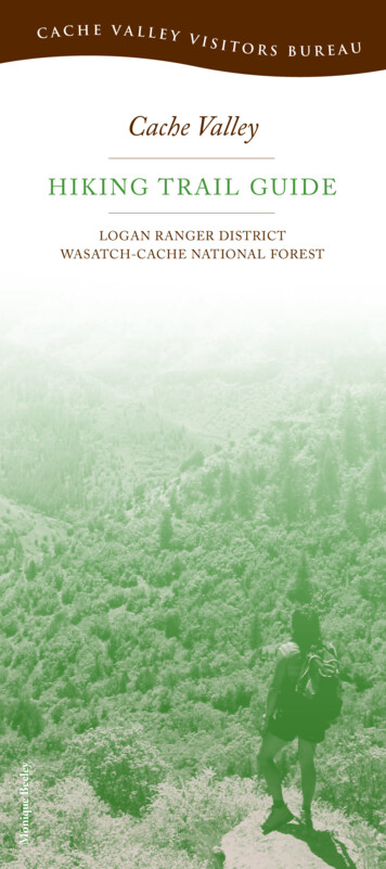
Cache Valley Visitors BureauCache ValleyH iki n g T rai l Gu i d eMonique BeeleyLogan Ranger DistrictWasatch-Cache National forest
Trail Location GuideLegend#119/101312853124/67
MAP 2for trails:3457813LegendAll maps face north.maps not to scaleMAP 3for trails:MAP 1for trails:126
MAP 4for trails:Bef ore You Go91 0 1112The trails on the maps are marked with their ForestService trail numbers, for example: 047Trail difficulty depends on your health and physicalcondition. Each trail description provides informationon beginning and ending elevations to assist you.Wear insect repellant and check yourself for ticks afterspending time in the mountains.Wear sunscreen and drink plenty of water toavoid dehydration.Please do not shortcut trails.Please remove any litter you find along the trail.Use restroom facilities or bury waste in a 6-inch hole200 feet away from water.If you happen to encounter a rattlesnake along the trail,please leave it alone! It is a valuable part of the ecosystem.At elevations above 8,000 feet, wet, cold, and windyweather is possible at any time so be prepared. Trails in theBear River Mountains are generally above 5,000 feet. Theair is thin, which puts extra stress on the heart and lungsand increases risk of sunburn.Carry your own water or use a quality pump and filterto purify water taken from backcountry streams and lakes.Giardia, a serious intestinal parasite, is prevalent.A guide to these and more extensive trails can be foundin the booklet Cache Trails, available at most Loganbookstores. A wide selection of United States GeologicalSurvey 7.5 minute maps are available at The Sportsman,129 N. Main and Al’s Sporting Goods, 1617 N. Main. TheForest Visitor Map is a comprehensive map of trails in theNational Forest and is available for purchase at the LoganRanger District, 1500 E. US Hwy. 89.
1Deep Ca nyo n/Well s v i lle Ri dge : 037Length: 3 miles to the Wellsville Ridge; 2 miles fartherto Stewart PassElevation Start/End: 5,400/8,600 feet2Coldwater East : 038Length: 3.6 miles to Stewart Pass, 1.5 miles farther toStewart PeakElevation Start/End: 6,200/8,400 feetTrailhead: Once in Mendon take Hwy. 23 to 300 North(look for the wildlife viewing sign), then head westabout 2 miles to the trailhead. GPS: Deep Canyon/Wellsville Ridge Trailhead N41o42'821" W112o1'030"Trailhead: Take Hwy. 30 west of Logan to Junction 23and turn left to Mendon. Turn right at 1800 South andfollow roadway to FR 086 and continue to start of trailat the watering trough. GPS: Beginning of FR 086,N41o41'951" W111o58'621"Ref. Map (7.5 min.): Honeyville, WellsvilleRef. Map (7.5 min.): Honeyville, WellsvilleFeatures: The first part of this wilderness trail passesthrough a lush region of maple woodland, shrubs,and flowering plants. Higher up is frequent evidenceof winter avalanche damage. Both valleys can be seenfrom the ridge, which is covered with flowers duringthe summer. This ridge is a favorite birdwatching areabecause it is a major raptor flyway.Features: The trail travels through maple and aspen treesand by the very small Coldwater Lake before beginningswitchbacks to the ridge. The vegetation is lush, butbeware of stinging nettles. As you travel the road to thetrailhead, the prominent hill on the left is known locallyas Mount Hughes. John Hughes and Robert Stewartwere instrumental in preserving this area for posterity.The entire mountain is now a Wilderness Area. Ifyou follow the ridge south to the Wellsville Cone, youwill see numerous fossils—horned coral is the mostcommon. Please leave the fossils where you find them soothers can enjoy them too.Trail Information: The trailhead and first portion ofthe trail are on private property. Please show respect.This trail is deceptive because it begins at a moderatepitch but then increases dramatically, so there aremany switchbacks. Stewart Pass is 2 miles south alongthe ridge. The Wellsville Cone is about a mile farthersouth. No water is available; carry your own. Hikers candescend via the Coldwater East Trail to Maple BenchTrailhead. Carry a map because there are few signs onthese wilderness trails.MAP 1Trail Information: There is a trail to the Wellsville Conethat bypasses the ridge. No water is available; carryyour own. The trail continues south to the Rattlesnaketrailhead in Sardine Canyon, with spurs leading west toColdwater Canyon and to Box Elder Peak, the highestpoint in the Wellsvilles.MAP 1
3Riv er T ra i l : 6034Riverside Nat ure Trail : 0 5 2Length: 3.7 miles one way; sections of trail are nevermore than 1.5 miles longLength: 1.3 miles one wayElevation Start/End: 4,900/5,400 feetTrailheads: There are five entry/exit points:1. Across US Hwy. 89 from the forest boundary sign atthe mouth of the canyon. The gate is usually closedand locked. Park at the boundary sign and carefullycross the road. GPS: N41o44'516" W111o46'567"2. Second Dam. GPS: N41o44'777" W111o44'817"3. Bridger Campground just past Zanavoo.4. Gus Lind Dispersed Camp.5. Spring Hollow Campground has a small parking areaat the entrance. GPS: N41o45'200" W111o43'010"Ref. Map (7.5 min.): Logan Peak, Mt. ElmerFeatures: The River Trail follows the Logan Citywater line, which is buried beneath the road and passesStokes Nature Center. The trail parallels the river andis never more than a few hundred feet from US Hwy.89, although traffic is not visible for most of its length.The trail goes south above Bridger Campground andGus Lind Flat Summer Home Area. It passes ThirdDam and ends at Spring Hollow. Moose have been seennear the river, and many species of birds and plants canbe observed.MAP 2Elevation Start/End: 4,900/5,400 feetTrailheads: There are two entry/exit points:1. Spring Hollow Campground has a small parking areaat the entrance. GPS: N41o45'200" W111o43'010"2. Guinavah-Malibu Campground, near theamphitheater. GPS: N41o45'741" W111o42'150"Ref. Map (7.5 min.): Logan Peak, Mt. ElmerFeatures:The Spring Hollow section of this trail is wide withinterpretive signs and benches. The section beforeGuinavah narrows and includes a steeper climb.MAP 25W in d Cave : 032Length: 2 miles one wayElevation Start/End: 5,100/6,000 feetTrailhead: Located 5.2 miles up US Hwy. 89. Thetrailhead is across from Guinavah-Malibu Campground.GPS: N41o45'747" W111o42'212"Ref. Map (7.5 min.): Mt. ElmerFeatures: The delicate triple arch and natural cave isnear the top of the China Wall geologic formation onthe north side of the canyon. This is part of the sameformation found on the Crimson Trail on the southside. It is dry enough for hiking in early spring. Bigtooth maple trees are abundant and fossils from theMississippian period are common.Trail Information: This is a popular trail because it isshort, steep, and uses lots of calories. This side of thecanyon is warm, so you may be lucky enough to see orhear a rattlesnake. If you do see a snake, please do notdisturb it. There are very few left in the canyon. Bringplenty of water and please do not cut through thetrail’s switchbacks.MAP 2
6C rim s o n T rai l : 015Length: 3 miles one wayElevation Start/Max: 5,200/6,000 feetTrailheads: Spring Hollow Campground, 4.3 miles fromLogan. GPS: N41o45'200" W111o43'010" or GuinavahCampground, 5.3 miles from Logan, GPS: N41o45'741"W111o42'150"Ref. Map (7.5 min.): Logan Peak, Mt. ElmerFeatures: This trail was the “Senior Walk” for BrighamYoung College’s graduating class until the college closedin 1926. The school colors were crimson and gold—thus the trail’s name. Most of the trail follows the ChinaWall on the south side of the canyon. This exposure getsmore water than the north side, so the vegetation tendsto be more lush. It also remains icy until late spring. Thetrail looks down on Guinavah Campground some 600feet below. The Spring Hollow end of the trail is abovethe group reservation sites.Trail Information: Spring Hollow is just beyond ThirdDam. Cross the bridge, turn right, and park. The trailstarts a short walk up the road in the upper group areaat the small bridge. The Guinavah trailhead is across thebridge near the amphitheater parking area. Use cautionin descending the short, steep slope as you come off theChina Wall near Guinavah. There is steady climbingat each end, but the view is worth the effort. Eitherway you can make a loop by meandering back on theRiverside Nature Trail.MAP 2Right Ha n d For k Trails7(including trails to Old Ephraim’s Grave)Elevation Start/Max.: 5,600/7,200 feetTrailheads: Right Hand Fork in Logan CanyonGPS: N41o46'656" W111o37'164"Ref. Map (7.5 min.): Temple Peak and Boulder MountainTrails: Hiking, and when dry, mountain biking and horses012 Maughan Hollow—2.1 miles056 Willow Creek—2.1 miles127 Ricks Canyon—3.9 miles607 Ephraim’s Cutoff—3.6 milesTrails: Hiking, and when dry, mountain biking, horses,and motorcycles055 Little Cottonwood—1.4 miles013 Steel Hollow—2.8 milesRoads: Hiking, and when dry, mountain biking, horses,motorcycles, ATVs, and JeepsFR 047 Cowley CanyonFR 147 Marie SpringsFR 056 Long HollowFR 153 Chicken CreekFR 007 Temple ForkThe Right Hand Fork area offers a variety ofinterconnecting trails and roads. Directions: Take USHwy. 89 9.2 miles up Logan Canyon to Right Hand ForkRoad. Turn right and travel 1 mile up Right Hand Fork(FR 081) to the first junction. Stay to the left and theroad turns to gravel. The trailhead is .6 miles farther. Parkyour vehicle at the trailhead, and choose from a variety ofoptions. Many travelers enjoy a visit to the final restingplace of the giant grizzly bear, Old Ephraim. His grave islocated on the east side of Long Hollow Road (FR 056).One way to hike to Ephraim’s stone monument from theRight Hand Fork Trailhead is to take the Willow CreekTrail and Temple Fork (FR 007) and Long Hollow (FR056) roads.MAP 3
8OldJ unip er : 0149W h i te P in e Lake : 025Length: 5.8 miles one wayLength: 4.5 miles one wayElevation Start/End: 5,400/7,200 feetElevation Start/Middle/End: 8,000/8,800/8,400 feetTrailhead: Wood Camp turnoff, 10.4 miles from Loganon US Hwy. 89 GPS: N41o47'800" W111o38'700"Trailhead: Day use parking at Tony Grove Lake parkingarea. Overnight parking at the backcountry trailhead¼-mile below the campground. There is a small fee forall parking in the Tony Grove area. GPS: N41o53'686"W111o33'535"Ref. Map (7.5 min.): Mt. ElmerFeatures: A good view of the main ridge of theBear River Range can be seen from many pointsalong the trail. The paths of several winter avalanchesare also visible and there are many flowering plantsand shrubs during the spring and summer. Fall colorsare outstanding and generally peak in late September.The old Jardine Juniper is estimated to be over1,500 years old.Trail Information: Cross the bridge at Wood Camp tothe small parking area up the hill. The trail crosses astreambed near the beginning and again at about 1.5miles later on the south side of an open area. The traildivides at the ridge above Cottonwood Canyon. Theleft fork goes to the upper part of Cottonwood. Takethe right fork to the juniper. The trail splits at about4 miles to loop around a hill; the left fork overlooksCottonwood Canyon, while the right fork overlooks theLogan Canyon area. At about midway around the loopa short spur trail switchbacks down the hill to the tree.This trail is very popular with mountain bikers.MAP 3Ref. Map (7.5 min.): Naomi PeakFeatures: This is breathtaking alpine hiking typical ofthe Great Basin highlands. There are many stands offir, spruce, and aspen. The glacial lake is in a beautifulsetting of cirque cliffs and high mountains. Wildflowersare abundant, and their colors peak during Julyand August.Trail Information: The trailhead is located at TonyGrove Lake. From Logan take US Hwy. 89 (19.2 miles)to the Tony Grove Road. Take Tony Grove Road (FR003) 7 miles to Tony Grove Lake. To help reduce thecongested parking at the lake, groups staying overnightor longer should park in the lower backcountry trailheadlocated just below the campground. People day-hikinginto the lake are welcome to park at Tony Grove Lake.The Tony Grove nature trail is 1.3 miles around thelake. The White Pine Lake trail is easy to follow, butyou will be gradually climbing the ridge dividing TonyGrove Lake and White Pine Lake. From the ridge, thetrail drops steeply down to White Pine Lake. Becausethere is an uphill grade both directions, allow at leastfour hours for this trip or longer if your group includessmall children.MAP 4
10Naom i P e a k : 005 a n d 136H11 igh Creek : 005Length: 3.3 miles one wayLength: 7 miles from Naomi Peak, 10 miles from TonyGrove LakeElevation Start/End: 8,000/9,979 feetElevation Start/End: 9,979/5,200 feetTrailhead: Day use parking at Tony Grove Lake parkingarea (small fee). Overnight parking at the backcountrytrailhead ¼-mile below the campground. There is asmall fee for all parking in the Tony Grove area.GPS: N41o53'686" W111o33'535"Trailhead: Tony Grove Lake Loop, see the Naomi Peaktrail description (Trail #10) first. GPS: High Creek(continuation of Trail 10) N41o53'686" W111o33'535"Ref. Map (7.5 min.): Naomi PeakRef. Map (7.5 min.): Naomi PeakFeatures: This wilderness trail winds through a riparianforest and parallels a booming mountain stream. Itprogresses into a wide glacial valley, eventually openinginto sub-alpine meadows covered with wildflowers. Thetrail culminates at 9,000 feet at High Creek Lake, aglacial cirque lake surrounded by towering cliffs. Hikersenjoy numerous waterfalls during the last 2 miles. Thisis also a popular trail for horseback riding.Features: At 9,979 feet, Naomi Peak is the highestpoint in the Bear River Range. The trail windsthrough spectacular meadows of wildflowers that areat their peak in July and August. The summit offersa breathtaking view of the surrounding peaks and ofCache Valley.Trail Information: The trailhead is located at TonyGrove Lake. From Logan take US Hwy. 89 (19.2 miles)to the Tony Grove Road. Take Tony Grove Road (FR003) 7 miles to Tony Grove Lake. The trail is welldefined, steep in a few places, and moderately rocky.Snow banks persist into the summer and a cold windusually blows on top. At the ridge the trail continuesinto the Mt. Naomi Wilderness to High Creek andCherry Creek canyons. The trail to Naomi Peak itself issouth along this ridge.Trail Information: The trails continue from HighCreek Lake west toward Cherry Peak and the cityof Richmond, or northwest to High Creek Canyon.Carry a map because there are few signs on thesewilderness trails.MAP 4Monique BeeleyMAP 4
12Green Canyon to Tony Grove : 00513Temple Fork Sawmill Trail : 062Length: 12 miles to Tony Grove TrailheadLength: 5.8 milesElevation Start/End: 6,100/8,100 feetElevation Start/End: 5,960/6,600 feetTrailhead: About 5 miles up Green Canyon Road,which starts at 1600 East 1900 North in Logan (NorthLogan). The road enters an open area and the trailstarts on the right side near a fence. GPS: N41o46'150"W111o46'146"Trailhead: 1.5 miles from the Temple Fork turnoff.GPS: N41o49'590" W111o34'518"Ref. Map (7.5 min.): Mt. Elmer, Naomi PeakFeatures: The trail follows the crest of the Bear RiverRange for several miles. Most of the trail is in the Mt.Naomi Wilderness, and it passes Jardine, Beirdneau,and Elmer peaks. Some of the most rugged areas of therange can be seen from the trail.Trail Information: The trail climbs to just below thesummit of Mt. Elmer, which is only a few hundred feetfrom the trail. It circles around the side of Mt. Elmer,down into the upper park of Cottonwood Canyon, thenback up about 800 feet to Cold Water Spring near TonyGrove Lake. This hike is worth the effort. This trail canbe easily lost, as numerous sheep trails and avalanchedebris chutes intersect it. Carry a map because there arefew signs on these wilderness trails.MAP 4Ref. Map (7.5 min.): Temple PeakFeatures: This very enjoyable walk along Temple ForkCreek leads you to the site of a sawmill that was builtin 1877 to provide lumber for buildings in Logan.Remnants of the road can be seen along the trail. Theroad from Logan to Temple Fork was built aboutfour years before the mill closed in 1883. The millburned down three years later. Some of the equipmentwas salvaged, but some pieces are still there. Thefoundations of cabins used by pioneer workers canalso be seen in the clearing at the site. Look for thecommemorative monument for more information.Trail Information: The first 3.5 miles of this trail is partof the Great Western Trail, a north-south trail systemthat runs from Canada to Mexico through five westernstates in the United States. The trail splits at the secondbridge. Stay to the left to go to the sawmill. The trail tothe right continues on the Great Western Trail.MAP 3
Cache Valley Visitors Bureau1-435-755-18901-800-882-4433199 N. Main St. Logan UTwww.tourcachevalley.comLogan Ranger District1-435-755-36201500 E. US Hwy. 89
Features: This trail was the “senior Walk” for Brigham Young college’s graduating class until the college closed in 1926. The school colors were crimson and gold— thus the trail’s name. Most of the trail follows the china Wall on the south side of the canyon. This exposure get