Transcription
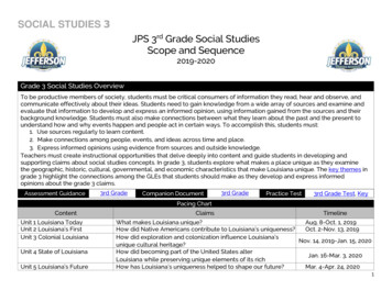
SOCIAL STUDIES 3JPS 3rd Grade Social StudiesScope and Sequence2019-2020Grade 3 Social Studies OverviewTo be productive members of society, students must be critical consumers of information they read, hear and observe, andcommunicate effectively about their ideas. Students need to gain knowledge from a wide array of sources and examine andevaluate that information to develop and express an informed opinion, using information gained from the sources and theirbackground knowledge. Students must also make connections between what they learn about the past and the present tounderstand how and why events happen and people act in certain ways. To accomplish this, students must:1. Use sources regularly to learn content.2. Make connections among people, events, and ideas across time and place.3. Express informed opinions using evidence from sources and outside knowledge.Teachers must create instructional opportunities that delve deeply into content and guide students in developing andsupporting claims about social studies concepts. In grade 3, students explore what makes a place unique as they examinethe geographic, historic, cultural, governmental, and economic characteristics that make Louisiana unique. The key themes ingrade 3 highlight the connections among the GLEs that students should make as they develop and express informedopinions about the grade 3 claims.Assessment GuidanceContentUnit 1 Louisiana TodayUnit 2 Louisiana’s FirstInhabitantsUnit 3 Colonial LouisianaUnit 4 State of LouisianaUnit 5 Louisiana’s Future3rd GradeGuideCompanion DocumentPacing ChartClaims3rd GradeCompanionPractice Test3rd Grade Test, KeyTimelineWhat makes Louisiana unique?Aug. 8-Oct. 1, 2019How did Native Americans contribute to Louisiana’s uniqueness?Oct. 2-Nov. 13, 2019How did exploration and colonization influence Louisiana’sNov. 14, 2019-Jan. 15, 2020unique cultural heritage?How did becoming part of the United States alterJan. 16-Mar. 3, 2020Louisiana while preserving unique elements of its richHowhas Louisiana’s uniqueness helped to shape our future?Mar. 4-Apr. 24, 2020heritage?1
SOCIAL STUDIES 3Unit 1: Louisiana Today(37 Days)OverviewStudents develop an understanding of the meaning of culture by identifying the common characteristics of culture. Throughoutgrade 3, students explore the question “What makes Louisiana unique?” For this topic, students understand the meaning ofculture and how it defines a place. They identify and define the many characteristics of culture, each of which represents thepeople who live there. They explore the place known as Louisiana in the context of the world and country. They also examineexamples of cultural elements that define Louisiana and make it a unique place.ClaimStudents will develop a claim to respond to this overarching question: What makes Louisiana unique?Key Connections The culture of Louisiana was created by many different cultural groups who have called Louisiana home. The physical features of each region of Louisiana influence its economy. The regions of Louisiana developed based on how climate, location, and natural resources influenced where peoplesettled and how they used the land. Culture can be represented through different ways such as symbols, landmarks, food, language, traditions, festival, andcelebrations.2
SOCIAL STUDIES 3Unit Terminology and ToolsContent VocabularyNative Americans, French, Spanish, Africans, Germans, Haitians, Canary Islanders,culture, customs, traditions, language, religion, celebrations, festivals, parades,Louisiana natural resources (Gulf of Mexico, Mississippi River, Lake Pontchartrain,crops, timber, seafood, oil), regions of Louisiana (North, Central, Acadiana, FloridaParishes, Greater New Orleans), economy, industry, income, careers, specialization,Louisiana symbols (pelican, magnolia, cypress trees, Catahoula, crawfish, alligator,fleur-de-lis), national symbols (bald eagle, American flag, red/white/blue, U.S.Constitution), types of maps (physical, political, resource, historical, climate,economic, and road), hemispheres, cardinal & intermediate directions, compass rose,physical characteristics of Louisiana (bayous, swamps, floodplains, forests,farmland), community, town, city, parish, state, Baton Rouge, urban, suburban, rural,producers, consumersStudies Weekly CorrelationCLEVER: Louisiana Studies Weekly, Weeks 1-7Supplemental MaterialsDiscovery Education Streaming: Introduction to LouisianaAssessments LDOE Unit 1 Assessment: Students will write an essay answering question: What makes Louisiana unique? JPPSS Unit 1 Assessment3
SOCIAL STUDIES 3Essential GLEsEssential content represents the most important concepts to be taught in each unit.Teachers should spend the majority of their time teaching the essential content.3.1.6 Compare and contrastthe influence of culturalgroups in Louisiana.Priority Concepts and Content Identify cultural groups that influenced Louisiana, including Native Americans,French, Spanish, Africans, Germans, Haitians, and Canary Islanders. Describe ways cultural groups influenced Louisiana’s culture, customs, andtraditions (language, religion, food, music).3.2.4 Identify cultural elementsthat have contributed to thestate’s heritage.Priority Concepts and Content Identify cultural elements that have contributed to Louisiana’s heritage such aslanguage, art, music, food, holidays, and celebrations (festivals, parades).3.4.7 Describe the importance ofnatural resources in Louisianausing maps.Priority Concepts and Content Describe the natural resources (Gulf of Mexico, Mississippi River, crops, timber,seafood, oil) of each of Louisiana’s 5 physical regions (North Louisiana, CentralLouisiana, Acadiana, Florida Parishes, Greater New Orleans) using a map. Compare and contrast the different physical features of Louisiana’s regions tomake a connection between the physical features and economy/industry of eachregion.3.7.1 Identify various ways thatpeople earn income and howearning income contributes tothe economic well-being of theircommunity and state.Priority Concepts and Content Recognize that Louisiana citizens can earn income from careers related to thenatural resources of the state.3.9.1 Explain the concepts ofspecialization andinterdependence in theproduction of goods andservices.Priority Concepts and Content Recognize that careers in the state’s natural resources involve job specialization(for example: fishing equipment and specialization in the seafood industry orlogging equipment and specialization in the timber industry).4
SOCIAL STUDIES 3Ancillary GLEsAncillary content represents skills that are used in support of bigger ideas, reviewcontent within a unit, and historical thinking skills. Ancillary content should not be cutfrom instruction.3.1.4 Compare and contrast stateand national historical symbols.Priority Concepts and Content Identify Louisiana state symbols such as the pelican, magnolia and cypress trees,catahoula, crawfish, alligator, and fleur-de-lis and describe their importance. Identify national symbols such as the bald eagle, American flag, red/white/bluecolors of the flag, and the U.S. constitution and describe their importance.3.1.5 Categorize landmarks asstate and national.Priority Concepts and Content Recognize the Mississippi River, the Gulf of Mexico, and Lake Pontchartrain asinfluential landmarks in the State of Louisiana.3.3.1 Describe characteristics anduses of various types of maps.Priority Concepts and Content Describe the different types of maps and explain their purposes-physical, political,resource, historical, climate, economic (natural resources and industry), and roadmaps.3.3.2 Identify the hemispheres inwhich Louisiana is located.Priority Concepts and Content Identify the hemispheres in which Louisiana is located.3.3.3 Locate variouscommunities and cities inLouisiana using cardinal andintermediate directions.Priority Concepts and Content Locate cities and parishes that are meaningful to students using a compassrose, and cardinal and intermediate directions on a map (the focus of thisstandard is proficiency in using cardinal and intermediate directions, not the specificcities and parishes chosen for students to locate)3.3.4 Locate and label majorgeographic features of Louisianaon a map.Priority Concepts and Content Describe the physical characteristics (rivers, lakes, bayous/swamps, floodplains,forests, farmland) of Louisiana’s 5 physical regions (North Louisiana, CentralLouisiana, Acadiana, Florida Parishes, Greater New Orleans).5
SOCIAL STUDIES 3 Identify The Mississippi River, Lake Pontchartrain, Sabine River, and Mt. Driskillusing a map3.3.5 Differentiate between atown, parish, state, and country inwhich the student lives using apolitical map.Priority Concepts and Content Name and locate on a political map the town/city, parish, state, and countrystudents live in, and describe the relationship between a town/city, a parish,and a state.3.3.6 Construct an outline mapof Louisiana from memory.Priority Concepts and Content Students draw a map of Louisiana, noting important features such as theMississippi River, Lake Pontchartrain, Baton Rouge (capital), and the town inwhich they live.3.3.7 Locate specific places on amap using a simple grid system.Priority Concepts and Content Locate cities, parishes, and various physical features that are meaningful tostudents using a grid system on a map (the focus of this standard is proficiency inusing a simple grid system on a map, not the specific cities, parishes, and geographicfeatures chosen for students to locate).3,4,1 Compare and contrastphysical features of variousregions of Louisiana.Priority Concepts and Content Identify different physical features in Louisiana’s 5 regions (North Louisiana, CentralLouisiana, Acadiana, Florida Parishes, and Greater New Orleans). Compare and contrast the physical features of Louisiana’s 5 regions.3.4.6 Distinguish betweenurban, suburban, and ruralcommunities in Louisiana.Priority Concepts and Content Explain what the terms urban, suburban, and rural mean and distinguish betweeneach of these types of communities in Louisiana3.8.2 Investigate ways in whichpeople are producers andconsumers and explain why theydepend on one another.Priority Concepts and Content Define the terms producers and consumers, and give examples of each. Recognize that some producers use natural resources to produce goods to sellto consumers (crops, timber, seafood, oil).6
SOCIAL STUDIES 3Topic 1: The Place Called LouisianaStudents exercise their geography skills by examining different types of maps. Students examine the location of Louisianawithin the larger world as well as locations within Louisiana.GLEsEssential3.4.7Ancillary3.3.4, 3.3.5, 3.3.6, 3.3.7, 3.4.1Key Questions How does location define a place? How does Louisiana’s environment provide for the needs of its people?Timeline: 15 DaysWhile the activities below were inspired by the LDOE’s sample lessons for this topic,many were modified to serve the needs of the teachers in JPS and to correspond to theJPS Student Resource Books. Additional information for each topic can be found in thePriority Concepts and Content section of the Essential and Ancillary GLEs found in theLDOE Companion Document.7
SOCIAL STUDIES 3Unique Louisiana1. Say: “Throughout the year, we will be learning all about Louisiana. We will be learning about Louisiana’s geography, history,economy, and culture.” Write the word “unique” on the board, and have students work with a partner or in small groups todiscuss the meaning of the word “unique.” Have students record their answer in the space provided in the Student ResourceBook. Once students have discussed their thoughts, have them share out what they think unique means. Record studentresponses on the board as they share. Facilitate a discussion in which students come to a working definition of unique.2. Say: “Louisiana is a unique place. That means that our state is different and special. There are many different things about ourstate that make it unique. We will be learning about all of the different ways that Louisiana is unique throughout the year. First,we are going to explore the place we call Louisiana. We are going to learn how we can define the location of Louisiana as wellas how the location helps to make the place unique.”3. Access Google Earth and project it so that the class can see it. Say: “We are going to look at pictures that were taken ofdifferent places. These places start small like our school and our community. The places can also be much larger like our state,our country, and the world. Let’s look at how these places are related to each other.” Search for your school in Google Earth.Point out the school building for students. Zoom out slowly so students can see their community, surrounding communities, andthen, the whole state. Search for Louisiana then zoom out slowly until the United States is in the frame. Point out Louisiana andthe United States. Zoom out again so that students can see the continent. Point out North America to students. Zoom out sostudents can see more of the Earth and rotate it on the screen to allow students to see the other continents around the world.4. Have students conduct a brief discussion with partners or in small groups about the location of Louisiana in relation to otherplaces. Encourage students to use the conversation stems (Note: LDOE Scope and Sequence pg. 200; conversation stems areincluded in the front of the Student Resource Book) during the discussion and provide evidence from the sources or theirknowledge of social studies to support their answers. Guiding questions include:a. Where is Louisiana located?b. How is location unique to a place?c. How is our community related to Louisiana?d. How is the United States related to Louisiana?8
SOCIAL STUDIES 35. Explain to students that there is another description for location known as a hemisphere. Say: “There are four hemispheres inthe world. A hemisphere is a section of the world. A hemisphere is larger than a continent. Louisiana is located in twohemispheres. As we watch the video, listen for information that will help us determine which two hemispheres we live in.” Allowstudents to view the YouTube video The Earth’s Hemispheres to learn about the hemispheres by examining a visual of thedivisions of Earth. Using the blank map of the world provided in the Student Resource Book, assist students in labeling thehemispheres by helping them locate the Prime Meridian and Equator.6. Access the “Defining A Place Organizer” in the Student Resource Book. Say: “We have looked at several different ways that wecan describe a location. On your organizer, we are going to put these in order from largest to smallest. In the top circle, writeworld because it is the largest description of a place. [pause] In the smallest circle, write State because it is the smallestdescription of a place that we will work with right now.” After students label the first (and smallest) circle, have students work inpairs or in small groups to complete the remaining circles. Once students have completed each level of the organizer, havestudents share out their answers and check their work. Say: “Look at the first circle that we completed together. We labeled itworld. What is the name of our world?” Allow students to respond, and then, say: “Write World Earth.” After students add theEarth to their organizer, have students work in pairs or in small groups to complete the remainder of the examples. As studentswork, provide support as needed.Louisiana Maps7. Say: “We have been looking at how to define the place we know as Louisiana, but there are also places we can look at insideour state. Now we are going to focus on Louisiana and the places that are within our state by using different maps of Louisiana.Maps can show us many different things about a place such as the rivers in the area, the population of the area, roads in thearea, and other features of the place.”8. Access the Louisiana Map Collection. Have students focus on Maps 1 and 2 in the Student Resource Book. Say: “Maps 1 and2 are different types of maps. Map 1 is called a political map, and Map 2 is called a physical map. Why is map 2 called aphysical map?” (Note: Students will typically respond that physical maps have natural features, like rivers or mountains. Say:“Political maps, like Map 1, show features that are not natural.”)9. Conduct a brief discussion with partners or in small groups about the location of Louisiana in relation to other places.Encourage students to use the conversation stems during the discussion and provide evidence from the sources or theirknowledge of social studies to support their answers. Guiding questions include:a. What do you notice about Louisiana in Map 1?b. In Map 2, we can see borders with other states and rivers. How are these two features related?9
SOCIAL STUDIES 310. Say: “In these maps, we can see that Louisiana’s borders are influenced by rivers. For example, the Mississippi Rivercreates a border between Louisiana and Mississippi and the Sabine River creates the border between Louisiana and Texas.We can also see that there are borders inside the state. Those divisions are known as parishes. Louisiana is the only state tohave parishes. In other states, these are called counties except for Alaska which is divided into boroughs. Since we are theonly state that has parishes, that is another thing that makes Louisiana a unique place.”11. Ask students: “When you look at the state of Louisiana, what does the shape remind you of?” (Note: students will typicallyrefer to the shape as a boot or the letter L.) In the space provided in the Student Resource Book, direct students to draw theoutline of Louisiana from memory and include physical features on their map. (Note: students should be able to include therivers that border Louisiana.) Have students compare the map they drew with the maps from the Louisiana Map Collection. Ask:“What similarities and differences do you see between the map you drew and the maps of Louisiana?” You may allow studentsan opportunity to share summaries of their comparisons.12. Say: “Now that we have a clear idea about the state in our minds, we’re going to look inside the state to focus on our parishand our local community.” Have students look again at Map 1 from the Louisiana Map Collection to locate the parish in whichthey live. Say: “Just like Louisiana is a part of the United States, our parish is a part of Louisiana. In each of these parishes, thereare communities.” Project Google Earth so that students can see it. Search for your local community. Use the zoom function tozoom out to the state level then slowly zoom in to the parish and local community level so that students can see therelationship between the state, parish, and community. Allow students the opportunity to consider the relationship in writing.13. Using Map 3 (“Louisiana Official Highway Map”) in the Student Resource Book, ask students to identify and circle the statecapital of Louisiana (Baton Rouge).Louisiana Geography Skills14. Review compass rose and cardinal and intermediate directions with students. Have students draw a compass rose in thespace provided on Map 4 (“Louisiana Outline Map”) in the Student Resource Book. Have student pairs use cardinal andintermediate directions to locate cities on the map starting from Baton Rouge. Students should call out to each other cardinalor intermediate directions as they locate new cities. Possible cities may include Shreveport, Alexandria, New Orleans,Lafayette, Lake Charles, and Monroe. Have students share and check their answers using a large classroom map.10
SOCIAL STUDIES 315. Using Map 4 (“Louisiana Outline Map”) in the Student Resource Book, ask students to locate their parish and town using thegrid, compass rose, and cardinal directions. Provide students with the following questions to practice using directions:a. Name a river located to the east of Baton Rouge.b. Using the grid, what is the location of New Orleans?c. What direction would you travel to visit the Gulf of Mexico?d. Is Monroe located north or east of Alexandria?16. Extended Practice: Assign students one option between a grid, compass rose, and cardinal or intermediate direction. Allowstudents to work in pairs crafting questions of their own. Allow students to share their questions with other groups until allgroups have practiced answering a grid, compass rose, and cardinal or intermediate direction question.17. Say: “Physical features like rivers and lakes are not the only aspect of Louisiana’s geography that makes this area unique.Louisiana is well known for having many different natural resources.” Using Map 5 (“Louisiana’s Geography and Resources”) inthe Student Resource Book, have students draw important resources onto their “Louisiana Outline Map” (Map 4), including amap key. Say: “Louisiana has such different geographical features across our state that we divide the state into regions. Aregion is an area that shares similar characteristics. In our state, there are five regions.” Using Map 6 (“Louisiana Regions Map”)in the Student Resource Book, have students locate the region where they live.18. Say: “We will be dividing into groups to do research on these regions. Each group will learn about a region, and then,teach the rest of the class about their assigned region.” Using the “Researching Regions of Louisiana” chart in the StudentResource Book, divide students into groups and have them work collaboratively to research the physical characteristics andnatural resources of a region. Instruct students to prepare a presentation that describes the geography (which will bepresented to the rest of the class later). Ask students to include information about climate and key physical geographicfeatures, including landforms, bodies of water, precipitation, elevation, bayous, swamps, and marshes. Students should alsonote natural resources that are available in their regions. Possible sources for research include, but are not limited to, thefollowing:a. Louisiana Map Collectionb. Average Annual Precipitationc. Louisiana Climate Data19. Using the “Louisiana’s Regions” chart in the Student Resource Book, instruct students to record the information that theylearned in their home group.11
SOCIAL STUDIES 3Assessment Opportunity 1:20. Have each group present its findings on the assigned region so that students have an opportunity to learn about eachregion of the state. As groups present the information for their region, have the other students record information on their“Louisiana's Regions” chart. After each group presents, provide time for the groups to discuss what their individual membersrecorded and adjust their chart before allowing the next group to present.Assessment Opportunity 2:21. Have students write a summary that explains how Louisiana’s regions are similar and different and how having suchdifferent characteristics across our state makes Louisiana unique.Topic 2: Defining CultureStudents develop a working definition of culture. They then examine the elements that define a cultureGLEsEssential3.1.6, 3.2.4AncillaryNoneKey Questions What is culture?What does it mean to be unique?How do Louisiana’s cultural characteristics make it unique?12
SOCIAL STUDIES 3Timeline: 10 DaysWhile the activities below were inspired by the LDOE’s sample lessons for this topic,many were modified to serve the needs of the teachers in JPS and to correspond to theJPS Student Resource Books. Additional information for each topic can be found in thePriority Concepts and Content section of the Essential and Ancillary GLEs found in theLDOE Companion Document.Unique Culture1. Say: “In the last task, we learned about the place we call Louisiana. The geography of a place can make it unique, but thereare other factors that also make a place unique. We are going to learn about culture. As we learn what culture is, we will belooking for examples around the world as well as in our lives and throughout Louisiana.”2. Read “Discovering Culture” in the Student Resource Book aloud to students. (Suggestion: Adopt and model anannotation or guided reading strategy to aid students in their independent reading of texts.) Have students discuss theelements of culture mentioned in the passage while working with a partner or in small groups. Guide students to identifythe elements of culture from the passage (e.g. language, customs, foods, celebrations, etc.). Point out that these elementsof culture are passed down through generations. Encourage students to use the conversation stems during the discussion.3. Using the “Comparing Cultures” chart in the Student Resource Book, divide students into jigsaw groups. Assign a studentfrom each home group one of the texts below.a. Group 1: “Brazil Today”b. Group 2: “Exploring Countries: France”c. Group 3: “The Ancient Art of Rangoli”4. Have students read their assigned text based on their expert group. (Suggestion: Adopt and model an annotation orguided reading strategy to aid students in their independent reading of texts.) As students read, have them take notesfocused on key details of how we learn about culture. Have students record the information they learn from their text inthe “Comparing Cultures” chart in the Student Resource Book. After they complete their reading, allow students to work intheir expert groups to solidify their notes and determine the best way to share their information with their home groups.Have each student return to their home group. Provide time for the students to present the information they gatheredfrom the text in their expert group with the home group.13
SOCIAL STUDIES 35. Say: “The culture of a place impacts how we live our everyday lives. We will be reading a text that describes the daily life ofa boy in Kenya, a country in Africa, to see how our lives are similar to and different from his.” Have students read “Day in theLife: Kenya” in the Student Resource Book. As they read, have students annotate the elements of culture that they identify inthe text. After reading the text, have each student turn to the “Comparing Daily Life” chart in the Student Resource Book. Havestudents compare and contrast daily life in Kenya with life here in Louisiana, and then, record their observations on the“Comparing Daily Life” chart.Louisiana Culture6. Say: “We learn many things from our families. We learn our language from them. We learn our customs from them. Welearn our culture from them. Think about what we read in the passage.” Have student turn to the “Characteristics of CultureGraphic Organizer” in their Student Resource Book. Ask students: “What is an element of culture that has been passed downto you?” Have students add an example into each bubble on the “Characteristics of Culture Graphic Organizer.” On the board,make columns with headings (i.e. holidays/celebrations, language, food, art/music) to record student responses. As studentsshare their responses, record their responses in the appropriate categories. Have students look for similarities anddifferences between the class responses.7. Say: “Just like we learn from our families, people in other places learn from their families. These families may havedifferent languages, food, and customs. Other people in the community may learn new things from them. The similaritiesacross different people and different families in a community are the characteristics that make up their culture. The cultureof a place makes that place unique. Louisiana has cultural elements that are shared by people in our state that make usunique from other places, even other states in our country.” Have students turn to the “Examples of Culture in Louisiana”chart in the Student Resource Book. Say: “Today we will be looking at some photos to start us thinking about examples ofculture throughout Louisiana.”8. Project the Looking Around Louisiana photos. (Note: Selected photos are included in the Student Resource Book. For colorversions of the selected photos, see LDOE Scope and Sequence pgs. 35-38. However, LouisianaTravel.com provides a widerarray of those and other photos in color.)9. Model for students the type of examples to include in their chart by doing the “Language” row as a class. Explain to studentsthat many places in Louisiana (cities, parishes, rivers, streets, etc.) have names that come from different languages. Point out inthe photo that the street names are in three different languages (English, French, and Spanish). Provide students with localexamples of this to include in this section of their organizers. Examples include:14
SOCIAL STUDIES 3 Terrebonne means “good land” in French Catahoula comes from a Native American word meaning “big, clear lake” LaFourche means “the fork” in French Plaquemines comes from a Native American word meaning “persimmon” Tangipahoa comes from a Native American word meaning “ear of corn” Feliciana means “happy land” in Spanish Mississippi comes from a Native American word meaning “big water” Ouachita named for a Native American tribe Rapides means “rapids” in French Calcasieu comes from a Native American word meaning “crying eagle” Caddo named for a Native American tribe10. After each photo, have students work with a partner or in small groups to record examples into each section of the“Examples of Culture in Louisiana” chart. If students are unfamiliar with any of the images, provide background information tosupport their understanding. Have student work with partners or in small groups to share out some of their responses.Encourage students to add to their chart as other students share. Encourage students to think of examples of Louisiana’sculture beyond those depicted in the photos to add to their charts.Assessment Opportunity 1:11. Complete the bottom chart on the “Examples of Culture in Louisiana” chart. Have students ident
SOCIAL STUDIES 3 4 Essential GLEs Essential content represents the most important concepts to be taught in each unit. Teachers should spend the majority of their time teaching the essential content. 3.1.6 Compare and contrast the influence of cultural groups in Louisiana. 3.2.4 Identify c

