Transcription
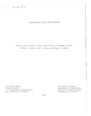
CALIFORNIA TREE SEED ZONESJohn M. Buak, Ronald S. Adams, Jerrold Cone, M. Thompson Conkle ,William J. Libby, Ceail J . Eden, and Miahael J. KnightCalifornia RegionForest ServiceU.S. Department of AgricultureSan Francisco, CaliforniaDivision of ForestryDepartment of ConservationCalifornia Resources AgencySacramento, California1970
CALIFORNIA TREE SEED ZONESbyJohn M. Buck, Rona ld S . Adams, Jerrold Cone,M. Thompson Conkle, William J. Libby, Cecil J . Eden,and Michael J. KnightCalifornia forest tree seed zones were established originally byFowells (1946), with revisions proposed y Roy (1963) and Schubert(1966) . The Forest Tree Seed Committee of the Northern California Section, Society of American Foresters, has revised the original zones and updated the r ecording system descr ibed in the earlie rreports. Fowells 1 (1946) Research Note should be reviewed for background material . Portions of Schubert 1 s (1966) pr oposals wereincorporated in the new system.The Forest Tree Seed Committee acknowledges the assistance of foresters and tree seed dealers in California and the Pacific Northwest who reviewed the rev i sed zone map and reporting system.The Cal ifornia Tree Seed Zone map (attached) is a n integral part ofthe seed collection repor ting system. Zones are delineated on thebasis of collection criteria adopted in the USDA forest seed policyof 1939 (U.S . Forest Service 1948). The policy specifies that seedshould (l) be collected within 100 miles north or south of the planting site and (2) dif er in elevation by less than 1,000 feet. Also,(3) careful consideration should be given to areas having unusualclimatic, topographic, or soil conditions t t might greatly affecttree growth. On the basis of these three criteria, the State wasdivided into six physiogra phic and climatic reg i ons, 32 subregionswithin regions, and 85 seed collection zones. One region is dividedint o four physiographic and climatic areas having 18 of the 85 zones(seep. 3, 900 Series) .1 / Committee members : John M. Buck (chairman), CaliforniaRegion, Forest Service, U.S. Department of Agriculture, San F a cisco;Ronald S. Adams, California Division of Forestry, Sacramento; JerroldCone, forestry consultant, Arcata; M. Thompson Conkle, Pacific Southwest Forest and Range Experiment Stat ion, U.S. Forest Service,Berkeley; and '.-lilliam J. Libby, School of Forestry and Conser1ation,University of Califor ia, Berkeley. Ccrrmittee co laborators: CecilJ. Eden, Cali.:'ornia Division of Forestry, Davis ; .Uc1:ael J . Knight,California Region . U.S . Forest Service, San F a ciscu.
Seed collection zones are l imited to about 50 miles in latitude .Where possible, bOQDdaries have been chosen to follow natural fea tures , such as crests of mountain ranges, ridgetops, and rivers, orphysical features, such as highways, canals, and railroads .The seed collection zones and three - digit method of designating thevarious zones are coordinated with the map and coding system developedby the Western Forest Tree Seed Council in 1966 and now used in Oregonand Washington.The six physiographic and climatic regions are; 090 Series--North Coast Redwood : The redwoods extend along thecoast in the fog belt, 10 to 30 miles wide, from extreme southwesternOregon as far south as Monterey Bay. An exception is an area nearCape Mendocino, which has no redwood . The redwood belt north of CapeMendocino is a relatively high site and contains Douglas - fir and theminor species, including western hemlock, Sitka spruce, grand fir,Port - Orford- cedar and western redcedar . South of Cape Mendocino, theredwood stands are generally of lower site and include Douglas - fir a sa second major species. 100 Series- - Central Coast: This region encompasses the Coast Rangefrom the Sacramento- San Joaquin Rivers south to the southern California mountains, a coastal strip from Monterey Bay to Santa Barbara, andall of the Channel Islands . 300 Series-- North Coast Interior; This region extends from thesummit of the Siskiyous south to San Francisco Bay and lies betweenthe coastal fog belt and the Sacramento Valley. The western portionis predominantly Douglas - fir, while the eastern portion is mixed conife rAn isolated zone, number 390, predominantly Douglas - fir, islocated on the coast in the Cape Mendocino area . 500 Series - -West Slope Cascades- Sierra: This region is an extension of the west slope Cascade mountain region in Oregon and extendssouth to the Tehachapi Mountains ,. Its west and east boundaries are,respective ly, the Cent ral Valle y and t he crest of the Cascades and theSierra NevadaFcwells · Zones II, II I , IV, V, VII, and VIII aregenerally include d in th s enlarged region.Fcwells (1946) points out tha t "The '#est slope of -::.he Sierra Nevadasupports two bread timber types, the mixed conifer and he subalpine .On t he lo,.ver and middle 1-1est slope of the Sierra Nevada and in thesouthern e xtension of the Cascade Range the timber stands are typically mixed conifer, c on ai n ing ponderosa p ine, sugar pine, Pacificwh i te fir, a nd Cal ifornia ince se - cedar, with Douglas- fir included i nthe northern part . In the vicinity of the Mokelumne River, Douglas -firceases to be an ilnpc:ctant part of tl:e stand ." The upper slope::: of the
Sierra Nevada support a suba lpine forest of California red fir, Je ffrey pine, lodgepole pine, and western white pine. 700 Series--East Slope Ca scades - Sierra : This is an extension ofthe east slope Cascade mounta in region in Oregon and extends south onthe east slope of the Cascades and the Sierra Nevada to Walker Pass i nKern County. The timber stand of the east slope of the Sierra Nevadaand of the Columbian Platea u of northeastern California consists ofponderosa pine and Jeffrey pine with mixtures of white f ir and incensecedar . 900 Se rie s -- Four Areas: The 900 series in the Northwest encompassessoutheastern Oregon; in California it serves as a "catchall" for fourseparate a reas to keep the numbering system within the three- digitdesigna tion . The four areas are :950-- Great Basin, northeastern California960--Cent ral Val ley980--s out hern California desert990-- s out hern California mountains (this area contains most ofthe natural conifer stands found in s outhern California)Numbering System for Seed ZonesThe three - digit designation (XYZ) used in numbering the seed collectionzones als o serves another purpose. It helps determine the suitabilityof seed for a planting area . Major areas in California having simila rt opographic, climatic, and edaphic c onditions are given the name"Physiographic and Clima1;ic Regi ons '' These regions are differentia tedb y the hundred- digit in the X positi on .Divisions of the regions , c a lled subregions , are shown by the ten- digitin the Y position. Divisions of the subregions, called zones, areindica ted by the unit digit in the Z position. Thus:Zone numbe rXYZandPhys iogra phic andZo!'.e Z P ys iographic Xc imaticr egionc imaticsubreg cn YIf the zone number (Z) is zero (o) , the zone is unique , a nd is c onside red a subregion . If the zone number is f r om one through nine , thezone i s an arb itra r y brea kdown of the sub r e gion t o ke ep zones about50 mile s long in latitude . Examples of t hi s designation are :A.Zone 390 . -- 3YZ represents the 300 Se rie s , or Nor th Coast I nte r iorphysi cgTaphic and clDTE t c region . 39Z r e presents one of the10 s ub r egions of this Tegi on. 390 is a n uni que zone . It s . inef:'ect., a subregion, since :.here are no other 39Z zones .-j-
B.Zone 525 . --5yz represents the 500 Series, or West Slope Cascades Sierra physiographic and climatic region. 52Z represents one ofthe seven subregions of this region. 525 is a zone, an arbitraryunit of the subregion. Other zones in the subregion are 521, 522,523, 524, and 526 .RulesThe following rules for using seed (or planting stock raised fromseed) collected from California Tree Seed Zones should be closelyobserved :1 . Whenever possible, use seed from the zone in which planting or seeding is to be done.2. If seed from this zone is not available, use seed from animmediately adjacent zone within the same physiographic and climaticsubregion (both zones having the same XY number and a Z number differing by only one or two numbers).3. If seed from an immediately adjacent zone within the samesubregion is not available, use the closest available seed from azone within the same subregion (bot h zones having the same XY number).4 . I f seed from a zone within the same subregion is not available, use seed from a zone within the same physiographic and climaticregion (both zones having the same X number) or from an immediatelyadjacent zone in another region .5 . Movement of seed from one region to another should be doneonly with considerable caution to insure meeting the silvical require ments of the introduced seed.6. Elevational distribution must always be considered, whetherwithin individual zones or between regions . The 1,000- foot criteriaadopted as USDA forest seed policy must be followe d cl osely. There fore, each seed lot must be separated by zone a nd 500- foot elevational differences.Standardized Labeling System for SeedA standardized label i g system for seed has been adopted by the SAFSection Tree Seed Committee, he U.S. Forest Service, and the California Division of Forestry. I t provides for species, zone, elevation, and year of collec t ion. Codes for scientific names of California wildland plants have been established (Reed , Powell, and Bal 1963) .The codes are used to identify the species in the labeling system.Elevation is designated with a two-digit n mber indicating tte eleva tion of the upper lLmit of the collection; for example, the number for0 to 500 .:'eet is 05, and for 4,001 to 4,500 :'eet is 45.
In the seed lot code, zone is represented by a whole number, elevation by a decimal, and year of collection by two numbers after adash . For example, the code PIPO 525 . 40- 67 represents Pinus ponderosa seed collected in zone 525, at an elevation between 3,501a nd 4,000 feet, and collected in 1967 . Other seed source informat i on , such as township, r ange, and section, may be added to theseed lot records, if des i red.Adoption of the California Tree Seed Zones and the labeling systemfor seed lots makes possible a "universa l language" for working withtree seeds and planting stock. All persons who are in regenerationwork, whether a s a seed dealer, nurseryma n, someone requesting seedsor planting stock or doing the seeding or planting, will have acommon understanding of the source of the seed or planting stock.Use of the standardized seed zones and labeling system will providea basis for t e sting the adequacy of the zone classification, forevaluating geographic var ia ion, and for determining any neededadjustment in seed zone boundaries .ReferencesFowells, H. A. 1946. Forest seed collection zones in California.U. S . Fore st Serv ., Cali . Forest & Range Exp . Sta. Forest Res.Note 51 , 4 p ., illus .Reed, Merton J., Powell, W. Robert, and Bal, Ben S. 1963. Elec tronic data processing codes for California wildl and plants.U. S . Forest Serv., Pacific SW . Forest & Range Exp. Sta. Res.Note PSW- N20, 314 p .Roy, Douglass F . 1963 . Instruc tions and codes for rec ording forest tree seed information in California. U.S. Forest Serv .,Pacific SW. Forest & Ra nge Exp . St a . , 22 p . , ill us .Schubert, Gilbert H. 1966 . Major and local seed collection zonesin California . (Unpublished report on file at Pacific SW.Forest & Range Exp . Sta . , Fares Serv . , U. S . Dep . Agr.,Redding , Cal i f . )U.S . Forest Service . 1948 . Woody- plant seed manual .Agr . Misc. Publ. 654, 416 p .U.S . Dep .
STATE OF CAUFORNIATHE RESOURCES AGENCYDEPARTMENT OF CONSERVATIONDIVISION OF FORESTRYCALIFORNIA TREE SEED ZONE-·--MAPPhyttoqropt'IIC ond chmohc rtq on boundariesPhyltOQropl'ue and chmohc reQton b-oundone w1thin the 900 nuesPhyt oQrooh e and chmot c tubreq on boundonesZonts
700 Series--East Slope Ca scades-Sierra: This is an extension of the east slope Cascade mounta in region in Oregon and extends south on the east slope of the Cascades and the Sierra Nevada to Walker Pass i n Kern County. The timber stan