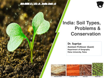
Transcription
Land,Soil, Water,Natural Vegetationand Wildlife ResourcesIn a small village in Tanzania, Africa, Mamba gets upvery early in the morning to fetch water. She has to walka long way and returns after a few hours. She then helpsher mother in the house and joins her brothers in takingcare of their goats. All her family owns is a piece of rockyland around their small hut. Mamba’s father can barelygrow some maize and beans on it after toiling hard. Thisis not enough to feed their family for the whole year.Peter lives in the heart of the sheep rearing region inNew Zealand where his family runs a wool processingfactory. Everyday when he returns from school, Peterwatches his uncle taking care of their sheep. Their sheepyard is situated on a wide grassy plain with hills in thefar distance. It is managed in a scientific way using thelatest technology. Peter’s family also grows vegetablesthrough organic farming.Mamba and Peter stay in two different parts of theworld and lead very different lives. This difference isbecause of the differences in the quality of land, soil,water, natural vegetation, animals and the usage oftechnology. The availability of such resources is themain reason places differ from each other.LandLand is among the most important natural resources.It covers only about thirty per cent of the total area ofthe earth’s surface and all parts of this small percentageare not habitable.The uneven distribution of population in differentparts of the world is mainly due to varied characteristicsof land and climate. The rugged topography, steep slopesof the mountains, low-lying areas susceptible to water2021–22Let’s doObserve the land,type of soil andwater availabilityin the region youlive. Discuss inyour class, how ithas influenced thelifestyle of peoplethere.Do you know?Ninety per centof the worldpopulationoccupies onlythirty per cent ofland area. Theremaining seventyper cent of theland is eithersparsely populatedor uninhabited.
logging, desert areas, thickforested areas are normallysparselypopulatedoruninhabited. Plains and rivervalleys offer suitable land foragriculture. Hence, these arethe densely populated areasof the world.Land UseLand is used for differentpurposes such as agriculture,Fig. 2.1: Salzburg in Austriamining, buildingNotice in how many ways the land has been used in the forestry,above picture.houses, roads and setting upof industries. This is commonly termed as Land use.Can you list out the different ways in which Mamba’sand Peter’s family use their land?The use of land is determined by physical factorssuch as topography, soil, climate, minerals andavailability of water. Human factors such as populationand technology are also important determinants of landuse pattern.Land can also be classified on the basis of ownershipLet’s doas – private land and community land. Private landTalk to someis owned by individuals whereas, community landelderly personis owned by the community for common uses likein your family orcollection of fodder, fruits, nuts or medicinal herbs.neighbourhood andThese community lands are also called commoncollect informationabout changesproperty resources.in the land usePeople and their demands are ever growing but theover the years, inavailability of land is limited. The quality of land alsothe place wherediffers from place to place. People started encroachingyou live. Displaythe common lands to build up commercial areas,your findings on abulletin board inhousing complexes in the urban areas and to expandyour classroom.the agricultural land in the rural areas. Today thevast changes in the land use pattern also reflect thecultural changes in our society. Land degradation,landslides, soil erosion, desertification are the majorthreats to the environment because of the expansionof agriculture and construction activities.8ResourcesandDevelopment2021–22
2.1.3.4.Fig. 2.2: Change in land use over timeConservationofLand ResourceGrowing population and their ever growing demand hasled to a large scale destruction of forest cover and arableland and has created a fear of losing this natural resource.Therefore, the present rate of degradation of land mustbe checked. Afforestation, land reclamation, regulateduse of chemical pesticide and fertilisers and checks onovergrazing are some of the common methods used toconserve land resources.GlossaryWeatheringThe breakingup and decay ofexposed rocks,by temperaturechanges, frostaction, plants,animals andhuman activity.SoilThe thin layer of grainy substance covering the surfaceof the earth is called soil. It is closely linked to land.Landforms determine the type of soil. Soil is madeup of organic matter, minerals and weathered rocksfound on the earth. This happens through the processof weathering. The right mix of minerals and organicmatter make the soil fertile.Land, Soil, Water, Natural Vegetation2021–22andWildlife Resources9
LandslidesLandslides are simply defined as the mass movementof rock, debris or earth down a slope. They often takeplace in conjunction with earthquakes, floods andvolcanoes. A prolonged spell of rainfall can causeheavy landslide that can block the flow of river forquite some time. The formation of river blocks cancause havoc to the settlements downstream on itsbursting. In the hilly terrain landslides have been amajor and widely spread natural disaster that oftenstrike life and property and occupy a position of majorconcern.A LandslideA Case StudyA massive landslide hit Pangi village near Reckong Peo in Kinnaur district ofHimachal Pradesh and damaged a 200-meter stretch of old Hindustan-Tibetroad, National Highway - 22. This landslide was triggered by intense blastingat Pangi village. Due to the blasting this weak zone of slope collapsed andcaused intense damage to the road and nearby villages. The Pangi village wascompletely vacated to avoid any possible loss of life.Mitigation MechanismAdvancement in scientific techniques has empowered us to understand whatfactors cause landslides and how to manage them. Some broad mitigationtechniques of landslide are as follows: Hazard mapping to locate areas prone tolandslides. Hence, such areas can be avoidedfor building settlements. Construction of retention wall to stop land fromslipping. Increase in the vegetation cover to arrestlandslide. The surface drainage control works to controlRetention Wallthe movement of landslide along with rain waterand spring flows.10ResourcesandDevelopment2021–22
Top soil with humus andvegetationDo you know?It takes hundredsof years to makejust one centimetreof soil.Sub soil with sand, silt andclayWeathered rock materialParent rockFig. 2.3: Soil ProfileFactorsofSoil FormationThe major factors of soil formation are the nature ofthe parent rock and climatic factors. Other factors arethe topography, role of organic material and time takenfor the composition of soil formation. All these differfrom place to place.Parent RockDetermines colour,texture, chemicalpropertiesmineral, content,permeabilityReliefAltitude andslope, determineaccumulationof soilSoilClimateTemperature,Rainfall influencerate of weatheringand humusformationFlora, Fauna andMicro-organismAffect the rate of humusformationTimeDetermines thicknessof soil profileFig. 2.4: Factors affecting soil formationLand, Soil, Water, Natural Vegetation2021–22andWildlife Resources11
ActivityIn India soilscould be alluvial,black, red, laterite,desertic andmountain soil.Collect a handfulof differenttypes of soil andobserve. How arethey ConservationSoil erosion and depletion are the major threats to soilas a resource. Both human and natural factors canlead to degradation of soils. Factors which lead to soildegradation are deforestation, overgrazing, overuse ofchemical feritilisers or pesticides, rain wash, landslidesand floods.Some methods of soil conservation are listed below:Mulching: The bare ground between plants is coveredwith a layer of organic matter like straw. It helps toretain soil moisture.Contour barriers: Stones, grass, soil are used to buildbarriers along contours. Trenches are made in front ofthe barriers to collect water.Rock dam: Rocks are piled up to slow down the flow ofwater. This prevents gullies and further soil loss.Fig 2.5: Terrace FarmingFig 2.7: Shelter BeltsofFig 2.6: Contour PloughingTerrace farming: Broad flat steps or terraces aremade on the steep slopes so that flat surfaces areavailable to grow crops. They reduce surface runoff and soil erosion (Fig. 2.5).Intercropping: Different crops are grown in alternaterows and are sown at different times to protect thesoil from rain wash.Contour ploughing: Ploughing parallel to thecontours of a hill slope to form a natural barrierfor water to flow down the slope (Fig. 2.6).Shelter belts: In the coastal and dry regions, rowsof trees are planted to check the wind movement toprotect soil cover (Fig. 2.7).Development2021–22
ActivityTake two trays A and B of samesize. Make six holes at one endof these trays and then fill themwith the same amount of soil.Leave the soil in tray A bare whilesow wheat or rice grains in trayB. When the grain in tray B hasgrown a few centimetres high,place both the trays in such away that they are on a slope.Pour one mug of water fromthe same height into each tray.Collect the muddy water thattrickles down the holes of bothtrays in two separate containersand compare how much soilis washed out of each tray?ABWaterWater is a vital renewable natural resource. Threefourth’s of the earth’s surface is covered with water.It is therefore appropriately called the ‘water planet’.It was in the primitive oceans that life began almost3.5 billion years back. Even today, the oceans covertwo-thirds of the earth’s surface and support a richvariety of plant and animal life. The ocean water ishowever saline and not fit for human consumption.Fresh water accounts for only about 2.7 per cent. Nearly70 per cent of this occurs as ice sheets and glaciers inAntarctica, Greenland and mountain regions. Due totheir location they are inaccessible. Only 1 per cent offreshwater is available and fit for human use. It is foundas ground water, as surface water in rivers and lakesand as water vapour in the atmosphere.Fresh water is therefore, the most precious substanceon earth. Water can neither be added nor subtractedfrom the earth. Its total volume remains constant.Its abundance only seems to vary because it is inconstant motion, cycling through the oceans, theair, the land and back again, through the processesof evaporation, precipitation and run-off. This asyou already know is referred to as the ‘water cycle’.Land, Soil, Water, Natural Vegetation2021–22Do you know?In 1975, theconsumption ofwater for humanuse was 3850cukm/year. It soaredto more than 6000cu km/year in theyear 2000.Do you know?A dripping tapwastes1200litres of water ina year.andWildlife Resources13
Humans use huge amounts of water not only fordrinking and washing but also in the process ting electricitythrough reservoirs ofActivitydams are the otherAn average urban Indian uses about 150 litresusages.Increasingof water every day.population,risingUseLitres per person per daydemands for food andDrinking3cash crops, increasingCooking4urbanisation and risingBathing20standards of livingFlushing40Washing clothes40are the major factorsWashing utensils20leading to shortages inGardening23supply of fresh waterTotal150either due to dryingCan you suggest some ways to bring down this amount?up of water sources orwater pollution.Do you know?Have you everheard about a watermarket? Amrelicity in Saurastraregion with apopulation of 1.25lakhs is completelydependent onpurchasing waterfrom the nearbytalukas.ProblemsofWater AvailabilityThere is scarcity of water in many regions of the world.Most of Africa, West Asia, South Asia, parts of westernUSA, north-west Mexico, parts of South America andentire Australia are facing shortages in fresh water supply.Countries located in climatic zones most susceptible todroughts face great problems of water scarcity. Thus,water shortage may be a consequence of variation inseasonal or annual precipitation or the scarcity is causedby over-exploitation and contamination of water sources.ConservationResourcesFig 2.8: River Yamuna is getting polluted dueto sewage, industrial effluents and garbage14ResourcesandofWaterAccess to clean and adequate watersources is a major problem facing theworld today. Steps have to be taken toconserve this dwindling resource. Eventhough water is a renewable resource, itsoveruse and pollution make it unfit foruse. Discharge of untreated or partiallytreated sewage, agricultural chemicalsand industrial effluents in water bodiesare major contaminants. They pollutewater with nitrates, metals and pesticides.Development2021–22
Most of these chemicals are non-biodegradable andreach human bodies through water. Water pollution canbe controlled by treating these effluents suitably beforereleasing them in water bodies.Forest and other vegetation cover slow thesurface runoff and replenish undergroundwater. Water harvesting is another methodto save surface runoff. The canals usedfor irrigating field should be properlylined to minimise losses by water seepage.Sprinklers effectively irrigate the area bychecking water losses through seepage andevaporation. In dry regions with high ratesof evaporation, drip or trickle irrigation isFig 2.9: A Water Sprinklervery useful. The valuable water resourcecan therefore be conserved by adoptingthese means of irrigation.Do you know?Natural VegetationandRain waterharvesting isthe process ofcollecting rainwater from rooftops and directingit to an appropriatelocation whereit is stored forfuture use. On anaverage, one spellof rain for twohours is enough tosave 8,000 litres ofwater.WildlifeSome school children were visiting an exhibition onhandicrafts. The articles in the exhibition were collectedfrom different parts of the country. Mona picked up a bagand exclaimed, “This is a beautiful handbag!” “Yes, itis made from Jute,” the teacher said. “Do you see thosebaskets, lamp shades and chairs? Those are made ofcanes and bamboos. In the eastern and north easternhumid regions of India, bamboo grows in plenty.” Jassywas excited to see a silk scarf. “See this beautifulscarf”. The teacher explained that silk is obtained fromsilk worms that are bred on Mulberry trees. The childrenunderstood that plants provide us with many differentproducts that we use in our day-to-day life.Natural vegetation and wildlife exist onlyin the narrow zone of contact between thelithosphere, hydrosphere and atmospherethat we call biosphere. In the biosphere livingbeings are inter-related and interdependenton each other for survival. This life supportingsystem is known as the ecosystem. Vegetationand wildlife are valuable resources. Plantsprovide us with timber, give shelter to animals,produce oxygen we breathe, protects soils soFig 2.10: Silk WormsLand, Soil, Water, Natural Vegetation2021–22andWildlife Resources15
Do you know?Vultures inthe Indiansubcontinent weredying of kidneyfailure shortlyafter scavenginglivestock treatedwith diclofenac, apainkiller that issimilar to aspirinor ibuprofen.Efforts are on toban the drug forlivestock use andbreed vultures incaptivity.essential for growing crops,act as shelter belts, helpin storage of undergroundwater, give us fruits, nuts,latex, turpentine oil, gum,medicinal plants and alsothe paper that is so essentialfor your studies. There areinnumerable uses of plantsand you can add some more.Wildlife includes animals,birds, insects as well as theaquatic life forms. They provideus milk, meat, hides and wool.Fig 2.11: Brahma KamalInsects like bees provide usa Medicinal Herbhoney, help in pollination offlowers and have an importantrole to play as decomposersin the ecosystem. The birdsfeed on insects and act asdecomposers as well. Vulturedue to its ability to feed on deadlivestock is a scavenger andconsidered a vital cleanser ofthe environment. So animalsbig or small, all are integral Fig 2.12: A Blue Kingfisherto maintaining balance inthe ecosystem.DistributionofNatural VegetationThe growth of vegetation depends primarily ontemperature and moisture. The major vegetationtypes of the world are grouped as forests,grasslands, scrubs and tundra.In areas of heavy rainfall, huge treesmay thrive. The forests are thus associatedwith areas having abundant water supply.As the amount of moisture decreases thesize of trees and their density reduces.Short stunted trees and grasses grow inthe regions of moderate rainfall forming thegrasslands of the world. Thorny shrubs andFig. 2.13: Grassland and Forest16ResourcesandDevelopment2021–22
scrubs grow in dry areas of low rainfall.In such areas plants have deep roots andleaves with thorny and waxy surfacereduce loss of moisture throughtranspiration. Tundra vegetation ofcold Polar Regions comprise of mossesand lichens.Today there are many more people inthe world than there were two centuriesback. To feed the growing numbers,large areas of forests have been clearedto grow crops. Forest cover all over theworld is vanishing rapidly. Thereis an urgent need to conservethis valuable resource.Fig. 2.14: A Python in a forestConservation of NaturalVegetation and WildlifeForests are our wealth. Plantsgive shelter to the animals andtogether they maintain theecosystem. Changes of climateand human interferences cancause the loss of natural habitatsfor the plants and animals. Manyspecies have become vulnerable Fig. 2.15: A collage of a forest made by school studentsor endangered and some areon the verge of extinction. Deforestation,soil erosion, constructional activities, forestfires, tsunami and landslides are some of thehuman and natural factors which acceleratethe process of extinction of these resources.One of the major concerns is the poachingwhich result in a sharp decline in the numberof particular species. The animals are poachedfor collection and illegal trade of hides, skins,nails, teeth, horns as well as feathers. Someof these animals are tiger, lion, elephant,deer, black buck, crocodile, rhinoceros, snowFig. 2.16: Loss of rainforest inGreat Nicobar after TsunamiLand, Soil, Water, Natural Vegetation2021–22andWildlife Resources17
Fig. 2.17: Black buck also needs protectionleopard, ostrich and peacock. These can beconserved by increasing awareness.National parks, wildlife sanctuaries,biosphere reserves are made to protect ournatural vegetation and wildlife. Conservationof creeks, lakes, and wetlands is necessary tosave the precious resource from depletionThere is a balance in the environmentif the relative number of species is notdisturbed. Human activities in several partsof the world have disturbed the naturalForest FireActivityRead the news item and find out how fire started in California ? Could it be avoided?Know MoreForest fire is a threat to the entire region of fauna and flora. It occurs mainly due tothree reasons :1. Natural fire due to lightening etc.2. Fire due to heat generated in the litter due to carelessness of people.3. Fire purposely caused by local inhabitants, mischief makers, miscreants etc.Some Control Measures1. Prevention of fires through education.2. Prompt detection of fires through well co-ordinated network of observation points,efficient ground patroling and communication network.18ResourcesandDevelopment2021–22
habitats of many species. Due to indiscriminate killings,several birds and animals have either become extinct orare on the verge of extinction.Awareness programmes like social forestry andVanamohatasava should be encouraged at the regionaland community level. School children should beencouraged to bird watch and visit nature camps sothat they appreciate the habitat of varied species.Many countries have passed laws against the tradeas well as killing of birds and animals. In India, killinglions, tigers, deers, great Indian bustards and peacocksis illegal.An international convention CITES hasbeen established that lists several speciesof animals and birds in which trade isprohibited. Conservation of plants andanimals is an ethical duty of every citizen.GlossaryNational ParkA natural areadesignated toprotect theecological integrityof one or moreecosystems for thepresent and thefuture generationsFig. 2:18: A Herd of CheetalsGlossaryBiosphere reservesSeries of protectedareas linkedthrough a globalnetwork, intendedto demonstratethe relationshipbetweenconservation anddevelopment.Fig. 2:19: A herd of Elephants in KazirangaNational ParkDo you know?CITES (the Convention on International Trade in Endangered Speciesof Wild Fauna and Flora) is an international agreement betweengovernments. It aims to ensure that international trade in specimens ofwild animals and plants does not threaten their survival. Roughly 5,000species of animals and 28,000 species of plants are protected. Bears,dolphins, cacti, corals, orchids and aloes are some examples.Land, Soil, Water, Natural Vegetation2021–22andWildlife Resources19
Exercises1. Answer the following questions.(i) Which are the two main climatic factors responsible for soil formation?(ii) Write any two reasons for land degradation today.(iii) Why is land considered an important resource?(iv) Name any two steps that government has taken to conserve plantsand animals.(v) Suggest three ways to conserve water.2. Tick the correct answer.(i) Which one of the following is NOT a factor of soil formation?(a) time(b) soil texture(c) organic matter(ii) Which one of the following methods is most appropriate to checksoil erosion on steep slopes?(a) shelter belts(b) mulching(c) terrace cultivation(iii) Which one of the following is NOT in favour of the conservationof nature?(a) switch off the bulb when not in use(b) close the tap immediately after using(c) dispose polypacks after shopping3. Match the followings :(i) Land use(ii) Humus(iii) Rock dams(iv) Biosphere(a) prevent soil erosion(b) narrow zone of contact between the lithosphere,hydrosphere and atmosphere(c) productive use of land(d) organic matter deposited on top soil(e) contour ploughing4. State whether the given statement is true or false.If true, write the reasons.(i) Ganga–Brahmaputra plain of India is an overpopulated region.(ii) Water availability per person in India is declining.(iii) Rows of trees planted in the coastal areas to check the windmovement is called intercropping.(iv) Human interference and changes of climate can maintain theecosystem.5. ActivityDiscuss some more reasons which are responsible for changes of land use pattern.Has your place undergone any change in the land use pattern in recent years?20ResourcesandDevelopment2021–22
Find out from your parents and elderly people. You can conduct an interview byasking the following questions.PlaceWhen yourWhen yourgrandparents wereparent’s were in their 30’sin their 30’sWhy do youthink this ishappening?Are commonareas andopen spacesdisappearing?RuralNumber ofcattle andpoultry ownedNumber oftrees andponds in thevillageMainoccupation ofthe head ofthe familyUrbanNumber ofcars ownedNumber ofrooms in thehouseNumber ofmetalledroadsNumber offlyovers in thecityNumber ofparks andplaygroundsBased on the table you have just completed, draw a picture of land use patternsthat you foresee in your neighbourhood after 20 years. Why do you think that landuse patterns change over the years?Land, Soil, Water, Natural Vegetation2021–22andWildlife Resources21
as – private land and community land. Private land is owned by individuals whereas, community land is owned by the community for common uses like collection of fodder, fruits, nuts or medicinal herbs. These community lands are also called . common property resources. People and their demands are ever gro