Transcription
General Habitat Assessment 15-acre Site11048 and 11079 Laurel AvenueCity of Bloomington, San Bernardino County, CaliforniaPrepared for:Boruchin Administrative Trustc/o Allan N. Lowy ESQ, (PLC), Of Council Turner Aubert & Friedman, LLP8383 Wilshire Blvd., Ste. 510Beverly Hills, CA 90211-2406Prepared by:Scott CameronEcological Sciences, Inc.601 Glade DriveSanta Paula, CA 93060805.921.0583July 2014
July 7, 2014Boruchin Administrative Trustc/o Allan N. Lowy ESQ, (PLC), Of Council Turner Aubert & Friedman, LLP8383 Wilshire Blvd., Ste. 510Beverly Hills, CA 90211-2406SUBJECT:Results of a Habitat Suitability Evaluation, 15-acre Site, City of Bloomington, SanBernardino County, CaliforniaLadies and Gentlemen:This letter report presents findings of a reconnaissance-level survey conducted to generally evaluate thesuitability of a 15-acre site (consisting of two separate parcels) to support sensitive biological resourcesas part of the environmental review process.IntroductionThe subject 15-acre site is regionally located in the City of Bloomington, San Bernardino County,California (Plate 1). Specifically, the project site is located at 11048 ( 10 acres) and 11079 ( 5 acres)Laurel Avenue. The site occurs on the “Fontana” USGS 7.5-minute topographic map, Township 1 South,Range 5 West, Section 28 (Plate 2).Projects proposed in this area that contain potentially suitable habitat to support sensitive biologicalresources must demonstrate to reviewing agencies that potential project-related impacts to sensitivebiological resources are adequately addressed and mitigated pursuant to the California EnvironmentalQuality Act (CEQA) and the federal Endangered Species Act (Act) of 1973, as amended. Biologicalresources within the project site may fall under the jurisdiction of several federal and state agencies,including, but not necessarily limited to, California Department of Fish and Wildlife (CDFW), U.S. Fish andWildlife Service (FWS), City of Bloomington (City), County of San Bernardino (County), Regional WaterQuality Control Board (RWQCB), and U.S. Army Corps of Engineers (USACE). Accordingly, results of thishabitat suitability evaluation are intended to provide the applicant and resource agencies with preliminarybiological information required for planning and permitting decisions concerning the proposed project.Due to the inherent limitations of unseasonal or habitat-based data, definitive conclusions regarding theactual presence or absence of selected sensitive biological resources cannot be made in this report.Therefore, conclusions relative to potential presence or absence of certain sensitive biological resourcesare based solely on the nature of habitat present. This general analysis of biological resources is basedon information compiled through field reconnaissance, literature review, and by applicable referencematerials. Methods used in this study are outlined below.Investigative MethodsInformation ReviewDocumentation pertinent to the biological resources in the vicinity of the site was reviewed and analyzed.Primary data sources reviewed to evaluate the occurrence potential of special-status resources on thesubject site, included, but were not necessarily limited to: (1) California Natural Diversity Data Base601 GLADE DRIVE SANTA PAULA, CA 93060 TEL 805.921.0583 FAX 805.921.0683email: scameron@ecosciencesinc.com
Survey Areaplate 1Regional Site LocationJuly 201415-acre Boruchin Site
Study Area Boundaryplate 2USGS Topographic Vicinity MapJuly 201415-acre Boruchin Site
(CNDDB 2014); (2) California Native Plant Society (CNPS 2014) on-line inventory for the Fontana andsurrounding 7.5-minute quadrangle maps; (3) available literature pertaining to habitat requirements ofspecial-status species potentially occurring in the project site; (4) 2013 USFWS Information, Planning,and Conservation System Database (IPaC); and (5) historic distributional data contained in Hall (1981);Grinnell and Miller (1944); Garrett and Dunn (1981); Holland (1986); Stebbins (1985); Hickman (1993);and CNPS (2001).Field SurveyEcological Sciences Principal Biologist, Scott Cameron, conducted a reconnaissance-level field survey tocharacterize on-site habitats and to evaluate their potential to support sensitive species on May 22, 2014.Plant species and vegetation communities were primarily identified by walking transects throughout thesite. All direct observations of wildlife were recorded, as was wildlife sign. In addition to species actuallydetected, expected use of the site by other wildlife was evaluated from habitat analysis of the site,combined with known habitat preferences of locally occurring wildlife species. The site was alsoevaluated for the potential presence of plant, animal, or habitats considered rare, threatened, sensitive,endangered, or otherwise unique by regulatory or resource agencies. Weather conditions during the May2014 survey were overcast and calm with air temperatures of approximately 61-63 F.Existing Site ConditionsThe parcel located at 11048 Laurel Avenue is characterized as a highly degraded site exposed tovarious types of anthropogenic disturbances. A small residence along with corrals and pens used forgoats, chickens, pigs, turkeys, geese, etc, as well as pasture for a cow is present on site. The remainderof the site is highly disturbed and exposed to extensive manure, debris, soil dumping, as well as recurringdiscing activities. A tree wind row bisects the eastern portion of the site. A majority of the site is relativelybarren of vegetation due to the aforementioned activities. Patchy non-native plant species recordedinclude foxtail chess (Bromus madritensis ssp. rubens), ripgut grass (Bromus diandrus), Mediterraneangrass (Schismus sp.), Bermuda grass (Cynodon dactylon), oat (Avena sp.), filaree (Erodium cicutarium),mustard (Brassica sp.), cheeseweed (Malva parviflora), Lamb’s quarters (Chenopodium album), commonprickly lettuce (Lactuca serriola), golden crownbeard (Verbesina encelioides), puncture vine (Tribulusterrestris), and fleabane (Conyza bonariensis). Native species present on site included a few scatteredcommon sunflower (Helianthus annuus). In addition, ornamental landscaping such as tree-of-heaven(Ailanthus altissima), Peruvian pepper (Schinus molle), Acacia (Acacia sp.), and common olive (Oleaeuropea) are present. Elevation is approximately 1,040 feet above msl. Plates 3a-3b photographicallyillustrate existing site conditions. Plate 4 schematically illustrates site features/vegetation types.The parcel located at 11079 Laurel Avenue is characterized by unfinished residential development (2houses) located in the southwestern portion of the site, disced areas with gravel and debris in thenorthern half of the site, and an abandoned orchard in the southern part of the site. A brick wall surroundsthe parcel. Various construction equipment and debris is also present on site. Surrounding land usesinclude rural residential and agriculture. The site is mostly barren except for the orchard area. Patchynon-native plant species recorded include foxtail chess, ripgut grass, Mediterranean grass, oat, filaree,mustard, cheeseweed, Lamb’s quarters, common prickly lettuce, mustard, golden crownbeard, puncturevine, and fleabane. Native species present on site included a few scattered telegraph weed (Heterothecagrandiflora) and common sunflower. Elevation is approximately 1,040 feet above msl. Plates 3c-3bphotographically illustrate existing site conditions. Plate 4 schematically illustrates site features/vegetationtypes.WildlifeCommon avian species observed on both parcels included red-tailed hawk (Buteo jamaicensis), commonraven (Corvus corax), mourning dove (Zenaida macroura), killdeer (Charadrius vociferus), Bullock's oriole4Boruchin Administrative TrustGeneral Habitat AssessmentJuly 7, 2014
View to east from northwestern portion of 11079View to north from north-center portion of 11079plateJuly 20143aSite Photographs15-acre Boruchin Site
View to south of orchard area of 11079View to west from southwestern portion of 11079plateJuly 20143bSite Photographs15-acre Boruchin Site
View to west from southeast portion of 11048View to east from southwestern portion of 11048plateJuly 20143cSite Photographs15-acre Boruchin Site
View to northeast from southern portion of 11048View to south from center of 11048plateJuly 20143dSite Photographs15-acre Boruchin Site
Map Key 11079 11048 orchard disced gravel with debris development tree wind row soil/manure piles disced with debris disced/grubbed/grazed/debris(extensive cobbles/gravels/manure) grazed pasture earthen berm Study Areaplate 4Site Features SchematicJuly 201415-acre Boruchin Site
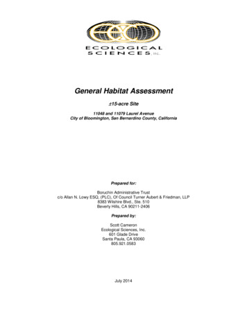
NAPSoil Map KeyTuB Tujunga loamy sandDb Delhi fine sandSource: Natural Resources Conservation Service (NRCS-website accessed May 21, 2014) Study Area Boundary Extent of Soil AnalysisJuly 2014plate 5Project Area Soils15-acre Boruchin Site
(Icterus bullockii), western kingbird (Tyrannus verticalis), northern mockingbird (Mimus polyglottos), housefinch (Carpodacus mexicanus), and house sparrow (Passer domesticus). Mammals recorded, or of whichsign was detected, included California ground squirrel (Spermophilus beecheyi).General Soils Analysis / Soil Conservation Map ReviewA review of soil maps prepared by the Natural Resources Conservation Service (NRCS) website for SanBernardino County, Southwestern Part, California indicate that the subject site is primarily located withinan area mapped as Delhi sand (Db), with a small portion containing Tujunga loamy sand (TuB) in thenortheast corner of each parcel. Soils are highly variable throughout the site due to exposure to varioushuman activities as described. Soils on 11048 contain large areas of cobble/gravel substrates withmanure and other debris assimilated in the substrate (friable to compact), while those present in 11079include gravels and other debris and also vary from friable to compact. Plate 5 (previous page) illustratesmapped area soils.Sensitive Biological Resources EvaluationDiscussed in this section are plant and wildlife species potentially present in the study area that havebeen afforded special recognition by federal or state agencies. The focus of this discussion is on thosespecies that would potentially pose considerable constraints on the proposed project because of theirhigh sensitivity status (listed or proposed for listing as rare, threatened, or endangered) with state and/orfederal resource agencies. In addition, plants included on Lists 1, 2, 3, or 4 of the CNPS inventory arealso considered of special-status. Vegetation communities that are unique, of relatively limiteddistribution, or of particular value to wildlife and considered sensitive by state and/or federal resourceagencies are also generally discussed.In general, those species presented in Tables 1 and 2 that are “not expected” or that have a “lowoccurrence potential” generally correspond to “less than significant” under CEQA. The occurrencepotential of special-status plant and wildlife species is primarily based on habitat types present,occurrence records of sensitive species from the site vicinity, and results of the on-site reconnaissancesurvey. No focused botanical or zoological surveys were conducted.Special-Status Plant SpeciesNo special-status plant species were detected on site during the reconnaissance-level survey and noneare expected due to lack of suitable habitat. Special-status plant species known from the region thatpotentially occur within the project site are summarized below in Table 1.Table 1Special-Status Plant Species Known to Occur in the Site VicinityCommon NameScientific NameChaparral sand verbenaAbronia villosa var. auritaFederal--StatusState--1Habitat RequirementsCNPS1BPlummer’s mariposa lilyCalochortus plummeraeFSC--1BParry’s spineflowerChorizanthe parryi ssp.parryiMany-stemmed dudleyaDudleya multicaulisFSC--3FSC--1BChaparral, coastal scrub with sandy soilsChaparral, cismontane woodlands,coastal scrub, Lower coniferous forests,and grasslands; associated with graniticsoils.Chaparral and coastal scrub; associatedwith sandy or rocky openings.Chaparral, coastal scrub, and grasslands;often associated with clay soils.OccurrencePotentialNot Expected:suitable habitatnot presentNot Expected:suitable habitatnot present onsiteNot Expected:suitable habitatnot presentNot Expected:suitable habitatnot present11Boruchin Administrative TrustGeneral Habitat AssessmentJuly 7, 2014
Table 1-continuedSpecial-Status Plant Species Known to Occur in the Site VicinityCommon NameScientific NameSanta Ana RiverwoollystarEriastrum densifoliumssp. sanctorumCalifornia muhlyMuhlenbergia californicaFederalFEStatusStateCE1Habitat RequirementsCNPS1BCoastal scrub, chaparral, and alluvialscrub; associated with sandy soil in riverfloodplains or terraced fluvial deposits.Not Expected:suitable habitatnot present----1BSan Diego ambrosiaAmbrosia pumilaFE--1BCalifornia saw-grassCladium californicum----2FECE1BChaparral, alluvial fan sage scrub;terraces and washes----1BChaparral, cismontane woodland, coastalscrub; sandy or gravellyFSC--1BPlayas, vernal pools----1B----2Chaparral and coastal scrub; associatedwith dry soils; known to occur onroadsides.Coastal scrub, Sonoran desert scrubFSC--1ASandy coastal scrubFECE1BSwamps and marshesProstrate vernal poolnavarretiaNavarretia prostrata----1BValley and foothill grassland, coastalscrub, vernal poolsNot Expected:suitable habitatnot presentChaparral ragwortSenecio aphanactis----2Chaparral, cismontane woodland, coastalscrub/alkalineSan Bernardino asterSymphyotrichumdefoliatumPrairie wedge grassSphenopholis obtusata----1B----2Meadows and seeps, marshes andswamps; coastal scrub, woodlands; mesicgrassland; ditchesCismontane woodland, meadows andseeps/mesicNot Expected:suitable habitatnot presentNot Expected:suitable habitatnot presentNot Expected:suitable h
07.07.2014 · General Habitat Assessment July 7, 2014 (Icterus bullockii), western kingbird (Tyrannus verticalis), northern mockingbird (Mimus polyglottos), house finch (Carpodacus mexicanus), and house sparrow (Passer domesticus). Mammals recorded, or of which sign was detected, included California ground squirrel (Spermophilus beecheyi).