Transcription
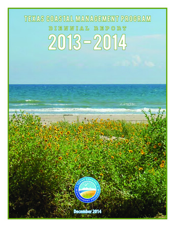
T E X A S C O A S TA L M A N A G E M E N T P R O G R A MB I E N N I A LR E P O R T2013 - 2014December 2014
CONTENTSList of Acronyms1Introduction2Program Goals4Program Map5Coordinating Partnerships6Highlights & Significant Events8Program Budget10Program Overview11Local Consistency Review11State Consistency Review12Federal Consistency Review13Permit Service Center15Texas Coastal Nonpoint Source Pollution Control Program16Program Changes17Grants18Funding Breakdown18Cycle 18 Projects19Cycle 19 Projects28Performance Measures39Education and Outreach58Coastal Demographics60
ACRONYMSABNCArmand Bayou Nature CenterCZMPCoastal Zone Management ProgramBEGThe University of TexasBureau of Economic GeologyCZMAPMSCoastal Zone Management ActPerformance Measurement SystemOSSFsOnsite Sewage FacilitiesCBBFCoastal Bend Bays FoundationFYFiscal YearPAGPermitting Assistance GroupCCACoastal Coordination ActGBFGalveston Bay FoundationPCBsPolychlorinated BiphenylsCCACCoastal Coordination AdvisoryCommitteeGLOTexas General Land OfficePSCPermit Service CenterJPAFJoint Permit Application FormPSMProjects of Special MeritLand CommissionerTexas Land CommissionerSACTexas Sunset Advisory CommissionNDZNo Discharge ZoneSSCNSpanish & Science Club NetworkNERRSNational Estuarine ResearchReserve SystemTACTechnical Advisory CommitteeCELCPCoastal and Estuarine LandConservation ProgramCITsCoastal Issue TeamsCMPTexas Coastal ManagementProgramCMSPCoastal and Marine SpatialPlanningCNRAsCoastal Natural Resource AreasCorpsU.S. Army Corps of EngineersCouncilCoastal Coordination CouncilNOAANational Oceanic and AtmosphericAdministrationNPSNonpoint SourceOBATexas Open Beaches ActTAMUCCTexas A&M University-Corpus ChristiTCEQTexas Commission onEnvironmental QualityTSSWCBTexas State Soil and WaterConservation BoardUSFWSU.S. Fish and Wildlife ServiceCZMACoastal Zone Management ActTexas Coastal Management ProgramOCRMOffice of Ocean and CoastalResource ManagementPage 12013 - 2014 Biennial Report
INTRODUCTIONThe Texas coast and adjoining waters support a wealth of economic activities, such as maritime transportation,oil and gas drilling, commercial fisheries, the development of offshore and renewable energy, and recreationalboating, bird watching and fishing. As a powerful economic engine and an invaluable environmental treasure, theTexas coast is vital for the success of the state and nation. But our shores face challenges from storms, land loss,population growth and a number of other forces.Coastal Zone Management ProgramIn 1972, the U.S. Congress passed the Coastal Zone Management Act (CZMA), which established the federalCoastal Zone Management Program (CZMP). The CZMP is a federal-state partnership that provides a basis forprotecting, restoring and responsibly developing the nation’s diverse coastal communities and resources.Coastal Coordination ActIn 1991, the Texas Legislature passed the Coastal Coordination Act (CCA). This addressed the need for a unified andcomprehensive approach to the management of coastal natural resources and other complex coastal issues. TheCCA called for the development of a program based on previously existing statutes and regulations and directedthe Texas General Land Office (GLO) to develop a long-range, comprehensive plan for managing coastal naturalresource areas (CNRAs) in cooperation with federal and state agencies, local governments and coastal citizens.The CCA also (1) set the boundaries of the state’s coastal zone to include all or part of 18 coastal counties andmore than 8 million acres of land and water; (2) established the framework for a federally approved coastalmanagement program; and (3) created the Coastal Coordination Council (Council) to establish rules for certificationof consistency with the goals and policies of the CMP, and to approve CMP funded projects.In 2010, the Council underwent review by the Texas Sunset Advisory Commission (SAC). The SAC determined thatwhile the state benefits from maintaining a federally approved Coastal Management Program, the Council was nolonger needed to administer it. In response to the SAC review, the 82nd Texas Legislature passed, and the Governorsigned into law, a bill which abolished the Council and transferred duties to the Texas Land Commissioner (LandCommissioner). This authorized the Land Commissioner to make consistency determinations as required by federallaw. The bill also required the Land Commissioner to establish a Coastal Coordination Advisory Committee (CCAC)with representatives from the networked agencies and public members appointed by the Land Commissioner.Texas Coastal Management ProgramThe Texas Coastal Management Program (CMP) was finalized in 1997 and accepted into the CZMP by the NationalOceanic and Atmospheric Administration (NOAA). The CMP is a networked program that links existing regulations,programs and local, state and federal entities that manage various aspects of coastal resource use. The CMP’smission is to improve the management of the state’s CNRAs designated to be of particular concern to the state andTexas Coastal Management ProgramPage 22013 - 2014 Biennial Report
ensure the long-term ecological and economic productivity of the Texas coast.Coastal Coordination Advisory CommitteeThe Coastal Coordination Advisory Committee (CCAC) is comprised of eight members representing state agenciesand four members representing local government and citizens. The state agencies represented include: the TexasGeneral Land Office, Railroad Commission of Texas, Texas Department of Transportation, Texas Commission onEnvironmental Quality, Texas Parks and Wildlife Department, Texas State Soil and Water Conservation Board, TexasWater Development Board and the Texas A&M Sea Grant College Program. The Land Commissioner-appointedcitizen members represent agriculture, coastal businesses, coastal governments and coastal residents.In addition to the CCAC members who advise the Land Commissioner on consistency issues when they arise,the Coastal Issue Teams (CITs) were formed to meet on selected subject matter as cross-agency issues arise. CITmembers coordinate on issues related to: (1) water quality; (2) CMP grants; (3) CMP coastal long-term planning;and (4) regulatory/permitting. The water quality-CIT is working toward approval of the non-point source programand currently is focusing on several of the four remaining non-point source conditions pending NOAA approval.The CMP grants CIT continues to provide comments on grant pre-proposals and reviews and scores final grantapplications for each grant cycle. The coastal long-term planning CIT members participated in the ResourceManagement Code (RMC) update and GIS decision support tool development as members of the Data StandardsCommittee. The regulatory/permitting CIT focuses on federal consistency issues and information exchange onconsistency reviews. The CCAC will continue to handle elevated coastal issues that concern multiple CITs andconsistency issues that may arise, however, no meetings have been held. The CCAC secretary sends an update tomembers quarterly.Coastal Coordination Advisory CommitteeCommissioner-appointed committee members include a coastal resident representative,coastal business representative, agriculture representative and a local elected official.Texas Coastal Management ProgramPage 32013 - 2014 Biennial Report
PROGRAM GOALSTexas Coastal Management Program Goalsuto protect, preserve, restore and enhance the diversity, quality, quantity, functions and values of coastalnatural resource areas;uto ensure sound management of all coastal resources by allowing for compatible economic developmentand multiple human uses of the coastal zone;uto minimize loss of human life and property due to the impairment and loss of protective features of coastalnatural resource areas;uto ensure and enhance planned public access to and enjoyment of the coastal zone in a manner that iscompatible with private property rights and other uses of the coastal zone;uto balance the benefits from economic development and multiple human uses of the coastal zone; thebenefits from protecting, preserving, restoring and enhancing coastal natural resource areas; the benefitsfrom minimizing loss of human life and property; and the benefits from public access to and enjoyment ofthe coastal zone;uto coordinate agency and subdivision decision-making affecting coastal natural resource areas by establishingclear, objective policies for the management of coastal natural resource areas;uto make agency and subdivision decision-making affecting coastal natural resource areas efficient byidentifying and addressing duplication and conflicts among local, state and federal regulatory and otherprograms for the management of coastal natural resource areas;uto make agency and subdivision decision-making affecting coastal natural resource areas more effective byemploying the most comprehensive, accurate and reliable information and scientific data available and bydeveloping, distributing for public comment, and maintaining a coordinated, publicly accessible geographicinformation system of maps of the coastal zone and coastal natural resource areas at the earliest possibledate;uto make coastal management processes visible, coherent, accessible and accountable to the people of Texasby providing for public participation in the ongoing development and implementation of the Texas CMP;anduto educate the public about the principal coastal problems of state concern and technology available for theprotection and improved management of coastal natural resource areas.Texas Coastal Management ProgramPage 42013 - 2014 Biennial Report
PROGRAM MAPTexas Coastal Management ProgramPage 52013 - 2014 Biennial Report
COORDINATINGPARTNERSHIPSThe CMP serves as an umbrella for the management of coastal resources along the Texas coast. Through networking with the state natural resource agencies and other entities, effective protection, restoration and enhancementof CNRAs can be accomplished. Below are examples of CMP partnerships with other programs throughout theTexas coastal zone.Coastal Impact Assistance ProgramThe Energy Policy Act of 2005 authorized the Coastal Impact Assistance Program (CIAP), which is administeredby the U.S. Fish and Wildlife Service and the GLO. CIAP is funded with 109,269,690 of federal royalties fromoffshore oil and gas leases to assist states that have either supported or been impacted by oil and gas explorationand development along the Outer Continental Shelf (OCS). CIAP funds are used for projects and activities for theconservation, protection or restoration of coastal areas, including wetlands; mitigation of damage to fish, wildlifeor natural resources; planning assistance and administrative costs; implementation of a federally approved marine,coastal or comprehensive conservation management plan; and mitigation of the impact of OCS activities throughfunding of onshore infrastructure project and public service needs.Coastal Erosion Planning and Response Act ProgramIn 1999, the Texas Legislature established the Coastal Erosion Planning and Response Act (CEPRA) program toreduce and minimize erosion impacts to public beaches and dunes, wetlands, the Gulf Intracoastal Waterway,homes, businesses and public infrastructure, thereby protecting the state’s natural resources and economic future.As a cost-sharing program, CEPRA provides funding to leverage federal, state, local and private resources. TheCEPRA program contributes up to 75 percent of the funding for Texas beach nourishment and dune restorationprojects, and 60 percent for wetland andhabitat restoration projects, shorelineprotection projects and erosion studies.Beach and Dune ProgramThe Beach and Dune Protection Programenforces the Open Beaches Act, DuneProtection Act and related administrativerules to ensure protection of CNRAs andaccessibility for all beach users.Texas BeachWatch ProgramThe Texas BeachWatch Program is fundedby the U.S. Environmental ProtectionAgency (EPA) to monitor water quality atTexas Coastal Management ProgramPage 62013 - 2014 Biennial Report
Texas recreational beaches. Results of water sampling and advisories are posted on the Texas BeachWatch websiteat www.TexasBeachWatch.com.Texas Coastal Ocean Observation NetworkIn partnership with the U.S. Army Corps of Engineers (USACE) and the Texas Water Development Board (TWDB),the GLO contracts with Texas A&M University–Corpus Christi to maintain and operate a state-of-the-art electronicwater level monitoring network. The information collected assists coastal communities in preparing for hurricanesand tropical storms, and assists the GLO in determining state-owned lands and for modeling tides and currentsduring oil spills.Gulf of Mexico Energy Security Act ProgramTo enhance the OCS oil and gas leasing activities and revenue sharing in the Gulf of Mexico, the Gulf of MexicoEnergy Security Act (GOMESA) was signed into law in 2006. Alabama, Louisiana, Mississippi and Texas sharelease revenues for coastal restoration and conservation projects, as well as for hurricane protection. The GLOadministers the Texas funds for projects along the Texas coast.One example of a large partnership success story is the Cedar Bayou/Vinson Slough Restoration project. Thisproject was a partnership with the Texas Parks and Wildlife Department, Coastal Conservation Association andAransas County to straighten Cedar Bayou and connect it with a channel from Vinson Slough near the beach ofSan Jose Island. This project re-establishes the hydraulic connection between the Gulf of Mexico and the Aransas/Mesquite bay system and the life-cycle migration route for a variety of marine species as well as the tidal flow tothousands of acres of tidal wetlands adjacent to Cedar Bayou and Vinson Slough.Interagency Coordination TeamsThe Interagency Coordination Team (ICT) concept was originally developed by USACE in the early 1990s as part ofthe Houston-Galveston Navigation Channel (HGNC) Expansion Project which involved deepening and wideningthe Houston Ship Channel and finding beneficial uses for the dredged material. The HGNC ICT, which consisted ofstate and federal resources agencies and the Port of Houston Authority, was created to address key environmentalissues and concerns associated with the project. Other non-governmental organizations such as the GalvestonBay Foundation and special interests including local residents, commercial fishermen and recreational boatersparticipated in ICT meetings by providing advice and feedback. In order to find solutions to key issues associatedwith the HGNC Project, the ICT formed several subcommittees, composed of ICT members with scientificexpertise in different environmental disciplines. Subcommittees include the Beneficial Uses Group (BUG), OysterCommittee, Cumulative Impacts Group and Benthic Recovery Group, among others. The BUG continues to meetas needed to monitor the progress of marsh restoration sites created from material dredged from the navigationproject.The success of the HGNC ICT led USACE to form additional ICTs for other large and potentially controversialprojects such as: the Gulf Intracoastal Waterway (GIWW) Laguna Madre maintenance dredging; GIWWWelder Flats-Aransas National Wildlife Refuge whooping crane habitat protection; Corpus Christi Ship ChannelImprovement Project; Sabine-Neches Waterway Improvement Project; and Sabine Pass to San Luis Pass ShorelineErosion Project.Texas Coastal Management ProgramPage 72013 - 2014 Biennial Report
HIGHLIGHTS &SIGNIFICANT EVENTSCMP 312 ReviewIn 2014, the CMP underwent the periodic NOAA Section 312 review that covered the period from 2007 through2014 and involved reviews of the program, successes, challenges and future planning efforts. The review involvedseveral meetings held through Web-based interviews with coastal partners, face-to-face meetings, and a publicmeeting in Corpus Christi. The GLO is waiting for the final findings document from NOAA. Preliminary conversationswith NOAA have been positive regarding the review.CMP Rule RevisionsGLO staff members have made significant progress revising and updating the CMP rules and procedures in Title31 of the Texas Administrative Code (TAC), Chapters 501-506, to reflect the abolition of the Coastal CoordinationCouncil and transfer of Council functions to the GLO and the Land Commissioner. Draft rule changes to 31 TACChapters 501-505 have been circulated within the agency for review and discussion, and the draft rule changeswere further reviewed in the summer of 2014 and discussed by members of the CCAC. The GLO published theproposed rule changes to Chapters 501-505 for public review and comment in the Texas Register. GLO staffmembers continue to work on proposed revisions to the federal consistency procedures in 31 TAC Chapter 506,and plan to complete draft rule changes to Chapter 506 over the course of the next year in consultation withNOAA.83rd Legislature (2013)HB 3459, relating to access to and protection of certain coastal areas, established provisions governing thedetermination of the boundaries of public beaches and the enforcement of the law governing access to them.This bill amended the OBA to allow the Land Commissioner by order to suspend action on conducting a line ofvegetation determination for a period of up to three years from the date the order is issued if the Land Commissionerdetermines that the line of vegetation was obliterated as a result of a meteorological event. During the moratorium,the landward boundary of the public beach will be set at 200 feet from mean low tide. Following the expiration ofthe moratorium, the Land Commissioner will determine the location of the line of vegetation, taking into accountany effect of the storm on the line of vegetation, and may consult with the Bureau of Economic Geology of theUniversity of Texas and consider other factors regarding the natural erosion rate for the affected area when makingthe line of vegetation determination. HB 3459 also clarified that the line of vegetation for an area of public beachin which there is no clearly marked line of vegetation is dynamic and may move landward or seaward due to theforces of erosion or natural accretion. Finally, the bill added to the list of artificial changes to natural vegetationthat do not affect the line of vegetation of a public beach.HB 2623, relating to the authority of certain counties and the GLO to temporarily close a beach or beach accesspoint, established health and safety provisions for beaches in proximity to a space launch site. The bill appliesonly to a county bordering on the Gulf of Mexico or its tidewater limits that contains a launch site approved by theFederal Aviation Administration. HB 2623 amended the OBA to grant the GLO the authority to allow the countyTexas Coastal Management ProgramPage 82013 - 2014 Biennial Report
commissioners court to close a beach and beach access points during space flight activities to protect public healthand safety. The legislation requires GLO approval before the county commissioners court may close a beach orbeach access point on a primary launch date that falls on certain holidays or weekends.HB 1044, relating to the operation of all-terrain vehicles and recreational off-highway vehicles, establishedprovisions governing the operation of such vehicles on public and private beaches along the seaward shore of theGulf of Mexico. This bill amended the OBA and certain sections of the Transportation Code to authorize the use ofan all-terrain vehicle, commonly referred to as an “ATV” or “four wheeler,” or a recreational off-highway vehicle,commonly referred to as “utility type vehicles” or “UTVs,” if the vehicle is registered and the operator possessesthe proper license. The legislation also authorizes the Texas Department of Transportation (TxDOT) or a countyor municipality to prohibit the operation of an all-terrain vehicle on a beach if Tx
Management Code (RMC) update and GIS decision support tool development as members of the Data Standards Committee. The regulatory/permitting CIT focuses on federal consistency issues and information exchange on . funding of onshore infrastructure project and public service needs. Coastal Er