Transcription
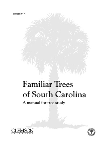
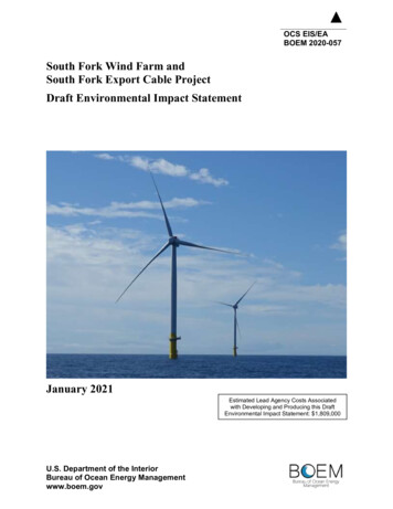
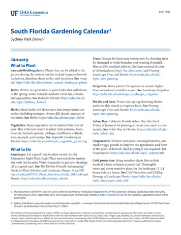
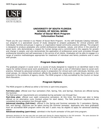
The South Florida EcosystemFederally Listed Species in S. FL:State Listed Species in S. FL:Figure 1. The counties of South Florida.68422The most striking conclusion that historical researchconveys about Florida and its ecosystems is that in any onearea there have been immense changes.S.D. Webb (1990)No region reflects this more than South Florida. Aunique combination of geological history, climate,geography, and environmental forces has made theSouth Florida Ecosystem an important reservoir oflandscape, community, and species diversity. Thevegetation of South Florida represents a mixture ofCaribbean, southern temperate, and local influences. TheSouth Florida Ecosystem supports the only subtropicalecological communities in the continental United States:about 60 percent of the native plant species south of LakeOkeechobee originated from the tropics. As a result of thisconvergence of Caribbean, temperate, and endemicinfluences, the South Florida Ecosystem supportssubstantial ecological, community, taxonomic, and geneticdiversity. This chapter provides an overview of SouthFlorida, highlighting its biodiversity, the pressing ecologicalissues, and ongoing management and restoration efforts.The Watersheds and Subregions of SouthFloridaThe South Florida Ecosystem encompasses 67,346 squarekilometers (26,002 square miles) covering the 19southernmost counties in Florida (Figure 1). From awatershed management perspective, South Florida can bedescribed by further subdividing the region into thefollowing subregions: Kissimmee River, LakeOkeechobee, Lake Wales Ridge, Peace River/CharlotteHarbor, Upper East Coast, Lower East Coast,Caloosahatchee River, Everglades, Big Cypress, andFlorida Keys, including Biscayne Bay, Card Sound, and thelower southwest estuaries (Figure 2).Page2-1
SOUTH FLORIDA ECOSYSTEMMulti-Species Recovery Plan for South FloridaFigure 2. Subregions and watersheds of the South Florida Ecosystem.Page2-2
SOUTH FLORIDA ECOSYSTEMMulti-Species Recovery Plan for South FloridaKissimmee RiverThe Kissimmee River subregion forms the upstream portion of the KissimmeeOkeechobee-Everglades watershed. Originating near Orlando and ending atLake Okeechobee, the subregion encompasses most of Osceola andOkeechobee counties as well as portions of Highlands, Polk, and Gladescounties. There are three sub-basins within the drainage: the upper basin, withLake Kissimmee and 18 smaller lakes; the lower basin with the KissimmeeRiver and its tributary watersheds (excluding Istokpoga Creek) between LakeKissimmee and Lake Okeechobee; and the Lake Istokpoga drainage area (COE1996, Koebel 1995). Lake Kissimmee is Florida s third largest lake, with asurface area of 140 km² (54 mi2). Lake Istokpoga is the fifth largest in the State,covering 112 km² (43 mi2) (Brenner et al. 1990). The drainage also includes theIndian Prairie/Harney Pond sub-basin south of Lake Istokpoga and the TaylorCreek/Nubbin Slough sub-basin, both of which are connected to LakeOkeechobee by drainage canals.Although relatively flat, the Kissimmee River drainage has greatertopographic relief than areas south of Lake Okeechobee. The western boundaryof the Kissimmee River subregion is clearly defined by the Lake Wales Ridge.The eastern boundary is low and poorly defined, with elevations reaching up to23 m (75 ft). The northeastern boundary is formed by the St. Johns Riverdrainage basin. Okeechobee and Osceola Plains are two broad physiographicareas within this subregion.The diversity of ecological community types in the Kissimmee Riversubregion includes high pine on hilltops and slopes, scrub scattered throughout,scrubby flatwoods on sandy coastal and interior sites, upland hardwood forestson rolling hills, dry prairie inland, forested wetlands, marshes, lakes, and rivers(blackwater streams).Lake OkeechobeeLake Okeechobee lies about 48 km (30 mi) west of the Atlantic Ocean and 96km (60 mi) east of the Gulf of Mexico. Extending across parts of Highlands,Charlotte, Glades, Hendry, Okeechobee, Martin, and Palm Beach counties, thissubregion covers the lake and its immediate drainage area to the west,including Fisheating Creek. This subregion does not include the KissimmeeRiver or Everglades drainages. Lake Okeechobee is the central feature of theSouth Florida Ecosystem-its liquid heart. The lake is formed by a broad,shallow, relatively circular depression in bedrock and has a surface area ofroughly 1,890 km2 (730 mi2) (COE 1994). Land levels around the lake varyfrom 3 m (10 ft) to 15 m (50 ft) above sea level (McPherson and Halley 1997).The lake is ringed with levees, pumping stations and control structures topermit fluctuation of lake levels in response to drought, flood conditions andwater supply demands. Major outlets are the St. Lucie Canal to the east and theCaloosahatchee Canal and River to the west. Also numerous agricultural canalsrelease excess lake water to Water Conservation Areas south of the lake.Lake Okeechobee formed over 6,000 years ago. Originally, the waterflowed south and west from the lake. The lake was the source of the EvergladesPage2-3
SOUTH FLORIDA ECOSYSTEMMulti-Species Recovery Plan for South Florida River of Grass sheetflow which sustained the Everglades and nourishedFlorida Bay and coastal estuaries. During the last 50 years the Okeechobeesubregion has been re-engineered; resulting in a much shallower and nutrientladen lake, with a littoral zone filled with exotic species. Today, the majorvegetative communities outside the lake proper are predominantly freshwatermarsh with some cypress forest wetlands and small fragments of remnant pondapple forest.Lake Wales RidgeThe Lakes Wales Ridge subregion is a unique mosaic of elevated sandy ridgesencompassing an area from about the southern Highlands County boundary160 km (99 mi) north to near Orlando. The Lake Wales Ridge averages about7.5 km (4.6 mi) in width (Christman 1988). Though the name implies a singlephysiographic area, the Lake Wales Ridge actually consists of three elevated,sandy ridges that were once the beach and dune systems of Miocene, Plioceneand early Pleistocene seas (Christman and Judd 1990). These relic dunes andthe deep, sandy, well-drained soils support a number of plant communities thathave adapted to xeric conditions over millions of years.Due to the elevation and geologic age of the soils of Lake Wales Ridgescrubs, it has been estimated that the highest hill tops in this area havesupported upland vegetation for about 25 million years. On the Lake WalesRidge, an estimated 200 ancient scrub islands have been identified (Christmanand Judd 1990). Between ridges and at the base of hills, the soils become fineand compacted and often retain surface water, forming wetlands and lakes.Rainfall, seepage, and elevated water tables provide the sources of water forthese aquatic systems. Combined with the aquatic and wetland communitiesthat now exist between and within the ridges, this subregion consists of acomplex mosaic of habitats, some unique to Florida.Because of its complexity, the Lake Wales Ridge contains a wide diversityof plant and animal communities. However, it is the xeric upland plant andanimal associations that constitute the majority of surface area. Althoughrelatively common within the Lake Wales Ridge, these xeric communities arerare when compared to their relative distribution within the State and nation.Several major ecological communities found within the Lake Wales Ridgesubregion provide important habitat for imperiled species. The most importantof those are scrub, high pine, scrubby flatwoods, lakes and freshwater marshes.Peace River/Charlotte HarborThe Peace River/Charlotte Harbor subregion encompasses about 7,800 km2(3,012 mi2) in southwest Florida and includes the Myakka and Peace Riverdrainages. The Myakka River originates about 72 km (45 mi) inland in westernManatee and eastern Hardee counties, while the Peace River begins about 115 km(71 mi) from the coast in Polk and western Highlands counties (Taylor 1974).Much of the Charlotte Harbor basin emerged from a shallow sea during theMiocene and Pleistocene epochs. Only the immediate coastal areas remainedinundated until about one million years ago. Most of this area lies within the GulfCoast Lowlands or DeSoto Plains physiographic regions, both of which arePage2-4
SOUTH FLORIDA ECOSYSTEMMulti-Species Recovery Plan for South Floridacomposed primarily of marine sands and sediments (Southwest Florida RegionalPlanning Council 1995). These soils are all deep, nearly flat, and poorly drained.Northern portions of the Charlotte Harbor subregion, primarily within thePeace River drainage, are characterized by cypress and hardwood hammocks andextensive areas of poorly drained marshes. Central and southern areas includemarsh, dry and wet prairies, pine flatwoods, and estuaries (DEP 1995). Mesicflatwoods support a wide diversity of animals and represent the third highestspecies richness of vegetative communities in Florida (Beever and Dryden 1998).Dry prairie is one of the most widespread upland vegetative communities in theCharlotte Harbor basin. Coastal areas, including Charlotte Harbor proper, containexpanses of seagrass beds, mangrove, and coastal strand communities. There areroughly 23,675 ha (58,500 acres) of seagrass in Charlotte Harbor (CHNEP 1996);this community provides important ecological functions that benefit manythreatened and endangered species as well as migratory birds. Mangroves providea variety of habitats and food resources for a diversity of animals, serve to holdand stabilize intertidal sediments, and provide erosion protection for adjacentuplands.Upper East CoastThe Upper East Coast subregion, which includes Indian River, St. Lucie, andMartin counties and a northern portion of Palm Beach County, covers over5,631 km2 (2,174 mi2) and has an average elevation of 6 m (20 ft). Formed bythe rise and fall of changing sea levels, the region is characterized by three eastto-west physiographic zones: (1) the Atlantic Coastal Ridge, (2) the EasternValley, and (3) the Osceola Plain (SFWMD 1994). The Atlantic Coastal Ridge,bordered on the east by the Atlantic Ocean and on the west by the EasternValley, consists of relic dune ridges formed by wind and wave action along thecoastline. Paralleling the east coast, the Ridge varies in width from a fewhundred meters to a few kilometers and ranges in elevation from sea level to28 m (92 ft) in Jonathan Dickinson SP, the highest coastal elevation in thissubregion.A wide variety of upland vegetative communities exist throughout thesubregion, including coastal dunes, coastal strand, maritime forest, scrub,hardwood hammock, and pine flatwoods. Wetland habitats are a vitalcomponent for the biodiversity of the region. Between the barrier islands andthe coastal ridge (or mainland) lies the Indian River Lagoon, a linear estuarinesystem that extends along more than a third of Florida s east coast. Numerousfreshwater wetlands and sloughs undergo a transition into riverine systems thatconnect directly to the Indian River Lagoon. The combination of freshwaterand saltwater wetlands, seagrass and mangrove communities in particular,contribute valuable cover, foraging areas, and reproductive habitats for manyfish and wildlife species in this subregion.Lower East CoastThe Lower East Coast subregion extends approximately 160 km (99 mi) northto south through large coastal portions of Palm Beach, Broward, and MiamiDade counties. The major topographic feature of the Lower East CoastPage2-5
SOUTH FLORIDA ECOSYSTEMMulti-Species Recovery Plan for South Floridasubregion is the Atlantic Coastal Ridge. This limestone ridge extends the lengthof the Atlantic Coast. Three major estuaries and marine systems occur in thissubregion: Lake Worth Lagoon in Palm Beach County, Biscayne Bay inMiami-Dade County, and West Lake in Broward County.The Lower East Coast subregion is the most highly urbanized area inFlorida, containing 30 percent of the State s residents. Most urbanizationoccurs along the coastal portion of the subregion with substantial agriculturepresent south and west of the Atlantic Coastal Ridge (Science Subgroup 1996).Although the region is highly urbanized, many species of native fauna andflora continue to exist in the remnant patches of native vegetative communities.Ecological communities found in this subregion include beach dune, coastalstrand, maritime and tropical hardwood hammocks, pine rocklands, scrub, pineflatwoods, mangrove swamps, coastal saltmarsh, freshwater marsh, and wetprairie (Myers and Ewel 1990, Science Subgroup 1996).Water resources for this subregion are primarily available from rainfall andsurface and groundwater storage systems such as shallow surficial aquifers.The area between Boynton Beach and Miami receives the highest amount ofrainfall in the State (163 cm or 64 in). The Biscayne Aquifer is the largest ofits kind, and one of the most important natural resources in the area. It extendsthroughout Miami-Dade County, into a majority of Broward County, and aportion of southern Palm Beach County. Public water for the Florida Keys,Broward County, and Miami-Dade County is supplied by the Biscayne Aquifer.This aquifer also depends on rainfall for recharge (Southwest Florida RegionalPlanning Council 1995, Science Subgroup 1996).Caloosahatchee RiverThe Caloosahatchee River subregion encompasses the Caloosahatchee Riverwatershed, the lower Charlotte Harbor estuarine system, including San CarlosBay, Matlacha Pass (south of an east-west line from Boca Grand Inlet), andPine Island Sound, the Estero Bay estuary and watershed, and the ImmokaleeRise. This area is approximately 516,000 ha (1.28 million acres), and includesmost of Lee County, the southeastern portion of Charlotte County, westernHendry County, and southern Glades County. The major physiographicprovinces of the subregion are the Caloosahatchee Valley, Gulf CoastLowlands, DeSoto Plain and the Immokalee Rise (Southwest Florida RegionalPlanning Council 1995). Within this subregion, the Immokalee Rise includesmost of Hendry County and eastern Lee County. It is about 8 m (25 ft) inelevation, but can peak at 11 m (36 ft) and 13 m (43 ft) in some areas. All soilsare deep, nearly level, and poorly drained, with a water table less than 25 cm(10 in) from the surface during at least part of the year (SWFRPC 1995).Historically, the Caloosahatchee River was a shallow, meandering 80 km(50 mi) long system, with headwaters near Lake Hicpochee (Science Subgroup1996). Today, however, it extends approximately 114 km (71 mi) from LakeOkeechobee to San Carlos Bay, as a channelized flood control and navigationalwaterway. The river is supplied by inflows from Lake Okeechobee and runoffwithin its own basin. It was extended to Lake Okeechobee by dredging in 1884,and was subsequently channelized to improve navigation and flood control.Page2-6
SOUTH FLORIDA ECOSYSTEMMulti-Species Recovery Plan for South FloridaThe river now has three locks or water control structures: Moore Haven Lock,Ortona Lock, and Franklin Lock. The freshwater portion of the river, alsocalled the C-43 Canal, extends eastward from the Franklin Lock and Damtoward Lake Okeechobee and the cities of LaBelle and Moore Haven. The C43 Canal is part of the cross-state Lake Okeechobee Waterway that providesnavigation between the east and west coasts of Florida. West of the FranklinLock, from Olga to the Gulf, the river broadens into a tidally influencedestuarine system. Franklin Lock, also called S-79, serves as a salinity barrier totidal changes and as a conveyor of freshwater into the estuary (COE 1994).The estuarine portion of the Caloosahatchee Subregion is approximately42 km (26 mi) long and extends from S-79 to Shell Point where it dischargesinto San Carlos Bay at the southern end of Charlotte Harbor (COE 1994). Theaverage discharge is 2,000 cubic feet/second (cfs) (Science Subgroup 1996).San Carlos Bay connects the mouth of the Caloosahatchee River to MatlachaPass and Pine Island Sound (COE 1994). The Caloosahatchee River candischarge freshwater to the southern portion of Pine Island Sound duringperiods of large releases from Lake Okeechobee, but the primary source offreshwater is sheetflow from the surrounding islands, as well as from the smallcreeks and marshes on Pine island, and the Sanibel River on Sanibel Island(CHNEP 1996).The Estero Bay estuary and watershed in southwestern Lee County,consists of Estero Bay and associated barrier islands, the Estero Bay basin,including the Imperial and Estero rivers, and the Six-Mile Cypress SloughWatershed (Science Subgroup 1996). Estero Bay is a shallow, subtropicalestuarine lagoon, approximately 4,580 ha (11,317 acres) in area. Five creeksand rivers drain into the bay including Hendry Creek, Mullock Creek, EsteroRiver, Spring Creek, and Imperial River. The Six-Mile Cypress Slough, incentral Lee County, (830 ha or 2,051 acres) is an important recharge area forthe watershed. Estero Bay is separated from the Gulf of Mexico by severalbarrier islands: Estero Island, the Lovers Key complex (Long Key, Lovers Key,Black Island), Big Hickory Island, Little Hickory Island, and Bonita BeachIsland (CHNEP 1996). Estero Bay was designated a State Aquatic Preserve andits tributary watersheds are protected by the State of Florida.Predominant ecological communities in this subregion, in addition to theCaloosahatchee River, proper, include pine flatwoods, scrubby flatwoods,coastal strand, freshwater marshes, mangroves, and seagrasses.EvergladesThe Florida Everglades is unique in the world, combining both temperate andtropical flora in a widely shifting mosaic of habitats. Historically, waterconnected the entire Kissimmee River-Lake Okeechobee-Evergladeswatershed. The system was bordered on the east by the Atlantic Coastal Ridgeand on the west by the Immokalee Rise (McPherson and Halley 1997). Prior todrainage of this system of wetlands by man, the Everglades region consisted ofdense, seemingly impenetrable wetlands, extending over an areaapproximately 64 km (40 mi) wide by 160 km (99 mi) long (Brooks 1974,Davis 1943, Parker 1974, Tebeau 1974) and covering an estimated 3.5 millionPage2-7
SOUTH FLORIDA ECOSYSTEMMulti-Species Recovery Plan for South Floridaha (8.6 million acres) (COE 1994). Today, much of the land that historicallysupported Everglades communities now supports a variety of land uses,ranging from intensively managed agriculture in the north (EAA), to rapidlyspreading urban uses along the east and west boundaries.Geologically, the Everglades system is young, formed 5,000 years ago asrising sea levels created pressure to contain freshwater within the shallowbedrock trough in South Florida, and allowed the accumulation of thick peat indeep areas (Gleason and Stone 1994). During the dry season and during periodsof below-average precipitation, the Everglades subsists on nutrients derivedprimarily from the atmosphere through rainfall (Lodge 1994). The system isnot directly fed by streams or rivers, but, is balanced through precipitation,evapotranspiration, and subsurface movement into and out of the aquifer(Wagner and Rosendahl 1987). It is this characteristic that gives rise to theuniqueness of the Everglades and its recognition as a system dependent onsheetflow. In contrast, most of the world s other large wetland systems that onsome level resemble the Everglades, such as the Pantanal of Brazil, the Llanosof Venezuela, and the Usumacinta and Grijalva river deltas of Mexico, receivetheir nutrients and water from rivers that overflow their banks (Lodge 1994).The Everglades subregion consists of a complex system of hydrologicallyinter-related landscapes. Because the Everglades is located on a peninsula thatextends from a temperate to a subtropical climate, the associated flora consistsof tropical, temperate, and endemic species (Gunderson 1994). Gunderson(1994) grouped Everglades communities into upland and wetland vegetativecomp
water supply demands. Major outlets are the St. Lucie Canal to the east and the Caloosahatchee Canal and River to the west. Also numerous agricultural canals release excess lake water to Water Conservation Areas south of the lake. Lake Okeechobee formed over 6,000 years ago. Originally, the water flowed south and west from the lake.File Size: 1MB