Transcription
EXHIBIT A82nd Avenue PlanPLANNING FOR A FUTURE CIVIC CORRIDORRECOMMENDED FOR ADOPTION May 2019
82nd Avenue PlanPLANNING FOR A FUTURE CIVIC CORRIDORPROJECT TEAMApril BertelsenTransit Coordinator and Project LeadWendy CawleyTraffic EngineerMauricio LeclercArea & Project Planning Supervising PlannerKevin DonohueMapping and Project SupportTaylor CampiStephanie LonsdaleCorrine MontanaMike SerritellaPlan Production SupportMarty StockonProject Manager, BPS 82nd Avenue StudyRadcliffe DacanayFormer Project Manager, BPS 82nd Avenue Study and PhotographyTo obtain a copy of this document or more information about this project, please contact:April BertelsenPortland Bureau of Transportation1120 SW 5th Avenue, Suite 800Portland, OR 97204Phone: 503-823-6177Website: u of Planning and Sustainability, companion website:82nd Ave Study: Understanding Barriers to Developmentwww.portlandoregon.gov/bps/72125The City of Portland complies with all non-discrimination, Civil Rights laws including Civil Rights Title VI andADA Title II. To help ensure equal access to City programs, services and activities, the City of Portland willreasonably modify policies/procedures and provide auxiliary aids/services to persons with disabilities. Call503.823.5282, TTY 503.823.6868 or Oregon Relay Service: 711 with such requests, or visit http://bit.ly/13EWaCg
82nd Avenue PlanPLANNING FOR A FUTURE CIVIC CORRIDORPLAN CONTENTS:Chapter 1Introduction1Chapter 282nd Ave Today7Chapter 3Safety, Access and Transit Improvements13Chapter 4New Right-of Way Dedication & FrontageImprovements27Chapter 5Recommendations for Next Steps and Future Study37Chapter 682nd Ave Public Engagement41Appendix A: Adopting ResolutionAppendix B: 82nd Avenue Corridor Maps ofEstimated Right-of-Way Dedication RequirementsView appendices online at:www.portlandoregon.gov/transportation/82ndAve
CHAPTER 1Introduction82nd Avenue Is Becoming aCivic CorridorNE KILLINGSWORTH STThe purpose of this plan is to identify capitalimprovement projects, policies, design practicesand other recommendations to support theincremental transformation of 82nd Avenue intoa Civic Corridor, as envisioned in the Portland 2035Comprehensive Plan.This plan covers 82nd Ave from NE Killingsworth toSE Clatsop (city limits). This section of 82nd Ave iscurrently designated a State Highway (OR 213) andunder the jurisdiction of the Oregon Department ofTransportation (ODOT). This plan is also intended tobe in service to a larger effort underway, the eventualtransfer of ownership of this segment of 82ndAvenue from ODOT to the City of Portland, under thestewardship of the Portland Bureau of Transportation(PBOT).7 MILESThe primary focus of this plan is increasing safetyand removing transportation barriers. The Cityof Portland and our partners are working to eliminatedeaths and serious injuries on our streets to meet ourVision Zero goal. This plan identifies many safetyimprovements to help remove 82nd Ave from theVision Zero High Crash Corridor network.SE CLATSOP ST82ND AVENUE PLAN 1
82nd Avenue Plan OverviewChapter 2: 82nd Ave TodayThis chapter contains a brief summary of existingconditions along 82nd Ave.Chapter 3: Safety, Access and TransitImprovementsThis chapter contains basic safety, access andtransit capital improvements to help support theincremental transformation of 82nd Avenue intoa Civic Corridor, as envisioned in the Portland2035 Comprehensive Plan, and help meet theCity’s Vision Zero policy and goal. Most of therecommended projects are enhanced pedestrianand bicycle crossings, increased lighting, signalchanges to reduce conflicts and other minorimprovements to existing signals. In addition,Enhanced Transit priority treatments and bus stopimprovements are recommended along 82nd Aveto improve the reliability, speed and capacity ofTriMet bus line 72.Chapter 4: New right-of-way dedication andfrontage improvementsThis chapter contains changes to PBOT’s currentproperty dedication requirements duringredevelopment to provide wider sidewalk corridorsalong 82nd Ave. These improvements will bemade incrementally over time, as redevelopmentoccurs. The change would bring PBOT right-ofway dedication requirements more in line withthe existing private property Special Setbackdevelopment requirements along 82nd Ave (45 feetfrom each side of the center line) in the PortlandZoning Code, Title 33.Chapter 5: Next Steps and Recommendations forFuture StudyThis chapter contains next steps and futurerecommendations that are beyond the scope ofthis plan or require additional planning, analysisand public engagement.Chapter 6: 82nd Ave Public EngagementThis chapter contains a summary of the multipleplanning processes along 82nd Ave in recent yearsthat lead to and informed this plan, as well as, themore recent public engagement efforts during thedevelopment of this plan.JULY 11, 2017: THUY TU PRESENTING AT THE CITY COUNCILTOWN HALL VISIONING FORUM ON 82ND AVE2 82ND AVENUE PLAN
Planning ContextThe Portland Bureau of Transportation (PBOT) andBureau of Planning and Sustainability (BPS) are workingtogether to address barriers within the 82nd Avecorridor. This plan was led by PBOT to help addresstransportation barriers. It was developed in coordinationwith the 82nd Ave Study: Understanding Barriers toDevelopment, led by BPS. This joint planning effort isfunded in part by a Metro Community Planning andDevelopment Grant.The City’s planning efforts were also coordinated withand informed by the planning process led by the OregonDepartment of Transportation (ODOT) to develop theODOT 82nd Ave of Roses Implementation Plan.Over the course of multiple planning processes along 82nd Ave, a coalition of community members haveadvocated for transformation of 82nd Ave more in line with the Civic Corridor envisioned in the Portland 2035Comprehensive Plan. They advocated for jurisdictional transfer of the roadway from ODOT to PBOT to helpfacilitate that transformation.Jurisdictional transfer of 82nd Ave will require coordination and negotiations between the state and thecity to reach agreeable terms to support a transfer of ownership, particularly around resources. A host ofimprovements are needed to bring the road to a state of good repair. Therefore, significant funding is neededto address deferred maintenance, increase safety and make improvements to begin the transformation of82nd Ave to a Civic Corridor.To begin these negotiations, PBOT and ODOT have signed a Memorandum of Understanding (MOU) todemonstrate a commitment to pursue a path forward for a jurisdictional transfer of 82nd Avenue and toensure that the agencies coordinate investments on 82nd Avenue in advance of a transfer. The MOU includes ashared Work Plan.Meanwhile, the city intends to seek increased design and engineering flexibility for improvements made underODOT ownership while working together to pursue additional funding for 82nd Ave.WHY CHANGE NOW?The City, ODOT and State Legislators have begun meeting to chart a path forward for improving 82nd Ave andthe future jurisdictional transfer. This has resulted in a commitment between the City and ODOT to addressfeasible improvements in the near-term while working towards a longer-term plan. In July 2018, PBOT andODOT Region 1 leadership jointly documented the following priorities and next steps:1. Work to ensure the best interim safety andmaintenance improvements while 82nd Avenue is stillunder ODOT’s jurisdiction.3. Ensure adequate funding to develop a conceptualplan that will be completed in time for potentialfunding opportunities.2. Ensure that ODOT and PBOT develop a sharedunderstanding of jurisdictional costs associated witha transfer.4. Work together to develop a broad and successfulpartnership to secure future funding for the transferand future planned improvements.82ND AVENUE PLAN 3
How We Got HereThere are many adopted policies and events informing the development of this plan for 82nd Ave. In addition,there are ongoing projects, policies, and programs that coincide with this planning process and objectives.These adopted policies inform and, in some cases, serve as the origin for the projects outlined in this plan.Some of the most important policies, plans, programs and events affecting 82nd Ave include:State Highway System Agreement between City and State (1944)The State and City of Portland entered into an agreement designating streets over which statehighways shall be routed within the City of Portland and maintenance responsibilities. This includedsegments of 82nd Ave as a street over which Cascade Highway (OR 213) was routed, from the (then)north city limit at Prescott Street southerly to Division Street; and from Division Street southerly tothe south city limit at Flavel Street (formerly part of County Roads Nos. 575 and 488).City Council established special setback lines on NE and SE 82nd Ave (1959)City Council established special setback lines (measured 45 feet from each side of the center lineof the roadway) through the adoption of Ordinance No. 110507 in 1959 and Ordinance No. 132139in 1971. Later, these setback lines became Special Setbacks incorporated into the City ZoningCode and the Official Zoning Maps. Currently, Special Setback requirements are located in Chapter33.288 of the Zoning Code (Title 33).82nd Avenue Corridor Study (1980)The study was developed by the Portland Bureau of Planning and adopted by City Council. Theintent of the study and its implementation was: To ensure healthy commercial development along82nd Ave; to maintain and enhance the quality of adjacent neighborhoods; and to improve theoverall image, safety, access and traffic movement in the corridor. Specific street improvementswere identified to achieve these goals.I-205 Freeway construction was completed by ODOT, parallel to 82nd Ave. (1982-83)82nd Ave street improvements constructed by ODOT (1980s)Pedestrian Master Plan & Pedestrian Design Guide (1998)The Pedestrian Master Plan established a 20-year framework for improvements and investments toenhance the pedestrian environment and increase opportunities to choose walking as a mode oftransportation.82nd Avenue of Roses High Crash Corridor Safety Plan (2008)The safety plan was developed by PBOT with the goals to: Reduce the number of pedestrians,bicyclists and motorists killed or injured in crashes along the 82nd Avenue of Roses corridor;Minimize the number of people that limit walking, biking or taking transit along 82nd Ave due totraffic safety concerns; develop a high crash corridor safety action plan model for the 82nd Ave ofRoses corridor that can then be easily replicated for future high crash corridors in Portland. PBOTimplemented several projects and actions recommended in the plan.Climate Action Plan (2009)The Climate Action Plan identifies objectives and actions to put Portland on a path to reducecarbon emissions by 80 percent of 1990 levels by 2050. Specificially outlined in this plan are goals toreduce automobile dependency and increase walking and biking mode-splits.Vision Zero Action Plan (2016)This action plan takes an equitable and data-driven approach to eliminate deaths and seriousinjuries on Portland’s streets by 2025. 82nd Ave is one of the city’s most dangerous streets.4 82ND AVENUE PLAN
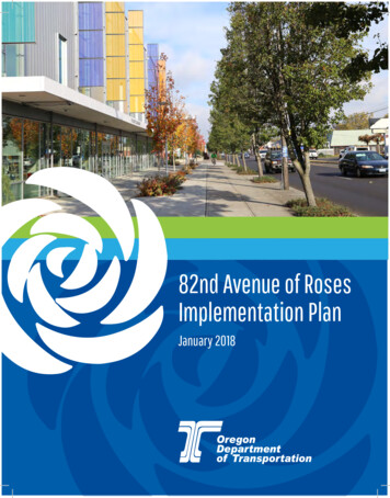
Fixing Our Streets (2016)This program uses revenue from Measure 26-173 and the Heavy Vehicle Use Tax to generatemoney for investing in street improvements and safety projects across the entire city. Fixing OurStreets helps PBOT expand preventative street maintenance that saves money and preventspotholes. It will also support investments that make it safer for children to walk to school.Investments include crossing improvements on 82nd Ave.BPS initiates the 82nd Ave Study – Understanding Barriers to Development (2016)In 2016, the City of Portland accepted a Community Planning and Development Grant (CPDG)from Metro to fund the 82nd Ave Study – Understanding Barriers to Development. The Bureauof Planning and Sustainability (BPS) is the lead agency for the study. BPS and PBOT are workingtogether to address barriers within the corridor.City Council Town Hall Visioning Forum on 82nd Ave (2017)On July 11, 2017, City Council held a town hall meeting on 82nd Ave at the JAMS space inpartnership with the Jade District, APANO, 82nd Ave Improvement Coalition and the U of OArchitecture School – Urban Design Studio. The public engagement process initiated by the UrbanDesign Studio class eventually led to the forum. Community members and U of O students sharedtheir vision for 82nd Ave and discussed jurisdictional transfer.ODOT 82nd Ave of Roses Implementation Plan (2018)In January 2018, ODOT completed the 82nd Ave of Roses Implementation Plan. This was atransportation planning effort to create a list of projects to improve safety, mobility, and access forpeople using 82nd Avenue (in the 7 mile segment between NE Killingsworth Street and SE JohnsonCreek Boulevard) that could be feasibly funded and constructed within at 5-10 year timeframe.Enhanced Transit Corridors Plan (2018)In June 2018, City Council adopted the Enhanced Transit Corridors (ETC) Plan. This plan identifiesa new vision for frequent, reliable, high-ridership transit and how we can achieve it in Portland.Enhanced transit is a key part of that vision. This plan identifies where transit priority, streamlining,and access treatments could be most beneficial on the planned TriMet Frequent Service networkwithin the City of Portland, including buses and streetcar. 82nd Ave was identified as an EnhancedTransit Corridor.Comprehensive and Transportation System Plan (2018)City Council adopts the 2035 Comprehensive Plan and Transportation System Plan and setsambitious targets to increase and prioritize walking, biking, and transit trips throughout the City ofPortland.Safe Routes to School (2018)Safe Routes to School (SRTS) is a partnership between the City of Portland, schools,neighborhoods, community organizations and agencies that advocate for and implement projectsand programs that make walking and biking around our neighborhoods and schools fun, easy, safeand healthy for all students and families while reducing congestion around schools.Community Forum hosted by the 82nd Ave Improvement Coalition (2018)On November 17, 2018, the 82nd Ave Improvement Coalition hosted a community forum about82nd Ave. It included a panel discussion with civic leaders, including Representative AlissaKeny-Guyer, Senator Michael Dembrow (staff representative), ODOT Region 1 Manager RianWindsheimer, and PBOT Interim Director Chris Warner.PedPDX, Portland’s Citywide Pedestrian Plan (Currently underway - adoption anticipated in 2019)PedPDX is Portland’s citywide pedestrian plan. It will prioritize sidewalk and crossing improvementsand other investments to make walking safer and more comfortable across the city. The plan willidentify key strategies and tools to help make Portland a great walking city for everyone.82ND AVENUE PLAN 5
Where We Want to Go:Policy Vision for Civic CorridorsPer the Portland 2035 Comprehensive Plan, pages GP3-16 & 17:“Civic Corridors are the city’s busiest, widest,and most prominent streets. They provide majorconnections among centers, the rest of the City, andthe region. They support the movement of peopleand goods across the city, with high levels of trafficand pedestrian activity. Civic Corridors provideopportunities for growth and transit-supportivedensities of housing, commerce, and employment.Development in Civic Corridors is intended to be upto mid-rise in scale, with lower scale generally moreappropriate in locations far from the Central Cityor transit stations. Mid-rise development typicallyranges from five to seven stories.Abundant trees and high-quality landscaping beautify CivicCorridors and offset the impacts of their large paved areas.These corridors exemplify the benefits of green infrastructureby cleaning and soaking up stormwater runoff and minimizingurban heat island effects, while also being enjoyable places tolive, work, and gather. Civic Corridors are safe for all types oftransportation. Civic Corridors policies apply to the roadway,the public realm of the street, and the buildings that line thestreet.ParkroseNE 60thNorth TaborMontavillaPolicy 3.48 Integrated land use and mobility. EnhanceCivic Corridors as distinctive places that are models ofecological urban design, with transit-supportive densitiesof housing and employment, prominent street trees andother green features, and high-quality transit service andpedestrian and bicycle facilities.Policy 3.49 Design great places. Improve public streetsand sidewalks along Civic Corridors to support the vitalityof business districts, create distinctive places, provide asafe, healthy, and attractive pedestrian environment, andcontribute to quality living environments for residents.Policy 3.50 Mobility corridors. Improve Civic Corridorsas key mobility corridors of citywide importance thataccommodate all modes of transportation within theirright-of-way or on nearby parallel routes.Policy 3.51 Freight. Maintain freight mobility and accesson Civic Corridors that are also Major or Priority TruckStreets.”6 82ND AVENUE ofFosterLents
CHAPTER 282nd Ave Today82nd Avenue is used by people in cars, on foot and bike, for goods movementand as a high frequency transit route. Yet, it does not adequately serve all modesand is a particularly stressful environment for people walking, using mobility devices,biking, crossing the street, and accessing transit. It is also designated a High CrashCorridor through the PBOT Vision Zero program. The street is typically a five-lanearterial with no on-street parking or bike lanes. Most of the existing sidewalks arenarrow and do not meet current city standards. Most of 82nd Ave does not meet newcity guidelines for marked crosswalk spacing. TriMet buses experience frequent delays.82nd Ave is an older street with aging infrastructure that often does not meet currentstandards. The maintenance needs exceed existing resources. ODOT is incrementallyaddressing maintenance through the Statewide Transportation Improvement Program(STIP). ODOT and PBOT have invested nearly 40 million along 82nd Ave throughprevious and upcoming projects. Still many street assets like paving and signals are inneed of repair or replacement.82ND AVENUE PLAN 7
Ownership and Jurisdiction82nd Ave is an Oregon state highway comprising the northern end of Oregon Route 213, also known as theCascade Highway. The Oregon Department of Transportation (ODOT) owns and maintains 82nd Avenue fromNE Killingsworth Street to SE Clatsop (City limits and further south). ODOT maintains the road from curbto curb, and shares jurisdiction over some of the sidewalks with the City of Portland. ODOT and the City ofPortland also share responsibility in the maintenance and adjustment of traffic signals.Typically, the sidewalks behind the curb are under PBOT ownership between NE Prescottand SE Flavel.GRAPHICODOT owns the sidewalks north of NE Prescott and south of SE Flavel. PBOT oversees sidewalk maintenance.Construction and maintenance of the sidewalk is the responsibility of the adjacent property owner, per CityCode, Title 17, Chapter 17.28. Typically, sidewalk corridors are built and widened to City standards when privateproperties develop or redevelop.ODOT has classified 82nd Avenue as a District Highway and has designated it as part of the National HighwaySystem. 82nd Avenue has no state or federal designation as a freight or truck route.CITY OF PORTLANDBUREAU OF TRANSPORTATION(PBOT)OREGON DEPARTMENT OFTRANSPORTATION (ODOT) Owns and maintains sidewalk right-of-way between NE Prescott toSE FlavelOperates signalsPays half of signal operating power share costsOwns and maintains travel lane right-of-way curb to curbOwns signalsPays half of signal operating power share costsOwns and maintains sidewalk right-of-way at NE Prescott and allareas north, and at SE Flavel and all areas southTypical Widths, Conditionsand Special SetbacksRoadway and Public Right-of-Way WidthsGenerally, 82nd Ave is about 60 feet between the curbs,providing two lanes in each direction and a center turn lane.This is not including sidewalks (width varies). The existing rightof-way is typically about 72 ft, though wider where bus pullouts have been provided or sidewalk dedications have beenmade.SidewalksMost of the existing sidewalks along 82nd Ave are narrow anddo not meet current city standards. The sidewalks vary in widthfrom 3 feet to 15 feet on both sides of the street. They are oftenonly 8 feet to 10 feet. A few areas have no sidewalk at all. Not allsidewalks and corners meet current Americans with DisabilitiesAct (ADA) design requirements. Many stretches of sidewalk lackstreet trees and are currently too narrow to accommodate theaddition of street trees.8 82ND AVENUE PLAN
CrosswalksMost of 82nd Avenue does not meet the city’s new guidelinesfor marked crosswalk spacing: enhanced crossings every 800feet, or every 530 feet in pedestrian districts.Special Setback for Development on Private PropertyThere is a Special Setback requirement along 82nd Ave fordevelopment on private property. It is measured 45 feet fromeach side of the center line of the roadway along NE andSE 82nd Ave. Special street setbacks apply to all buildings,structures, signs, off-street parking areas, and exterior display,storage, and activities fronting a street with a special streetsetback designation on the Official Zoning Maps. This typicallyresults in a minimum of 90 feet between buildings and otherdevelopment on private property.NOTE: TYPICAL CROSS SECTION(ROADWAY AND RIGHT-OF-WAY)VARIES THROUGHOUT CORRIDORGRAPHIC72 feetTypical Existing Right-of-Way90 feet (45 ft from center line)Current Special Street Setback82ND AVENUE PLAN 9
GRAPHICUNDERDEVELOPMENTTHE MOST COMMON TYPE OF PEDESTRIAN CRASHIS BEING HIT WHILE CROSSING 82ND AVENUE ATUNCONTROLLED INTERSECTIONS OR MIDBLOCK LOCATIONS.Safety82nd Ave is on the PBOT Vision Zero High CrashCorridor network. To address the city’s Vision Zerogoal, we need to increase safety on 82nd Ave. Thefollowing statistics are based on the PBOT Vision Zeroanalysis of crash data.82nd Ave is one of the top 30 high-crash streets inthe city for pedestrians, bicycles, and motor vehicles.Sixteen (16) people have died of traffic relatedcrashes on 82nd Ave since 2007. The majority werepedestrians. More crashes occur on the segmentfrom SE Clinton Street to SE Schiller Street than anyother similar length segment in the corridor.Six (6) of the City’s High Crash Intersections are along82nd Ave: SE Powell, SE Division, E Burnside, NEGlisan, NE Fremont, and SE Flavel.Recent PBOT Vision Zero crash analysis of crashpatterns on 82nd Avenue indicates the following mostcommon crash types by mode. This covers crashhistory from 2006 to 2015.10 82ND AVENUE PLAN82nd Ave has a higher incidence of the following crashtypes compared to other High Crash Corridors:Crashes involving pedestrians (all injury severities): The most common type of pedestrian crashis being hit while crossing 82nd Avenue atuncontrolled intersections or midblock locations(29 crashes of this type). The second most common type of pedestriancrash on 82nd Ave to get hit by drivers turning leftat traffic signals (19 crashes of this type).Crashes involving cyclists (all injury severities): The most common type of cyclist crash on 82ndAve is being hit on the sidewalk. (9 crashes of thistype) The second most common type of cyclist crashis being hit by a right turner at an unsignalizedintersection (8 crashes of this type).Crashes involving only automobile drivers(fatal and serious injury severity): Automobile drivers are more likely to be fatally orseriously injured in rear-end crashes (19 crashesof this type) or turning crashes (19 crashes of thistype)
People and MovementDemographics82nd Avenue is home to one of the most diversepopulations in the region; the census tract around82nd Avenue and Powell Boulevard is the mostdiverse in the state.Motor vehicle volumes (daily)15,000 near NE Prescott Street; 20,000 north of NEFremont Street, 22,000 to 27,000 from NE FremontStreet to SE Clatsop Street.Transit ridershipLine 72 has the highest number of boarding rides inthe TriMet bus system. More than 14,000 boardingrides on an average weekday. The segment of theline 72 (southbound) between the 82nd Avenue MAXstation and 82nd/Powell has the 11th highest averagepassenger delay per mile in the frequent servicenetwork – this would be an important place to focuson priority treatments for transit. The segment of theline 72 (northbound) between 82nd/Flavel and 82nd/Powell has the 19th highest average passenger delayper mile in the frequent service network – this wouldbe an important place to focus on priority treatmentsfor transit.LINE 72 HAS THE HIGHEST NUMBER OF BOARDING RIDES IN THETRIMET BUS SYSTEM. MORE THAN 14,000 BOARDING RIDES ON ANAVERAGE WEEKDAY.82ND AVENUE PLAN 11
12 82ND AVENUE PLAN
CHAPTER 3Safety, Accessand TransitImprovementsThis chapter contains basic safety, access and transit capitalimprovements to help support the incremental transformation of82nd Avenue into a Civic Corridor, as envisioned in the Portland2035 Comprehensive Plan, and help meet the City’s Vision Zeropolicy and goal.The primary focus of these improvements is increasing safety and removingtransportation barriers. Most of the recommended projects are enhancedpedestrian and bicycle crossings, increased lighting, signal changes to reduce conflictsand other minor improvements to existing signals. In addition, Enhanced Transitpriority treatments and bus stop improvements are recommended along 82nd Ave toimprove the reliability, speed and capacity of TriMet bus line 72.Once combined with the incremental widening of sidewalks as redevelopment occurs,these improvements will help create a more accessible, comfortable and invitingenvironment along 82nd Ave. Together, these changes will support more walking,rolling, biking and transit ridership along 82nd Ave. This will increase transportationcapacity and provide more equitable and efficient movement of people and goodsalong the corridor and between centers.The total estimated cost for these conceptual improvements is still being determined.Additional project development, design and engineering is needed to determine thetotal cost with more confidence.The recommendations in this chapter are intended to supplement therecommendations in the ODOT 82nd Ave of Roses Implementation Plan.The recommended improvements presented here will serve as a starting point forprojects as they enter the funding and design phase. Details are subject to change inresponse to site-specific details, project cost, and community engagement.82ND AVENUE PLAN 13
Safety and Access ImprovementsEnhanced CrossingsThis plan recommends a total of twenty-four(24) enhanced crossings to help meet the newPBOT spacing guidelines for marked crosswalks.The estimated cost is 24 million. This includescrossing treatments, lighting, rebuilding corners,improvements to meet ADA accessibility guidelinesand other associated electrical and civil engineeringimprovements. Crossing enhancements and markedcrosswalks are recommended at the followinglocations.Extend Existing Islands and Add EnhancedPedestrian and Bicycle Crossings (north–south): NE Going Place NE Thompson NE Holladay (Neighborhood Greenway) NE Oregon (access to Montavilla Park, CommunityCenter and Multnomah University) SE Ash SE Salmon SE Hawthorne SE Cooper (Safe Route to School)New Enhanced Pedestrian and Bicycle Crossings: NE Alberta (Neighborhood Greenway, SacajaweaPark) NE Beech NE Klickitat NE Russell (Safe Route to School) NE Schuyler SE Harrison SE Clinton (Safe Route to School) SE Tibbetts/Brooklyn (Neighborhood Greenway) SE Rhone SE Schiller SE Mitchell (Safe Route to School) SE Ramona SE Tolman SE Ogden/Knapp (Safe Route to School) SE Lambert SE ClatsopPBOT CROSSWALK SPACING GUIDELINESGenerally no more than 800 feet betweenpedestrian crossings except in areas designatedas Pedestrian Districts and Centers where thestandard is 530 feet between crossings.14 82ND AVENUE PLANAll crossings treatments and cost estimates arepreliminary and subject to change. Final decisions oncrossing treatments will be made during the projectdevelopment phase based on a traffic engineeringanalysis and approvals. Based on current PBOTengineering practice and technology, the crossingsare scoped to include Pedestrian Hybrid Beaconsor Rectangular Rapid Flashing Beacons (RRFB). Theywill either be mounted overhead on mast arms ormounted on poles behind the curb and on medianislands. All marked crosswalks on State-ownedhighways require review and approval by the StateTraffic Engineer, if built before transfer.Examples of types of potential crossingtreatments:RECTANGULAR RAPID FLASHING BEACONOVERHEAD RECTANGULAR RAPID FLASHING BEACONPEDESTRIAN HYBRID BEACON (HAWK SIGNAL)
Improvements to Existing Signals to Reduce ConflictsAt existing signals along the whole corridor, add side street detection for pedestrians and autos, wheremissing. Add protected left turns from 82nd Ave onto side streets at existing signals, where feasible.Investigate the feasibility of also adding protected left turns from the side streets onto 82nd Ave at signalswhere left turn lanes can be added between the existing curbs or additional right-of-way can be acquiredwithout causing building impacts. Avoid the use of flashing yellow permissive left turning phases against thepedestrian walk signal phases. Per recent PBOT design guidance, evaluate the signal phasing at all signals forLeading Pedestrian Intervals.Add protected left turns at existing signals: NE Prescott, NE Fremont, NE Siskiyou, NE Tillamook, SEWoodstockOther Improve
potholes. It will also support investments that make it safer for children to walk to school. Investments include crossing improvements on 82nd Ave. BPS initiates the 82nd Ave Study - Understanding Barriers to Development (2016) In 2016, the City of Portland accepted a Community Planning and Development Grant (CPDG)