Transcription
CHAPTER 64.VILLAGE OF MERRIONETTE PARK ANNEX64.1 HAZARD MITIGATION PLAN POINT OF CONTACTPrimary Point of ContactAlternate Point of ContactLeonard Edling, Fire Chief3165 W 115th StreetMerrionette Park, IL 60803Telephone: 708-396-3180Email Address: chief@mpfire.orgMarty Quinn, Deputy Fire Chief3165 W 115th StreetMerrionette Park, IL 60803Telephone: 708-396-3180Email Address: mquinn@mpfire.org64.2 JURISDICTION PROFILEThe following is a summary of key information about the jurisdiction and its history: Date of Incorporation: 1947 Current Population: 1900 as of 2010 Census Population Growth: 4.95% Location and Description: The Village of Merrionette Park is a suburb of Chicago locatedin Cook County 18.6 miles south of the Chicago Loop. Merrionette Park is a smallresidential, industrial, and commercial community boarded by the City of Chicago to thenorth and east, Oak Lawn to the northwest, Blue Island to the south, and Alsip to the west.Merrionette Park has a rail line, which is on the east boarder of the village, and is within 4miles from IL tollways and Interstate Highways as well as a major shipping canal. Thisstretch of expressways and canal has a large volume of commercial traffic with hazardousmaterials of all types. In addition, Merrionette Park is home to a large medical complex and apesticide company. Population surges can double and at times triple our residentialpopulation resulting from a large shopping complex and a nightclub that has become apremiere nightspot and concert location in the south western Chicago suburbs withoccupancy exceeding 5,000 for some events. According to the 2010 census, the village has atotal area of 0.38 square miles. Brief History: 1940-41 James Merrion built 125 Single family homes in unincorporatedCook County on property known as Van Latens Farm. The original Merrionette Park wasbound by the Grand Truck railroad tracks on the east, and Troy and Kedzie on the west. Thenew residents formed a group called “The Merrionette Park Property OwnersAssoc.”. In 1946 members of the association voted to name the village Merrionette Park. Thevillage was officially incorporated on February 18, 1947. With Incorporation cameannexation of the area. The new area covered from 115th Street to 119th street, from theGrand Truck Railroad to Central Park (on 119th St). In May, 1952, E.T. Mahoney developedthe property from 115th Street to Parklane Drive. This “Southside” subdivision was known as“Mahoney Estates” and consisted of 339 single family homes. The 1960s saw newdevelopment on 118th Street. Stone Brook Plaza at 115th and Kedzie came in the 1970s,along with the much needed Water Tower. Following was the Stone Brook Mall andits anchor store, Dominick’s and Handy Andy. The extra income the Village received fromthese malls was used to replace street lights, repave streets and purchase very much needed64-1
Cook County Multi-Jurisdictional Hazard Mitigation Plan; Volume 2: Planning Partner Annexesemergency equipment plus a much deserved pay increase to all Village employees. The1990s found the development of 33 new homes on Merrion Lane, the updated retention pondon Homan and the completion of the then Meyer Medical Pavilion and the closing of HandyAndy. In the Mid 2000s the village saw the development the 115 Bourbon Street night club inthe vacant Handy Andy building, the construction of the Everett College building and redevelopment of the vacant firestone dealership into a medical dialysis center . Climate: Merrionette Park’s climate is typically continental that experiences 4 distinctseasons with cold winters, warm summers, and frequent short fluctuations in temperature,humidity, cloudiness, and wind direction. Many consider the more moderate temperatures ofspring and fall to be the most pleasant. Lake Michigan provides a moderating influence ontemperature while boosting the amount of rain and snowfall received in the city. Governing Body Format: The Village of Merrionette Park operates under a VillagePresident form of Government. 6 Trustees, the Board President, Village Clerk, and aTreasurer make up the Village Board. This body of Government will assume theresponsibility for the adoption and implementation of this plan. Merrionette Park operates 5departments including the Clerk’s Office, Building Department, Fire Department, PoliceDepartment, and Public Works Department. Development Trends: Anticipated development trends are low. Over 90% of property inMerrionette Park is fully developed with residential, industrial, and commercial property.There is a low projected growth rate with no plans for annexing or rezoning.64.3 CAPABILITY ASSESSMENTThe assessment of the jurisdiction’s legal and regulatory capabilities is presented in Table 64-1. Theassessment of the jurisdiction’s fiscal capabilities is presented in Table 64-2. The assessment of thejurisdiction’s administrative and technical capabilities is presented in Table 64-3. Information on thecommunity’s National Flood Insurance Program (NFIP) compliance is presented in Table 64-4.Classifications under various community mitigation programs are presented in Table 64-5.64-2
VILLAGE OF MERRIONETTE PARK ANNEXTABLE 64-1.LEGAL AND REGULATORY CAPABILITYState orOtherLocalFederalJurisdictionalStateAuthority Prohibitions Authority Mandated CommentsCodes, Ordinances & RequirementsBuilding CodeYesNoNoYesChapter 161- Adopted 1993, lastamended 2005ZoningsYesNoNoYesChapter 159 -1959, last amended2001SubdivisionsYesNoNoNoChapter 156- 1971, neveramendedStormwater ManagementYesNoYesYesChapter 152- 1979, last amended2000 and Chapter 50- 1971, lastamended 2013Post Disaster RecoveryYesNoNoNoChapter 92 – 1968, last amended1992Real Estate DisclosureNoNoYesYes(765 ILCS 77/) Residential RealProperty Disclosure Act.Growth ManagementNoNoNoNoSite Plan ReviewYesNoNoNoChapter 150-1992, last amended2002Chapter 151 – 1973, lastamended 1999Chapter 153 – 1975, neveramendedChapter 154 -1974, last amended2001Public Health and SafetyYesNoYesYesCook County Board of Health.Chapter 93 -1971, last amended2000and 94 – 1971, last amended2001Environmental ProtectionNoNoNoNoNoNoNoNoPlanning DocumentsGeneral orComprehensive PlanIs the plan equipped to provide linkage to this mitigation plan? N/AFloodplain or Basin PlanNoNoNoStormwater PlanNoNoMWRDNoCapital ImprovementPlanNoNoNoNoWhat types of capital facilities does the plan address? N/AHow often is the plan revised/updated? N/A64-3
Cook County Multi-Jurisdictional Hazard Mitigation Plan; Volume 2: Planning Partner AnnexesTABLE 64-1.LEGAL AND REGULATORY CAPABILITYState orOtherLocalFederalJurisdictionalStateAuthority Prohibitions Authority Mandated CommentsHabitat ConservationPlanNoNoNoNoEconomic DevelopmentPlanNoNoYesYesShoreline ManagementPlanNoNoNoNoComprehensiveEmergency ManagementPlanNoNoYesYesCook County DHSEMThreat and HazardIdentification and RiskAssessmentNoNoYesNoCook County DHSEM PreparingTHIRATerrorism PlanNoNoYesYesCook County DHSEMPost-Disaster RecoveryPlanNoNoNoNoContinuity of OperationsPlanNoNoYesNoCook County DHSEMPublic Health PlansNoNoNoNoCook County DPHThe Economic DevelopmentCommission is charged withreviewing all economicdevelopment related programs andincentives including tax incentivesoffered through the Cook County 6bprogram.Response/Recovery PlanningTABLE 64-2.FISCAL CAPABILITYFinancial ResourcesAccessible or Eligible to Use?Community Development Block GrantsYesCapital Improvements Project FundingNoAuthority to Levy Taxes for Specific PurposesYesUser Fees for Water, Sewer, Gas or Electric ServiceYesIncur Debt through General Obligation BondsYesIncur Debt through Special Tax BondsYesIncur Debt through Private Activity BondsNoWithhold Public Expenditures in Hazard-Prone AreasNoState Sponsored Grant ProgramsYesDevelopment Impact Fees for Homebuyers or DevelopersNo64-4
VILLAGE OF MERRIONETTE PARK ANNEXTABLE 64-3.ADMINISTRATIVE AND TECHNICAL CAPABILITYStaff/Personnel ResourcesAvailable? Department/Agency/PositionPlanners or engineers with knowledge of landdevelopment and land management practicesYesConsulting EngineeringEngineers or professionals trained in building orinfrastructure construction practicesYesPublic Works / Consulting EngineeringPlanners or engineers with an understanding ofnatural hazardsYesConsulting EngineeringStaff with training in benefit/cost analysisYesFinanceSurveyorsYesConsulting ServicesPersonnel skilled or trained in GIS applicationsYesConsulting EngineeringScientist familiar with natural hazards in localareaNoEmergency managerYesCook County DHSEMGrant writersYesConsulting ServicesTABLE 64-4.NATIONAL FLOOD INSURANCE PROGRAM COMPLIANCEWhat department is responsible for floodplain management in yourjurisdiction?Public Works / BuildingCommissionerWho is your jurisdiction’s floodplain administrator? (department/position)Building CommissionerAre any certified floodplain managers on staff in your jurisdiction?Consulting EngineeringWhat is the date of adoption of your flood damage prevention ordinance?11/16/79When was the most recent Community Assistance Visit or CommunityAssistance Contact?Have not received aCommunity Assistance VisitDoes your jurisdiction have any outstanding NFIP compliance violations that Noneed to be addressed? If so, please state what they are.Do your flood hazard maps adequately address the flood risk within yourjurisdiction? (If no, please state why)No , Local flooding caused byundersized sewersDoes your floodplain management staff need any assistance or training tosupport its floodplain management program? If so, what type ofassistance/training is needed?Yes , Technical training andequipmentDoes your jurisdiction participate in the Community Rating System (CRS)? If Yesso, is your jurisdiction seeking to improve its CRS Classification? If not, isyour jurisdiction interested in joining the CRS program?64-5
Cook County Multi-Jurisdictional Hazard Mitigation Plan; Volume 2: Planning Partner AnnexesTABLE 64-5.COMMUNITY CLASSIFICATIONSParticipating?ClassificationDate ClassifiedCommunity Rating SystemNoN/AN/ABuilding Code Effectiveness Grading ScheduleYesUnknownUnknownPublic ProtectionYesISO 42010StormReadyYesGold (countywide)2014Tree City USANo64.4 JURISDICTION-SPECIFIC NATURAL HAZARD EVENT HISTORYTable 64-6 lists all past occurrences of natural hazards within the jurisdiction. Repetitive flood lossrecords are as follows: Number of FEMA-Identified Repetitive Loss Properties: 0 Number of FEMA-Identified Severe Repetitive Loss Properties: 0 Number of Repetitive Flood Loss/Severe Repetitive Loss Properties That Have BeenMitigated: 0TABLE 64-6.NATURAL HAZARD EVENTSType of EventFEMA Disaster # (if applicable)DatePreliminary Damage AssessmentSevere StormsDR-41162013—Severe Winter StormsDR-19602011—Severe Storms/FloodingDR-19352010—Severe Storms/FloodingDR-18002008—Severe Storms/FloodingDR-17292007—Severe Winter StormEM-31612000—Winter Snow R-11291996—Severe Storms/FloodingDR-9971993—Severe Storms/FloodingDR-7981987—Severe Storms/FloodingDR-7761986—64-6
VILLAGE OF MERRIONETTE PARK ANNEX64.5 HAZARD RISK RANKINGTable 64-7 presents the ranking of the hazards of concern. Hazard area extent and location maps areincluded at the end of this chapter. These maps are based on the best available data at the time of thepreparation of this plan, and are considered to be adequate for planning purposes.TABLE 64-7.HAZARD RISK RANKINGRankHazard TypeRisk Rating Score (Probability x Impact)1Tornado542Severe Weather543Flood544Severe Winter Weather515Earthquake366Drought77Dam Failure064.6 HAZARD MITIGATION ACTION PLAN AND EVALUATION OFRECOMMENDED ACTIONSTable 64-8 lists the actions that make up the jurisdiction’s hazard mitigation plan. Table 64-9 identifiesthe priority for each action. Table 64-10 summarizes the mitigation actions by hazard of concern and thesix mitigation types.64-7
Cook County Multi-Jurisdictional Hazard Mitigation Plan; Volume 2: Planning Partner AnnexesTABLE 64-8.HAZARD MITIGATION ACTION PLAN MATRIXApplies tonew orexistingassetsHazards MitigatedObjectivesMetLead AgencyEstimatedCostSources ofFundingTimelineaAction M6.1—Water main, valve, and fire hydrant replacement along 118th Street which is prone to breaksExistingAll2, 7PW 420,000,MediumIEPA LowInterest LoanShort-TermPW 300,000,MediumCommunityDevelopmentBlock GrantShort-TermAction M6.2—Construct a Salt Storage FacilityExistingSevere WinterWeather2, 7Action M6.3—Storm sewer replacement/upsizing on 115th Street which is prone to floodingExistingFlood7, 9PW, MWRD 250,000,HighBond, GeneralLong term,revenue,DependingMWRD-Phase II upon FundingAction M6.4—Retrofit Water Supply Systems to prevent water lossExistingDrought, SevereWeather, TornadoEarthquake2, 7PWMediumVillageLong-TermGeneral revenueShort-Term,OngoingMediumGeneral revenue,Bonds, FEMAGrantsLong-TermMedGeneral revenue,BondsLong-TermAction M6.5—Adopt MWRD Watershed Management OrdinanceNew &ExistingFlood, SevereWeather3, 9, 10VillageBoardLowAction M6.6—Install/Upgrade Generators at water plant and lift stationsExistingFlood, Drought,Severe Weather2, 7PWAction M6.7—Expand/Improve Public Works FacilityExistingAll Hazards2, 7BD, PWAction M6.8—Where appropriate, support retrofitting, purchase, or relocation of structures in hazard-proneareas to prevent future structure damage. Give priority to properties with exposure to repetitive losses.ExistingAll7, 13VillageHighFEMA HazardMitigationGrantsLong-term(depending onfunding)Action M6.9—Continue to support the countywide actions identified in this plan.New andexistingAllAllVillageLowGeneral FundShort- andlong-termAction M6.10—Actively participate in the plan maintenance strategy identified in this plan.New andexistingAll3, 4, 6DHSEM,Village64-8LowGeneral FundShort-term
VILLAGE OF MERRIONETTE PARK ANNEXTABLE 64-8.HAZARD MITIGATION ACTION PLAN MATRIXApplies tonew orexistingassetsHazards MitigatedObjectivesMetLead AgencyEstimatedCostSources ofFundingTimelineaAction M6.11—Consider participation in incentive-based programs such as the Community Rating System,Tree City, and StormReady.New andexistingAll3, 4, 5, 6, 7,9, 10, 11,13VillageLowGeneral FundLong-termAction M6.12—Maintain good standing under the National Flood Insurance Program by implementingprograms that meet or exceed the minimum NFIP requirements. Such programs include enforcing an adoptedflood damage prevention ordinance, participating in floodplain mapping updates, and providing publicassistance and information on floodplain requirements and impacts.New andexistingFlooding4, 6, 9VillageLowGeneral FundShort-termand ongoingAction M6.13—Where feasible, implement a program to record high water marks following high-waterevents.New andexistingFlooding, SevereWeather3, 6, 9VillageMediumGeneral Fund;FEMA GrantFunds (PublicAssistance)Long-termAction M6.14—Consider the development and implementation of a Capital Improvements Program (CIP) toincrease the Village’s regulatory, financial and technical capability to implement mitigation actions.New andexistingAll1, 2, 7PublicWorksHighCIP componentof general fund(if implemented)Long terma. Ongoing indicates continuation of an action that is already in place. Short-term indicates implementationwithin five years. Long-term indicates implementation after five years.64-9
Cook County Multi-Jurisdictional Hazard Mitigation Plan; Volume 2: Planning Partner AnnexesTABLE 64-9.MITIGATION STRATEGY PRIORITY SCHEDULEAction# ighLowLowLowHighMediumHighDo Benefits Is ProjectEqual orGrantExceed Costs? sCan Project Be FundedUnder ExistingPrograms/ oSee Chapter 1 for explanation of priorities.TABLE 64-10.ANALYSIS OF MITIGATION ACTIONSHazard Type1. PreventionAction Addressing Hazard, by Mitigation Typea3. Public4. Natural2. Property Education andResource5. EmergencyProtectionAwarenessProtectionServicesDam FailureDrought1, 4, 6, 7, 10,8141, 4, 6, 7, 10,3, 6, 8Earthquake143, 5, 6, 7, 10, 3, 5, 6, 7, 8,Flood11, 12, 13, 1411, 12Severe Weather 1, 2, 3, 4, 5, 6, 1, 3, 4, 5, 6, 7,7, 10, 13, 14810, 148Severe WinterWeatherTornadoa.10, 1486. StructuralProjects991, 4, 6, 7, 14991, 4, 6, 7, 149, 11, 123, 6, 11, 149, 119, 119, 119, 111, 2, 3, 4, 6,7, 14149, 119, 11149, 11, 12See Chapter 1 for explanation of mitigation types.64-1011, 12
VILLAGE OF MERRIONETTE PARK ANNEX64.7 FUTURE NEEDS TO BETTER UNDERSTAND RISK/VULNERABILITYNone at this Time64.8 ADDITIONAL COMMENTSNone at this time64-11
HAZUS-MH RISK ASSESSMENT RESULTS FORMERRIONETTE PARK
Cook County Hazard Mitigation Plan; Volume 2—Planning Partner AnnexesMERRIONETTE PARK EXISTING CONDITIONS2010 Population .1,900Total Assessed Value of Structures and Contents . 343,359,596Area in 100-Year Floodplain .12.50 acresArea in 500-Year Floodplain .12.50 acresNumber of Critical Facilities .4HAZARD EXPOSURE IN MERRIONETTE PARKNumber ExposedPopulation BuildingsValue Exposed to HazardStructureContentsTotal% of TotalAssessed ValueExposedDam FailureBuffalo CreekU. Salt Cr. #2TouhyU. Salt Cr. #3U. Salt Cr. #40000000000 0 0 0 0 0 0 0 0 0 0 0 0 0 0 688 4,739,434 4,739,434 5,609,717 5,609,717 10,349,151 ��— 135,764,088 181,416,347 107,889,378 133,078,953 243,653,467 314,495,30070.96%91.59%ESTIMATED PROPERTY DAMAGE VALUES IN MERRIONETTE PARKEstimated Damage Associated with HazardBuildingContentsTotalDam FailureBuffalo CreekU. Salt Cr. #2TouhyU. Salt Cr. #3U. Salt Cr. #4% of TotalAssessed ValueDamaged 0 0 0 0 0 0 0 0 0 0 0 0 0 0 00.00%0.00%0.00%0.00%0.00%Earthquake1909 Historical Event 987,885 247,229 1,235,1150.36%Flood10-Year100-Year500-Year 0 54,278 54,278 0 18,517 18,517 0 72,795 72,7950.00%0.02%0.02%Tornado100-Year500-Year 13,576,409 26,486,787 10,788,938 19,429,527 24,365,347 45,916,3147.10%13.37%
HAZARD MAPPING FOR MERRIONETTE PARK
S KEDZIE AVEåÙVILLAGE OFMERRIONETTE PARKCritical Facililtiesohv O" W 115TH STKEDZIE AVE « «g%cfedú89i:"XÑ115TH STK !5åÙcÎop"X89i:åÙkjAirport FacilityBus FacilityDamsEmergency Operations CenterFire Station FacilityHazardous MaterialsHighway BridgeLight Rail BridgeLight Rail FacilityMedical Care FacilityMilitaryOil FacilityPolice Station FacilityPort FacilityPotable Water FacilityRail FacilityRailway BridgeSchool FacilityOther FacilityBase Map Data Sources:Cook County, U.S. Geological Surveyc.åÙ 119TH ST00.10.2Miles
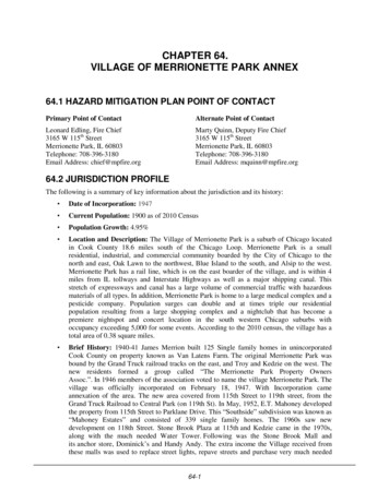
VILLAGE OFMERRIONETTE PARKS KEDZIE AVEIllinois Historical1909 EarthquakeModified Mercalli IntensityI (Not Felt)II-III (Weak)IV (Light)V (Moderate)VI (Strong)VII (Very Strong)VIII (Severe)IX (Violent)X (Extreme)115TH STW 115TH STKEDZIE AVEEvent Date of May 26, 1909. Originalmagnitude of 5.0; increased magnitude foranalysis of 6.0. Depth: 10 km. EpicenterLat/Long: 41.6N 88.1WAn Epicenter Map is derived from a databaseof historical earthquakes developed from threesources (Composite Earthquake Catalog,2002, Earthquake Data Base, 2002, andEarthquake Seismicity Catalog, 1996). Thedatabase has been sorted to remove historicalearthquakes with magnitudes less than 5.0.The Epicenter Map is based on a historicalearthquake epicenter, selected from thedatabase.Base Map Data Sources:Cook County, U.S. Geological Survey.119TH ST0 0.10.2Miles
VILLAGE OFMERRIONETTE PARKS KEDZIE AVENational Earthquake HazardReduction Program (NEHRP)Soil ClassificationSite ClassA - Hard RockB - RockC - Very Dense Soil, Soft RockD - Stiff SoilE - Soft SoilF - Site-Specifc Evaluation115TH STW 115TH STKEDZIE AVESoil classification data provided by the IllinoisState Geological Society.The procedures outlined in the NEHRPprovisions (Building Seismic Safety Council,2004) and the 2003 International BuildingCodes (International Code Council, 2002)were followed to produce the soil site classmaps. Central U.S. Earthquake Consortium(CUSEC) State Geologists used the entirecolumn of soil material down to bedrock anddid not include any bedrock in the calculationof the average shear wave velocity for thecolumn, since it is the soil column and thedifference in shear wave velocity of the soils incomparison to the bedrock which influencesmuch of the amplification.Base Map Data Sources:Cook County, U.S. Geological Survey119TH ST.0 0.10.2Miles
VILLAGE OFMERRIONETTE PARKS KEDZIE AVEFEMA DFIRMFlood Hazard AreasFloodway1 Percent Annual Flood HazardFlood Depth20 ft-1 ft115TH STW 115TH STKEDZIE AVEFlood hazard areas as depicted on FEMADigital Flood Insurance Rate Maps (DFIRM).The 1 percent annual flood hazard iscommonly referred to as the 100 yearfloodplain.Base Map Data Sources:Cook County, U.S. Geological Survey.119TH ST0 0.10.2Miles
VILLAGE OFMERRIONETTE PARKS KEDZIE AVELiquefaction SusceptibilityNot SusceptibleSusceptibleHighBedrockModerate to HighPeatModerateWaterLow to ModerateIceLowVery Low to LowVery Low115TH STW 115TH STKEDZIE AVELiquefaction data provided by the Illinois StateGeological Society. Liquefaction data basedon the Youd and Perkins (1978) method.A liquefaction susceptibility map provides anestimate of the likelihood that soil will liquefyas a result of earthquake shaking. This type ofmap depicts the relative susceptibility in arange that varies from very low to high. Areasunderlain by bedrock or peat are mappedseparately as these earth materials are notliquefiable, although peat deposits may besubject to permanent ground deformationcaused by earthquake shaking.Base Map Data Sources:Cook County, U.S. Geological Survey119TH ST.0 0.10.2Miles
VILLAGE OFMERRIONETTE PARKS KEDZIE AVE100- and 500-YearTornado Events100-Year Modeled Tornado Event (F4)500-Year Modeled Tornado Event (F5)115TH STW 115TH STKEDZIE AVEThe 100- and 500-year events have beenmodeled based on fifty-nine years of tornadodata for Cook County. The wind speeds,widths, lengths, and direction for each eventwere developed using existing historicaltornado data. The simulated storms and theircorresponding losses within this jurisdictionwere used to determine the 100- and 500-yeareconomic loss event.Base Map Data Sources:Cook County, U.S. Geological Survey119TH ST.0 0.10.2Miles
Grand Truck Railroad to Central Park (on 119th St). In May, 1952, E.T. Mahoney developed the property from 115th Street to Parklane Drive. This "Southside" subdivision was known as "Mahoney Estates" and consisted of 339 single family homes. The 1960s saw new development on 118th Street.