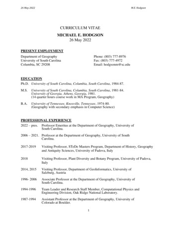
Transcription
26 May 2022M.E. HodgsonCURRICULUM VITAEMICHAEL E. HODGSON26 May 2022PRESENT EMPLOYMENTDepartment of GeographyUniversity of South CarolinaColumbia, SC 29208Phone: (803) 777-8976Fax: (803) 777-4972Email: hodgsonm@sc.eduEDUCATIONPh.D. University of South Carolina, Columbia, South Carolina, 1984-87.M.S.University of South Carolina, Columbia, South Carolina, 1981-84.University of Georgia, Athens, Georgia, 1981.(14 quarter hours course work in MA Program, Geography)B.A.University of Tennessee, Knoxville, Tennessee, 1974-80.(Geography with secondary emphasis in Computer Science)PROFESSIONAL EXPERIENCE2022 – pres. Professor Emeritus at the Department of Geography, University ofSouth Carolina.2006 – 2021. Professor at the Department of Geography, University of SouthCarolina.2017-2019Visiting Professor, STeDe Masters Program, Department of History, Geographyand Antiquity Sciences, University of Padova, Italy2018Visiting Professor, Plant Diversity and Botany Program, University of Padova,Italy2014, 2015Visiting Professor, Department of GeoInformatics, University ofSalzburg, Austria1996- 2006Associate Professor at the Department of Geography, University ofSouth Carolina.1994-1996Team Leader and Research Staff Member, Computational Physics andEngineering Division, Oak Ridge National Laboratory.1987-1994Assistant Professor at the Department of Geography, University ofColorado at Boulder.1
26 May 20221981-19871981-1981M.E. HodgsonResearch/Teaching assistant for the Geography Department, andprogrammer/analyst for the Social and Behavioral SciencesLaboratory, University of South Carolina, Columbia.Research/Teaching assistant in the Geography Department, Universityof Georgia, Athens.1980-1981Geographer/programmer with Henningson, Durham & Richardson,Knoxville, Tennessee.1977-1980Research assistant in the Resource Analysis Group, Oak RidgeNational Laboratories, Oak Ridge, Tennessee.TEACHING EXPERIENCEUniversity of South Carolina-Columbia, Department of Geography:Introduction to Drones for Airborne Spatial Data (285): Spring 2019, 2020, 2021 (newcourse)Lidargrammetric and Photogrammetric Digital Surface Mapping (552): Spring 2010, 2012,2016, 2018, 2019, 2021 (new course)GIS Databases and Their Use (565): Spring 2011, 2013, 2017 (new course)Introduction to Geographic Information Systems (363): Spring and Fall 1997-2022GIS-Based Modeling (564): Fall 1997-2003, Spring 2004, Fall 2006-2022 (new course)Seminar in Geographic Information Systems (763): Spring 1997 – 2002, Fall 2003-2005,Spring 2007-2009Advanced Seminar in Geographic Information Systems (863): Fall 1996, 1999, 2002, Spring2006, Spring 2015Air Photo Interpretation (345): Fall 1986.Computer Cartography (555): Spring 1986 (co-taught).University of Salzburg, Austria, Department of Geoinformatics:Analysis and Modeling, LiDAR: Summer Semester 2014PhD Seminar: Summer Semester 2015University of Padova, Italy, Department of History, Geography and Antiquity Sciences:Territorial Development & GIS, Sustainable Territorial Development International Masters:November/December 2017, 2018, 2019.Advanced GIS for Local Development, Local Development Master Program: January 2020,January 2022.GIS science e Sistemi a Pilotaggio Remoto (12-hrs course lectures on “GIS for DisputeResolution”), November 2016, 2017, 2018, 2019Advanced GIS Analysis: December 2015University of Padova, Italy, Department of Geosciences:GIS-Based Modeling of Environmental Change (4-hrs course lectures, Department ofGeosciences), December 2016University of Padova, Italy, Department of Biology:GIScience approaches for Monitoring Vegetation Change (6-hrs course lectures, PlantDiversity and Geobotany course), May/June 20182
26 May 2022M.E. HodgsonUniversity of Colorado-Boulder, Department of Geography:Geographic Interpretation of Aerial Photography (3093): Fall 1990-94.Remote Sensing of Environment (4093/5093): Fall 1988.Mapping from Remotely Sensed Imagery (4083/5083): Spring 1993, 1994. (new course)Introduction to Geographical Information Systems (4103/5103): Fall 1987-93.Seminar in GIS (5113): Spring 1991. (new course)Cartography II (404): Spring 1988, Fall 1989.Computer Cartography (406/506): Spring 1988-92.University of North Carolina-Greensboro, Department of Geography:Remote Sensing (423-51): Summer 1986.GRADUATE STUDENT COMMITTEESPh.D. Committee Chair (*all completed degree)Loey Knapp*, 1994 (GIS-Task Analysis and Visualization), Chief Information Officer, U. ofMontanaXingong Li*, 2000 (GIS Modeling of Vector Fields), Professor at U. KansasEdwin Chow*, 2005 (GIS/Remote Sensing Hydrology), Professor at Texas State U.Bandana Kar*, 2008 (GIS, Remote Sensing, and Hazards), Group Leader, Oak Ridge NationalLaboratory.Leanne Sulewski*, 2013 (GIS Modeling of Energy Infrastructure Risk), Research Scientist,National Geospatial Intelligence AgencyShufan Liu*, 2014 (GIScience and Remote Sensing), Software Engineer, MicrosoftChris Gillam*, 2016 (GISci and Archaeology), Adjunct Faculty, Winthrop UniversityPh.D. Committee Member (graduation year)Joe Boardman (Geology, 1989) Mark Serreze (1989)Joe Zamudio (Geology, 1992) Antonio Lara (1991)Joy Mast (1993)Don Cline (1996)Michael Scott (1994)Debbie Thomas (1999)Steve Schill (2001)Rick Bunch (2000)Mark Jackson (2001)Karen Gaines (2003)Genny Healy (Geology)Jim Scurry (2003)George Raber (2003)Jason Tullis (2003)Chris Emrich (2005)Jeff Vincent (2006)Maria Garcia Quijano (2006) Charlie Zhang (2006)Jungho Im (2006)Kamrul Huda (Civil Eng.)Courtney Russell (2008)Zhongwu Wang (2008)Todd Patterson (2009)Ke Liao (2011)Kimberly Meitzen (2011)Subhajit Ghoshal (2011)Yi Chang (2012)Zhenyu Liu (2011, Syracuse)Alpen Olmsted (2014, C.S.)Lisa Randle (2018, Anthr.)Larianne Collins (2014)Youliang QiuBhaktiar F-Zadeh (2014, Salzburg, AT) Jin Hai (2017)Chen-Ling Hung (2018)Junyu Lu (2018)3Jim Maslanik (1988)Tom Sever (Anthropology, 1990)Jeff Colby (1995)Fang Qiu (2000)Brendan Lane (Math, 2001)Joann Renhaack (GIINT)Tony Fillippi (2003)David Vaughn (2004)Don Field (2007)Melanie Gall (2007)Jinyoung Rhee (2007)Josh McDuffie (2009)Jenn Webb (2010)Eric Tate (2011)Nate Kettle (2012)Caglar Koylu (2014)Hu Wang (2014)Qian Fan (2021)Yuan Huang
26 May 2022Xi Zhu (2018)Christopher Krause (2021)Andre Coleman (2022, U. Utah)M.E. HodgsonHuixuan Li (2021)Yuqin Jiang (2022)Huan NingXiao Huang (2020)Grayson Morgan (2022)MA/MS Committee Chair (graduation year)George Allen (1988)Wendy Haubert (1989)Renuka Ellis (1989)Sara Wold (1989)Jeff Colby (1989)Jon Barbour (1990)Don Cline (1992)Mathilde Nel (1993)John Carron (1993)Masatoshi Chiba (1999)Yongjun Lei (1999)Katie Field (2000)Melinda Young (2000)Scott Pezanowski (2002) Edwin Chow (2002)Tom Toland (2002)Bridget Beesley (2002)Linda LeVay (2002)Apurva Goyal (2003)Yvette Greene (2004)Jitka Kotelenska (2005)Tommy Bramble (2006)Jianwu Chen (2006)Aaron Myers (2006)Elijah Evans (2008)Erica Pfistra-Altschul (2014) Chris Witt (2017)Aysegul Yenaras (2017)Grayson Morgan (2020)Alan Rickenbaker (2020)Rohit Nepali (2021, U Padova)MA/MS Committee Member (graduation year)Axel Schweiger (1988)Kathy Gard (1989)Jay GardnerSofian Saidin (1993)Mark Bramer (1997)Tony Filippi (1998)Rich Bunch (1998)Alison Cundall (1997)Paul Putnam (2000)Chris Locke (1999)George Raber (2001)Laura Schmidt (2001)Jan Mojzisek (2002)David DosReis (2003)Tara Koman (2003)Joel Copeland (2003)Kevin Riordan (2003)Curtis Wursten (2003)Brian Fitsgerald (2003)Melanie Baker (2004)Jonathan Buffaloe (2003)Marshall McGee (2005)Matt Schmidtlein (2005)Chris Saylor (2005)Linna Li (2006)Andrew Edmunds (2006)Christina Finch (2006)Reggie McCarn (2008)James Hibbert (2007)Chris Burton (2007)Heather Landry (2008)Lindsey Barnes (2008)Mary Megison (2008)Justin Roberson (2008)Jiayu Wang (2010)Dan Morath (2010)Michael DuBois (2013)Sara Flecher (2013)Sumi Selvaraj (2016)Yuqin Jiang (2017)Meghan Woods (2016)Chris King (2017)Huan Ning (2019)Bri Ferguson (2020)Logan Lee (2020)Derek Matchette (2022)Lize Nel (1992)Steve Schill (1997)James Burd (1998)Na Liu (1999)Jarrett Laughlin (2001)Matt Wellslager (2001)Chris Robinson (2002)Steven Long (2003)Steve Jones (2003)Angela Nelson (2005)Joe Dickerson (2005)Feng Zhao (2006)Mari Stensvold (2006)Michael Morgan (2009)Christine Eggers (2007)Ginni Melton (2008)Mike Morgan (2009)Joel Mathwig (2012)Bill Soohoo (2015)Darrell WatsonTyler Dearman (2018)Tracy Whelen (2020)Ben AlandPUBLICATIONSBooks/MonographsPalm, R. and M.E. Hodgson, 1993. Natural Hazards in Puerto Rico: Experience, Attitudes and4
26 May 2022M.E. HodgsonBehavior of Homeowners (IBS, University of Colorado: Boulder, CO), 150 p.Palm, R.I. and M.E. Hodgson, 1992. After a California Earthquake: Attitude and BehaviorChange. (Chicago Press: Chicago, IL), 130 p.Palm, R.I., M.E. Hodgson, D. Blanchard, and D. Lyons, 1990. Earthquake Insurance inCalifornia: Environmental Policy and Individual Decision-Making. (Westview Press: Boulder,CO), 161 p.Chapters in BooksPiovan, S.E. and M.E. Hodgson. 2020. Military-engineered floods as defense from the enemy: abrief review and case study from WWI in Northern Italy, Ecosystems Services in Floodplains,edited by D. Canzian and E. Novello. (Padova University Press, Padova, Italy), pp. 105-115,ISBN 978-88-6938-183-6.Hodgson, M.E., B. A. Davis, D. Accardo, H. Xu, K. Beidel, S.E. Piovan, 2015. Application ofMobile Data Capture with Imagery Support, Time Sensitive Remote Sensing; Chris Lippitt andDoug Stow, editors (Springer-Verlag), pp. 55-75.Hodgson, M.E., S.E. Battersby, B.A. Davis, S. Liu, and L. Sulewski, 2013. Geospatial DataCollection/Use in Disaster Response: A United States Nationwide Survey of State Agencies,Cartography from Pole to Pole, M.F. Buchroithner, N. Prichtel, and D. Burghardt, editors;(Springer-Verlag), pp. 407-419.Hodgson, M.E., B.A. Davis, and J. Kotelenska, 2010. Remote sensing and GIS data/informationin the emergency response/recovery phase, Geotechnical Contributions to Urban Hazard andDisaster Analysis P.S. Showalter and Y.Lu, editors; (Springer-Verlag), DOI 10 10.1007/978-90481-2238-7, pp. 327-354.Jensen, J.R., and M.E. Hodgson, 2006. Remote Sensing of Natural and Man-made Hazards andDisasters, chapter 8 in Manual of Remote Sensing (American Society for Photogrammetry andRemote Sensing, Bethesda: MD), pp. 401-429.Jensen, J.R., M.E. Hodgson, J.A. Tullis and G.T. Raber, 2004, Remote Sensing of ImperviousSurfaces and Building Infrastructure, Using Geospatial Technologies in Urban Environments(R.R. Jensen, J. Gatrell and D.D. McLane, editors), New York, NY: Springer-Verlag, Inc., pp 521.J.R. Jensen and M.E. Hodgson, 2004. Remote Sensing of Selected Biophysical andUrban/Suburban Phenomena, Geography and Technology, edited by S. Brunn, S. Cutter, and J.Harrington (Kluwer: Netherlands), pp. 109-154.D.S.K. Thomas, S. L. Cutter, M. Hodgson, M. Gutekunst, S. Jones, 2003. Use of Spatial Dataand Geographic Technologies in Response to the September 11th Terrorist Attack on the WorldTrade Center, Beyond September 11th: An Account of Post-Disaster Research, Publication #39(NHRAIC, University of Colorado), pp. 147-162.5
26 May 2022M.E. HodgsonM.E. Hodgson and S.L. Cutter, 2002. Mapping and the Spatial Analysis of Hazardscapes inAmerican Hazardscapes: The Regionalization of Hazards and Disasters, ed. by S. L. Cutter.Washington D.C., Joseph Henry Press, pp 37-60.Contributing Author, 1989. Remote Sensing, Geography in America. (Merrill Press: Columbus,Ohio), pp. 747-775.Jensen, J.R. and M.E. Hodgson, 1986. Appendix A: The SENSOR Digital Image ProcessingPrograms, in Introductory Digital Image Processing: A Remote Sensing Perspective.(Prentice-Hall, Inc.: Englewood Cliffs, N.J.), pp. 272-363.Jensen, J.R., M.E. Hodgson, and H.E. Mackey. 1986. Remote Sensing Forest Biomass forLoblolly Pine Using High Resolution Airborne Remote Sensor Data, Chapter 30, in The ForestAlternative for Treatment and Utilization of Municipal and Industrial Wastes. (University ofWashington Press: Seattle), pp. 324-334.Refereed Journal ArticlesPeroni, F., S.E. Pappalardo, F. Facchinelli, E. Crescini, M. Munafo, M.E. Hodgson, M.D.Marchi, 2022. How to Map Soil Sealing, Land Take and Impervious Surfaces? A SystematicReview, Environmental Research Letters. 17, https://doi.org/10.1088/1748-9326/ac6887.Ning, H., and Z. Li, C. Wang, M.E. Hodgson, X. Huang, X. Li., 2022. Converting Street ViewImages to Land Cover Maps for Surveying: A Case Study on Sidewalk Network Extraction forthe Wheelchair Users, Computers, Environment, and Urban Systems. 95: 2.101808.Morgan, G., and M.E. Hodgson, C. Wang, S. Schill, 2022. Unmanned Aerial Remote Sensing ofCoastal Vegetation: A Review, Annals of GIS. , Y. Cui, M.E. Hodgson, 2021. Mapping Salt Marsh Along Coastal South Carolina UsingU-net, ISPRS Journal of Photogrammetry and Remote Sensing. 179: 7.011Li, Z., X.Huang, X. Ye, Y. Jiang, M. Yago, H. Ning, M.E. Hodgson, X. Li., 2021. MeasuringGlobal Multi-Scale Place Connectivity using Geotagged Social Media Data, NatureCommunications Scientific Reports, 11(14694), https://doi.org/10.1038/S41598-021-94300-7Jiang, Y., D. Guo, Z. Li, and M.E. Hodgson, 2021. A Novel Big Data Approach to Measure andVisualize Urban Accessibility, Computational Urban Science, 1Wang, C and G. Morgan, M.E. Hodgson, 2021. sUAS for 3D Tree Surveying: ComparativeExperiments on a Closed-Canopy Earthen Dam, Forests, 21: 659,https://dx.doi.org/10.3390/f12060659.Hodgson, M.E. and D. Sella-Villa, 2021. State-level Statutes Governing Unmanned AerialVehicle Use for Academic/Research in the USA, 42(14), International Journal of Remote6
26 May 2022M.E. HodgsonSensing, 42(14): 5370-5399, odgson, M.E. and S.E. Piovan, 2021. An Indoor Landscape for Instruction of 3-D AerialDrone Imagery, Journal of Geography in Higher 00084.Morgan, G. and M.E. Hodgson, 2021. A Post Classification Change Detection Model withConfidences in High Resolution Multi-Date sUAS Imagery in Coastal South Carolina.International Journal of Remote Sensing, 42(11): 1890266.Hodgson, M.E. and G. Morgan, 2021. Modeling Sensitivity of Topographic Change with sUASImagery, Geomorphology, 375(15), gson, M.E., 2020. On the Accuracy of Low-Cost Dual-Frequency GNSS Network Receiversand Reference Data, GIScience & Remote Sensing, 57 (7): 588.Piovan, S.E., M. Filippini, M.E. Hodgson, 2020. Loss of Wetlands in the Southern VenetianPlain: a Geo-Historical Perspective. Bollettino dell’Associazione Italiana di Cartografia,168: 2948, http://hdl.handle.net/10077/30963.Morgan, G., M.E. Hodgson, S. Wang, 2020. Using sUAS-derived Point Cloud to SupplementLiDAR Returns for Improved Canopy Height Model on Earthen Dams, Papers in AppliedGeography, 6(4): 436-448, khshan, S., M.E. Hodgson, and S.L. Cutter, 2020. Vulnerability of Populations Exposed toSeismic Risk in the State of Oklahoma. Applied Geography, 124,https://doi.org/10.1016/j.apgeog.2020.102295, online 2 October 2020.Ning, H., Z. Li, M.E. Hodgson, C. Wang, 2020. Prototyping a Social Media Flooding PhotoScreening System Based on Deep Learning, International Journal of Geographic Information,9(2): 104, https://doi.org/10.3390/ijgi9020104.Merschdorf, H., M.E. Hodgson, T. Blaschke, 2020. Modeling Quality of Urban Life Using aGeospatial Approach, Urban Science, 4(1), 5, https://doi.org/10.3390/urbansci4010005.Hung, J., A. James, and M.E. Hodgson, 2018. An Automated Algorithm for Mapping BuildingImpervious Areas from Airborne LiDAR Point-Cloud Data for Flood Hydrology, GIScience &Remote Sensing, https://doi.org/10.1080/15481603.2018.1452588.Xu, Haiqing, M.E. Hodgson, S. Piovan, D. Tufford, 2018. The Potential of Using LiDAR andCIR Aerial Imagery for Palustrine Wetland Typology and Change, GIScience & Remote Sensing,55: 477-501, iovan, S.E., E. Maugeri, S. Luconi, M.E. Hodgson, 2018. “I Percorsi delle armate del generaleSherman attraverso le aree umid del South Carolina,” Bulletin of the Association of ItalianCartographers, pp. 108-122, https://DOI: 10.13137/2282-572X/.7
26 May 2022M.E. HodgsonContreras, D., T. Blaschke, M.E. Hodgson, 2017. Lack of Spatial Resilience in a RecoveryProcess: The Case of L’Aquila, Italy, Technological Forecasting & Social change, .12.010.Li, Z., M.E. Hodgson, W. Li., 2017. A General-purpose Framework for Parallel Processing ofLarge-scale LiDAR Data, International Journal of Digital Earth, 10, 842.Liu, S. and M.E. Hodgson, 2016. Satellite Image Acquisition Collection Modeling for LargeArea Hazard Emergency Response, ISPRS Journal of Photogrammetry and Remote 6.04.007, 118:13-21.Shook, E., M.E. Hodgson, S.Wang, B.Behzad, K.Soltani, A.L. Hiscox, and J. Ajayakumar, 2016.Parallel Cartographic Modeling: A Methodology for Parallelizing Spatial Data Processing,International Journal of Geographical Information 172714.Piovan, S. and M.E. Hodgson, 2016. How Many Carolina bays? An analysis of Carolina baysfrom USGS topographic maps at different scales, Cartography and Geographic InformationScience, odgson, M.E., A. McCombs, A. Hiscox, 2015. Sensitivity of Flux Footprint Modelling toGeographic Resolutions and Autocorrelation, GI-Forum Journal for Geographic InformationScience. 1: 90-93.Im, J., Z. Lu, J. Rhee, and M.E. Hodgson, 2014. Building Type Classification Using Spatial andLandscape Attributes Derived from LiDAR Remote Sensing Data, Landscape and UrbanPlanning, 130:134-148, Liu, S. and M.E. Hodgson, 2013. Optimizing Large Area Coverage from Multiple SatelliteSensors, GIScience & Remote Sensing. 50(6): 82.Battersby, S.E., M.E. Hodgson, and J. Wang, 2012. Spatial resolution imagery requirements foridentifying structure damage in a hurricane disaster: A cognitive approach, PhotogrammetricEngineering and Remote Sensing 78(6): 625-635.Kar, B., and M.E. Hodgson, 2012. A Process Oriented Areal Interpolation Technique: A CoastalCounty Example, Cartography and Geographical Information Science. 39(1): 3-16,https://doi.org/10.1559/152304063913.Kar, B., and M.E. Hodgson, 2012. Observational Scale and Modeled Potential Residential Lossfrom a Storm Surge, GIScience & Remote Sensing, 49(2):202-227.James, L. A., M.E. Hodgson, S. Ghoshal, M.M. Latiolais, 2012. Geomorphic Change DetectionUsing Historic Maps and DEM Differencing: The Temporal Dimension of Geospatial Analysis,Geomorphology, 137(1): 181-198, https://doi.org/10.1016/j.geomorph.2010.10.039.8
26 May 2022M.E. HodgsonHodgson, M.E. and B.A. Davis, Y. Cheng, J. Miller, 2010. Modeling Remote Sensing SatelliteCollection Opportunity Likelihood for Hurricane Disaster Response, Cartography andGeographical Information Science. 37(1): 7-15, https://doi.org/10.1559/152304010790588061.Chow, T.E. and M.E. Hodgson, 2009. Effects of Lidar Post-Spacing and DEM Resolution toMean Slope Estimation, International Journal of Geographical Information Science, 23(10):1277-1295, https://doi.org/10.1080/13658810802344127.Jensen, J.R., and M.E. Hodgson, M. G-Q Quijano, J. Im, and J. Tullis, 2009. A Remote Sensingand GIS-assisted Spatial Decision Support System for Hazardous Waste Site Monitoring,Photogrammetric Engineering and Remote Sensing. 75(2): 169-177,https://doi.org/10.14358/PERS.75.2.169.Im, J. and M.E. Hodgson, 2009. Characteristics of Search Spaces for Identifying OptimumThresholds in Change Detection Studies, GIScience & Remote Sensing, 46(3): .Im, J., J.R. Jensen, and M.E. Hodgson, 2008. Object-based Land Cover Classification UsingHigh Posting Density LIDAR Data, GIScience & Remote Sensing 45(2): .García Quijano, M., J.R. Jensen, M.E. Hodgson, B. C. Hadley, J.B. Gladden, 2008. Significanceof Altitude and Posting-density on LIDAR-derived Elevation Accuracy on Hazardous WasteSites, Photogrammetric Engineering and Remote Sensing, 74(9): 1137-1146, vhttps://doi.org/10.14358/PERS.73.9.1137Hodgson, M.E. and B. Kar, 2008. Modeling the Potential Swath Coverage of Nadir and OffNadir Pointing Remote Sensing Satellite-Sensor Systems, Cartography and GeographicalInformation Science, 35(3): 147-156, /doi.org/10.1559/152304008.Im, J., J.R. Jensen, and M.E. Hodgson, 2008. Optimizing the binary discriminant function inchange detection applications, Remote Sensing of Environment, 1.007.Kar, B. and M.E. Hodgson, 2008. A GIS-based model to determine site suitability of emergencyevacuation shelters, Transactions in GIS, 12(2): 227-248, , J., J. Rhee, J.R. Jensen, and M.E. Hodgson, 2007. An Automated Binary Change DetectionModel Using a Calibration Approach, Remote Sensing of Environment, 106:89-105.Raber, G., J.R. Jensen, Hodgson, J.A. Tullis, B.A. Davis, and J. Berglund, 2007. Impact ofLIDAR Nominal Posting Density on DEM Accuracy and Flood Zone Delineation,Photogrammetric Engineering & Remote Sensing, 73(7):793-804.Chow, T.E., K.F. Gaines, M.E. Hodgson, M.A. Wilson, 2005. Habitat and Exposure Modelingfor Ecological Risk Assessment, Ecological Modeling, 189:151-167,9
26 May 2022M.E. .001.Hodgson, M.E., J.R. Jensen, G. Raber, J. Tullis, B. Davis, G. Thompson, K. Schuckman, 2005.An Evaluation of LIDAR-Derived Elevation and Terrain Slope in Leaf-off Conditions,Photogrammetric Engineering & Remote Sensing, 71(7): gson, M.E., X. Li, and Y. Cheng, 2004. A Parameterization Model for TransportationFeature Extraction, Photogrammetric Engineering & Remote Sensing, 70(12): .Li, X. and M.E. Hodgson, 2004. Vector Field Data model and operations, GeographicInformation Science and Remote Sensing, 41(1): 1-24, https://doi.org/10.2747/1548-1603.41.1.1.Hodgson, M.E. and P. Bresnahan, 2004. Accuracy of Airborne Lidar-Derived Elevation:Empirical Assessment and Error Budget, Photogrammetric Engineering & Remote Sensing,70(3):331-339, https://doi.org/10.14358/PERS.70.3.331.Hodgson, M.E., J.R. Jensen, J. Tullis, K. Riordan, R. Archer, 2003. Synergistic Use of LIDARand Color Aerial Photography for Mapping Urban Parcel Imperviousness, PhotogrammetricEngineering & Remote Sensing, 69(9): 973-980, https://doi.org/10.14358/PERS.69.9.973.Hodgson, M.E., J.R. Jensen, L. Schmidt, S. Schill, and B. Davis, 2003. An Evaluation ofLIDAR- and IFSAR-derived Digital Elevation Models in Leaf-on Conditions with USGS Level1 and Level 2 DEMs, Remote Sensing of Environment. 84(2): 4-1.Lloyd, R., M.E. Hodgson, A. Stokes, 2002. Visual Categorization with Aerial Photographs,Annals of the Association of American Geographers. 92(2): oyd, R. and M.E. Hodgson, 2002. Visual Search for Land Use Objects in Aerial Photographs,Cartography and Geographic Information Science. 29 (1): msey, E.W., M.E. Hodgson, S.K. Sapkota, S.C. Laine, G.A. Nelson, D.K. Chappell, 2001.Forest Impact Estimated With NOAA AVHRR and Landsat TM Data Related to a PredictedHurricane Windfield Distribution, International Journal of Remote Sensing. 77(3): 7-6.Cutter, S. M.E. Hodgson, and K. Dow, 2001. Subsidized Inequities: The Spatial Patterning ofEnvironmental Risks and Federally-Assisted Housing, Urban Geography, 22(1): wen, D.J., J.R. Jensen C. Hendrix, M.E. Hodgson, and S.R. Schill, 2000. A GIS-Assisted RailConstruction Econometric Model that Incorporates LIDAR data, Photogrammetric Engineering& Remote Sensing. 66 (11): 1323-1328, EID: 2-s2.0-0033753116.10
26 May 2022M.E. HodgsonHodgson, M.E. and G. Gaile, 1999. A Cartographic Modeling Approach for Surface OrientationRelated Applications, Photogrammetric Engineering & Remote Sensing, 65(1): 85-95.Hodgson, M.E., 1998. What Size Window for Image Classification? - A Cognitive Perspective,Photogrammetric Engineering & Remote Sensing, 64(8): 797-808, EID: 2-s2.0-0031926936.Hodgson, M.E., 1998. Comparison of Angles from Surface Slope/Aspect Algorithms,Cartography and Geographic Information Systems. 25(3): .Mast, J.N., T.T. Veblen, and M.E. Hodgson, 1997. Tree Invasion within the Pine/grasslandEcotone Along the Colorado Front Range: An Approach with Historic Aerial Photography andGIS Modeling, Ecology and Management. 93:187-194.Hodgson, M.E. and G. Gaile, 1996. Characteristic Mean and Dispersion in Surface Orientationsfor a Zone, International Journal of Geographical Information Systems. 02111.Hodgson, M.E., 1995. What Cell Size Does the Computed Slope/Aspect Angle Represent?Photogrammetric Engineering & Remote Sensing, 60(5): 513-517, EID: 2-s2.0-0029503367.Palm, R. and M.E. Hodgson, 1993. Natural Hazards in Puerto Rico, Geographical Review.83(3): 280-289, https://doi.org/ 10.2307/215730.Hodgson, M.E., 1992. Rapid K-Neighbor Identification Algorithm for the Sphere, Cartographyand Geographic Information Systems. 762335.Palm, R.I., and M.E. Hodgson, 1992. Earthquake Insurance: Mandated Disclosure andHomeowner Response in California, Annals of the Association of American Geographers. 82(2):207-222, Hodgson, M.E. and R.W. Plews, 1989. N-Dimensional Display of the Mean Location of SpectralClusters, Photogrammetric Engineering & Remote Sensing, 55(5):613-619, EID: 2-s2.00024656078.Hodgson, M.E., 1989. Searching Methods for Rapid Grid Interpolation, The ProfessionalGeographer, 41 (1): 51-61, ensen, J.R., E.W. Ramsey, H.E. Mackey, and M.E. Hodgson, 1988. Thermal Modeling of HeatDissipation in Pen Branch Delta Using Thermal Infrared Imagery, GeoCarto International. 4:1728, https://doi.org/10.1080/10106048809354178.Hodgson, M.E., J.R. Jensen, and H.E. Mackey, 1988. Monitoring Wood Stork Foraging Habitatwith Remote Sensing and Geographic Information Systems, Photogrammetric Engineering &Remote Sensing, 55 (11): 1601-1607, EID: 2-s2.0-0024105911.Hodgson, M.E., 1988. Reducing the Computational Requirements of The Minimum Distance11
26 May 2022M.E. HodgsonClassifier, Remote Sensing of Environment, 25:117-128, https://doi.org/ 10.1016/00344257(88)90045-4.Jensen, J.R., M.E. Hodgson, H.E. Mackey, and W. Krabill, 1987. Correlation Between AircraftMSS and LIDAR Remotely Sensed Data on a Forested Wetland, Geocarto International, 2(4):39-54, https://doi.org/10.1080/10106048709354119.Hodgson, M.E., J.R. Jensen, H.E. Mackey, and M.C. Coulter, 1987. Remote Sensing of WetlandHabitat: A Wood Stork Example, Photogrammetric Engineering & Remote Sensing, 53 (8):1075-1080., EID: 2-s2.0-0023401291.Coulter, M.C., A.L. Bryan, H.E. Mackey, J.R. Jensen, and M.E. Hodgson, 1987. Mapping ofWood Stork Foraging Habitat with Satellite Data, Colonial Waterbirds, 10(2): 178-180.Jensen, J.R., M.E. Hodgson, E. Christensen, H.E. Mackey, L.R. Tinney, and R. Sharitz, 1986.Remote Sensing Inland Wetlands: A Multispectral Approach, Photogrammetric Engineering &Remote Sensing, 52 (1): 87-100, EID: 2-s2.0-0022926946.Jensen, J.R. and M.E. Hodgson, 1985. Remote Sensing Biomass, The Professional Geographer,37 (1): 46-56, ensen, John R. and Michael E. Hodgson, 1983. Remote Sensing Brightness Maps,Photogrammetric Engineering & Remote Sensing, 49 (1): 93-102, EID: 2-s2.0-0020642206.Manuscripts in Review or in Preparation (refereed journals)M.E. Hodgson and S.E. Piovan, Modeling and Repeating Early Photographic Positions withAerial Drones, GeoCarto International, in production.Piovan, S. and M.E. Hodgson. Modeling Population Displacement from an Army EngineeredMassive Flood,” Transactions in GIS or Natural Hazards, in preparation.Hodgson, M.E., N. Vitzilaios, M. Myrick, T. Richardson. Suitability Analysis of OperatingLocations for Aerial Drone-based Water Samples, in production.M.E. Hodgson, S.E. Piovan, J. Kupfer, X. Li, P. Gao. Modeling Wetlands Likelihood,Photogrammetric Engineering and Remote Sensing, in preparation.Y. Jiang, A.A. Popov, Z. Li, M.E. Hodgson, A novel method for spatiotemporal event detectionusing Discrete Empirical Interpolation Method, in production.Published Book Reviews:Hodgson, M.E., 1992, book review of Star, J. and J. Estes, 1990, Geographic InformationSystems: An Introduction. (Prentice-Hall, Inc.: Englewood Cliffs, NJ), 303 pages forCartography and Geographical Information Systems, 19(3): 181-182.12
26 May 2022M.E. HodgsonPublished Technical PapersSanim, K-R.I., M. Kalaitzakis, B. Kosaraju, Z. Kitzhaber, C. English, N. Vitzilaios1, M. Myrick,M. Hodgson, T. Richardson, 2022. Development of an Aerial Drone System for Water Analysisand Sampling, Proceedings of the 2022 International Conference on Unmanned Aircraft Systems(ICUAS).Hodgson, M.E. and J. Kupfer, 2017. A Geospatial Wetlands Impacts and Mitigation ForecastingModels, USC-SCDOT Report FHWA-SC-17-05, 63p, /08/SPR-707-Final-Report-7-01-
CURRICULUM VITAE MICHAEL E. HODGSON 26 May 2022 PRESENT EMPLOYMENT Department of Geography University of South Carolina Columbia, SC 29208 Phone: (803) 777-8976 Fax: (803) 777-4972 Email: hodgsonm@sc.edu EDUCATION Ph.D. University of South Carolina, Columbia, South Carolina, 1984-87.


