Transcription
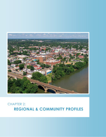
CHAPTER 2:REGIONAL & COMMUNITY PROFILES
Regional & Community ProfilesCHAPTER 2 - REGIONAL & COMMUNITY PROFILES2.1 - GEORGE WASHINGTON REGIONAL COMMISSION PROFILEABOUT; LOCATION & GEOGRAPHYThe George Washington Regional Commission (GWRC) is one of 21 Planning DistrictCommissions, corresponding to the 22 planning districts in the State of Virginia formed in 1968through §15.2-4200 - §15.2-4222 of the Code of Virginia. The purposes of the various commissionsand the GWRC is to encourage and facilitate local government cooperation and state-localcooperation in addressing regional basis problems of greater than local significance, withfunctional areas warranting regional cooperation to include, among other things, emergencymanagement.1Figure 2-1: GWRC Region Relative to the State of VirginiaThe GWRC planning district, alsoknown as Planning District 16, covers aregion located in northeasternVirginia, and includes the four (4)counties of Caroline, King GeorgeSpotsylvania, and Stafford, the City ofFredericksburg, and two incorporatedtowns, Port Royal and Bowling Green,both located within Caroline County(Figure 2-1). The region encompasses1,410 square miles, covering both hillypiedmont areas of the state as well aslow coastal plains.The GWRC region is among the fastestgrowing areas in Virginia, largely dueto its proximity and multipletransportation infrastructureconnections to the Washington, D.C.area. The City of Fredericksburg, along with Stafford and Spotsylvania Counties, are part of theWashington D.C. Primary Metropolitan Statistical Area (PMSA). Caroline County, including thetowns of Bowling Green and Port Royal, is part of the Richmond, VA Metropolitan Statistical Area(MSA), and are also seeing strong economic and population growth, along with economicrevitalization.Interstate 95 is the major transportation feature of the region, shaping many facets of populationgrowth, economic activity, and tourism. As the primary highway route serving the east coast ofthe United States, sections of I-95 through the GWRC region have Average Daily Traffic (ADT)1§15.2-4207, Purposes of commission, Code of VirginiaRegional Hazard Mitigation Plan 2022p.2
Regional & Community Profilesvolumes varying between 80,000 and 150,000 vehicles per day based upon data available andupdated through January 31, 2022. 2The fall line of the Rappahannock River divides the GWRC region into two distinct physiographicregions, the Northern Piedmont and the Coastal Plains. The Piedmont is a rolling to hillylandscape comprising the western portions of Spotsylvania and Stafford Counties. The levelCoastal Plain covers sections of eastern Spotsylvania and Stafford counties, the majority ofCaroline County, including the towns of Bowling Green and Port Royal, and the entirety of KingGeorge County.The GWRC region contains portions of three major Virginia watersheds; the Potomac, theRappahannock, and the York. The upper reaches of each watershed are typical Piedmontuplands with streams and rivers flowing across the fall line on their way to the Chesapeake Bay.Tidal marshes and flats are common throughout the lower portions of the major ChesapeakeBay tributaries.POPULATIONThe total population of the GWRC region has consistently outpaced the overall growth rates atboth the state and national levels (from 2010 to 2020, 7.8% and 7.4% respectively). While theregion’s population change between the 2010 and 2020 U.S. Census counts, at 16.7%, is not asgreat as it was between the 2000 and 2010 Census counts when the region grew by almost 36%(Figure 2-2), the region and most localities continue to grow at rates reliably greater that thestate and national population growth; with the exception of Caroline County, which was almostconsistent with state and national growth rates, and Stafford County, which grew at almostthree times the state and national rates, the region and most localities grew at a rate of almosttwo times that of state and national population growth.Figure 2-2: Regional Population GrowthJurisdiction2000Census2010Census2000–2010% Change2020 Census2010–2020% ChangeCaroline CountyCity of FredericksburgKing George CountySpotsylvania CountyStafford CountyGWRC Region 82,5518.2%15.2%13.3%14.4%21.7%16.7%Source: United States Census (2000, 2010, and 2020)In large part, the GWRC region’s continued growth is due to its location between the growingand prosperous Washington D.C. and Richmond, VA metropolitan areas, and with multi-modaltransportation access to these metropolitan areas and large sections of the U.S. easternseaboard. This has proven to be a profitable location for a wide range of national andSource: Virginia Department of f5c50356b964cb1909b0cb737eed2d4, data updated January 31,20222Regional Hazard Mitigation Plan 2022p.3
Regional & Community Profilesinternational companies. Sustained regional economic growth is very likely in this region, which,along with the Region’s competitive location between the Washington and Richmond MSAs, islikely to bring continued population growth.2.2 - COMMUNITY PROFILESTOWN OF BOWLING GREENThe Town of Bowling Green has been the county seat of Caroline Countysince 1803. It is located 72 miles south of Washington, D.C., 108 milessoutheast of Baltimore, Maryland and 35 miles north of Virginia's capital, theCity of Richmond. The Town’s history includes three centuries of colonialand modern Virginia development. Bowling Green has a well-documentedhistoric district highlighted by the Bowling Green Farm, a brick dwellingdating to the 17th Century.CAROLINE COUNTYCaroline County was created in 1727 through the division of portions ofKing William, King and Queen, and Essex Counties. Like each of the GWRCjurisdictions, Caroline County holds an important place in both Virginiaand American history. The County, located within 30 miles of the City ofRichmond, covers roughly 549 square miles and remains primarily rural. ThisCounty has two incorporated towns, Bowling Green, the county seat, andthe historic Town of Port Royal; Port Royal is located along theRappahannock River, which establishes the northeastern boundary of theCounty.The County also hosts the United States Army’s Fort A.P. Hill, which operates under its ownjurisdiction. The Fort is a 76,000-acre installation that provides year-round administrative andlogistical support and training for the U.S. Army’s Active Army, reserves, and other branches ofthe military and the U.S. Government.CITY OF FREDERICKSBURGFredericksburg is an independent city situated along the RappahannockRiver and bordered by Spotsylvania County on the south and StaffordCounty on the north. The City was founded in 1728, incorporated as a townin 1781, and became an independent city in 1879. The City’s historic districtcovers about 40 square blocks, but the City of Fredericksburg nowencompasses a total of 10 square miles. The historic district has over 350original buildings built before 1870.The City of Fredericksburg is located just one hour south of Washington D.C. and 45 minutesnorth of the City of Richmond. Growth and development have occurred in the urbanizing areassurrounding the City. Fredericksburg is closely linked to Stafford and Spotsylvania counties. TheFredericksburg, Spotsylvania, and Stafford area is one of the fastest-growing areas in theCommonwealth.Regional Hazard Mitigation Plan 2022p.4
Regional & Community ProfilesKING GEORGE COUNTYKing George County was formed in 1720, and like other jurisdictions in theregion, King George County’s roots are deeply imbedded in both thefounding of the United States and in its rural past. The County coversapproximately 183 square miles. Both the Potomac and the RappahannockRivers border the County, along the northern and southeastern bordersrespectively, and the County is located near both the Washington andFredericksburg urban areas, and serves as a gateway to Virginia’s scenicNorthern Neck. Agriculture continues to be a major economic force in KingGeorge County, but the County also hosts a variety of other industries, including the NavalSupport Facility Dahlgreen (“NSF Dahlgren”), a federal military installation and the region’slargest employer.Two important regional transportation arteries travel through King George County, US HWY 301and Route 3. HWY 301 connects Virginia to Southern Maryland/DC region, and Maryland iscurrently constructing a new four-lane bridge over the Potomac River to replace the currenttwo-lane bridge; the new bridge is scheduled to open in early 2023. Route 3 connects Virginia’srural Northern Neck to the Fredericksburg area and larger GWRC region.TOWN OF PORT ROYALThe Town of Port Royal was once the only chartered town in CarolineCounty and is that County’s oldest incorporated town. Located along theRappahannock River, the Town was an important colonial shipping port,and later a center of warehousing, freight, and passenger travel on theRiver. The Town is listed, in its entirety, on the National Register of HistoricPlaces.SPOTSYLVANIA COUNTYSpotsylvania County was formed in 1721 and has played host to manyimportant events in the Commonwealth’s history, being the birthplace ofseveral colonial settlements and industries such as iron works and cannonforging, as well as major Civil War battles such as Wilderness andChancellorsville. Based upon County resources, Spotsylvania County has anarea of approximately 414.25 square miles square miles,3 and has seenincreased growth as a suburban extension of both Fredericksburg and theWashington DC metro area. Like other communities in the region, itcontains portions of Interstate 95 and US Route 1, making the County an important part of theeast coast transportation system. Despite its advancing suburbanization, agriculture, forestry,rural residential, and open space remain the primary land uses of the southern and westernareas of the County, supported by the land use designations and designated PrimaryDevelopment Boundary contained in the County’s Comprehensive ion-About-SpotsylvaniaRegional Hazard Mitigation Plan 2022p.5
Regional & Community ProfilesSTAFFORD COUNTYStafford County was founded in 1664 and was home to two of the Nation’sfounders, George Washington and George Mason, as well as the locationof important events forming the Nation’s and Commonwealth’s history.The County is the northernmost and most populated county within theGWRC region and continues to be the fastest growing county within theregion. Stafford County has an area of approximately 270 square milesand is located only 40 miles from Washington, DC. The County has been amajor location of DC-area suburbanization, containing portions ofInterstate 95 and US Route 1. In addition to strong connections to the DC-area, northern areas ofthe County are occupied by Marine Corps Base Quantico, which includes the FBI Academy. TheRappahannock River borders the County on the west, and the Potomac River borders theCounty on the east. The County has over 75 miles of waterway shoreline and 42 travelablewaterways.RAPPAHANNOCK TRIBEThe Rappahannock Tribe is one of the eleven state-recognized tribes, andas of January 2018 with the passage of the Thomasina E. Jordan IndianTribes of Virginia Federal Recognition Act of 2017, is one of six federallyrecognized tribes in the state. Historically, the Rappahannock Tribe datesto the 17th Century, with a record of the Tribe meeting Captain John Smithin December 1607 at their capital town “Topahanocke” on the banks ofthe Rappahannock River, located in present-day Essex County.Presently, the Rappahannock Tribe maintains what is referred to as theRappahannock Tribal Service Area (RTSA), comprising the counties of Caroline (located in theGWRC region), Essex, King and Queen, and King William. The RTSA contains a concentration ofthe Tribe’s citizens, however, the Tribe is not geographically bound, with citizens residingthroughout the state. With respect to the GWRC region and Caroline County, a concentration ofcitizens of the Tribe resides in the Central Point area of the County.Regional Hazard Mitigation Plan 2022p.6
Commonwealth. Regional & Community Profiles Regional Hazard Mitigation Plan 2022 p.5 . In addition to strong connections to the DC-area, northern areas of the County are occupied by Marine Corps Base Quantico, which includes the FBI Academy. The Rappahannock River borders the County on the west, and the Potomac River borders the