Transcription
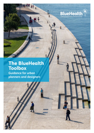
The BlueHealthToolboxGuidance for urbanplanners and designers
ContentsIntroduction1Why BlueHealth is important2The BlueHealth Toolbox4Using the tools together5Environmental Assessment Tool (BEAT)Decision Support Tool (DST)Behavioural Assessment Tool (BBAT)Community Level Survey (BCLS)SoftGISInternational Survey (BIS)67891011References12Please cite this document as: Grellier J, Mishra H S, Elliott L R,Wuijts S, Braubach M F W, Hall K L, Bell S, White M P, Fleming LE. The BlueHealth Toolbox – Guidance for urban planners anddesigners. 2020. DOI: 10.5281/zenodo.3786387The BlueHealth Toolbox – Guidance for urban planners anddesigners. BlueHealth Consortium, bluehealth2020.eu/toolbox
IntroductionThe BlueHealth Toolbox is for planners, designers and other decision-makers responsible forblue spaces. The tools provide the means to make comparable assessments of urban bluespaces before and after any proposed changes. Such changes can include a wide rangeof interventions, from physical alterations to the environment to advertising campaignsthat influence how people interact with it. The tools provide evidence about the qualityof blue environments, as well as information about how people and communities use,perceive and interact with blue spaces. They also assess the state of people’s healthand wellbeing. Together, this evidence can enhance urban planning and design.Access to quality blue spacesis increasingly recognised as away to benefit people’s healthand wellbeing.The BlueHealth Toolbox provides themeans to incorporate robust evidenceinto planning and design, as well aswider decision making.The BlueHealth Toolbox comprisessix tools that work at differentspatial scales to collect social andenvironmental data on blue spaces.The tools can reveal elements of existingblue spaces that improve health withminimal cost to the environment, and soinform future management.1
Why BlueHealth is importantToday over 200 million Europeans live incities established on coastlines, along rivernetworks, or on the shores of lakes.Where natural ‘blue’ features are not present, fountains,canals, ponds or other water features may be constructedto generate blue spaces within the urban fabric. Theseblue spaces – and the blue infrastructure within them– play a major role in determining the quality of oururban areas and contribute a wide range of services andbenefits for urban populations1.Exposure to blue space can promote health andwellbeing and prevent disease. Evidence suggeststhat people who live near – or have views of – waterare generally healthier2,3, experience fewer symptomsof mental distress4,5 and are more satisfied with theirlives6–8 than those who don’t. The positive effects ofliving near the coast, for instance, seem particularlypronounced for those with the highest levels ofsocioeconomic deprivation2, suggesting that there isless health inequality, and fairer access to good qualityenvironments, in such locations.Several pathways may account for thepositive relationship between health andexposure to blue space:People feel happier7,9 and less stressed10 in bluespace settings than in other outdoor locations11.Those living near blue spaces spend more timewithin them than those living further away12and coastal inhabitants are more likely to meetnational guidelines for physical activity thanthose inland13. Bluespaces are seen as particularly importantplaces to participate in positive social interactionswith friends and family14, and are more widelyused for health and wellbeing purposes thangreen spaces15.Water bodies can contribute to mitigating theurban heat island effect16, which is especiallyimportant in urban areas as average summertemperatures rise and heat-related morbidity andmortality increase17.As urban green spaces are increasingly encroachedupon by construction18 and as populations near largewater bodies increase in size, urban blue spaces maybecome increasingly important sites for recreationand other activities. Incorporating evidence on thehealth-promoting effects of exposure to blue spacesinto urban planning could help tackle public healthchallenges19. These include reducing the incidence ofdiseases associated with stress and sedentary lifestyles(e.g. heart disease, type 2 diabetes, cancer, etc.), andreducing morbidity and mortality related to increasingtemperatures20–22.2
Why use evidence-based design?Urban planners and landscape architects continuouslyseek relevant and up-to-date professional knowledgeto meet the demands and brief of a project. Plannersand designers frequently look at similar completedprojects as precedents and constantly interact withdecision-makers and community members to informtheir approach. Public health practitioners and policymakers may seek to boost population health throughvarious interventions, such as changes made to theurban fabric, or strategies designed to encouragephysical activity or relaxation in natural spaces.Gathering, evaluating and applying existing knowledgefrom elsewhere is a well-established practice in urbanplanning, as it is a relatively low-cost approach. However,there is often little connection between the success ofthe case studies used and the success of the projects thatdraw on them for reference.An evidence-based approach to design supportssustainable development and achieve the aims of aproject in the face of growing public health issues,increasing pressure on health-promoting urban nature,and growing social and ecological constraints. Inparticular, evidence-based approaches can help inform:Designersby enabling them to better understand asite and the needs of local communities.Evidence-based approaches can also helpdesigners respond to demands imposedby clients, project briefs and planningagencies by proposing solutions with ahigher likelihood of success.Planners and policy makersby providing a robust rationale for arguingwhy a particular policy or planningapproach should be implemented, whenfaced with competing demands andpressures on public space.Providing evidence for planning anddesigning blue spacesChanges to urban environments, such as the design,repurposing, or maintenance of blue spaces, can influencephysical and mental health. These impacts can bepositive or negative. Consequently, it is important to takethese impacts into account in decision making and touse an evidence-based approach. A key aspect of such anapproach is that various kinds of data are systematicallycollected and analysed before and after any interventionis made in order to identify what ‘worked’, how it worked,and what challenges remain.The BlueHealth toolbox was designed with theseprocesses in mind. It enables information on blue spacesto be collected consistently for any planning or designinterventions both before and after implementation.This information includes key aspects of environments(including risks and benefits), the status and behavioursof their users, and the opinions of other parties whomight be affected by an intervention.3
The BlueHealth ToolboxThe BlueHealth Toolbox comprises six tools that gather data on the environmental characteristics ofblue spaces; how these spaces are used; the behaviours of people within them; and the perceptions,experiences and health status of people who engage with blue spaces directly (through visitingthem), or indirectly (by living nearby).Each tool is designed to work at a particular spatial scale– from site to country level (Figure 1). All tools can beused at any point in the process of changing a blue space.They are most informative when used pre- and postintervention, particularly when they are administered atmultiple points in time (Figure 2).The Toolbox is a set of diagnostic tools for collectinginformation about places and the people using oraffected by them. They are not designed to understandthe governance processes that inform the planning andmanagement of blue spaces or their location. Stakeholderengagement is needed alongside Toolbox results toidentify and communicate the societal benefits of anyintervention. Visit: ANeighbourhoodBBBISATSiteS oftG ISFigure 1: Employing BlueHealth Toolbox at different spatial scales.Lighter tone indicates tool can be applied in some cases4BCLS
Using the tools togetherIndividually, each tool provides information on a key set of characteristics relating to the site,typically before and after an intervention.Used in combination within a single, integratedassessment framework (the BlueHealth Toolbox), the toolshave the potential to provide an evaluation team with avery rich data set on multiple aspects of a blue space andthe human populations affected by it.There are three core dimensions to consider whenselecting which tools to employ in assessing a specificintervention:1The spatial scale relevant to theeffects of an intervention.2The timing of anintervention evaluation3The population that may be impactedby an intervention.Some tools, such as the BBAT, are designed to assesscharacteristics at the site level. Others can be used atmultiple spatial scales, such as the BIS, which can beadministered at international, regional, and city levels(see Figure 1). This allows users to select the tool mostappropriate for their needs.Application of tools atmultiple pre- and postintervention time pointsMinimal assessmentApplication of toolsonly at pre- and postintervention time pointsIdeally the tools should be applied before and after anychange is made to a site or its users (an ‘intervention’).This will allow the user to reveal and quantify the effectsthat an intervention has on health and wellbeing. As thecharacteristics of most environments vary over daily,seasonal and annual timescales, so does their usageand the health status of those using them. For a fairevaluation, it is important to collect data at multiple pointsbefore and after any intervention (Figure 2). This appliesfor both environmental characteristics and health status.PopulationSpatial scaleIdeal assessmentTimingConsideration should be given to several populations wheninvestigating how people use, feel about, or are otherwiseaffected by a site and changes in it. On-site interviewswill only ever provide information about current users ofan urban blue space, and nothing about those who areprevented from visiting by any of several barriers. Doorstepinterviews and the like provide useful information aboutthose populations assumed to have a relationship to thesite (even if they do not visit it), but some blue spaces arepotential destinations for populations spread across wholecities. SoftGIS provides a partial solution to this, but it toorelies on very partial and potentially biased sampling as aresult of it being an online platform.Captures seasonal andother ‘natural’ variationin pre-interventionbaselinesMonitors potentiallyadverse impacts ofintervention throughoutimplementationEvaluates impacts ofintervention soon afterimplementation againstbaselinesAssesses longevity andvariation of impactsduring later terventionphaseLate post-interventionphaseDetermines preintervention baselines,without considerationof seasonal or other‘natural’ variationEvaluates impacts ofintervention againstbaselinesFigure 2: Using the BlueHealth Toolbox throughout an intervention.5
BlueHealthEnvironmental Assessment Tool(BEAT)bluehealth2020.eu/BEATWhat is it?The BlueHealth Environmental Assessment Tool (BEAT)provides robust, objective measures of the environmentalcharacter of a blue space, including the terrestrial andaquatic systems within the site23.The BEAT is primarily designed to be used as an onlinetool, but it is also available for download, allowing aprinted version to be used on sites without internet access.Who is it for?Two versions of the tool have been developed:How does it work?The tool guides the user through:1. A preliminary desk-based study that collects data on asite’s location and character.2. An on-site evaluation of the site’s character.3. The main survey, in which the social, aesthetic andphysical characteristics of the site are scored.4. An evaluation of the aquatic ecosystem.An example of data types collected by the BEAT6A Professional BEAT for professional users, such aslandscape architects, ecologists, recreation planners, urbanplanners and hydrologists who have expert knowledge ofthe relevant domains and may have sophisticated methodsor instruments available to assess the character of the site.A Community BEAT for community groups with an interestin their local environment and who are seeking informationon aspects of a blue space to inform their activity, perhapsas a citizen science or educational project, or in support offunding applications for other activities. This version of thetool is shorter and less complicated to use.
BlueHealthDecision Support Tool(DST)bluehealth2020.eu/DSTWhat is it?Once a site has been characterised, the BlueHealthDecision Support Tool (DST) helps identify the key healthrelated risks and benefits of a given blue space.It provides a novel means of approaching planning,management and maintenance of blue infrastructure,with both health promotion and the prevention orreduction of potential health risks in mind. The toolhighlights threats and ways to mitigate them, as well asspotting possible opportunities for boosting public healthand wellbeing.How does it work?The tool allows the user to select one of six different bluespaces, namely marine environments, rivers, lakes, urbanwater bodies, blue spaces in green space (parks etc.), andornamental blue spaces like fountains.The DST identifies the scale of threats, opportunities, andpopulations likely to be affected. This guidance can beused for planning and management based on three keyoutcomes:1. Human health risks related to blue spaces, such asdrowning, illnesses, vector-borne diseases, or climatespecific factors like UV exposure.2. Human health benefits, such as
Access to quality blue spaces is increasingly recognised as a way to benefit people’s health and wellbeing. The BlueHealth Toolbox provides the means to incorporate robust evidence into planning and design, as well as wider decision making. The BlueHealth Toolbox comprises six tools that work at different spatial scales to collect social and environmental data on blue spaces. The tools can .