Transcription
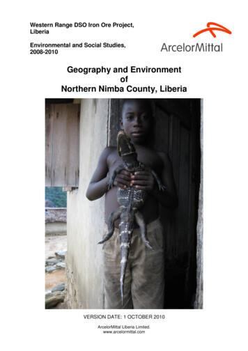
Western Range DSO Iron Ore Project,LiberiaEnvironmental and Social Studies,2008-2010Geography and EnvironmentofNorthern Nimba County, LiberiaVERSION DATE: 1 OCTOBER 2010ArcelorMittal Liberia Limited.www.arcelormittal.com
Western Range DSO Iron Ore Project, LiberiaEnvironmental and Social Studies, 2008-2010Geography and Environment of Northern NimbaContentsIntroduction. 3Location . 3Landforms, terrain and soils . 4The Nimba Range . 4Soils . 5Iron ore . 6LAMCO and the history of iron ore mining in Nimba . 6Climate and hydrology . 8Seasons and the ITCZ. 8Rainfall . 8Temperature . 9Hydrology . 9Biodiversity . 10Recognition and protection . 11Forest degradation: threats to biodiversity . 12‘Slash and burn’ as a threat . 12Other threats . 13History of migration and settlement in the area . 14The indigenous peoples of Nimba . 14Contact with Europe . 14The ‘Congoes’ . 14LAMCO and migration . 15Current ethnography and demography . 16Ethnography . 16Culture . 16Demography and disparity . 17Development in Liberia and the effects of the Civil War . 18The civil war . 18The current situation . 19Political and administration system . 20The history of the Constitution . 20The current system . 20Agricultural systems . 22Transport and markets . 23Timeline of Liberian history, 1847-2009 . 24A chronology of key events . 24Years of instability . 24Tentative ceasefire . 25Border fighting . 25Rebel offensives . 25Taylor in exile . 26Johnson-Sirleaf elected . 26Taylor on trial . 26Timeline: ArcelorMittal in Liberia . 27ArcelorMittal Liberia’s environmental and social studies . 28Sources . 29Acknowledgements . 29Page 2 of 29
Western Range DSO Iron Ore Project, LiberiaEnvironmental and Social Studies, 2008-2010Geography and Environment of Northern NimbaIntroductionThis document is intended to give readers a clear explanation as to why the biophysical and socioeconomic conditions of northern Nimba are what they are today. This is to help developunderstanding as to what they entail and why they require special care and management.‘Nimba’ refers to the geographical Nimba mountain area, as distinct from the political area of ‘NimbaCounty’. Northern Nimba County, the subject of this report, forms part of both Nimba County and theNimba mountain area. The Nimba mountains extend across the national borders into Guinea andIvory Coast, but this document is concerned only with the Liberian section.LocationLiberia is a small country on the Gulf of Guinea of the West African coast, and shares borders withSierra Leone, Guinea and Ivory Coast. Nimba County is one of its largest counties. Northern NimbaCounty, the area with which this document is concerned, is situated close to the intersection of theLiberian, Guinean and Ivorian borders.The name Nimba derives from Mount Nimba, the highest of the mountain range, which is thought tocome from the Mano for ‘mountain on which sisters slip’ – possibly a reference to its steepness.NorthernNimbaPage 3 of 29
Western Range DSO Iron Ore Project, LiberiaEnvironmental and Social Studies, 2008-2010Geography and Environment of Northern NimbaLandforms, terrain and soilsThe Nimba RangeThe most distinctive landforms of northern Nimba County are the Nimba Range of mountains. Theseare dominated by a ridge which runs 40km in a north-east to south-west direction along the GuineanIvorian border, across the Guinean-Liberia border and on for the remaining half of its length. Themountains’ highest point is 1752m above sea level, on the Guinean section of the main Nimba ridge,and is known as Mount Richard-Molard; in Liberia, the highest point is 1300m on the same ridge, andreferred to in this document as ‘Mount Nimba’. In northern Nimba County the significant but isolatedpeaks of Tokadeh, Beeton and the twin peaks of Gangra and Yuelliton lie to the west of the mainNimba ridge.The main Nimba ridge from Mount Tokadeh, looking north-eastwards into GuineaThe rock from which these mountains developed was formed over 500 million years ago, when siltand iron-rich mud were deposited at the bottom of a pre-Cambrian sea, gradually compressing andhardening to form a sedimentary rock. Tectonic movement led to this rock being lifted and folded intoa mountain chain, the pressure involved transforming the sand- and silt-based rock into quartzites,and the iron-laden mud into itabirite.Over thousands of years, the tropical climate of the region, as well as the action of the St John andCestos Rivers and their tributaries, has deeply weathered this rock, carving the mountains into steepsided ridges (some with slopes of 70 ) rising above wide plateaux, themselves about 450m above sealevel. The Nimba itabirite has weathered to leave the high concentrations of iron ore found in thesemountains.The faint silhouettes of Mounts Beeton, Gangra and Yuelliton from the old Nimba minePage 4 of 29
Western Range DSO Iron Ore Project, LiberiaEnvironmental and Social Studies, 2008-2010Geography and Environment of Northern NimbaSoilsThese processes have also led to the formation of heavily weathered soils, which vary depending onlocation, but are generally infertile due to their low organic content. Lush vegetation is enabled inforested areas by the development of topsoils mainly consisting of decaying organic matter, known ashumus. In open areas, however, minerals are leached from the soil by the high rainfall. In northernNimba County, the upland soils have a high iron content, which oxidises to give them their rich redcolour. By contrast, the soils in the valley bottoms are predominantly clayey gleysols, giving thewaterlogged conditions suitable for swamp rice cultivation.Iron-rich soil (ferralsol) on Mount TokadehShallow soil over iron ore on Mount GangraThe majority of the terrain in the area is forested or cultivated, with the notable exception of sitesformerly mined by LAMCO, where there is very little vegetation.Mount Yuelliton from an exploration access track on Mount GangraPage 5 of 29
Western Range DSO Iron Ore Project, LiberiaEnvironmental and Social Studies, 2008-2010Geography and Environment of Northern NimbaIron oreThe weathering of the Nimba Itabirite has caused large deposits of iron ore to form in the mountainsof the Nimba Range, including (in Liberia) Mounts Nimba, Tokadeh, Gangra and Yuelliton; there arealso ore formations in the Guinea and Ivory Coast sections of the Nimba ridge. In these deposits,most ore is present as Haematite (Fe2O3), with some Magnetite (Fe3O4). In some places the oreconsists of around 60% Fe (iron), which is about as pure as haematitic ore can be with the effects ofoxidisation. This is known as Direct Shipping Ore because it contains such a small proportion ofimpurities and requires little processing (pure magnetitic ore can be up to about 68% Fe).The Nimba pit in May 1989, almost at its end. and the pit as it is todayLAMCO and the history of iron ore mining in NimbaIn 1953 the Liberian government gave permission for a group of foreign geologists to begin exploringnorthern Nimba County in search of iron ore reserves. In 1955 a Scottish geologist, Sandy Clarke,found what he described as ‘a world of iron ore’ on Mount Nimba, and the Liberian American-SwedishMinerals Company (LAMCO) was formed by a group of US and Swedish investors in order to exploitthis ore body. A 273km railway was rapidly built between 1960 and early 1963 connecting northernNimba County to the coast at Buchanan – a remarkable feat of engineering, considering the terrainand the very limited infrastructure in Liberia at the time. Production began in 1963, and in its first tenyears LAMCO excavated 84 million tons of iron ore from the Nimba mine. Tokadeh was mined from1972, but closed in 1982 due to a depressed world iron ore market.LAMCO mine terraces visible on the main Nimba ridgeAs the project grew, the residential area was moved from Grassfield to Yekepa, which became athriving town, with a population of over 20,000 by the late 1970s. To encourage their (mainlySwedish) workers to stay on the project, LAMCO installed a number of leisure facilities, including aswimming pool, golf course, cinema, air strip and library. The company also funded a hospital and anumber of schools. As the resources at the Nimba mine started to be depleted, plans were made toexploit iron ore reserves discovered on Mounts Gangra and Yuelliton, and to connect the railway to aPage 6 of 29
Western Range DSO Iron Ore Project, LiberiaEnvironmental and Social Studies, 2008-2010Geography and Environment of Northern Nimbanew project in Guinean Nimba. A new company, the Nimba International Mining Company (NIMCO)was to be formed in order to do this.The Yekepa swimming pool in LAMCO days. and as it is today, after 20 years of neglectHowever, the political situation in Liberia was deteriorating, and in 1989 mining was stopped. Soonafterwards the Liberian government terminated its contract with LAMCO and the company’s expatriateemployees were forced to leave. LAMCO’s assets were given over to the Liberian Mining Company(LIMINCO), but in early 1990 insurrectionist forces came over the border from Ivory Coast to NimbaCounty, Yekepa was captured and all mining activities stopped. Much of the mining equipment andLAMCO infrastructure was looted and damaged during the civil war, as a series of war lords invadedthe town.Left: Per Arne Lindqvist, Chief of Production at Tokadeh in 1973, the year LAMCO started mining there.Centre: A LAMCO locomotive renamed for LIMINCO. Right: the first ore train, in 1963.Peace was eventually restored, and in 2005 the steel giant ArcelorMittal was given a concession torestore the LAMCO-era mining infrastructure, including the port and railway, in order to mine onMounts Tokadeh, Gangra and Yuelliton.Abandoned machinery at Nimba mineThe LAMCO rail workshop at YekepaPage 7 of 29
Western Range DSO Iron Ore Project, LiberiaEnvironmental and Social Studies, 2008-2010Geography and Environment of Northern NimbaClimate and hydrologyThe climate of Liberia and of northern Nimba County is tropical, with fairly consistently high rainfalland temperatures, although there are distinct wet and dry seasons, driven by the movement of theInter-Tropical Convergence Zone – distinct enough that the Monrovia Brewery receives a significantincrease in demand for large Club beers during the dry season. Northern Nimba County’s location at8 North means that the midday sun is never much lower than 60 above the horizon, passing directlyoverhead twice a year; day length is consequently similar throughout the year. This proximity to theequator also means that Liberia does not experience tropical cyclones.Seasons and the ITCZClimate in West Africa is driven by the energy of the sun and the path of its latitude through the year,and the annual cycles of humidity and differences in temperature that these create between theSahara desert and the Gulf of Guinea. In general terms, these factors generate a zone of warmer,lighter and therefore rising air, known as the Inter-Tropical Convergence Zone (ITCZ), which movesnorth of the equator during the northern hemisphere summer, and south during the northernhemisphere winter. Winds on the earth’s surface converge to the ITCZ, hence its name. In July, it isaround 10 north of Liberia, causing winds to prevail from the south-west; in January, the ITCZ ispositioned over the Liberian coastline, drawing winds from the north-east. These differences driveseasonal change.RainfallIn Liberia, rainfall varies greatly with distance from the sea. Coastal areas such as Buchanan canreceive more than 4,000mm of rainfall a year, while Yekepa is estimated to have an average annualrainfall of 1,800mm. Altitude is also a factor: it is estimated that the mountain tops of northern NimbaCounty receive almost double the rainfall of the surrounding plains.During the wet season, moist winds from the south-west prevail, and the warm temperatures and highrainfall combine to produce very high humidity levels. Observations have also been made of violentrainstorms known as squall lines, which are thought to be most frequent in June and July, althoughthe wettest month of the year is September. The dry season lasts from around November until April,with March usually the driest month. During this season, hotter, drier conditions are brought from theSahel by prevailing winds, known as the Harmattan, from the north-east. Throughout the year, raintends to fall in brief, heavy showers.Page 8 of 29
Western Range DSO Iron Ore Project, LiberiaEnvironmental and Social Studies, 2008-2010Geography and Environment of Northern NimbaTemperatureTemperature also varies through the year. In the wet season, the temperatures tend to be moreconsistent, with around 4 C variation between day and night temperature, compared to 8 C during thedry season, when reduced cloud cover results in hotter days and cooler nights. The averagetemperature at Yekepa is 27.5 C in February, but drops as low as 23 C in June. Northern NimbaCounty’s altitude gives it generally cooler temperatures than the lowlands, and the mountain tops tendto be several degrees cooler than the valleys between them.A mountain stream on TokadehThe Dayea River upstream from YekepaHydrologyThere are a number of water courses, including the Kahn and Dayea Rivers and many creeks, innorthern Nimba County. Almost all of these drain into the St John River, which starts in Guinea andforms the western border between Guinea and the whole northern part of Nimba County. Most of theriver catchments are in good ecological condition, with the exception of the water courses that drainthe former mine workings on Mounts Tokadeh and Nimba, which have higher levels of sedimentcontent and turbidity. All the water courses in the area have high iron concentrations due to the soilsand geology already described. The hydrology is complex, with many of the creeks and riversfollowing a course that may cross the Guinean-Liberian border a number of times.The Dayea River at Yekepa during the later dry seasonPage 9 of 29
Western Range DSO Iron Ore Project, LiberiaEnvironmental and Social Studies, 2008-2010Geography and Environment of Northern NimbaBiodiversityThe biodiversity of the Nimba area is considered to be of global importance. This indicates that thearea hosts a wide range and high numbers of species, and features high levels of endemism – that is,a number of species which have evolved in the area, and which therefore do not exist anywhere elseon the planet.This great biodiversity is thought to be partly the result of climate change over thousands of years,when hotter, drier periods in West Africa caused animals to migrate into the cooler, wetter mountainsof Nimba. When the climate improved again, they did not always move back to the plains. Inaddition, the mountain ecosystem found in Nimba is remote from other similar environments, so thatsome of the species which evolved for its conditions are not found anywhere else. The area has alsobeen relatively undisturbed, or at least was until LAMCO began operations.The proposed mine sites in northern Nimba County, despite not being as biodiverse as parts of thenearby East Nimba Nature Reserve, still boast at least 66 large mammal species, 242 species of bird,33 fishes, 43 amphibians, 78 molluscs, 74 ants and termites, and 742 species of butterflies andmoths. Endemic species in northern Nimba County include the viviparous Nimba toad, which givesbirth to live young, and the rare Nimba otter shrew (which eats freshwater crabs and is neither anotter nor a shrew). Groups of chimpanzees are also known to range along the Nimba ridge and in theforests around the western mountains.Page 10 of 29
Western Range DSO Iron Ore Project, LiberiaEnvironmental and Social Studies, 2008-2010Geography and Environment of Northern NimbaBiodiversity is also an important part of the indigenous culture of northern Nimba County. It providesfood, firewood and medicine, as well as the basis for unusual cultural practices. According to someMano villagers these include people inhabiting the bodies of forest animals, and a rich heritage offolklore and fables, which often feature animals (particularly the leopard, spider and antelope) as theirprotagonists.Recognition and protectionNorthern Nimba County forms part of the Guinean Forests of West Africa Biodiversity Hotspot, asidentified by Conservation International. This indicates that as well as having great biodiversity, it isalso considered to be an area where the biodiversity is under threat. It is recognised by manyauthorities on a global and regional scale, including the World Wildlife Fund, Birdlife International andFauna and Flora International. On a national level, part of northern Nimba County is protected by theEast Nimba Nature Reserve, where activities such as mining and logging are prohibited.Centre: a rare Nimba otter shrew, found in a stream near Mount TokadehPage 11 of 29
Western Range DSO Iron Ore Project, LiberiaEnvironmental and Social Studies, 2008-2010Geography and Environment of Northern NimbaForest degradation: threats to biodiversityLiberia forms part of the Upper Guinean forest ecosystem, which stretches from Togo to SierraLeone. However, only 10% of the original ecosystem still survives, with 40% of the remainingecosystem thought to be in Liberia, particularly in Sapo National Park in southern Liberia and theNimba Nature Reserve in northern Nimba County.‘Slash and burn’ as a threatThe traditional method of agriculture in northern Nimba County is that of shifting cultivation or ‘slashand burn’ agriculture. This technique has developed as a result of the thin topsoils, since thevegetation-soil nutrient exchanges are highly dynamic under natural forest and humid tropical climate.Any area that is cleared for cultivation quickly loses the nutrients in its soil because it is no longer partof the forest ecosystem, and instead is subject to increased oxidation and leaching. Consequently,the practice is to move on to another area of forest when the previous area becomes infertile. Theterm ‘slash and burn’ refers to the methods used to clear an area of forest.Fallow land a few years after cultivationFirewood and other forest productsPage 12 of 29
Western Range DSO Iron Ore Project, LiberiaEnvironmental and Social Studies, 2008-2010Geography and Environment of Northern NimbaWhere populations are very limited, shifting cultivation is on a small enough scale in relation to theforest that its impact is minimal: there is enough land that each area can be left fallow for a longenough period for the forest and soil to be able to regenerate with time (perhaps 40 years). However,as populations rise, the impact of agriculture on the forest increases. The amount of pristine forest inthe Nimba area has gradually been reduced to the point where the majority of vegetation is nowsecondary forest, and most of that has not fully recovered from the last cultivation cycle. A newconcern is that the displacement of people by mining operations in northern Nimba County will causeeven more pressure to be put on the remaining forest habitat.A well spaced commercial rubber plantationA dense, poorly managed private rubber plantationOther threatsSome areas of forest will also be directly destroyed by the recommencement of mining. Other majorthreats to the quality of the forest include logging, whether this is large-scale commercialdeforestation, the illegal carving of planks using chainsaws, known as pit-sawing, or the localcollection of firewood. While there is currently no large-scale logging in northern Nimba Countybecause the accessible forests have already been logged, pit sawing has seen a big increase sincethe war. Numerous sawyers are affecting large areas, and the process is highly inefficient because itcan waste up to 70% of the available timber. Forest is also degraded by being replaced by largeplantations of cash crops, such as rubber trees. Local bush meat hunting, which provides food andan extra source of income, is another threat to biodiversity. Although rodents form the majority of thebushmeat, primates are particularly threatened because their long reproductive cycles mean slowerpopulation increase – and because they fetch higher prices.Illegal logging in the Nimba forestsA giant rat or oppassum, popular legal bushmeatPage 13 of 29
Western Range DSO Iron Ore Project, LiberiaEnvironmental and Social Studies, 2008-2010Geography and Environment of Northern NimbaHistory of migration and settlement in the areaThe indigenous peoples of NimbaIt is not known exactly when people first came to the Nimba area, although the influences of the Maliththand Songhai empires of the 14 and 15 centuries, as well as the spread of Islam, are thought tohave reached as far as the south of modern-day Guinea.ththBetween the 16 and 18 centuries, the Mande peoples began to migrate south-westwards in wavesfrom what is now northern Ivory Coast. They were apparently driven out by migrating Kpele tribes, inturn forced out by Malinke people. The Mande groups – including Mano and Gio tribes – settled inthe Nimba region, where they began to adopt intensive forest agriculture. In addition, Mande peoplethare thought to have migrated south to Nimba around the start of the 20 century, fleeing the French ineastern Guinea. The Mano and Gio peoples remain the dominant ethnic groups in the area. Innorthern Nimba County, most of the village populations are over 80% Mano, with smaller percentagesof Gio in a few villages, including Gbapa and Makinto.Contact with EuropeLittle is known about Liberia before 1822, as indigenous writing was not developed until afterwards.However, European trade and exploration in West Africa reached the Grain Coast, as the area that isnow Liberia and Sierra Leone is now known, and indigenous people – the coastal tribes, includingthBassa – traded slaves, gold, ivory and pepper with Europeans from as early as the 15 Century.The ‘Congoes’thHowever, by the end of the 18 Century the Atlantic slave trade was coming under increasingcriticism in the west, and as slaves began to be freed, thought turned to how to accommodate them.Resettlement in their ancestral home of West Africa began to seem an attractive option. In 1787, agroup of American slaves was settled in Freetown, Sierra Leone, as a reward for fighting for theBritish in the American War of Independence.As the USA moved towards emancipation, a similar concept was formed, with the added intention ofgetting a US stronghold in Africa. The American Colonization Society was established in 1817, andnegotiations with the British and local chiefs along the Grain Coast eventually led to the creation of asettlement in Cape Montserrado in 1822. The settlement was called Monrovia after the US Presidentof the time, Monroe. The new colony was named Christopolis but this was soon changed to Liberia. Anumber of other colonies, including Maryland and Mississippi in Africa, were founded along the coast.Page 14 of 29
Western Range DSO Iron Ore Project, LiberiaEnvironmental and Social Studies, 2008-2010Geography and Environment of Northern NimbaThe colonists – known as ‘Congoes’ – met with conflict with indigenous tribes from the outset, but thecolony remained and expanded with more migrations from the USA. It merged with the other coloniesto become the Commonwealth of Liberia in 1839, with Thomas Buchanan (after whom the port city isnamed) as its first Governor. Independence from the USA was granted in 1847, with Joseph JenkinsRoberts heading the first, all-Congo government. The term ‘Congo’ is thought to derive from ashipload of slaves from the Congo who were dumped in Monrovia when the slave trade wasabolished by the British and a ship was caught mid-voyage, but this is uncertain.Expansion continued into the ‘hinterland’, the huge, virtually unexplored area beyond the colonisedcoastal counties, but the government remained almost exclusively Americo-Liberian, and contact withindigenous peoples was often violent or exploitative. The Fernando Po scandal of 1929 erupted whenthe government was found to have forcibly recruited indigenous Liberians to work, effectively asslaves, on the Spanish colony of Fernando Po (now part of Equatorial Guinea).Meanwhile the Liberian government was also undergoing pressure as Britain and Fran
and iron-rich mud were deposited at the bottom of a pre-Cambrian sea, gradually compressing and hardening to form a sedimentary rock. Tectonic movement led to this rock being lifted and folded into a mountain chain, the pressure involved transforming the sand- and silt-based rock into quartzites, and the iron-laden mud into itabirite.