Transcription
LS/LSIT VIDEO EXAMPREPARATION COURSEWORKBOOKEDITED BYL.E. Luke WilsonState of CaliforniaDepartment of TransportationDivision of Engineering ManagementOffice of Engineering TechnologyGeometronics Branch
Caltrans LS/LSIT Video Exam Preparation Course Caltrans Geometronics, 1993For workbooks, contact:Caltrans Publications Unit, MS 161900 Royal Oaks DriveSacramento, CA 95815(916) 445-3520For video tapes, contact:Audio-Visual Pool, MS 341120 N StreetSacramento, CA 95814(916) 654-4034ii
TABLE OF CONTENTSIntroduction . vAcknowledgments . ixUnit 1Exam Preparation . 1-1Unit 2Basic Survey Math . 2-1Unit 3Basic Measurements . 3-1Unit 4Azimuth Determination by Celestial Observation. 4-1Unit 5Traversing . 5-1Unit 6Leveling . 6-1Unit 7Route Surveying . 7-1Unit 8Areas and Volumes . 8-1Unit 9Photogrammetry . 9-1Unit 10 The Global Positioning System . 10-1Unit 11 The California Coordinate System . 11-1Unit 12 U.S. Public Land Survey System . 12-1Unit 13 Principles of Boundary Determination . 13-1Unit 14 Water Boundary Location . 14-1Unit 15 Legal Descriptions . 15-1Unit 16 California Law for Surveyors . 16-1iii
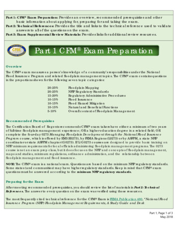
Caltrans LS/LSIT Video Exam Preparation CourseThis workbook is intended for Caltrans employees preparing for the CaliforniaLand Surveyor (LS) or Land Surveyor in Training (LSIT) examinations.Materials presented in this workbook are typical of examination subjects andare not intended to be a comprehensive, complete, or exhaustive coverage ofthe entire scope of land surveying practice. Users of this workbook andaccompanying videos assume all responsibility for its use. Caltrans, the Editor,and the various contributors to the workbook and accompanying videos donot accept or assume any responsibility for its use, including responsibilitiesfor errors, omissions, and oversights in preparation of the materials includedin the workbook and accompanying videos. Users of this workbook andaccompanying videos should contact the California State Board of Registrationfor Professional Engineers and Land Surveyors regarding their current rulesand schedules for LSIT and LS Examinations prior to sitting for eitherexamination.iv
INTRODUCTIONINTRODUCTIONThis course is designed to help you prepare for the Land Surveyor in TrainingExamination (LSIT) and the California Land Surveyor Exam (LS). It should beused as a part of your preparation for the exams, not your only preparation.The course introduces typical topics covered on the two exams and can beused as a bench mark against which to measure your readiness for examquestions.The course includes a set of video tapes and a workbook and is composed of16 units: 15 on different surveying topics and one on general exampreparation. Each unit was authored by a practicing licensed land surveyor.The course is designed for both the LSIT and LS exams, so you will find someunits more useful than others depending on which exam you are taking.The units designed for the LSIT exam are Basic Survey Math, BasicMeasurements, Traversing, Leveling, and Areas and Volumes. Units writtenwith LS candidates in mind are The Global Positioning System, CaliforniaCoordinate System, U. S. Public Land Survey System, Principles of BoundaryDetermination, Water Boundary Location, Legal Descriptions, Photogrammetryand California Law for Surveyors. The units on Exam Preparation, RouteSurveying and Azimuth Determination by Celestial Observation are not aseasily categorized.This is not to say that an LS candidate need not review Basic Measurements oran LSIT candidate need not review Water Boundary Location. Those takingthe LS exam should be thoroughly familiar with all of the material covered forthe LSIT. LSIT candidates must be familiar with the LS topics, with theunderstanding that LSIT problems will not be as complex or require the sameexpertise as problems on the LS Exam.The course can be used to best advantage by treating the table of contents likea menu. Units can be reviewed in any particular order you choose. Prioritizethe units based on your personal needs. Work through each unit you select byreviewing the workbook, watching the video tape and solving the problems.Completing work on a unit will help you develop an accurate assessment ofyour exam readiness for the topic.Each workbook unit begins with an introductory statement and a list of thetypes of problems you are most likely to encounter on an exam. Units alsoinclude a list of key terms, a video outline, a set of sample problems and theirsolutions and a reference section.v
Caltrans LS/LSIT Video Exam Preparation CourseThe “Introduction” and “Performance Expected on the Exams” sections of theworkbook list types of questions posed on exams as well as the breadth of thesubject matter in the unit. These sections are designed to give you a taste ofwhat will appear on the video.The “Key Terms” and “Sample Test Questions” sections of the workbook aredesigned to test your knowledge of the topics. You will have difficulty on theexam if you do not acquire the basic vocabulary of the profession. Sampletest questions are designed by presenters to both test general knowledge ofsurveying and to give you practice with the type of questions you are mostlikely to encounter on the tests. Keep in mind that the LSIT is a closed booktest with a multiple choice format.Some of the sample test problems are from past LS exams. These problemsare identified by stating the problem number and year the problem appearedon the exam as in the following example: Problem D-5, 1984 LS. You shouldwork as many old exam problems as possible. LS exams from previous yearscan be purchased from the California State Board of Registration forProfessional Engineers and Land Surveyors for 3.23 per test.The “Answer Key” not only gives you solutions to the problems, but in mostcases shows the solution methodology. Knowing the problem solvingmethodology is the key to success on the exams.Finally, the “Reference” section at the end of each unit is provided as a guideto further study. References given are not meant to be all inclusive, butreflect the preference of each individual instructor.Each workbook unit contains a “Video Presentation Outline,” which serves asa preview of the information presented in the video. More importantly itprovides a framework for note taking while viewing the video. You canpersonalize the video outline, which includes formulas, sketches and problemsolutions from the video, with your own comments and notes. The workbookVideo Presentation Outlines, annotated with your own notes, can be used as areference when you take the LS exam.Video tapes for each unit vary in their format, length and method ofpresentation. In presenting the material, the instructors have used theirexperience and personal teaching styles to emphasize certain important facts.The tapes, being only one to two hours long, are not meant to be acomprehensive teaching lecture. They are designed to review topics likely toappear on the exams, offer exam-taking tips, and present useful informationsuch as mathematical formulas and problem-solving methodologies.vi
INTRODUCTIONThis course can help organize your test preparation. After using the course toidentify topics for further study, you should develop a plan to increase yourknowledge in these areas. Your program of study might include seminars,college courses or simply studying one of the texts recommended in thereference sections in the workbook. Certainly you should find and solve asmany surveying problems as possible. There are several books of problemsavailable and referenced in the workbook chapters.When all is said and done, the key to success on the exam is based onthorough knowledge of the subject matter and lots of practice solvingproblems. As Robert McComb says, the most important principle of exampreparation is “study, study, study.”vii
Caltrans LS/LSIT Video Exam Preparation CourseACKNOWLEDGMENTSWe are all indebted to the creative efforts of the instructors, who worked sohard in an unfamiliar medium. Thank you Richard Burns, Lester E. Carter, Jr.,Don D’Onofrio, Mitchell Duryea, Jeremy Evans, R. W. “Russ” Forsberg, DonHunter, Bill Jackson, Carrol Leong, Jim McCavitt, Robert McComb, RoyMinnick, Charles Safford, John Sands, Vincent J. Sincek, C. J. Vandegrift, andEdward Zimmerman.The instructors are highly visible, but the project was equally dependent onmany other good people and their organizations. Thanks to Larry Fenske andDave Goodman of Caltrans Geometronics for their inspiration; EdwardZimmerman, chief of Caltrans Geometronics Publications and Training Section;who was both instructor and administrator; and Jim Comins and Elisa Holmesof Los Rios Community College District Training Source, who guided usthrough the publishing process.Thanks also to Kirk Wiecking, Director of the Sacramento City College MediaResources Center, whose sure-footedness and insistence on proper planningkept us on track; Terry Hajec, Graphic Artist at Sacramento City College, whomanaged production of graphics and the workbook; Jennifer Martin, videoproducer, who eased everyone’s anxieties; Dave Sauer, Engineer of theSacramento City College TV Studio, and his studio crew, Mike Colozzi andAllen Elston; Ric Hornor of Electric Canvas, who created the video and printgraphics; Sarah Toll of Electric Page, who typeset the workbook and KakwasiSomadhi of Sacramento City College, who proofread the workbook.L.E. Luke WilsonEditorviii
U N I T1EXAM PREPARATIONCharles Safford, PLSPrincipal Survey AnalystRick Engineering, San DiegoIntroductionThis video course is designed to help you prepare for what will probablyprove to be the most important tests in your career as a professional landsurveyor, the Land Surveyor in Training (LSIT) and the Land Surveyor (LS)exams. This unit will cover application for admittance to the exams, contentof the exams, preparation for the exams, test taking strategy, and appeals.Natural abilities and past experience both have an impact on how individualsperform in exam situations. Some people test well because they handle thestress of the testing situation well, or have had the benefit of testingexperience from college work. The single most important attribute necessaryfor success is the self-confidence that comes from thoroughly understandingthe subject.
Caltrans LS/LSIT Video Exam Preparation CoursePerformance Expected on the ExamsApply successfully to take the exam.List the topics covered and the type of questions used on the exam.Develop a study plan. Elicit support for your plan from family, friends, andemployer.Develop a test taking strategy for the exam.Outline the appeals process for the exam.Key TermsResponsible field trainingMultiple choiceResponsible office trainingFactual questionsApplication questionsReferences (on exam)References (on application)ReciprocityComityGrandfather clauseCertified transcript1-2
Exam PreparationVideo Presentation OutlineApplying to Take the Exams For Applications and InformationBoard of Registration for ProfessionalEngineers and Land SurveyorsP. O. Box 659005Sacramento, CA 95865-9005(916) 920-7466 Board PublicationsInformation for Licensing as a Land Surveyor Plain Language Pamphlet of theLand Surveyor’s Act and Board Rules Eligibility Requirements– Land Surveyor in Training ExamFor information and sample test, write:National Council of Engineering ExaminersP. O. Box 1686Clemsen, SC 29633-1686– Land Surveyor ExamExperience- Responsible field training- Responsible office training- Employment verification formsEducationReferencesExam Preparation A place to study A schedule for study A strategy for study– Review– Problem solving Study aids1-3
Caltrans LS/LSIT Video Exam Preparation CourseTaking the Exam What to bring to the exams Exam strategyOverview of California Land Surveyor Exams Land Surveyor in Training Exam– Closed book– Multiple choice questions on the fundamentals of land surveying– More emphasis recently on boundary and public land principles Land Surveyor Exam (eight hour open book)– Emphasis on:- Application of principles- Making professional judgments– Topics covered on exams 1987–1992 (by % of total points for each topic)61%Boundary determination and legal descriptions8%California statute law9%State plane coordinates8%Photogrammetry7%Construction, route surveying5%Astronomy2%Other (error analysis, GPS)– Other topics- From past exams- Probable future topics Review of 1990 Exam Review of 1991 Exam1-4
Exam PreparationThe Appeals Process 60 day appeal period Materials provided by the Board StrategyReferencesBrinker, Russell C., 4567 Review Questions for Surveyors, 1978.Chelapati, C. V., ed., Land Surveyor License Examination Review Manual,Professional Engineering Development Publications, Long Beach, CA,1987.Harbin, Andrew L., Land Surveyor Reference Manual, ProfessionalPublications, San Carlos, CA, 1985.Minnick, Roy, Land Survey Test Training Manual, Landmark Enterprises,Rancho Cordova, CA, 1972.Safford, Charles, Syllabus for Land Surveyor Examinations, LandmarkEnterprises, Rancho Cordova, CA, 1988.1-5
U N I T2BASIC SURVEY MATHEdward Zimmerman, PLSCalifornia Department of TransportationIntroductionThe purpose of this video unit is to present basic math concepts andprinciples useful to survey computations. It has been assumed that mostviewers are already familiar with some or most of the topics presented in thebeginning of the unit. It is important to have a developed understanding of thebasic operations of arithmetic, algebra, geometry, and trigonometry. This unitis not designed as a complete math course, but rather as an overview andguide to computation processes unique to surveying and mapping. Surveyorswho need to work on math operations and fundamental skills addressed in thevideo will find sources for further study in the reference section at the end ofthis unit.
Caltrans LS/LSIT Video Exam Preparation CourseSurvey mathematics generally consists of applications of formulas andequations that have been adapted to work toward the specific needs of thesurveyor such as: Units of measurement and conversions Check and adjustment of raw field data Closure and adjustment of survey figures Calculations for missing elements of a figure Working with coordinates (COGO) Intersections of straight lines and of circlesIt is hoped this video unit will help viewers to recognize solution formats forproblems and then make correct and effective use of appropriate methods tosolve these particular survey problems.Performance Expected on the ExamsRecognize solution formats, and make correct and effective use of appropriatemathematical solutions to particular survey applications.Key Terms2-2Absolute valueAdjacent sideAlgebraArcArithmeticAzimuthBearingCentral angleChordCircular curveCircumferenceComplementary angleCoordinate conversionCosecantCosineCotangentCubesDecimal systemdelta x, delta xDepartureExternal distanceGeodetic northGradsGrid north
Basic Survey MathHexagonHorizontal curveHypotenuseIntersectionsIntersection of straight line and arcIntersections of straight linesInverse processesLatitudeLaw of cosinesLaw of sinesLength of arcMagnetic northMeterMid-ordinate distanceMost probable valueOblique triangleOpposite sideOrder of operationsParabolaParallelogramPentagonPercent of slopePercentagepiPlane geometryPolar coordinatesPolygonPythagorean theoremQuadrantsQuadratic equationQuadrilateralRadianRadiusRadius pointRandom errorRate of changeRectangular coordinatesResidualRhomboidRight triangleRootsRounding offSag curveSecantSector of a circleSegment of a circleSexagesimal systemSigned numbersSignificant figuresSimultaneous equationSineSquare rootSquaresStandard errorSupplementary anglesUS survey footTangentTrigonometry2-3
Caltrans LS/LSIT Video Exam Preparation CourseVideo Presentation OutlineArithmetic Decimal system Rounding off and significant figures Percentage Squares, cubes and rootsConversion of Units of Measure Converting lineal units Converting angular units Converting units of areaRandom Error Analysis Error definitions Error residuals Statistical error matrix Propagation of error Error in summation Error in product Error in seriesAlgebra Signed numbers Equations Order of operations Parentheses Evaluating equations and combining terms Solving equations The quadratic equation formula2-4
Basic Survey MathPlane Geometry Angles Geometrical theorems Geometrical figures Polygons TrianglesTrigonometry Right triangles Pythagorean theorem Trigonometric functions Oblique triangles Directions: bearings and azimuths Latitudes and departures Plane coordinatesCoordinate Geometry Intersection of straight lines Intersection of straight line and arc Intersection of two arcs2-5
Caltrans LS/LSIT Video Exam Preparation CourseSample Test Questions1. The product of 416.78 multiplied by 210.98 is?A.B.C.D.879.328,793.3287,932.24879,322.442. The quotient of 36.11 divided by 191.67 is?A.B.C.D.188.4018.841.880.193. Square the number 0.713729, showing the results to the nearest fivedecimal places.A.B.C.D.0.509410.509400.509420.509434. The percentage of slope for a proposed ramp is 3.55%. What is thechange in elevation of this ramp for a horizontal length of 356 ft?A.B.C.D.-126.38 ft 12.60 ft 12.64 ft 126.38 ft5. Where the centerline slope of a highway has a vertical drop of 14.75 ft in265 ft horizontally, what is the rate of change expressed in percentage?A. 0.55%B. 0.56%C. 5.55%D. 5.57%6. Determine the square root of 0.6935, showing the result to the nearest fivedecimal places.A.B.C.D.2-60.8327760.832760.832770.832766
Basic Survey Math7. 24.91 expressed in ft and in, equals:A.B.C.D.24 ft, 10-7/8 in24 ft, 10-3/8 in24 ft, 10-1/4 in24 ft, 11 in8. 4,178.309 meters equals United States survey ft.A.B.C.D.1,273.56 survey ft1,273.55 survey ft13,708.20 survey ft13,708.34 survey ft9. 6,172.98 United States survey ft equals meters.A.B.C.D.1,881.528 m1,881.547 m20,252.313 m20,252.519 m10. When converted to survey ft, 3,421.381 meters equals survey ft.A.B.C.D.1,042.84 survey ft1,042.85 survey ft11,224.87 survey ft11,224.98 survey ft11. 21.56 chains converts to survey ft.A.B.C.D.1,422.36 survey ft1,386.00 survey ft1293.60 survey ft1,422.96 survey ft12. 14 34' 37" converted to radian measurement is ?A.B.C.D.0.250345 rad0.254416 rad0.250351 rad0.250337 rad13. 0.758612 rad, when converted to degrees, minutes, and seconds is .A.B.C.D.43 46' 52"43 41' 35"43 33' 12"43 27' 55"2-7
Caltrans LS/LSIT Video Exam Preparation Course14. How many hectares are contained in a rectangular parcel that measures19.23 ch. x 40.63 ch.?A.B.C.D.78.131 hec781.315 hec31.619 hec193.063 hec15. An angle has been measured six individual times with the followingresults: a.) 46 21' 45"; b.) 46 22' 10"; c.) 46 22' 05"; d.) 46 22' 00";e.) 46 21' 45"; f.) 46 21' 55". What is the most probable value of theangle?A.B.C.D.46 21' 45"46 21' 50"46 21' 57"46 22' 00"16. Determine the standard error for the following group of six measurements:a.) 11,249.71 ft; b.) 11,250.06 ft; c.) 11,249.86 ft;d.) 11,249.99 ft; e.) 11,250.01 ft; f.) 11,249.98 ft.A.B.C.D. 0.13 ft 0.12 ft 0.10 ft 0.08 ft17. Determine the standard error of the mean for the measurement set inproblem #16.A.B.C.D. 0.21 ft 0.13 ft 0.05 ft 0.03 ft18. A rectangular parcel of land was surveyed. The measurement for side Xwas 339.21 ft with an error of 0.05 ft. Side Y was measured as 563.67 ft,with an error of 0.09 ft. What is the area of the parcel and what is theexpected error in the area?A.B.C.D.2-8Area 191,202 ft2 or 4.389 ac.; standard error 41.7 ft2Area 191,202 ft2 or 4.389 ac.; standard error 41.5 ft2Area 191,202 ft2 or 4.389 ac.; standard error 24.1 ft2Area 191,202 ft2 or 4.389 ac.; standard error 53.5 ft2
Basic Survey Math19. The total length for a highway centerline was measured in four differentsegments using different equipment and different methods of measurementon different days. The total length of the line was found by totaling thelength of each segment. Standard error for each segment was determinedto be:Standard Error of Segment #1 0.04 ftStandard Error of Segment #2 0.03 ftStandard Error of Segment #3 0.08 ftStandard Error of Segment #4 0.11 ftThe standard error of the total distance of the centerline is ?A.B.C.D.Standard error of the sum 0.14 ftStandard error of the sum 0.26 ftStandard error of the sum 0.02 ftStandard error of the sum 0.07 ft20. What is the sum of the following five numbers: (-230.67); ( 517.39);( 100.26): (-311.47); and . The remainder after -146.11 has been subtracted from -37.82 is ?A.B.C.D.-108.29108.29-183.93183.9322. Write an equation based on the following word statement: “three times anumber, plus the number cubed, minus the number multiplied by 87.” Inthe algebraic equation, let b stand for the number referred to in theproblem statement.A.B.C.D.3 (b b3) - (87b)3 (b b3) - 87b3 b b3 - 87b(3b) b3 - (87b)23. Letting w 12 and z 3, evaluate the following equation:5w (21 - w) 14z (z - 23).A.B.C.D.4182,8782,88119,1622-9
Caltrans LS/LSIT Video Exam Preparation Course24. If angle 3 in the sketch below is 71 39' 12", calculate the values of angles 1,2, 5, and 8. Assume lines P-Q and R-S are parallel.A.B.C.D. 1 108 20' 48"; 2 108 20' 48"; 5 108 20' 48"; 8 71 39' 12" 1 108 20' 48"; 2 71 39' 12"; 5 71 39' 12"; 8 108 20' 48" 1 108 20' 48"; 2 71 39' 12"; 5 108 20' 48"; 8 71 39' 12" 1 108 20' 48"; 2 108 20' 48"; 5 71 39' 12"; 8 71 39' 12"RP37216548SQ25. If angle 1 in the sketch below is 46 11' 20", calculate the values of angles 2and 3.A.B.C.D. 2 46 11' 20"; 3 133 48' 40" 2 43 48' 40"; 3 133 48' 40" 2 46 11' 20"; 3 136 11' 20" 2 43 48' 40"; 3 136 11' 20"N90 GLM21HI90 K3J2-10
Basic Survey Math26. Solve for angle A in the triangle shown below:15 38' 56"15 23' 08"15 58' 20"15 58' 21"B993.14'A.B.C.D.3609.11'AC27. Solve for the missing side “a” of the triangle in the sketch below.A.B.C.D.156.43 ft154.72 ft175.23 ft172.84 ftB11'.347a26 47' 09"AC28. What is length of side “c” in the triangle shown in the sketch below?A.B.C.D.578.61 ft598.75 ft600.36 ft580.29 ft44.11'BCc04 21' 34"A2-11
Caltrans LS/LSIT Video Exam Preparation Course29. What is the length of side Y to Z in the sketch of parcel #37 shown below?A.B.C.D.557.17 ft559.56 ft558.56 ft556.25 ftZY90 372.23'PARCEL 37Not to Scale103 21' 30"90 471.17'WX30. Line P to Q intersects the street alignment as shown in the sketch below.What is the length of line P-Q?A.B.C.D.52.50 ft52.52 ft52.54 ft52.56 ftP52.00'98 14' 25"Not to Scale2-12Q
Basic Survey Math31. Given the following dimensions shown for the oblique triangle in the sketchbelow, solve for the length of side “b.”A.B.C.D.B855.58 ft857.02 ft438.34 ft37.12 ft59 03' 41"'97.45036 11' 27"AbC32. Solve for side “a” using the elements given for the oblique triangle shownin the sketch below.751.27 ft618.43 ft744.27 ft620.70 ft3'B521.7A.B.C.D.a61 12' 14"A671.11'C2-13 Ê
Caltrans LS/LSIT Video Exam Preparation Course33. From the elements of the oblique triangle given in the sketch below, solvefor angle A.68 06' 10"67 54' 41"67 50' 53"67 30' 19"B6'357.17.4391'A.B.C.D.357.41'AC34. Using information given in the sketch below, calculate the coordinates forpoint R.A.B.C.D.y 1,945.62; x 11,612.43y 1,945.73; x 11,612.39y 1,945.61; x 11,612.33y 1,945.68; x 11,612.39y 3,407.16x 7,186.10PS 46 11' 21" E2106.43'O2-14S 89 56' 06" E2906.27'R
Basic Survey Math35. After looking at the sketch below, determine the bearing and distance ofthe line from point C to point D.A.B.C.D.N 89 19' 27" W; 91.33 ftS 89 49' 06" W; 91.31 ftS 89 19' 27" E; 91.33 ftS 89 19' 17" E; 91.29 ftBN 51 26' 12" E91.73'S 44 02' 51" E87.11'y 3,400.65x 7,409.67DAy 3,407.16x 7,186.10C36. Determine the coordinates of the point “x”where the two lines intersect asshown in the sketch below.A.B.C.D.y 1,652.56; x 1,733.14y 1,652.47; x 1,732.99y 1,652.64; x 1,733.24y 1,652.53; x 1,733.19DEy 1,756.00x 1,198.00y 2,011.00x 1,997.00Xy 1,200.00x 1,400.00Gy 1,560.00x 2,212.00F2-15
Caltrans LS/LSIT Video Exam Preparation Course37. Using information given in the sketch, calculate the bearing of the linefrom the “RP” to point X. Also determine the distance from L to X.A.B.C.D.Bearing “RP” to X N 48 51' 10" E; Distance L to X 438.71 ftBearing “RP” to X N 50 51' 50" E; Distance L to X 439.85 ftBearing “RP” to X N 49 10' 30" E; Distance L to X 440.00 ftBearing “RP” to X N 49 12' 40" E; Distance L to X 441.07 ftECLXMy 2,731.00x 3,012.00y 2,580.00x 2,207.000'5.0sdiuy 2,365.50x 2,250.37Ra3 4BCRP38. Determine the bearing of lines RP-1 to X and line RP-2 to X from the surveydata shown in the sketch below.A. Bearing Line RP-1 to X N 44 17' 50" W;Bearing Line RP-2 to X N 40 12' 45" EB. Bearing Line RP-1 to X 40 12' 45" E;Bearing Line RP-2 to X N 40 12' 45" WC. Bearing Line RP-1 to X N 44 17' 50" E;Bearing Line RP-2 to X N 40 12' 45" WD. Bearing Line RP-1 to X N 40 12' 45" W;Bearing Line RP-2 to X N 44 17' 50" WX '000.49RP-1s iuadiusdRaR'.00050y 1,831.00x 1,563.00y 1,814.67x 2,228.552-16RP-2
Basic Survey Math39. Determine the deflection angle and the sub-chord length (from beginning ofcurve) required to locate sta. 30 74.50 on its correct position on the arcusing data given in the sketch below.A.B.C.D.Deflection 03 11' 33"; Sub-chord 155.94 ftDeflection 06 23' 06"; Sub-chord 155.69 ftDeflection 06 23' 06"; Sub-chord 311.48 ftDeflection 03 11' 33"; Sub-chord 152.07 ftSta. 31 34.87I 17 34' 21"BCR 1400.00'Not to Scale40. Using curve information given in the sketch, calculate the external and mid ordinate distances for the curve.A.B.C.D.External 0.37 ft;External 1.00 ft;External 1.04 ft;External 4.15 ft;Mid-ordinate 0.37 ftMid-ordinate 1.00 ftMid-ordinate 1.04 ftMid-ordinate 4.14 ftI 04 11' 19"R 1500.00'Not to Scale2-17
Caltrans LS/LSIT Video Exam Preparation Course41. Using the data given in the sketch below, calculate the centerline radiusthat will allow the outside edge of a 42-ft roadway (overall width) to clearthe center of the tree by 6 ft.A.B.C.D.C/L radius 4,366.42 ftC/L radius 4,478.80 ftC/L radius 4,424.92 ftC/L radius 4,436.80 ftI 18 34' 30"31.0TreeCLNot to Scale42. From data given on the sketch of the vertical curve below, calculate theelevation at station 31 56.A.B.C.D.Elev. @ sta. 31 56 225.02 ftElev. @ sta. 31 56 225.25 ftElev. @ sta. 31 56 225.47 ftElev. @ sta. 31 56 225.72 ft 2.60%PVI-4.05%EVC 36 50.00Elev. 212.47L 1200'2-18
Basic Survey Math43. Referring back to Problem #42 (above), calculate the station and elevationof the high point of the curve.A.B.C.D.Sta. 29 19; Elev. 205.74 ftSta. 29 19; Elev. 227.27 ftSta. 30 50; Elev. 226.80 ftSta. 33 88; Elev. 221.17 ft44. Using the information given in the diagram below, calculate the station andelevation of the BVC of curve designed to provide a minimum of 3.0 ftclearance at the top of pipe located at station 6 87. Determine “L” to thenearest half station.A.B.C.D.Sta. @ BVC 3 50; Elev. 39.18 ftSta. @ BVC 4 00; Elev. 38.36 ftSta. @ BVC 4 25; Elev. 37.94 ftSta. @ BVC 3 25; Elev. 39.59 ftLTop of Pipe 36.11BVC-1.65% 4.10%PIVC @ 6 50.00Elevation 34.232-19
Caltrans LS/LSIT Video Exam Preparation CourseAnswer Key1. C. 87,932.242. D. 0.193. A. 0.509414. C. 12.64 ft5. D. -5.57%6. C. 0.832777. A. 24 ft – 10 7/8 in8. D. 13,708.34 survey ft9. A. 1,881.528 meters10. D. 11,224.98 survey ft11. D. 1,422.96 survey ft12. B. 0.254416 rad13. D. 43 27' 55"14. C. 31.619 hec15. C. 46 21' 57"16. B. 0.12 ft17. C. 0.05 ft18. B. 191,202 ft2 or 4.389 ac.; std. error 41.5 ft219. A. 0.14 ft20. D. -405.7721. B. 108.2922. D. 3b – 87b23. A. 41824. A. 1 108 20' 48"; 2 108 20' 48"; 5 108 20' 48"; 8 71 39' 12"25. A. 2 46 11' 20"; 3 133 48' 40"26. B. 15 23' 08"27. A. 156.43 ft28. D. 580.29 ft29. B. 559.56 ft30. C. 52.54 ft31. D. 437.12 ft32. D. 620.70 ft33. D. 67 30' 19"34. A. y 1,945.62; x 11,612.4335. D. S 89 19' 17" E; 91.29 ft36. A. y 1,652.56; x 1,733.1437. C. Bearing “RP” to X N 49 10' 30" E; Distance L to X 440.00 ft38. C. Bearing Line RP-1 to X N 44 17' 50" E;Bearing Line RP-2 to X N 40 12' 45" W39. A. Deflection 03 11' 33"; Sub-chord 155.94 ft40. C. External 1.00 ft; Mid-
Rick Engineering, San Diego . Introduction . This video course is designed to help you prepare for what will probably prove to be the most important tests in your career as a professional land surveyor, the Land Surveyor in Training (LSIT) and the Land Surveyor (LS) exams. This unit will cover application for admittance to the exams, content
