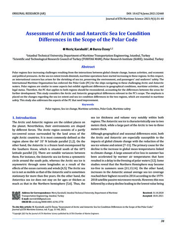
Transcription
Assessment of Arctic and Antarctic Sea Ice Condition Differences in the Scope of the Polar CodeORIGINAL RESEARCH (AR)DOI: 10.4274/jems.2021.32448Journal of ETA Maritime Science 2021;9(1):31-40Assessment of Arctic and Antarctic Sea Ice ConditionDifferences in the Scope of the Polar CodeMeriç Karahalil1,2Scientific31-40Burcu Özsoy1,21Istanbul Technical University, Department of Maritime Transportation Engineering, Istanbul, Turkeyand Technological Research Council of Turkey (TUBITAK MAM), Polar Research Institute (KARE), Istanbul, TurkeyAbstractPolar regions face increasing challenges resulting from the interactions between global climate change, human activities, and economicand political pressures. As the sea ice extent trends diminish, maritime operations have started increasing in these regions. In this respect,an international concern has arisen for the shrinking of sea ice, preserving the environment, and passengers’ and seafarers’ safety. TheInternational Maritime Organization has enforced the Polar Code (PC) for the ships navigating in these challenging Arctic and Antarcticwaters. Polar regions are similar in some aspects but exhibit significant differences in geographical conditions, maritime activities, andlegal status. Therefore, the PC that applies to both regions should be reconsidered, accounting for the differences between the areas forfurther development. This study considers the Arctic and Antarctic geographical differences relevant to the PC’s scope. The emphasis isplaced on the changes regarding the sea ice extent and sea ice condition differences in the two regions, which are essential in maritimesafety. This study also addresses the aspects of the PC that need improvement.Keywords1. IntroductionPolar regions, Sea ice change, Maritime activities, Polar Code, Maritime safetyThe Arctic and Antarctic regions are the coldest places onthe planet. Nevertheless, their environments are shapedby different forces. The Arctic region consists of a partlyice-covered ocean surrounded by the land areas of theeight Arctic countries. It is most commonly defined as theregion above the 66 33’ N latitude parallel [1,2]. On theother hand, the Antarctic is a frozen land encompassed bythe Southern Ocean, which is situated south of the 60 Slatitude parallel [3]. There are notable variances betweenthem. For instance, the Antarctic sea ice forms a symmetriccircle around the south pole, whereas the Arctic sea ice isasymmetric through some longitudes as a result of theeffects of the ocean currents and winds [4,5]. The Arctic seaice is not as mobile as that of the Antarctic and is sometimesstationary for more than five years. On the other hand, theAntarctica sea ice does not stay on for ages or thicken asmuch as that in the Northern hemisphere [5,6]. Thus, thesea ice thickness and volume vary notably within bothregions. The Antarctic sea ice is characteristically one to twometers thick, while a large part of the Arctic is two to threemeters thick.Although geographical and seasonal differences exist, boththe Arctic and Antarctic are especially susceptible to theimpacts of global climate change with the reduction of thesea ice volume and extent [7-11]. The primary cause for thedecline is the increase in global mean temperatures linkedto climate change. A large amount of ice loss in summer hasbeen accelerated by warmer air temperatures that haveresulted in a delay in the freezing of polar waters [12]. Somestudies reveal that the Northern Hemisphere may becomeice-free in summers soon [11,13,14]. On the other hand,increases in the Antarctic annual average sea ice coveragereached their highest record in 2014 according to the 19792018 satellite passive microwave records. However, this wasfollowed by a sharp decline leading to the lowest value beingAddress for Correspondence: Meriç Karahalil, Istanbul Technical University, Department of MaritimeTransportation Engineering, Istanbul, TurkeyE-mail: merickrhll@gmail.comORCID ID: orcid.org/0000-0001-6196-2770Received: 31.10.2020Accepted: 18.01.2021To cite this article: M. Karahalil, and B. Özsoy, “Assessment of Arctic and Antarctic Sea Ice Condition Differences in the Scope of the Polar Code.”Journal of ETA Maritime Science, vol. 9, pp. 31-40, 2021. Copyright2021 by the Journal of ETA Maritime Science published by UCTEA Chamber of Marine Engineers31
Assessment of Arctic and Antarctic Sea Ice Condition Differences in the Scope of the Polar Codemeasured in 2017 [15]. Notably, sea ice prediction modelsand studies indicate that the Arctic sea ice extent (SIE) hasbeen decreasing at an alarming percentage since 1990,whereas the Antarctic region trends have been different.The melting rates explained above create less sea ice,presenting maritime opportunities, particularly in theArctic [16]. Potential Arctic sea routes between the Atlanticand Pacific oceans serve as new passages for internationalmaritime transportation organizations that providefinancial and time savings due to the shorter distancebetween the East Asia and Western Europe voyages [17].Although the transit numbers are still few today, the numberof operations has been rising [18]. The Northern Sea Route(NSR) will become an available course for open water ships,and the probability of transit will increase by approximately94-98% between 2040-2059 [19]. Moreover, a researchregarding the transportation in the Arctic proves that theNSR could be a good alternative route for global logistics[20]. Additionally, two types of shipping activities areexpected to grow in the Arctic region: (1) transit shipping,travel, and transfer of goods from one port to another; and(2) regional shipping to exploit natural resources. Oncethere are more open waters, the Arctic may witness a boostin traffic with the growth in the extraction of the naturalreserves. For instance, there is already an increasing amountof oil and gas transport traffic in the Barents Sea, tourismtraffic in Svalbard, and local fishing in Canada’s northernwaters [21,22]. The exploration of vast oil and gas resourceswill pave new opportunities in the Arctic for internationaloperators to expand icebreaker fleets and invest in iceclass ships. On the other hand, a significant increase hasbeen observed in large and small passenger ships, privateyachts, fishing vessels, and research vessels [23,24]. Forinstance, the trends in visiting these remote areas bypassenger ships to seek out unique ecosystems and specieshave been facilitated by tourists [25]. On the other hand,Antarctic resources are protected by the Antarctic Treaty(AT) signatory countries, which recognize tourism andfishing as the only profitable activities [26,27]. Additionally,AT consultative and observing countries enter the region intheir vessels to conduct scientific studies in Antarctica. As thenumber of vessels increases because of the situation createdby lower quantities of sea ice, numerous environmentaland maritime safety issues have been developed [28].Maritime activities are dangerous and pose a threat tosensitive polar ecosystems and vulnerable marine wildlifeand habitats. Moreover, the polar environment’s harshnesspresents significant risks such as floating ice, thick fog,and polar storms that may cause ice damage or stockingin the ice, running aground, and machinery malfunctions.Thus, the risks and hazards of extreme circumstances of32the polar regions should be grasped to take advantageof commercial benefits [29]. Ice navigation research alsohighlights challenges that involve the interpretation of seaice conditions, weather, ship classifications, icebreakerassistance, and crew experience [30]. An investigation ofmaritime accidents in the polar regions revealed that theaccidents have mostly been related to sea ice, which arefurther categorized as ice floe hit, being trapped by ice, andice jets [31]. On the other hand, navigational challengesand the risks for the ships operating in the polar regionsare pointed out by authors as route selection problem, rootcause analysis of Arctic marine accidents, and navigationalrisk assessment of Arctic navigation [32-34].The existence of sea ice limits maritime operations athigh latitudes in both hemispheres. Thus, it is essentialto know the characteristics of sea ice and its formation,and monitoring and producing sea ice forecasts is crucialto support maritime operations [35]. The Polar Code(PC)’s efforts to mitigate the hazards and reduce risksto the environment elevate “seaworthiness” to a higherstandard [36]. However, there is a single mandatory PCfor both polar regions. Although the preamble of the PCnotes the differences between the two areas, our studyargues that some significant differences regarding thesea ice have not been evaluated in the content. Thequestions are, what are these differences and whatare their interactions with PC. This study provides anoverview of the differences of the Arctic and Antarcticsea ice conditions via remote sensing data analyses in thePC’s scope. This study indicates the inadequacies of PCwith some evidences of the impacts of the ice conditionsfor ice navigation for further studies. Consequently, thisstudy declares the research gaps for further studies onthe polar regions’ maritime safety.2. Study Area2.1. Sea Ice in Arctic and AntarcticThe most apparent difference between the NorthernHemisphere and Southern Hemisphere is their geographicalconditions [6,37-40]. The changes in SIE for eachhemisphere are clarified in the figures below. Figure 1 (a)and (b) demonstrate an example of the maximum (max)and minimum (min) Arctic SIE based on the data from theNational Snow and Ice Data Center (NSIDC).NSIDC states that the SIE typically covers about 14 millionsq km in winter and 5 million sq km in summer. The Arcticreaches the smallest SIE every September and grows to itsmaximum every March. The Arctic SIE has diminished byabout three percent per decade since 1979 [41]. The Arcticsea ice thickness in summer has also declined dramaticallyfrom 3.64 m in 1980 to 1.89 m in 2008, exhibiting a total
Journal of ETA Maritime Science 2021;9(1):31-40decrease of 48% in thickness [37]. However, as the icesheets are more likely to crash into each other, a thick ridgeice occurs. The ridge ice does not generally melt duringsummer and continues to grow the following autumn. TheArctic SIE was 14.78 million sq km on March 20th, 2020and 4.15 million sq km on September 18, 2019, which are650,000 sq km and 2.10 million sq km below the 19812010 average min. extent, respectively [42]. Recent studiesindicate that by 2030, the September sea ice cover willshrink to 60%, becoming less than 40% in the 2060s andless than 10% by 2090 [11].Most of the Antarctic is perennially coated by ice and snow.During winter, an average of 18 million sq km of sea iceexists, but only about 3 million sq km of sea ice remainsin the summer. The Antarctic SIE reaches its min. everyFebruary and grows to its max. in September as shown inFigures 2 (a) and (b).Figure 1. The Arctic SIE in (a) March 5th, 2020 and (b) September18th, 2019. The yellow line indicates the SIE in 1981-2010Source: Data from NSIDC, 2019 [42]A nearly complete sea ice that forms during wintersdisperses during summers. The Antarctic annual sea icemax. extent was the second lowest according to the NSIDCsatellite record in 2019. Further, the SIE diminished by13.2% in February 2019 compared to the averaged SIE forall the months of February from 1979 to 2009. The annualmin. of the Antarctic SIE is 2.69 million sq km in February2020 and 18.244 million sq km in September 2019, whichare 0.404 million sq km and 0.234 million sq km below the1981-2010 average min. extent, respectively [42].Table 1 lists a variety of differences between the Southernand Northern hemisphere’s sea ice parameters. Oppositegeographical distributions are evident where the Arcticsea ice grows asymmetrically, whereas the Antarctic sea iceremains symmetric. Sea ice can currently exist at 38 N and55 S in the in the Arctic and Antarctic regions, respectively.Owing to the difference in the sea ice evolution processes,the ice types differ. In the Antarctic, frazil ice is common andcolumnar surfaces are also found, though more rarely. In theArctic, the topside of the ice comprises of frazil ice, while thedownside is mainly congelation ice [39]. The Arctic ice meltsat the air and ice interaction, whereas the Antarctic sea iceusually melts at the ocean and ice interaction. As a result,melt ponds are rarely observed in Antarctica, whereas meltponds take a large part of the Arctic ice surface [43]. Thickand extensive ice shelves surround 75% of Antarctica’scoastline; however, they are not typical for the Arctic [44].In Antarctica, relatively large ice platelets are produced bythe flowing, low salinity water underneath the ice shelves.These ice platelets can be present up to several metersin depth beneath a sea ice sheet. In contrast, platelet icegrows in pools in the Arctic region [45]. While Landfast iceis typically found at water depths in Antarctica, landfastice in the Arctic comes in direct contact with the seafloor,because most of the shallow areas are sheltered by the iceshelves. Polynyas are divided into two types: (1) open-oceanpolynyas and (2) coastal polynyas. Open-ocean polynyasTable 1. Polar regions’ sea ice differencesFigure 2. The Antarctic SIE in (a) February 20th, 2020 (2.69 millionsq km) and (b) September 2019 (18.244 million sq km). The yellowline indicates the SIE in 1981-2010Source: Data from NSIDC, 2019 [42]1Latitude2Geometricdistribution3Type of ice4Melting process5Ice shelf6Platelet ice7Land fast ice8Melt ponds9PolynyasArcticAntarctic90 N-38 N55 S-75 SAsymmetricMainly columnarSymmetricMainly frazilAir/ice interactionOcean/ice interactionNot presentPresentNot presentPresentOver shallow waterMainly over deep waterCoastalOpen oceanSignificantInsignificant33
Assessment of Arctic and Antarctic Sea Ice Condition Differences in the Scope of the Polar Codeare estimated to occur due to the deep warm water thatis mainly common in Antarctica, and Katabatic winds arebelieved to cause coastal polynyas that are typically foundin the Arctic region [46].2.2. PCThe International Maritime Organization (IMO) undertookwork on a code for regulating the ship design, building, andoperations in the early 1990s, and the guidelines for shipsoperating in Arctic ice-covered waters were accepted in2002 [47]. Nevertheless, these guidelines applied only tothe Arctic region and did not include the Antarctic region.Afterward, noteworthy arrangements were made by theIMO in 2009, amending them to cover the Antarctic waters[48]. Finally, the IMO changed the regulations from beingmere guidelines to compulsory lawful requirements. Thishas been a long process for the PC, and it entered into legalforce on January 1st, 2017 [49,50]. The PC is structured onthe former IMO instruments and consists of two parts: PartI, introduction and safety measures and Part II, pollutionprevention measures. Part II consists of five chapters thatwill not be evaluated in this study. Within the scope of PC,the sources of the hazards in the polar regions have beenidentified as ice, low temperature, periods of darkness anddaylight, remoteness, and lack of accurate information andcrew experience [50].Consisting of 12 chapters, Part I of PC focuses on thesafety of shipping in the polar waters and addressesa wide range of safety measures, including the needfor ships to have a polar certificate and requirementsaccording to the types of ships and ice conditions. Shipsare categorized according to their design properties indifferent ice conditions. Every ship to which the PC appliesshall have a Polar Ship Certificate (PSC) concerning thedesign and construction of the ships and equipment, crewand passenger clothing, ice removal, and fire safety. Tosupport in the decision-making process, the Polar WaterOperational Manual (PWOM) was developed to providestandards for vessels and crew, information about theship’s specific operational capabilities, limitations, andprocedures to be followed in normal operations and in theevent of incidents [50]. Other chapters of Part I include theship structure, subdivision and stability, watertight andweathertight integrity, machinery installations, fire safety/protection, life-saving appliances and arrangements, thesafety of navigation, communication, voyage planning, andmanning and training. Additionally, the polar operationallimit assessment risk indexing system is a significant toolfor assessing the ships’ operational limitations and risksof navigation in ice. It is similar with the PSC and PWOM,but it is not a mandatory requirement. Its limitations arethe human factor, the frame of application, and legal status34[51]. According to a PC research, shortcomings are statedthat it does not exclude fishing and leisure vessels, it doesnot propose advanced training for all crew members,and the pollution risks are not adequately addressed.Additionally, it does not consider the crew’s experience,and all Arctic aspects such as light ice conditions and shipswithout ice class are treated insufficiently [52].3. MethodologySea ice observations have been carried out in the shipsand coastal stations for more than 100 years. However,considering the remoteness of the Arctic and Antarcticregions, in situ measurements are not practical. For thisreason, the satellite era, which gained momentum at thebeginning of the 1960s, has become the most crucialobservation method for the polar regions. Data from thesatellites are utilized widely in research and in monitoringthe SIE and other parameters [35,53].The evolution of remote sensing systems for satellitescommenced with the launch of the Russian Cosmos-243satellite in 1968. Later, The National Aeronautics andSpace Administration (NASA) launched the electricallyscanning microwave radiometer (ESMR), which supplieddata from 1972 to 1977. However, these satellites could notmeet the technical requirements; therefore, developmentstudies continued. With the development of new satellitesystems, sea ice data has gained reliability. After the ESMRperiod, the scanning multichannel microwave radiometer(SMMR) was operated from 1978 to 1987. SMMR morecorrectly perceived the sea ice concentration extent withat least 15% sea ice. The US’s Defense MeteorologicalSatellite Program introduced passive microwave sensors,special sensor microwave imager (SSM/I), and particularsensor microwave imager and sounder instruments. Thefirst long-term sea ice data was provided for scientistsafter the introduction of SSMR [54]. In 2003, NASAlaunched the Ice, Cloud, and land Elevation Satellite(ICESat) to track the sea ice thickness, ice sheet heights,and land cover. Further, the ICESat-2 launched inSeptember 2018 provides a more comprehensive andprecise ice thickness valuation, marking a significantdevelopment [55]. These instruments have providedthe most extended and consistent time series of sea icedata, permitting research on the tendencies of the sea iceconditions in polar regions.In 1993, NASA contracted NSIDC to serve as theDistributed Active Archive Center (DAAC), which providesa comprehensive data on sea ice, ice sheets, and ice shelvesto support research. The NSIDC DAAC archive distributecryospheric data from NASA and help researchers utilizethe data products [54].
Journal of ETA Maritime Science 2021;9(1):31-404. Results4.1. Arctic SIEFigure 3 (a) displays the average monthly SIE values in1979-2019. The average monthly values from 1979 to2009 are indicated by the thick blue curve, and the red linerepresents that of 2019, which remains below the averageof 1979-2009 in all months. In the last decade, all values remained below the average and each year exceeds therecorded value of the previous year. In Figure 3 (b-c), theaverage monthly SIE every March and September between1979 to 2019 is indicated when the Arctic ocean begins tofreeze and melt, respectively. The SIE in the Arctic region inMarch and September declines at a rate of 2.6% and 12.85%per decade, respectively. The linear trendline shows thesteady decrease of the Arctic SIE for both months withthe most significant decline experienced in September. Asa result of this decreasing trend, the periods when the seaice begins to freeze lengthen. September receives the mostattention because it is the month with the least SIE.4.2. Antarctic SIEFigure 4 (a) displays the average monthly Antarctic SIEin 1979-2019. The thick blue curve indicates the averagemonthly SIE values from 1979 to 2015. Figure 4 (b-c)shows the average monthly Arctic SIE every February andSeptember from 1979 to 2019. The SIEs in February andSeptember 2017 are the lowest in the last decade. TheAntarctic SIE values for February over the years are evenlower than those in the Arctic in September. Further, theAntarctic SIE values for September are well above the Arcticmax. SIE. The Antarctic monthly and annual SIE values (forFigure 3. Arctic SIE in (a) in 1979-2019, (b) average in March 19792019, and (c) average in September 1979-2019Figure 4. Antarctic SIE in (a) 1979-2019, (b) February 1979-2019,and (c) September 1979-2019SIE: Sea ice extentSIE: Sea ice extent35
Assessment of Arctic and Antarctic Sea Ice Condition Differences in the Scope of the Polar Code5. Discussionsthe 41 years of the dataset, 1979-2019) indicate trends until2014. Following that, a low record in three years is reached.The Antarctic min. monthly ice extent always occurs inFebruary and is still less than five million sq km.The development of the PC and its importance andshortcomings for ice navigation are introduced in section2.2. Although the PC states that the differences were takeninto consideration in its efforts to adapt the Antarctic region,the changes and differences revealed in this study should beconsidered for the further development of PC.As seen in Table 2, both polar regions reach their max.during winter and shrinks down to the min. duringsummer. The Arctic min. SIE in September 2012 andthe max. SIE March 2017 extents have been the lowestrecorded SIE by the satellite for 41 years. The lowestmin. Arctic SIE was 3.56 million sq km in September2012 and reached its second lowest recorded value in2019. In 2019, the ice extent diminished by 33.23% and6.1% compared to the average in September and March(1979-2019), respectively. The lowest monthly averageAntarctic SIE was 2.288 million sq km in February 2017,and the lowest recorded yearly average for the same was10.75 million sq km in 2017. Snow thickness creates a bigdifference between both poles, reaching a considerablethickness in Antarctica as compared to the Arctic snowcover. Further ice thickening may be caused by snowfallsas well as melting and refreezing of snow. Sea ice thicknessvaries considerably within both regions. While the typicalsea ice thickness of the Arctic is above two meters, theAntarctic sea ice is characteristically below the two-meterrange. Multiyear ice, which has survived more than onemelting season, is three meters thick or more and firmerthan the one-year ice. A large part of the Arctic Oceanis composed of multiyear ice, where most of it occursas pack ice. Resultantly, the strength of the ice is higherin the Arctic, which is vital for navigation. The averageArctic multiyear ice has significantly reduced from 1979to 2019. The Antarctic mainly consists of seasonal ice thatfreezes and melts in a season and remains in a few coastalregions.The study related to navigational risks in ice-covered watersemphasizes the importance of environmental factors such asice thickness, ice formation, weather conditions (e.g., wind,fog, visibility, and temperature), the drift of pack ice, floatingice floes, and ice restrictions, which affect the vessel’smovement and etc. [32]. Because it is being surrounded byland, the sea ice stays in the Arctic water, while the oppositecondition occurs in the Antarctic. Additionally, the SIE andvolume are diminishing more rapidly in the Arctic than inthe Antarctic. These are essential parameters regarding theships’ operational capabilities. Some crucial questions to beconsidered are where the ice is and where it is drifting, whatkind of ice it is, how thick and strong it is, and whether thereare icebergs. Within these questions’ framework, differentapplications should be made for both regions depending onthe sea ice conditions.The area of the PC is also geographically limited. It canbe extended to sea ice concentrations with a coverage ofone-tenth or higher. The PC‘s Arctic boundary should bechanged to cover the sea ice’s edge of the 1979-2010 line,rather than the 60 N line [56]. As mentioned in previoussections, maritime activities in the Antarctic region involvepassengers, fishing, research, and re-supply ships, whereasthose in the Arctic include various types of vessels inoperation. As an outcome of the implementation of the PC,patterns of activities are expected to differ within the Arcticand Antarctic regions. Additionally, while there has beenTable 2. Arctic and Antarctic SIE differences1Max./Min. SIE months2Max. SIE3Min. SIE4The trends in SIE; 1979-20195Snow thickness6Mean thickness7Typical thickness8Strength of ice9The age of ice10The average multiyear ice ry616.342x10 km² (March 1979)19.756x10⁶ km² (September 2014)Significant decreaseSmall decrease3.566x106 km² (September 2012)ThinnerThicker1976: 5 m0.5-0.6 mHighLow 2 mLargely multiyear ice1979 to 1996; 5.531 106 km²,1997 to 2016; 4.226 106 km²SIE: Sea ice extent, Max: Maximum, Min: Minimum362.288x106 km² (February 2017) 2 mLargely one-year ice3.5x106 km²
Journal of ETA Maritime Science 2021;9(1):31-40an increase in the Arctic maritime activities, no significantincrease in the traffic density is observed in Antarcticain recent years. The number of unique ships entering theArctic PC area in the month of September from 2013 to2019 has increased by 25% (1298 to 1628 ships), andthe total distance sailed by all vessels increased by 75%[57]. Besides, many vessels that are currently operating inthe polar regions are the non-parties to The InternationalConvention for the Safety of Life at Sea (non-SOLAS), whichmeans that the vessels are not compliant with PC and maypresent risks.There are several definitions of sea ice for navigation. Asmentioned in previous sections, 30% of Arctic sea ice ismultiyear ice (3 m or thicker), while the Antarctic mainlyhas first-year ice (0.3 m-2 m thick). First-year ice maydamage the vessel’s hull and multiyear ice impact mayexceed the force of the vessel’s strength. On the otherhand, if the vessel’s machinery power is limited, driftingice can easily collapse and the vessel might beset in the ice.Moreover, the drift ice motion takes place differently evenwithin each region [58,59]. There should be up-to-date iceinformation for masters sailing in the polar regions to maketactical navigation decisions.On the other hand, the goal of PC Part I, Chapter 11,“Voyage Planning,” is to ensure sufficient information forthe safety of the ships, the crew, and the passengers andto protect the environment. One of the most critical issuesin this chapter is that the master shall consider a route,taking into account the areas that are remote from searchand rescue (SAR) capabilities. The remoteness, lack ofinfrastructure and assets, lack of accurate charting, andthe harshness of the environment make the emergencyresponse and SAR operations significantly moredifficult in the Antarctic. Additionally, it is highlightedin the Council of Managers of National AntarcticPrograms report (SAR Workshop IV SAR Coordinationand Response in the Antarctic) that although there aresignificant differences between the polar regions, therewould be best practices to learn from Arctic SAR agencies[60]. Moreover, multiple criteria such as regulations andrestrictions, traffic congestion, charges, route length, seadepth, weather, and sea conditions are the critical factorsfor voyage planning, which differs in two regions [61].For instance, the ice-strengthened passenger ship M/SExplorer was the first ship that sunk in the Antarcticwaters following a collision with ice in 2007. Accordingto the incident report, the primary cause was the shipcaptain’s misjudgment of ice where they were countering.Even though he worked in the Baltic Sea, the Antarctic iceconditions have shown to be rather different from thosein the Baltic [62,63].The human factor in the polar regions is crucial andexperienced people are needed. The human element wasthe primary contributor to the total number of accidents(roughly 77%) due to inattention, heavy weather, age,and lack of communication [24]. Seafarers are usuallyinadequately trained to deal with polar conditions [30,64].PC Part I Chapter 12, “Manning and Training,” aims toensure adequately qualified, trained, and experiencedpersonnel. There should be a curriculum that addresses thepolar regions’ differences for ice navigation in polar watersin basic and advanced level training.6. ConclusionsThis study analyzed the SIE changes in the Arctic andAntarctic regions based on the NSIDC datasets. Afterreviewing the 41-year satellite records, SIE’s variationsindicated a long-term trend of reduction from 1979 to2019. Although some studies have demonstrated theselessening outcomes, our analysis takes a precise approachregarding the differences in the PC’s scope. The differencesin the Arctic and Antarctic sea ice characteristics werecompared within some limitations. Because the resultsare obtained through remote sensing data analysis,they represent changes in ice conditions observed bysatellites only. The differences observed according to theformation processes and features of sea ice that concernnavigation have been introduced. As explained in themethodology chapter, SIE changes measured from thedata obtained from various satellite and remote sensingsystems were interpreted for both r
sq km in winter and 5 million sq km in summer. The Arctic reaches the smallest SIE every September and grows to its maximum every March. The Arctic SIE has diminished by about three percent per decade since 1979 [41]. The Arctic sea ice thickness in summer has also declined dramatically from 3.64 m in 1980 to 1.89 m in 2008, exhibiting a total