Transcription
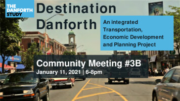
DestinationDanforthAn integratedTransportation,Economic Developmentand Planning ProjectCommunity Meeting #3BJanuary 11, 2021 6-8pm
LAND ACKNOWLEDGEMENTTo commence this meeting we would like to first take amoment to acknowledge the land on which we are meeting.This land is the traditional territory of many nations includingthe Mississaugas of the Credit, the Anishnabeg, theChippewa, the Haudenosaunee and the Wendat peoplesand is now home to many diverse Indigenous, Inuit and Métispeoples. We also acknowledge that Toronto is covered byTreaty 13 with the Mississaugas of the Credit.1
WEBEX MEETING MECHANICS Video: Your video will remain off. Recommend “side by side” view. Q&A:To ask a question Use the Q&A chat box to submit aquestion to all panelists. Questions not responded to live will beresponded to in the meeting notes.2
WEBEX MEETING MECHANICSAudio Issues?Option 1: Try either a headset or use alaptop/computer/device speakersOption 2: Call in by phone: Step 1: Call 1-416-915-6530 Step 2: Enter the Meeting AccessCode: 177 826 0328 Step 3: If asked for an Attendee ID,skip by pressing the “#” key3
This meeting is being recordedPlease be aware that this meeting is being recorded and personal information,such as your opinions, statements and voice will become part of a publicrecord. Under section 27 of the Municipal Freedom of Information andProtection of Privacy Act, records created for the general public do not restrictaccess and may be made available on the City Planning website.4
FACILITATIONMeeting Conduct: Be direct and frame questions to specific speakers. Be brief and limit yourself to one question or comment at the time, therewill be other opportunities to engage. Be a good listener and keep an open mind. Use raise hand or Q&A function to ask questions. Be respectful. City of Toronto is an inclusive public organization. Racistor other forms of discriminatory, prejudicial, or hateful comments andquestions will not be tolerated. Engage with high energy, be personable as you would in person! For more instructions visit toronto.ca/participate5
AGENDA6:00 Introductions6:05 Community Meeting #2 Recap6:15 Planning Study UpdateHeritage Question PeriodLand Use and Built Form Question PeriodParks, Open Space and Public Realm Question Period7:50 Closing and Next Steps6
PROJECT TEAMCouncillor Welcome Councillor Paula Fletcher, Ward 14 Councillor Brad Bradford, Ward 19Team IntroductionsFacilitation Karla Kolli, Facilitator – Dillon Consulting Merrilees Willemse, Facilitator – Dillon ConsultingCity Planning Lynda Macdonald, Director, Community Planning Nader Kadri, Planner, Community Planning Joseph Luk, Senior Urban Designer, Urban Design Gary Miedema, Project Manager, Heritage Planning Kevin Lee, Urban Designer, Urban Design Sherry Goldstein, Senior Planner, Research & Information Loryssa Quattrociocchi, Assistant Planner, Heritage Planning Zoi de la Pena, Assistant Planner, Heritage PlanningTransportation Services Jacquelyn Hayward, Director, Project Design &Management (Project Director) Saikat Basak, Project Manager, Cycling &Pedestrian ProjectsEconomic Development & Culture Mike Major, Manager, BIA Office7
LIVE POLLING When a poll islaunched, the pollingquestion should popup automatically in apanel on the rightside of the Webexmeeting window. If it does notautomatically popup, you can click the“Polling” tab on theright to open it up. To respond to thepoll, click on youranswer(s) and clicksubmit.8
Live Polling Practice Question:What is your relationship to the Danforth?A)B)C)D)I live nearbyI work on the DanforthI shop on the DanforthNone of the above – I’m just interested in the study.9
DANFORTH STUDY SCHEDULE20192020To Dec 2019Dec 2019 – Feb 2020Mar – Sep 2020Feb – Nov 2021Oct – Feb 202151234Work PlanDevelopmentBackgroundReviewInput andStrategyFinal PlanningFramework 2021Terms ofReference Economic Analysisand SurveyDraft HistoricalOverview andPreliminaryAssessmentArea Profile Report SACPublicMeetingSACPublicMeeting*IEC – Infrastructure and Environment CommitteeTEYCC – Toronto East York Community CouncilSACComplete StreetDesign &ImplementationReport on CompleteStreet PilotHeritage ContextStatement andInventoryPlanning and UrbanDesign AnalysisInterestGroupMeetings Final RetailVibrancy & Eco.Dev. ReportCultural HeritageResourceAssessmentPlanning nterestGroupMeetingsStreet Design& PilotEvaluation Complete StreetPilot FinalEvaluation ReportUrban DesignGuidelinesSACPublicMeetingTEYCC*IEC*10
01Planning StudyUpdate1. Direction to Initiate the Study2. What We’ve Heard?3. Heritage4. Land Use and Character Areas5. Development Analysis6. Buildings and Built Form Analysis7. Parks, Open Space and Public Realm11
PLANNING STUDY: Direction to Initiate the Study Danforth Avenue is identified as an area for growth andintensification in the City’s Official Plan (Avenues) Avenues are expected to be transformed incrementally12
PLANNING STUDY: Direction to Initiate the Study City Council requested the Chief Planner and the Executive Director, City Planning to undertake aplanning study of Danforth Avenue in two segments, from the Don River to Coxwell Avenue and fromCoxwell Avenue to Victoria Park Avenue. Councillor Fletcher’s Motion - The Terms of Reference for the upcoming Danforth Planning andComplete Streets Study include options to secure new affordable rental along Danforth Avenue. Segment 1 Planning Study from Coxwell Avenue to Victoria Park Avenue was completed in July 201813
PLANNING STUDY OBJECTIVES1. Integrate each of the study components into the long-range planning framework.2. Develop a new site and area specific policy and the related urban design guidelines.3. Identify public realm, parks and open space improvements to enhance and green thearea to support enhanced liveability and environmental and biodiversity objectives.4. Assess and review area demographics, community services and facilities, affordablehousing, and growth estimates.5. Outline opportunities for future development to support growth.6. Ensure key heritage elements are incorporated into the plan.7. Ensure all work includes a sustainability and resiliency lens14
Live Polling Question:Please state your overall agreement with the Planning Study objectives1. Integrate each of the study components into the long-term planning framework.2. Develop a new site and area specific policy and the related urban design guidelines.3. Identify public realm, parks and open space improvements to enhance and green the area to4.5.6.7.support enhanced liveability and environmental and biodiversity objectives.Assess and review area demographics, community services and facilities, affordable housing, andgrowth estimates.Outline opportunities for future development to support growth.Ensure key heritage elements are incorporated into the plan.Ensure all work includes a sustainability and resiliency lens.Strongly Agree, Agree, Neutral, Disagree, or Strongly Disagree15
02Planning StudyUpdate1. Direction to Initiate the Study2. What We’ve Heard?3. Heritage4. Land Use and Character Areas5. Development Analysis6. Buildings and Built Form Analysis7. Parks, Open Space and Public Realm16
WHAT WE HEARDPrevious Community Meetings #1, #2& Public Survey17
WHAT WE HEARDPlanning Study Public InputSupport thedevelopment ofmore affordablehousing andrental unitsSupport for moderatedensity that doesn’tnegatively impact theneighbourhoods.Support for moregreenspace, streettrees, parkettes, andpublic art and providemore pedestrian accessand reduce barriers.Consistent support to encouragemixed-use development, preserveheritage, and reinforce the ‘mainstreet’ retail character.The desire formore communityspaces – such ascommunitycentres,gathering spaces,libraries andrecreationcentres.Incorporateresiliency, energyefficiency,sustainable buildingmaterials.18
03Planning StudyUpdate1. Direction to Initiate the Study2. What We’ve Heard?3. Heritage4. Land Use and Character Areas5. Development Analysis6. Buildings and Built Form Analysis7. Parks, Open Space and Public Realm19
PLANNING STUDY - HeritageHeritage Surveys and Contextually-informedEvaluations Heritage surveys have been a growing andimportant component of planning studies The identification of potential heritage propertiesthrough these studies is informed by communityconsultation and stakeholder engagement Lists/maps of potential heritage properties havebeen included in urban design guidelines, Site andArea Specific Policies/Secondary Plans, and asattachments to staff reportsCompleted and in process heritage surveys (2019)20
PLANNING STUDY - HeritageCultural Heritage Resource Assessment (CHRA)City Planning undertakes a Cultural Heritage Resource Assessment to document an area’sdevelopment history and to ensure that properties of cultural heritage value or interest areappropriately identified, understood and conserved.Cultural Heritage Resource Assessments are proactive, transparent and open about wherepotential heritage resources are located and why they have cultural heritage value or interest.Criteria for Determining Cultural Heritage Value or Interest:Cultural heritage value or interest is consistent with provincial regulations and will include theconsideration of cultural heritage values including design or physical value, historical orassociative value and contextual value. The contributions of Toronto’s diverse cultures will beconsidered in determining the cultural heritage value of properties on the Heritage Register.21
PLANNING STUDY - HeritageHow will the results of the CHRA be used? Properties identified as heritage resources inform planning policies and guidelines to makesure that they are an integral part of the future.These properties will also be considered for inclusion as “listed” properties on the City ofToronto’s Heritage RegisterMap showing properties identified through the Danforth Avenue I CHRA (Source: Map 4, Danforth Avenue Urban Design Guidelines)22
PLANNING STUDY - HeritageListing on the Heritage Register Having properties “listed” on the Heritage Register as non-designated properties is an importantfirst step in ensuring we can preserve our heritage, but it does not prevent growth. A "listed" property has no a legal protection under the Ontario Heritage Act and only affects aproperty owner if they apply for a demolition permit or submit a planning application. When a property is listed it does not necessarily mean that it will be subsequently “designated”under the Ontario Heritage Act. Listed means further evaluation of the property will take place. If an owner applies to demolish a “listed” property, City Council has a brief time (60 days) todecide whether to move forward with designation of the property under Part IV of the OntarioHeritage Act "Listing" a property does not change the existing building permit process - it does not restrict anowner's ability to make exterior and interior alterations, when demolition is not involved. It doesnot trigger maintenance requirements over and above existing property standards.23
PLANNING STUDY - HeritageJulyPhotographicSurvey ofpropertiesJune 2020CHRAcommencedwith ryNovemberscan ofDecemberproperties and Held two HeritagehistoricalFocus Groupresearch formeetingsHistorical& circulated a draftOverviewof the HistoricalOverviewJanuary-February 2021SAC and CommunityMeetingFebruary 2021Finalrecommendationscommunicatedthrough DanforthStudy PlanningReport24
HistoricalOverview25
PLANNING STUDY - HeritageHistorical OverviewThe production of a historical overview of a study area isthe first step of a Cultural Heritage Resource Assessment.Historical overviews are the result of both research andcommunity engagement.A historical overview: presents themes and periods of development within astudy area in order to understand why a property orproperties exist within it. relates individual properties to one another in order toinform the identification of buildings and landscapesthat may have cultural heritage value.Looking east from Logan Avenue, 1932. Detail,City of Toronto Archives, Fonds 1231, Item 210226
PLANNING STUDY - HeritageDraft Periods of Development Indigenous CommunitiesEarly Settlement of Concessions 1 and 2 Surrounding Today's Danforth Avenue (1780s-1850)The Creation of the Don and Danforth Plank Road and Other Early Infrastructure and TransitImprovements (1851-1909)The Construction Boom of the 1910s and 1920s (1910-29)The Depression and Inter-War Construction Slow Down (1930-49)Post-War Immigration and Redevelopment (1950-Present)27
PLANNING STUDY - HeritageIndigenous CommunitiesDetail, Pierre Raffeix, Map of Lake Ontario (Lake of St Louis), 1688.Detail, Treaty 13 (Toronto Purchase), 1805.Library and Archives Canada.28
PLANNING STUDY - HeritageEarly Settlement Surrounding Today’s Danforth Avenue(1780-1850)Browne's Map of the Township ofYork (1851), annotated to showlots 15-8 and Playter’s lot29
PLANNING STUDY - HeritageEarly Settlement Surrounding Today’s Danforth Avenue(1780-1850)George Tremaine's Map ofthe County of York, CanadaWest (1860), annotated toshow the Don and DanforthPlank Road30
PLANNING STUDY - HeritageThe Don and Danforth Plank Road and Other EarlyInfrastructure and Transit Improvements (1851-1909)1903 Goad's Atlas Map showing slow development in this period.31
PLANNING STUDY - HeritageThe Don and Danforth Plank Road and Other EarlyInfrastructure and Transit Improvements (1851-1909)Historic photo of streetcar No. 325, at Danforth and Broadview (1896)742 (left) and 744 (right) Broadview Avenue (1899)32
PLANNING STUDY - HeritageThe Construction Boom of the 1910s and 1920Construction date map showing the building constructed from 1910-2933
PLANNING STUDY - HeritageThe Construction Boom of the 1910s and 1920Sunkist Fruit Market at 561 Danforth Avenue (1929)309-341 Danforth Avenue (1919)34Playter’s Society Hall (1911)Allen’s Danforth Theatre (1919)884-888 Danforth Avenue (1929)
PLANNING STUDY - HeritageThe Depression and Inter-War Construction Slow Down(1930-49)Danforth Avenue lookingwest from Logan Avenue(1932)35
PLANNING STUDY - HeritagePost-War Immigration and Redevelopment (1950-Present)Aerial photograph showingDanforth Avenue at PapeAvenue (1965)36
PLANNING STUDY - HeritagePost-War Immigration and Redevelopment (1950-Present)Illustration by Carlos Marchiori in The Toronto StarFebruary 24, 1976St Catherine of Siena Catholic Church (1966), a parishestablished by the Italians living in the area37
Live Polling Question:What types of buildings do you think are most important to thehistory of the Danforth? (check all that apply)A.B.C.D.Main street commercial buildings from the 1910s and 1920sPlaces of WorshipBanksBuildings associated with important community uses (eg. social clubs,theatres, long-standing restaurants)E. All of the above38
Q&A Period39
04Planning StudyUpdate1. Direction to Initiate the Study2. What We’ve Heard?3. Heritage4. Land Use and Character Areas5. Development Analysis6. Buildings and Built Form Analysis7. Parks, Open Space and Public Realm40
PLANNING STUDY - Character ElementsWhy we identify characterareas? The Danforth Avenue Planning Studyencompasses a large geographic area witha number of distinct characteristics. Identifying these distinctions will help toprotect and enhance the desired qualitiesfor each area. Some planning policies or guidelines mayapply to the whole Study Area, while othersmay only be applicable for a certainCharacter Area.41
PLANNING STUDY - Character ElementsThe study area is made upof a number of characterelements including . Existing land uses Block structure Landscape Architecture/buildingtypology Sidewalk widths Lot sizes Pattern of publicspaces42
PLANNING STUDY – Land Use and Development Large majority of properties arenarrow generally not wider than7.5m (some double lots 15m orwider). Most buildings on Danforth Avenueare retail/restaurant/service atgrade with residential above. Vast majority of buildings are 2 or 3storeys. Most lots are not built to themaximum permitted density.43
05Planning StudyUpdate1. Direction to Initiate the Study2. What We’ve Heard?3. Heritage4. Land Use and Character Areas5. Development Analysis6. Buildings and Built Form Analysis7. Parks, Open Space and Public Realm44
PLANNING STUDY - Development PotentialWhy do we need to know whatthe development potential is? Danforth Avenue is considered an“Avenue” in the Official Plan and istargeted for developmentintensification We need to know how muchdevelopment exists today in order toplan for the population and theservices required to develop a completecommunity The city is constantly evolving and weneed to ensure we are responding tocurrent city-building objectives(affordable housing, expanded transit,community and social services, etc.)45
PLANNING STUDY – Provincial PolicyMunicipalities are required toundertake an intensificationstrategy to satisfy ProvincialGrowth Plan polices. intended to prioritize growth where transitcurrently exists or is planned, including inMajor Transit Station Areas (MTSAs). The City is currently reviewing 180 potentialMTSAs as part of the MunicipalComprehensive Review and every station hasto be delineated by 2022. 4 priority transit projects are identified inToronto including the Ontario Line whichincludes Pape Station. New draft inclusionary zoning policies wouldrequire the construction of affordable housingas part of some new residential developments.The Danforth Study will inform the MTSAdelineation.46
PLANNING STUDY – Growth EstimatesAs part of the planning study we are reviewing thefollowing three development scenarios1. Existing situation (status quo)2. Buildings that could be built within existing zoning permissions asof-right (14-16 metres or a 4-5 storeys)3. Taller mid-rise buildings (generally 6-9 storeys)47
PLANNING STUDY – Growth EstimatesExisting Situation3,500 people6,200 jobs Current population and jobs in thestudy area were calculated through areview of existing properties andbuildings using the City’s Land UseInformation System and EmploymentSurvey3D massing of existing development48
PLANNING STUDY – Growth EstimatesExisting Situation3,500 people6,200 jobs3D massing of existing developmentAs-of-Right Zoning4,000 -- 7,000 people6,500 -- 9,700 jobsTypical 3D massing of maximumzoning permissions Maximum buildingheights and density thatcould be constructedgiven as-of-rightzoning permissions(excluding propertiesalready fully developed,churches, institutionaluses, and heritageproperties)49
PLANNING STUDY – Growth EstimatesCriteria for Mid-rise Development: frontage on Danforth Avenue (15 metres in width) lot to allow for minimum building depth (11.6metres deep) depth of lot a minimum of 30.6 metres existing laneway access existing ownership consolidation for narrow lotsLots excluded: existing institutional use, churches, already fullybuilt out rental housing park use or adjacency to parkMid-rise Development4,200 – 8,000 people7,200 - 11,600 jobs3D massing of a typical mid-rise building50
PLANNING STUDY – Growth EstimatesExisting Situation3,500 people6,200 jobsAs-of-Right Zoning4,000 -- 7,000 people6,500 -- 9,700 jobsMid-rise Development4,200 – 8,000 people7,200 - 11,600 jobs3D massing of existing developmentTypical 3D massing of maximumzoning permissions3D massing of a typical mid-risebuilding51
Live Polling Question:What services or amenities would you like to see inthe community as the Danforth area evolves in thefuture? (select all that y servicesAffordable housingParks and open spacesG) Grocery storesH) Seniors housing/Long-term careI) GymsJ) Health/dental officesK) Other (please specify)52
06Planning StudyUpdate1. Direction to Initiate the Study2. What We’ve Heard?3. Heritage4. Land Use and Character Areas5. Development Analysis6. Buildings and Built Form Analysis7. Parks, Open Space and Public Realm53
PLANNING STUDY – Built Form (Massing and Height)What is Built Form?Built form captures a few urban designideas: Shape and configuration of buildings Relationship of the building to itssurrounding environment such asstreets, parks, open spaces and otherbuildings Function and uses inside a buildingmay affect the built form54
PLANNING STUDY – Built FormWhy are we interested inreviewing the existingbuilt form? To ensure future development createscomfortable and enjoyable spaces To minimize negative impacts on itssurroundings To maintain, complement and/or improvearea characteristics Provide for appropriate building types anduses55
PLANNING STUDY – Built FormWhat kind of building massing andheights are permitted now? Currently, most properties have an as-of-rightpermission to construct a 14m or 16m building(approximately 4-5 storeys) The Official Plan and the City’s Avenues and MidRise Buildings Study identify Danforth Avenue asan area where mid-rise buildings are appropriate Mid-rise buildings on Danforth Avenue could be upto 27m in height (approximately 8-9 storeys) Mid-rise buildings have to be designed to complywith a list of performance standards to ensure agood fit and compatibility with adjacent properties56
PLANNING STUDY – Built FormExisting Condition Generally low rise buildings of 2 to 4storeys Majority of lots are narrow 6 metres in lotwidth (72%) Some shallow lots 30 metres in lot depth Variety of rear yard conditions such asrear yard-facing-rear yard and rear yardfacing-side yard conditions Some lots do not have public lane access Majority of existing buildings have groundfloor commercial/retail spaces57
PLANNING STUDY – Built FormBuilt Form Goals Prioritize and respect area character,commercial vibrancy, and built/culturalheritage; Provide nuanced and context-specific builtform policies and guidelines to help newdevelopments transition to lower-scaledareas and fit-in with the existing areacharacter; Encourage a range of commercial/retailspaces to strengthen main streetcharacter and activity; and Utilize appropriate planning tools tomanage development pressures andachieve desirable outcomes.58
PLANNING STUDY – Built FormWhat are mid-rise buildings? The maximum height of mid-rise buildings areequivalent to the width of the street Mid-rise buildings on Danforth Avenue are typically27m or 8-9 storeys Mid-rise buildings on Broadview Avenue aretypically 20m or 6 storeys Most mid-rise buildings have retail/commercialspace at grade and residential units above Some buildings have included office spaces59
PLANNING STUDY – Built FormWhy are we proposing mid-risebuildings on Danforth andBroadview? Danforth and Broadview Avenues havebeen identified as areas appropriate formid-rise buildings Provides moderate levels of intensificationin areas well served by transit Can integrate with low-rise street withheritage buildings more appropriately Performance standards to respond tosurrounding considerations60
Built Form – Mid-Rise DevelopmentPhase 1 (East Of Coxwell) Phase 1 of the Danforth Avenue Studybetween Coxwell and Victoria Park wascompleted in 2019 The planned character statementidentifies the appropriate built form to bemid-rise buildings The design of these buildings will includevertical and horizontal rhythms tocomplement the fine-grain patterncurrently on the street61
Built Form – Mid-Rise DevelopmentPhase 1 (East Of Coxwell) Guidelines encourage small additions toexisting buildings on one or two lots Provides guidance on how small additionsshould be designed to maintain the existingstreet character Also provides guidance on how new low-risedevelopments should be designed to fit intoa consistent row of low-rise buildings62
Built Form – Mid-Rise DevelopmentPhase 1 (East Of Coxwell) Guidelines for mid-rise developmentsare also provided Follows the general principles of theMid-Rise Guidelines with someadjustments A lower building stepback heightalong the Danforth Avenue frontageto improve the fit of the building intolower-scaled street When a development is adjacent toor near heritage properties, theguidelines state a lower streetwalland/or a stepback shall be provided63
Built Form – Mid-Rise DevelopmentRecommendations The recommendation is to continue similarstrategies developed for Phase 1: Deep lot and shallow lot depths categories Maintain the same rear yard setbackrequirements Maintain the same rear angular plane Building height dependant on lot depth Align streetwall height to adjacent low-risebuildingsAdditional recommendations A Stepback above 16m along DanforthAvenue and Broadview Avenue frontages64
Built Form – Mid-Rise DevelopmentPotential Mid-Rise Building The mid-rise design criteria toreduce impacts on surroundings Maximum building height of 27m or8-9 storeys Maximum streetwall height of 16mor 4-5 storeys Retail/commercial uses at grade65
Built Form – Mid-Rise DevelopmentDesign elements currently under review Building stepbacks above thestreetwall Maximum building and streetwallheight for buildings withoffice/commercial uses abovethe ground floor Terraces and angular planes atthe rear of the building Corner and wide lots Integration with heritagebuildings66
Built Form – Mid-Rise DevelopmentPotential Mid-RiseBuilt FormConceptual Illustration of Danforth Avenue with Mid-Rise Built Form67
Live Polling Question:Do you think mid-rise buildings, with built formtransitions and stepbacks, are an appropriate builtform to accommodate growth in the Study Area?A.B.C.D.E.Strongly AgreeSomewhat AgreeNeutralSomewhat DisagreeStrongly Disagree68
PLANNING STUDY – Transition ZoneA potential new Transition Zone A Transition Zone is a concept used to describe a proposed new height transition area between thetaller Mixed Use Areas fronting Danforth Avenue and the lower-rise Neighbourhood Areas adjacentto Danforth Avenue The Transition Zone would permit more than is allowed today but would provide an intermediatescale between mid-rise buildings and low-rise residential dwellings69
PLANNING STUDY – Transition ZoneWhy are Transition Zonesbeing considered? Help to buffer the low-riseneighourhoods to the north from tallerbuildings closer to Danforth Provide opportunities for intermediatescale of built form near transit Allow opportunities to improveexisting conditions such as pedestrianwalkways, lanes and other publicrealm areas70
PLANNING STUDY – Transition ZoneTransition Zone Built Form71
PLANNING STUDY – Transition ZonePotential Transition Zone BuildingsThere are several potential low-rise building types which are appropriate for theTransition Zones: Townhouses Multi-Unit Townhouses (ie. Stacked Townhouses) Low-Rise Apartments72
PLANNING STUDY – Transition ZoneTransition Zone Built Form73
PLANNING STUDY – Transition ZoneConceptual Illustration of Danforth Avenuewith Alternate Mid-Rise Built Form74
PLANNING STUDY – Transition ZoneConceptual Illustration of Transition Zone Looking South with Mid rise on Danforth behind75
Built Form – Transition ZoneExisting Example Of Transition Zone Buildings3 Storey Townhouses on Logan Avenuenorth of Danforth AvenueView looking West through Logan Avenue Parkette fromLogan AvenueView looking East through Logan Avenue Parkette fromPlum Place76
Live Polling Question:Do you feel like the Transition Zonewould be a good opportunity to expandhousing in the area?A) YesB) NoC) I’m not sure77
Q&A Period78
07Planning StudyUpdate1. Direction to Initiate the Study2. What We’ve Heard?3. Heritage4. Land Use and Character Areas5. Development Analysis6. Buildings and Built Form Analysis7. Parks, Open Space and Public Realm79
PLANNING STUDY – Public RealmWhy study the public realm? To maintain and improve the vibrant mainstreet character of Danforth Avenue Identify improvements and create thesupporting policy and design guidelines80
PLANNING STUDY – Public RealmAnalysis of the ExistingPublic RealmFor the analysis of the existing public realm,we reviewed the following areas: Contributions of BIA Current and planned improvements Streetscape condition Publicly owned right-of-way areas Parks and open spaces Pedestrian connectionsSeasonalPlanter inGreekTown onthe Danforth BIA81
PLANNING STUDY – Public RealmContributions of BIAs to the Public RealmBroadview Danforth BIAGreekTown on theDanforth BIAThe Danny DanforthMosaic BIA82
PLANNING STUDY – Public RealmContributions of BIAs to the Public Realm The Danny Danforth Mosaic BIA StreetscapeMaster Plan was completed in 2019. Established many public realm proposalsincluding public art programs, streetscapedesign, side street improvements, light fixturedesign. The new Planning Framework and UrbanDesign Guideline will incorporate The DannyStreetscape Master Plan and its public realmstrategies.83
PLANNING STUDY – Public RealmCurrent Projects Second Exit Projects will providefurther opportunities to enhanceaccess and connections in theneighbourhood and to transit Stations included in the Second ExitProject include Donlands, Chester andGreenwood stations84
PLANNING STUDY – Public RealmCurrent Projects Alexander the Great Square –Danforth Avenue and Logan Avenue(2022) Project is being undertaken incooperation with GreekTown on theDanforth BIA Caithness Parkette – DanforthAvenue and Caithness Avenue (2021) City project85
PLANNING STUDY – Public RealmExisting StreetscapeCondition Sidewalk widths are generally 5mon Danforth Avenue and 3m onBroadview Avenue Danforth Avenue has generoussidewalk space with street treesand some outdoor café spaces Broadview Avenue has a moretypical
SAC. Public. Meeting. 2020. Dec 2019 - Feb 2020. 2. Background Review Economic Analysis and Survey Draft Historical Overview and Preliminary Assessment Area Profile Report. SAC. Public. Meeting. Mar - Sep 2020. 3. Input and Strategy Complete Street Design & Implementation Report on Complete Street Pilot Heritage .