Transcription
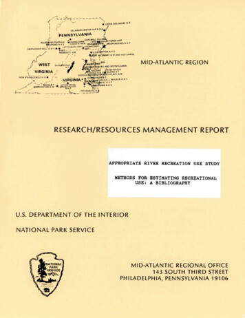
MID-ATLANTIC REGIONRESEARCH/RESOURCES MANAGEMENT REPORTAPPROPRIATE RIVER RECREATION USE STUDYMETHODS FOR ESTIMATING RECREATIONALUSE: A BIBLIOGRAPHYU.S. DEPARTMENT OF THE INTERIORNATIONAL PARK SERVICEMID-ATLANTIC REGIONAL OFFICE143 SOUTH THIRD STREETPHILADELPHIA, PENNSYLVANIA 19106
The Mid-Atlantic Region (MAR) of the National Park Service is the centraladministrative office for 28 park units in five states: Maryland, New Jersey,Pennsylvania, Virginia, and West Virginia. The diversity of parks and theirresources is reflected in their designations as national parks, national seashores, national historic parks, national recreational areas, nationalmilitary parks, and national rivers.The MAR Branch of Resource Protection administers scientific consultation,research, and monitoring efforts in these parks, involving a wide range ofbiological, physical, and social sciences. The Research/Resources ManagementSeries was established as a medium for distributing current scientificinformation obtained from studies designed to improve the management,protection and interpretation of park resources. Information contained inthis Series is potentially useful to other Park Service areas outside theMAR and also benefits independent researchers working in the parks andelsewhere. The Series provides for the retention of research information andmakes possible more complete in-house evaluation of internal research, technical,and consultant reports.The Series includes:1.Research reports which directly address resource managementproblems in the parks.2.Literature reviews and bibliographies of existing informationrelative to park resources or resource management problems.3.Presentations of basic resource inventory data.4.Other applicable reports relating to the research and resourcemanagement programs of the Mid-Atlantic Region.Research/Resources Management Reports are produced in limited quantitiesand, as long as the supply lasts, copies may be obtained from the Branch ofResource Protection, Mid-Atlantic Region.NOTE:Use of trade names does not constitute or imply U.S. Governmentendorsement of commercial products.
Submitted December 1984APPROPRIATE RIVER RECREATION USE STUDYMETHODS FOR ESTIMATING RECREATIONALUSE: A BIBLIOGRAPHYPrepared byJeffrey L. Marion, Ph.D., Research BiologistNational Park Service, Mid-Atlantic RegionSponsored by the USDI National Park Service, Mid-Atlantic Regionin cooperation with the USDA Forest Service, North Central ForestExperiment Station under study number FS-NC-1901-84-06.
TABLE OF CONTENTSINTRODUCTION2VISITOR OBSERVATION AND COUNTS3TRAIL COUNTERS4ROAD TRAFFIC COUNTERS5INTERVIEWS AND QUESTIONNAIRES6PHOTOGRAPHYSuper-8mm and Time-Lapse SystemsRemote Sensing and Aerial PhotographyGeneral8899SELF REGISTRATION10PERMITS11OVERVIEW OF TECHNIQUES121
INTRODUCTIONA wide variety of methods for both measuring and estimatingrecreational use have been developed and applied. It is thepurpose of this bibliography to provide a reference list of thesemethods. Papers have been grouped under several broad categoriesbased on the type of assessment technique employed. Topic areasinclude:Visitor Observation and Counts: This section includes papersdescribing methods employing direct visitor observation or visualcounts of visitors or their vehicles.Trail Counters: Papers describe pressure plate trail counterswhich can be buried under the trail tread, and electric eyecounters, which can also be used to control super-8mm cameras.Road Traffic Counters; Papers describe various types of roadtraffic counters, including pneumatic and inductive loopcounters, and some photographic techniques.Interviews and Questionnaires; Papers describe studiesemploying interviews and survey sampling methods providingestimates of visitor use.Photography: This section is divided into three sub-sectionscovering a wide variety of photographic techniques. Super-8mmand time lapse systems offer some of the most accurate andefficient methods for assessing recreational use on roads,rivers, and trails. Remote sensing and aerial photographymethods are effective primarily for water-based recreation.General photographic references describe some basic photographiccapabilities and techniques.Self Registration: Papers in this section describe variousvisitor self registration methods, typically employingregistration boxes at trailheads. Many papers examine problemswith non-compliance and the effects of nonresponse on therepresentativeness of the information collected.Permits: Papers describe the advantages and disadvantages ofboth self-issued and agency-issued permits, including permitcompliance and accuracy.Overview of Techniques: Papers describing and comparing manydifferent techniques are included in this final section.2
- 3 A Bibliography of Methods for Acquiring Recreational Use DataVISITOR OBSERVATION AND COUNTSAlexander, G.R., and D.S. Shatter. 1966. Fishing and boating on segments ofthe Au Sable River in Michigan, 1960-1963. Mich. Dept. of Cons. Researchand Development Report No. 68 (Institute for Fisheries Res. Rep. No.1722).Burch, W.R. 1964. A new look at an old friend: observation as a techniquefor recreation research. USDA, For. Serv., Pacific Northwest For. Expt.Stn., Stn. Pap.Burch, W.R. 1974. Observation as a technique for recreation research. In:Land and Leisure: Concepts and Methods in Outdoor Recreation. O.W. Fisher,J.E. Lewis, and G.B. Priddle (eds. ) .Maaroufa Press, Chicago.Bury, R.L., and J.W. Hall. 1963. Estimating past and current attendance atwinter sports areas.a pilot study. USDA For. Serv. Pacific SouthwestFor. and Range Expt. Stn. Res. Note PSW-33.Bury, R.L., and R. Marglies. 1964. A method for estimating currentattendance on sets of campgrounds.a pilot study. USDA, For. Serv.,Pacific Southwest For. Expt. Stn., Res. Note PSW-42.Ciali, C.P., R.E. Leonard, and J.J. Lindsay. 1973. Collecting hikerinformation in the backcountry: a methodological study. Univ. ofVermont, Recreation Mgmt. Program Research Rpt. SNR-RM4.Collings, P.S., and A.J. Grayson. 1977. Monitoring day visitor use ofrecreational areas. London (England): Forestry Commission, Forest Record112.Erickson, D.L., C.J. Liu, H.K. Cordell, and W.L. Chen. 1980. A computerprogram for selecting sample days for recreation use estimation. USDAFor. Serv., Southeast For. Expt. Stn., Gen. Tech. Rap. SE-19.Hayden, P.S. 1974. Snake River boat use study. USDI, Natl. Park Serv.,Unpubl. Rpt., Grand Teton Natl. Park, Wyoming.Heberlein, T.A., and P. Dunwiddie. 1979. Systematic observation of uselevels, campsite selection, and visitor characteristics at a high mountainlake. J. Leis. Res. 11:307-316.Hendee, J.C., M.L. Hogans, and R.W. Koch. 1975. Dispersed recreation on 3forest road systems in Washington and Oregon: First year data. USDA For.Serv., Pacific Northwest For. Expt. Stn., Res. Note PNW-280.Hendee, J.C., R.N. Clark, and T.E. Dai ley. 1977. Fishing and otherrecreation behavior at high-mountain lakes in Washington State. USDA For.Serv., Pacific Northwest For. Expt. Stn., Res. Note PNW-304.
- 4 -James, G.A. 1968. Pilot" test of sampling procedures for estimatingrecreation use on winter-sports sites. USDA For. Serv. Southeast For.Expt. Stn., Res. Paper SE-42.James, G.A., H.P. Wingle, and J.O. Griggs. 1971. Estimating recreation useon large bodies of water. USDA, For. Serv., Southeast For. Expt. Stn.,Res. Paper SE-79.James, G.A., and A.K. Quinkert. 1972. Estimating recreational use atdeveloped observation sites. USDA For. Serv. Southeast For. Expt. Stn.Res. Paper SE-79.Leonard, R.E., H.E. Echelberger, H.J. Plumley, and L.W. Van Meter. 1980.Management guidelines for monitoring use on backcountry trails. USDA,For. Serv., Northeast For. Expt. Stn., Res. Note NE-286.Lime, D.W. 1979. Visitor observation: a tool for appraising interpretiveactivities, pp. 49-55. In : Proc. of 1979 Assoc, of InterpretiveNaturalists Workshop, Bloomington, MN. pp. 49-55.Love, L.D. 1964. Summer recreation use of selected National Forestcampgrounds in the central Rocky Mountains. USDA For. Serv. RockyMountain For. and Range Expt. Stn., Res. Paper RM-5.Mattson, C D . , and W.R. Bentley. 1967.use. J. Forestry 65(6):410-413.Ratio estimates of free campgroundSchreuder, H.T., G.L. Tyre, and G.A. James. 1975. Instant and intervalcount sampling: two new techniques for estimating recreation use. For.Sci. 21(11:40-44.U.S. Army Corps of Engineers. 1976. Analysis of supply and demand of urbanoriented nonreservoir recreation. Unpubl. Rpt., Sacramento Dist.Wagar, J.A. 1964. Estimating numbers of campers on unsupervised campgrounds.USDA, For. Serv., Northeast For. Expt. Stn., Res. Pap. NE-18.TRAIL COUNTERSDeLand, L.F. 1976. Development of the Forest Service trail traffic counter.USDA, For. Serv., Equip. Devel. Center, Test Rept. 7700-10.Gasvodo, D.S. 1978. Installation and operation of the Canon 814-XL cameratraffic classification system. USDA, For. Serv., Equip. Devel. Center.James, G.A., and H.T. Schreuder. 1972. Estimating recreation use in theGorgonio Wilderness. J. For. 69(81:490-493.James, G.A., and H.T. Schreuder. 1972. Estimating dispersed recreation usealong trails and in general undeveloped areas with electric-eye counters:preliminary findings. USDA, For. Serv., Southeast For. Expt. Stn.,Note SE-181.
- 5 Leatherberry, E.G., and D.W. Lime. 1981. Unstaffed t r a i l r e g i s t r a t i o ncompliance i n a backcountry recreation area. USnA, For. Serv., NorthCentral For. Expt. S t n . , Res. Pap. NC-214.Leonard, R.E., H.E. Echelberger, H.J. Plumley, and L.W. Van Meter. 198D.Management guidelines f o r monitoring use on backcountry t r a i l s . USDA,For. S e r v . , Northeast For. Expt. S t n . , Res. Note NE-286.Lucas, R.C., H.T. Schreuder, and G.A. James. 1971. Wilderness usee s t i m a t i o n : a p i l o t t e s t of sampling procedures on the Mission MountainsP r i m i t i v e Area. USDA, For. S e r v . , Intenmountain For. Expt. S t n . , Res.Pap. INT-ing.Lucas, R.C., and T . J . Kovalicky. 1981. Self-issued wilderness permits as ause measurement system. USDA, For. Serv., Intenmountain For. Expt. S t n . ,Res. Pap. INT-270.Lucas, R.G. 1983. Low and variable v i s i t o r compliance rates at voluntaryt r a i l r e g i s t e r s . USDA, For. Serv.,-Intenmountain For. Expt. S t n . , Res.Note INT-326.More, T.A. 1980. T r a i l d e t e r i o r a t i o n as an i n d i c a t o r of t r a i l use i n anurban f o r e s t recreation area. USDA, For. Serv., Northeast For. Expt.S t n . , Res. Note ME-292.T i e t z , J.G. 1973. Project record: t r a i l t r a f f i c counter accuracy t e s t .USDA, For. Serv., Equip. Devel. Center, Rpt. No. 7477-2203.USDA, For. Serv. 1971.Missoula, MT.T r a i l t r a f f i c counter.Equip. Devel. Center,ROAD TRAFFIC COUNTERSEisner, G.H. 1970. Camping use-axle count r e l a t i o n s h i p : estimation w i t hdesirable p r o p e r t i e s . For. Science If!:493-495.Gasvoda, D.S., and L.R. Resse. 1975. Automated c l a s s i f i e r f o r analyzingt r a f f i c data. USDA, For. Serv., Equip. Devel. Center Spec. Rep. EDAT1414.2.Gasvoda, D.S. 1978. I n s t a l l a t i o n and operation of the Canon 814-XL camerat r a f f i c c l a s s i f i c a t i o n system. USDA, For. Serv. Equip. Devel. Center,Rpt. No. 7871-2603.James, G.A., and T.H. R i p l e y . 1963. Instructions f o r using t r a f f i c counters,to estimate recreation v i s i t s and use. USDA, For. Serv., Southeast For.Expt. S t n . , Res. Pap. E-3.James, G.A. 1966. Instructions for using t r a f f i c counters to estimater e c r e a t i o n v i s i t s and use on developed s i t e s . USDA For. Serv.Southeastern For. Expt. S t n . , no series no. (Expands on James A Ripley.)
- 6 -James, G.A., and C.L. Tyre. 1967. Use of water-meter records to estimaterecreation visits and use on development sites. USDA, For. Serv.,Southeast For. Expt. Stn., Res. Note SE-73.Lucas, R.C. 1964. Recreation use of the Quetico-Superior area.Serv., Lake States For. Expt. Stn., Res. Pap LS-8.USDA, For.Promnitz, L., W. Beardsley, S. Jungst, C. Ramm, G. Campbell, and T. Burk.(However, inside title page shows only Wendell Beardsley.) No date.Summary report: a system for inventory of recreation use and facilities,prepared for Illinois Dept. of Cons., Ames, IA: Iowa State University.USDA, For. Serv. 1973. Design analysis of three inductive loop road trafficcounters. Equip. Devel. Center, Rpt. No. 7471-2210.USDA, For. Serv. 1973. New methods of compiling traffic data.Center, Rpt. No. 7471-2204.USDA, For. Serv. 1974. Road traffic counters recommended.Center, Rpt. No. 7571-2301.Equip. Devel.Equip. Devel.USDA, For. Serv. 1974. Limited accuracy tests of two inductive loopcounters. Equip. Devel. Center, Rpt. No. 7571-2215.USDA, For. Serv. 1974. Field trails with Super 8 movie cameras for trafficclassification. Equip. Devel. Center, Rpt. No. 7571-2801.USDA, For. Serv. 1974. Lesson plans for traffic surveillance equipment.Equip. Devel. Center, Rpt. No. 7671-2801.USDA, For. Serv. 1977. Inductive loops—their design, installation, andmaintenance for road traffic survel1iance. Equip. Devel. Center, Rpt. No.7700-9.USDA, For. Serv. 1975. Cassette traffic recording system.Center, Rpt. No. 7571-2506.Equip. Devel.USDA, For. Serv. 1975. Automated classifier for analyzing traffic data.Equip. Devel. Center, Rpt. No. 7571-2804.Wagar, J.A., and J.F. Thalheimer. 1969. Trial results of net countprocedures for estimating visitor use at developed recreation sites.USDA, For. Serv., Intermountain For. Expt. Stn., Res. Note INT-105.INTERVIEWS AND QUESTIONNAIRESBaker, R.A., and M. Chubb. 1977. Measuring dispersed recreation in a heavilyused forest area. Rpt. to North Central For. Expt. Stn., USDA For. Serv.,from Dept. Geography, Michigan State Univ., East Lansing, MI.Ciali, C.P., R.E. Leonard, and J.J. Lindsay. 1978. Collecting hikerinformation in the backcountry: a methodological study. Univ. of Vermont,Recreation Mgmt. Program Research Rpt. SNT-RM4.
- 7 Cushwa, C.T., B.S. McGinness, and T.H. Ripley. 1965. Forest recreationestimates and predictions in the North River Area, George WashingtonNational Forest, VA. V i r g i n i a Agr. Expt. Stn. Bui. 558.Fleener, G.G. 1971. Recreational use of the Platte River, Missouri, pp.63-78. J n : Stream Channelization Symp. P r o c , Spec. Publ. 2, North Cent.D i v . Am. F i s h . Soc.Fleener, G.G. 1975. Recreational use of Grand River. Prog. Rept., D-J P r o j .F-I-R-24, Study S-17, Job 1 , Missouri Dept. Conserv.Fleener, G.G. 1976. Recreation use estimation on Forest Service lands in theUnited States. USDA, For. S e n / . , Southeast For. Expt. S t n . , Res. Pap.SE-31.Fleener, G.G. 1976. Recreation use of pool 2 1 , Mississippi River, Spec.R p t . , Missouri Dept. Conserv., Columbia, MO.James, G.A. 1967. Recreation use estima-tion on Forest Service lands i n theUnited States. USDA, For. S e n / . , Southeast For. Expt. S t n . , Res. NoteSE-79.James, G.A., and R. Henley. 1968. Sampling procedures for estimating massand dispersed use on large areas. USDA, For. Sen/., Southeast For. Expt.S t n . , Res. Pap. SE-31.James, G.A., N.W. Taylor, and M.L. Hopkins. 1971. Estimating recreationaluse of a unique t r o u t stream i n the coastal plains of South Carolina.USDA, For. S e n / . , Southeast For. Expt. S t n . , Res. Mote SE-159.James, G.A., and H.T. Schreuder. 1971. Estimating recreation use i n the SanGorgonio Wilderness. J . For. 69(8):49u-493.James, G.A., H.P. Wingle, and J.D. Griggs. 1971. Estimating recreation useon large bodies of water. USDA, For. S e n / . , Southeast For. Expt. S t n . ,Res. Pap. SE-79.Lucas, R.C. 1963. Rias i n estimating r e c r e a t i o n i s t s length of stay fromsample i n t e r v i e w s . J . For. 61 (12) : 9 1 2 - 9 1 * .Lucas, R.C. 1964. Recreation use of the Ouetico-Superior area.S e r v . , Lake States For. Expt. S t n . , Res. Pap. LS-8.Lucas, R . C , and J . Oltman. 1971.J . Leisure Res. 3(1):23-A3.USDA, For.Survey sampling wilderness v i s i t o r s .Lucas, R . C , H.T. Schreuder, and G.A. James. 1971. Wilderness use e s t i m a t i o n :a p i l o t t e s t of sampling procedures on the Mission Mountains PrimitiveArea. USDA, For. Serv., Intermountain For. Expt. S t n . , Res. Pap. INT-109.McCurdy, D.R. 197D. A manual f o r measuring public use on wi 1 dlands--parks,f o r e s t s , and w i l d l i f e refuges. S. 111. Univ. Dept. F o r e s t . , Publ. 5.
- 8 -Wenger, W.D., J r .1964. A t e s t of unmanned r e g i s t r a t i o n s t a t i o n s onwilderness t r a i l s : factors influencing effectiveness.IJSDA, F o r .P a c i f i c Northwest F o r . E x p t . S t n . , Res. Pap. PNW-16.Serv.,PHOTOGRAPHYa)Super-8mm and time lapse systemsBabcock, R.E.1976. B u f f a l o N a t i o n a l R i v e r ecosystems, Part I I .Resour. Res. C e n t . , P u b l . 3 8 , U n i v . of Arkansas.WaterBesse, L . R . , B. Marsh, and D.C. O s t h e l l e r .1974. F i e l d t r i a l s w i t h super-8mmcameras f o r t r a f f i c c l a s s i f i c a t i o n .USDA, F o r . S e r v . , Equip. Devel.C e n t e r , Spec. Rpt.Gasvoda, D.O.1978.I n s t a l l a t i o n and o p e r a t i o n of t h e Canon 814-XL camerat r a f f i c c l a s s i f i c a t i o n s y s t e m . USDA, F o r . S e r v . Manual, Equip. D e v e l .Center.Haugen, A . O . , and R.E. L e n n i n g . 1970. Pre-impoundment r e c r e a t i o n a l usep a t t e r n s and waterfowl o c c u r r e n c e i n t h e S a y l o r v i l l e , R e s e r v o i r Area.Iowa S t a t e Water Resour. Res. I n s t . , Completion R p t . , P r o j . A-023-1A.Hogans, M.L.1976. A t e s t of cameras and photographic formats t o r e c o r d andanalyze i n f o r m a t i o n about d i s p e r s e d , r e c r e a t i o n users on f o r e s t r o a d s .M.S. T h e s i s , U n i v . Washington, C o l l . F o r . Resour., S e a t t l e , WA.L e a t h e r b e r r y , E . C . , and D.W. Lime.1 9 8 1 . Unstaffed t r a i l r e g i s t r a t i o ncompliance i n a backcountry r e c r e a t i o n a r e a . USDA, For. S e r v . , NorthC e n t r a l F o r . E x p t . S t n . , Res. Pap. NC-214.L e a t h e r b e r r y , E.C. 1984. Using photography t o r e c o r d r e c r e a t i o n use:e t h i c a l concerns.Submitted t o J . F o r .L e o n a r d , R . E . , H.E. E c h e l b e r g e r , H . J . P l u m l e y , and L.W. Van Meter.Management g u i d e l i n e s f o r m o n i t o r i n g use on backcountry t r a i l s .F o r . S e r v . , N o r t h e a s t F o r . E x p t . S t n . , Res. Note NE-286.some1980.USDA,L u c a s , R . C . , and T . J . K o v a l i c k y .1 9 8 1 . S e l f - i s s u e d w i l d e r n e s s p e r m i t s as ause measurement system. USDA, F o r . S e r v . , I n t e r m o u n t a i n F o r . Expt. S t n . ,Res. Pap. INT-270.Lucas, R.C.1983. Low and v a r i a b l e v i s i t o r compliance r a t e s a t v o l u n t a r yt r a i l registers.USDA, F o r . S e r v . , I n t e r m o u n t a i n For. E x p t . S t n . , Res.Mote INT-326.Marnell, L.F.1975. Use of t i m e - l a p s e photography f o r e s t i m a t i n g r i v e rt r a f f i c a t the Ozark N a t i o n a l Scenic Riverways.Pap. presented a t t h eWorkshop f o r Outdoor R e c r e a t i o n Researchers and Cooperators,L a n d - B e t w e e n - t h e - L a k e s , TM.M a r n e l l , L . , 0 . F o s t e r , and K. C h i l m a n .1978. River r e c r e a t i o n researchconducted at Ozark N a t i o n a l Scenic Riverways 1970-1977: A summary ofr e s e a r c h p r o j e c t s and f i n d i n g s .USD I , N a t l . Park S e r v . , Van Buren, MO.
- 9 -Murphy, G.L.1973. The use of p h o t o g r a p h i c d e t e c t i o n systems f o r c o u n t i n gand c l a s s i f y i n g v e h i c l e s on' F o r e s t S e r v i c e roads, pp. 15-27, I N : Soc.P h o t o o p t i c a l I n s t r u m e n t a t i o n Engineers P r o c , V o l . 37, Washington", DC.Sohn, A . J . 1968. Time-lapse movie camera f o r r e c o r d i n g r e c r e a t i o n a c t i v i t ycycles.J . Pap. J - 5 9 5 0 , pp. 184-189, J n : Iowa A g r i . and Home Econ. E x p t .S t n . , Ames, I A .USDA, F o r . S e r v . 1974. F i e l d t r i a l s w i t h Super-8mm movie cameras f o rtraffic classification.E q u i p . D e v e l . Center.b)Remote sensing and a e r i a lphotographyHogans, M.L.1976. A t e s t of cameras and photographic formats t o r e c o r d anda n a l y z e i n f o r m a t i o n about d i s p e r s e d r e c r e a t i o n users on f o r e s t r o a d s .M.S. t h e s i s , U n i v . Washington, C o l l . F o r . Resources, S e a t t l e , WA.James, G . A . , H.P. W i n g l e , and J . D . G r i g g s .1 9 7 1 . Estimating r e c r e a t i o n useon l a r g e bodies of w a t e r .USDA, F o r . S e r v . , Southeast For. Expt. S t n . ,Res. Pap. SE-79.Schel 1 , K . F . , and J . H . T a f t .1972. A p p l i c a t i o n of remote sensing t e c h n i q u e st o measurement of use of o u t d o o r r e c r e a t i o n resources.USD I , Bur. OutdoorR e c r . Study Rpt.S e i t z , W . K . , and R.B. D a h l g r e n .1975. Water-based r e c r e a t i o n a l use p a t t e r n so f t h e Upper Iowa R i v e r .Iowa S t a t e U n i v . , J . Res. 5 0 ( 2 ) : 1 3 1 - 1 4 5 .U.S. Army Corps of E n g i n e e r s .1976. A n a l y s i s of supply and demand oforiented nonreservoir r e c r e a t i o n .U n p u b l . R p t . , Sacramento D i s t .c)urbanGeneralH e r r i n g t o n , R . B . , and R.S. T o c h e r .1967. A e r i a l photo technique f o r ar e c r e a t i o n i n v e n t o r y of mountain l a k e s and streams. USDA, F o r . S e r v . ,I n t e r m o u n t a i n F o r . E x p t . S t n . , Res. Pap. INT-37.Hogans, M.L.1978. Using photography f o r r e c r e a t i o n r e s e a r c h . USDA, F o r .S e r v . , P a c i f i c Northwest F o r . E x p t . S t n . , Res. Note PNH-327.Hogans, M.L.1976. A t e s t o f cameras and photographic formats t o r e c o r dand analyze i n f o r m a t i o n about d i s p e r s e d r e c r e a t i o n users on f o r e s t r o a d s .M.S. t h e s i s , U n i v . Washington, C o l l . F o r . Resources, S e a t t l e , WA.Magi 11 , A . W . , and R.H. T w i s s .1965. A guide f o r r e c o r d i n g e s t h e t i c andb i o l o g i c a l changes w i t h p h o t o g r a p h s .USDA, F o r . S e r v . , P a c i f i c SouthwestF o r . E x p t . S t n . , Res. Note PSW-77.
- 10 SELF REGISTRATIONEchelberger, H.E., R.E. Leonard, and H.J. Plumley. 1981. Validation oft r a i l s i d e r e g i s t r a t i o n boxes. J . Soil Water Conserv. 36( 1):53-54.Hayden, P.S. 1974. Snake River boat use study. USDI, N a t l . Park S e n / . ,Unpuhl. R p t . , Grand Teton N a t l . Park, Wyoming.Hendee, J . C . , and R.C. Lucas. 1973. Mandatory wilderness pennits:necessary management t o o l . J . For. 71:206-209.AJames, G.A., and H.T. Schreuder. 1971. Estimating recreation use i n theSan Gorgonio Wilderness. J . For. 69(8):490-493.Leatherberry, E.C., and D.W. Lime. 1981. Unstaffed t r a i l r e g i s t r a t i o ncompliance i n a backcountry recreation area. IJSOA, For. Serv., NorthCentral For. Expt. S t n . , Res. Pap. NC-214.Leonard, R . C , H.E. Echelberg, H.J. Plumley, and L.W. Van Meter. 1980.Management guidelines f o r monitoring use of backcountry t r a i l s . USDA,For. S e r v . , Northeast For. Expt. S t n . , Res. Note NE-386.Lucas, R . C , and J . Oltman. 1971.J . Leisure Res. 3 ( l ) : 2 3 - 4 3 .Survey sampling wilderness v i s i t o r .Lucas, R . C , H.T. Schreuder, and G.A. James. 1971. Wilderness use e s t i m a t i o n :a p i l o t t e s t of sampling procedures on the Mission Mountains PrimitiveArea. USOA, For. Serv., Intenmountain For. Expt. S t n . , Res. Pap. INT-109.Lucas, R.C. 1975. Low compliance rates at unmanned t r a i l r e g i s t e r s .For. Serv., Intenmountain For. Expt. S t n . , Res. Note INT-200.USOA,Lucas, R . C , and T . J . Kovalicky. 1981. Self-issued wilderness permits as ause measurement system. USOA, For. S e r v . , Intenmountain For. Expt. S t n . ,Res. Papt. INT-270.Merriam, L . C , J r . , and others. 1973. Newly developed campsites i n theBoundary Waters Canoe Area: A study of 5 years' use. Agric. Expt. S t n . ,S t n . B u i . 511, For. Series 14, Univ. Minnsota, St. Paul, MNWagar, J.A. 1969. Estimation of v i s i t o r use from s e l f - r e g i s t r a t i o n atdeveloped recreation s i t e s . USOA, For. Serv., Intenmountain For. Expt.S t n . , Res. Pap. INT-7CWenger, W.D., -In. 1964. A t e s t of unmanned r e g i s t r a t i o n stations i nwilderness t r a i l s :factors i n f l u e n c i n g effectiveness. USOA, For. Serv.,P a c i f i c Northwest For. Expt. S t n . , Res. Pap PNW-16.Wenger, W.O., J r . , and H.M. Gregersen. 1964. The e f f e c t of nonresponse onthe representativeness of wilderness t r a i l r e g i s t e r information. USOA,For. Serv., Pacific Northwest For. Expt. S t n . , Res. Pap. PNW-17.
- 11 PERMITSBehan, R.W. 1974. Police s t a t e wi 1 derness--a comment on mandatory wildernesspermits. J . For. 72(2):98-99.Eisner, G.H. 1972. Wilderness management. .A computerized system f o rsummarizing permit i n f o r m a t i o n . USDA, For. Serv., Pacific Southwest For.Expt. S t n . , Gen. Tech. Rept. PSW-2.Fazio, i l . R . , and D.L. G i l b e r t .1974. Mandatory wilderness permits:i n d i c a t i o n s of success. J . For. 72:753-756.SomeFrayer, W.E., and D.L. B u t t s . 1974. BUS: a processing system f o r records ofbackcountry camper use. J . Leis. Res. 6(4): 305-311.Godin, V . , and R.E. Leonard. 1 *77. Permit compliance i n eastern wilderness:preliminary r e s u l t s . USDA, For. Serv., Northeast For. Expt. S t n . , Res.Note ME-2 28.Hendee, J . C . , and R.C. Lucas. 1973. Mandatory wilderness permits:necessary management t o o l . J . For. 71(4):206-209.aHendee, .1 ,C. 1974. A s c i e n t i s t ' s views on some current wilderness managementissues. Western Wildlands l ( 2 ) : 2 7 - 3 2 .Hendee, J . C . , and R.C. Lucas. 1974. Response to Mr. Rehan (Police s t a t ew i l derness--a comment on mandatory wilderness p e r m i t s ) . J . For.72(2):100-101.Hendee, . l . C , G.H. Stankey, and R.C. Lucas.USDA, For. Serv., Misc. Publ. No. 1365.H u l b e r t , J . H . , and J . F . Higgins.J . For. 75(6):338-34f).1977.1973.Wilderness management.BWCA vi s i t o r di s t r i b u t i o n systemLeonard, R.E., H.E. Echelberger, and M. Schnitzer. 1973. Use c h a r a c t e r i s t i c sof the Great Gulf Wilderness. USDA, For. Serv., Northeast For. Expt.S t n . , Res. Pap. NE-423.Leonard, R.E., H.E., Echelberger, H.J. Plumley, and L.W. Van Meter.Management guidelines f o r monitoring use on backcountry t r a i l s .For. S e r v . , Northeast For. Expt. S t n . , Res. Note NE-236.1980.USDA,Lime, D.W., and R.C. Ruchman. 1974. Putting wilderness permi t informationt o work. J . For. 72(in):(522-626.Lime, D.W., and G. Lorence. 1974. Improving estimates of wilderness use frommandatory travel permits. USnA, For. Serv., North Central For. Expt.S t n . , Res. Pap. NC-101.Lucas, R . C , and T . J . Kovalicky. 19 8 1 . Self-issued wilderness permits as ause management system. USDA, For. Serv., Intermountin For. Expt. S t n . ,Res. Pap. INT-270.
- 12 -Parsons, D.J., T.J. Stohl'gren, and J.M. Kransaar. 1982. Wilderness permitaccuracy: Differences between reported and actual use. Environ. Mgmt.6(41:329-335.Peterson, G.L., and D.W. Lime. How does travel distance to the BoundaryWaters influence use? Naturalist 31(4):22-27.Plager, A., and P. Womble. 1981.Mount McKinley National Park.Compliance with backcountry permits inJ. For. 79(31:155-156.Stankey, G.H. 1979. Management options for limiting use. Pap. presented atthe Natl. Recr. and Park Assoc. Ann. Meet., New Orleans, LA.Steinberg, J.M. 1973. Permit required!Better Camping 14(21:33-38.But why?Van Wagtendonk, J.W., and J.M. Benedict. 1980.and validity. J. For. 78(7) -.399-401."And what does it mean?Wilderness permit complianceUSDA, For. Serv. 1972-1983. Boundary Waters Canoe Area Wilderness visitor useestimates. Annual summary reports, Superior Natl. For., Duluth, MN.OVERVIEW OF TECHNIQUESJames, G.A. 1971. Inventorying recreation use. In: Recreation: Symposiumproceedings, pp. 78-95, USDA, For. Serv., Northeastern For. Expt. Stn.,Upper Daroy, PA.Leonard, R.E., H.E. Echelberger, H.J. Plumley, and L.W. Van Meter. 1980.Management guidelines for monitoring use on backcountry trails. USDA,For. Serv., Northeast For. Expt. Stn., Res. Note NE-286.Marcus, L.F., M. Gould, Jr., and R.L. Bury. 1961. Measuring the recreationuse of National Forests. USDA For. Serv. Pacific Southwest For. and RangeExpt. Stn., Tech. Paper 59.Marnel, L.F. 1977. Methods for counting river recreation users. Jjv.Proceedings river recreation management and research symposium. USDA,For. Serv., North Central or. Expt. Stn., Gen. Tech. Rep. NC-28.Plumley, H.J., H.T. Peet, and R.E. Leonard. 1973. Records of backcountry usecan assist trail managers. USDA For. Serv. Northeastern For. Expt. Stn.,Res. Paper NE-414.Smith, E. No date. Measuring recreation use: a review of literature andannotated bibliography. Ames, IA: Iowa State Univ. (unpubl.).University of Edinburgh, Tourism and Recreation Research Unit. 1981.Monitoring the use of informal recreation sites. TRRU Research Report No.46. Sponsored by the Countryside Commission for Scotland. Edinburgh,Scotland.Wenger, K.F. (ed. ) 1984. Use measurement, pp. 819-325.Handbook. John Wiley & Sons, New York, NY.iVr.Forestry
NATIONAL PARK SERVICE MID-ATLANTIC REGIONAL OFFICE 143 SOUTH THIRD STREET PHILADELPHIA, PENNSYLVANIA 19106 . management programs of the Mid-Atlantic Region. Research/Resources Management Reports are produced in limited quantities . For. Serv., Southeast For. Expt. Stn., Gen. Tech. Rap. SE-19. Hayden, P.S. 1974. Snake River boat use study .
