Transcription
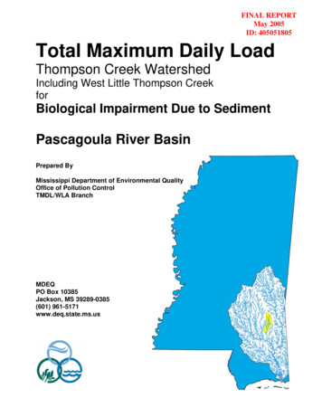
FINAL REPORTMay 2005ID: 405051805Total Maximum Daily LoadThompson Creek WatershedIncluding West Little Thompson CreekforBiological Impairment Due to SedimentPascagoula River BasinPrepared ByMississippi Department of Environmental QualityOffice of Pollution ControlTMDL/WLA BranchMDEQPO Box 10385Jackson, MS 39289-0385(601) 961-5171www.deq.state.ms.us
TMDL for Biological Impairment due to Sediment – Thompson Creek WatershedFOREWORDThis report contains one or more Total Maximum Daily Loads (TMDLs) for water body segmentsfound on Mississippi’s 1996 Section 303(d) List of Impaired Waterbodies. Because of theaccelerated schedule required by the consent decree, many of these TMDLs have been prepared outof sequence with the State’s rotating basin approach. The implementation of the TMDLs containedherein will be prioritized within Mississippi’s rotating basin approach.The amount and quality of the data on which this report is based are limited. As additionalinformation becomes available, the TMDLs may be updated. Such additional information mayinclude water quality and quantity data, changes in pollutant loadings, or changes in landuse withinthe watershed. In some cases, additional water quality data may indicate that no impairment exists.Conversion FactorsTo convert 10-610-910-1210-1510-18ToMultiply ntimillimicronanopicofemtoattoSymboldcm:npfaTo convert fromacredaysmetersft3hectaresmilestonnesμg/l * cfsμg/l * MGDMultiple10102103106109101210151018ToMultiply la River Basinii
TMDL for Biological Impairment due to Sediment – Thompson Creek WatershedCONTENTSTMDL INFORMATION PAGE. vEXECUTIVE SUMMARY . vi1.0 INTRODUCTION . 11.1 Background. 11.2 Stressor Identification . 21.3 Applicable Water Body Segment Use . 21.4 Applicable Water Body Segment Standard . 32.0 TMDL ENDPOINT AND WATER QUALITY ASSESSMENT . 42.1 Selection of a TMDL Endpoint and Critical Condition. 43.0 SOURCE ASSESSMENT and LOAD ESTIMATION . 53.1 Assessment of Point Sources . 53.2 Assessment of Nonpoint Sources . 63.3 Load Estimation. 84.0 DETERMINING THE TARGET SEDIMENT LOAD . 94.1 Selecting a Reference Condition (Simon, et al., 2002a). 94.2 Analysis of Available Suspended-Sediment Data (Simon, et al., 2002a) . 114.3 Target Sediment Yields . 125.0 ALLOCATION. 145.1 Wasteload Allocations . 145.2 Load Allocations. 145.3 Incorporation of a Margin of Safety (MOS). 155.4 Calculation of the TMDL . 155.5 Seasonality . 165.6 Reasonable Assurance . 166.0 CONCLUSION. 176.1 Future Activities . 176.2 Public Participation. 17DEFINITIONS. 18ABBREVIATIONS . 24REFERENCES . 25Pascagoula River Basiniii
TMDL for Biological Impairment due to Sediment – Thompson Creek WatershedFIGURESFigure 1. Location of the Thompson Creek and West Little Thompson Creek Watersheds .1Figure 2. Thompson Creek and West Little Thompson Creek Watersheds with §303(d)Listed Segments .2Figure 3. Thompson Creek Watershed Landuse Distribution.7Figure 4. West Little Thompson Creek Watershed Landuse Distribution .7Figure 5. Six Stages of Channel Evolution (Simon and Hupp, 1986) .11Figure 6. Thompson Creek and West Little Thompson Creek Watersheds with Level IVEcoregions .13TABLESTable i.Listing Information .vTable ii.Water Quality Standard .vTable iii. Total Maximum Daily Loads.vTable 1.Thompson Creek Watershed Landuse Distribution.6Table 2.West Little Thompson Creek Watershed Landuse Distribution .6Table 3.Unstable Stream Sediment Yield Ranges for Level IV Ecoregions within thePascagoula River Basin .8Table 4.Stable Stream Sediment Yield Ranges for Level IV Ecoregions within thePascagoula River Basin .12Table 5.TMDL Yields.15Pascagoula River Basiniv
TMDL for Biological Impairment due to Sediment – Thompson Creek WatershedTMDL INFORMATION PAGETable i. Listing InformationIDCountyHUCNameThompson r Richton: From headwaters to confluence with Pine CreekWest Little Thompson CreekMS093T1EWayne03170005Near Good Hope: From headwaters to mouth at Thompson CreekTable ii. Water Quality StandardParameterBeneficial useNarrative Water Quality CriteriaSediment/SiltationAquatic Life SupportWaters shall be free from materials attributable to municipal,industrial, agricultural, or other dischargers producing color,odor, taste, total suspended solids, or other conditions in suchdegree as to create a nuisance, render the waters injurious topublic health, recreation, or to aquatic life and wildlife, oradversely affect the palatability of fish, aesthetic quality, orimpair the waters for any designated uses.Table iii. Total Maximum Daily LoadsSegmentWLALAMOSTMDLMS093T2E5.88E-03 to 1.05E-02*5.88E-03 to 1.05E-02*implicit5.88E-03 to 1.05E-02*MS093T1E5.73E-03 to 1.44E-02*5.73E-03 to 1.44E-02*implicit5.73E-03 to 1.44E-02**tons per acre per day at the effective dischargeNote: TMDL targets are based on level IV ecoregions. If multiple level IV ecoregions are present in the watershed, the target isa weighted average of those ecoregions.Pascagoula River Basinv
TMDL for Biological Impairment due to Sediment – Thompson Creek WatershedEXECUTIVE SUMMARYMDEQ has conducted statewide biological monitoring using benthic macroinvertebrates as theindicator to develop a regionally-calibrated Index of Biological Integrity (IBI) for wadable streams.This index, now known as the Mississippi Benthic Index of Stream Quality (M-BISQ), was thenused in the biological assessment of the State’s wadable streams and rivers including ThompsonCreek and West Little Thompson Creek. Based on the M-BISQ scores, these water bodies weredetermined to be impaired. Therefore, Thompson Creek (MS093T2E) and West Little ThompsonCreek (MS093T1E) are on the Mississippi 2002 Section 303(d) List of Water Bodies for biologicalimpairment (MDEQ, 2002a). Stressor identification studies were then completed for the ThompsonCreek watershed and the West Little Thompson Creek watershed to determine the most likelycause(s) of the impairments. These analyses identified sediment as the most probable stressor ofeach water body. This TMDL is being completed for clean sediment. Certain contaminants may beassociated with sediment such as pesticides and nutrients. These contaminants are not beingaddressed directly within this TMDL. However, these contaminants would also be controlled by thesame best management practices (BMPs) that control the sediment coming from fields.The State of Mississippi Water Quality Criteria for Intrastate, Interstate, and Coastal Watersregulation does not include a numerical water quality standard for aquatic life protection due tosediment (MDEQ, 2002b). The narrative standard for the protection of aquatic life is sufficient forjustification of TMDL development, but does not provide a quantifiable TMDL target. The targetsfor this TMDL are based on reference sediment yields developed by the Channel and WatershedProcesses Research Unit (CWPRU) at the National Sedimentation Laboratory (NSL).CWPRU developed reference sediment yields, or targets, for each level III ecoregion withinMississippi and EPA Region 4. These yields were derived from the empirical analysis of historicalflow and sediment transport data for stable streams in each level III ecoregion. These targets wereused by MDEQ in the development of the James Creek Sediment TMDL (MDEQ, 2003b) andmultiple sediment TMDLs within the Yazoo River Basin. The methods used to develop the level IIIreference yields are described in detail in the reports titled, “Reference” and “Impacted” Rates ofSuspended-Sediment Transport for Use in Developing Clean Sediment TMDLs: Mississippi and theSoutheastern United States (Simon, et al., 2002b) and Actual and Reference Sediment Yields for theJames Creek Watershed – Mississippi (Simon, et al., 2002a).Recently CWPRU refined the level III reference sediment yields for each level IV ecoregion withinthe Pascagoula River Basin. There are multiple level IV ecoregions within each level III ecoregion.To obtain the level IV reference yields CWPRU applied the same methods used to develop the levelIII targets discussed above. The reference loads, or TMDL targets, for this TMDL were derivedfrom the empirical analysis of historical flow and sediment transport data for stable streams in theappropriate level IV ecoregions for the Thompson Creek and West Little Thompson Creekwatersheds, which are the Southern Hilly Gulf Coastal Plain (65d) and the Southern Pine Plains andHills (65f).Pascagoula River Basinvi
TMDL for Biological Impairment due to Sediment – Thompson Creek WatershedAccording to 40 CFR §130.2 (i), TMDLs can be expressed in terms of mass per time, toxicity, orother appropriate measure. This TMDL is expressed as the tons of sediment that can be dischargedfrom an acre of a subwatershed during a day (tons/acre/day) at the effective discharge and still attainthe applicable water quality standard. This results in a range of acceptable reference yields of5.88E-03 to 1.05E-02 tons per acre per day at the effective discharge for Thompson Creek and5.73E-03 to 1.44E-02 tons per acre per day at the effective discharge for West Little ThompsonCreek.It is expected that all values within these ranges will result in attainment of water quality standards.The TMDL ranges are expressed at the effective discharge. The effective discharge is the channelforming flow or the flow that moves the most sediment. The effective discharge is obtained bycombining flow frequency data with sediment transport relationships. These TMDL ranges are notapplicable on an annual basis, because the effective discharge only occurs statistically once everyone and a half years, not on a daily basis. However, because the effective discharge is the criticalcondition, compliance with the TMDL at effective discharge will result in the attainment of thewater quality standards at all times.For many §303(d) listed streams in the Pascagoula River Basin, including Thompson Creek andWest Little Thompson Creek, sediment data were either not available or were insufficient tocalibrate a water quality model for prediction of existing sediment loads. Therefore, this TMDLdoes not provide an existing load specific to each water body. However, a source assessment isincluded. In addition, CWPRU also estimated the typical range for unstable streams within eachlevel IV ecoregion in the Pascagoula River Basin. A range of unstable values was assigned toThompson Creek and West Little Thompson Creek based on the level IV ecoregions within thedrainage area of each water body. These unstable ranges are representative of the existing loads thatwould be expected for Thompson Creek and West Little Thompson Creek. The unstable range forThompson Creek is 1.15E-02 to 2.17E-02 tons per acre per day at the effective discharge. Theunstable range for West Little Thompson Creek is 9.43E-03 to 2.37E-02 tons per acre per day at theeffective discharge. The unstable yields are larger than the target yields, therefore, a reduction planis recommended for the Thompson Creek and West Little Thompson Creek watersheds. Based onthe ranges of stable and unstable yield values, a reduction of 49% to 52% is needed in the ThompsonCreek watershed, and a reduction of 39% is needed in the West Little Thompson Creek watershed.Pascagoula River Basinvii
TMDL for Biological Impairment due to Sediment – Thompson Creek Watershed1.0 INTRODUCTION1.1 BackgroundThe identification of water bodies not meeting their designated use and the development of totalmaximum daily loads (TMDLs) for those water bodies are required by Section 303(d) of the CleanWater Act (CWA) and the Environmental Protection Agency’s (EPA) Water Quality Planning andManagement Regulations (40 CFR part 130). The TMDL process is designed to restore andmaintain the quality of those impaired water bodies through the establishment of pollutant specificallowable loads. The pollutant of concern for this TMDL is sediment from landuse runoff and inchannel sediment processes.The listed segments of Thompson Creek and West Little Thompson Creek are within United StatesGeological Survey (USGS) Hydrologic Unit Code (HUC) 03170005. The Thompson Creekwatershed is located in Jones, Wayne, and Perry Counties (Figure 1). The West Little ThompsonCreek watershed lies within Jones and Wayne Counties. The Thompson Creek watershed is 121,738acres. The West Little Thompson Creek watershed is 7,903 acres. Both drainage areas containmany landuse types including agricultural land, pastureland, and wetland areas. However, thedominant landuse within both drainage areas is forest. The locations of the §303(d) listed segmentsare shown in Figure 2.Figure 1. Location of the Thompson Creek and West Little Thompson Creek WatershedsPascagoula River Basin1
TMDL for Biological Impairment due to Sediment – Thompson Creek WatershedFigure 2. Thompson Creek and West Little Thompson Creek Watersheds with §303(d) Listed Segments1.2 Stressor IdentificationThe impaired segments of Thompson Creek and West Little Thompson Creek were listed due tofailure to meet minimum water quality criteria for biological use support based on biologicalsampling conducted in 2001 (MDEQ, 2003a). The bioregion reference condition for the PascagoulaRiver Basin was 61.35. Both Thompson Creek and West Little Thompson Creek scored below thisreference condition receiving M-BISQ scores of 48.20 and 42.55, respectively. Because of the 2001sampling results, detailed assessments of the watersheds and potential pollutant sources, calledstressor identification studies, were completed. The purpose of stressor identification studies is toidentify the most probable stressors and sources that are likely causing degradation of instreambiological conditions. The results of the stressor identification studies indicated that sediment wasthe most likely stressor in both the Thompson Creek and West Little Thompson Creek watersheds(MDEQ, 2004a; MDEQ, 2004b).1.3 Applicable Water Body Segment UseThe water use classification for Thompson Creek and West Little Thompson Creek, as establishedby the State of Mississippi in the Water Quality Criteria for Intrastate, Interstate, and CoastalWaters regulation, is Fish and Wildlife Support (MDEQ, 2002b). Waters with this classification areintended for fishing and propagation of fish, aquatic life, and wildlife. Waters that meet the Fish andWildlife Support criteria should also be suitable for secondary contact, which is defined as incidentalcontact with water including wading and occasional swimming.Pascagoula River Basin2
TMDL for Biological Impairment due to Sediment – Thompson Creek Watershed1.4 Applicable Water Body Segment StandardThe State of Mississippi Water Quality Criteria for Intrastate, Interstate, and Coastal Waters do notinclude a water quality standard applicable to aquatic life protection due to sediment (MDEQ,2002b). However, a narrative standard for the protection of aquatic life was interpreted to determineapplicable targets for this TMDL. The narrative standard is that waters shall be free from materialsattributable to municipal, industrial, agricultural, or other dischargers producing color, odor, taste,total suspended solids, or other conditions in such degree as to create a nuisance, render the watersinjurious to public health, recreation, or to aquatic life and wildlife, or adversely affect thepalatability of fish, aesthetic quality, or impair the waters for any designated uses.Pascagoula River Basin3
TMDL for Biological Impairment due to Sediment – Thompson Creek Watershed2.0 TMDL ENDPOINT AND WATER QUALITY ASSESSMENT2.1 Selection of a TMDL Endpoint and Critical ConditionOne of the major components of a TMDL is the establishment of target endpoints, which are used toevaluate the attainment of acceptable water quality. Target endpoints, therefore, represent the waterquality goals that are to be achieved by meeting the load and wasteload allocations specified in theTMDL. The endpoints allow for a comparison between observed conditions and conditions that areexpected to restore designated uses.This sediment TMDL is expressed as acceptable ranges of sediment loadings at the effectivedischarge. The ranges were developed from data measured at stable streams in the sameecoregion(s). The target range for Thompson Creek is a sediment yield in the range from 5.88E-03 to1.05E-02 tons of sediment per acre per day at the effective discharge. The target range for WestLittle Thompson Creek is a sediment yield in the range from 5.73E-03 to 1.44E-02 tons of sedimentper acre per day at the effective discharge. The discharge which moves the most sediment, or is thechannel-forming flow, is known as the effective discharge. This discharge has been selected as thecritical condition for this TMDL (Simon, et al., 2002b). If the sediment targets applicable forsediment in Thompson Creek and West Little Thompson Creek are maintained during criticalconditions, then the health of the streams should improve.Pascagoula River Basin4
TMDL for Biological Impairment due to Sediment – Thompson Creek Watershed3.0 SOURCE ASSESSMENT and LOAD ESTIMATIONAn important part of the TMDL analysis is the identification of individual sources, sourcecategories, or source subcategories of sedimentation in the watershed and the amount of pollutantloading contributed by each of these sources. Under the CWA, sources are broadly classified aseither point or nonpoint sources. Under 40 CFR §122.2, a point source is defined as a discernable,confined, and discrete conveyance from which pollutants are or may be discharged to surface waters.The National Pollutant Discharge Elimination System (NPDES) program regulates point sourcedischarges. Point sources can be described by two broad categories: 1) NPDES regulated municipaland industrial wastewater treatment plants (WWTPs) and 2) NPDES regulated industrial activities(which include construction activities) and municipal storm water discharges (Municipal SeparateStorm Sewer Systems [MS4s]). For the purposes of this TMDL, all sources of sediment loading notregulated by NPDES permits are considered nonpoint sources. More detailed source assessments forthe Thompson Creek and West Little Thompson Creek watersheds are given in the StressorIdentification for Thompson Creek (MDEQ, 2004a) and the Stressor Identification for West LittleThompson Creek (MDEQ, 2004b).3.1 Assessment of Point SourcesThere are no NPDES permitted facilities in the West Little Thompson Creek watershed. There isone facility in the Thompson Creek watershed with an NPDES permit that is permitted for TotalSuspended Solids (TSS). The facility is not included because no changes are required in the permitdue to this TMDL. This is considered appropriate since this source provides a negligible loading ofsuspended solids to the receiving waters compared to wet weather sources (e.g., NPDES regulatedconstruction activities, MS4s, and nonpoint sources). Also, the TSS component of a NPDESpermitted facility is different from the pollutant addressed within this TMDL. The TSS componentof the permitted discharges is generally composed more of organic material, and therefore, providesless direct impact on the biologic integrity of a stream (through settling and accumulation) thanwould stream sedimentation due to soil erosion during wet weather events. The pollutant of concernfor this TMDL is sediment from landuse runoff and in-channel processes.Sediment loadings from NPDES regulated construction activities and MS4s are considered pointsources of sediment to surface waters. These discharges occur in response to storm events and areincluded in the WLA portion of this TMDL. As of March 2003, discharge of storm water fromconstruction activities disturbing between one and five acres must also be controlled by an NPDESpermit. The purpose of the NPDES permit is to eliminate or minimize the discharge of pollutants(sediment) from construction activities. Since construction activities at a site are of a temporary,relatively short term nature, the number of construction sites covered by the general permit varies.The target for these areas is the same range as the TMDL target of 5.88E-03 to 1.05E-02 tons peracre per day at the effective discharge for Thompson Creek and 5.73E-03 to 1.44E-02 tons per acreper day at the effective discharge for West Little Thompson Creek. The WLAs provided to theNPDES regulated construction activities and MS4s will be implemented as BMPs as specified inMississippi’s General Stormwater Permits for Small Construction, Construction, and Phase I & IIMS4 permits. Properly designed and well-maintained BMPs are expected to provide attainment ofwater quality standards.Pascagoula River Basin5
TMDL for Biological Impairment due to Sediment – Thompson Creek Watershed3.2 Assessment of Nonpoint SourcesNonpoint loading of sediment in a water body results from the transport of the material intoreceiving waters by the processes of mass wasting, head cutting, gullying, and sheet and rill erosion.Sources of sediment ureRangelandConstruction sitesRoadsUrban areasMass wasting areasGulliesSurface miningIn-channel and instream sourcesHistorical landuse activities and channel alterationsThe Thompson Creek watershed 121,738 acres. The West Little Thompson Creek watershed is7,903 acres. Both drainage areas contain many different landuse types, including forest, cropland,pasture, barren, and wetlands as shown in Tables 1 and 2 and Figures 3 and 4. However, thedominant landuse within both watersheds is forest. The landuse information for the watershed isbased on the State of Mississippi’s Automated Resource Information System (MARIS), 1997. Thisdata set is based on Landsat Thematic Mapper digital images taken between 1992 and 1993. TheMARIS data are classified on a modified Anderson level one and two system with additional leveltwo wetland classifications.Table 1. Thompson Creek Watershed Landuse 00.0%Table 2. West Little Thompson Creek Watershed Landuse 3073.9%7309.2%120.2%450.5%7,903100.0%Pascagoula River Basin6
TMDL for Biological Impairment due to Sediment – Thompson Creek WatershedFigure 3. Thompson Creek Watershed Landuse DistributionFigure 4. West Little Thompson Creek Watershed Landuse DistributionPascagoula River Basin7
TMDL for Biological Impairment due to Sediment – Thompson Creek Watershed3.3 Load EstimationDue to lack of data for calibration it was determined that a modeling exercise to quantify the loadfrom each source and estimate the total existing load would be inappropriate. However, a range ofunstable values was determined for each level IV ecoregion based on unstable watersheds wheresufficient data were available (Table 3). If a watershed contained multiple level IV ecoregions, thesediment yield ranges were determined based on a weighted average of the level IV ecoregionspresent in the watershed. The Thompson Creek watershed is located within Level IV Ecoregions65d (70%) and 65f (30%). The West Little Thompson Creek watershed is located within Level IVEcoregions 65d (38%) and 65f (62%). Similar sources are present in the unstable watersheds as arepresent in the Thompson Creek and West Little Thompson Creek watersheds. Therefore, theexisting loads for Thompson Creek and West Little Thompson Creek are believed to be within theseranges. The unstable range for Thompson Creek is 1.15E-02 to 2.17E-02 tons per acre per day at theeffective discharge. The unstable range for the West Little Thompson Creek is 9.43E-03 to 2.37E02 tons per acre per day at the effective discharge.Table 3. Unstable Stream Sediment Yield Ranges for Level IV Ecoregions within the Pascagoula River BasinLevel IV EcoregionUnstable Streams Sediment Yield Range*Ecoregion 65dEcoregion 65f1.35E-02 to 1.98E-026.94E-03 to 2.61E-02Ecoregion 65p9.35E-04 to 7.61E-03Ecoregion 65r1.51E-03 to 7.61E-02*tons per acre per day at the effective dischargePascagoula River Basin8
TMDL for Biological Impairment due to Sediment – Thompson Creek Watershed4.0 DETERMINING THE TARGET SEDIMENT LOADThe information and methodologies described in the following sections are based on research effortsconducted by the CWPRU of the National Sedimentation Laboratory in Oxford, Mississippi. Theprimary sources of the information presented in this section are:·Actual and Reference Sediment Yields for the James Creek Watershed – Mississippi (Simon, etal., 2002a)·“Reference” and Impacted” Rates of Suspended-Sediment Transport for Use in DevelopingClean Sediment TMDLs: Mississippi and the Southeastern United States (Simon, et al., 2002b)4.1 Selecting a Reference Condition (Simon, et al., 2002a)Sediment loads (transport rates) in streams vary by orders of magnitude over timeand by location. Controls such as geology and channel-boundary materials, land use,channel stability, and the type and timing of precipitation events make prediction ofsediment loads difficult and complex. Still, in order to determine the amount ofsediment that impairs a given waterbody (TMDL), one must first be able todetermine the sediment load that would be expected in an unimpaired stream of agiven type and location. However, baseline conditions of flow, sedimentconcentrations, and transport rates for streams in the wide variety of physiographicprovinces and under a wide variety of land uses are poorly understood.There is no reason to assume that “natural” or background rates of sediment transportwill be consistent from one region to another. Within the context of clean sedimentTMDLs, it
Thompson Creek Watershed Including West Little Thompson Creek for . Biological Impairment Due to Sediment . Pascagoula River Basin . Prepared By . Mississippi Department of Environmental Quality . Office of Pollution Control . TMDL/WLA Branch . MDEQ . PO Box 10385 . Jackson, MS 39289-0385