Transcription
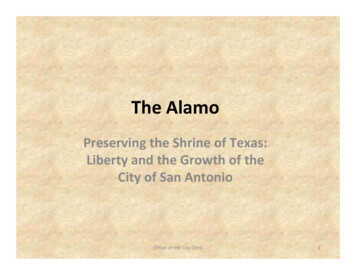
The AlamoPreserving the Shrine of Texas:Liberty and the Growth of theCity of San AntonioOffice of the City Clerk1
The Alamo is where a small group of defenders held off the centralist army of General Antonio LopezDe Santa Anna. The Battle and death of the defenders on the morning of March 6, 1836 has come tosymbolize courage and sacrifice for liberty. The grounds and two remaining buildings – the Church andthe Long Barracks – stand as silent reminders of those who lived and died at the Alamo. Since theBattle, the City of San Antonio has developed around the Alamo. The Office of the City Clerk holds manyoriginal documents showing how the Alamo has changed and developed as the City has grown.More than 2.5 million people visit the Alamo annually.* The Alamo Shrine (or Church) still stands in the samespot as it did during the 1836 Battle. Alamo Plaza, the area in front of the Alamo, was originally part of theAlamo’s courtyard and mission compound.The Alamo was built in its current location in 1724, and was formally know as San Antonio de Valero.*Visitation statistics per the Alamo Website www.thealamo.orgOffice of the City Clerk2
Timeline of Significant Alamo and Texas History EventsOffice of the City Clerk3
Timeline of Significant Events ‐ 1836Office of the City Clerk4
At the time of the Battle, the Alamo did not have its classic bell shaped facade. Inthe years following the Battle, the Alamo stood in ruins.Drawing of the Ruins of the AlamoCOSA Public Information Office Records – photo from UTSA’s Institute ofTexan Cultures, San Antonio, TexasOffice of the City Clerk5
For Sale Stones from The Alamo’s WallAfter the Battle, the Alamo becameingrained in the memories of Texans.People in San Antonio and thesurrounding communities longed forany item associated the battle ground.In 1840, it was approved by the CityCouncil to sell stones from the AlamoWall for .50 per cart load.Stones from the Alamo werepurchased by the Texas Legislature tobuild a memorial on the grounds of theState Capital.Office of the City Clerk, Council Journal Book A, 1837‐1849,April 2, 1840, Page 47Office of the City Clerk6
The US Army and The AlamoThe U.S. Army arrived in San Antonio shortly before Texas becamepart of the Union. The U.S. Army took an early interest in the Alamoand completed several early drawings of the buildings and grounds.In 1847, a plan to restore the Alamo to make it useable for the U.S.Army was carried out. The buildings were remodeled, a newwooden roof was added, the walls were reinforced, and the face ofthe Alamo church was repaired, giving the Alamo its symbolic bell‐shaped facade.On June 9, 1853 the City Council grantedthe US Army permission to use the Alamoas a quartermaster depotCouncil Journal Book B, 1849‐1856June 9, 1853, Page 222The US Army moving into the Alamo afterrenovations have been completedCOSA, Public Information Office Records – photo from UTSA’s Institute of TexanCultures, San Antonio, Texas, The San Antonio Light CollectionOffice of the City Clerk7
Custodianship of The AlamoOn February 20, 1883 the membersof the City Council agreed that if theState of Texas purchased theAlamo, the City of San Antoniowould take care of, preserve andkeep the Alamo in good order.After the 1836 Battle, the AlamoChurch and grounds fell into ruins.Little attention was given to theAlamo’s condition. In 1841, theCatholic Church was givencustodianship by the Republic ofTexas. When Texas was annexed, theU.S. Government took over thebuildings and grounds, but heCatholic Church still had a landlordrole over the church and grounds. In1883, the new Catholic Bishop of SanAntonio transferred the Alamo to theState of Texas. The state then placedthe Alamo in the custody of the Cityof San Antonio, on condition that theCity care for the building and pay acustodian for that purpose.Office of the City Clerk, CouncilJournal Book E, 1879 ‐1884,February 20, 1883, Page 421Office of the City ClerkThrough Ordinance #JF 481 on July 20,1885 the City Council officially acceptedcustodianship of the Alamo from theState of Texas.Office of the City Clerk, Council Journal Book F,1884 ‐1886, July 20, 1885,Pages 454 ‐ 4568
Custodianship of The AlamoImmediately following the Alamo’s transferto the City of San Antonio, there was a pushto rescue and clean up the Alamo andsurrounding grounds. Citizen groups fromSt. Mark’s Episcopal Church and the AlamoMonument Association were instrumental inthe initiative. City leader Joseph Dwyercontributed a large collection of animals forthe museum exhibit. Within six months oftaking over the Alamo, the City opened thedoors of the Alamo as a Shrine. In keepingwith the agreement to care for the building,the City hired the Alamo’s first Custodian,Tom Rife, on July 27, 1885. Tom Rife was aVeteran of the Texas War of Independenceand former San Antonio Policeman. Until hisdeath, he helped preserve and protect theAlamo.Office of the City Clerk, Council Journal Book J, 1892 ‐1904,March 3, 1893, Pages 435Office of the City Clerk, Council Journal Book I, 1890 ‐1892,March 30, 1891, Pages 413 ‐ 414Office of the City Clerk9
Samuel Maverick and Alamo CitySurvey Book 1, Page 114 and 115 survey of SamuelMaverick’s land , 1849 by Francois Giraud, the City ofSan Antonio SurveyorSamuel Maverick was a land baron andlegislator. He first arrived in San Antonio in1835, where he engaged in land speculation. Hewas the representative for the Alamo Defendersto the Convention of 1836 where he help draftthe Texas Declaration of Independence and theConstitution of the Republic of Texas. Hispresence at the Convention saved him from apremature death at the Battle of the Alamo. Hehad strong ties to the Alamo, and wished to livewhere his comrades gave their lives defendingliberty. In 1838, Samuel Maverick moved hisfamily to San Antonio and built a two‐storyhome in the northwest corner of the old Alamocompound. In 1848, Maverick begansubdividing; this became known as “AlamoCity.” Through purchasing and subdividing theland, he had a great impact on the evolution ofAlamo Plaza.Office of the City Clerk10
Samuel Maverick and Alamo CityThe City Surveyor, Francois Giraud, first surveyed the area in 1849. The survey wascompleted on onion skin paper and placed in Survey Book 1. The notes provide detailsabout the property, including notes on the old Alamo walls and an acequia that ran onthe property.In 1885, City Surveyor, C.P. Matlack resurveyed The 1885 survey was then used in 1914the area and enlarged the survey. He noted on to show how streets and other buildingswere developing around the Alamo.the original survey’s accuracy.City Engineer’s Records, Map of Plat and Field Notes of Alamo Property, 1885and 1914, by C.P. Matlack, the City of San Antonio SurveyorOffice of the City Clerk11
New Life for the ConventoAfter the U.S. Army moved out of the Alamo, theCatholic Church (the Alamo’s landlord) decided to sellthe convento building. Honore Grenet purchased thebuilding and set up a wholesale grocery inside. He alsoleased the Alamo from the Catholic Church for awarehouse. Honore Grenet died unexpectedly in 1881,and his heirs sold the building to merchants CharlesHugo and Gustavo Schmeltzer.The Hugo Schmeltzer Store next to the Alamo.City Engineer’s Office Records, Map of CityProperty, Alamo Plaza, 1889Alamo Plaza in the 1880s, with the Market House in the foreground. Newlyremodeled Hugo Schmeltzer Store in the background. New trolley tracks areseen to the left.COSA, Public Information Office Records – Photosfrom UTSA’s Institute of Texan Cultures, SanAntonio, TexasOffice of the City Clerk12
Early Map of Alamo PlazaCompleted by the City Engineer’s Office, themap above shows a paving plan for AlamoPlaza. The map is not dated, but is estimatedto be from the late 1800’s.Office of the City Clerk13
Development of Alamo PlazaIn 1888, Alderman AntonWulff called for the building offour paved streets around theplaza and the landscaping of agarden in the center withmultiple iron benchesinstalled.The City Engineer’s Office completed the map abovedetailing the main parts of the Alamo Mission: theacequias, City streets and the area that becameAlamo Plaza. The date for this map is unknown, butis estimated around the 1880’s.City Engineer’s Records, Map of Alamo Mission, date unknownOffice of the City ClerkCOSA, Public Information Office Records – photo fromSan Antonio Conservation Society14
Development of Alamo PlazaIn 1883, the City was looking to extend the property linebounding Alamo Plaza. The City Engineer conducted asurvey of Alamo Plaza. The survey above not only shows theproposed new lines for Alamo Plaza, but in addition, itshows the name of property owners and businesses.City Engineers Records, Sketch of Survey of Proposed New East Line of Alamo Plaza, May 22, 1883Office of the City Clerk15
Development of Alamo PlazaOn March 25, 1905, the CityEngineer’s Office completed thesurvey entitled “Subdivision of AlamoProperty.” The survey shows theAlamo Church building; the conventocourtyard is highlighted in red. Notedon the survey are Alamo Plaza,Bonham Street, and East HoustonStreet. Various measurements areprovided along with a note about theAlamo Ditch.City Engineer’s Records, Sketch of Survey ofProposed New East Line of Alamo Plaza,May 22, 1883Office of the City Clerk16
Development of Alamo PlazaWhen East Crockett Street was widened and extended, the surveyincluded much of the Alamo Property and Alamo Plaza. In addition tosurvey and engineering data needed for street improvements, this mapalso shows businesses and property owners. Furthermore, this mapprovides a scaled image of how the Alamo property and Alamo Plazaappeared in 1914.City Engineers Records, Proposed Widening and Extension of East Crockett Street , 1914Office of the City Clerk17
Surveying and Urban PlanningCity Block Numbers are anessential part of urban planning.In the planning and developmentof San Antonio, the Alamo (churchcomplex) was assigned City BlockNumber 115. Part of the AlamoProperty and Alamo Plaza fall intothe following City Block Numbers– 423, 143, 145.Maps showing city block numbersare often detailed, and showbusinesses and property owners.They also help capture changes tothe property over time.“Map Showing CB 156, 160, 159, 908, 148, 416, 423, 914, 145, 108, 116,405 and 406” provides an unique perspective, for it shows propertyowners and businesses located on Alamo Plaza, across from the Alamo.Office of the City Clerk18
Surveying and Urban Planning“Plat of CB 115 Showing Alamo Church Property and Adjoining Buildings” shows theAlamo Church, Plaza, other buildings, and also notes property owners. While themap is not dated, it was likely created in the mid‐1920s. The map describes theAlamo shrine as having stone walls, an earth floor, and a reinforced concrete roof. Italso notes that the shrine was rebuilt in 1918, and updated with fire‐proofconstruction.Office of the City Clerk19
Trueheart Surveys of the AlamoEdward G. Trueheart was theCity Engineer from 1899 to1901. During his tenure heproduced several surveys ofcity blocks throughout theCity. Several of the surveysshow the Alamo and AlamoPlaza.The map to the right showsthe Alamo complex (NCB 115)and adjacent streets.City Engineers Office, Engineer's Office Block Maps Book XX,Page 115, November 1, 1900Office of the City Clerk20
Trueheart Surveys of the AlamoCompleted by Edward Trueheart the Block Mapscapture the Alamo Plaza and the Alamo Propertyfrom different perspectivesTop Left: City Engineers Office, Engineer's Office Block Maps Book XX,Page 145 914, October 1, 1900Top Right: Top Left: City Engineers Office, Engineer's Office BlockMaps Book XX, Page 140, November 1, 1900Bottom Right: Top Left: City Engineers Office, Engineer's Office BlockMaps Book XX, Page 151, November 1, 1900Office of the City Clerk21
Tax MapsThe City Block Tax Maps show the lotlines, the block and lot numbers, thestreet names, lot dimensions, andeasements of property within the citylimits.Broken down by City Block Number,the maps provide another way oflooking at the Alamo property.Right : New City Block Plat Map Books (100) CityBlock # 115Office of the City Clerk22
Tax MapsLeft: New City Block Plat Map Books (400) City Block # 442Middle: New City Block Plat Map Books (400) City Block # 425Right: New City Block Plat Map Books (700) City Block # 772Office of the City Clerk23
Renovations and Beautification of Alamo PlazaIn the early 1900’s, the area around the Alamo began to change again. The second floor of the convento buildingwas removed in 1912. Alamo Plaza was repaved in 1915. In the 1930’s, the grassy square and flagstones wereinstalled in front of the Alamo Church. Also during this time the Alamo Church received a new roof and extensivelandscaping was done throughout the Alamo Complex. By 1935, beautifications were complete and the Alamobegan to take on its current look.Map Above: City Engineer’s Office Records, Plat showing proposedPaving on East Side of Alamo Plaza, January 12, 1915Left: COSA, Public Information Office Records – photo from UTSA’sInstitute of Texan Cultures, San Antonio, Texas, San Antonio LightCollection; Express News CollectionOffice of the City Clerk24
Aerial View of Alamo Plaza ‐ 1931In 1931, aerial photos of Alamo Plaza was taken from a blimp over downtown. Thephotos show a unique perspective of the Alamo Complex and Alamo Plaza.Left: This image shows the three gardens which make up Alamo Plaza. This image alsoshows showing buildings and how streets flowed into and around the Alamo Complex.Middle: In this image, the remolded convento area and courtyard to the left of theAlamo Church.Right: This image provides a good perspective of how cars moved around Alamo Plaza.COSA, Public Information Office Records – photos from UTSA’s Institute of Texan Cultures, San Antonio, Texas, San Antonio Light CollectionOffice of the City Clerk25
The Alamo and the Texas CentennialOne‐hundred years after the battle of theAlamo and after Texas won its independencefrom Mexico, people came from near and farto celebrate and remember. The Alamobecame the backdrop for many of thecelebrations; a large flag‐draped platform wasset up in front of the convento. The CatholicChurch was an active participant in thecelebrations and even hosted a church servicein front of the Alamo. Flags from thedefenders’ countries of origin were also ondisplay, along with a military guard. In honor ofthe Centennial, President Roosevelt visited theAlamo in June of 1936. The Texas CentennialCommission announced plans for the erectionof a memorial in honor of the Alamodefenders. In September, the City Council andseveral others backed the plan for thememorial that is known as the AlamoCenotaph.COSA, Public Information Office Records – photos from UTSA’s Institute ofTexan Cultures, San Antonio, Texas, Express News CollectionOffice of the City Clerk26
The Alamo CenotaphIn 1939, construction was completed on the Alamo Cenotaph, which is located on theNorth end of Alamo Plaza. According to tradition, the Cenotaph marks the spot wherethe slain defenders of the fortified mission were piled after the battle and burned ingreat funeral pyres. Seen on the sides of the Cenotaph are carvings of the Alamodefenders, including depictions of William B. Travis, Jim Bowie, Davy Crockett andJames B. Bonham. The monument also bears the names of men who died at the Alamo.In addition, the following inscription can be found on the revered memorial:Erected in Memory of the Heroes whosacrificed their lives at the Alamo, March 6,1836 in the defense of Texas, "They chosenever to surrender nor retreat, these bravehearts with flag still proudly waving perishedin the flames of immortality that their highsacrifice might lead to the founding on thisTexas."COSA, Public Information Office Records – photo from UTSA’s Institute of Texan Cultures, San Antonio, Texas, Zintgraff CollectionOffice of the City Clerk27
family to San Antonio and built a two‐story home in the northwest corner of the old Alamo compound. In 1848, Maverick began Survey subdividing; this became known as "Alamo City." Through purchasing and subdividing the land, he had a great impact on the evolution of Alamo Plaza.