Transcription
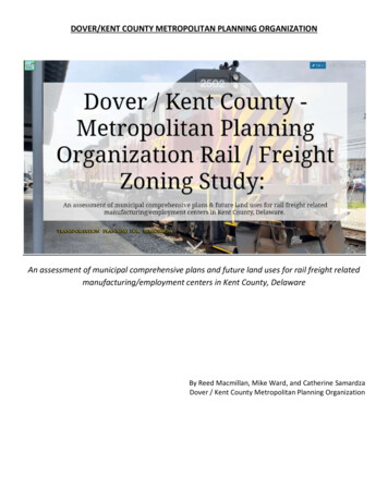
DOVER/KENT COUNTY METROPOLITAN PLANNING ORGANIZATIONAn assessment of municipal comprehensive plans and future land uses for rail freight relatedmanufacturing/employment centers in Kent County, DelawareBy Reed Macmillan, Mike Ward, and Catherine SamardzaDover / Kent County Metropolitan Planning Organization
DOVER/KENT COUNTY METROPOLITAN PLANNING ORGANIZATION RAIL ZONING STUDY:An assessment of municipal comprehensive plans and future land uses for rail freight relatedmanufacturing/employment centers in Kent County, DelawareNovember 2018Written byReed MacmillanExecutive Director, D/KC MPOMike WardGIS Planner, D/KC MPOCatherine SamardzaExecutive Assistant, D/KC MPOPublished byDover/Kent County MPO1783 Friends WayCamden, Delaware 19934www.doverkentmpo.orgFunded byFederal Highway Administration (FHWA)Federal Transit Administration (FTA)The Delaware Department of Transportation (DelDOT)The preparation of this document was financed by the 2019 Unified Planning Work Program of the Dover KentCounty MPO, which is funded by the Federal Highway Administration (FHWA), Federal Transit Administration(FTA), and the Delaware Department of Transportation (DelDOT).The report reflects the views of the authors, who are responsible for the facts and accuracy of the research.The contents do not necessarily reflect the official view of FHWA, FTA, or DelDOT.Cover photo courtesy of Cliff Grunstra, Carload ExpressRAIL ZONING STUDY / NOVEMBER 20182
PrefaceAs the executive director for the Dover/Kent County Metropolitan Planning Organization, I am pleased toprovide this publication, DOVER/KENT COUNTY METROPOLITAN PLANNING ORGANIZATION RAIL ZONINGSTUDY: An assessment of municipal comprehensive plans and future land uses for rail freight relatedmanufacturing/employment centers in Kent County, Delaware. Funded by FHWA, FTA, and DelDOT, thisresource is intended to show the importance between local government comprehensive plans and how thesedocuments can support state and regional rail freight plan goals and objects, better coordination betweenlocal, state, and rail operators land use decisions, and attract rail freight related manufacturing/employmentcenters to Kent County, Delaware.Land use decisions are made at the local government level while a majority of existing rail freight plans aremade at the state level. The D/KC MPO is responsible to ensure existing and future transportation projects arecontinuing, cooperative, and comprehensive and as such, appreciates continued support from FHWA, FTA,DelDOT, and our local MPO partners in order to ensure transportation policy information is shared. I ampleased to acknowledge the following individuals efforts made on this project:City of Dover Dave Hugg, AICP, Director of Planning and Community DevelopmentCity of Harrington Jeremy Rothwell, PlannerCity of Milford Rob Pierce, Planner and D/KC MPO TAC memberDelaware Department of Transportation Nathan Attard, Transportation Planner and D/KC MPO TAC memberDelaware Office of State Planning Coordination David L. Edgell, AICP, Principal Planner and D/KC MPO TAC Vice ChairmanDelmarva Central Railroad, Carload Express Cliff Grunstra, Chief Marketing Officer and D/KC MPO TAC memberKent County Kris Connelly, Assistant Planning Director and D/KC MPO TAC ChairmanRAIL ZONING STUDY / NOVEMBER 20183
DOVER/KENT COUNTY METROPOLITAN PLANNING ORGANIZATIONRAIL ZONING STUDYI. Executive SummaryII. Purpose of Studya. Backgroundb. Scope of StudyIII. Plan(s) Review & Resultsa. Applicable Municipal Comprehensive Plan Summariesb. Other Applicable Plans1. Delmarva Freight Plan2. Delaware State Rail Plan3. Industrial Zoned Parcel Rezoning Activity4. Subdivision Development Plan ActivityIV. Future Comprehensive Plan InitiativesV. RecommendationsVI. ConclusionVII. ReferencesRAIL ZONING STUDY / NOVEMBER 20184
Executive SummaryThere are several State of Delaware and regional (Delmarva Peninsula) rail freight-related plans highlighting federal andstate goals and objectives to be considered in overall transportation planning policy. These state and regional plansdetail the goals, objectives, and strategies that help guide the Delaware Department of Transportation (DelDOT),stakeholders, and the public with rail freight policies and capital investments. Although many of these plans embrace amulti-state/multi-jurisdictional and multi-modal freight planning perspective (DelDOT, 2015, pp.5), there appears to be avoid regarding Kent County and municipal initiatives that would support the various State and regional freight plans.Comprehensive planning may help fill in this void and therefore comprehensive plans were used as a gauge to ascertainmunicipal and County inclusion of State and regional rail freight goals and objects. Assessments regarding rail freightinformation within comprehensive plans was used as a primary research tool for the Rail Zoning Study.The Dover/Kent County Metropolitan Planning Organization (D/KC MPO) Rail Zoning Study summarizes 13 municipal andKent County's current State-certified Comprehensive Plans regarding future uses for rail freight through the use of aninteractive web map. There are five basic questions this study evaluates:1.2.3.4.How do municipalities and Kent County address rail freight systems within their comprehensive plans?What is the rezoning trend regarding industrially zoned parcels adjacent to the rail line?What is the residential subdivision activity on parcels adjacent to the rail line?Are there areas within the municipalities or Kent County where large manufacturing or employment centerscould leverage rail freight systems by being co-located with current or planned rail lines?5. What other rail freight studies should be considered for the MPO region?The Study reviewed 14 future land use maps and compared all parcels immediately adjacent to and part of a one (1)mile buffer radius (1/2 mile on each side of the rail line) along the entire 55-mile short line railroad from Smyrna (seeExhibit A) southward past Farmington and southeastward past Milford in order to identify parcels larger than 6 acresand appropriately zoned where a rail freight-related manufacturing/employment center might be considered. The RailZoning Study interactive map was created as a visual means to capture the findings of this Study as well as providing aland use decision tool for Kent County; the 13 applicable municipalities; Federal, State, and local governmental agencies;and all Kent County citizens.The Study found that rail freight is one element often missed in many of the comprehensive plans reviewed. Withoutidentifying specific rail freight goals, local jurisdictions may often overlook the importance of freight in theircommunities, and may not carry out an adequate review of where freight facilities are located or planned (EnvisionFreight, 2011, pp.1). Likewise, without detailed rail freight elements within comprehensive plans, rail operators such asthe Delmarva Central Railroad get concerned about adjacent parcel down zonings from industrial uses to residentialuses that allow large residential subdivisions to be built adjacent to the rail line, creating a safety and noise concern.Moreover, the Study found that many of the 14 comprehensive plans did not mention a linkage regarding rail uses andState plans such as the 2015 Delmarva Freight Plan and 2011 Delaware State Rail Plan. Acknowledgement of these twoState plans and providing implementation measures at the local jurisdictional level may assist Delaware in attaining themultiple goals and objectives listed in both plans.Lastly, the Study outlines five (5) recommendations that may help support existing Federal, State and Regional freightplan goals and objectives; link local transportation initiatives articulated in comprehensive plans with available FederalRAIL ZONING STUDY / NOVEMBER 20185
and State transportation funding (Envision Freight, 2011, pp. 2); and identify future economic initiatives requiringadditional studies. Comprehensive plans can help initiate the required proactive planning efforts required to identifyappropriate future land use areas necessary for potential rail freight-related manufacturing/employment centers. Thesefuture centers can leverage multi-modal systems (highway and rail), provide another economic development attributefor potential manufacturing and distribution employers, and create additional employment opportunities for the futureof Kent County, Delaware.RAIL ZONING STUDY / NOVEMBER 20186
Purpose of StudyAs described in the Executive Summary, there were five basic questions evaluated in this Study. The "Background andScope of Work" section provides information regarding how these five questions were developed. The "PlanReview/Results" section explains how the comprehensive plans were reviewed and provides a list of observations thatresulted from those reviews. The "Future Initiatives" section provides a list of recommendations resulting from this RailZoning Study.Background. On January 3, 2018 the Dover/Kent County Metropolitan Planning Organization (D/KC MPO) sent out anotice to MPO members (State agencies, committee and council members and local municipalities) solicitingrecommendations or ideas for Transportation Planning Studies to be included in our FY19 Unified Planning WorkProgram (UPWP). On January 8, 2018 Mr. Cliff Grunstra (Chief Marketing Officer for Carload Express) and member ofthe D/KC MPO Technical Advisory Committee (TAC) suggested the D/KC MPO review how state and regional rail freightgoals are being included at the local governmental level. There appeared to be limited information regarding local landuse activities regarding railroad rights of way, industrial/economic development to attract new rail related business andindustry, and rezoning activity from industrial to residential uses adjacent to the railroad which might impact future railfreight opportunities. On July 23, 2018 the D/KC reviewed the Rail Zoning transportation study idea to ascertain thepossibility of the D/KC MPO staff conducting the Rail Zoning Study rather than contracting out to consulting firms. As aresult, the scope of work was developed on July 25, 2018.Scope of Work. The Dover/Kent County Metropolitan Planning Organization (D/KC MPO) conducted a Zoning Map studyregarding all parcels of land adjacent to the railroad lines in Kent County, Delaware. The purpose of the study is tocreate an inventory of properties with appropriate zoning suitable as future commercial, manufacturing, or industrialsites where Cargo Oriented Development (COD) could occur and which would promote and support economic growththat relies on freight rail transportation networks and facilities by maximizing access to freight terminals and nodes. Thestudy was conducted by D/KC MPO staff, who provided the following: A map depicting (to include but not limited to) all undeveloped/vacant, commercial, and industrial parcelshaving at least 500’ of direct railroad frontage and having a width at least 200’; a one-mile boundary study area(1/2 mile each side of the rail line) along the entire active rail line in Kent County; and parcels at least 6 acres insize on both sides of the track in Kent County (to include municipalities); current and proposed commercial,manufacturing, or industrial zoning (Note: A freight rail operator indicated parcels with minimum of 500 ft alongrail might be a good starting point with a calculation 500 x 500 250,000 sq ft. divided by 43,560 5.7 acres,rounded to 6 acres was an acreage attribute in the parcel GIS file easily searchable);Applicable State, County, and Municipal Comprehensive Plan language regarding Rail Freight future use; andRecommendations (to include future Rail Freight studies; multi-modal mobility hubs; etc.).The current operator of the rail line in Kent County is the Delmarva Central Railroad (DCR), a subsidiary of CarloadExpress Incorporated (CEI); by formal agreement, the rail line operator is also a member of the D/KC MPO TAC. Mr. CliffGrunstra noted that there did not appear to be a County-wide study that addressed future land uses and freight railtransportation in Kent County, Delaware, and suggested that such a study be done. The proposed study reviewed futureland uses within required municipal and County comprehensive plans to assess how local governments incorporatedstate and regional rail freight goals and transportation.RAIL ZONING STUDY / NOVEMBER 20187
As part of the scope or work, the D/KC MPO GIS Planner Mike Ward created an interactive map (see Exhibit A) whichillustrates the study area within Kent County, Delaware and the location of the County in relation to its regionalproximity to Maryland and New Jersey. As you scroll through the web page, the comprehensive plans will be seen onthe left side of the screen beginning with the northern most municipality (Town of Smyrna) and progresses southwardthrough each subsequent municipality along the rail line and concludes with the southeastern-most municipality (City ofMilford), encompassing 13 municipalities. Kent County was evaluated as well, since the rail line traverses throughunincorporated areas between municipalities. A total of 14 Comprehensive Plan Updates were reviewed regardinglanguage in those plans that may provide information on any future land use changes leveraging rail freight-relatedmanufacturing/employment centers.NOTE: According to the Delmarva Freight Plan, there is also a railroad line moving southwest from Clayton, just outsideKenton, Hartly, and Marydel into Maryland that is considered inactive (DelDOT, 2015, pp. ES-12). For purposes of thisStudy, this line is not included.As you scroll through the site, you will be able to see each of the 14 areas in this study. A summary of each Statecertified comprehensive plan, as found on the Office of State Planning Coordination Comprehensive Plan web page, willbe seen on the left side of the screen to include that municipality’s future land use map and any additional mapsassociated with rail freight-related uses. To use the GIS map, simple click on the " " button in the lower right screen andclick anywhere on the map and move the map image to the location you wish to view in more detail. The “scroll”button on your mouse or arrow buttons on your keyboard will move the comprehensive plan maps and plan review onthe left side of the screen, up or down, to the next municipality. As you scroll to the next municipality, you will see theKent County map remain in place until you click on the map and move it in any direction. The “ ” and “-“ buttons on thelower left-hand side of the screen will enlarge or reduce the map’s size. Lastly, each municipality has a green orboundary line, since many Kent County municipalities are located adjacent to one another and this will help the viewermatch the municipal comprehensive plan map with the municipality within the main screenThe results of this Study are meant to continue the dialog with Federal, State, and Local land use, road, and economicplanners; Rail Freight interests; and our citizens regarding how to better leverage rail freight-relatedmanufacturing/employment centers. Some key points to consider: Some once-appropriately zoned parcels 6 acres or larger and adjacent to the rail lines have been rezoned overtime to residential uses;Residential uses adjacent to the rail lines are a safety concern without appropriate setback distances;Existing railroad rights of way that are not actively used by the railroad are often vacated and converted for bikeand pedestrian pathways; once converted, those areas can no longer be considered for future rail lines; andRail freight-related uses for manufacturing / employment centers appear more plausible and supported in theCity of Dover; Harrington; and the City of Milford.RAIL ZONING STUDY / NOVEMBER 20188
Exhibit A- 1 mile Railroad Corridor 13 Municipalities and Kent CountyInteractive web site: id 09d5870675ae41d7ad906c400ccfb84aExhibit B- Future Map Industrial Areas within 1 mile Railroad CorridorRAIL ZONING STUDY / NOVEMBER 20189
Plan(s) Review & ResultsApplicable Municipal Comprehensive Plan Summaries. The Comprehensive Land Use Plan is a document designed toguide the future actions of a community; provides a vision for the future, with long-range goals and objectives for allactivities that affect the local government; and includes guidance on how to make decisions on public and private landdevelopment proposals, the expenditure of public funds, availability of tax policy (tax incentives), cooperative effortsand issues of pressing concern, such as farmland preservation or the rehabilitation of older neighborhoods areas(Extensions, 2015). In Delaware, comprehensive development plan requirements are codified in Title 22 in the DelawareState Code and require municipalities to review adopted comprehensive plans every 5 years to determine if itsprovisions are still relevant given changing conditions in the municipality or in the surrounding areas (OSPC, n.d.).Furthermore, the adopted comprehensive plan should be revised, updated and amended as necessary, and readopted atleast every 10 years. Although many Kent County municipalities attempt to follow these time criteria regarding theircomprehensive plans, limited full time staff and financial resources usually impact when municipalities can update theircomprehensive plans. Nonetheless, the Delaware Office of State Planning Coordination (OSPC) does a remarkable job inproviding outreach to these municipalities to assist in updating the plans. The OSPC maintains the most current certifiedcomprehensive plans on their website ive-plan.shtml ) and this iswhere the 13 municipal and Kent County Comprehensive Plans were found for this Study.NOTE: During the time this Study was being conducted (July through October 2018), some of the jurisdictions wereupdating their comprehensive plans and when possible, updated information was incorporated.The main purpose of reviewing these 14 Comprehensive Plans was to ascertain if rail freight-related uses or proposedfuture uses were being considered by the municipalities and Kent County; identify future land use zoning map changesregarding industrial zoning; and identify potential areas where rail freight-related manufacturing / employment centersmight be supported by rail spur lines. The review process was as follows: Went to the OSPC Comprehensive Plan web site and used their Comprehensive Plan Database (which again,contains the most currently "certified" comp plan on record) to search for copies of the 14 ComprehensivePlans;Selected a municipality where the railroad is also located and opened the applicable comp plan in a PDF format;Conducted a word search for "Railroad" to identify specific pages to review;Made color copy of future land use map; andMade summary notes regarding each comp plan rail freight verbiage and future land use map in an excelspreadsheet related to the comp plan highlighting rail uses, potential rail spur line, and the number of existingparcels 6 acres or larger (minimum size a rail spur line might be considered) zoned industrial, commercial, ormanufacturing (NOTE- these summaries were incorporated into the interactive map).Rail freight current and future uses could be included in applicable municipal comprehensive plans in the Land Use,Economic Development, and Transportation Chapters. Although this Study concentrated on municipal and Kent Countycomprehensive plans where an active rail line is located, it appeared that rail freight was only mentioned in a cursorymanner in those plans. Limited rail freight information and land use planning is not new. In his 2015 master's thesis,"Short Line Railroads and Municipal Land Use Planning, Policy, and Regulation" Alexander R. Train highlighted limited railfreight information within many municipal land use planning documents such as comprehensive plans. In fact, Mr. Trainindicated that, "50% of the planners surveyed believed current policy pertaining to rail freight to be poor andRAIL ZONING STUDY / NOVEMBER 201810
insufficient" (Train, 2015, pp. 12) and this finding appears relevant when comparing local municipal comprehensiveplans where rail freight lines are operated in Kent County, Delaware. Nonetheless, Kent County and some municipalitiesare considering all economic development opportunities within their Comprehensive Plans and identifying areas whererail freight might be leveraged.Appendix 1 provides the summaries for all 14 reviewed comprehensive plans. Each future land use map can also beviewed on the interactive map found on the Dover/Kent County MPO web page (https://doverkentmpo.delaware.gov/ ).After reviewing the comprehensive plans and their future land use maps for this study, the following observations apply: 1 comprehensive plan is listed as being expired; 7 are currently being updated; and 6 have been certified;11 comprehensive plans do not highlight rail uses and 3 do highlight rail uses (Clayton; Felton; and Harrington);There are 57 parcels 6 acres or larger adjacent the rail line with commercial, manufacturing, or industrial zoning(34 total from 13 municipalities (incorporated area) (13 in Dover, 8 in Harrington, and 5 in Milford) and 23 totalin Kent County (unincorporated area).3 municipalities (Dover; Harrington; and Houston) reference some future land use changes which could leveragerail freight-related manufacturing/employment centersOnly 1 (Harrington) provided information regarding future investments into freight and passenger rail.None of the 14 comprehensive plans contained rail freight data and use in their Economic DevelopmentChapters.A final comment regarding these 14 Comprehensive Plans can be summed up quoting a line from Alexander Trains 2015Thesis, "in most cases, the railroad's operations and infrastructure are omitted from town plans, with the exception ofopportunities for recreational trail conversions" (Train, 2015, pp. 1).RAIL ZONING STUDY / NOVEMBER 201811
Other Applicable PlansThere are many railroad-related studies and plans available for review; simply type in "Railroad Studies" in your internetsearch engine and see the results (approximately 44 million). However, refining your search for railroad studies in KentCounty, Delaware provides fewer yet still extensive results (approximately 1.6 million). The point is that this Rail ZoningStudy attempted to ascertain how 13 municipalities and Kent County addressed rail freight in their comprehensive plansin comparison to applicable State or Regional rail freight plans. Although there were several other studies addressingpassenger rail, such as the "Delmarva Intercity Rail Feasibility Study" completed in December 2013, this Rail ZoningStudy primarily focused on freight rail systems. As such, the Delmarva Freight Plan and Delaware State Rail Plan aresummarized below as two plans that recommend the importance of local jurisdictional coordination and provide somedetail as to the importance of addressing rail freight systems in local land use planning documents such ascomprehensive plans.Delmarva Freight Plan. "This plan summarizes current and future freight planning and transportation needs to enhancefreight and goods movement and related economic opportunities on the 14-county tri-state area of the DelmarvaPeninsula" (DelDOT, 2015, pp.3). This comprehensive document identifies freight flows and freight issues relevant tolocal and regional economics, integrates commodity flow modeling and performance-based scenario planning, andprovides information for decision-makers on freight infrastructure investments and policy guidance (DelDOT, 2015,pp.3). The document provides information on regional freight assets such as key highway, rail, port, waterway, air, andpipeline connecting multimodal hubs and freight system assets (DelDOT, 2015, pp.3). There are a few aspects of thisdocuments which are applicable to this Rail Zoning Study scope of work which are illustrated by the following points: Page 134 identifies several rail concerns but the "preservation of short line rail assets and service" is a real issue,as demonstrated by some municipalities wanting to convert rail right of way into bike and walking paths;Most Land Use decisions (including adoption of Comprehensive Plans) are made at the local jurisdictional level,and some decisions are void of rail freight considerations (i.e. approve a residential subdivision adjacent the railline, etc.);As described on page 156, there is an interest in preserving the Peninsula's rail networks and increase raildependent customers to help justify and enhance the local viability of the rail mode;As described in Chapter 6, there are planning efforts that leverage some environmental benefits by gaininginsights into truck-to-rail mode shift benefits; andAs described on page 243, recognize the need to provide multi-modal freight hubs linking roadway network withrail, water, air, or pipeline transportation systems.The points noted above could contribute to an "action plan" that local governments might utilize to consider future landuse changes involving rail freight-related manufacturing/employment centers.Delaware State Rail Plan (SRP). This document describes how rail fits into the overall transportation planning processand presents a series of goals, objectives, and strategies for Delaware's passenger and freight rail system (DelDOT, 2011,pp. 2-1). In addition to providing short histories on the various rail lines in Delaware outlined in Chapter 4, and freightactivity by commodity and mode in Chapter 5, the document describes Federal Funding Programs in Chapter 8 that arenecessary for a long-range investment program for current and future freight and passenger infrastructure. However,Chapter 3 (SRP Vision, Goals and Objectives) outlines six (6) broad goals for Delaware's rail transportation system as wellRAIL ZONING STUDY / NOVEMBER 201812
as specific objectives with strategies developed to attain those objectives (DelDOT, 2011, pp. 3-2). Interestingly, thefollowing two (of the six) goals are relevant to this Rail Zoning Study: Preserve the existing network and provide additional rail capacity to maintain and improve Delaware'simportant link in regional and national rail networks; andContribute to the decision-making process with local governments and land owners to preserve rail corridorsand potential station areas for future investment.Both goals include multiple objectives and strategies which provide a sound "action plan" when considering future landuse changes involving rail freight-related manufacturing/employment centers.Industrial Zoned Parcel Rezoning Activity. The Kent County railroad operator expressed concern regarding industrialzoned parcels adjacent to the railroad being down-zoned into some other zoning classification that would precludepotential rail freight-related manufacturing or employment center development. Rezoning history from the 13municipalities in this Study were not readily available and therefore not included in this study. However, Kent Countyindustrial rezoning activity for parcels adjacent to the railroad was acquired. Appendix 2 provides a summary of thatindustrial rezoning activity. Summary points regarding Kent County industrial rezoning activity: From 1972 to 2018 there were 31 total Kent County re-zoning applications adjacent to the railroad of which 24were approved; 4 were denied; and 3 were withdrawn;7 of these rezonings were approved for the parcels to be rezoned to an Industrial zoning from a Residentialand/or Commercial zoning (gain of Industrial zoned parcels);10 of these rezonings were approved for the parcels to be rezoned to Residential and/or Commercial zoningfrom Industrial zoning (loss of Industrial zoned parcels);From 1972 through 2018 there was a net loss of 3 Industrial zoned parcels or 18% (3 more of the "loss"Industrial parcels divided by 17 total (gains plus loss) rezonings) adjacent to the railroad.NOTE: Although there are 3 less parcels zoned Industrial, there is a total of 15 additional acres of Industrialzoned land (238 acres gained vs 223 acres lost) from 1972 through 2018.Subdivision Development Plan Activity. Most of Kent County's municipalities have evolved over time from an industrialand agricultural past to a bedroom communities. Similar to the industrial rezoning activity, the Kent County railroadoperator was concerned about residential subdivision plan activity on properties adjacent to the railroad. This wasprimarily a safety concern as setback requirements vary between Kent County (unincorporated areas) and municipalities(incorporated areas). Specifically, residential areas adjacent to the railroad lead to significant safety concerns regardingchildren playing too close to the rail line. A secondary concern was noise issues residential homeowners mightexperience if their homes were built in close proximity to the railroad. Appendix 3 depicts the 23 residentialsubdivisions that are adjacent to the railroad. Here are summary points: Kent County encompasses approximately 586 square miles or 375,040 acres in size;Kent County unincorporated area parcels adjacent to the railroad comprise approximately 7,681.61 acres;There are eleven (11) recorded residential subdivisions adjacent to the railroad in the unincorporated area (KentCounty) equaling approximately 763 acres;Thirteen (13) incorporated municipal parcels adjacent to the railroad equals approximately 1,154.10 acres;RAIL ZONING STUDY / NOVEMBER 201813
Eight (8) of the thirteen (13) municipalities have a combined eleven (11) recorded residential subdivisionsadjacent to the railroad equaling approximately 534 acres.RAIL ZONING STUDY / NOVEMBER 201814
Future Comprehensive Plan InitiativesAs described in the reference section
The Dover/Kent County Metropolitan Planning Organization (D/KC MPO) Rail Zoning Study summarizes 13 municipal and Kent County's current State-certified Comprehensive Plans regarding future uses for rail freight through the use of an interactive web map. There are five basic questions this study evaluates: 1.
