Transcription
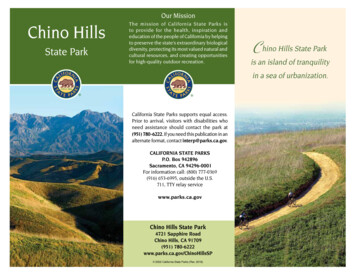
Our MissionChino HillsState ParkThe mission of California State Parks isto provide for the health, inspiration andeducation of the people of California by helpingto preserve the state’s extraordinary biologicaldiversity, protecting its most valued natural andcultural resources, and creating opportunitiesfor high-quality outdoor recreation.Chino Hills State Parkis an island of tranquilityin a sea of urbanization.California State Parks supports equal access.Prior to arrival, visitors with disabilities whoneed assistance should contact the park at(951) 780-6222. If you need this publication in analternate format, contact interp@parks.ca.gov.CALIFORNIA STATE PARKSP.O. Box 942896Sacramento, CA 94296-0001For information call: (800) 777-0369(916) 653-6995, outside the U.S.711, TTY relay servicewww.parks.ca.govChino Hills State Park4721 Sapphire RoadChino Hills, CA 91709(951) 780-6222www.parks.ca.gov/ChinoHillsSP 2002 California State Parks (Rev. 2018)
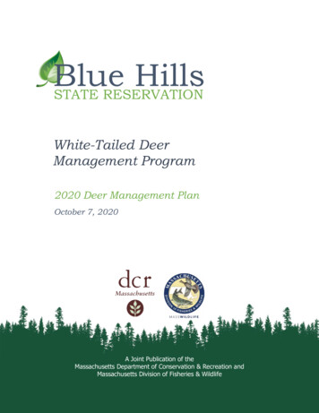
Chino Hills State Park, a premier naturalopen-space area in the hills around theSanta Ana Canyon near Riverside, is a criticallink in the Puente-Chino Hills biologicalcorridor. This “bio-link” stretches nearly 31miles from the Santa Ana Mountains to theWhittier Hills. The park has more than 14,000acres of rolling, grassy hills and valleys,dotted with stands of oaks and sycamores.The park is also a place where people canescape everyday pressures to find peace andsolitude in a natural setting. Visitors can campfor a few days or enjoy walking, horsebackriding, or bicycling over trails that meanderalong ridge tops and through valleys,woodlands, sage scrub, and grasslands.More than 90 miles of trails offer excellentopportunities for viewingwildlife and native plants.The park features a visitorcenter, a campground, picnicareas, and equestrian facilities.PARK HISTORyOver the centuries, manypeople have made use of theopen spaces and plentifulwater, plant, and animalresources of the Chino Hills.Before European contact, theTongva (Gabrielino) Indians,who lived along the SantaAna River basin, set uptemporary camps here forgathering food.After the Spanish founded Mission SanGabriel in 1771, the Chino Hills were usedextensively for grazing by mission cattle.During the Mexican Republic era, the hillswere used as spillover pasture from suchsurrounding Mexican ranchos as Santa Anadel Chino and La Sierra Yorba. After Mexicoceded California to the United States in 1848,the land continued to be used for cattle.Private land acquisition here began in the1870s and continued into the 1890s. Somelate nineteenth- and early twentieth-centuryoil exploration and mining activity also tookplace in areas now within the park. In 1948 the1,720-acre Rolling M Ranch was established,and the land was leased to nearby landowners for cattle grazing. A ranch house,historic barn, and several windmills andwatering troughsserve as remindersof the cattleranching days.In 1977 theCaliforniaLegislature passeda resolutiondirecting CaliforniaState Parks toconduct a studyon acquiring ChinoHills land for parkpurposes. A localcitizens group,Hills for Everyone,worked closelywith CaliforniaWindmill at Telegraph CanyonState Parks and the legislature to createthe park with an initial acquisition of2,237 acres. The California State Parkand Recreation Commission officiallydeclared the area a unit of the State ParkSystem in 1984. Since then, numerousland acquisitions from various privatelandowners have expanded the park to itspresent acreage.WILdLIFEBecause of its greatvariety of habitatsand microclimates,Chino Hills StatePark is an ideallocation forobserving manywildlife speciesBobcatnative to SouthernCalifornia.More than 200species of birdsand mammals,numerous reptilesand amphibians, andthousands of typesCoastal cactus wrenof insects and otherinvertebrates live in the park. Some ofthese animals — including the least Bell’svireo, the California gnatcatcher, and thecoastal cactus wren — are considered rare,threatened, or endangered. The diversityof native plants and animals found in thisregion is ranked one of the highest in theUnited States.
GEOLOGyRanging from 400 to 1,781 feet inelevation, the park straddles the northWHAT IS A BIOLOGICAL CORRIdOR?Development has claimed large tractsof wildlife habitat. Biological corridorslink the remaining habitats by actingas passageways between designatedopen spaces.When small patches of wildernessare cut off from other open-spaceareas, many of the species presentat the time of isolation will inevitablydisappear. Biological corridors help tomaintain healthy populations of plantsand animals by allowing for geneticexchange, species migration, andrepopulation after a catastrophe suchas fire.end of the Santa Ana Mountains and thesoutheast portion of the Puente-Chino Hills,which together form the northern end of theThe Puente-Chino Hills bio-link offerspeople a refuge from urban life whileconnecting the park’s plants and animalsto other natural areas. Since SouthernCalifornia is so heavily urbanized, it isimpossible to preserve the huge tracts ofland needed to ensure species diversity.However, by providing a major biologicallink between islands of open space,Chino Hills State Park effectively enlargeshabitats. Water Canyon Natural Preserve,Coal Canyon, and the rest of the park arepart of a biological corridor that allowswide-ranging species like bobcats ormountain lions to avoid becoming walledoff in isolated habitats.Peninsular Ranges in Southern California.This formation interrupts the generally flatLos Angeles Basin with a variety of rollinghills, mountains, and canyons on its southand east sides. The hills are a result ofuplift and folding along the Whittier andChino faults.The Puente-Chino Hills are made up ofsedimentary rocks of the Puente Formation,deposited from five to fifteen millionyears ago. Associated with this formationare petroleum resources that have beenexplored and exploited in the Los Angelesregion since the late 1800s. Fine claysoils are found in these formations and inalluvial deposits that wash down from thehills and mountains during winter rains.VEGETATIONPlant communities include variousassociations of riparian, grassland, sagescrub, woodland, and chaparral.In the park’s riparian zones, willow andsycamore trees stand above understoriesof wild rose, stinging nettle, and mule fat.Cattails grow along seasonal and year-roundcreeks. These areas provide habitat for avariety of wildlife, among them red-wingedblackbirds and many nesting birds thatcome from Central and South America eachspring to raise their young.Southern California black walnut treesjoin coast live oaks above creeks on northfacing slopes. These walnut woodlandsare another important and rare plantcommunity preserved in the park. Only afew thousand acres of this California habitat
still exist, with just over 1,000acres in preserves. Severalhundred acres are protectedat Chino Hills State Park.The Tecate cypress is arare species of conifer foundonly in a few places inthe United States. Tecatecypress trees are found inCoal Canyon, near the largerecological reserve managedby the California Departmentof Fish and Wildlife.Other plant communitiesfound along the hills, slopes,and canyons include coastal sage scrub,mixed chaparral, alluvial sage scrub, and mulefat scrub. Wildlife species depend on theseplants to survive.Grassland species native to California, suchas purple needle grass and giant rye, can befound among the park’s annual non-nativegrasses. Part of the park’s restoration programis returning native grassland to its naturaldominant state.RECREATION ANdINTERPRETIVE PROGRAmSMore than 90 miles of multi-usetrails wind through the park. Thepark is open seven days a weekfor day use; campsites can bereserved by calling (800) 444-7275.School programs, Junior Rangerprograms, and educational talksare offered year round.PLEASE REmEmBERSpeed limit—15 mph for all vehiclesand bicycles.MDiscovery CenterThe Discovery Center, located at 4500Carbon Canyon Road in the city of Brea,offers hands-on exhibits about the wildlife,plant life, and other natural resources ofthe park. Staff and volunteers also conductnature hikes, talks, programs, and eventsat the Discovery Center. A meeting room isavailable to rent for events and meetings.Visit www.parks.ca.gov/ChinoHillsSP forDiscovery Center hours, an event calendar,and meeting-room rental information.ACCESSIBLE FEATuRESThe Native Plant Trail, the Discovery Centerand interpretive trail, and the Rolling MRanch day-use area are accessible. Thecampground has accessible campsites andrestrooms with showers. Two Bane Canyonvista points have shade ramadas and picnictables. For ongoing accessibility updates,please visit http://access.parks.ca.gov.CattailSmoking is prohibited outside of thecampgound and throughout the entire parkduring fire season.Campfires are not permitted due to firedanger. Charcoal grills are not allowedduring fire season.Trash—Pack it in; pack it out!Weapons of any kind are prohibited.Trails—For safety’s sake, stay ondesignated trails and don’t hike alone. Beaware of wildlife, especially rattlesnakes.Collecting— All natural and culturalfeatures are protected by law and may notbe disturbed or collected.DPark closure—The park will closefollowing rain of more than one quarterinch and remain closed until road andtrail surfaces are no longer saturated. Highclay content in the soil causes “greased”conditions when wet. Trail use during thistime causes severe erosion and rutting oftrail and road surfaces. The park is alsoclosed during times of extreme fire danger.
100001010000toPomona142 to100000Chino HillsS tate P arkiC01003 mitCany0010ONa CanyonRd50Sa nt a An al1500Campground: HorseEquestrianStaging Area01 mileTrail: Hike(Hike/Bike/Horse)241Accessible FeatureCOALANAHEIMBridge1500CANYONP R E S E RV EtoIrvine( D E P T. O F F I S HPicnic AreaRanger StationRestroomsCampfire CenterShowersCampgroundTrailheadCampground: GroupAND WILDLIFE)002500Trail: Hike& HorseTrail: Multi-useMileage fromRolling M RanchParking20CanyonPaved RoadUnpaved dersn500Traia ilRivONN AT U R A LP R E S E RV Einer TrNY0P i pe lRi v eyo1.5 Kilometers00C an50iGreen RiverGolf Course5000ilm0016ver TraillaTr500Tra0050AntoRiverside91e200a Ril TrailwAnver TrailayNYONACHGUOSan taa Ana RiFreePSRv erSantila Rint a A n500Tra ilRidg100.51 MileviaF E AT H E R LY R E G I O N A L P A R KWAT E RCANYON0.5Can4 miCoaDay-UseCorral5000AlisoScullyte raughSlTelegraph Cy n TrlSailes71ilTraAL CEQUESTRIANFACILITIES913m5 mil910BrushCanyonTrailiCOAAn aS a n taair TrRiv eNHScully ill1050O0RINGS CANYONilil4m500Sa915000YnyoSTnza Rdnta55NScullyHillSatoSanta AnaAAlluim2DeligBobcaTr a00TYORBAR E G I O N A L PA R K500RdAvePomonaCARMcDermTrailTraRidgeSLi tCan t l eyo nTr a i lRid0010SidewinderCarEa s yStreetTrailTOiLO90onnyCaCil10lPowerline Tr a iS2mSan Antonio RdIiVillage Center DrL3m01000AeP R E S E RV EYORBA LINDAraEspeaAnnta5001000RRi00dg50round toFullertonEuclidTrailSO1000Ca1000ME CANYONNOTraedLineceFeniCreeValley ViewhREast1mao rr l lira0OTrail LIR100niWTrailyoCanN AT U R A LScuNCANYOii2m2mBLUon1mAlisoYorba Linda BlvdDE MU00dB lv10ntdisOl d ETrailTra0onsee Equestrian Facilitiesdetail map belowyo nWAT E R C A N Y O N150YONSan Juan Hill1000dnyon RnQuarterhorseDriveThis park is supported in partthrough a nonprofit organization.For more information, contact:Chino Hills State Park Interpretive wAlisoRimcrese CateWa r1781ft543mBaniCAN3mGEBoviniaNE4mht Trail00Rolling MRanch1 miC H I N O H I L L S S TAT E PA R KTrail 15iPsee Rolling M Ranchand Campgrounddetail mapTrailgeRidSouthiBA3 miIDE R2mONaph Canyon gePn1000torRapFourCornersRidgeCAthou iOi4 m TrailniyoCanphhgraraplegTeoCanyTr ailge5 miEquestrianParking AreaBlack GoldGolf CourseleTekeeRHills for Everyone TrailTrailett DrtoLa Habra50090ore6 miRidgCrTrail5 mi1000SouthmcaDiemerTrailiCanyononSyn1000Trail 7mi4mi8 mi6 miBREA1685ft514mia7mGilman Peak6mG il mTelegraphlL C0WaterPlantiRidgeUE150North9 0 Carbon Canyon Rd8mNorth5mPGER00Discovery CenterPark Entrance1500TraildgeRiDRIPP10OlindaVillageRdr e ekUcS o q u e l C a ny o n C1000PRADOR E G I O N A L PA R Ka ilTrailLila500Carbon Canyon83inTrailPradoLakenconBANboTrNEARBy STATE PARKS California Citrus StateHistoric Park9400 Dufferin Avenue,Riverside 92504(951) 780-6222 Lake Perris StateRecreation Area17801 Lake Perris Drive,Perris 92571(951) 940-5600RanyKiosk2mLa VidaSleepyHollowRd1000Tow00ilrldrfietteAR4721 Sapphire Road03m100BOPark Entrance0Bu100CARBONCANYONREGIONALPA R KyonPlCanYNACN100100050reTOid gNer Rl10071Soque0ng00kwyCHINO HILLS100Ra10ElinvarRd00BRUSH CANY10toOntario10Chino HillsViewpoint 2002 California State Parks (Rev. 2018)200020CLEVELANDN AT I O N A LFOREST250000
hino Hills State Park, a premier natural open-space area in the hills around the Santa Ana Canyon near Riverside, is a critical link in the Puente-Chino Hills biological corridor. This "bio-link" stretches nearly 31 miles from the Santa Ana Mountains to the Whittier Hills. The park has more than 14,000 acres of rolling, grassy hills and .
