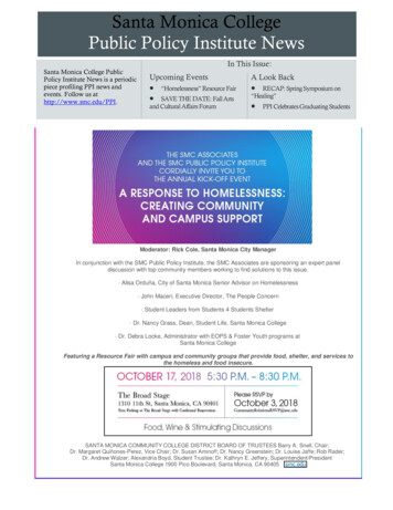
Transcription
City of Santa Monica’sBig Blue BusFiscal Year 2005-07Short Range Transit PlanDecember 2004
Big Blue Bus Route DescriptionAppendix ALine 1: Santa Monica BoulevardRoute ItineraryVenice BeachMain Street Shopping AreaSanta Monica Pier & Pacific ParkSanta Monica PlaceThird Street PromenadeWest Los Angeles Civic CenterWestwoodUCLARoute DescriptionBeginning at Windward and Main, along Main toPico, to Ocean Avenue, to Santa Monica Boulevard,to Westwood Boulevard, to Le Conte, to Hilgard, toUCLA Bus Terminal (Strathmore Drive). Return routeis reverse of above.Line 2: Wilshire BoulevardRoute ItineraryVenice High SchoolVenice BeachMain Street Shopping AreaSanta Monica High SchoolSanta Monica PlaceThird Street PromenadeWilshire Blvd.BrentwoodVA HospitalWestwoodUCLARoute DescriptionBeginning at Walgrove and Venice Boulevard, alongVenice to Lincoln, to California, to Abbot Kinney, toWestminster, to Riviera, to Windward, to Pacific (inVenice), which becomes Neilson Way to Hill, to 4th,to Wilshire, to Westwood Boulevard, to Le Conte, toHilgard, to UCLA Bus Terminal (Strathmore Drive).Return route is the same as above up to Lincoln andSuperba, to Penmar, to Victoria, to Walgrove, toVenice Blvd.Line 3: Montana Avenue & Lincoln BoulevardRoute ItineraryGreen Line StationLAXWestchesterMarina del ReyVeniceSanta Monica High SchoolSanta Monica PlaceThird Street PromenadeMontana Ave. Shopping AreaBrentwoodV.A. HospitalWestwoodUCLARoute DescriptionBeginning at the Green Line Station (Aviation &Imperial) along Aviation to Century, AirportBoulevard to 96th, into the L.A. Airport Bus Terminal(96th and Vicksburg-Lot C), onto 96th, to Sepulveda,to Manchester, to Lincoln, to Pico, to 4th, to Wilshire,to Lincoln, to Montana, to San Vicente, to Wilshire, toWestwood, to Le Conte, to Hilgard, to UCLA BusTerminal (Strathmore Drive). Return route is thereverse of above.Line 4: San Vicente & Carlyle AveRoute ItineraryDowntown Santa MonicaThird Street PromenadeSan VicenteRoute DescriptionLine 4 serves the Third Street Promenade and SantaMonica Place, 4th Street to San Vicente, CarlyleAve., Brentwood along San Vicente Blvd., theA-1
Big Blue Bus Route DescriptionBrentwoodV.A. HospitalSawtelle Blvd.Westside PavilionAppendix AVeterans Administration, Sawtelle Blvd., and theWestside PavilionLine 5: Olympic BoulevardRoute ItineraryPico Rimpau Transit CenterMidtownBeverly HillsCentury CityWest Los AngelesWater GardenSanta Monica DMVBig Blue Bus HeadquartersSanta Monica PlaceDowntown Santa MonicaRoute DescriptionBeginning at the Terminal at Pico and Rimpau, alongPico to Beverly Drive, to Olympic, to Century ParkEast, to Constellation, to Century Park West, toOlympic, to Stewart, to Colorado, to 4th St, toWilshire Blvd. Return route is the reverse of above.Line 7 & Super 7: Pico BoulevardRoute ItineraryPico Rimpau Transit CenterMidtownPico Robertson AreaRancho ParkWestside PavilionSanta Monica CollegeSanta Monica High SchoolSanta Monica Pier & Pacific ParkThird Street PromenadeSanta Monica PlaceRoute DescriptionBeginning at 4th and Broadway, along Broadway toOcean Avenue, to Pico, to the Terminal at Pico andRimpau. Return route is reverse of the above toOcean Avenue, then via Ocean to Santa MonicaBoulevard, to 6th to Broadway to 4th.Super 7 - A faster service which follows the sameroute but only stops at Pico Rimpau Transit Center,La Brea, Fairfax, La Cienega, Robertson, BeverlyDr., Westwood, Sepulveda, Sawtelle, Bundy, 20thStreet, Santa Monica College, Lincoln, Main, OceanAvenue, and Third St. PromenadeLine 8: Ocean Park BoulevardRoute ItineraryDowntown Santa MonicaThird Street PromenadeSanta Monica PlaceSanta Monica Pier & Pacific ParkSanta Monica Civic CenterMain Street Shopping AreaWestdaleRancho ParkWestside PavilionWestwoodUCLARoute DescriptionBeginning at Broadway Blvd. & 6th St. to 2nd to MainSt., then to Ocean Park Boulevard, to Gateway, toBarrington Ave. to National to Westwood Blvd., to LeConte, to Hilgard, to UCLA Bus Terminal(Strathmore Drive). Return is the reverse of above.A-2
Big Blue Bus Route DescriptionAppendix ALine 9: Pacific PalisadesRoute ItineraryPacific PalisadesNorth Santa MonicaThird Street PromenadeSanta Monica PlaceRoute DescriptionBeginning at Sunset and Marquez, along Sunset toChautauqua, to Pacific Coast Highway, to WestChannel Road, to Entrada Drive, to 7th, to Montana,to 6th, to Wilshire, to 4th (Downtown Santa Monica)and Colorado. Return route from 4th St andColorado, then reverse of above to 7th, thenEntrada, to West Channel Road, to Mesa, toEntrada, to Pacific Coast Highway, to Chautauqua,to Sunset to Marquez.Line 10: Santa Monica Freeway ExpressRoute ItinerarySanta Monica Pier & Pacific ParkSanta Monica PlaceThird Street PromenadeWest Los AngelesDowntown Los AngelesFinancial DistrictLos Angeles Civic CenterLos Angeles Music CenterUnion Station/AmtrakPatsaouras Transit PlazaRoute DescriptionBeginning on 2nd St. at Colorado, Colorado Ave.,onto Ocean Avenue, to Santa Monica Boulevard, toBundy, to Santa Monica Freeway, to Olive(Downtown Los Angeles), to 8th, to Figueroa, to 4th,to Hope to Temple, to Los Angeles St., to Alameda,to Cesar E. Chavez, to Patsaouras Transit Plaza Bay#1. Return route is reverse of above, except Flowerto 6th, to Grand, to the Santa Monica Freeway.Line 11: 14th Street to 20th Street CrosstownRoute ItinerarySanta Monica CollegeYWCA14th & Wilshire Shopping CenterSanta Monica HospitalLincoln Middle SchoolJohn Adam's Middle SchoolMontana Ave. Shopping DistrictSt. John's HospitalRoute DescriptionOperated as a one-way loop from 14th and Pearl, toMontana, to 14th, to Montana, to 20th, to OceanPark Boulevard to 18th, to 17th, to Pearl, to 14th andPico.Line 12: Westwood & PalmsRoute ItineraryPico Rimpau Transit CenterMidtownRobertson Blvd.BeverlywoodCulver CityPalmsWestdaleRoute DescriptionBeginning at Rimpau and Pico, along Pico toRobertson, to National, to Venice Boulevard, toBagley (Culver City), to National, to Palms, toGlendon, to Charnock, to Sepulveda, to National, toWestwood, to Le Conte, to Hilgard, to UCLA BusTerminal (Strathmore Drive). Return route is thereverse of the above.A-3
Big Blue Bus Route DescriptionRancho ParkWestside PavilionWestwoodUCLAAppendix ANote: Selected morning and afternoon buses, allmidday buses, all night buses after 6:30 p.m.and allweekend buses start from Pico & Robertson, ontoPico, to Wooster, to Whitworth, to Robertson andthen same route shown above to Pico & Robertson.Line 13: Cheviot HillsRoute ItineraryPico Rimpau Transit CenterMidtownPalmsCheviot HillsRancho Park20th Century Fox StudiosHillcrest Country ClubWestside PavilionRoute DescriptionWeekday and Saturday Route Cheviot Hills (Inbound to VA) Beginning at the Terminal at Picoand Rimpau, along Pico to Robertson, to Airdrome,to Bagley, to Monte Mar, to Beverly Drive, to Pico, toMotor, to Manning, to Ashby, to Pico. Return route isthe reverse of above.Saturday Route Cheviot Hills - (Inbound to VA)Beginning at the Terminal at Pico and Rimpau, alongPico to Robertson, to Airdrome, to Bagley, to MonteMar, to Beverly Drive, to Pico, to Motor, to Manning,to Ashby, to Overland, to Westwood, to Pico.Line 14: Bundy to CentinelaRoute ItineraryCulver CityCentinela AvenueBundy DriveBrentwoodRoute DescriptionBeginning at Church Lane & Sepulveda, to Sunset,along Sunset to Barrington (Brentwood Village), toMontana, to Bundy, which becomes Centinela, toWashington Boulevard, to Inglewood Boulevard, toCulver Boulevard, to Centinela. Return alongCentinela, then Bundy, then reverse of above route.Line 16: UCLA CommuterRoute ItineraryPalms NeighborhoodWestside PavilionWestwood VillageUCLA - Ackerman Union AreaRoute DescriptionBeginning on National Blvd at Venice Blvd, north,then west on National Blvd to Palms Blvd, north onOverland Ave to National Place to Westwood Blvd.North on Westwood Blvd, straight across Le Conteonto Westwood Plaza, past the Medical Plaza to theAckerman Union turn-around. Reversed in theafternoon.VA CommuterRoute ItineraryMorning Route:Pico/Rimpau Transit CenterPico BoulevardRoute DescriptionMorning Route:From the Pico/Rimpau Transit Center, west on Pico,right on Beverly Drive, left on Olympic, right onA-4
Big Blue Bus Route DescriptionCentury CitySawtelle Shopping/Dining DistrictVeterans AdministrationAfternoon Route:Veterans AdministrationSawtelle Shopping/Dining DistrictWestside PavilionPico/Rimpau Transit CenterAppendix ACentury Park East, left on Constellation, left onCentury Park West, right on Olympic, right onSawtelle and into the VA campus onto Eisenhower,terminating in the north VA campus.Afternoon Route:From the VA Transit gazebo near the police building,south to Eisenhower to Bonsall, past building 500,onto Sawtelle, left on Pico then following Pico to theRimpau Transit Center.A-5
BIG BLUE BUS SYSTEM MAPAPPENDIX BB-1
BIG BLUE BUS SYSTEM MAPAPPENDIX BB-1
BIG BLUE BUS SYSTEM MAPAPPENDIX BB-1
BIG BLUE BUS SYSTEM MAPAPPENDIX BB-1
BIG BLUE BUS SYSTEM MAPAPPENDIX BB-1
BIG BLUE BUS SYSTEM MAPAPPENDIX BB-1
BIG BLUE BUS SYSTEM MAPAPPENDIX BB-1
BIG BLUE BUS SYSTEM MAPAPPENDIX BB-1
BIG BLUE BUS SYSTEM MAPAPPENDIX BB-1
to Cesar E. Chavez, to Patsaouras Transit Plaza Bay #1. Return route is reverse of above, except Flower to 6th, to Grand, to the Santa Monica Freeway. Line 11: 14th Street to 20th Street Crosstown Route Itinerary Route Description Santa Monica College YWCA 14th & Wilshire Shopping Center Santa Monica Hospital Lincoln Middle School