Transcription
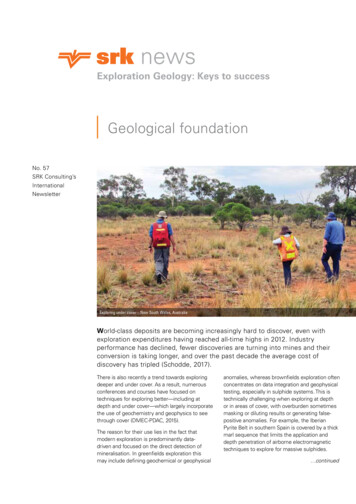
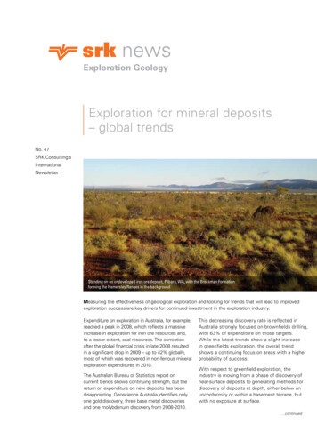
newsExploration GeologyExploration for mineral deposits– global trendsNo. 47SRK Consulting’sInternationalNewsletterStanding on an undeveloped iron ore deposit, Pilbara, WA, with the Brockman Formationforming the Hamersley Ranges in the backgroundMeasuring the effectiveness of geological exploration and looking for trends that will lead to improvedexploration success are key drivers for continued investment in the exploration industry.Expenditure on exploration in Australia, for example,reached a peak in 2008, which reflects a massiveincrease in exploration for iron ore resources and,to a lesser extent, coal resources. The correctionafter the global financial crisis in late 2008 resultedin a significant drop in 2009 – up to 42% globally,most of which was recovered in non-ferrous mineralexploration expenditures in 2010.The Australian Bureau of Statistics report oncurrent trends shows continuing strength, but thereturn on expenditure on new deposits has beendisappointing. Geoscience Australia identifies onlyone gold discovery, three base metal discoveriesand one molybdenum discovery from 2008-2010.This decreasing discovery rate is reflected inAustralia strongly focused on brownfields drilling,with 63% of expenditure on those targets.While the latest trends show a slight increasein greenfields exploration, the overall trendshows a continuing focus on areas with a higherprobability of success.With respect to greenfield exploration, theindustry is moving from a phase of discovery ofnear-surface deposits to generating methods fordiscovery of deposits at depth, either below anunconformity or within a basement terrane, butwith no exposure at surface.1 continued
Exploration for mineraldeposits (continued)SRK remains at the forefront of providinghigh-quality support to explorationcompanies active in both brownfieldsand greenfields exploration. Searchfor deep or buried deposits relies onexploration targeting from geophysicaldatasets or specialised geochemicaldatasets by applying quality structuralgeology to geological interpretation ofthem. Geological analysis remains a keycomponent of greenfields explorationsupport, and detailed mapping andadvanced visualisation of structuraldata applied to brownfields or resourceexpansion projects can add significantlyto success. Particularly in brownfields,advances in 3D modelling significantlyenhance the probability of success andcapability in designing drill programsbased on geophysical and structuraltargets. Applying new modelling andvisualisation techniques is at the core ofthis competency.Both areas present significantexploration challenges if the costof discovery is to remain withineconomic bounds.Peter WilliamsPeter has over40 years experiencein the mineralsindustry, including18 years as aconsultant on arange of projectsfrom project reviewsand audits andpublic reporting, to structural studieson both a regional and orebody scale.He has conducted major interpretationprojects from aeromagnetic data forexploration targeting, and has workedin a range of geological terranes inAustralia, West Africa, East Africa,Zimbabwe, Zambia, Democratic Republicof Congo, Indonesia, Papua New Guinea,Vanuatu, Solomon Islands and Europe.This newsletter provides case studieswhere SRK has contributed significantly,delivering discovery efficiently andimproving exploration success inan exploration environment that isincreasingly technically challenging.Peter Williams: pwilliams@srk.com.auPeter Williams: pwilliams@srk.com.au*Mineral ExplorationSeasonally adjusted and trend series*Metres DrilledOriginal series m1000Seasonally AdjustedTrend2000New depositsExisting 2007Jun2009Jun2011Jun2003Jun2005Jun2007* Source: Australian Bureau of Statistics, September 20112Jun2009Jun2011Mining and exploration in Indonesiapresent challenges that are technical,legal and social in nature. The countryis currently developing regulations forits new mining law, so there is someuncertainty, albeit within a well-definedlegal framework.Indonesia provides numerousopportunities for exploration, and SRKis currently involved in several majorprojects there, mainly concerned withpreparing JORC resource statementson coal, gold, laterite nickel andcopper deposits. This active tectonicenvironment with volcanic arcs fromthe Cretaceaous to Recent periodsoverlying Late Paleozoic to Mesozoicbasement rocks, contain some worldclass orebodies.Asia Minerals Corporation recentlyengaged SRK Indonesia to assess thepotential of small manganese depositsin Nusa Tengara Timor (NTT) in WestTimor to feed a proposed new, localprocessing facility to comply with thenew mining law. This will require aresource of about 2.5 million tonnes.
Indonesia – exploration on thecusp of developmentTypical bedded manganese deposit and artisanal extraction techniques, West Timor (above); Massive chert manganese breccia deposits, unconformity related, with local owners, West Timor (left)The opportunity is significant;there are more than 50 knownmanganese sites in NTT, where theore is currently extracted by artisanalmining techniques and exported asunprocessed product.The individual deposits are small,spread across extensive areas. Severaleconomically-viable, near-surfacedeposits are commonly pursuedconcurrently to provide sufficienttonnes for processing. The advantageis that deposits are generally highgrade with low impurities.The key to discovering andexploiting such deposit fields is inunderstanding the deposit genesis fortargeting, and following a disciplinedexploration methodology. In Timor, thedeposits are located in sedimentaryrock deposited on the seafloor,subsequently displaced acrossthe region, with numerous thrustfaults and remnant mud volcanoes.Currently, there is no model ofseafloor manganese deposits that fitswell with the Timor occurrences.Developing exploration skillsIn collaboration with geologists fromAsia Minerals Corporation and otheradvisors, SRK hosted a workshop inJakarta to advance the understanding ofmanganese deposits and generate anexploration program that would addressthe physical and climatic aspects ofNTT in West Timor and provide thehighest probability of success indefining manganese deposits to about50m depth along strike from knownoccurrences.The workshop identified and mappedthose occurrences, and prioritisedthem for field inspection. The mappingprogram outlined criteria and methodsto determine the characteristics ofthe deposits and to help develop agenetic model for NTT manganese. Itidentified remote sensing requirements,geophysical methods, includingpotential field and active electricalmethods, and geochemical methods.The group defined a test area currentlyaccessible under exploration licence,where these techniques can be3employed and where geometry iseither known or can be reasonablyinferred. The results from testingthese techniques will guide futureprogram development.SRK will continue its involvementthrough field reviews, regularexploration program audits, andassessment of exploration results.Over a 2-day workshop, Asia MineralsCorporation learned about the keydata collection required to assesscurrent exploration areas and generateexploration models, adopted amethodology to assess the entireeastern NTT region for explorationpotential, and an immediate programto assess its current developmentlicence for preliminary resourceestimation. In the process, itgained a committed team aware ofthe different components that anexploration program needed andthe inter-relationships that deliverexploration success.Peter Williams: pwilliams@srk.com.au
Structural geology collaborationresults in new find for SumitomoEast DeepLiese ZoneJames SiddornJames Siddorn,P.Geo., is a PracticeLeader in StructuralGeology, based inSRK’s Toronto office.He is a specialistin the structuralanalysis of oredeposits, focused ondeciphering the deposit-scale controlson ore plunge, geotechnical domains,and hydrogeological pathways. Jamesis an expert in the applied geologicalinterpretation of aeromagnetic data,with extensive underground andsurface mapping experience, and broadmining experience in conventional andmechanised underground mining. Hehas spent 17 years in the structuralanalysis and 3D geological modelling ofgold, magmatic sulfide, silver, uranium,tantalum, and diamond depositscovering different geological terranesworldwide. James has taught more than20 Applied Structural Geology coursesworldwide, to over 1000 geologists,geophysicists, and engineers.James Siddorn: jsiddorn@srk.com4021In March 2010, Sumitomo MetalMining Pogo LLC (Sumitomo)commissioned SRK Consulting Canadato undertake a structural geologyinterpretation of the Pogo districtin central Alaska, to assist ongoingexploration targeting. The interpretationwas focused on compiling a structuralgeology interpretation of recentlyacquired geophysical data, combinedwith staged site visits, to examine thestructural geology of the Pogo depositand collaborate with the Sumitomoexploration team.The Pogo deposit is Alaska’s largestproducing gold mine. It is underlainby high-grade gneisses of the LateProterozoic to mid-Paleozoic YukonTanana terrane, which have beenintruded by granitoid bodies, mostlybelonging to a voluminous midCretaceous suite. The Yukon-Tananaterrane and Cretaceous intrusionsextend from west of Fairbanks throughthe central Yukon, for a distance of over700 kilometres.4Gold mineralisation at Pogo is hostedwithin the structurally controlled Liesevein system. Overall, the Liese veinsystem dips shallowly northwest and is astacked system of three laminated veins(L1, L2, and L3). SRK and Sumitomorecognised that the lateral extent ofthe Liese vein system is large, withthe L1 vein currently known to have adown-dip extent of greater than 1700metres. The northeast margin of theLiese vein system is truncated by a postmineralisation diorite (about 95 millionyears old). The crosscutting nature of thediorite, combined with the lateral extentof the vein system, indicated to SRK andSumitomo that the vein system mayextend beyond the northeast margin ofthe diorite, representing a significantexploration target in the shadow of theexisting mill.In 2011, Sumitomo began undergroundand surface drilling examining thepotential for vein systems northeast ofthe diorite and have since outlined asignificant new gold zone, the East Deepzone. The East Deep zone represents
Providing expert advice to theCanahuire project in southern PeruIDioriteLocation of the Pogo Liese, East Deep, and 4021gold zones relative to the post-mineralisationdiorite and late sinistral faultthe lateral continuation of the Liesevein system beyond the diorite and willrepresent a significant contribution to theresource inventory of the Pogo deposit.Sumitomo is currently planning a newportal and decline ramp from the surfacethat will link in with two exploration driftsthat have been driven over to this zone.In addition, a significant outcome forSumitomo’s collaboration with SRKwas the ability to start 4-dimensionalreconstructions. A great exampleof this was the realisation that theLiese Creek diorite existed north ofthe 4021 prospect (figure above).In addition, when overlain with theinterpreted structural events, thisoffset is seen to be from a northeasttrending sinistral fault. By reconstructingthis movement, Sumitomo will havea better understanding of targetinggold mineralisation between the Lieseand 4021 zones. This has led to theconstruction of an updated “Liese Zone”model of gold mineralisation.n August 2010, Canteras Del HallazgoS.A.C., (CDH) a joint venture betweenGold Fields Ltd. and Companiade Minas Buenaventura S.A.A.,commissioned SRK Consulting Canadato provide expert structural geologyadvice into the exploration andresource delineation programs at theCanahuire Project in southern Peru.This assignment included reviewingand providing recommendations forincreasing the understanding of thestructural geology of the Canahuiredeposit through staged reviews andinput (two site visits and one datareview meeting) over the course ofone year. SRK worked closely withthe CDH and Gold Fields explorationteams, in part providing on-the-jobtraining to key project personnel asthe study progressed.The Canahuire deposit is anintermediate sulfidation epithermalgold-copper-silver deposit hostedwithin breccias of a diatreme complexthat crosscuts deformed Yura Groupsedimentary rocks. The deposit islocated 120 km northeast of the cityof Moquegua, in the Ichuna regionof the Andean fold and thrust belt ofsouthern Peru. This area of Peru hasrecently received renewed explorationinterest, including the discovery of theCanahuire deposit, in part related toa regional prospectivity analysis thatSRK previously conducted.SRK provided a definition of theregional tectonic history, includingthe tectonic controls on the formationof the Canahuire deposit and howthese may be related to otherporphyry and epithermal districts insouthern Peru. This regional analysisoutlined potential structural trendsand locations that are important forexploration in the Ichuna region on abroader scale.The Canahuire deposit displays astrong structural and geometricalcontrol to the distribution of diatremefacies and also gold-copper-silvermineralisation. A particular focus ofSRK’s input and analysis was on thecontrols on the distribution of highergrade ( 10 grams per tonne) gold.This included outlining the potentialgeometry of hydrothermal pathwaysand traps, and the influence ofpost-mineralisation faulting on themodification of grade distributionwithin the deposit.James Siddorn: jsiddorn@srk.comJames Siddorn at 5000m elevation with the Canahuire deposit (orange-brown oxide weathering) in the distanceJames Siddorn: jsiddorn@srk.com5
Ground based geophysicsMore and more, geophysics isbecoming an important explorationtool as companies turn their effortstowards hidden and buried deposits.However, it is vital to know thelimitations of both the techniques anddata when designing, implementingand interpreting the results of ageophysical program. One aspect ofthis fact was highlighted in a recentSRK ES project involving inducedpolarisation (IP) and time-domainelectromagnetic (TEM) surveys inOman, in search of copper-goldmineralisation for Gentor Resources.Following a site visit to audit drillingprotocols and logging procedures,SRK ES was commissioned toconduct followup ground geophysicsover a pre-defined airborneelectromagnetic anomaly in theOman Mountains, west of Sohar.While a gravity survey to assist in theexploration was initially requested,having seen the very rugged terrainin the prospect areas firsthand, SRKES considered this impractical. Itwould require a highly accurate digitalelevation model to correct the data.That work exceeded the needs of theproject at its current stage and wouldadd limited geological value, given thetime it would take to complete.As an alternative, SRK ES conductedan IP and TEM survey over a threeweek period, which involved verychallenging fieldwork in rough terrain.The process of data collection had tobe adapted to the ground conditions,as they proved problematic whentrying to obtain good electricalcontacts for the IP survey. The TEMsurvey progressed rapidly, producingresults that improved the definition ofthe conductive anomaly and coincidedwell with mineralised intersectionsin previous diamond core drill holes.Due to the speed at which SRK EScompleted these survey lines, twofurther prospect areas were coveredwith TEM surveys.The results left Gentor with a numberof promising targets to follow up withfurther studies and scout drilling. Incontracting SRK ES, Gentor gainedrobust geophysical results in atimely manner, despite the obstaclespresented by steep scree slopes andexposed environments.Dan Marsh: dmarsh@srkexploration.comExample surfaces modelled in Leapfrog,representing fault surfaces as logged incore at the Youga Gold Mine, Burkina Faso.The image reproduced with permission ofEndeavour Mining Corporation.An understanding of the structuralcontrols on zones of mineralisationis of fundamental importance forbrownfield exploration efforts.The combination of field geologyobservational skills with new, rapid,computerised modelling toolsenhances SRK’s ability to providerapid three-dimensional answers toclients. SRK’s Vancouver office hasbeen fairly active in gold projects inBurkina Faso, including the Tanloukaproject on the Markoye shear zonein the central-east of the country,the Youga deposits in the southeastand the Nami gold zone of the Karmadeposit in the Goyen greenstone beltin the western part of the country.In Burkina Faso, SRK is typicallytasked to explain the timing of thepossible gold mineralising eventsrelative to the PaleoproterozoicEburnean deformational history, andto define the controlling structuralgeometries on the mineralisation.Time-domain electromagnetic (TEM) surveying for Au/Cu mineralisation in Oman6
Rapid assessment of structural geometriesfor brownfield targeting, Burkina FasoWay n e bar n e t tWayne Barnett has14 years’ experiencein the mining andexploration industry.He is a specialistin structuralgeological analysisand 3D modellingfor rock masscharacterisation and geotechnical riskevaluation. Wayne consults in structuraland geotechnical drill core logging andquality management, mapping datacapture, in rock joint characterisationand the spatial domain-based analysis ofstructural and geotechnical data.Wayne Barnett: wbarnett@srk.comMineralisation often occurs earlyrelative to deformation, and goldmay be deposited or mobilised morethan once. Fundamental structuralobservations of deformation timingis key to determining the possiblelarge- and small-scale geometries ofmineralisation. Available data variesbetween projects, but may be derivedfrom mapping and/or drill core. Rapidvisualisation of zones of mineralisationand rapid modelling is very valuablebefore, during and after the site visit,during the post-visit interpretation(see figure above).We typically use software to evaluatethe distribution of mineralisationintersected in existing drill holesbefore the site visit, in order toselect the key drill holes that requireobservation, based on preliminaryinterpretation. During the site visit,drill core observations of structuraldeformation textures, cross-cuttingrelationships, as well as orientatedcore measurements of structuralgeometries are used to test andcontinue the interpretation of themineralisation timing and geometry.The observations are immediatelyintegrated back into 3D tocontinuously develop and test the3D models. Leapfrog’s AranzTM(ARANZ Geo Limited) acceleratedwireframing capability allowsgeologists to demonstrate to theclient a 3D structural interpretationand a tangible product even beforethe site visit ends. Preliminaryideas on further drill targeting canbe presented and debated with theproject geologists.The integration of structuralobservational skills and new advanced3D modelling tools is a successfulcombination that improves SRK’sability to add value to our clients inbrownfields exploration.Wayne Barnett: wbarnett@srk.com7Dan MarshDan Marsh is anExplorationGeologist with SRKES specialisingin explorationgeophysics. Danholds a Master’sdegree in Geophysicsfrom the Universityof Southampton and has three years’experience in exploration geophysics,first with Rio Tinto and now with SRKES. Dan is part of a geophysical teamthat designs and reviews investigations,including ground magnetic, inducedpolarisation (IP), time domainelectromagnetic (TEM) and radiometricsurveys for a range of commodities with aglobal reach.Dan Marsh: dmarsh@srkexploration.com
Target generation and grassrootsexploration in MauritaniaNiall TomlinsonNiall Tomlinson(MSc CGeol), isan ExplorationGeologist andnow an Associatewith SRK ES. Hehas extensivefield experiencein South America,West Africa and Central Asia. Hisexpertise covers the managementand implementation of integratedexploration programs at variousstages, from grassroots to feasibility,and in a variety of commodities.Exploration camp in southern Mauritanides, MauritaniaGareth O’DonovanGareth O’Donovanis a CorporateConsultant(Exploration) with over26 years experiencein mining andexploration projectsin Africa, SouthAmerica, the RussianFederation and Asia. He specialises in thedesign, implementation and managementof exploration projects from grassrootsto pre-feasibility in all terrains andenvironments, mobilising multi-disciplinaryfield teams. More recently, Gareth hasconcentrated on reviews, competentperson’s reports, audits and valuationsof exploration and mining propertiesworldwide and in a variety of commodities.For the past 9 years he has been ManagingDirector of SRK Exploration Services Ltdbased in Cardiff.Gareth O’Donovan:godonovan@srkexploration.comIn 2010/11 SRK Exploration Serviceswas commissioned by Alecto Energyplc to conduct its grassroots copper/gold exploration program in SouthernMauritania. From the outset, SRK’sinvolvement started with visits andmeetings with the MauritanianMinistry of Mines on Alecto’s behalf.This culminated in selecting threelicences in the Mauritanian MobileBelt, followed by reconnaissance visitsto the licence locations in August2010, during which we observed areasof copper oxide mineralisation at thesurface. A rock chip sampling programreturned anomalous copper values,generating a number of targets forfollow-up exploration.Following fund raising based onthese results, SRK ES designed amulti-phase exploration program togenerate exploration targets and makea decision on the merit of each licence.Work began with a soil samplingprogram over targets generated in8the reconnaissance phase. SRK ESmobilised an experienced team toa remote location on the fringe ofthe Sahara to manage the significantlogistical requirement, and conduct thesampling program and other activities,such as detailed geological mapping.SRK ES used a mobile XRF analyserto test samples in the field, therebyallowing for rapid identification ofany significant mineralisation and theimmediate design of any requiredinfill sampling. This process resultedin a cost saving to the client fromreduced laboratory costs and increasedefficiency of sampling. All samplesgenerated with anomalous coppervalues and/or gold pathfinder elementswere also submitted for laboratorytesting to confirm their content.We are now planning the next phasefor these prospects by assistingAlecto in rapidly advancing theirexploration assets towards a drilling
Evolution of SRK ESSRKExploration Services Ltd(SRK ES) was established in Cardiffin 2003 as a small group of likeminded exploration geologists with aview to filling a perceived gap in theconsultancy market. Initially formed as asubsidiary company of SRK ConsultingUK, SRK ES achieved full SRKConsulting Practice status in 2008.Headed by the Managing Director GarethO’Donovan, the initial staff comprised ofa small number of permanent associates,all of whom believed in the SRK ESphilosophy that everything is possible.Over the years the team has expandedto more than 20 permanent staffplus a large team of associates andcontractors worldwide. Our philosophyremains “yes, we can do that”.stage. This phase involves groundgeophysics and trenching of thetargets previously identified; both willbe managed by the SRK ES in-housegeophysical and geological teams.SRK ES aims to help Alecto establisheffective field teams and camps andmanage the project’s developmentthrough office-based consultingservices, as well as ground teams andgeological supervision.By contracting SRK ES to managetheir exploration portfolio, Alectowas able to engage an experiencedand integrated multi-disciplinaryexploration team on the ground,developing targets in a time andcost effective manner, while givingpotential investors confidence in themanagement of the program.In an increasingly competitive marketSRK ES has built a strong team ofexploration-focused geologists whoare young and enthusiastic, individuallyskilled but also backed by a wide rangeof experienced experts in their field.Our Principal Group includes JamesGilbertson, Bill Kellaway, AlexandraAkyurek, Tracey Laight and MikhailTsypukov. Their experience base isextensive, covering exploration, programdesign, management and review, projectvaluation, geological modelling, and inputto corporate mergers and acquisitions.To ensure that the younger explorationgeologists joining the team benefitfrom the broad experience of theircolleagues, SRK ES has developed anin-house training program designedto share experiences and establish abase level of skills that normally requiredecades to gain.SRK ES continues to provide traditionalconsultancy services, technical reviews,valuations, and competent person’sreports as well as hands-on explorationmanagement, offering a wide range ofexploration skills in various commoditiesand terrains. Our newest branch office,SRK ES Denmark, headed by CasperMejer Petersen, was opened in 2012 tosupport the growing exploration industryin Greenland.We particularly endeavor to provideassistance to early stage explorationentrepreneurs and junior explorationcompanies who have ideas butinsufficient technical skills to executethe exploration work required. SRK ESprovides a package to these companiesthat includes access to a large team ofskilled individuals for a limited periodof time, sufficient to execute a fieldprogram without having to search forand hire its own staff.Our services range across targetgeneration, licence acquisition,program design and execution, andwe provide an important interface withthe upstream departments of the SRKConsulting Group and their resourceand mining expertise.Gareth O’Donovan:godonovan@srkexploration.comNiall TomlinsonGareth O’Donovan:godonovan@srk.exploration.comPart of the Gardar Province, South Greenland. Home to some of the world’s largest REE and Ta-Nb deposits9
Applying conceptual geometricalmodels in evaluating mineral prospectsContinuity of geology and grade arekey traits that must be demonstrableduring the process of estimating areportable Mineral Resource. Toooften, however, assay grade takesprecedence in interpreting the socalled geological model, while thegeology – lithology, structure andalteration – are vastly underused oreven ignored during the modellingprocess. This can lead to a follow-thedots (grade) geological model in whichlittle or no thought has been devotedto the actual likelihood of the gradesbeing linked according to the model.Over the years, SRK has encounterednumerous projects where seeminglysimple geological models, based ongrade alone, have become unstuck ata later phase of exploration, evaluationor production. By paying carefulattention to the geological structuresin drillholes and by applying a relevantempirical geometrical relationship orconceptual geometrical model to thegeology of the deposit, the geologistcan produce a more accurate reflectionof the geology in the 3D models usedin Mineral Resource Estimates.Because SRK’s Structural Geologistsare highly qualified and have conductedtechnical evaluations on many deposittypes, their experience allows themto draw on conceptual models ofDot-to-dotthe geometry or controls on mineraldeposits and a case book of real-worldexamples. This breadth of experienceis particularly useful in the explorationstage, where geometrical informationis scarce.Juno1 (left): Geological block model showing fold axis,faults, assays and ore shoot. Juno2 (right): Sectionsand plan showing different prospectivity within thegeological block model.Knowledge and project experiencebring a sound footing for the accurateinterpretation of geological data andthe means to interpret the continuityof mineralised veins and dykes, foldedgeological bodies and stratiformdeposits with increased confidence,lowering the overall project risk.Recent examples have included: the interpretation of complex veinfault relationships in an epithermalAu-Ag deposit to explain the variableexploration intercepts, and to assistin defining geological domains for theMineral Resource Estimate. using conceptual models of veingeometry and growth to assist in thecharacterisation and likely impactson mining of a significant gemstonedeposit. identifying pre-lithificationdeformation in sediments fromdrillholes and reinterpreting drillsections in a large, early-stage bulkcommodity exploration.Chris Bonson: cbonson@srk.co.ukReality!Schematic diagram of how a dot-to-dot approach can get it wrong, with grave consequences.Recognition at the early stages can mitigate the risk to the project even in highly complex deposits.10Brownfield exploration poses manychallenges to the geologist: largeamounts of data are usually availablebut often difficult to integrate anduse effectively; at the same time oldideas and exploration models oftenhamper new interpretations andthe development of new targets.Traditional interpretation involves a timeconsuming and subjective 2D sectionanalysis. In contrast, 3D targeting addsa new approach to the brownfieldexploration rebus.Excalibur Mining Ltd is currentlyexploring for gold in the Tennant Creekregion of Australia’s Northern Territory.The company’s main focus is theredevelopment of the Juno and NoblesNob gold deposit (2Moz of mined ore)and the discovery of new depositsin the vicinity of the historical mines.The area has more than 80 years ofprospecting and exploration history anda very large quantity of data is availableto guide exploration. SRK has appliedstate-of-the-art 3D targeting to identifynew exploration targets in the area.
Excalibur 3D targetingFa b i o Ve r g a r aFabio Vergara, MSc,Structural Geology,is a GeologyConsultant withSRK’s Perth office.He specialises in3D modelling andgeological mappingand has worked onprojects in Australia and West Africa.His expertise includes developing 3Dmodels using Leapfrog , GOCAD andGeomodeller , geological mapping ofstructurally complex terrain and GIStargeting studies. He has worked on gold,VMS
exploration success are key drivers for continued investment in the exploration industry. Exploration for mineral deposits - global trends No. 47 . advisors, SRK hosted a workshop in Jakarta to advance the understanding of . located 120km northeast of the city of Moquegua, in the Ichuna region of the Andean fold and thrust belt of
