Transcription
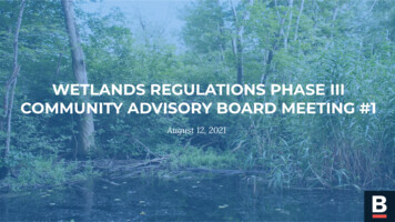
WETLANDS REGULATIONS PHASE IIICOMMUNITY ADVISORY BOARD MEETING #1August 12, 2021
AGENDA Introductions Commitments, Norms, and Goals Wetlands Protection Ordinance 101 Outreach Discussion Next Steps
COMMUNITY ADVISORY BOARD MEETING #1INTRODUCTIONS
CITY STAFFReverend MariamaWhite-HammondAlison BriziusNick MorenoKate OetheimerCatherine (Cat)McCandlessChief of Environment,Energy, & Open SpaceCommissioner,EnvironmentDepartmentExecutive Director,Boston ConservationCommissionConservationAssistantClimate Change &Environmental PlanningProject Manager
CONSULTING TEAMLEGAL EXPERTISEGIS MAPPING &TECHNICAL EXPERTISEOUTREACH &ENGAGEMENT
LET’S GET TO KNOW EACH OTHER! Name Pronouns Neighborhood Occupation and community involvement What is your favorite urban wild or park in Boston? What motivated you to participate in this CAB? Why is this topic important to you?
COMMUNITY ADVISORY BOARD MEETING #1COMMITMENTS, NORMS, AND GOALS
OUR COMMITMENTAs facilitators of the project and the CABmeetings, the Conservation Commissionand the project team are committed tocreating a safe, transparent, and inclusivespace for CAB members to guide thisprocess and inform the content of thefinal climate resilience and environmentaljustice regulations and guidelines.We will strive to set clear expectations,schedule meetings with advanced notice,use accessible language, andserve as a resource to you and theBoston community at large.
COMMUNITY NORMS1.Assume good intent of your fellow CAB members. If a harmful comment is made, this is space where youcan respectfully let that person know so we can all learn and move forward together.2.Your time is valuable. We will always start and end on time.3.Stay engaged throughout the meeting. In a virtual environment, this means keeping your video on,practicing active listening, and not multitasking.4.Step up (if you're shy) and step back (if you're speaking a lot).5.If you don’t understand something, ask for clarification. We are all learning together and there is no suchthing as a dumb question in this space.6.Foster transparency while respecting privacy. Any information shared outside of the space will be clearlystated and agreed upon by all members of the CAB. Any information shared within this space should alwaysbe done with that individual's consent.Do these norms resonate with you? Are there others that we should add?
PROJECT GOALDraft regulations, guidelines, andperformance standards for the CoastalFlood Resilience Zone, Inland FloodResilience Zone, Extended RiverfrontArea, and climate equity andenvironmental justice, with clear stepsfor implementation.
OUR GOALS FOR THE CAB Engage representatives of a cross-section of Boston, both geographically and demographically, in thepublic rulemaking process; Determine what people most care about in relation to wetlands and climate resiliency, and how thisvaries across neighborhoods; Evaluate what kind of public outreach works well, and how this varies across neighborhoods; Seek feedback from the CAB on drafts of the regulations and guidelines and any associatedmaterials; and Seek feedback from the CAB on the accessibility of the public process and how the City can betterengage with its constituents regarding wetlands protection and regulations.
COMMUNITY ADVISORY BOARD MEETING #1WETLANDS PROTECTION 101
WETLANDS 101Wetlands are land areas that containsurface water all or part of the time, aswell as adjacent upland areas (bufferzones).Legally the term includes not onlyareas we typically think of as wetlands,such as Belle Isle Marsh or the CharlesRiver, but also intermittent streams,floodplains, and other areas that may bedry for a significant portion of the year.A buffer zone is the area of land within100 feet of a wetland. Work in a bufferzone could have an impact on thenearby wetland, depending on the typeand location of the work.More than half of the US’ original wetlandacreage has been lost to agricultural,commercial, and residential development.In their natural state, wetlands providemany ecosystem services, such as: Protection of the public water supply,Protection of groundwater,Prevention of pollution,Flood control,Prevention of storm damage,Protection of fisheries & landcontaining shellfish, andProtection of wildlife habitat.
THE MA WETLANDS PROTECTION ACTThe Massachusetts Wetlands ProtectionAct (General Laws Chapter 131, §40)protects wetlands, floodplains,riverfront areas, and other areas fromalteration.Under the Act no one may “remove, fill,dredge, or alter” any wetland, floodplain,bank, land under a water body, landwithin 100 feet of a wetland, or landwithin 25 feet of a perennial stream orriver, without a permit (known as anOrder of Conditions) from theConservation Commission.In its review of an activity, the Commissionis tasked with ensuring that the proposedactivity will not impact the “interests” ofthe Act.Under the City’s Home Rule authority, theCity can supplement the jurisdiction,authority, and procedures of theConservation Commission, and to protectadditional resource areas, for additionalvalues, with additional standards andprocedures stricter than those of the Act.
THE ORDINANCEUnder the Ordinance, the Commissionmay establish stricter standards andprotect additional wetland resourceareas than under existing state law.Specifically, it extends protection toisolated vegetated wetlands, vernalpools and vernal pool habitat.The ordinance also allows theCommission to develop standards forprojects in the floodplain to ensurefuture residents are protected fromflooding.Climate change is also a major piece of theOrdinance. The Ordinance allows for: Creation of Flood Resilience Zones; Development of climate resilienceregulations; Extension of the Riverfront Area; and Development of environmentaljustice regulations and guidelines.It is important to remember that the Act &Regulations are the baseline and that theperformance standards must conformwith language in Boston WetlandsOrdinance.
PICTURE TIMELand Subject to Coastal StormFlowage (100-year floodplain)Isolated Vegetated Wetlandin RoslindaleVernal Poolin Allandale Woods
THE RESOURCE AREA VALUESSimilar to the “interests” of the Act, the Ordinance establishes a list of resource area values: protection of the public or private water supply and quality; protection of the public and private groundwater supply and quality; short term and long term coastal and stormwater flood control, erosion and sedimentationcontrol; storm damage prevention, including coastal storm flowage; protection of surface water supply and quality, including water pollution control; flood conveyance and storage; protection of fisheries, land containing shellfish, wildlife habitat, rare and endangered plantand animal species and habitat, wetland plant habitat, and recreation; to protect the health, safety, and welfare of the public; and to mitigate impacts from climate change.
THE PHASED APPROACH TO REGULATIONSPHASE IPHASE IIADMINISTRATIVE &PROCEDURALDevelop administrative andprocedural regulations to: Clarify the application andhearing process;Establish additional filingrequirements and fees; andCodify requirementsestablished by the Ordinance.PERFORMANCESTANDARDSDevelop performance standards for: Isolated Vegetated Wetlands(IVW); Vernal Pools and Vernal PoolHabitat; and Land Subject to Coastal StormFlowage (LSCSF).PHASE IIICLIMATE RESILIENCE &ENVIRONMENTAL JUSTICEDevelop regulations and guidelines for: Climate resilience; Coastal Flood Resilience Zone(CFRZ); Inland Flood Resilience Zone(IFRZ); Extended Riverfront Area; Climate Equity & EnvironmentalJustice.
TIMELINE TO DATEDECEMBER 2019Ordinance passed by City Counciland signed by the MayorMAY 2021The Phase II Regulations areintroduced to the CommissionAUGUST 2020The Commission approvedthe Phase I RegulationsAUGUST 2021Formation of the CAB forthe Phase III Regulations
THE REGULATION ADOPTION PROCESSTECHNICAL CONSULTANTSCOMMUNITY ADVISORYBOARDDRAFT REGULATIONSINTRODUCED TOCOMMISSIONOFFICIAL COMMENTPERIODCOMMISSION MAY REQUESTREVISIONSREGULATIONS VOTED ONBY COMMISSIONALL COMMUNITY MEMBERS
“The Applicant shall, to the extent applicableas determined by the Commission, integrateclimate change and adaptation planningconsiderations into their project to promoteclimate resilience to protect and promoteResource Area Values and functions into thefuture.These considerations include but are notlimited to: sea level rise, increased heatwaves, extreme precipitation events,stormwater runoff, changing precipitationpatterns and changes in coastal andstormwater flooding.”
COASTAL FLOOD RESILIENCE ZONE (CFRZ)The Coastal Flood Resilience Zone (CFRZ) is defined in the Ordinance as:“The area of land beyond the current boundary of land subject to coastal storm flowage or landsubject to tidal action that the Commission determines has a reasonable probability ofbecoming subject to coastal storm flowage or tidal action due to sea level rise (SLR) withinapproximately the next 50 years. The ‘coastal flood resilience zone,’ as delineated on mapsadopted by the Commission, may be periodically reviewed and revised by the Commission and maybe divided into sub-zones with different regulatory requirements.”Questions being asked: What is the extent of flooding based on the current projections in 2030, 2050, and 2070? How should these areas be regulated and to what degree? When should regulation of these areas begin?
INLAND FLOOD RESILIENCE ZONE (IFRZ)The Inland Flood Resilience Zone (IFRZ) is defined in the Ordinance as:“The area of land beyond the current boundary of land subject to flooding that the Commissiondetermines has a reasonable probability of flooding as the strength, duration or frequency ofprecipitation events increase within approximately the next 50 years. The “inland floodresilience zone” as delineated on maps adopted by the Commission may be reviewed and revisedby the Commission as more accurate information and precipitation projections become available.”Questions being asked: What is the extent of flooding based on the current projections and storm scenarios? How should these areas be regulated and to what degree? When should regulation of these areas begin?
EXTENDED RIVERFRONT AREAThe Riverfront Area in Boston is defined in the Ordinance as:“The area of land between the mean annual high water line and a parallel line measuredtwenty-five (25) feet horizontally landward of the mean annual high water line of any river,stream, brook, or creek, except for areas the Commission may designate as Extended RiverfrontAreas, in which the Riverfront Area may be extended up to two hundred (200) feet.”Questions being asked: Where are all of the city’s perennial and intermittent streams? What are the land uses 50, 100, 150, and 200 feet from the stream? Where does it make sense to extend the Riverfront Area?
“The Commission may issue regulations andguidelines addressing climate equity andenvironmental justice for inclusion within theClimate Change Resilience planningconsiderations, consistent with the intent andprovisions of this Ordinance.The Commission shall issue regulations andguidelines only after public notice, publichearing and direct engagement with residentsand neighborhoods that may be adverselyaffected by disparate impacts ofclimate change.”
CLIMATE RESILIENCEThe City is preparing for: 9 inches of Sea Level Rise (SLR) by 2030; 21 inches of SLR by 2050; and 40 inches of by 2070.Existing documentation provides a framework for the City’s interest in regulating proposedprojects subject to future flood risk (specifically the 1% annual chance flood risk in the year 2070with 40” of sea level rise) within “the next, roughly, fifty years,” as referenced in the Ordinance.In addition to SLR, the Ordinance also requires a consideration of: Extreme heat; The timing, frequency, intensity, and amount of precipitation; Storm surges; Increased intensity or frequency of storm events or extreme weather events; and Frequency, intensity, and duration of droughts.
CLIMATE EQUITY & ENVIRONMENTAL JUSTICEClimate equity and environmental justice is a common theme throughout the Ordinance. Thescope for this project is intended to include: Developing guidelines and regulations that promote climate equity and environmental justiceas they relate to proposed projects; and Incorporating environmental justice in the development of the regulations through publicengagement and outreach in partnership with the City and CAB.Environmental justice includes both substantive and procedural considerations. Theproject team has reviewed existing materials that contain: Substantive strategies; Stakeholder engagement anecdotes; and Considerations meant to promote environmental justice and protect communities that aredisproportionately impacted as a result of extreme weather events and other impacts ofclimate change.
WETLANDS PROTECTION 101 - Q&AQUESTIONS? LET’S DISCUSS!
COMMUNITY ADVISORY BOARD MEETING #1OUTREACH DISCUSSION
OUTREACH GOALSEDUCATIONTo convey projectedfuture flood riskanalysis information,environmental justiceissues, and theimportance of wetlandsto empowercommunity membersto generate ideasVISIONINGTo facilitate visioningabout what thecommunity wants tosee incorporated intothe regulations andguidelines to expandthe Commission’sability to protectwetlandsPRIORITIZATIONTo understand thecommunity’sprioritization of thecore values that willapply to the ClimateResilience andEnvironmental JusticeRegulations andGuidelines
DISCUSSION QUESTIONS What does your community care about in the context of wetlands? What is your personal community connector superpower? For example: I love to meet new people; I’m good at organizing events; I have a strong social mediapresence; I have a large network; etc. As a representative of your community, what kind of outreach works and does not work? What resources do you need from us to be equipped to conduct engagement in yourcommunity?
JOIN EASYRETROFROM YOUR COMPUTER:https://tinyurl.com/WPO3CAB1Link will be shared in the chat!FROM YOUR MOBILE DEVICE:1.Open your phone’s camera;2.Hover your camera over the QR code;3.Select a question;4.Click the sign5.Type your response!NEED ANOTHER OPTION?Type in the chat or unmute yourself and we will add your response to EasyRetro for you!
COMMUNITY ADVISORY BOARD MEETING #1NEXT STEPS
NEXT STEPS CAB MEETING #1 Post-Meeting Survey https://forms.gle/WXCzfYAA1KHR2PXH9 CAB MEETING #2 To be scheduled in September During the second CAB meeting, we will discuss environmental justice as it relates tothe Wetlands Protection Ordinance and review draft outreach materials prepared bythe Project Team. City and Consultant Team next steps CAB next steps and information sharing Any final thoughts or questions?
THANK YOU!
COMMUNITY ADVISORY BOARD MEETING #1 August 12, 2021. AGENDA Introductions Commitments, Norms, and Goals Wetlands Protection Ordinance 101 Outreach Discussion . The Riverfront Area in Boston is defined in the Ordinance as: "The area of land between the mean annual high water line and a parallel line measured twenty-five (25) feet .