Transcription
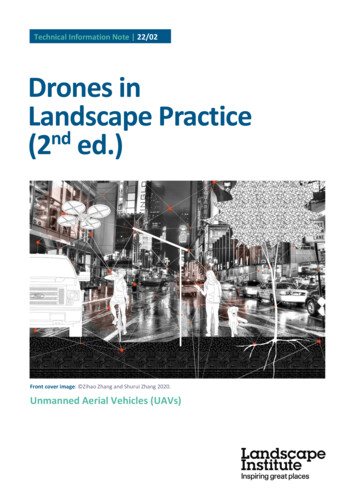
Technical Information Note 22/02Drones inLandscape Practicend(2 ed.)Front cover image: Zihao Zhang and Shurui Zhang 2020.Unmanned Aerial Vehicles (UAVs)
rd1Drone terms and categories22.1Purpose22.2Terms22.3Categories of operation32.4Sources of information4Drone uses, requirements and operations83.1Drone uses83.2Drone requirements93.3Operation principles113.4Case study one113.5Drone photogrammetry123.6Case study two143.7Drone Artificial Intelligence (AI) and Machine Learning (ML)153.8Future of drones16Further readingDRONES IN LANDSCAPE PRACTICE (2ND EDITION)18
1 Foreword1.1 AcknowledgementsEdition 1 (2017) authored by:The Landscape InstituteCurrent (2nd) edition (2022) authored by:Dr Paul Cureton – University of LancasterMike Shilton – Transoft Solutions UK, for the Landscape InstituteProf. Dr. Olaf Schroth – Geodesign and Landscape Informatics, Hochschule Weihenstephan-TriesdorfLaura Glover – CopyeditorThis Technical Information Note has been prepared on behalf of the Landscape Institute by a workinggroup comprising the following members:Dr Paul Cureton, University of LancasterThe consultation process on this document included inviting comments from the wider LI membership,in particular:The Association of Remotely Piloted Aircraft Systems UK (ARPAS-UK)LI Technical Committee and LI Digital Practice GroupLI Members subscribed to the Visualisation discussion group on Talking Landscape (now replaced by LIConnect)1.2 ForewordThis document covers drone operations and their uses for deployment in UK airspace. Although somedetail is included for cautionary reasons, this document is not guidance and the information provided isaccurate as of the time of publication. Please note that regulations are regularly updated. Please refer toTable 1 for the latest information, updates and legislative amendments.The authors and the Landscape Institute make no representations, warranties or guarantees, whetherexpress or implied, regarding the content of this Technical Information Note, including but not limitedto, that it is accurate, complete or up to date. Published by the Landscape Institute.Edition 1: March 2017 COPYRIGHT 2017 The Landscape Institute and the Authors named above.Edition 2: March 2022 COPYRIGHT 2022 The Landscape Institute and the Authors named above.Front cover image: Zihao Zhang and Shurui Zhang 2020. It is produced for Zhang, Zihao, and ShuruiZhang. 2020. ‘The Cybernetic Environment as a New Frontier.’ Lunch Journal 14: 149.DRONES IN LANDSCAPE PRACTICE (2ND EDITION)1
2 Drone terms and categories2.1 PurposeDrones or Unmanned Aerial Vehicles (UAVs) can be deployed and controlled by a variety of systems,with direct application to landscape and urban landscape practice and planning. Drones provide newsurvey possibilities and operate in a ‘hover space’ between human scales of landscape observation andlow-flying light aircraft, usually between 10m–120m. Drones can therefore provide ‘near range’ visualinformation amongst other sensory data sets. They represent a powerful, cost-efficient design tool forsites, and client and public consultation, by providing new perspectives on the spatial layout, landscapeand urban landscape conditions, as well as data capture.(UAVs) are just one example of newlandscape sensing technologies thatrecent design scholarship has identified aspotentially transformative of landscaperepresentation, modelling and designtechniques.Brett Milligan, University of California2.2 Terms‘Drones’ is a universal generic term for a fixed wing or multi-rotor vehicle. Standard terms are: Remote Piloted Aircraft Systems (RPAS) (preferred term by drone pilots)Unmanned Aerial Vehicles (UAVs) (preferred term by drone pilots)Small Unmanned Aerial System (SUAS)Small Unmanned Aircraft (SUA) (UK legal term)Unmanned Aircraft Systems (UAS) (entirety of a system and preferred term the CAA) andUnmanned Aircraft (UA).These terms refer to aerial vehicles operating with various degrees of autonomy. The operation of thesevehicles requires the pilot to understand the flight system, which varies in complexity. Most civilian andconsumer drones refer to four rotor blade drones and a camera. They are technically known as remotecontrolled rotary gyroscopically stabilised quadcopters, which have gimbals that provide a stableplatform for a high definition (HD) camera or sensor. Commercial drones navigate, position plot andreturn home using global navigation satellite systems (GNSS) and global positioning systems (GPS). Theremote controller, or transmitter, is called a ground control station (GCS). GCS can be complex systems,sophisticated pieces of software/hardware that communicate with the UAV via a transmitter. ModernGCSs display real-time data on the UAVs performance and position and can serve as a ‘virtual cockpit’.The different types of UAV include: Multi-rotary vehicles that have between 4–8 rotors, quadcopter, hexacopter and octacopter.Fixed wing drones that can carry heavier payloads but are not able to hover in fixed positions.Fixed wing craft require runways or take off strips and can travel for longer distances, travel athigher speeds and survey greater distances /- 1km².DRONES IN LANDSCAPE PRACTICE (2ND EDITION)2
Hybrid models called tilt wing craft or vertical take-off and landing (VTOL) which trade off thetwo benefits of faster speeds/distances and maintaining fixed stable positions.Kite Aerial Photography (KP), tethered drones and dirigibles, or airships, that can also be used tosurvey landscapes and urban environments.The public typically relates to aerial vehicles as drones, UK legislation refers to SUAs and trainingorganisations use the term UAVs and RPAS. The Civil Aviation Authority (CAA) use the term UAS andpilots are called operators. The CAA has produced a master glossary of definitions and abbreviations forreference.The primary guidance for the operation of unmanned aircraft systems within the UK is CAP 722:Unmanned Aircraft System Operations in UK Airspace, by the CAA.2.3 Categories of operationThe Air Navigation Order 2016 (ANO) is a legal statutory instrument which covers civil aviation in the UKand governs the legal requirements of drone flights. There are three categories of regulation for theoperation of unmanned aerial vehicles in the UK; Open, Specific and the Certified category.Open categoryIn the UK, you must register with the CAA before flying most drones or model aircraft outdoors. Thisinvolves a theory test for a flyer ID, and individuals and organisations must register any drone or modelaircraft for an operator ID. For commercial operations, third-party insurance must be in place inaccordance with EC Regulation 785/2004 (Insurance requirements for air carriers and aircraftoperators). These general requirements are set up for drone use and are known as Open categoryoperations. This category is split into three areas as follows: A1 drones weighing less than 250g can be flown over people, but not crowds, for a short time –but not intentionally.A2 drones must maintain a 30m degree of separation from people, the operator must pass theCAA theory exam and have gained general practical experience. The training course is calledCertificate of Competency (A2 CofC) and is valid for five years before renewal.A3 drones must stay at least 50m horizontally away from people and 150m meters horizontallyaway from parks, industrial and built-up areas.CAA permission is now required for commercial drone work and commercial drone operations need tobe conducted in what the CAA call a Specific category that requires permission.Specific categorySpecific category operations require authorisation by the CAA and appropriate risk assessments, forexample, for flying over an urban area. The Permission for Commercial Operation (PfCO) has beenreplaced by the Specific category as of 31 December 2020. The General Visual Line of Sight Certificate(GVC), introduced on 1 January 2021, allows operation in the Specific category to fly drones up to 25kg.GVC-approved remote pilot assessment organisations, or recognised assessment entities (RAE), can beviewed on the CAA website. Additional permissions may be required. For example, aerial filming inLondon is subject to several permissions. These permissions could include NATS/local air traffic controlservices (ATC), the Port of London Authority (PLA), Metropolitan Police, Protection Command (formerlyDiplomatic Protection unit). In all cases, landowners’ permission(s) must be obtained, as well as a GVCand third-party insurance. Insurance must be EC Regulation 785/2004 compliant. The insurance must bein the name of the applicant, not just the name of the pilot (unless the pilot is the applicant), or thetrading name. For example, for companies, the insurance must include the full name of the companyincluding Ltd/Limited/PLC as appropriate.Certified categoryThe Certified category is a new area in development by the CAA which will have the equivalentregulations of manned aviation. Whichever the category of operation, operating safely is the primarybasis. Additional weight restrictions apply for operating drones over 25kg and these are set out in CAP722, Annex B.DRONES IN LANDSCAPE PRACTICE (2ND EDITION)3
Public perceptionsThere are public perception issues with drone safety and operations, and this can disrupt fieldwork orgenerate misunderstandings with clients. The CAA conducted a risk assessment on these issues in 2018(CAP 1627). For client liaison regarding drone operations, NESTA Flying High: The future of dronetechnology in UK Cities has several executive summaries and blog entries regarding future directionsand public perceptions. The Institution of Mechanical Engineers (IMechE) has also conducted publicdrone perception surveys.PrivacyThe Information Commissioner’s Office (ICO) recommends responsible operation and the respect ofprivacy of others. The form of imagery and data acquired can be an important consideration infieldwork.2.4 Sources of informationThe following list is not exhaustive, but links to the major regulatory and professional bodies relevant todrone applications and operations (see Table 1).Table 1: Sources of informationBody ororganisationWebsiteDescription andremitCAARemotely piloted aircraft and drones Civil AviationAuthority (caa.co.uk)As the UK'saviation regulator,CAA ensure thatthe aviationindustry meets thehighest safetystandards, thatconsumers havechoice, value formoney and areprotected andtreated fairly whenthey fly, throughefficient use ofairspace.NATShttps://www.nats.aero/National Air TrafficService (NATS)provides air trafficnavigation servicesto aircraft flyingthrough UKcontrolled airspaceand at numerousUK .uk/The Association ofRemotely PilotedDRONES IN LANDSCAPE PRACTICE (2ND EDITION)4
Aircraft SystemsUK (ARPAS-UK) isthe only industrytrade associationand professionalbody focused onthe UK dronecommunity.EASAhttps://www.easa.europa.eu/The EuropeanUnion AviationSafety Agency(EASA) is thecentrepiece of theEuropean Union'sstrategy foraviation safety. Itsmission is topromote thehighest commonstandards of safetyand environmentalprotection in civilaviation.BMFAhttps://bmfa.org/The British ModelFlying Association(BMFA) is theNational GoverningBody for the sportof model flying. Itsaims are topromote, protect,organise andencourage modelflying within theUK.FPV UKhttps://fpvuk.org/FPV UK is the UKassociation forradio controlmodel and droneflying.IMechEhttps://www.imeche.org/The Institution ofMechanicalEngineers (IMechE)is a globalcommunity ofmechanicalengineersrepresented inover 140 countries.The Institution isthe largestDRONES IN LANDSCAPE PRACTICE (2ND EDITION)5
network ofmechanicalengineeringknowledge, skilland opportunity inthe world.RTPIRTPI Planning Enforcement Handbook for EnglandThe Royal TownPlanning Institute(RTPI) publish thePlanningEnforcementHandbook forEngland. Section1.3 is on use ofdrone surveillancefor /The RoyalAeronauticalSociety (RAS) is theworld’s onlyprofessional bodydedicated to theaerospacecommunity. Theywork to further theadvancement ofaeronautical art,science andengineeringaround the istoric Englanduses airborneremote sensingmethods toidentify, record,illustrate andmonitor thecondition of a widevariety of heritageassets.The archaeologicaluse of aerialphotographytransforms ourknowledge ofarchaeologicallandscapes.DRONES IN LANDSCAPE PRACTICE (2ND EDITION)6
/DRONES IN LANDSCAPE PRACTICE (2ND EDITION)The RoyalInstitution ofCharteredSurveyors (RICS)recently publisheda global guidancenote on Earthobservation andaerial surveys (6thedition). Theguidance note isintended for use byland, sea,engineering andenvironmentalprofessionals whoare acting in anadvisory capacity,by surveyknowledgeableclients who specifytheir own surveysand by earthobservation andaerial surveyspecialists.7
3 Drone uses, requirements andoperations3.1 Drone usesDrones may be used at remote locations for a range of applications, such as: to survey sitesto monitor construction phasesfor inspection and maintenance andfor vegetation monitoring.Drones have an important role in heritage gardens and historic landscapes. They may also have a valuefor rapid survey of phenomena such as flooding or infrastructure inspection. The various areas of use ofdrones are a testimony to its industry growth. Drones are used to map areas to create a series of stillorthographic images (see Figure 1) which are then processed post-flight and stitched together, detectingidentical points, to create a 3D point cloud from which orthomosaics, are taken. Orthomosaics aremosaics of multiple aerial images that together form a dataset. This data can be used in buildinginformation modelling (BIM) workflows and can be used as a basis for cut and fill calculations andgrading, amongst many other computational processes (Cureton, 2020). Drones may also be used togain an aerial perspective of a site for a client, to make a documentary video of the area or to providepreliminary information for a design brief.Figure 1. Alex Gwilliam, videographer, Bottoms Reservoir constructed by John FrederickBateman 1865–1877, Longdendale Chain, North DerbyshireImage courtesy of Alex Gwilliam, 2021DRONES IN LANDSCAPE PRACTICE (2ND EDITION)8
3.2 Drone requirementsA commercial drone pilot is expected to hold: flight planning materiallandowner’s permissionspilot logssite assessmentsaircraft records and maintenance logsinsurance.Drones in commercial civilian operations follow the guidance that they must always remain in view, orvisual line of site (VLOS), always maintain manual piloting capability in case of GPS signal loss and have aflight log and safety operations manual. The CAA has produced The Drone and Model Aircraft Code tosupport its legislation for the public and recreational flyers, including the below acrostic: Don’t fly near airports or airfieldsRemember to stay below 400ft (120m)Observe your drone at all times – stay 150ft (50m) away from people and propertyNever fly near aircraftEnjoy responsibly.Pilots should know about their unmanned system, as well as its full functionality. The pre-flight planningstage involves numerous processes, including: checking the unmanned system’s deployment is legal prior to operationconsulting aeronautical mapsengaging in inspection and safety checks of equipmentdesk-based site and risk assessment.The pilot should record the areas of operation and mitigate any risks. They should check the class ofairspace they operate in and gather permissions if necessary. They must also document localaerodromes and air spaces in case the vehicle suffers a loss of control. The distance considered isgenerally ten nautical miles from the area of operation.There are five classes of airspace in the UK which determine the flight rules: Controlled – A, C, D, E.Uncontrolled – G.Drones can fly in controlled airspace (class A, C, D, E), although notification to the air traffic control(ATC) unit is recommended. See NATS for definitions of airspace. Certain areas of UK airspace containdangerous areas, prohibited zones or are restricted areas. These may be areas where there areaerodromes, glider sites or high-intensity transmitters, or areas of military activity. Drones may alsohave in built software ‘geo-fences’ preventing the device from entering these airspaces.A Notice to Airmen (NOTAM) or Notice to Aviators is generally not required for VLOS operations due tothe small scale, duration and operating limitations of VLOS flights. The potential need for NOTAM actiondoes have to form part of the operator’s risk assessment process, particularly above 400ft (120m),outside of controlled airspace, or when several unmanned aircraft will be operating together or as aswarm.Drone flights require landowner permission where the drone takes off and lands. Councils, parishes andpark spaces may have bylaws for drone usage, and operators are expected to check these in pre-flightphases. National Trust and Crown Estates also have strict guidelines (mainly referring to therequirement of a fee for commercial aerial work). Other landowners, such as Network Rail, requirenotification to its air operations team (see Operating drones close to or over the railway).The process diagram below (Figure 2) describes the drone systems, payloads (the weight a drone cancarry), flights and CAA-specific category flights, drone derived data and indicative applications of dronesin landscape practice. There are many variations to the list depending on the site, client needs, technicalskills and digital workflows present within the company or organisation. This diagram is intended to beused as a visual prompt for practices to map against capabilities and scope of services.DRONES IN LANDSCAPE PRACTICE (2ND EDITION)9
Figure 2. Process diagramImage courtesy of Paul CuretonDRONES IN LANDSCAPE PRACTICE (2ND EDITION)10
3.3 Operation principlesA landscape practice may wish to have a pilot operator as a sub-contracted element of their workportfolio. This allows the pilot to receive commissioned work when both firms tendered on the sameproject. In this case, the arrangement would allow practices to maintain confidentiality and avoid aconflict of interest. This structure also follows best practice to Rule 10 of the Landscape Institute’s Codeof Practice (2021). The Association of Remotely Piloted Aircraft Systems UK (ARPAS-UK) has a list of itsmembers which have met specific category operations and are CAA approved.To operate in the Visual Line of Sight (VLOS), the pilot must maintain direct unaided visual contact tomonitor flight paths and avoid collisions. Operating a drone outside of the VLOS risks collision, as thepilot only has the mounted camera frontal view, and obstacle avoidance sensors will not necessarilydetect cables or small objects. Beyond the Visual Line of Sight (BVLOS) applications require additionalpermissions and, in 2021, CAA began piloting the concept in the UK.A drone pilot may require a spotter and may be required to access construction sites. A spotter can beused for extended VLOS, although they will need additional training and specific consent from the CAA.Site access should be accommodated in all pre-flight plans, pre-construction meetings and must complywith the latest Construction (Design and Management) (CDM) Regulations. The drone pilot’s siteassessment and risk assessment form (risk register) should be shared with the nominated principaldesigner, and/or principal contractor. A drone pilot, as part of a landscape practice, may also need to beaccounted for under Lone Worker legislation cited under the Health and Safety at Work Act 1974 andthe Management of Health and Safety at Work Regulations 1999 and policies of practice.Any accidents, crashes or injuries that occur must have Mandatory Occurrence Reports (MORs). This is asystem not for attributing liability, but for the reinforcement of safety of drone operations. An exampleof an MOR could be a bird strike, loss of control or structural damage. There is a legal duty to reportthese issues.3.4 Case study oneFigure 3. A drone captured aerial view revealing the setting and scale of 'Capability’ Brown’slandscape surrounding Berrington Hall, Herefordshire. The house was designed and built byBrown’s son-in-law, Henry Holland, between 1778–1781 for London banker Robert HarleyImage courtesy of National Trust/Mike Calnan (see www.topographica.co.uk).Drones are also useful for before and after comparisonsof major restorations or for recording seasonal changesDRONES IN LANDSCAPE PRACTICE (2ND EDITION)11
via time-lapse sequences, as well as repeatable fixedpoint photo monitoring of tree growth following majorstorms, or deer herd head counts in parkland.Mike Calnan, Historic Gardens Review, Issue 41, 2020.3.5 Drone photogrammetryThe National Trust, like many other conservation organisations, is adopting drone technology to help itbetter understand and manage properties in its care (see Figure 3). Applications have included 3Dmodels of built structure and archaeology to help plan conservation works. Drone 2D mapping has beenused to record change, such as inland flooding or coastal erosion, soil health and the spread of plantdisease. Occasionally, more detailed close-range drone-based LiDAR surveys have been justified forarchaeology and other purposes. The National Trust used drones extensively for its in-house createdphotographic and video contributions to the UK’s 2016 Capability Brown Tercentenary Festival. Thisgave a wider online audience the chance to see the full extent of his landscapes as Brown may haveenvisaged them (see one of a number of aerial videos and the National Trust’s, Capability BrownLandscape).Photogrammetry is the process of measuring, recording and interpreting photographs to create a spatialmodel, and this section introduces some of the principles and workflows of drone photogrammetry.Drone photogrammetry mapping is one the most common applications in landscape practice, second tomedia and site photography. However, the quality and accuracy of data is dependent on both thehardware being used and the expertise of pilots in their approaches and strategies to fieldwork. Forfurther information, refer to the RICS Earth observation and aerial surveys 6th edition global GuidanceNote.It is important in pre-flight planning and procurement of drone services to envisage the expectedoutcome, for example: are 2D maps required?are multiple flights across various seasons needed or is the site inaccessible apart from droneflight?what resolution would clients like the model to be?what is the spatial extent of the study? Typically, it is 10–100ha per survey (Duffy et al, 2020,p.14).A drone using a range of software can execute a waymarked path. Commonly, a drone flight can beautomated in a grid pattern to create a 2D georeferenced map. The drone flight will gather orthophotos,a hybrid between maps and aerial photographs. They have been corrected for geometrical distortionand have been registered and matched to a coordinate system. The images are combined, and anycolour differences are merged.Photogrammetry is a cost-effective way of gathering spatial data. Using a ground sampling distancecalculator will determine the altitude of the drone for survey and the required resolution. The closer tothe ground, the more pixels of the area e.g., 2cm/pixel. When mapping vegetation, an image resolutionhigher than 10cm/pixel follows best practice. The level of detail (LOD) is a subjective task, as clients maydemand a LOD higher than required, or the LOD may be insufficient for more detailed site design in laterphases. Some drones have Real-Time Kinematic (RTK) modules which can provide higher accuracyprecision mapping.High relative accuracy can be achievedwithout Ground Control PointsDRONES IN LANDSCAPE PRACTICE (2ND EDITION)12
(GCPs) by flying low with high overlap andstrong oblique coverage if necessary.Adam Carp, The Complete Guide to Professional Mapping with DroneDeploy, p.8.A 3D map will require multiple grid patterns overlaid, or an overlaid linear area or corridor. The dronecamera will need both nadir imagery, where the camera faces directly beneath the drone at the time ofthe exposure, and oblique imagery, where imagery is captured approximately at a 45-degree angle tothe ground surface. Oblique photography at lower altitudes will improve the quality of the model. Thefurther the images overlap, the further the quality of the final model to a point. Vegetation mappingrequires increased overlap. Images can have front or side overlap and are mosaiced or overlapped tocreate an orthomosaic map. Flight patterns may also need to be adjusted depending on elevation.Elevation shift can result in loss of quality, and it is important to maintain ground distance.Pilots might wish to consider temporal resolution, the time elapsed between each survey flight, whichcan cause issues in data. Multiple surveys, when combined for larger sites, may vary substantiallydepending on weather systems and site accessibility.Once drone images are gathered from a site, there is a phase of post-processing using structure frommotion (SfM), a photogrammetric range imaging technique for estimating 3D structures from 2D photos.Using various software platforms, this creates a 3D ‘reality’ environment mesh and point cloud. Examplefile formats include GeoTIFF, KML, STL, OBJ, DXF, FBX, SKP. Identical points between each image arefound, and these are called key points. The more overlaps in the photographs, the more 3D key pointscan be established. The flight pattern, some ground control points and the range of angles for imageryand whether they are oblique or plan will also influence the quality of the output.This process of SfM is called ‘reality capture’ and is geographically referenced. Geo-referenced modelscan be improved by using ground control points placed on site. However, certain shiny, reflective andtransparent surfaces can cause holes in the generated 3D mesh output and model which creates voids.This requires additional editing, modelling and correction. Dense tree canopies and homogenoussurfaces also cause considerable issues. Semantic segmentation algorithms are used to link each pixel inan image to a class label and, during processing, may remove people, cars and moving elements, thoughthis subject to various software capabilities.Common software platforms include: Esri Drone DeployPix4DContextCaptureGlobal MapperAgisoft Metashape andDJI Terra.This list is not exhaustive and there are a range of open-source and commercial software platforms thatcan integrate with geographic information systems (GIS) and parametric modelling programs.The range of outputs resulting from a drone survey include: a digital surface model (DSM)digital terrain model (DTM)contour linesclassified point cloudorthomosaiccontour point cloud3D meshvector orthermal map.DRONES IN LANDSCAPE PRACTICE (2ND EDITION)13
BIM workflowsOnce a site model has been processed, designers may use the photogrammetric model to ‘design in’ ormeasure and execute parametric volumes, shapes and components. Therefore, drone derived surveyscan be used in pre-construction site surveys and repeated as part of monitoring of construction phasesand ‘As Built’ construction documentation.3.6 Case study twoFigure 4. Construction Phase Aerials, 2017 (top) and 2020 (bottom), Barton Park, Development,Oxford, Tree FrontiersImage courtesy of @Tree FrontiersDRONES IN LANDSCAPE PRACTICE (2ND EDITION)14
Drones used on construction sites can provide a huge array of information, assisting everyone involvedin the project in monitoring progression as well as post-development marketing. Barton Park is adevelopment scheme on the outskirts of Oxford, providing 800 new homes with a mix of land uses.The use of drones was adopted early in the project to assist in the design and planning stages of thedevelopment. Once planning consent was obtained, the continued use of drones to capture aerialfootage allowed the project team to monitor all stages (see Figure 4).Still images assisted in monitoring healthand safety compliance on site.Nick Bolton, Case Interview, 2021.As Nick Bolton explains, the use of images assisted in monitoring health and safety compliance on site.By using drones, the client team could understand the progression of construction without the need formultiple site visits. The local authority team used the images provided to ensure compliance withplanning conditions and, as the project progressed, changes in the land use and the translation fromvision to reality became clear.3.7 Drone Artificial Intelligence (AI) and Machine Learning (ML)Drone AI is an emerging area in academic research, but with increasing commercial applicationsintegrated within various software platforms, or as stand-alone services. Drone AI operates on-demandduring flight and in cloud-based systems. The range of AI is highly diverse. Computer vision and machinelearning can be used to analyse crowds in parks, for person or animal detection, for object and streetfurniture identification and for defect detection e.g., dieback in forests due to drought or viral infection.Computer vision is a field of AI for the high-level understanding of digital media for automation. Dronecomputer vision is AI autonomous navigation and flight through an environment, as well as hazarddetection. Machine learning are algorithms that classify, cluster, train and count to mimic humanintelligence. For example, in the Picterra project (see Fig
3.7 Drone Artificial Intelligence (AI) and Machine Learning (ML) 15 3.8 Future of drones 16 4 Further reading 18. DRONES IN LANDSCAPE PRACTICE (2ND EDITION) 1 1 Foreword . The General Visual Line of Sight Certificate (GVC), introduced on 1 January 2021, allows operation in the Specific category to fly drones up to 25kg. .