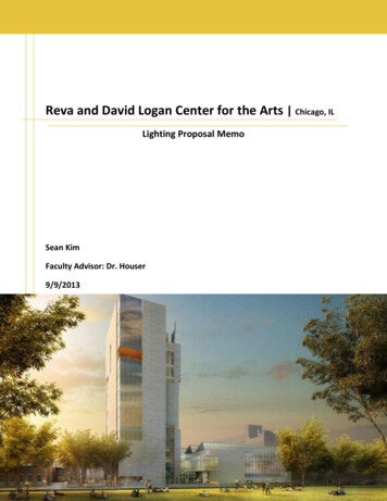
Transcription
7761 W RIVERSIDE DRIVE, SUITE 201BOISE, ID 83714-5044T. 208.898.0012 F. 208.947.1655www.parametrix.comMEMORANDUMDate:March 12, 2012To:Caleb Hood, Project ManagerFrom:Kristen McCoySubject:Existing Studies Reviewcc:Susan GrahamProject Number:314-2554-036Project Name:South Meridian Future Land Use Map UpdateThe City of Meridian is considering the best long term solution for the South Meridian area. The project area isapproximately nine square miles, between I-84 and Lake Hazel Road and McDermott to roughly Linder Road(Figure 1). The properties in this area are currently included in Meridian’s Area of City Impact, but mostproperties have the land use designation of a “Future Planning and Referral Area.” To prepare for futuredevelopment and annexation into the City, a comprehensive plan future land use amendment is being investigatedwith City land use designations.Prior to developing the vision and goals for South Meridian, it is important to understand current conditions in thearea, including existing land use policies, plans, development commitments, environmental constraints, propertyand land ownership, and infrastructure opportunities and constraints. This memo summarizes the applicableobservations, opportunities, and constraints obtained through reviewing the following documents: Airport/Overland Road Corridor StudyTen Mile Road Corridor StudySouth Meridian PlanSouth Meridian Transportation PlanACHD Countywide Roundabout StudyAda County Zoning MapCanyon County Zoning MapMeridian Comprehensive PlanNampa Comprehensive PlanKuna Comprehensive PlanMeridian Water & Sewer Master Plans (**see separate memo for more detail on infrastructure**)ACHD Draft Capital Improvement PlanACHD Draft “B” Five Year Work PlanValley Regional Transit – Valley Connect Plan2035 Communities in MotionACHD Bicycle Master PlanMeridian Pathways Master PlanACHD Pedestrian/Bike Transition PlanACHD Livable Street Design Guidelines
March 12, 2012Page 2 of 7LAND USEThe South Meridian Planning Area is located in unincorporated Ada County, within the City of Meridian’s Areaof Impact. The area borders unincorporated Canyon County to the west, City of Kuna to the south, and existingCity of Meridian limits to the north and east. The 2009 City’s Future Land Map designates adjacent land uses aslow and medium density residential to the east and mixed employment and commercial near Ten Mile Road andI-84. The Ten Mile Interchange Specific Area Plan (adopted in 2007), identified land use recommendations fornearly 2,400 acres to the north and west of the South Meridian planning area. Of this acreage, just over 300 acresare designated for mixed use commercial, residential and lifestyle center, and more than 900 acres ofemployment, including industrial uses. Rounding out the area is 800 acres of residential with the remaining inparks, open space, and right of way.Current Ada County zoning in the Planning Area is primarily Rural Urban Transition (RUT), which, per CountyCode: Provides standards and regulations for the development of property within areas of city impact, consistentwith the goals and policies of the applicable city comprehensive plan;Allows agriculture and rural residential uses to continue within areas of city impact until urban publicfacilities are extended;Provides design standards that shall permit redevelopment of property to higher densities when urbanpublic facilities are extended; andLimits new agricultural uses within the areas of city impact to those that shall not significantly impactnearby urbanizing areas with noise, odor, dust, or other nuisances normally related to more intensive farmuses, such as livestock confinement facilities with three hundred one (301) or more animal units. Thisarticle, however, shall in no way preclude the continued use of properties within these areas foragriculture.A few areas at the north end of the Planning Area, near I-84, are zoned R-1, which allows for one dwelling unitper acre.West of the Planning Area is unincorporated Canyon County, and within the City of Nampa’s Area of Impact.Current Canyon County Zoning west of McDermott is zoned rural residential. The City of Nampa’sComprehensive Plan designations for that area include agricultural between I-84 and Stamm, residential betweenStamm and Powerline, and agricultural south of Powerline. The Comprehensive Plan also identifies a future IdahoPower substation at the corner of McDermott and Victory.The city of Kuna recently annexed over 230 acres north of Lake Hazel Road, between Linder and Ten MileRoads. The current City of Kuna Comprehensive Plan identifies the area between Lake Hazel and Amity Roads,within the entire South Meridian Planning Area, as Kuna’s “planning” area (different from the Area of Impact)with a rural residential land use designation. The area south of Lake Hazel includes agricultural and low densityland uses.Development CommitmentsThere are currently two preliminary plats within the study area. One, located at the southwest corner of Amity &Linder, is a 19.5 acre site submitted in 2011 for Bridgepoint Church. The other, located northwest of the Ten Mileand Overland intersection is a 6.8 acre site submitted in 2011 for two residential lots under the name “Barletta”Subdivision. There are also a handful of existing, developed subdivisions within the planning area (Figure 2).Property and Land OwnershipThere are currently approximately 730 parcels within the project area. Meridian School District owns a 66 acreparcel at the northeast corner of Amity and Ten Mile Road. There are no other publicly-owned lands within thestudy area at this time (i.e. parks, emergency services, etc.).
March 12, 2012Page 3 of 7TRANSPORTATIONThe primary roadways within the Planning Area are vital to the connectivity of not only the Planning Area, butalso the region. Because the Planning Area is centrally located, between Nampa, Kuna, Meridian, and Boise, anefficient and planned roadway system is necessary to bring homes and businesses to the area.The current ACHD Master Street Map classifies Black Cat, Linder, Victory, Amity, and Ten Mile as residentialarterials. Lake Hazel is classified as a residential mobility arterial and McDermott is a mobilityarterial. COMPASS’ 2035 Function Classification classifies Ten Mile, Amity, and Lake Hazel as principalarterials, Victory, Black Cat and Linder as minor arterials, and McDermott as an expressway. North of thePlanning Area (I-84), SH-16 will be extended as an expressway connecting I-84 to SH 44, in the general vicinityof McDermott Road. Design for the first segment of the SH-16 expressway, from SH 44 to US 20/26 is currentlyunderway with construction likely in the next few years. Completing the design and construction for theexpressway to I-84 is not likely within the next 20 years. Plans to continue the expressway south of I-84 have notbeen finalized, nor funded. However, it is likely that at some point in the long-term future, the SH-16 expresswaywill continue south through the South Meridian Planning Area, near the existing McDermott Road alignment.In addition, a future east-west corridor (Airport/Overland Road) is planned between Ten Mile and GarrityBoulevard in the City of Nampa. This corridor, planned to be 3-4 lanes is anticipated to accommodate up to28,000 vehicles per day by the year 2035.COMPASS’ 2035 Communities in Motion (CIM) is the regional long-range transportation plan for Ada andCanyon Counties. The plan describes each corridor within the region, its importance to, characteristics,recommended improvements, opportunities, past, current, or programmed improvements, as well as desiredimprovements to meet the anticipated demand of the community. The list below summarizes COMPASS’description of each corridor within the Planning Area.Ten Mile Road: Purpose/Function- Provides north-south mobility in Meridian and a connection to Kuna. Planned to be aprimary north-south corridor into the future. Links high-growth areas of Meridian & Kuna. Improvements- CIM identified Ten Mile Road from Lake Hazel to Chinden as a funded project, wideningfrom 2 to 5 lanes. It also identified widening south of Lake Hazel, to Kuna, as a recommended, unfundedimprovement.Black Cat Road: Purpose/Function- Serves as a minor north-south arterial between McDermott Road and Ten Mile Road. Improvements- CIM did not identify any funded improvements for Black Cat through 2035. CIM identified awidening project as an unfunded improvement north of the Planning Area (north of I-84).McDermott Road: Purpose/Function- Provides vital north-south travel and access to Ada and Canyon Counties. With itsconnection to the proposed SH-16 extension, McDermott Road has potential as a future expressway; and isplanned as such between SH-44 and Kuna-Mora Road. Improvements- CIM identified funded investments which include improvements much farther north than thePlanning Area boundary. However, identified unfunded improvements include conducting a study for thecorridor as an expressway, establishing rights-of-way needs, developing an access management plan, andwidening from Lake Hazel to I-84 from 2 to 5 lanes, including a railroad overpass at Hubbard.
March 12, 2012Page 4 of 7Linder Road: Purpose/Function- Serves as a “reliever” for Ten Mile and Meridian Road.Improvements- CIM identified funded improvements which are located south of the Planning Area.Identified unfunded improvements include widening between Kuna-Mora and Ustick Road, including an I-84overpass.Lake Hazel Road Purpose/Function- Provides a southern route alternative to I-84 and a connection from unincorporated AdaCounty to Boise (Maple Grove), with plans to extend to Gowen Road. Improvements- CIM identified unfunded improvements from Happy Valley Road in Nampa to Locust Grovein Meridian, including a railroad overpass.Amity Avenue: Purpose/Function- Connects Nampa with Boise (south of I-84). Also provides an alternative route to I-84,between Garrity and Meridian interchanges. Improvements- CIM identified a funded investment project along Amity, widening Southside to Cloverdalefrom 2 to 5 lanes.In addition to the information COMPASS presents in CIM, ACHD also has programmed improvements toroadways within the Planning Area. In the Five Year Work Plan (Draft B), several projects were identified withinthe Planning Area, including: Ten Mile/Victory Interim Signal - Widen intersection to add left turn lanes on all approaches; install interimsignal Amity Road Bridge (1/2 mile east of McDermott) – Replace and widen to five lanes Amity Road Bridge (1/4 mile east of Ten Mile) – Replace and widen to five lanes Amity Road Bridge (700 feet east of McDermott) – Replace and widen to five lanes Ten Mile; Victory to Overland – Widen to five lanes with curb, gutter, and sidewalk Ten Mile/Amity intersection – Install interim signalACHD is currently conducting a county-wide roundabout study to identify the intersections where roundaboutsare feasible based on screening criteria. ACHD policy requires a roundabout to be considered for any intersectionidentified for improvement. This study will identify the roundabout locations to preserve adequate right-of-way.The outcomes of the study will be integrated into the Master Street Map to ensure appropriate right-of-waypreservation. Based on the work completed to-date, the following recommendations were made:IntersectionNoRoundaboutRecommendedMcDermott / Overland*Multi-LaneRoundaboutRecommended McDermott / VictoryMcDermott / AmitySingle-LaneRoundaboutRecommended McDermott / Lake Hazel* Black Cat / Overland* Black Cat / Lamont* Black Cat / Victory* Dual-LaneRoundaboutRecommended
March 12, 2012Page 5 of 7IntersectionNoRoundaboutRecommendedBlack Cat / undaboutRecommended Black Cat / Lake Hazel Ten Mile / Overland Ten Mile / Lamont* Ten Mile / Victory Ten Mile / AmityDual-LaneRoundaboutRecommended Ten Mile / Lake Hazel* Linder / Victory Linder / Amity Linder / Lake Hazel* * Intersections that need additional analysis to determine final configurationRoadway TypologiesACHD adopted the Livable Street Design Guide in 2009. The guide provides parameters for streets within AdaCounty. Each street typology outlines the context which the roadway is expected to be found, as well as thedesign details including cross section, travel and turn lane dimensions, bike lanes, sidewalks, landscape buffers,pedestrian zones, etc. Depending on the final, recommended land use scenario for South Meridian, andcorresponding traffic demand, the appropriate street typologies will be determined for each arterial roadwaywithin the study area. Determining the typologies now will help prepare for future right-of-way needs in thefuture.TransitValley Connect is a plan produced by Valley Regional Transit which establishes a vision of the comprehensivealternative transportation system needed, given the growth projections and regional and local road plans. In theSouth Meridian Planning Area, there are no existing transit services provided. However, corridors in the Areahave been identified as future routes including: Kuna-Meridian route, which includes a park & ride lot in Kuna and would provide secondary service (pickups approximately every 30-60 minutes all day, with frequent stops) between Kuna and MeridianOverland route, which would provide primary service (pick-ups approximately every 15-30 minutes duringthe peak hours, and 30-60 minutes mid-day with frequent stops between MeridianMicron Employer Express route, which would operate every 30 minutes during peak times between SouthMeridian and MicronBike & PedestrianThe ACHD Roadway to Bikeways Plan, adopted in 2009, was prepared to provide a vision, strategies and actionitems to improve conditions for bicycling in Ada County over the next fifty years. Specific to the South MeridianPlanning Area, no specific route improvements were recommended. However, the needs identified in the report,were based on 2009 figures. Based on the land use scenarios determined through this study, bicycle facilities maybe recommended. In addition, the street typologies determined in ACHD’s Livable Street Design Guide mayinclude bicycle and pedestrian facilities in the design standard.
March 12, 2012Page 6 of 7ACHD Pedestrian-Bicycle Transition Plan (prepared in 2004) was intended to provide a comprehensive plan forthe Ada County pedestrian and bicycle system. The goal of the Plan was to identify missing sections discouragingpedestrian travel and plan for well-connected sidewalks and full mobility and access. Specific to the SouthMeridian Planning Area, the Plan indicated there were no existing bicycle facilities, but note that bike lanes alongTen Mile Road (between I-84 and Victory) were planned within the next 10 years, and Ten Mile, south ofVictory, and Amity between Ten Mile and Maple Growth are long-term priorities for bicycle lane improvements.The City of Meridian’s Parks & Pathways Master Plan indicated there are no existing pathways within thePlanning Area. However, there are future pathways planned along irrigation canals and laterals. These will likelybe primarily constructed through development, with small gaps supplemented by the City as necessary tocomplete the network.ENVIRONMENTALSeveral irrigation canals and laterals lie within the project area, including the Ridenbaugh Canal, Calkins Lateral,Rawson Canal, Point Lateral, Mason Creek, Farr Lateral, and Ridenbaugh Hi-Line Canal. These irrigationfacilities lie within the jurisdiction of three irrigation districts: Nampa Meridian, New York, and Boise-Kuna. Thewaterways currently serve irrigation water to the properties within the area. In the future, they can both provideirrigation water as well as possibly serve as amenity features and City pathway routes.The US Fish and Wildlife Service’s National Wetlands Inventory indicate there are no existing wetlands withinthe project area. The EPA Enviromapper online tool was used to identify any possible hazardous material siteswithin the project area. Two sites were identified: The Dan Van Grouw Dairy (off of Black Cat, between Amityand Lake Hazel) and C. Wright Construction (west of Black Cat, just south of I-84). Because of the farming andagricultural history of the area, additional hazardous material sites may exist but not be reported. Upondevelopment, it will be the responsibility of the property owner/developer to identify and mitigate any foundhazardous material sites.One of the significant environmental features within the South Meridian Planning Area is the presence of PrimeFarmland. As shown in Figure 3, a significant amount of the area is classified as “Prime Farmland if irrigated.”This land provides unique and necessary soils that, if irrigated, provide opportunity for natural food growth in thelocal market. However, this land is not protected from re-development.There is one FEMA mapped floodplain within the project area, located along the Mason Creek Lateral betweenMcDermott and Ten Mile Roads, south of Amity (Figure 4). Though this floodplain doesn’t necessarily restrictdevelopment, it will involve additional requirements and permitting.A portion of the area is located within IDEQ’s Ada/Canyon Nitrate Priority Area for Groundwater (Figure 4). Ifseptic systems are used in this area, the levels of nitrates in the groundwater will dictate the allowabledevelopment densities which could possibly range from 1-unit per 5-acres up to 1-unit per 2-acres.INFRASTRUCTURE OPPORTUNITIES AND CONSTRAINTSCurrently, there are no water or sewer services provided by the City of Meridian to the South Meridian PlanningArea. The City’s adopted Sewer Master Plan proposes adding three trunk lines south of I-84, which would servethe majority of the Planning Area. However, these extensions would be a substantial cost to the City to providesewer to the majority of the planning area. Due to that, it appears that one of two courses of action appear mostprudent.1) Zone the area very low density (i.e. 1 unit per 5-120 acres) and utilize septic systems; or2) Develop an agreement and utilize the City of Kuna’s wastewater treatment plant for the southwestportion of the Planning Area. The distance required to pump sewage to the Kuna treatment plant does notappear to be any further than what is contemplated and required in the Meridian master plan. If anagreement is reached by both cities, it is likely the southwest portion of the Planning Area could be re-
March 12, 2012Page 7 of 7developed, incorporated into the City of Meridian, and served by the City of Kuna’s wastewater treatmentplant, which could be immediately available and reduce capital expenses.If urban densities are planned, public sewer systems will be required; higher densities are generally moreeconomical because there is a larger population base to spread the capital and operational costs onto.The City’s draft Water Master Plan does not propose expanding current water services into the Planning Area inthe near future. As with other areas in the City, the water system will be expanded “as needed” and asdevelopment occurs. Additional well sites will need to be evaluated and permitted after more concrete plans forthe area are in place. The water system is not currently a constraint for the South Meridian Planning Area project.CONCLUSIONThe City of Meridian has been considering the best long-term solution for the South Meridian Planning Area forseveral years. Previous planning efforts resulted in a land use mix that had significant impacts on the roadways,water, sewer, and other public services, and the city stepped back to reconsider. At that time, it was officiallylabeled “Future Referral Area” on the City’s Comprehensive Plan. Since that time, the economy and pace ofdevelopment have slowed, but the new Ten Mile interchange has opened. These conditions have created theopportunity to revisit the area’s land use designations in preparation for future development and growth in thearea.This plan is intended to provide long-range vision for South Meridian. The land use designations determinedduring this study will not mean development of the area within the next one to two, or even ten years. However,it’s impossible to plan for future development without knowing what development is allowed within an area.Upon the outcome of this study, land use designations and the associated population densities will necessitate theneed for services and infrastructure that likely are not included in current plans for the area. Once therecommended land use plan is determined, the City of Meridian will develop their strategy for providing waterand sewer services, fire and police station demand, and park sites and pathway routes to serve the Planning Area.ACHD will determine the necessary improvements to the roadways that serve the area and future residents;Valley Regional Transit will identify possible transit routes; Meridian School District will identify future schoolneeds and potentially site options.
Figure 1South Meridian Planning Area
Figure 2Exis ng Subdivisions &Preliminary Plats
Figure 3South Meridian Prime Farmland
Figure 4South MeridianEnvironmental Resources
7761 W RIVERSIDE DRIVE, SUITE 201 BOISE, ID 83714-5044 T. 208.898.0012 F. 208.947.1655 www.parametrix.com MEMORANDUM Date: March 12, 2012 To: Caleb Hood, Project Manager From: Kristen McCoy Subject: Existing Studies Review cc: Susan Graham Project Number: 314-2554-036 Project Name: South Meridian Future Land Use Map Update The City of Meridian is considering the best long term solution for the .