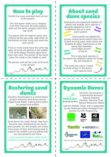
Transcription
Sand Dune Vegetation Mapping andCondition Assessment for Otamarakauto Cape Runaway 2009Prepared by Heather MacKenzie, Environmental Data OfficerEnvironment Bay of PlentyEnvironmental Publication 2010/02February 20105 Quay StreetP O Box 364WhakataneNEW ZEALANDISSN: 1175 9372Working with our communities for a better environmentE mahi ngatahi e pai ake ai te taiao
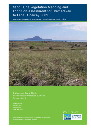
Sand Dune VegetationMapping and ConditionAssessment forOtamarakau – CapeRunaway 2009Environmental Publication 2010/02ISSN: 1175 9372February 2010Environment Bay of Plenty5 Quay StreetPO Box 364Whakatane 3158NEW ZEALANDPrepared by Nancy WillemsCover Photo:Moutohora as viewed from the Piripai dunes.Photographer Heather MacKenzie.
AcknowledgementsHeather MacKenzie and Mieke Kapa completed the preparation and field work for this part ofthe region’s dunes. Thanks to Wildlands for technical assistance and their work in developingthe methodology. Thanks to Annabel Beattie for working on final details, and Nancy Willemsfor reviewing the report.Environmental Report 2010/02 – Sand Dune Vegetation Mapping and Condition Assessmenti
Executive summaryThe establishment of sand dune extent and condition monitoring for the Bay of Plenty regionwas completed in 2009. The work identified and mapped undeveloped sand dunes acrossthe Bay of Plenty region. Sand dunes were mapped by walking sand dune extents, using2007 aerial photography and a series of stratified belt transects at 1 km intervals (withinsites) along the coastline.This monitoring was carried out as a part of the Terrestrial Indigenous Biodiversity NaturalEnvironment Regional Monitoring Network (NERMN). The data collected during this surveywill provide a baseline for sand dune condition and extent in the Bay of Plenty region. Futuremonitoring will provide information on changes in sand dune extents, pest plants anddensities and other impacts.Otamarakau to Cape Runaway is covered in this report, along with Orokawa Bay. WildlandConsultants mapped Orokawa Bay during the mapping of the Tauranga Ecological District(ED) in 2008, however, it was not included in their report as it falls outside of the TaurangaED.This report should be read in conjunction with Wildland Consultants (2008a and 2008b).Recommendations for dune maintenance will be made in a following report.Environmental Report 2010/02 – Sand Dune Vegetation Mapping and Condition Assessmentiii
ContentsAcknowledgementsiExecutive summaryiiiPart 1: Introduction11.1Purpose of report11.2Background1Part 2: Methods3Part 3: Results53.1Bay of Plenty region53.2Orokawa Bay53.3Otamarakau-Cape Runaway (Eastern Bay of Plenty)5Part 4: Management priorities for transect in the EasternBay of Plenty154.1Orokawa Bay154.2Ōtamarākau-Matatā-Whakatāne dunes154.3West End174.4Ōhope dunes184.5Ōhope Spit184.6Ohiwa Spit194.7Whangakopikopiko Island194.8Bryans Beach194.9Waiōtahe Spit194.10Waiōtahe Beach194.11Waiōtahe Beach Middle194.12Waioweka Estuary19Environmental Report 2010/02 – Sand Dune Vegetation Mapping and Condition Assessmentv
4.13Hikuwai Beach204.14Hikuwai Beach Middle204.15Tirohanga Dunes204.16Tirohanga Pa214.17Omarumutu214.18Hawai214.19South of Taratuia Point214.20Tapuaeharuru214.21Whangaparaoa Beach22Part 5: High priority pest plant management actions23Part 6: Discussion25Part 7: References27Appendix 1 – Plant names used in text31Appendix 2 – Photographs of additional vegetation classes for the33Bay of Plenty regionAppendix 3 – Options for Management of Vegetation Succession forregenerating indigenous dune forest37viEnvironmental Report 2010/02 – Sand Dune Vegetation Mapping and Condition Assessment
Part 1: Introduction1.1Purpose of reportSand dune mapping of the Bay of Plenty region (Otamarakau to CapeRunaway/eastern Bay of Plenty only) was completed by Environment Bay of Plentystaff from February-March 2009. This was a continuation of the mapping of theBay of Plenty region. Mapping was carried out for the Tauranga Ecological Districtby Wildland Consultants in 2008.This report outlines the work and gives management priorities for transects forOrokawa Bay and from Otamarakau to Cape Runaway.An overview report will be produced for the whole of the Bay of Plenty region topresent a picture of the state of the region’s sand dunes based on the initial survey.1.2BackgroundSand dune monitoring was carried out as a part of the Terrestrial IndigenousBiodiversity Natural Environment Regional Monitoring Network (NERMN). The datacollected during this survey will provide a baseline for sand dune condition andextent in the Bay of Plenty region.Re-measures will cover the entire region and the frequency is envisaged to be everyfive years, coinciding with new aerial photography.Environmental Report 2010/02 – Sand Dune Vegetation Mapping and Condition Assessment1
Part 2: MethodsSand dunes of the eastern Bay of Plenty region were mapped by walking sand dune extents,using 2007 aerial photography and a series of stratified belt transects at 1 km intervals alongthe coast. The Tauranga Ecological District was mapped by Wildland Consultants in 2008and the remaining coastline was mapped in-house in 2009.Transect’s bisecting areas without dune landforms were not measured. However, thenumbering of transects remained the same to retain that part of the sampling design. Themethodology used was developed by Wildland Consultants and can be viewed in detail inWildland Consultants (2008a).The mapping of the Bay of Plenty region has led to the creation of three GIS layers at1:1,000. The data these layers capture are: Site boundary all – The extents of the 42 Sand Dune Vegetation ConditionMonitoring Areas in the Bay of Plenty region. Vege layer easternbop – The spatial extent of vegetation types within each of theSand Dune Vegetation Condition Monitoring Areas in the eastern Bay of Plenty region. new transects with bearings – The locations and bearings (inland direction) of the83 transects within the Sand Dune Vegetation Condition Monitoring Areas in theeastern Bay of Plenty region.The first two layers have now been merged into a regional sand dune vegetation and siteslayer.Environmental Report 2010/02 – Sand Dune Vegetation Mapping and Condition Assessment3
Part 3: Results3.1Bay of Plenty regionThe complete survey identified and mapped undeveloped sand dunes that occur inthe Bay of Plenty region. The region’s sand dunes have been divided into 42 siteswith a total of 166 transects bisecting them. Below are described the results fromOrokawa Bay and the eastern Bay of Plenty only. For site/transect specific data onthe western Bay of Plenty region refer to Wildland Consultants (2008b).3.2Orokawa BayOrokawa Bay was monitored by Wildland Consultants in 2008, but was omitted fromthe report due to it being outside of the Tauranga Ecological District. Managementpriorities for Orokawa Bay will be covered in this report instead. Orokawa Bay hasone transect (see Figure 1).3.3Otamarakau-Cape Runaway (Eastern Bay of Plenty)Sand dune vegetation mapping of the eastern Bay of Plenty region mapped a totalof 20 sites and 83 transects (see Figure 2, sheets 1-3). An additional transect wasestablished between transect 143 and transect 144 (transect 144.1). Detailedvegetation types (Table 1) were mapped for site extents, these detailed vegetationtypes were then grouped into one of the 81 vegetation classes observed for theBay of Plenty region (68 present in the eastern Bay of Plenty) (Table 2).5
Figure 1Location of sand dune vegetation and condition monitoring transects (Orokawa Bay).Environmental Report 2010/02 – Sand Dune Vegetation Mapping and Condition Assessment6
Figure 2Location of sand dune vegetation and condition monitoring transects (Ōtamarākau-Cape Runaway) – Sheet 1.Environmental Report 2010/02 – Sand Dune Vegetation Mapping and Condition Assessment7
Figure 3Location of sand dune vegetation and condition monitoring transects (Ōtamarākau-Cape Runaway) – Sheet 2.Environmental Report 2010/02 – Sand Dune Vegetation Mapping and Condition Assessment8
Figure 4Location of sand dune vegetation and condition monitoring transects (Ōtamarākau-Cape Runaway) – Sheet 3.Environmental Report 2010/02 – Sand Dune Vegetation Mapping and Condition Assessment9
Table 1:StructuralClass01 ForestVegetation types observed during the surveying of wild unmanagedvegetation on sand dune landforms (including dune wetlands) in theentire Bay of Plenty region.Vegetation Class02 Treeland01 Pine forest02 Banksia forest03 Willow forest04 Indigenous forest01 Pine treeland03 Vineland02 Banksia treeland03 Eucalyptus treeland04 Silver Poplar treeland05 Mixed exotic treeland06 Mixed indigenous treeland07 Pohutukawa treeland08 Macrocarpa treeland01 Pohuehue vineland04 Scrub02 Cape ivy vineland03 Periwinkle vineland04 Japanese honeysucklevineland05 Muehlenbeckia australisvineland06 Moth plant vineland07 Pink bindweed vineland01 Mixed indigenous scrub02 Gorse scrub03 Coast tea tree scrub04 Grey willow scrub05 Shrubland05 Blackberry scrub06 Lupin scrub07 Manuka scrub01 Manuka shrubland02 Ti kouka-taupatashrubland03 Lupin shrubland04 Gorse shrubland05 Coast tea tree shrubland10Vegetation Types and Habitats01.01.01 Pine forest01.02.01 Banksia forest01.03.01 Willow forest01.04.01 Indigenous forest02.01.01 Pine treeland02.01.02 Pine-mixed indigenous treeland02.02.01 Banksia treeland02.03.01 Eucalyptus-mixed indigenous treeland02.04.01 Silver poplar treeland02.05.01 Mixed exotic treeland02.06.01 Mixed indigenous treeland02.07.01 Pohutukawa dominant treeland02.08.01 Macrocarpa-mixed indigenous treeland03.01.01 Pohuehue-Ficinia nodosa vineland03.01.02 Pohuehue-bracken vineland03.01.03 Pohuehue-marram vineland03.01.04 Pohuehue-kikuyu vineland03.01.05 Pohuehue-agapanthus vineland03.01.06 Lupin/pohuehue vineland03.01.07 Pohuehue dominant vineland03.01.08 Pohuehue-panahi vineland03.01.09 African boxthorn/pohuehue dominated vineland03.01.10 Pohuehue-exotic grasses vineland03.01.11 Pohuehue-spinifex vineland03.01.12 Pohuehue-South African iceplant vineland03.02.01 Cape ivy vineland03.03.01 Periwinkle vineland03.04.01 Japanese honeysuckle vineland03.05.01 Muehlenbeckia australis vineland03.06.01 Moth plant dominated vineland03.07.01 Pink bindweed-kikuyu vineland04.01.01 Ti kouka-karamu scrub04.01.02 Ti kouka-mamaku-karamu scrub04.01.03 Mixed indigenous scrub04.02.01 Gorse-pohuehue scrub04.02.02 Gorse-broom/pohuehue scrub04.02.03 Gorse-pampas scrub04.02.04 Gorse dominated scrub04.02.05 Gorse-African boxthorn scrub04.02.06 Gorse-lupin/spinifex scrub04.03.01 Coast tea tree scrub04.04.01 Grey willow scrub04.04.02 Grey willow-tutu scrub04.05.01 Blackberry scrub04.06.01 Lupin/saltwater paspalum scrub04.07.01 Manuka dominated scrub05.01.01 Manuka-mixed indigenous shrubland05.02.01 Ti kouka-taupata shrubland05.03.01 Lupin/spinifex shrubland05.03.02 Lupin dominated shrubland05.03.03 Lupin-marram shrubland05.04.01 Gorse/oioi-kikuyu shrubland05.04.02 Gorse/exotic grasses shrubland05.04.03 Gorse-pampas shrubland05.05.01 Coast tea tree-pine shrublandEnvironmental Report 2010/02 – Sand Dune Vegetation Mapping and Condition Assessment
StructuralClassVegetation Class06 African boxthorn shrubland07 Grey willow shrubland06 Tussockland08 Coastal kanuka shrubland09 Saltmarsh ribbonwoodshrubland10 Kanuka shrubland11 Mixed indigenousshrubland01 Sea rush tussockland02 Pampas tussockland07 Fernland01 Bracken fernland08 Grassland01 Spinifex grassland02 Marram grassland03 Buffalo grass grassland04 Kikuyu grassland05 Cocksfoot grassland06 Knot-root bristle-grassgrassland07 Tall fescue grassland08 Sea couch grassland09 Reed sweet grassgrassland10 Indian doab grasslandVegetation Types and Habitats05.06.01 African boxthorn/pohuehue shrubland05.06.02 African boxthorn/bracken shrubland05.06.03 African boxthorn dominated shrubland05.07.01 Grey willow shrubland05.07.02 Grey willow-mixed indigenous shrubland05.08.01 Coastal kanuka shrubland05.09.01 Saltmarsh ribbonwood shrubland05.10.01 Kanuka dominant shrubland05.11.01 Mixed indigenous shrubland06.01.01 Sea rush tussockland06.01.02 Sea rush-saltwater paspalum tussockland06.02.01 Pampas-mixed indigenous tussockland06.02.02 Pampas-Ficinia nodosa tussockland06.02.03 Pampas-gorse tussockland06.02.04 Pampas-grey willow tussockland06.02.05 Pampas dominated tussockland07.01.01 Bracken-pohuehue fernland07.01.02 Bracken dominated fernland07.01.03 Bracken-kikuyu fernland07.01.04 Bracken-ripgut brome fernland07.01.05 Brush wattle/bracken fernland08.01.01 Spinifex-pingao/Calystegia soldanella grassland08.01.02 Spinifex/Calystegia soldanella grassland08.01.03 Spinifex-marram grassland08.01.04 Spinifex dominated grassland08.01.05 Spinifex-sea rocket grassland08.01.06 Spinifex-pingao grassland08.01.07 Lupin/spinifex grassland08.02.01 Marram grassland08.02.02 Marram-Ficinia nodosa grassland08.02.03 Marram-sea couch grassland08.02.04 Marram-pohuehue-exotic grasses grassland08.03.01 Buffalo grass-pohuehue grassland08.03.02 Buffalo grass-kikuyu-sea couch grassland08.04.01 Kikuyu-pohuehue grassland08.04.02 Kikuyu-blackberry grassland08.04.03 Kikuyu grassland08.04.04 Exotic shrubs/kikuyu grassland08.04.05 Kikuyu-cocksfoot grassland08.04.06 Kikuyu-sea couch grassland08.05.01 Cocksfoot grassland08.05.02 Cocksfoot dominated grassland08.06.01 Knot-root bristle-grass grassland08.07.01 Tall fescue dominated grassland08.07.02 Tall fescue-kikuyu grassland08.07.03 Tall fescue-pohuehue grassland08.07.04 Tall fescue-cocksfoot grassland08.08.01 Sea couch dominant grassland08.08.02 Sea couch-pohuehue grassland08.08.03 Sea couch-kikuyu grassland08.08.04 Sea couch-spinifex grassland08.08.05 Sea couch-bracken grassland08.08.06 African boxthorn/sea couch grassland08.08.07 Sea couch-Carex pumila grassland08.08.08 Sea couch-cocksfoot grassland08.09.01 Reed sweet grass grassland08.09.02 Grey willow/reed sweet grass grassland08.10.01 Indian doab grassland08.10.02 Indian doab- saltwater paspalum grassland08.10.03 Indian doab-sea couch grassland08.10.04 Indian doab-pohuehue grassland08.10.05 Indian doab-ripgut brome grassland08.10.06 Indian doab-buffalo grass grasslandEnvironmental Report 2010/02 – Sand Dune Vegetation Mapping and Condition Assessment11
StructuralClassVegetation Class11 Saltwater paspalumgrassland12 Smooth brome grassland13 Rats tail grassland14 Hares tail grassland09 Sedgeland15 Ripgut brome01 Pingao sedgeland02 Carex testacea sedgeland03 Ficinia nodosa sedgeland04 Baumea juncea sedgeland10 Rushland05 Giant umbrella sedgesedgeland06 Carex pumila sedgeland07 Baumea articulatasedgeland08 Carex geminata sedgeland09 Marsh clubrush sedgeland01 Oioi rushland11 Reedland02 Wiwi rushland01 Raupo reedland13 Herbfield02 Schoenoplectustabernaemontani-Baumeaarticulata reedland01 South African iceplantherbfield02 Gazania herbfield03 Flatweed herbfield04 Mixed exotic herbfield05 Asparagus densiflorusherbfield06 Agapanthus herbfield19 Sandfield1207 Canna lily herbfield08 Rorripa palustris herbfield09 Aster subulatus herbfield10 Panahi herbfield11 Inkweed herbfield01 SandfieldVegetation Types and Habitats08.11.01 Saltwater paspalum grassland08.11.02 Saltwater paspalum Carex pumila grassland08.12.01 Smooth brome grassland08.13.01 Rats tail dominated grassland08.14.01 Hares tail-sea couch grassland08.14.02 Hares tail-kikuyu grassland08.15.01 Ripgut brome dominated grassland09.01.01 Pingao sedgeland09.01.02 Pingao-spinifex sedgeland09.02.01 Carex testacea-pohuehue-Ficinia nodosa sedgeland09.03.01 Ficinia nodosa-pohuehue sedgeland09.03.02 Ficinia nodosa dominated sedgeland09.03.03 Gores/Ficinia nodosa sedgeland09.04.01 Baumea juncea sedgeland09.04.02 Baumea juncea-Apodasmia similis sedgeland09.05.01 Giant umbrella dominated sedgeland09.06.01 Carex pumila dominated sedgeland09.07.01 Baumea articulata-saltwater paspalum sedgeland09.07.02 Baumea articulata dominated sedgeland09.08.01 Carex geminata dominant sedgeland09.09.01 Marsh clubrush sedgeland10.01.01 Oioi rushland10.01.02 Oioi-wiwi rushland10.01.03 Kanuka/oioi rushland10.01.04 Saltmarsh ribbonwood/oioi rushland10.02.01 Wiwi rushland11.01.01 Raupo reedland11.01.02 Raupo-harakeke reedland11.01.03 Raupo/reed sweet grass reedland11.01.04 Raupo/marsh clubrush reedland11.01.05 Grey willow/raupo reedland11.02.01 Schoenoplectus tabernaemontani-Baumea articulatareedland13.01.01 South African iceplant herbfield13.02.01 Gazania linearis-Arctotis-South African iceplantherbfield13.02.02 Gazania linearis dominated herbfield13.03.01 Flatweed herbfield13.03.02 Flatweed-pohuehue herbfield13.04.01 Mixed exotics herbfield13.05.01 Ficinia nodosa/Asparagus densiflorus-Gazania linearispohuehue herbfield13.05.02 Asparagus densiflorus-buffalo grass herbfield13.06.01 Agapanthus praecox-Gazania linearis-South Africaniceplant herbfield13.06.02 Agapanthus praecox herbfield13.07.01 Canna lily herbfield13.08.01 Rorripa palustris herbfield13.09.01 Aster subulatus herbfield13.10.01 Panahi -Carex pumila herbfield13.11.01 Inkweed-Indian doab herbfield19.01.01 Spinifex dominated sandfield19.01.02 Pingao-spinifex sandfield19.01.03 Carex pumila dominated sandfield19.01.04 Ficinia nodosa-panahi sandfield19.01.05 Sea rocket sandfield19.01.06 Carpodrotus edulis sandfield19.01.07 Panahi sandfield19.01.08 Beach sand sandfield19.01.09 Sea rocket -spinifex sandfield19.01.10 Sand-stone-debris sandfieldEnvironmental Report 2010/02 – Sand Dune Vegetation Mapping and Condition Assessment
StructuralClass22 Open waterVegetation Class01 Open waterTable 2:Structural Class01 ForestVegetation Types and Habitats19.01.11 Panahi -Carex pumila sandfield19.01.12 Sea rocket -kikuyu sandfield19.01.13 Sand-driftwood debris sandfield19.01.14 Sea couch-panihi sandfield19.01.15 Panahi-inkweed-wiwi sandfield19.01.16 Marram sandfield22.01.01 Open freshwater22.01.02 Impounded open waterExtent of each vegetation class for Orokawa Bay and the EasternBay of Plenty.Vegetation Class03 Willow Forest04 Indigenous Forest02 Treeland01 Pine treeland03 Eucalyptus treeland04 Silver poplar treeland05 Mixed exotic treeland06 Mixed indigenous treeland07 Pohutukawa treeland08 Macrocarpa treeland03 Vineland01 Pohuehue vineland02 Cape ivy vineland04 Japanese honeysuckle vineland05 Muehlenbeckia australis vineland06 Moth plant vineland07 Pink bindweed vineland04 Scrub01 Mixed indigenous scrub02Gorse scrub04 Grey willow scrub05 Blackberry scrub07 Manuka scrub05 Shrubland01 Manuka shrubland02 Ti kouka-taupata shrubland03 Lupin shrubland04 Gorse shrubland06 African boxthorn shrubland07 Grey willow shrubland08 Coastal kanuka shrubland09 Saltmarsh ribbonwood shrubland10 Kanuka shrubland11 Mixed indigenous shrubland06 Tussockland01 Searush tussockland02 Pampas tussockland07 Fernland01 Bracken fernland08 Grassland01 Spinifex grasslandEnvironmental Report 2010/02 – Sand Dune Vegetation Mapping and Condition AssessmentArea 4.662.9914.5217.5152.5152.5173.9013
02 Marram grassland03 Buffalo grass grassland04 Kikuyu grassland05 Cocksfoot grassland06 Knot-root bristle-grass grassland07 Tall fescue grassland08 Sea couch grassland09 Reed sweet grass grassland10 Indian doab grassland11 Saltwater paspalum grassland12 Smooth brome grassland13 Rats tail grassland14 Hares tail grassland15 Ripgut brome grassland09 Sedgeland01 Pingao sedgeland03 Ficinia nodosa sedgeland04 Baumea juncea sedgeland05 Giant umbrella sedge sedgeland06 Carex pumila sedgeland07 Baumea articulata sedgeland08 Carex geminata sedgeland09 Marsh clubrush sedgeland10 Rushland01 Oioi rushland02 Wiwi rushland11 Reedland01 Raupo reedland02 Schoenoplectus tabernaemontani-Baumea articulata reedland13 Herbfield01 South African iceplant herbfield02 Gazania herbfield03 Flatweed herbfield04 Mixed exotic herbfield06 Agapanthus herbfield10 Panahi herbfield11 Inkweed herbfield19 Sandfield01 Sandfield22 Open water01 Open waterGRAND TOTAL Environmental Report 2010/02 – Sand Dune Vegetation Mapping and Condition Assessment
Part 4: Management priorities for transect in theEastern Bay of PlentyManagement priorities for transects in the eastern Bay of Plenty are listed below. The sitename is followed by the transect numbers occurring within the site. The managementpriorities are predominantly the main pest plant species that could be eradicated or controlledto most benefit the sand dunes.One transect bisects multiple sites and is therefore in this section twice (out of order thesecond time). As noted in the methods there will be gaps in the numbering of transects dueto some sections of the coastline not being dune landforms.4.1Orokawa Bay003 There are no management priorities here. Californian thistle (Cirsium arvense)is present, but should eventually be shaded out by the regeneration forest.4.2Ōtamarākau-Matatā-Whakatāne dunesThis site is a long extent of dunes that is heavily utilised by the public for recreation.There is increased erosion due to impacts of four-wheel vehicle tracking along andthrough the dunes. Vehicle access to the dunes will continue to damage the dunes,increase erosion and reduce indigenous duneland vegetation. Although this is acomplex issue it needs to be addressed.087 Eradication of moth plant (Araujia sericifera), dimorphotheca (Osteospermumfruticosum) and pampas (Cortaderia selloana) would enhance the ecologicalvalues of the dune system. Control of marram grass (Ammophila arenaria) onforedune would allow for natural regeneration by spinifex (Spinifex sericeus).088 Eradicate pampas and control exotic grasses on the foredune. Control ofmarram grass on foredune would allow for natural regeneration by spinifex.089 There are a number of large blow outs resulting from vehicle tracking. Controlof marram and planting of spinifex in areas of erosion would aid in reducingblowouts. Spot spray pampas.090 Eradicate small area of blackberry (Rubus fruticosus). Control marram.091 Eradicate the small amounts of blackberry and boxthorn (Lyciumferocissimum). Control marram. Planting of blowouts with spinifex wouldreduce further erosion.092 Remove the few mature eucalyptus trees (Eucalyptus botryoides) present.Eradicate blackberry and kikuyu (Pennisetum clandestinum) alongside railwaytrack.093 Control blackberry.094 Control kikuyu on the margins of the transect to prevent further spread into thedunes. Control blackberry.095 Eradicate boxthorn and pampas. Control marram from undulating swale.Environmental Report 2010/02 – Sand Dune Vegetation Mapping and Condition Assessment15
096 Eradicate Pampas, blackberry and boxthorn by spot spraying. Controlmarram.097 Eradicate brush wattle (Paraserianthes lophantha), grey willow (Salix cinerea)and woolly nightshade (Solanum mauritianum). Control blackberry.098 Eradicate boxthorn and brush wattle. Continue with pampas control. One ofthe management regimes (three options1 in the Wildland Consultants 2007) forthe regenerating dune forest under the eucalyptus trees should be initiated.We recommend the use of management Option 2, to maintain the currentunderstorey regeneration. Once the indigenous understorey has achievedsufficient canopy closure, the removal of large eucalyptus trees (via ringbarking/poisoning) should be considered.099 Control of marram and planting of spinifex to reduce blow outs on foredune.Control of pampas that dominates the dune swale where debris from slips hasbeen deposited. Recommend to initiate management of regenerating duneforest option 2 (see transect 098).100 Eradication of South African iceplant (Carprobrotus edulis) and replacementplanting of spinifex would enhance the foredune area.101 Eradicate boxthorn. Control marram on foredune and pampas and grey willowin the dune swale. Recommend to initiate management of regenerating duneforest option 2 (see transect 098).From this transect until the causeway between transect 103 and 104 there willbe significant changes occurring before the next monitor due to some areasbeing used for long-term debris disposal and the construction of sedimentponds. Management will be constrained by this project and the relevantconsents that apply.102 Eradicate boxthorn and agapanthus (Agapanthus praecox). Control marramon foredune, and pampas and brush wattle on the edge of the developedarea. Also control kikuyu to prevent it encroaching onto the foredune.103 Control marram on foredune. The area of gorse (Ulex europaeus) could beeradicated with low level of effort required. Control blackberry, boxthorn andJapanese honeysuckle (Lonicera japonica).104 Control boxthorn and the area of gorse between the sea and wetland.105 Control marram on foredune. Eradicate boxthorn. Control of blackberry andgorse would enhance the ecological values of the dunes.106 Eradicate Agarvae americana and agapanthus that is present in patches onthe established dune. Control of boxthorn and possibly of blackberry wouldadd to the ecological values and quality of the dunes.107 Control boxthorn.108 Control marram and boxthorn.109 Eradicate moth plant. Control boxthorn and gorse.1Option 1: No Action. Option 2: Low Level Intervention. Option 3: More Intensive Intervention. SeeAppendix 3 for full descriptions for the proposed management actions.16Environmental Report 2010/02 – Sand Dune Vegetation Mapping and Condition Assessment
110 Eradicate pampas. Control boxthorn, barberry (Berberis glaucocarpa).111 Control boxthorn, barberry spindle tree (Euonymus europaeus) and evergreenbuckthorn (Rhamnus alaternus).112 Control kikuyu to stop it spreading over the rest of the foredune. Controlboxthorn.113 Eradicate Japanese spindle tree (Euonymus japonicus). Control boxthorn.114 Eradicate South African iceplant and swamp oak (Casuarina glauca). Controlkikuyu to stop further spread into the dunes.115 Eradicate marram. Control of gorse, boxthorn and pampas would greatlybenefit the ecological values at this site.116 Control gorse, pampas and marram.117 Eradicate gazania (Gazania linearis). Control boxthorn.118 Control boxthorn.119 Control boxthorn.120 Eradicate similax (Asparagus asparagoides). Control boxthorn.121 Control boxthorn and blackberry.122 Eradicate Phoenix palm (Phoenix canariensis). Control boxthorn.123 Eradicate South African iceplant, boxthorn, banksia (Banksia integrifolia) andyucca (Yucca gloriosa). Norfolk Island pines (Araucaria heterophylla) could bereplaced with a relevant native tree species. Control kikuyu to stop it fromencroaching from the mown verge into the dune system.124 Eradicate South African iceplant before it spreads over the whole foredune.Control boxthorn and pampas.125 Eradicate similax. Control boxthorn and radiata pine (Pinus radiata) from thecrest of the established foredune. Control hawthorn (Crataegus monogyna),Chinese privet (Ligustrum sinense) and tree privet (Ligustrum lucidum) fromthe treeland at southern end of the dunes. Control marram, Japanesehoneysuckle and sweet briar (Rosa rubiginosa) throughout. There is a largevehicle access track to the beach from the foredune; this has resulted inincreased erosion.126 Eradicate similax. Control marram, boxthorn, kikuyu and gorse. Radiata pinescould be removed from the area outside of the Urupa.4.3West End131 Could control exotic grasses and replace with spinifex to re-establish andstabilise this narrow piece of dune. Eradicate South African iceplant, greywillow and cape daisy (Arctotis stoechadifoilia).Environmental Report 2010/02 – Sand Dune Vegetation Mapping and Condition Assessment17
132 Eradicate South African iceplant, yucca, agapanthus, similax, dimorphotheca,montbretia (Crocosmia x crocosmiiflora) and buffalo grass (Stenotaphrumsecundatum). Control of exotic grasses and replacement with spinifex wouldadd ecological value and aid in stabilising this narrow piece of dune.Discourage dumping of garden waste by residents. Also discourage beachaccess via non formed tracks to reduce tracking and erosion.4.4Ōhope dunes133 Eradicate South African iceplant, agapanthus, gazania, Japanese spindle tree,gorse, similax, dimorphotheca and watsonia (Watsonia bulbillifera). Controlkikuyu. Discourage residents from planting garden species and the dumping ofgarden waste on the dunes.134 Eradicate South African iceplant, yucca, gazania and succulents. Controlkikuyu and sea couch (Elytrigia pycnantha). Discourage garden wastedumping and informal tracking.135 Eradicate South African iceplant, agapanthus, yucca, Acacia sophorae andpampas. Control a number of garden escapees including; similax, gazania,montbretia, canna lily, Japanese spindle tree, cape daisy and climbingasparagus (Asparagus scandens). Control buffalo grass and sea couch.Discourage garden waste dumping on the dunes.136 Eradicate Acacia sophorae, South African iceplant, yucca, Japanese spindletree, dimorphotheca and red hot poker (Kniphofa uvaria). Control kikuyu fromencroaching further into dunes from the mown road edge. Discourage gardenwaste dumping on the dunes.137 Eradicate Acacia sophorae, South African iceplant, dimorphotheca, red hotpoker, gazania, similax, montbretia, Japanese spindle tree and prickly pear(Opuntia vulgaris). Control buffalo grass. Discourage the dumping of gardenwaste that is leading to the establishment of pest plants.138 Build a sand ladder where there is severe tracking and a blowout, alsoplanting spinifex to reduce the erosion and helping to bind sand in this area.Eradicate Acacia sophorae, agapanthus, gorse, South African iceplant, cannalily, pampas, watsonia and dimorphotheca. Control blackberry.139 Eradicate agapanthus, dimorphotheca, Acacia sophorae, South African iceplant, watsonia, Japanese spindle berry, moth plant, gazania, Liliumformosum, canna lily and blue morning glory (Ipomoea indica). Control brushwattle, berry, evergreen buckthorn, Chin
Environmental Report 2010/02 - Sand Dune Vegetation Mapping and Condition Assessment iii Executive summary The establishment of sand dune extent and condition monitoring for the Bay of Plenty region was completed in 2009. The work identified and mapped undeveloped sand dunes across the Bay of Plenty region.