Transcription
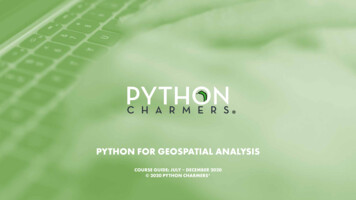
PYTHON FOR GEOSPATIAL ANALYSISCOURSE GUIDE: JULY – DECEMBER 2020 2020 PYTHON CHARMERS
Python for Geospatial AnalysisA specialist courseAudience: This is a course for GIS analysts, scientists, engineers, surveyors, and other analysts working with geospatial data sets.Context: Spatial data is ubiquitous and location analytics are more important than ever. A well drawn map is not only beautiful to look at, butcan change how you see the world. In the last 10 years Python has become the go-to language for scientific computing and spatial science.Overview: You will learn to work with and analyze general, scientific,and geospatial datasets in many useful formats and learn to solve awide range of analytical problems in Python for geospatial applications.You will also learn about the elegance and power of the Python language and the breadth of its amazing ecosystem of powerful packagesfor geospatial analysis.Format: Each topic is a mixture of expert instruction, worked examples,and hands-on exercises.Expert instructors: See bios below.Duration: 5 daysModules:Days 1–5: “Python for Geospatial Analysis”Days 1–2: “Introduction to Python”Days 3–5: for graduates of Python Charmers courses or peoplewith significant Python experience (3–6 months)Price:Regular course (5 days): 3,500 (excl GST)Modular / partial courses: 800 (excl GST) per dayDates and locations in 2020:Sydney: 6-10 July; 5-9 OctoberMelbourne: 27-31 July; 16-20 NovemberCanberra: 14-18 September; 7-11 DecemberWe offer live online participation as an alternative to face-to-face participation.
Skills & ActivitiesSkillsActivitiesDays 1–2: You will gain a solid understanding of the Python languageand experience using Python for a wide range of scripting and data-manipulation tasks with data in useful formats (CSV, Excel, SQL); andcreating beautiful statistical graphics and simple dashboards.Exercises: There will be practical exercises throughout the trainingcourse. These will be challenging and fun, and the solutions will bediscussed after each exercise and provided as source code. During theexercises, the trainer will offer help and suggestions.Day 3: You will learn about time-series analysis; manipulating vector/matrix data; performing Monte Carlo simulations; constructing statistical models; linear regression; clustering; outlier / anomaly detection.Worked examples: To prepare you for the exercises, the trainer willpresent worked examples and demos and help you to follow along onyour own computer.Days 4: You will learn all about working with geospatial data using Python, including accessing spatial data formats (shapefiles, KML, rasterand vector formats), analyzing raster and vector geospatial datasets;and visualizing the results on a map.Day 5: You will gain an overview of available scientific routines, including for gridded data interpolation, curve fitting, optimization, signaland image processing. You will also learn how to speed up slow codeand parallelize it across multiple cores or a cluster for large datasets.
Topic outlineDay 1: Python basicsDay 1 covers how to use Python for basic scripting and automation tasks,including tips and tricks for making this easy: Why Python? What’s possible? The Jupyter notebook for rapid prototyping Modules and packages Python concepts: an introduction through examples Essential data types: strings, tuples, lists, dicts Worked example: retrieving real-time data from a REST web API Raising and handling exceptions
Topic outlineDay 2: Handling, analyzing, and presenting data in PythonPython offers amazingly productive tools like Pandas for working with different kinds of data. Day 2 gives a thorough introduction to analyzing and visualizing data easily: Reading and writing essential data formats:CSV, Excel, SQL, time-series (others on request) Indexing and selecting data in Pandas Data fusion: joining & merging datasets Summarization with “group by” operations; pivot tables Visualization and statistical graphics with Seaborn Automated reporting; interactive dashboards ipywidgets and voilà
Topic outlineDay 3: Time-series, simulation, inference and modellingDay 3 shows you how to manipulate time-series and matrix/vector data. Itthen describes simulation methods and walks you through using powerfulmethods of inference and modelling, clustering and outlier detection: Time-series analysis: parsing dates; resampling; interpolation; joining Introduction to NumPy for manipulating vector and matrix data:data types, powerful indexing, reshaping, ufuncs Monte Carlo simulation and applications Statistical modelling and density estimation with scipy and scikit-learn Linear regression with statsmodels Clustering with scikit-learn, with geospatial applications Outlier and anomaly detection with pyod
Topic outlineDay 4: Spatial analysis in PythonDay 4 will provide a comprehensive tutorial in working with geospatial datausing Python. It will cover spatial data access, spatial analysis, and visualizingthe results on a map. Reading & writing vector data with Geopandas and GDAL Reading and writing rasters with Rasterio Working with NetCDF data with xarray Projections with Geopandas, pyproj and shapely Creating beautiful maps and overlaying statistical data Introduction to vector and raster image analysis with PySAL and SciPy
Topic outlineDay 5: Scientific computing with PythonDay 5 teaches you specialized tools in Python for scientific and engineeringcomputing. It gives you a comprehensive introduction to SciPy and the broader package ecosystem. It then teaches you how to profile and speed up slownumerical code and how to parallelize code for large datasets across severalcores/processors or distribute them across a cluster.Morning: scientific computing Tour of SciPy and related packages, with fancy demos: dense & sparse linear algebra interpolation (e.g. for gridded data) optimization and curve fitting integration / ODEs signal & image processing handling scientific units and uncertaintiesAfternoon: scaling up Speeding up code by 4x to 10,000x: profiling, vectorization, JIT compilation with numba parallel and distributed computing with dask
Personal helpWe are happy to offer on-the-spot problem-solving after each day of thetraining for you to ask one-on-one questions — whether about the coursecontent and exercises or about specific problems you face in your work andhow to solve them. If you would like us to prepare for this in advance, you arewelcome to send us background info before the course.
Other informationMaterials: We will provide you with printed course notes, cheat sheets, and a USBstick containing kitchen-sink Python installers for multiple platforms, solutions tothe programming exercises, several written tutorials, and reference documentationon Python and the third-party packages covered in the course.Venue: Modern computer-based training facilities (CBD location) for face-to-facetraining. Courses are also available online via video streaming and a cloud notebookserver for sharing code with the trainer(s).Computer:Face-to-face: an internet-connected computer will be provided for you.Virtual: we recommend 8 GB of RAM, a headset mic and a webcam.Timing: The course will run from 9:00 to roughly 17:00 each day, with breaks of 50minutes for lunch and 20 minutes each for morning and afternoon tea.Food and drink: We will provide lunch, morning and afternoon tea, and drinks.Certificate of completion: We will provide you a certificate if you complete thecourse and successfully answer the majority of the exercise questions.
Instructor bioHenry WalshawHenry has almost 15 years of experience in Python application developmentand has trained hundreds of people in how to use Python fromorganisations including AGL, the Bureau of Meteorology, ESRI, the NSWDepartment of Finance, National Australia Bank, and Telstra.Henry’s core technical expertise relates to the development and analysis oflarge scale spatial datasets (primarily using Python), and communicatingthis understanding to both subject matter experts and the general public.Before joining Python Charmers, Henry worked in both governmentand industry — at Geoscience Australia, the Victorian Department ofSustainability and Environment, and the Environmental Protection Agency(EPA); as a consultant with Sinclair Knight Merz (SKM), a manager at we-doIT, and as CTO of a startup. He holds a Bachelors in Computational Science.
Instructor bioDr Edward SchofieldEd has consulted to or trained over 2500 people from dozens oforganisations in Python, including Atlassian, the Bureau of Meteorology,Cisco, CSIRO, Dolby, Geoscience Australia, Harvard University, Singtel Optus,Oracle, Shell, Telstra, Toyota, Verizon, and Westpac. He is well-known in thePython community as a former release manager of SciPy and the author ofthe widely used future package. He regularly presents at conferences in dataanalytics and Python in Australia and internationally.Ed holds a PhD in machine learning from Imperial College London. Healso holds BA and MA (Hons) degrees in mathematics and computerscience from Trinity College, University of Cambridge. He has 20 years ofexperience in programming, teaching, and public speaking.
Instructor bioDr Robert LaytonRobert is the author of the book “Data Mining in Python”, published byPackt. He provides analysis, consultancy, research and development workto businesses, primarily using Python. Robert has worked with government,financial and security sectors, in both a consultancy and academic role. Heis also a Research Fellow at the Internet Commerce Security Laboratory,investigating cybercrime analytics and data-mining algorithms forattribution and profiling.Robert is a contributor to the Python-based scikit-learn open source projectfor machine learning and writes regularly on data mining for a number ofoutlets. He is also the author of the website “LearningTensorflow.com”. Hehas presented regularly at a number of international conferences in Python,data analysis, and its applications.
Instructor bioDr Juan Nunez-IglesiasJuan Nunez-Iglesias is co-author of the book Elegant SciPy, published byO’Reilly Media. Juan is a core developer of the scikit-image Python library,and has contributed to many others in the scientific Python ecosystem,including SciPy, NetworkX, and Matplotlib. He has taught and presented atthe SciPy conference in Austin, EuroSciPy, PyCon Australia, the AdvancedScientific Programming in Python summer school, and Software Carpentryworkshops.Juan is a research fellow at Monash University, with interests inneuroscience and biological image analysis. He also has a particular interestin renewable energy and the environment.Juan has Bachelor’s degree in Biomedical Science from the University ofMelbourne and both an MSc in Statistics and PhD in Computational Biologyand Bioinformatics from the University of Southern California.
About Python Charmers Python Charmers is the leading provider of Python training in the Asia-Pacific region,based in Australia and Singapore. Since 2010, Python Charmers has given over 450 trainingcourses and bootcamps to over 4,500 delighted people from organizations such as AGL,Atlassian, Barclays, CSIRO, Cisco, Deloitte, Dolby, IMC, pwc, Singtel Optus, Shell, Sportsbet,Telstra, Toyota, Transurban, Verizon, VicRoads, Westpac, and Woolworths. Python Charmersspecializes in teaching programming and data science to scientists, engineers, data analysts,quants, and computer scientists in the Python language.Python Charmers’ trainers boast years of Python experience and deep roots in the opensource community, as both speakers at events and contributors to well-known open sourceprojects, including NumPy, SciPy, Scikit-Learn, Pandas, and Python-Future.
Testimonials: Testimonials from past participants of similarbootcamps and training courses are available s: We are happy to customise this program furtheron request. Please let us know if you would like to discussthis or have any other questions.Contact:Phone: 61 1300 963 .com
Python for Geospatial Analysis A specialist course Audience: This is a course for GIS analysts, scientists, engineers, survey-ors, and other analysts working with geospatial data sets. Context: Spatial data is ubiquitous and location analytics are more im-portant than ever. A well drawn map is not only beautiful to look at, but