Transcription
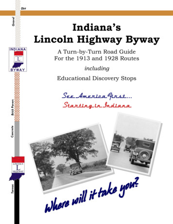
Flexibilityin HighwayDesignU.S. Department of TransportationFederal Highway AdministrationPage i
This page intentionally left blank.Page ii
A Message from the AdministratorDear Colleague:One of the greatest challenges the highway community faces is providing safe, efficienttransportation service that conserves, and even enhances the environmental, scenic,historic, and community resources that are so vital to our way of life. This guidewill help you meet that challenge.The Federal Highway Administration (FHWA) has been pleased to work with theAmerican Association of State Highway and Transportation Officials and otherinterested groups, including the Bicycle Federation of America, the National Trustfor Historic Preservation, and Scenic America, to develop this publication. It identifiesand explains the opportunities, flexibilities, and constraints facing designers anddesign teams responsible for the development of transportation facilities.This guide does not attempt to create new standards. Rather, the guide builds on theflexibility in current laws and regulations to explore opportunities to use flexibledesign as a tool to help sustain important community interests without compromisingsafety. To do so, this guide stresses the need to identify and discuss those flexibilitiesand to continue breaking down barriers that sometimes make it difficult for highwaydesigners to be aware of local concerns of interested organizations and citizens.The partnership formed to develop this guidance grew out of the design-relatedprovisions of the Intermodal Surface Transportation Efficiency Act of 1991 and theNational Highway System Designation Act of 1995. Congress provided dramaticnew flexibilities in funding, stressed the importance of preserving historic and scenicvalues, and provided for enhancing communities through transportationimprovements. Additionally, Congress provided that for Federal-aid projects not onthe National Highway System, the States have the flexibility to develop and applycriteria they deem appropriate.It is important, therefore, that we work with our State and local transportationcolleagues to share ideas for proactive, community-oriented designs for transportationfacilities. In this guide, we encourage designers to become partners with transportationspecialists, landscape architects, environmental specialists, and others who can bringtheir unique expertise to the important task of improving transportationdecisionmaking and preserving the character of this Nation’s communities. Asillustrated in the guidance, we can encourage creativity, while achieving safety andefficiency, through the early identification of critical project issues, and throughconsideration of community concerns before major decisions severely limit designoptions.We believe that design can and must play a major role in enhancing the quality ofour journeys and of the communities traveled. This guide will help you achievethose dual purposes.Sincerely yours,Jane F. GarveyActing FederalHighway AdministratorPage iii
This page intentionally left blank.Page ii
ForewordFOREWORDThis Guide is about designing highways that incorporate community values and aresafe, efficient, effective mechanisms for the movement of people and goods. It iswritten for highway engineers and project managers who want to learn more aboutthe flexibility available to them when designing roads and illustrates successfulapproaches used in other highway projects. It can also be used by citizens who wantto gain a better understanding of the highway design process.Congress, in the Intermodal Surface Transportation Efficiency Act (ISTEA) of 1991and the National Highway System Designation (NHS) Act of 1995, maintained astrong national commitment to safety and mobility. Congress also made a commitmentto preserving and protecting the environmental and cultural values affected bytransportation facilities. The challenge to the highway design community is to finddesign solutions, as well as operational options, that result in full consideration ofthese sometimes conflicting objectives.To help meet that challenge, this Guide has been prepared for the purpose of provokinginnovative thinking for fully considering the scenic, historic, aesthetic, and othercultural values, along with the safety and mobility needs, of our highwaytransportation system. This Guide does not establish any new or different geometricdesign standards or criteria for highways and streets in scenic, historic, or otherwiseenvironmentally or culturally sensitive areas, nor does it imply that safety and mobilityare less important design considerations.When Congress passed ISTEA in 1991, in addition to safety, it emphasized theimportance of good design that is sensitive to its surrounding environment, especiallyin historic and scenic areas. Section 1016(a) of ISTEA states:If a proposed project .involves a historic facility or is located inan area of historic or scenic value, the Secretary may approvesuch project .if such project is designed to standards that allowfor the preservation of such historic or scenic value and suchproject is designed with mitigation measures to allow preservationof such value and ensure safe use of the facility.Aesthetic, scenic, historic, and cultural resources and the physical characteristics ofan area are always important factors because they help give a community its identityand sense of place and are a source of local pride.Page v
ForewordIn 1995, Congress reemphasized and strengthened this direction through the NHSAct, which states, in section 304:A design for new construction, reconstruction, resurfacing.restoration, or rehabilitation of a highway on the NationalHighway System (other than a highway also on the InterstateSystem) may take into account.[in addition to safety, durabilityand economy of maintenance].(A) the constructed and natural environment of the area;(B) the environmental, scenic, aesthetic, historic, community, andpreservation impacts of the activity; and(C) access for other modes of transportation.The National Highway System (NHS) consists of approximately 161,000 miles ofroads, including the Interstate System, or 4 percent of the total highway mileage.The primary purpose of the NHS is to ensure safe mobility and access. Byemphasizing the importance of good design for these roads, Congress is saying thatcareful, context-sensitive design is a factor that should not be overlooked for anyroad.A Policy on the Geometric Design of Highways and Streets (Green Book), publishedby the American Association of State Highway and Transportation Officials(AASHTO), contains the basic geometric design criteria that establish the physicalfeatures of a roadway. This Guide is correlated to a large extent to the Green Bookbecause that is the primary geometric design tool used by the highway designcommunity. Like the Green Book, this Guide contains sections on functionalclassification, design controls, horizontal and vertical alinement, cross-sectionelements, bridges, and intersections. There are many good projects highlighted inthis Guide that were achieved working within the parameters of the Green Book toobtain safety and mobility and to preserve environmental and cultural resources.These projects used the flexibilities that are available within the criteria of the GreenBook. These projects also used a comprehensive design process, involving the publicand incorporating a multidisciplinary design approach early and throughout theprocess.If highway designers are not aware of opportunities to use their creative abilities,the standard or conservative use of the Green Book criteria and related State standards,along with a lack of full consideration of community values, can cause a road to beout of context with its surroundings. It may also preclude designers from avoidingimpacts on important natural and human resources.Page vi
ForewordThis Guide encourages highway designers to expand their consideration in applyingthe Green Book criteria. It shows that having a process that is open, includes publicinvolvement, and fosters creative thinking is an essential part of achieving gooddesign. This Guide should be viewed as a useful tool to help highway designers,environmentalists, and the public move further along the path to sensitively designedhighways and streets by identifying some possible approaches that fully consideraesthetic, historic, and scenic values, along with safety and mobility. It also recognizesthat many designers have been sensitive to the protection of natural and human-maderesources prior to ISTEA.The decision to use and apply the concepts illustrated and discussed in the Guide forany specific project remains solely with the appropriate State and/or local highwayagencies. In addition, while many of the concepts discussed will clearly aid the decisionprocess, it must be recognized that changes in the design or design criteria will notalways resolve every issue to a mutual level of satisfaction.Page vii
This page intentionally left blank.Page ii
Table of ContentsTABLE OF CONTENTSLetter from the Administrator . . . . . . . . . . . . . . . . . . . . . . . . . . . . . . . . . . . . . .iiiForeword. . . . . . . . . . . . . . . . . . . . . . . . . . . . . . . . . . . . . . . . . . . . . . . . . . . . . .vIntroduction . . . . . . . . . . . . . . . . . . . . . . . . . . . . . . . . . . . . . . . . . . . . . . . . . . . xiPART I-THE DESIGN PROCESSChapter 1-Overview of the Highway Planning and Development Process. . . . . . 1PART II-DESIGN GUIDELINESChapter 2-Highway Design Standards . . . . . . . . . . . . . . . . . . . . . . . . . . . . . . 27Chapter 3-Functional Classification . . . . . . . . . . . . . . . . . . . . . . . . . . . . . . . . . 41Chapter 4-Design Controls . . . . . . . . . . . . . . . . . . . . . . . . . . . . . . . . . . . . . . . 55Chapter 5-Horizontal and Vertical Alinement . . . . . . . . . . . . . . . . . . . . . . . . . 63Chapter 6-Cross-Section Elements . . . . . . . . . . . . . . . . . . . . . . . . . . . . . . . . 73Chapter 7-Bridges and Other Major Structures . . . . . . . . . . . . . . . . . . . . . . . 101Chapter 8-Intersections . . . . . . . . . . . . . . . . . . . . . . . . . . . . . . . . . . . . . . . . . 113PART III-CASE STUDIES1-Route 9 Reconstruction: New York, NY . . . . . . . . . . . . . . . . . . . . . . . . 1312-Carson Street Reconstruction: Torrance, CA . . . . . . . . . . . . . . . . . . . . 1433-Historic Columbia River Highway:Multnomah, Hood River, and Wasco Counties, OR . . . . . . . . . . . . . . . . . . 1514-State Route 89 - Emerald Bay: Eldorado County, CA . . . . . . . . . . . . . . . . . 1675-East Main Street Reconstruction: Westminster, MD . . . . . . . . . . . . . . . . . . 1756-U.S. Route 101 - Lincoln Beach Parkway: Lincoln County, OR . . . . . . . . . . 183Appendix . . . . . . . . . . . . . . . . . . . . . . . . . . . . . . . . . . . . . . . . . . . . . . . . . . 193Page ix
This page intentionally left blank.Page ii
IntroductionINTRODUCTIONAn important concept in highway design is that every project is unique. The settingand character of the area, the values of the community, the needs of the highwayusers, and the challenges and opportunities are unique factors that designers mustconsider with each highway project. Whether the design to be developed is for amodest safety improvement or 10 miles of new-location rural freeway, there are nopatented solutions. For each potential project, designers are faced with the task ofbalancing the need for the highway improvement with the need to safely integratethe design into the surrounding natural and human environments.In order to do this, designers need flexibility. There are a number of options availableto State and local highway agency officials to aid in achieving a balanced roaddesign and to resolve design issues. These include the following: Use the flexibility within the standards adopted for each State. Recognize that design exceptions may be optional whereenvironmental consequences are great. Be prepared to reevaluate decisions made in the planning phase. Lower the design speed when appropriate. Maintain the road’s existing horizontal and vertical geometry andcross section and undertake only resurfacing, restoration, andrehabilitation (3R) improvements. Consider developing alternative standards for each State, especiallyfor scenic roads. Recognize the safety and operational impact of various designfeatures and modifications.Page xi
IntroductionThis Guide illustrates the flexibility already available to designers within adoptedState standards. These standards, often based on the AASHTO Green Book, allowdesigners to tailor their designs to the particular situations encountered in eachhighway project. Often, these standards alone provide enough flexibility to achievea harmonious design that both meets the objectives of the project and is sensitive tothe surrounding environment.When faced with extreme social, economic, or environmental consequences, it issometimes necessary for designers to look beyond the “givens” of a highway projectand consider other options. The design exception process is one such alternative. Inother cases, it may be possible to reevaluate planning decisions or rethink theappropriate design.For existing roads, sometimes the best option is to maintain the road as is or makeonly modest 3R improvements. Since the passage of ISTEA, States also have theability to develop new standards outside the Green Book criteria for all roads not onthe NHS. It is important, however, to recognize that the Green Book criteria arebased on sound engineering and should be the primary source for design criteria.When the impact of the proposed action is evaluated and flexible design considerationsare appropriate, they should be investigated.All these options may give designers flexibility to use their expertise and judgmentin designing roads that fit into the natural and human environments, while functioningefficiently and operating safely.The ultimate decision on the use of existing flexibility rests with the State designteam and project managers. Each situation must be evaluated to determine thepossibilities that are appropriate for that particular project. Managers are encouragedto allow the designers to work with staff members from other disciplines to aid inexploring options, constraints, and flexibilities.Page xii
Chapter 1Chapter 1OVERVIEW OF THE HIGHWAYPLANNING AND DEVELOPMENTPROCESSA successful process includesdesigner and communityinvolvement from the beginning.(Rt. 123/124 in New IpswichVillage, NH)Highway design is only one element in the overall highway development process.Historically, detailed design occurs in the middle of the process, linking thepreceding phases of planning and project development with the subsequent phasesof right-of-way acquisition, construction, and maintenance. While these are distinctactivities, there is considerable overlap in terms of coordination among the variousdisciplines that work together, including designers, throughout the process.It is during the first three stages, planning, project development, and design, thatdesigners and communities, working together, can have the greatest impact on thefinal design features of the project. In fact, the flexibility available for highwaydesign during the detailed design phase is limited a great deal by the decisionsmade at the earlier stages of planning and project development. This Guide beginswith a description of the overall highway planning and development process toillustrate when these decisions are made and how they affect the ultimate design ofa facility.Page 1
THE STAGES OF HIGHWAY DEVELOPMENTChapter 1Although the names may vary by State, the five basic stages in the highwaydevelopment process are: planning, project development (preliminary design), finaldesign, right-of-way, and construction. After construction is completed, ongoingoperation and maintenance activities continue throughout the life of the facility.Figure 1.1Although these activities are distinct, there isconsiderable overlap between all phases ofhighway planning and development.PlanningThe initial definition of the need for any highway or bridge improvement projecttakes place during the planning stage. This problem definition occurs at the State,regional, or local level, depending on the scale of the proposed improvement. Thisis the key time to get the public involved and provide input into the decision-makingprocess. The problems identified usually fall into one or more of the followingfour categories:1. The existing physical structure needs major repair/replacement (structure repair).2. Existing or projected future travel demands exceed availablecapacity, and access to transportation and mobility need to beincreased (capacity).3. The route is experiencing an inordinate number of safety andaccident problems that can only be resolved through physical,geometric changes (safety).4. Developmental pressures along the route make a reexaminationof the number, location, and physical design of access pointsnecessary (access).Page 2
Chapter 1Whichever problem (or set of problems) is identified, it is important thatall parties agree that the problem exists, pinpoint what the problem is, anddecide whether or not they want it fixed. For example, some communitiesmay acknowledge that a roadway is operating over its capacity but do notwant to improve the roadway for fear that such action will encourage moregrowth along the corridor. Road access may be a problem, but a community may decide it is better not to increase access,Increased public involvement inhighway planning and developmentis essential to success.Obtaining a community consensus on the problem requires proactive publicinvolvement beyond conventional public meetings at which well-developed designalternatives are presented for public comment. If a consensus cannot be reachedon the definition of the problem at the beginning, it will be difficult to moveahead in the process and expect consensus on the final design.Planning Occurs at Three Government LevelsState Planning. At the State level, State DOTS are required to develop and maintaina statewide, multimodal transportation planning process. Broad categories ofhighway improvement needs are defined, based primarily on ongoing examinationsof roadway pavement conditions and estimates of present-day and 20-yearprojections of traffic demands. In addition, each State is required to conduct biennialinspections of its major bridges (and similar, less frequent, inspections of minorstructures) to determine their structural adequacy and capacity. In a number of States,regional transportation plans for multiple counties are prepared within the contextof the statewide planning process. Every few years, the State selects improvementprojects based on the longrange-plan and includes them in the StatewideTransportation Improvement Program, or STIP.Page 3
Chapter 1Regional Planning. State efforts are supplemented in urbanized areas with a population of more than 200,000 through the metropolitan transportation planning process. Metropolitan planning organizations (MPOs) develop their own regional plans,unlike non-MPO areas, which must rely on the State planning process. The metropolitan planning process requires the development of a long-range plan, typicallyprepared with a 20- to 25-year planning horizon. The plan not only defines a region’smultimodal transportation needs, but also identifies the local funding sources thatwill be needed to implement the identified projects. Each urbanized area or MPOthen uses this information to prepare a shorter, more detailed listing and prioritizationof projects for which work is anticipated within the next 3 to 5 years. The listing ofthese projects is referred to as the shortrange Transportation Improvement Program, or TIP The TIP is incorporated into the STIPLocal Planning. Most cities and counties follow a similar process of project identification, conceptual costing, and prioritization of the roadways for which they areresponsible. Generally, these are roads that are not the responsibility of the StateDOT. However, the State must work with localities to get their input into thelong-range plan and STIPFactors To Consider During PlanningIt is important to look ahead during the planning stage and consider the potentialimpact that a proposed facility or improvement may have while the project is stillin the conceptual phase. During planning, key decisions are made that will affectand limit the design options in subsequent phases. Some questions to be asked atthe planning stage include: How will the proposed transportation improvement affect thegeneral physical character of the area surrounding the project? Does the area to be affected have unique historic or sceniccharacteristics? What are the safety, capacity, and cost concerns of the community?Answers for such questions are found in planning-level analysis, as well as in public involvement during planning.Page 4Figure 1.2Factors to consider in planning.
Chapter 1An urban boulevard that evolved froma freeway concept.(Martin Luther King, Jr., BoulevardBaltimore, MD)PROJECT DEVELOPMENTAfter a project has been planned and programmed for implementation, it movesinto the project development phase. At this stage, the environmental analysisintensifies. The level of environmental review varies widely, depending on the scaleand impact of the project. It can range from a multiyear effort to prepare anEnvironmental Impact Statement (a comprehensive document that analyzes thepotential impact of proposed alternatives) to a modest environmental reviewcompleted in a matter of weeks. Regardless of the level of detail or duration, theproduct of the project development process generally includes a description of thelocation and major design features of the recommended project that is to be furtherdesigned and constructed, while continually trying to avoid, minimize, and mitigateenvironmental impact.The basic steps in this stage include the following: Refinement of purpose and need Development of a range of alternatives (including the “no-build”and traffic management system [TMS] options) Evaluation of alternatives and their impact on the natural andbuilt environments Development of appropriate mitigationPage 5
Chapter 1In general, decisions made at the project development level help to define the majorfeatures of the resulting project through the remainder of the design and constructionprocess. For example, if the project development process determines that animprovement needs to take the form of a four-lane divided arterial highway, it maybe difficult in the design phase to justify providing only a twolane highway. Similarly,if the project development phase determines that an existing truss bridge cannot berehabilitated at a reasonable cost to provide the necessary capacity, then it may bedifficult to justify keeping the existing bridge without investing in the cost of atotally new structure.Figure 1.3Scoping brings all participants intothe process.ScopingJust as in planning, there are many decisions made during the scoping phase ofproject development, regardless of the level of detail being studied. Therefore, it isimportant that the various stakeholders in the project be identified and providedwith the opportunity to get involved (see Figure 1.3). Agency staff can identifystakeholders by asking individuals or groups who are known to be interested oraffected to identify others and then repeat the process with the newly identifiedstakeholders. A good community impact assessment will also help identifystakeholders and avoid overlooking inconspicuous groups. The general public shouldnot be omitted, although a different approach is usually needed with the generalpublic than with those who are more intensely interested. The Federal HighwayAdministration (FHWA) has recently published a guide entitled, Community ImpactAssessment: A Quick Reference for Transportation, that describes this communityimpact assessment process.’Page 6
Chapter 1Assessing the Character of an AreaIn order for a designer to be sensitive to the project’s surrounding environment, heor she must consider its context and physical location carefully during this stage ofproject planning. This is true whether a house, a road, a bridge, or something assmall as a bus passenger waiting shelter is to be built. A data collection effort maybe needed that involves site visits and contacts with residents and other stakeholdersin the area. A benefit of the designer gathering information about the physicalcharacter of the area and the values of the community is that the information willhelp the designer shape how the project will look and identify any physicalconstraints or opportunities early in the process (see Figure 1.4).The physical character of anarea can vary, from a peacefulcountryside.(Snickersville Turnpike,Loudoun County, VA). . . to an urban corridor.(Martin Luther King Blvd.,Baltimore, MD)Page 7
Chapter 1Figure 1.4Understanding what is importantabout the land.Some of the questions to ask at this stage include: What are the physical characteristics of the corridor? Is it in an urban,suburban, or rural setting? How is the corridor being used (other than for vehicular traffic)? Arethere destination spots along the traveled way that require safe accessfor pedestrians to cross? Do bicycles and other nonmotorized vehiclesor pedestrians travel along the road? What is the vegetation along the corridor? Is it sparse or dense; arethere many trees or special plants? Are there important viewsheds from the road? What is the size of the existing roadway and how does it fit into itssurroundings?Page 8
Chapter 1Figure 1.4(continued) Are there historic or especially sensitive environmental features(such as wetlands or endangered species habitats) along theroadway? How does the road compare to other roads in the area? Are there particular features or characteristics of the area that thecommunity wants to preserve (e.g., a rural character, a neighborhoodatmosphere, or a main street) or change (e.g., busy electrical wires)? Is there more than one community or social group in the area? Aredifferent groups interested in different features/characteristics? Aredifferent groups affected differently by possible solutions? Are there concentrations of children, the elderly, or disabledindividuals with special design and access needs (e.g.,pedestriancrosswalks, curb cuts, audible traffic signals, median refuge areas)?Page 9
Chapter 1FINAL DESIGNAfter a preferred alternative has been selected and the project description agreedupon as stated in the environmental document, a project can move into the finaldesign stage. The product of this stage is a complete set of plans, specifications,and estimates (PS&Es) of required quantities of materials ready for the solicitationof construction bids and subsequent construction. Depending on the scale andcomplexity of the project, the final design process may take from a few months toseveral years.The need to employ imagination, ingenuity, and flexibility comes into play at thisstage, within the general parameters established during planning and projectdevelopment. Designers need to be aware of design-related commitments madeduring project planning and project development, as well as proposed mitigation.They also need to be cognizant of the ability to make minor changes to the originalconcept developed during the planning phase that can result in a “better” finalproduct.The interests and involvement of affected stakeholders are critical to making designdecisions during this phase, as well. Many of the same techniques employed duringearlier phases of the project development process to facilitate public participationcan also be used during the design phase.(a)(b)The following paragraphs discuss some important considerations of design,including: Developing a concept Considering scale and Detailing the design.Developing a ConceptA design concept gives the project a focus and helps to move it toward a specificdirection. There are many elements in a highway, and each involves a number ofseparate but interrelated design decisions. Integrating all these elements to achievea common goal or concept helps the designer in making design decisions.(c)Some of the many elements of highway design are illustrated in Figure 1.5,including:(a) Number and width of travel lanes, median type and width, and shoulders(b) Traffic barriers(c) Overpasses/bridges(d)(d) Horizontal-and vertical alinement, and affiliated landscape.Figure 1.5All elements of highway design needto be part of an overall concept.Page 10
Chapter 1Having a multidisciplinary team can assist in establishing a design “theme” for theroad or determining the existing character of a corridor that needs to be maintained.Design consistency from the perspective of physical size and visual continuity isan important factor when making such improvements, and a multidisciplinary designteam can assist in maintaining that consistency.The earlier the multidisciplinary team is formed, the better. As with the public,various professionals need to be involved in the decision-making process early,when they can have the most effective impact on the eventual design of a project. Inthis way, it is possible to avoid having to force-fit aesthetic design treatments, suchas landscape treatments, as “add-ons” to the project to try to “pretty up” a designthat isn’t quite right or one that is unacceptable to the community. The opportunitiesfor landscape architects, architects, planners, urban designers, and others will beenhanced, and the chances of a successful project increased, if their skills are utilizedfrom the beginning. A multidisciplinary design team may co
road. A Policy on the Geometric Design of Highways and Streets (Green Book), published by the American Association of State Highway and Transportation Officials (AASHTO), contains the basic geometric design criteria that establish the physical features of a roadway. This Guide is correlated to a large extent to the Green Book
