Transcription
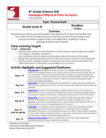
8th Grade Science Unit:Geological Effects of Plate TectonicsUnit SnapshotTopic: Physical EarthDuration:Grade Level: 814 daysSummaryThe following activities provide students the opportunity to become familiar withthe current theory of Plate Tectonics and the constructive and destructiveprocess involved in plate motion and interaction, resulting in variousgeological events and features.Clear Learning Targets“I can” statementsdescribe the movement and interaction of the 3 primary types of plate boundaries(convergent, divergent, transform).use a boundary map to explain various plate interactions around the world.explain the resulting geologic effects of plate boundary movement and interaction.identify specific geologic events and features around the world and explain howplate movement or interaction is responsible for such events.Activity Highlights and Suggested TimeframeDays 1-2Day 3-4Engagement: The objective of this activity is to engage students and assessstudent knowledge related to the current plate tectonics theory through the useof a mapping activity and interactive plate boundary map, guided-questions,and discussion. Students will map the locations of Earthquakes and Volcanoesaround the world using data in order to infer the relationship between theseevents and plate boundaries.Exploration: Students will explore the movements of various tectonic plates anddiscover real-world events that occur due to plate interactions through interactivewebsites.Days 5-7Explanation: Students will gain deeper understanding of the current theory ofplate tectonics and vocabulary through Earth Science Textbook guided readingand study, as well as a kinesthetic vocabulary reinforcement activity (Whoosh).Day 8-12Elaboration: Students will use research, explain details, and provide evidencerelated to Plate Tectonic Theory to explain the cause and effects of variousgeologic events that could possibly occur around the world. Students will use 21stCentury skills to create a news broadcast of an event.Day 13and on-goingDay 14Evaluation: The objective of the assessments is to focus on and assess studentknowledge and growth to gain evidence of student learning or progressthroughout the lesson, and to become aware of students misconceptions relatedto the current theory of plate tectonics. A teacher-created short-cycle assessmentcan be used to assess all learning targets (Day 13)Extension/Intervention: Based on the results of the short-cycle assessment,facilitate extension and/or intervention activities.Columbus City SchoolsCurriculum Leadership and DevelopmentScience Department June 20131
LESSON PLANSNEW LEARNING STANDARDS:8.ESS.2b -Earth’s Crust consists of major and minor tectonic plates that move relative toeach other.There are three main types of plate boundaries: divergent, convergent and transform. Each type ofboundary results in specific motion and causes events (such as earthquakes or volcanic activity) or features(such as mountains or trenches) that are indicative of the type of boundary.SCIENTIFIC INQUIRY and APPLICATION PRACTICES:During the years of grades K-12, all students must use the following scientific inquiry and application practices with appropriatelaboratory safety techniques to construct their knowledge and understanding in all science content areas:Asking questions (for science) and defining problems (for engineering) that guide scientificinvestigationsDeveloping descriptions, models, explanations and predictions.Planning and carrying out investigationsConstructing explanations (for science) and designing solutions (for engineering)that concludescientific investigationsUsing appropriate mathematics, tools, and techniques to gather data/information, and analyze andinterpret dataEngaging in argument from evidenceObtaining, evaluating, and communicating scientific procedures and explanations*These practices are a combination of ODE Science Inquiry and Application and Framework for K-12Science Education Scientific and Engineering PracticesCOMMON CORE STATE STANDARDS for LITERACY in SCIENCE:oCCSS.ELA-Literacy.RST.6-8.7 Integrate quantitative or technical information expressed in words in a text witha version of that information expressed visually (e.g., in a flowchart, diagram, model, graph, or table).CCSS.ELA-Literacy.WHST.6-8.8 Gather relevant information from multiple print and digital sources, usingsearch terms effectively; assess the credibility and accuracy of each source; and quote or paraphrase thedata and conclusions of others while avoiding plagiarism and following a standard format for citation.CCSS.ELA-Literacy.WHST.6-8.2b Develop the topic with relevant, well-chosen facts, definitions, concretedetails, quotations, or other information and examples.*For more information: http://www.corestandards.org/assets/CCSSI ELA%20Standards.pdfSTUDENT KNOWLEDGE:Prior Concepts Related to Forces, Movement and Igneous EnvironmentsK-2: Properties of materials can change. Pushing and pulling can affect the motion of an object.Grades 3-5: Forces change the motion of an object. Rocks have specific characteristics. Heat is a form ofenergy. Energy can be conserved. Earth’s surface has specific characteristics. Heat results when materialsrub against each other. Gravitational force and magnetism also are studied.Grades 6-7: Rocks have characteristics that are related to the environment in which they form. Thermalenergy is a measure of the motion of the atoms and molecules in a substance. Energy can be transformed,transferred and conserved. Thermal energy can be transferred through radiation, convection andconduction.Future Application of ConceptsHigh School: Thermal energy, gravitational energy, radioactive decay and energy transfer are studied. In thegrades 11/12 Physical Geology course, further studies of plate tectonics, seismology and volcanism arefound.Columbus City SchoolsCurriculum Leadership and DevelopmentScience Department June 20132
MATERIALS:VOCABULARY:EngageEarth Science Textbook Skills Lab Student WorksheetsColored Projector/InternetOptional: laptops, computer lab, iPads3 Primary Types of Plate Boundaries graphic organizersPlates on the Move Student SheetsExplainEarth Science TextbooksGuided Reading and Study Worksheets from textbook resourcesReview and Reinforce Worksheet from textbook resourcesElaborateOptional: laptops, computer lab, iPadsEarth Science TextbooksLibrary Books or articles related to the given various geologiclocations for researchOptional: Video ormPlate BoundariesPlate 2 days)(What will draw students into thelearning? How will you determinewhat your students already knowabout the topic? What can bedone at this point to identify andaddress misconceptions? Wherecan connections be made to thereal world?)SecondaryConvectionFaultHawaiian IslandsMariana TrenchMid-Atlantic RidgeNew Madrid Fault SystemRidgeRing of FireSan Andreas FaultSea-Floor SpreadingTrenchTsunamiAll CSS Safety and Laboratory Procedures/Rules apply.Gather materials for laboratory investigationsCopy student worksheetsReserve computer lab/laptops if possibleObjective: The objective of this activity is to engage students and assessstudent knowledge related to the current plate tectonics theorythrough the use of a mapping activity and interactive plateboundary map, guided-questions, and discussion. Students will mapthe locations of Earthquakes and Volcanoes around the world usingdata in order to infer the relationship between these events andplate boundaries.What is the teacher doing?Skills Lab: Mapping Earthquakes andVolcanoes (Day 1)Distribute the Earth Science TextbookSkills Lab Worksheets: MappingEarthquakes and Volcanoes. Thiscan be found in the All-In-OneTeacher Resources Unit One Bookpp. 448-450.Provide colored pencilsFacilitate activity and follow-up withdiscussion.Columbus City SchoolsCurriculum Leadership and DevelopmentScience Department June 2013What are the students doing?Skills Lab: Mapping Earthquakes andVolcanoes (Day 1)1. Students complete Skills Lab:Mapping Earthquakes andVolcanoes.3
Plate Boundaries Map (Day 2)See Teacher PageProject the following website moduleon the board and make sure you onthe Maps rning/module04swf.swfClick on the Boundaries Tab to showthe boundary lines between theplates.Next click on the Volcanoes tab toshow where volcanoes are locatedaround the world, and that many ofthem are aligned along plateboundaries.Plate Boundaries Map (Day 2)1. Students view the interactivewebsite as a class.Next Click on Earthquakes to showthe relationship between Volcanoesand Earthquakes.Next Click on hotspots and explainthe difference between plateboundaries and hotspots.Next Click on the Velocity Tab toshow the direction and movementof the plates.Finally click on the names.Facilitate a discussion using the mapand the provided guided questions.2. Students are engaged inconversation related to themap features as the teacherfacilitates.3. Students use and analyze themap to answer teacherguided questions.Consider showing the followingDiscovery Ed Video Clip if needed:Discovering Plate Tectonics [7:08]Plate Tectonics [5:46]Objective: Students will explore the movements of various tectonic plates anddiscover real-world events that occur due to plate interactionsthrough interactive websites.What is the teacher doing?EXPLORE(2 days)(How will the concept bedeveloped? How is this relevantto students’ lives? What can bedone at this point to identify andaddress misconceptions?)Plate Boundary Motion (Day 3)See TEACHER PAGEProject the same website from Day ing/module04swf.swfor provide students with individualdevices (computers, laptops, Ipads).Distribute the 3 Primary Types of PlateBoundaries graphic organizer.Columbus City SchoolsCurriculum Leadership and DevelopmentScience Department June 2013What are the students doing?Plate Boundary Motion (Day 3)4
Click on the “Details” Tab and show orallow students on their own to vieweach animation and the relatedinformation.-Ocean-Continent Subduction-Continent-Continent Collision-Ocean to Ocean Supbduction-Continental Rift-Mid-Ocean Ridge-Continental Transform-Oceanic Transform-Oceanic Hot Spots-Continental Hot SpotsAssist students with completing thegraphic organizer using the informationfrom this website.Plates on the Move (Day 4)Either project the following website onthe board or have students useindividual devices to ex.phpAssist students in completing page oneof the handout.Click on:1. Students view variousanimations related toplate boundarymovement andcomplete the graphicorganizer using theinformation related to theanimation.Plates on the Move (Day 4)1. Students use the websiteinformation andinteractive animations tolearn more about theplate boundaries and theevents caused by plateinteractions ormovements.2. Students complete Plateson the move studentworksheet.The Intro should be read aloudEmphasize that students my NOT clickon “Skip the Intro”. This is the coreexplanation.Assist students with completing part 2 ofthe worksheet individually, in partners, oras a class.Columbus City SchoolsCurriculum Leadership and DevelopmentScience Department June 20135
Objective: Students will gain deeper understanding of the current theory ofplate tectonics and vocabulary through Earth Science Textbookguided reading and study, as well as a kinesthetic vocabularyreinforcement activity (Whoosh).What is the teacher doing?Guided Reading and Study/Reviewand Reinforce (Days 5-6)Provide students with the EarthScience Textbook and PlateTectonics Guided reading andStudy Worksheet/Review andReinforce pages from the EarthScience All-In-One TeacherResources Unit One Book pp. 337340.Assist students as they read andcomplete the worksheets.Plate Tectonics WHOOSH (Day 7)See TEACHER PAGEA WHOOSH is used as a kinestheticway to get students excited aboutvocabulary.Begin by modeling a WHOOSH forEXPLAINyour students(3 days)Students will develop their own(What products could themovements to go along with thestudents develop and share?How will students share what theyunit’s vocabulary and share theirhave learned? What can bemovements with a partner.done at this point to identify andThe teacher will tell a story usingaddress misconceptions?)the new vocabulary words. Whena student hears these words, theywill do their correspondingmovement.The class will then split into smallgroups and each group will createtheir own story using thevocabulary.Groups will then present theirWHOOSH to the class and theteacher can assess their learningof new vocabulary.What are the students doing?Guided Reading and Study/ Reviewand Reinforce (Days 5-6)1. Students complete the PlateTectonics Guided Reading andStudy.Plate Tectonics WHOOSH (Day 7)2. Students participate in the Whooshactivity by creating movementsthat represent vocabulary wordsrelated to Plate Tectonics Theory.Optional HW or RICA:Earth Science Textbook All-In-OneTeacher Resources Unit One:Enrich – The Birth of the Himalayasp.341Columbus City SchoolsCurriculum Leadership and DevelopmentScience Department June 20136
Objective: Students will use research, explain details, and provide evidencerelated to Plate Tectonic Theory to explain the cause and effects of variousgeologic events that could possibly be occurring around the world. Studentswill use 21st Century skills to create a news broadcast of an event.ELABORATE(5 days)(How will the new knowledge bereinforced, transferred to newand unique situations, orintegrated with relatedconcepts?)What is the teacher doing?What are the students doing?Earthquake Entrance Ticket (Day 8)Distribute the provided Entranceticket.If needed, show students a plateboundaries map.Discuss student responses.Optional Article: GeoFacts No. 3:Earthquakes and Seismic Risk eoFacts/geof03.pdfEarthquake Entrance Ticket (Day 8)1. Complete entrance ticket2. Discuss answers.ENN Breaking News Report (Days 812)See TEACHER PAGEDistribute the ENN Breaking NewsTask Sheet and Rubric.Go over the task with the students.Ask for a student to paraphrasethe directions.ENN Breaking News Report (Days 8-12)Group students into productionteams to allow for differentiationand have them research an event(simple one for lower level,increasing complexity for moreadvanced learners.)Assist as students plan their“broadcast” and model, andassign roles within the group.Teacher ensures that students willhave the materials necessary tobuild the models.Assist students as they write thescript and begin rehearsing, whileteacher facilitates the groups’progress.Assist as students build the modeland practice their broadcast.3. Students are placed intoproduction teams.4. Students are given one of thefollowing topics to study:Volcanic Eruption - Ring of FireVolcanic Eruption – HawaiianIslandsEarthquakes near San AndreasFaultHot Springs and Geysers –YellowstoneHot Springs-IcelandEarthquakes-New Madrid FaultSystemEarthquakes near theHimalayan Mountains5. Students plan and develop theirbroadcast and develop theirmodel.Students present their broadcastswhile teacher assesses learningoutcomes.Columbus City SchoolsCurriculum Leadership and DevelopmentScience Department June 20136. Students practice their broadcast.7. Students perform and/or videorecord their news broadcast.7
Objective: The objective of the assessments is to focus on and assessstudent knowledge and growth to gain evidence of student learning orprogress throughout the lesson, and to become aware of studentsmisconceptions related to the current theory of plate tectonics. Ateacher-created short-cycle assessment can be used to assess alllearning targets (Day 13)FormativeHow will you measure learning as it occurs?EVALUATE(on-going)(What opportunities will studentshave to express their thinking?When will students reflect onwhat they have learned? Howwill you measure learning as itoccurs? What evidence ofstudent learning will you belooking for and/or collecting?)Consider developing ateacher-created formativeassessment1. The Skills Lab engage activity andPlate Boundaries Map withdiscussion can assess students’prior knowledge of the currentTheory of Plate Tectonics.2. Plates on the Move and textbookguided reading activities canassess student progressiontowards mastery of theobjectives.EXTENSION1. Earth Science TextbookPerformance Assessment:Modeling Plate Boundaries.This can be found on p. 355 inthe Earth Science Textbook AllIn-One Teacher Resources UnitOne Book.EXTENSION/INTERVENTION(1 day or as needed)SummativeWhat evidence of learning will demonstrateto you that a student has met thelearning objectives?1. ENN News Broadcast can assessstudents’ ability to explain currentplate tectonic theory as it relatesto a real-world geologic event.2. Teacher-created short cycleassessment will assess all clearlearning targets. Consider utilizingassessment questions from theEarth Science Textbook ChapterTest on pp.356-359 in the EarthScience Textbook All-In-OneTeacher Resources Unit One Book.INTERVENTION1. Discovery Ed(www.unitedstreaming.com)related videos.2. www.explorelearning.comGIZMO: Plate Tectonics2. Earth Science TextbookChapter Project: Design andBuild an Earthquake-SafeHouse. This can found onpp.370-376 in the EarthScience Textbook All-In-OneTeacher Resources Unit OneBook.3. Earth Science Textbook Enrich:Magnetic Reversals Throughthe Ages. This can found on p.350 in the Earth ScienceTextbook All-In-One TeacherResources Unit One Book.Columbus City SchoolsCurriculum Leadership and DevelopmentScience Department June 20138
Only continents move (Wegener's original concept, along with thecommon use of 'Continental Drift' term in general texts, secondaryeducation earth science films, etc.)Most crust motions (especially those associated with processes ofmountain building or deep sea trench formation) are due to verticalmotions, not lateral (terms like 'mountain uplift' and earth sciencetextbook terminology, as well as relict idea from old cosmologies).Divergent ocean ridges are due to vertical uplift or convergence, ratherthan divergence (In students' experience, buckling is usually due toconvergence or uplift, not heat/density differences, so illustrations ofridges do not readily fit with a pulling apart motion).Present oceans only began as Pangea broke apart - tied to generalidea that Pangea was the original continent at the Earth's start (feweducational earth science films mention what came before Pangea &emphasis on Atlantic spreading leads to Pacific being overlooked).Plate movement is imperceptible on a human timeframe (common useof fingernail growth analogy is only true for slowest plates andunderestimates importance of motion).COMMONMISCONCEPTIONSPlate motion is rapid enough that continent collision can causefinancial and political chaos, while rifting can divide families or separatea species from its food source.Oceans are responsible for oceanic crust (rather than being closer toother way round).Continental 'shelves' are similar to shelves in homes, extend out overedge of continent and can break and collapse to form tsunamis (soBoxing Day tsunami was due to shelf collapse)The edge of a continent is the same thing as a plate boundary.A plate boundary type is the same thing as a plate. For example, aplate has to be divergent or convergent.*The misconceptions listed above came misconception list.htmlStrategies to address misconceptions:Misconceptions can be addressed through the use ofwww.unitedstreaming.com video clips, pictures/diagrams of plate interactions,boundaries, and geologic events/features, through the use of models, and online simulations/animations.Columbus City SchoolsCurriculum Leadership and DevelopmentScience Department June 20139
Lower-level: Provide additional text resources (tradebooks, articles) that areappropriate for the reading level of the student. Integratewww.unitedstreaming.com videos into instruction. Provide picturesand diagrams to help students visualize plate tectonics concepts.Provide an alternative or appropriate revised version of thebroadcast project to meet the needs of your students.DIFFERENTIATIONHigher-Level: Consider having students interpret real-data as evidence for platemovement. Consider having students compare and contrastformer theories related to Earth’s surface movements (i.e.Continental Drift) with the more current theory. Consider assigningextension activities.Strategies for meeting the needs of all learners including gifted students, EnglishLanguage Learners (ELL) and students with disabilities can be found at thefollowing sites:ELL agement/DocumentDownload.aspx?DocumentID 105521Gifted agement/DocumentDownload.aspx?DocumentID 105522Students with mentManagement/DocumentDownload.aspx?DocumentID 105523Textbook Resources:Pearson/Prentice Hall Earth Science TextbookChapter 5.5 The Theory of Plate Tectonics pp.150-158.Chapter 6.1 Forces in Earth’s Crust pp. 162-168Chapter 7.1: Volcanoes and Plate Tectonics pp.200-204ADDITIONALRESOURCESWebsites:Plate Boundary e 5.aspPlate and Boundaries – Annenberg /programs/education and outreach/aotm/11/2a.PlateBoundaries Background.pdfMountain Maker, Earth /Discovery Ed/Other Video Links:Discovering Plate Tectonics [7:08]Plate Tectonics [5:46]Hot Spots and Plate Tectonics [2:35]Plate Tectonics, Volcanoes, and Earthquakes [4:50]Columbus City SchoolsCurriculum Leadership and DevelopmentScience Department June 201310
Literature/Articles:Stille, Darlene, R. (2007). Plate Tectonics: Earth’s Moving Crust.Minneapolis, Minn.: Compass Point Books.Silverstein, Alvin. (2009). Plate Tectonics. Minneapolis, Minn.: Twenty-FirstCentury Books.Saunders, Craig. (2011). What Is the Theory of Plate Tectonics? NewYork: Crabtree Publishing.Erikson, Jon. (2001). Plate Tectonics: Unraveling The Mysteries of theEarth. New York: Facts on File.Snedden, Robert. (2010). Earth’s Shifting Surface. Chicago, Ill.: RaintreePublishing.Hooper, Meredith. (2004): Island That Moved: How Shifting Forces ShapeOur Earth. New York: Viking Publishers.GeoFacts #3 - Earthquakes and Seismic Risk in Facts/geof03.pdfScience News for Kids - A Volcano Wakes Up, by Kate kes-up-2/Columbus City SchoolsCurriculum Leadership and DevelopmentScience Department June 201311
ENGAGE: Plate Boundary Map – TEACHER PAGE(Day 2)1. Project the following website module on the board and make sure you on the Maps rning/module04swf.swf2. Click on the Boundaries Tab to show the boundary lines between the plates.3. Next click on the Volcanoes tab to show where volcanoes are located around the world, andthat many of them are aligned along plate boundaries.4. Next Click on Earthquakes to show the relationship between Volcanoes and Earthquakes.5. Next Click on Hotspots and explain the difference between plate boundaries and hotspots.6. Next Click on the Velocity Tab to show the direction and movement of the plates.7. Finally click on the Names.8. Facilitate a discussion using the map and the following guided questions:A. Where are some areas where two plates are coming together? Plate Names?Answer: North American Plate and Pacific Plate; Eurasian plate and Pacific Plate/IndianAustralian Plate/Arabian Plate/African PlateB. Where are some areas where two plates are moving apart? Plate Names?Answer: Antarctic Plate and Pacific Plate/ Indian-Australian Plate; African and EurasianPlates; North American and Eurasian Plates; North American and African Plates; SouthAmerican and African Plates; Nazca and Pacific Plates; Cocos and Pacific PlatesC. Where are some areas where two plates are sliding past one another? Plate Names?Answer: Scotia and Antarctic/South American Plate; Antarctic and African Plates; Africanand South American Plates; Caribbean and North American PlatesD. Do you see volcanoes forming more around certain types of plate boundarymovement?Answer: Yes – Volcanoes form more around plates that move towards one another(convergent boundaries).Columbus City SchoolsCurriculum Leadership and DevelopmentScience Department June 201312
EXPLORE: Plate Boundary Movement – TEACHER PAGE(Day 3)1. Project the same website from Day ing/module04swf.swfor provide students with individual devices (computers, laptops, Ipads).2. Distribute the 3 Primary Types of Plate Boundaries graphic organizer.3. Click on the “Details” Tab and show or allow students on their own to view eachanimation and the related information.-Ocean-Continent Subduction-Continent-Continent Collision-Ocean to Ocean Subduction-Continental Rift-Mid-Ocean Ridge-Continental Transform-Oceanic Transform-Oceanic Hot Spots (optional)-Continental Hot Spots (optional)4. Assist students with completing the graphic organizer using the information fromthis website.Columbus City SchoolsCurriculum Leadership and DevelopmentScience Department June 201313
Name: Date: Period:Explore: Three Primary Types of Plate BoundariesDirections:1) In Box 1, List the various types of crust movements for each type of boundary.2) In Box 2, describe what type of movement is occurring in each type of plate boundary.3) List the major geological events that result from each type of plate boundarymovement.1) CONVERGENT Boundary2) Directions of Plate Movement:3) Major Geological Events:2) DIVERGENT Boundary2) Directions of Plate Movement:3) Major Geological Events:3) TRANSFORM Boundary2) Directions of Plate Movement:3) Major Geological Events:Columbus City SchoolsCurriculum Leadership and DevelopmentScience Department June 201314
Name Teacher Answer Key Date: Period:Explore: Three Primary Types of Plate BoundariesDirections:1) In Box 1, List the various types of crust movements for each type of boundary.2) In Box 2, describe what type of movement is occurring in each type of plate boundary.3) List the major geological events that result from each type of plate boundarymovement.1) CONVERGENT BoundaryOceanic-Continent SubductionContinent-Continent CollisionOcean-Ocean Subduction2) DIVERGENT BoundaryContinental RiftMid-Ocean Ridge2) Directions of Plate Movement:3) Major Geological Events:VolcanismMountain BuildingEarthquakes2) Directions of Plate Movement:3) Major Geological Events:Sea-Floor SpreadingOcean Basins creationFaultsSmall Volcanic EruptionsEarthquakes3) TRANSFORM BoundaryContinental TransformOceanic Transform2) Directions of Plate Movement:or3) Major Geological Events:FaultsEarthquakesColumbus City SchoolsCurriculum Leadership and DevelopmentScience Department June 201315
Name Date PeriodExplore: Plates on the MoveGoogle: Plates on the moveOr p1234When the edgesof plates meet,four things NARROWSSUBDUCTIONCLICK on:1. Click on a red dot to explore a volcano, mountain, hot spot, or earthquake.2. After you zoom into it, look at the map to see how the plates are moving. Record thelocation, the plates involved, and the type of plate interaction/movement (slip,spreading,collision, subduction, hotspot).3. To the left play the animation about the plate interaction.4. Click on STATS, and record information.5. CLICK on STORY. Write 4 sentences about the location.Columbus City SchoolsCurriculum Leadership and DevelopmentScience Department June 201316
Name Date PeriodPLATES ON THE MOVELocation 1 :Plates Involved are:Type of interaction: (circle onvergent)SUBDUCTION(convergent)HOT SPOT**Play animation**STATS:Event: Date:STORY:Location 2 :Plates Involved are:Type of interaction: (circle onvergent)SUBDUCTION(convergent)HOT SPOT**Play animation**STATS:Event: Date:STORY:Columbus City SchoolsCurriculum Leadership and DevelopmentScience Department June 201317
Name TEACHER ANSWER KEY Date PeriodExplore: Plates on the MoveGoogle: Plates on the moveOr pWhen the edgesof platesmeet, fourthings STwo plates slide past each other2SPREADING(divergentboundary)Two plates move a part from eachother3COLLISION(convergentboundary)Two plates crash and fold up4SUBDUCTIONOne plate sinks below the otherCLICK on:1. Click on a red dot to explore a volcano, mountain, hot spot, or earthquake.2. After you zoom into it, look at the map to see how the plates are moving. Record thelocation, the plates involved, and the type of plate interaction/movement (slip, spreading,collision, subduction, hotspot).3. To the left play the animation about the plate interaction.4. Click on STATS, and record information.5. CLICK on STORY. Write 4 sentences about the location.Columbus City SchoolsCurriculum Leadership and DevelopmentScience Department June 201318
WHOOSH!Teacher PageA WOOSH is used as a kinesthetic way to
Science Department June 2013 1 8th Grade Science Unit: Geological Effects of Plate Tectonics Unit Snapshot Topic: Physical Earth Grade Level: 8 Duration: 14 days Summary The following activities provide students the opportunity to become familiar with the current theory of Plat
