Transcription
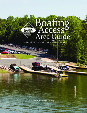
ACCESS AREAS PROVIDE A FREE LAUNCHwww.ncwildlife.org
COASTAL REGION BOATING ACCESS AREASby Access Area, Body of WaterAstoria Landing, Roanoke River MARTIN COUNTYN 35 49' 19''W 76 54' 11''Address: 1333 Astoria Dr., Jamesville, NC47 parking spacesFrom the junction of NC 171 and US 64 Business in Jamesville, travel on US 64 Business east0.6 miles. Turn right on Astoria Rd. and travel 0.6 miles. Turn right to the area.Aurora, South Creek BEAUFORT COUNTYN 35 18' 17''W 76 46' 49''Address: 1 Main St., Aurora, NC22 parking spacesFrom the junction of NC 33 and NC 306 west of Aurora, travel on NC 33 east 1.4 miles. Turn left onFirst St. and travel 0.2 miles. Turn right on Main St. and travel to the area at the end of the road.Avalon Beach, Kitty Hawk Bay DARE COUNTYN 36 02' 08''W 75 41' 12''Address: 2025 Bay St., Kill Devil Hills, NC20 parking spacesFrom the east end of the Wright Memorial Bridge on NC 158 east, over Currituck Sound inSouthern Shores, travel east 6 miles. Turn right on W. Avalon Dr. and travel 0.6 miles. Turn left onBay Dr. and travel 0.1 miles. Turn right on Dock St. to the area.Beaufort, Taylor’s Creek CARTERET COUNTYN 34 42' 35''W 76 37' 56''Address: 2370 Lennoxville Rd., Beaufort, NC31 parking spacesFrom the east end of the drawbridge on US 70 in Beaufort, travel on US 70 east 1 mile. Turn righton Lennoxville Rd. (SR 1310) and travel 1.5 miles. Turn right to the area.Belhaven, Pantego Creek BEAUFORT COUNTYN 35 32' 20''W 76 37' 30''Address: 135 West Water St., Belhaven, NC30 parking spacesFrom the junction of US 264 Business and NC 99 in Belhaven, travel on US 264 Business(Main St.) east 0.7 miles. Turn right on Haslin St. and travel 0.1 miles (one block). Turn righton Water St. and travel 50 yards to the area on the left.Big Flatty, Big Flatty Creek PASQUOTANK COUNTYN 36 09' 00''W 76 07' 59''Address: 265 Shadneck Rd., Elizabeth City, NC12 parking spacesFrom the junction of US 17 and US 158 in Elizabeth City, travel on US 17 south 1.1 miles.Turn left on Halstead Blvd. (SR 1152) and travel 2.1 miles. Continue on NC 34 East for 7.5miles. Turn right on Esclip Rd. and travel 2.3 miles. Turn left on Soundneck Rd. (SR 1104) andtravel 1.7 miles. Turn right on Shadneck Rd. (SR 1108) and travel 1.6 miles. Turn right on theaccess road to the area.Blounts Creek, Blounts Creek BEAUFORT COUNTYN 35 24’ 26”W 76 57’ 46”Address: 350 Crisp Landing Rd., Chocowinity, NC37 parking spacesFrom the junction of US 264 and US 17 in Washington, travel on US 17 south 4.1 miles. Take theexit toward NC 33 east and travel 10 miles. Turn left onto Clay Bottom School Rd. (SR 1114) andtravel 0.6 miles. Take first right onto Cotton Patch Rd. (SR 1115) and travel 1.8 miles. Continueon left to stay on Crisp Landing Rd. (SR 1116). The area is at the end of the road.Boardman, Lumber RiverROBESON COUNTYN 34 26’ 35”W 78 57’ 38”Address: 17 V C Britt Rd., Orrum, NC10 parking spacesFrom I-95, take exit 13 to US 74 East toward Wilmington. Travel about 14.5 miles and turnright on V C Britt Rd. (SR 2245), just before the bridge over Lumber River. The entrance to thearea is on the left.Bowsertown Road, Croatan SoundBrice’s Creek, Brice’s Creek Handicap accessible CRAVEN COUNTYN 35 02' 59''W 77 02' 55''Address: 953 Perrytown Rd., New Bern, NC15 parking spacesFrom the junction of US 17 Business and US 70 in New Bern, travel on US 70 south about1 mile. Turn right on Williams Rd. (SR 1167) and travel 1.4 miles. The road turns into KelsoRd. Turn left on Madame Moores Ln. (SR 1004) and travel 1.6 miles. The road turns intoBrices Creek Rd. Turn left on Perrytown Rd. (SR 1143) and travel 1.5 miles. Turn left onNational Forest Rd. and travel 1.3 miles to the area.Bricklanding Road, Intracoastal Waterway BRUNSWICK COUNTYN 33 54’ 19”W 78 23’ 38”Address: 1921 Bricklanding Rd. SW, Shallotte, NC28 parking spacesFrom the junction of US 17 B (Main St.) and Whiteville Rd. NW (NC 130), in Shallotte, travelon Blake St. (NC 107) 0.1 miles to Village Dr. (NC 107). Turn right and travel 3.8 miles (theroad changes name to Brick Landing Rd. SW). Turn left and continue on Brick Landing Rd.(SR 1143) for 1.3 miles. The area is at the end of the road.Bridgeton, Neuse River CRAVEN COUNTYN 35 08' 41''W 77 02' 52''Address: 880 Wildlife Rd., Bridgeton, NC20 parking spacesFrom the junction of US 17 and NC 55 in Bridgeton, travel on US 17 north 2.8 miles. Turn lefton Wildlife Rd. (SR 1431) and travel 1 mile to the area at the end of the road.Brumley Road, Currituck SoundCURRITUCK COUNTYN 36 30' 29''W 75 54' 36''Address: 192 Brumley Rd., Knotts Island, NC18 parking spacesFrom the NCDOT Ferry Docks on Knotts Island, travel on NC 615 north 2.2 miles. Turn righton Brumley Rd. (SR 1259) and travel 0.8 miles to the area at the end of the road.Cannon’s Ferry, Chowan River CHOWAN COUNTYN 36 16' 05''W 76 40' 16''Address: 247 Cannon’s Ferry Rd., Tyner, NC25 parking spacesFrom the junction of US 17 and NC 32 in Edenton, travel on NC 32 north 14.1 miles. Turn left onCannon’s Ferry Rd. (SR 1231) and travel 0.9 miles. Turn left to the area.Castle Hayne, Northeast Cape Fear River NEW HANOVER COUNTYN 34 21' 49''W 77 53' 47''Address: 6418 Orange St., Castle Hayne, NC76 parking spacesFrom I-40, take Exit 414 toward Castle Hayne and travel on Holly Shelter Rd. (SR 1002) west0.9 miles. Turn right on US 117 and travel north 0.5 miles. Turn right on Orange St. (SR 1341)and travel 0.2 miles. Turn left to the area.Castle Street, Cape Fear River NEW HANOVER COUNTYN 34 13' 39''W 77 57' 00''Address: 602 Surry St., Wilmington, NC13 parking spacesFrom I-40, take Exit 416A to I-140/US 17 south toward Shallotte and travel on US 421 south6.8 miles. Take Exit 14 to US 421 north toward Wilmington and travel 4 miles. Take US 17east toward Wilmington. After crossing the bridge, take S. Front St. toward downtown andtravel 0.1 miles. Turn left on W. Castle St. and travel to the area at the end of the road.Cedar Island, Pamlico SoundNCWRC-maintained areas DARE COUNTYN 35 53' 53''W 75 40' 38''Address: 1153 Bowsertown Rd., Manteo, NC28 parking spacesFrom the junction of US 64/264 Bypass and NC 345 near Manteo, travel on US 64 Businesswest 1.4 miles. Turn left on Bowsertown Rd. (SR 1129) and travel 0.4 miles. Turn left on California Ln. (SR 1345) and travel 0.1 miles. Turn right to the area. CARTERET COUNTYN 35 01' 02''W 76 18' 45''Address: 115 Driftwood Dr., Cedar Island, NC20 parking spacesFrom the junction of US 70 and NC 12 near Sea Level, travel on NC 12 north 11.7 miles. Turn righton Driftwood Rd. and travel 0.3 miles to the area at the end of the road.COASTAL REGION BOATING ACCESS AREAS1
Cedar Point, Intracoastal Waterway CARTERET COUNTYN 34 40' 40''W 77 06' 32''Address: 144 Cedar Point Blvd., Cedar Point, NC44 parking spacesFrom the intersection of NC 58 and NC 24 in Cape Carteret, travel on NC 24 west 2.4 miles.Turn left to the area.Chinquapin, NE Cape Fear RiverDUPLIN COUNTYN 34 49' 53''W 77 49' 56''Address: 230 Quiet Water Dr., Chinquapin, NC8 parking spacesFrom the junction of NC 50 and NC 41 in Chinquapin, travel on NC 41 west 1 mile. Turn righton Durwood Evans Rd. (SR 1964) and travel 0.3 miles. Turn left on Quiet Water Dr. and travel0.5 miles to the area at the end of the road.Coinjock, Intracoastal Waterway CURRITUCK COUNTYN 36 21' 33''W 75 56' 42''Address: 482 Waterlily Rd., Coinjock, NC22 parking spacesFrom the east end of the Intracoastal Waterway Bridge on US 158 in Coinjock, travel on US 158east 0.3 miles. Turn left on Waterlily Rd. (SR 1142) and travel 1.8 miles. Turn left to the area.Columbia, Scuppernong River TYRRELL COUNTYN 35 54' 59''W 76 16' 41''Address: 165 Ramp Rd., Columbia, NC15 parking spacesFrom the junction of US 64 and NC 94 in Columbia, travel on US 64/NC 94 west 1.1 miles. Turn right on NC 94 (Old Columbia Rd.) and travel 0.3 miles. Turn righton Ramp Rd. (SR 1228) and travel 0.2 miles. Turn left on the access road to the area.Conaby Creek, Conaby CreekCow Pen Landing, Neuse River Emerald Isle, Intracoastal Waterway CARTERET COUNTYN 34 40' 13''W 77 00' 24''Address: 6800 Emerald Dr., Emerald Isle, NC131 parking spacesFrom the NC 58 Bridge in Emerald Isle, continue on NC 58 (Emerald Dr.) east 3 miles. Turn leftto the area.Engelhard, Pamlico Sound HYDE COUNTYN 35 30' 50''W 75 59' 18''Address: 35696 US Hwy. 264, Engelhard, NC15 parking spacesFrom the junction of US 264 and NC 94, south of Lake Mattamuskeet, travel on US 264 east15.1 miles. After passing Engelhard, turn right on Kitty Island Rd. and travel 0.2 miles to thearea at the end of the road.BLADEN COUNTYN 34 38' 28''W 78 18' 47''Address: 886 Ennis Bridge Rd., Ivanhoe, NC20 parking spacesFrom the junction of NC 210 and NC 41, east of White Lake, travel on NC 210 south 4.8miles. Turn left on Ennis Bridge Rd. (SR 1007) and travel 0.8 miles. Turn left to the area. PITT COUNTYN 35 41' 42''W 77 29' 24''Address: 3013 NC Hwy. 222, Falkland, NC30 parking spacesFrom the junction of NC 43 and NC 222, east of Falkland, travel on NC 222 east 0.3 miles.Turn right to the area on the east side of the Tar River Bridge.Fayetteville, Cape Fear RiverCRAVEN COUNTYN 35 14' 20''W 77 10' 00''Address: 1199 Cow Pen Landing Rd., Vanceboro, NC20 parking spacesFrom Vanceboro, travel on US 17/NC 43 south about 4 miles. Turn right on NC 43 (WeyerhaeuserRd.) and travel 3.2 miles. Turn right on River Rd. (SR 1400) and travel 3.2 miles. Turn right on CowPen Landing Rd. (SR 1441) and travel 0.5 miles to the area at the end of the road. WASHINGTON COUNTYN 35 51' 43''W 76 23' 03''Address: 321 Spruill Bridge Rd., Creswell, NC11 parking spacesFrom US 64, take Exit 558 toward Creswell and travel on Alligood Rd. south 0.5 miles. Theroad turns into 6th St. (SR 1310). Turn left on Spruill Bridge Rd. (SR 1142) and travel 0.7miles. Turn left to the area.Dawson Creek, Dawson CreekElwell’s Ferry, Cape Fear RiverBLADEN COUNTYN 34 28' 26''W 78 22' 08''Address: 2702 North Elwell Ferry Rd., Council, NC10 parking spacesFrom the junction of NC 87 and US 701 in Elizabethtown, travel on NC 87 (E. Broad St.) east16 miles. Turn left on N. Elwell Ferry Rd. (SR 1730) and travel 2.6 miles. Turn left to the area.Falkland, Tar River CRAVEN COUNTYN 35 11' 33''W 77 05' 01''Address: 1065 Cool Springs Rd., New Bern, NC15 parking spacesFrom the junction of US 17 and NC 55 in Bridgeton, travel on US 17 north 7.8 miles. Turn left onCool Springs Rd. (SR 1435) and travel 2.5 miles. Turn right to the area.Creswell, Scuppernong River Ennis Bridge, South RiverWASHINGTON COUNTYN 35 53' 47''W 76 42' 15''Address: 85 Conaby Ln., Plymouth, NC25 parking spacesFrom the junction of US 64 and NC 45, east of Plymouth, travel on NC 45 north 1.8 miles. Turnright on Conaby Ln. (SR 1350) and travel 0.1 miles. Turn left to the area.Cool Springs, Neuse RiverEdenhouse Bridge, Chowan RiverCHOWAN COUNTYN 36 03' 19''W 76 41' 02''Address: 248 Wharf Landing Rd., Edenton, NC48 parking spacesFrom US 17 east of Edenton, take Exit 224 to US 17 Business and travel away from Edentonon Queen St. (SR 1204) less than 0.5 miles. Turn left on Wharf Landing Rd. (SR 1208) andtravel 1 mile to the area at the end of the road. PAMLICO COUNTYN 34 59' 52''W 76 44' 57''Address: 303 Creek Place Rd., Oriental, NC21 parking spacesFrom NC 306 in Arapahoe, travel on Kershaw Rd. (SR 1005) east 4.8 miles. Turn right onJaniero Rd. (SR 1302) and travel 2.8 miles. Turn right on Creek Place Rd. and travel 0.3 miles.Turn left on the access road to the area.East Lake Ferry, Alligator RiverDARE COUNTYN 35 53' 51''W 75 58' 13''Address: 19669 Old Ferry Dock Rd., East Lake, NC15 parking spacesFrom the junction of US 64 and US 264 near Manns Harbor, travel on US 64 west 11.1 miles.Turn right on Old Ferry Landing Rd. (SR 1153) and travel 0.2 miles. Turn left to the area. CUMBERLAND COUNTYN 34 59' 48''W 78 51' 03''Address: 2517 Wilmington Hwy., Fayetteville, NC20 parking spacesFrom I-95, take Exit 46 to NC 87 toward Fayetteville and travel north 2.2 miles. Take Exit 100to Owen Dr. (SR 1007) and travel east 0.3 miles. Turn right on Wilmington Rd. (SR 2337) andtravel 1.1 miles. Turn left on the access road to the area.Federal Point, Buzzard Bay NEW HANOVER COUNTYN 33 57' 34''W 77 56' 30''Address: 2515 South Fort Fisher Blvd., Kure Beach, NC36 parking spacesFrom the intersection of US 421 and K Avenue in Kure Beach, travel on US 421 south 3.7miles. The area is at the end of US 421, on the left.Frying Pan, Alligator River TYRRELL COUNTYN 35 48' 16''W 76 06' 31''Address: 5550 Frying Pan Rd., Columbia, NC15 parking spacesFrom the junction of US 64 and NC 94 in Columbia, travel on NC 94 south 6.8 miles. Turn left onFrying Pan Rd. (SR 1307) and travel 5.5 miles. Turn right to the area.Gatesville, Chowan River GATES COUNTYN 36 21' 33''W 76 46' 19''Address: 700 New Ferry Rd., Gatesville, NC12 parking spacesIn Gatesville, at the junction of NC 137 and New Ferry Rd. (SR 1111) (beside courthouse),travel on New Ferry Rd. south 3.2 miles to the area at the end of the road.COASTAL REGION BOATING ACCESS AREAS2
Great Lake, Great LakeHavens Garden, Pamlico River CRAVEN COUNTYN 34 51' 35''W 77 03' 07''Address: 3550 Great Lake Rd., Maysville, NC5 parking spacesFrom the junction of NC 58 and NC 24 in Cape Carteret, travel toward Trenton on NC 58north 8.5 miles. Turn right on Hunters Creek Rd. (SR 1100) and travel 0.6 miles. Turn right onGreat Lake Rd. (SR 1101) and travel 6.5 miles to the area at the end of the road.Greenville, Tar RiverHaywood Landing, White Oak River PITT COUNTYN 35 35' 51''W 77 18' 51''Address: 940 Port Terminal Rd., Greenville, NC50 parking spacesFrom the junction of NC 33 and US 264 in Greenville, travel on NC 33 (10th St.) east 1.1miles. Turn left on Port Terminal Rd. (SR 1533) and travel 0.4 miles. Turn left to the area.Grifton, Contentnea CreekPITT COUNTYN 35 22' 07''W 77 26' 03''Address: 510 Water St., Grifton, NC19 parking spacesFrom the junction of NC 11 and NC 55, north of Kinston, travel NC 11 (S. Highland Ave.)north 7.1 miles. Turn right on NC 118 (Grifton Hugo Rd.) and travel 0.5 miles. Continue lefton NC 118 (S. Highland Ave.) for 0.5 miles. Turn right on W. Main St. and travel 0.3 miles. Turnright then left to the area.TYRRELL COUNTYN 35 41' 49''W 76 06' 34''Address: 6885 Gum Neck Rd., Columbia, NC10 parking spacesFrom the junction of US 64 and NC 94 in Columbia, travel on NC 94 south 13.1 miles. Turnleft on S. Gum Neck Rd. (SR 1321) and travel 2.8 miles to SR 1320. Continue left on SR 1320(S. Gum Neck Rd.) and travel 1.6 miles to SR 1316. Turn right on Gum Neck Landing (SR1316) and travel 0.6 miles. Turn left to the area. PASQUOTANK COUNTYN 36 13' 09''W 76 16' 34''Address: 1043 Halls Creek Rd., Elizabeth City, NC24 parking spacesFrom the junction of US 17 and US 158 in Elizabeth City, travel on US 17 south 6.5 miles. TakeExit 254 to Okisko Rd. (SR 1140) and travel east 3.6 miles. The road turns into Halls Creek Rd.(SR 1140). After crossing the bridge, turn right to the area.Hamilton, Roanoke River MARTIN COUNTYN 35 56' 51''W 77 12' 10''Address: 316 Main St., Hamilton, NC38 parking spacesFrom the intersection of NC 903 and NC 125 in Hamilton, travel on Front St. south 1 block.Turn left on Main St., beside the Hamilton Municipal building, and travel 0.3 miles. Turn lefton the access road to the area.Hampstead, Intracoastal Waterway PENDER COUNTYN 34 24’ 23”W 77 36’ 21”Address: 613 Lewis Rd., Hampstead, NC62 parking spacesFrom the junction of US 17 and NC 210 in Hampstead, travel on US 17 east 6.6 miles. Turnright onto Sloop Point Rd. (SR 1561) and travel 1.8 miles. Turn right onto Sloop Point LoopRd. (SR 1563) and travel 0.1 miles. Turn left on Lewis Rd. (SR 1564) and travel 0.5 miles. Thearea is at the end of the road.Hancock Creek, Hancock Creek JONES COUNTYN 34 49' 12''W 77 11' 09''Address: 8460 NC Hwy. 58 South, Maysville, NC20 parking spacesFrom the junction of US 17 and NC 58 in Maysville, travel on NC 58 south 7.4 miles. Turnright on the Croatan National Forest entrance road and travel 0.1 miles. Turn right at theintersection and travel 1.8 miles. Turn right at the junction and travel 0.4 miles to the area atthe end of the road.High Hill, Lumber RiverROBESON COUNTYN 34 35' 29''W 78 59' 03''Address: 6098 NC Hwy. 72 East, Lumberton, NC30 parking spacesFrom the junction of NC 72 and NC 211 in Lumberton, travel on NC 72 east 1.6 miles.After crossing the bridge, turn right to the area.Holden Beach, Intracoastal WaterwayGum Neck Landing, Alligator RiverHall’s Creek, Little RiverBEAUFORT COUNTYN 35 32’ 12”W 77 02’ 21”Address: 1053 East Main St., Washington, NC17 parking spacesFrom the intersection of US 17 and US 64 in Washington, travel on N. Bridge Rd. (US 17) south0.18 miles. Turn left on E. Main St. (NC 32) and travel 1.3 miles to the area on the right. CRAVEN COUNTYN 34 55' 03''W 76 51' 11''Address: 1100 Cahoogue Creek Rd., Havelock, NC18 parking spacesFrom the junction of NC 101 and US 70 in Havelock, travel on NC 101 east 5 miles. Turn lefton Cahoogue Creek Rd. (SR 1717) and travel 3.5 miles to the area at the end of the road.Harrellsville, Wiccacon RiverHERTFORD COUNTYN 36 18' 50''W 76 47' 33''Address: 206 Old Ferry Rd., Harrellsville, NC10 parking spacesFrom the junction of NC 45 and NC 561 near Harrellsville, travel on NC 45 south 0.2 miles.Turn left on Old Ferry Rd. (SR 1433) and travel 0.7 miles to the area at the end of the road. BRUNSWICK COUNTYN 33 54' 58''W 78 16' 03''Address: 99 South Shore Dr., Holden Beach, NC15 parking spacesFrom the junction of US 17 Business and NC 130 in Shallotte, travel on NC 130 east 8.7 miles.Turn left on Ocean Blvd. (SR 1116) and travel 0.1 miles. Turn left on Jordan St. and follow it tothe area on the right, under the bridge.Holly Shelter, Northeast Cape Fear River PENDER COUNTYN 34 32' 54''W 77 48' 58''Address: 7271 Shaw Hwy., Burgaw, NC40 parking spacesFrom I-40, take Exit 398 toward Jacksonville and travel on NC 53 east 6.3 miles. Turn right onShaw Hwy. (SR 1523) and travel 6.2 miles. Turn right to the area.Hookerton, Contentnea Creek GREENE COUNTYN 35 25’ 32”W 77 35’ 27”Address: 107 North William Hooker Dr., Hookerton, NC23 parking spacesFrom the junction of US 70 and US 258, west of Kinston, travel on US 258 north towardSnow Hill for 9 miles. Turn right on Glenfield Rd. (SR 1103) and travel 3.2 miles. Cross NC 58,continue on NC 123 for 3.8 miles. Cross Main St., the area is at the end of the road, on theleft.Hunt’s Bluff, Black RiverBLADEN COUNTYN 34 27' 57''W 78 10' 51''Address: 351 Hunts Bluff Rd., Kelly, NC15 parking spacesFrom the junction of NC 53 and NC 210, east of Kelly, travel on NC 53 east 4.3 miles. Turnright on Longview Rd. (SR 1547) and travel 1.2 miles. Turn left on Hunts Bluff Rd. and travel0.3 miles to the area at the end of the gravel road.Hydeland Canal, Pamlico Sound HYDE COUNTYN 35 25' 17''W 76 12' 32''Address: 1725 Hydeland Rd., Swan Quarter, NC20 parking spacesFrom the junction of US 264 and NC 94, south of Lake Mattamuskeet, travel on US 264 west0.4 miles. Turn left on Juniper Bay Rd. (SR 1121) and travel 1.1 miles. Turn left on HydelandRd. (SR 1122) and travel 0.8 miles. Turn right to the area.Ivanhoe, Black RiverSAMPSON COUNTYN 34 36' 18''W 78 14' 33''Address: 3681 Ivanhoe Rd., Ivanhoe, NC10 parking spacesFrom the junction of US 421 and NC 41, east of Harrells, travel on NC 41 (Tomahawk Hwy.)east 0.6 miles. Turn left on Wildcat Rd. (SR 1007) and travel 3.7 miles. Turn left on IvanhoeRd. (SR 1100) and travel 5.8 miles. Turn right to the area.COASTAL REGION BOATING ACCESS AREAS3
Lillington, Cape Fear RiverJacksonville Landing, New River ONSLOW COUNTYN 34 45’ 08”W 77 26’ 08”Address: 135 South Marine Blvd., Jacksonville, NC89 parking spacesFrom the junction of US 17 and NC 24 in Jacksonville, travel on US 17 (Wilmington Hwy. andMarine Blvd.) northeast 1.1 miles. Turn right on Old Bridge St. (SR 1402). Travel 0.1 miles tothe entrance on the left.Mann’s Harbor, Croatan SoundKenansville, Northeast Cape Fear RiverDUPLIN COUNTYN 34 56' 15''W 77 51' 32''Address: 170 Wildlife Landing Ln., Kenansville, NC20 parking spacesFrom the junction of NC 24 and NC 41 in Beulaville, travel on NC 24 west 4.6 miles. Turn righton Wildlife Landing Ln. and travel 0.3 miles. Turn right to the area.LENOIR COUNTYN 35 15’ 27”W 77 35’ 26”Address: 963 NC Hwy. 11/55, Kinston, NC40 parking spacesFrom the junction of I-795 and US 70 in Goldsboro, travel on US 70 east for about 28 miles.Turn left on NC 11/55 (Old Pink Hill Rd.) and travel 0.7 miles to the area on the right.Lake Mattamuskeet, Lake Mattamuskeet WASHINGTON COUNTYN 35 27' 26''W 76 10' 30''Address: 38 Mattamuskeet Rd., Swan Quarter, NC16 parking spacesFrom the junction of US 264 and NC 94, south of Lake Mattamuskeet, travel on US 264 east2.3 miles. Turn left on Headquarters Rd. (SR 1330) and travel 0.6 miles. Pass the Lake Mattamuskeet Lodge on the right, follow the road over the canal and turn right on Refuge QuartersDr. After crossing Outfall Canal, turn at the first left and travel 0.3 miles to the area.Lake Rim, Lake RimCUMBERLAND COUNTYN 35 01' 58''W 79 02' 24''Address: 7490 Raeford Rd., Fayetteville, NC40 parking spacesFrom the western junction of US 401 Bypass and US 401 in Fayetteville, travel on US 401south 2.8 miles. Turn right on Raeford Rd. (SR 3569) and travel 1 mile. Turn right to the area.Lake Waccamaw, Lake WaccamawCOLUMBUS COUNTYN 34 18' 01''W 78 33' 06''Address: 2404 Canal Cove Rd., Lake Waccamaw, NC15 parking spacesFrom US 74, take exit US 74/76 Business toward Whiteville, travel south 0.2 miles. Turn left to NC214 (Sam Potts Hwy.) and travel east 8.6 miles. Turn right on Flemington Dr. (SR 1557) and travel0.3 miles. Turn right on Canal Cove Rd. (SR 1900) and travel 2.4 miles. Turn left to the area. PAMLICO COUNTYN 35 06' 24''W 76 56' 02''Address: 3337 Lee Landing Rd., Reelsboro, NC12 parking spacesFrom the junction of US 17 and NC 55 in Bridgeton, travel on NC 55 east 6.3 miles. Turn righton Chair Rd. (SR 1131) and travel 1.1 miles. Turn right on Lee Landing Rd. (SR 1103) and travel 1.6miles to the area at the end of the road. CRAVEN COUNTYN 35 18' 49''W 77 18' 11''Address: 360 Maple Cypress Rd., Grifton, NC13 parking spacesFrom the junction of US 17 Business and NC 43 in Vanceboro, travel on NC 43 north 0.5miles. Turn left on NC 118 and travel 2.2 miles. Turn left on Nelson Rd. (SR 1450) and travel5.8 miles. Turn left on Maple Cypress Rd. (SR 1470) and travel 0.3 miles. Turn right on theaccess road to the area.Mashoes, East Lake Bay DARE COUNTYN 35 55' 42''W 75 48' 53''Address: 2081 Mashoes Rd., Manns Harbor, NC16 parking spacesFrom the junction of US 64/264 and US 64 Business in Manns Harbor, travel on US 64 east3.3 miles. Turn left on Mashoes Rd. (SR 1113) and travel 2.7 miles. Turn left on the accessroad to the area.Mason’s Landing, Tranter’s Creek BEAUFORT COUNTYN 35 33' 46''W 77 05' 10''Address: 625 Clarks Neck Rd., Washington, NC39 parking spacesFrom the junction of US 17 and US 264 in Washington, travel on US 264 west 1.6 miles. Turn lefton Clarks Neck Rd. (SR 1403) and travel 0.5 miles. Before crossing the bridge, turn left to the area.McNeil’s Bridge, Lumber RiverROBESON COUNTYN 34 37' 28''W 79 03' 23''Address: 3244 Kenric Dr., Lumberton, NC10 parking spacesFrom I-95, take Exit 17 to US 72 toward Pembroke and travel on NC 72 west 0.3 miles. Turnleft on Kenric Dr. (SR 1539) and travel 0.1 miles. Turn left to the area.Midway Drive, Albemarle Sound CHOWAN COUNTYN 36 00' 39''W 76 33' 53''Address: 142 Midway Dr., Edenton, NC45 parking spacesFrom the north end of the Albemarle Sound Bridge on NC 32 near Edenton, travel on NC 32north 1.3 miles. Turn left on Southside Rd. (SR 1114) and travel 2.8 miles. Turn left on MidwayDr. (SR 1119) and travel 0.4 miles. Turn right to the area.Morehead City, Intracoastal WaterwayLennon’s Bridge, Big Swamp CreekROBESON COUNTYN 34 28' 51''W 78 52' 44''Address: 12646 Old Whiteville Rd., Lumberton, NC15 parking spacesFrom the junction of NC 211 and NC 72 in Lumberton, travel on NC 211 south 3.3 miles. Turnright on Old Allenton Rd. (SR 1002) and travel 7.8 miles. Turn right to the area.Lewiston Woodville, Roanoke River DARE COUNTYN 35 54' 38''W 75 46' 18''Address: 5227 US Hwy. 64, Manns Harbor, NC54 parking spacesFrom the junction of US 64/264 and US 64 Business in Manns Harbor, travel on US 64 north2 miles. Before crossing the Manns Harbor Bridge, turn right to the area.Maple Cypress, Neuse RiverKinston, Neuse River Lee’s Landing, Upper Broad CreekHARNETT COUNTYN 35 23' 51''W 78 46' 26''Address: 640 Wildlife Rd., Lillington, NC15 parking spacesFrom the junction of US 421 and US 401 in Lillington, travel on US 401 south 0.4 miles. Turnleft on E. McNeil St. (SR 2016) and travel 2.2 miles. Turn left on Wildlife Rd. (SR 2069) andtravel 0.6 miles to the area at the end of the road. BERTIE COUNTYN 36 05' 51''W 77 14' 58''Address: 838 Weeping Mary Rd., Lewiston Woodville, NC27 parking spacesFrom the junction of NC 11/42 and NC 308 in Lewiston Woodville, travel on NC 11/42(Lewiston Rd.) south 1.8 miles. Turn right on Weeping Mary Rd. (SR 1128). Travel 4 milesto the entrance on the right. CARTERET COUNTYN 34 43' 20''W 76 45' 04''Address: 3407 Arendell St., Morehead City, NC33 parking spacesFrom the junction of NC 24 and US 70 in Morehead City, travel on US 70 east 2.7 miles.Turn right to the Crystal Coast Visitors’ Center. The area is behind the center.Murfreesboro, Meherrin River HERTFORD COUNTYN 36 26' 58''W 77 04' 59''Address: 126 US Hwy. 258 North, Como, NC15 parking spacesFrom the intersection of US 158 and US 258 in Murfreesboro, travel on US 258 north 0.6 miles.Turn right to the area.Newport, Newport River CARTERET COUNTYN 34 46' 41''W 76 51' 34''Address: 333 East Chatham St., Newport, NC10 parking spacesFrom the junction of NC 24 and US 70 in Morehead City, travel on US 70 west 3.7 miles. Turn righton E. Chatham St. (SR 1247) and travel 1.4 miles. Turn right to the area.COASTAL REGION BOATING ACCESS AREAS4
Oak Island, Intracoastal WaterwayRices Creek, Rices Creek BRUNSWICK COUNTYN 33 55' 42''W 78 03' 34''Address: 4950 Fish Factory Rd. SE, Southport, NC80 parking spacesFrom the junction of US 17 and NC 87, south of Winnabow, travel on NC 87 (George II Hwy.)south 11.9 miles. Turn right on NC 133 (River Rd.) and travel 4.7 miles. Turn left on Fish FactoryRd. (SR 1101) and travel 0.6 miles. Turn left to the area.Ocean Isle Beach, Intracoastal Waterway BRUNSWICK COUNTYN 33 53' 42''W 78 26' 22''Address: 67 Causeway Dr., Ocean Isle Beach, NC58 parking spacesFrom the junction of US 17 and Ocean Isle Beach Rd., south of Shallotte, travel Ocean Isle BeachRd. SW (SR 1184) 3.4 miles to NC 904. Continue on NC 904 (Causeway Dr.) for 0.8 miles. Turn lefton the first road after crossing the bridge and follow it to the area at the end, under the bridge.Oriental, Smith’s Creek PAMLICO COUNTYN 35 01' 32''W 76 42' 02''Address: 100 Midyette St., Oriental, NC20 parking spacesFrom the north end of the NC 55 Bridge in Oriental, travel north one block and turn left onHodges St. After one block, turn left on Midyette St. and follow it to the area at the end.Oyster Creek, Core Sound CARTERET COUNTYN 34 49' 08''W 76 27' 03''Address: 1300 US Hwy. 70, Davis, NC16 parking spacesFrom the junction of US 70 and NC 101, east of Beaufort, travel on US 70 east 18.5 miles.Turn right to the area.Perquimans, Perquimans River PERQUIMANS COUNTYN 36 08' 01''W 76 19' 11''Address: 386 Boat Ramp Rd., Hertford, NC21 parking spacesFrom the north end of the Perquimans River Bridge on US 17, near Hertford, travel on US 17north 0.9 miles. Turn right on New Hope Rd. (SR 1300) and travel 9.1 miles. Turn right on BoatRamp Rd. (SR 1319) and travel 1.2 miles. Turn left to the area.Pireway, Waccamaw River BRUNSWICK COUNTYN 34 00' 53''W 78 37' 54''Address: 9379 Pireway Rd. NW, Ash, NC29 parking spacesFrom the junction of US 17 and NC 904, south of Shallotte, travel on NC 904 (Longwood Rd.)west 5.3 miles. Turn left on NC 904 (Pireway Rd.) and continue west 5.5 miles. Before crossing the bridge, turn left to the area.Plymouth, Roanoke River WASHINGTON COUNTYN 35 54' 46''W 76 43' 14''Address: 3133 NC Hwy. 45 North, Plymouth, NC25 parking spacesFrom the junction of US 64 and NC 45, east of Plymouth, travel on NC 45 north 3.1 miles.Before crossing the bridge, turn left to the area.Pollocksville, Trent River JONES COUNTYN 35 00' 35''W 77 13' 05''Address: 110 East St., Pollocksville, NC32 parking spacesFrom the junction of NC 58 and US 17 in Pollocksville, travel on US 17 north 0.8 miles. Turnright on East St. and travel less than 0.1 miles to the area on the left.Poplar Branch, Currituck Sound CURRITUCK COUNTYN 36 17' 14''W 75 53' 01''Address: 101 Poplar Branch Rd., Poplar Branch, NC22 parking spacesFrom the east end of the Intracoastal Waterway Bridge on US 158 in Coinjock, travel on US158 east 4.9 miles. Turn left on NC 136 (Macedonia Church Rd.) and travel 1.2 miles. Turn lefton Poplar Branch Rd. and continue on NC 136 for 1 mile to the area at the end of road.Poyners Road, Tulls Creek CURRITUCK COUNTYN 36 28' 06''W 76 04' 36''Address: 458 Poyners Rd., Currituck, NC11 parking spacesFrom the junction of US 168 and NC 34 in Sligo, travel on US 168 east 0.4 miles. Turn left onPoyners Rd. (SR 1232) and travel 1.9 miles. Turn left to the area.BRUNSWICK COUNTYN 34 08' 48''W 78 04' 08''Address: 797 Gordon Lewis Dr. SE, Winnabow, NC20 parking spacesFrom the junction of US 17 and Governors Rd. (SR 1521) in Winnabow, travel 1.4 miles southeast on SR 1521. Turn left on Gordon Lewis Dr. (SR 1567) and travel 0.4 miles to the area.Rose Bay, Pamlico Sound HYDE COUNTYN 35 27' 49''W 76 25' 18''Address: 6740 US Hwy. 264 East, Scranton, NC30 parking spacesFrom Belhaven, travel on US 264 east 9 miles to the junction with NC 45. Continue on US 264east 10 miles. Turn right to the area.
Avalon Beach, Kitty Hawk Bay DARE COUNTY N 36 02' 08'' W 75 41' 12'' Address: 2025 Bay St., Kill Devil Hills, NC 20 parking spaces From the east end of the Wright Memorial Bridge on NC 158 east, over Currituck Sound in Southern Shores, travel east 6miles. Turn right on W. Avalon Dr. and t
