Transcription
1
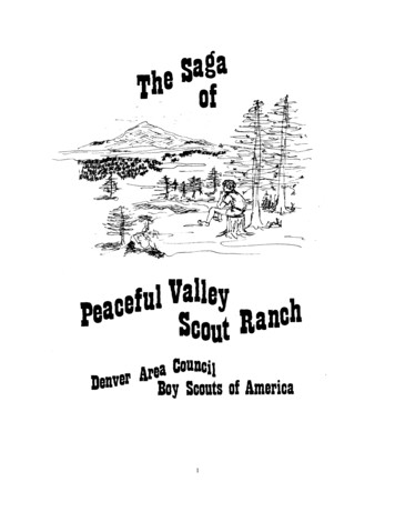
The Peaceful Valley SagaThis combined version of both the original and the updated version of the Saga is dedicated to thosewho made this Scout haven possible. As we enter into the 5th decade of the Scout Ranch we lookforward to the continuing outreach to those youth, both boys and girls, that are our hope for the futureworld leaders.One of the driving forces of Peaceful Valley Scout Ranch passed away in 2000. It is with the mostprofound expression of gratitude that we offer our thanks to our past Scout Executive Bill Kephart.Part one of this Saga is as originally written by Albert C. Rehmer.2
3
We are gratefultoAlbert C. RehmerFor this“Saga of Peaceful Valley”Not only has he spent much time in the preparationof the manuscript but he has given hours, days andMonths to the necessary research. And we know thathis wife Jean has contributed encouragement and directhelp to bring the “saga” to this point.Someday we hope that Al’s efforts will appear in amore picturesque printed booklet.Executive BoardDenver Area CouncilBoy Scouts of AmericaThis re-creation of Mr.’s Rehmer’s Saga has been re-printed in its original format and style. Noattempt has been made to edit or correct any of his work. We again offer our thanks for his groundwork in continuing the “Saga of Peaceful Valley”. The second phase of the Saga is continued at theend of Mr. Rehmer’s work.Original graphics and illustrations by Ginger M. Green4
The Saga of the Peaceful Valley Scout RanchI.“A prologue to the story.”II.“In the beginning.”III.“Son, this here land is Indian country.”IV.“Pike sat erect in his saddle. In the west he saw amountain which appeared like a small cloud.”V.“It’s history is written in the ruts upon the sod.”VI.“Timber.!”VII.“The clickety-clack of a railroad track.”VIII.“The sodbusters and ranchers come to the valley of the Kiowa.”IX.“Torrential were the rains that fell upon the divide, andthe ‘ole Kiowa cut loose with a roar.”X.“’Twas an ill wind that would bring no good that streakedout of the north on that cold winter morn.”XI.“Looking at these times through the eyes of a boy.”XII.“The Boy Scouts come to the valley of the Kiowa.”XIII.“Say, scout, have you discovered the valley of the Kiowa.?”XIV. “Only the beginning-Peaceful Valley Scout Ranch Revisited ”XV.Acknowledgments.5
PrefaceThe story of the Peaceful Valley Scout Ranch will never be told in its entirety--too much has been lostto the passing of the years. In our endeavor here we can only hope that we have been able to capturesome on the spirit and the highlights of the times. Perhaps we will have captured just enough to whetyour appetite and make you search for more!This saga is dedicated to all the Boy Scouts and their leaders who will in years to come tread upon thehills of the Ranch and lie upon the land at night to take their rest.Albert C. Rehmer, author.The Peaceful Valley songTune: “Love me tender”Sunlit meadows, moonlit trails,Land of memories.We have proved our Scouting skills,Midst your rocks and trees.Scouting friendships-Welded strong,In our hearts will be.We have gained the strength we need,To live in harmony.Peaceful Valley-You are oursAnd will always be.Peaceful Valley we’ll be true,Through eternity. words by Gary Schrenk, Eagle Scout, Post 54.Peaceful Valley Staff member, summer 19666
I.“A prolog to the story.”The hills are gentle by the standards of folk accustomed to the towering snow-capped Rockiesthat lace the face of Colorado. The many ponderosa pine scatter themselves about the slopes inrandom fashion. The valley of the Kiowa feeds from the divide to the south, winds its way ratheraimlessly to the north where it drains into the South Platte basin. The air is crisp and clean. They evensay there is air here that no other human being has ever breathed! In the summertime one can watchthe mighty thunderstorms as they build to the west, then come tumbling off lofty Pike’s Peak to dumptheir rains upon the grateful land. But in winter it is a cold northerly wind with a graying sky that maytell you to make haste for snow is on the way.The bluebirds are as blue as any sky you’ve ever seen, and the blue jay will let you know with afew well-chosen scolding remarks that you have entered his domain. In the still of a quiet night, quitelate, one can occasionally hear the forlorn howl of a lonely coyote as he makes his nocturnal rounds.This is indeed a land at peace with itself and in harmony with beauty and nature. This is the valley ofthe Kiowa as a scout may view it today.It has been written that, “A boy’s will is the wind’s will, and the thoughts of youth are long,long thoughts.” Surely this could have been written about a scout and a place called the Peacefulvalley Scout Ranch, for across the face of these more than twenty-six hundred acres move legions ofcity boys. It is here that they have the chance to view nature in much of its untouched splendor, walkamong its rolling hills, explore the rugged timeworn crevices, and perhaps to sit upon a tall hill toponder - as anybody should - just who he is in the great scheme of things and what the future may holdfor him. On a clear night the heavens abound with a starry array that would fire the imagination of anyboy. Add to that an inspiring council campfire with all of its songs and laughter. You then have theingredients to help a boy feel good about himself and the world around him.Yes, the hills are gentle, the land is generous and fair. That a boy should walk upon the face ofthis land is only right, for it is certain that the days spent here will be remembered and cherished all thedays of his life. The Peaceful Valley Scout Ranch is all these and more. It is indeed an Americandream for an American boy.7
But there is a saga to tell about this Ranch! In the passing of time, days and years long goneby, there were those events and stories - filled with sound and fury, fact and fiction, fantasy andfolklore - that are just waiting to be told. Perhaps they can best be told around a friendly campfire. So,bring along a friendship log, throw it on the fire, and let the story begin!8
II.“In the beginning.”It would be sheer folly to go back into the history of the valley of the Kiowa too far. We knowthat most exciting things happened during the last hundred years. But at the same time we feel itwould add to out story to briefly recall a few of these things about the Ranch that go a long, long wayback into the history of the area.This area is supposed to be millions of years old. No one really knows but scientists have beenstudying the various carbon deposits and such, and can guess the age of deposits, give or take a fewmillion years. For some of the interesting stories about fossils, dinosaurs, and the many other creaturesthat once roamed the area, one should secure Al Look’s book entitled ”1000 million years on theColorado Plateau.” In this book the author explains the way he thinks this part of the world wasformed.We have been told that the area in which the Ranch lies was once a part of a massive mountainrange - much like the Rockies today. They stretched in a southeasterly direction for hundreds of miles.Time and nature have eroded away these once mighty mountains.But don’t let this fool you! Even today the elevation at the Peaceful Valley Scout Ranch isseven thousand feet. The divide, some seven miles to the south, is seventy-five hundred feet. It isinteresting to note that the elevation of the divide is equal to that of Lookout Mountain, west ofDenver. What wonderful country! It is the eastern most part of the Rockies and as one views a reliefmap it is easy to see the Rockies stretch their piney fingers out into the plains in that Black Forestregion.There are numerous signs to give us clues to the kinds of things that happened in the history ofthe area. For example, petrified wood has been found in abundance on the Ranch. This tells us thatgreat, ancient forests once stood on this land, fell to the earth, were buried in mud and sand. Finallythe trees petrified. Of interest is the fossil remains found in the rocks. Also, we know that once upon atime this region was covered by a vast ocean. The characteristic minerals found in this region arepetrified wood, agate and jasper - all native to this section of the state. Also, we can find minerals suchas rock crystal, smoky quartz, and amazonite. These latter three have been carried by streams from themountains to the west.There is evidence that man came to the east slopes of the Rockies about twenty-five thousandyears ago. The Folsom and Yuma people did indeed live and hunt on this land. It has been estimatedthey left about ten thousand years ago. Modern day Indian tribes began coming into this area abouttwenty-five hundred years ago.But what about the Indians of the past one hundred years or so? Now here is a story!9
III.“Son, this here land is Indian country.”“Indians! Indians! Indians!” Nothing could have caused greater fear in the hearts of the earlypioneers than to hear the cry of a pending Indian attack. And attacks came. Our story has to tell aboutthe red man because he had an important part to play in the drama as it unfolded along the Kiowa an inthe region.It is difficult to say when the first red man came to the valley of the Kiowa. But he certainlydid come and the evidence is there. Even today many a scout who has visited the Ranch can claim anarrowhead find. In fact, a few years ago Ranger Sam Jackson found a very good tomahawk!For many, many years before the white man ventured into what we now call Colorado, rovingbands of Indians moved about the mountains and plains. Certainly you have read about the UteIndians who occupied the Colorado Mountains. The “buffalo Indians”, as they were called in the earlytimes, lived on the plains of eastern Colorado. By the time the first pioneer came to Colorado in thenineteenth century, the Indians had become expert horsemen, had firearms, and used metal tools.People who have made a real study of the Indians of Colorado say that the area of the PeacefulValley Scout Ranch can claim possibly five or more tribes of red men during the nineteenth century.Of course, it is ever so difficult to pinpoint Indian tribes during these early days. They were nomads,following good pasture for their ponies and ample food supplies for themselves. The Scout Ranch didindeed have these basic needs in abundance. However, it is generally agreed that the part of Coloradoincluding the mountains to the west was the home of the Ute’s. Our story will point up the fact thatthis tribe was frequently a visitor in the Kiowa valley. The Cheyenne’s and Arapahoe’s could layclaim to that area east of the Front Range and north of the Arkansas River. The Kiowa’s andComanche’s ranged widely, but generally lived south of the Arkansas in Colorado. The Kiowa’s didspend time in the valley of the Kiowa. How else could the creek have gotten its name? So much forsome of the facts.10
Many grand stories have been passed down about the Indians who lived along the Kiowa orvisited the area. One of these stories has to do with old Ute Chief Colorow when he camped along theWest Kiowa creek, just a short distance from the present Scout Ranch. The Indian campsite was on theAxel Brazelton Ranch. The old Chief brought with him more than three hundred braves. Mrs. ClaraElsner, daughter of Alex Brazelton, told us the story.“Chief Colorow ate dinner with my father (Alex Brazelton) often during the more than twoweeks he camped in the area. He ate like a wolf, assuring my uncle in between mouthfuls that hisbraves would not harm him. One day he saw that my uncle had a slab of bacon. Colorow cut a longslice of the bacon and heaped it with sugar and ate it like it was delicious!”Mrs. Elsner gave us another interesting account of the Indians that went something like this.“It seemed the Indian braves liked nothing better than to wrestle - we’re sure it must have beenIndian wrestling. One day one of the braves chose my father to wrestle. In the match the brave wasdefeated and didn’t take kindly to it! The brave went for his knife about the time my father took off forthe closest hill as fast as his legs would carry him. The other braves thought this was great fun, butfinally convinced the defeated brave to let it end there.”An early pioneer settler told of seeing Indians stampede a herd of buffalo over a bluff to killthem for meat. Unfortunately, he never did tell anyone the whereabouts of the location.11
On one of the bluffs on the Ranch, people who have lived there have come upon rocks thatapparently have been placed in a very definite arrangement. It would appear that they were laid toform a “V”, and could have been used to herd buffalo over the cliff to their deaths. Crafty Indianslong ago figured out how to stampede buffaloes over high cliffs to secure meat and hides. This methodoften proved more profitable that the mounted hunt.Still another story had to do with the ways of Indians. The unknown settler told it like this.“One day my father had to go to Denver and there was a neighbor man who came to eat dinnerwith my mother and us kids. We had just finished. Stealthily in the door stepped a big buck Indianwith gun in hand. The neighbor man made him leave his gun outside of the door. The buck took thebutter off the dish and rubbed it on his hair. When he had finished eating what was on the table hetook the meat platter that had fat on it and rubbed it over his face and hands. Then he left.” (Oil,grease and lard were used by Indians to repel insects, just like our present day repellents.)Carl F. Mathews wrote of early Indian troubles in his book, “Early days around the divide”.“Affairs ran along smoothly for the homesteaders until 1864 when the restless Arapahoe’s andCheyenne’s began their forays in retaliation for their lands being invaded and the buffalo herds beingkilled off, depriving them of their main source of livelihood.about the last of June, a party ofsoldiers had been looking for Indians in the vicinity of Colorado City (Colorado Springs) and seeingnone, camped for lunch at Jimmy’s camp, about ten miles east; posting a sentry over the horses, theywere lying on the grass and ridiculing the reports of the settlers regarding Indians, when suddenly aband of some twenty-five Indians dashed over the hill, and before the men realized what has happened,their horses were gone. It was a shamefaced band of soldiers who hiked into Colorado City and facedthe jeers of settlers!”Despite precautions that settlers took to ward off Indian attacks, they did come. In 1864 just afew miles northwest of the Scout Ranch, the farmhouse of the Hungate family was attacked, and allfive members of the family massacred. The band of Indians headed by Roman Nose was guilty of theattack. Within a few months after the Hungate massacre, numerous Indian attacks occurred in the areaeast of Denver.12
More that fifty men, women and children were killed, and stage lines stations were burned.Indian leaders by the names of Roman Nose, Black kettle, Left Hand, Little Raven and White Antelopewere leading these raids.One of the stories about these times has to do with the superstition of Roman Nose. Hebelieved no white man would ever kill him so long as he avoided eating food prepared with ironutensils. His superstition did not hold true for him. He died in the battle of Beecher Island - somedistance east of the Scout Ranch on Bijou Creek.At dusk when the sun starts its tumble behind the hills to the west, it is not too difficult toimagine that there is a Kiowa brave and his horse silhouetted against the dying day. If only this landcould yield more of its rich secrets about the days of the Indians along the Kiowa! But “dead men tellno tales”, and we are told that Indians are buried all over the valley. So scout, watch your step, for youmay be crossing a trail that an Indian once used, or perhaps you will be making your camp where somered man once made his camp, took his sleep.The red man did walk and hunt on your land. He lived and died along ‘ole Kiowa Creek. Son,this here land was Indian country!13
IV.“Pike sat erect in his saddle. In the west he saw a mountain which appearedlike a small cloud.”Winter was on its way in 1806 when Lieutenant Pike forged his way across the plains of whatis now eastern Colorado. He was on an official mission ordered by the United States Government toinspect the “Shining mountains” and to secure and bring back to the government information about thetremendous area the United States had just purchased from France under the Louisiana Purchase forthree cents an acre in 1893. As the mission worked its way up the Arkansas River the official recordsin the Army journal had this to say.“Suddenly the bare plains were broken by a clump of cottonwoods lining the stream, red rockcliffs rose about four hundred feet. Then about 2:00 P.M., November 15, 1806, Pike sat erect in hissaddle. In the west he saw a mountain which appeared like a small cloud. In half an hour, as the menrose to the west, the mountain appeared in full view. The soldiers rested their horses and gave threecheers to the ‘Mexican Mountain’ - thinking it was the natural boundary between the provinces ofLouisiana and New Mexico”.Although Lieutenant Pike’s first sighting of this majestic mountain came from an area on theArkansas River - some fifty miles to the south of the Ranch - today a scout on the Peaceful ValleyRanch can feel the same exhilaration Pike must have felt when he saw the mountain for the first time.On the Ranch it is possible to climb any number of hills or bluffs and suddenly have the great peakloom before him in the southwest.Long before any white man came to this area, this mountain belonged to the Indians. It wasrevered as the legends handed down suggest. Perhaps the best legend has to do with the origin ofPike’s Peak itself.14
“Many years ago, the red man said there dwelt in the west a tribe of Indians to whom godManitou had given a land so fair that is seemed to be earthly paradise. At first they were very happy,exalting in fishing and hunting, enjoying the rugged mountains and vast plains, delighting in the blue,blue sky and sunshine, admiring the rainbow that came after the summer showers. But presently theybecame weary of the perfection on earth. They longed for heavenly paradise. God Manitou watchedas they gathered bits of rocks, earth and maize to take to heaven. Manitou was troubled for the lack ofappreciation of the good life he had given them. Finally he said, ‘Oh, my children. You despise theearth, yet you would take part of it to paradise. I must punish you for your discontent and selfishness’.“He loosened floodwaters upon them. The waters covered the plains, rose higher and higher.The Indians each fought for his own safety. Still they carried with them sacks of earth, stone andmaize. Manitou took pity on them. ‘My children,’ he commanded as they arrived at the gate ofheaven, which is at the end of the plains where the sky and mountains meet; ‘drop your burdens toearth. Know that earth is earth and heaven is heaven’. And they dropped their earth and rocks andmaize into one vast heap that rose high above the waters to the very threshold of the portal where stoodthe Great Spirit Manitou. This, say the Indians, is the origin of Pike’s Peak, which is directly under theentrance to heaven and which is made of the earth’s richest possessions”.On a clear day it is claimed one can see Manitou in the contour lines of the mountains that formthe chain to the south of the peak itself. It is said that he rests on his back with his face to the blue,blue sky, guarding the legend of his beautiful majestic mountain.Climb the highest hill, scout. Look to the southwest and have that feeling come over you thatyou are Lieutenant Pike viewing this majestic mountain for the first time. Rethink the legend ofManitou and its meaning. Then carefully try to apply its meaning to a tenderfoot scout as he gives theScout sign and says, “On my honor I will do my best to do my duty.”.There is another major geographical feature near the Ranch. Though it is less dominating thanPike’s Peak, it is much closer to the Ranch. Just a few miles to the east of Bijou - is a large rockybutte, rising high above the level of the surrounding plain. It has sheer rock walls on all sides, with noway of reaching the top except through one narrow pass. Today it’s known as Fremont’s Fort - and forgood reason. It was here that Colonel John C. Fremont, with a complement of scouts, was besieged fordays and nights by hostile Indians. The Indians made several attempts to reach the top and massacreFremont’s scouts, but each time they were turned back with heavy losses. This continued for severaldays until two scouts made their escape and made their way to the little town of Auraria - now Denver- and secured help which was able to reach the fort to rescue the survivors.WOW! What a history! Pike sure started something when he first rode over that final hill andgot his first look at the peak.15
V.“Its history is written in the ruts upon the sod.”A modern jet streaks across the sky above. Shining, sleek new automobiles roll on ultramodern highways, seemingly with little effort. Perhaps - just perhaps - an occasional passerby will askthe questions: “What place is this? Where are we now?”Time has taken its toll in the tracks left by those who trod upon the sod on the plains of easternColorado. But after more than a century of passing time, amidst the buffalo grass and clumps ofsagebrush, remain faint traces of timeworn ruts forged by the wagons upon the sod. Erased are thesimple campfire sites that once gave comfort to these early comers, and gone are the simple gravemarkers that followed the trails, giving silent testimony to times of sickness, hunger and thirst, terriblestorms and Indian troubles.Have you ever heard of the Smoky Hill trail? Why, it is one of the most famous old trails ofthe west! In fact, several Denver area scout troops have traveled portions of the trail to qualify for theHistoric Trails Award. This trail passed within a few miles to the north of the Scout Ranch. There areold-timers who say that some of the wagons which once upon a time used this trail, crossed the Ranchproperty. The Smoky started way back in St. Joseph, Missouri - right on the Missouri River - andended in San Francisco, California. The trail crossed Kiowa Creek at Kiowa, just a scant seven oreight miles north of the Ranch. A few miles further north of the Smoky lies the old Starvation Trail. Itwas a short cut-off of the Smoky Hill Trail and its name implies exactly what the travelers thought ofthe trail. Still further north was the northern branch of the Smoky.The Smoky Hill Trail moved along the Smoky Hill River across Kansas to its headwaters ineastern Colorado, then west to Cherry Creek and on into Denver. It was the shortest road to the newlydiscovered gold fields in the Rockies.16
However, due to the near desert conditions, it was the most difficult. Other well-known trailswere the Oregon to the north and the Santa Fe to the south. The scarcity of water made the Smoky thehardest and most dangerous of the great prairie roads from the Missouri River to the gold fields ofColorado. One author claimed that more people died of hunger and thirst on the Smoky than from allthe Indian attacks put together. In 1859 the Rocky Mountain News reported the following account.“Two footmen have just arrived via the Smoky route. They appear to have suffered fromhunger and thirst. They reported having passed some ten or fifteen dead bodies, unburied, and manygraves. These men say they lived for nine days on prickly pear cactus and hawk”.A pioneer train arriving in Denver about the same time gave this account.“We picked up three men who had given out and laid down to die of hunger and thirst, havingeaten nothing for four days.We traveled 150 miles without water, except for melting snow, whichfortunately for us, snow fell twice during the time”.Covered wagons and on foot, even pushcarts and wheelbarrows, brought these pioneers to themountains via the Smoky. The equipment was poor, the food scant. They faced the chilling winds, thesnows of the winter and the mud of the early spring. Then there was the scorching sun that beat downupon them, days on end without rain. The Smoky Hill Trail was lined with abandoned property,broken wagons, dead horses and oxen, and the ominous unmarked graves. The trail was often tenmiles wide, depending on local conditions. It followed the contours of the countryside, keeping to theridges rather than the low ground. Grazing areas for the animals or even the highly essential buffalochips would often change the route the trail took for several miles. The Butterfield Stage line used thisroute and it is interesting to note that the fare from Kiowa to Denver in 1880 was 5.15.Just a little more than one hundred years ago a very famous traveler by the name of GeneralUlysses S. Grant, campaigning for the presidency of the United States and later to become outeighteenth president, traveled the old Smoky by stagecoach to Denver. This was in 1868. Stillstanding in Denver is the Four-Mile House, last stop on the Smoky before arriving in Denver. Scoutsmay view the building at Cherry Creek and South Forest Street17
Although the Cherokee Trail and the Jimmy Camp Road did not run directly through the Scoutranch, they were close, and their stories should be told.The Cherokee Trail ran north out of Colorado Springs (Then known as Colorado City) passingnext to the land now owned by the Air Force Academy, followed Plum Creek and then on toFranktown. This trail dates back considerably before that of the Smoky. Fremont and a number ofother early explorers followed much of this trail enroute to exploration in the Denver area. The trail tothe west coast, crossing the Continental Divide at Fort Bridger, Wyoming, on into Salt Lake City,thence through Nevada and into California. It is interesting to note that the Russell Party (to beremembered is early California gold field history) led a gold-seeking group along portions of theCherokee and the Jimmy Camp road into Denver just one hundred years ago. They were headed forthe California gold fields. The irony of this story if that this party passed right by the mountains thatwould be yielding to a tremendous gold strike one year later!The Jimmy Camp road ascended from Jimmy Camp Creek, east of Colorado Springs, movednorth across the divide near the Scout Ranch on West Kiowa Creek. This road can still be locatedabout four miles west of the Ranch. Its greatest value to the area had to do with the wagons that usedthis road to take timber cut along the Kiowa and other creeks to Denver. Many feeder wagon trails, allthrough the Black Forest area, fed into the Jimmy Camp road. It was the closest way to Denver. Theroad was named for a Jimmy Daugherty. He was a member of Major Long’s Expedition whichclimbed Pike’s Peak in 1820, Later, Jimmy returned to the Pike’s Peak region, establishing himself inhis lonely cabin on Jimmy Camp Creek. He was visited by an occasional trapper and he obtained fursby trading with the Indians. Once a year he went to St. Louis where he traded his furs for supplies,including whiskey, and weapons and trinkets for the Indians.18
Once a year Jimmy went to St. Louis where he traded his furs for supplies, including whiskey,weapons, and trinkets for the Indians. On his return trip to his cabin he would build a huge fire on anearby hill. The Indians, who were Jimmy’s friends, looked for the signal. It is said that Jimmy wasmurdered in 1833 by eleven men who robbed and killed him for his possessions. Ute Indians foundJimmy’s body and buried it beneath the dirt floor of the cabin. They trailed the murderers and avengedhis death by hanging them.On Interstate 25 at Platteville, Colorado one can visit the rebuilt St. Vrain Fort. Traders, whoestablished the very famous Bent’s Fort on the Arkansas River east of Pueblo, also established Fort St.Vrain. In the book, “Rivalry on the River”, considerable mention is made of the fur trade that movedfrom the St. Vrain Fort to Fort Bent. This author points out the fur trade caravans came up KiowaCreek, right through the property that is now owned by the Scouts, over the divide to Fort Bent, thenon to St. Joseph, Missouri.When a stranger steps up to you and asks, “What place is this?” Don’t hesitate to tell the storyas it unfolded. Time will continue to cover the trails with grass. But there is still a good chance tofollow the history of the times as it was written in the ruts upon the sod.VI.“Timber.!”“In the broken ridges of the divide which separates the valleys of the Platte and ArkansasRivers, there were camped a band of trappers on a creek called the Bijou. Numerous strips of buffalowere hanging in process of cure - should the party settle themselves here in order to lay in a store ofprovisions. It was termed in the language of the times, ‘Lay in meat.’ ”This is the manner in which George Ruxton introduced his book, “Life in the Far West”. Thebook was first published in 1847 and became an important source for those who wrote about thesetimes and these places. According to Ruxton, the dry creeks, including Kiowa Creek, in the area thatwe see today, were live brooks, dotted with beaver dams, when mountain men first came to the area.E.C. Mathews in his book, “Twixt here and sundown”, felt moved to tell it like this:“The last fifty years have brought a great many changes which I notice more than othersbecause I have been away most of the time. When we brothers get together in summer, to walk on theold ranch (on the Kiowa), we scare up a few deer and gather a few flint arrowheads lost by Indianhunters of bygone days. But the flowing springs of yesteryear have gone dry. The soil in the
the Kiowa as a scout may view it today. It has been written that, “A boy’s will is the wind’s will, and the thoughts of youth are long, long thoughts.” Surely this could have been written about a scout and a place called the Peaceful valley Scout Ranch, for across the face of these mo