Transcription
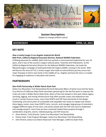
Session Descriptions(Subject to change without notice)WEDNESDAYAPRIL 14, 2021KEY NOTEHow a Lonely Cougar in Los Angeles Inspired the WorldBeth Pratt, California Regional Executive Director, National Wildlife FederationA lifelong advocate for wildlife, Beth Pratt has worked in environmental leadership for over 25years, and in two of the country’s largest national parks: Yosemite and Yellowstone. As theCalifornia Regional Executive Director for the National Wildlife Federation, she leads the#SaveLACougars campaign to build potentially the largest wildlife crossing in the world. Bethwill discuss the story of P-22, a lonely cougar who made an extraordinary journey across twomajor freeways to find a new home in the middle of Los Angeles and how the story is a modelfor engaging an audience in education and science.PARTNERSHIPSNon-Profit Partnership at Wilder Ranch State ParkSanta Cruz Mountains Trail Stewardship (formerly Mountain Bikers of Santa Cruz) and the SantaCruz District of California State Parks have been partnering for the last five years to improve themulti-use trails in Wilder Ranch State Parks. Much of the trail network in this park utilizes legacyranching, logging, and mining infrastructure that often provide a poor trail experience andresult in myriad resource issues. Learn how SCMTS and CSP have partnered on the design,fundraising, and construction of sustainable and enjoyable trail routes to replace and restorethese legacy routes. Learn how SCMTS trains, recruits, and manages large groups of volunteers,engages different types of trail users, and works closely with the CSP trail crew to implementand manage projects. Learn how we have creatively funded these projects through acombination of grants, events, individual giving, and CSP resources. Drew Perkins, Trails Director, Santa Cruz Mountains Trail Stewardship Emma Ussat, Trails Program Manager, Santa Cruz Mountains Trail Stewardship Chris Pereira, Santa Cruz District Road and Trails Manager, California State Parks1
Mutually Beneficial Partnerships to Achieve Current and Future Trail Planning ObjectivesAs rural communities struggle with limited resources and capacity, creativity and innovation areessential for advancing complex and challenging trail projects. Through a collaborative multiyear partnership, rural Mariposa County and the California Polytechnic State University (CalPoly) Landscape Architecture program are exploring the holistic potential of a sustainable,multi-beneficial trail system in Mariposa County. In addition to contributing to the current trailplanning effort, the project provides an arena for emerging landscape architects and plannersto engage with local communities on contemporary trail issues. The trail planning effort, whichincludes a study of the non-motorized multi-use trail along the historic Yosemite Valley Railroadgrade through the Wild and Scenic Merced River corridor, contributes to a comprehensive trailsystem in Mariposa County, providing guidelines for the trail system through communityinvolvement and expert input. Using the “Geodesign Framework,” which considers broadaspects of the project through workshops and a series of reviews with community membersand stakeholders, the collaboration team have worked to find suitable alternatives andestablish a sustainable trail system. The partnership advances local trail planning objectives,while also providing an engaging and compelling pedagogical environment to help developfuture generations of trail planners and geodesign practitioners. Miran Jung Day, Assistant Professor, Landscape Architecture Department, Cal Poly SLO Mikey Goralnik, Community Design & Development Planner, Mariposa Co. Planning Dept. Aidan Anakin Stofka, 4th year Landscape Architecture student, Cal Poly SLO Joceylin Figueroa, 4th year Landscape Architecture student, Cal Poly SLOThe Who, What, and How of Trail GovernanceEstablishing the right governance structure for a trail organization is one of the most importantelements in making a good trail, a great trail. Generally, goodwill and interest can get a trailvery far, but realizing the full potential of any system requires long-term governance andoversight. Trail governance brings together the right partners and establishes funding forsustainable operations, maintenance and programming. This session will explore Joint PowerAuthorities (JPAs), Cooperative Agreements, New Trail Agencies and Non-Profits among others,to educate participants on the wide range of governance structures available to those lookingto implement a trail in their community. Pros and Cons will be discussed in reference to existingtrail case studies so participants can relate the trails they are currently championing to othersystems around the country. This session will include a brief 30-minute presentation and then asmall group, “Build Your Own Trail Governance Structure,” activity that will get participantsthinking about their own trails and appropriate governance structures for them. The activity willresult in 3-4 outlines of potential trail governance structures for actual trails. Deven Young, Principal, Alta Planning Design Emily Duchon, Principal, Alta Planning Design Jason Spann, Associate Landscape Architect, California State Parks2
PLANNINGRail Towns to Trail Towns: Leveraging Historical Development Patterns and Realizing Trailoriented CommunitiesRail-trails inherit many aspects of the railroads that came before them: they feature steadygrades; they transect diverse environments; and they connect communities. A critical feature ofrail-trails is the way they interface with the communities through which they pass. This sessionpresents a framework for understanding the historical spatial relationship betweencommunities and railroads, and strategies for transforming these spaces into thriving trailamenities. The session will then examine the history, advocacy, planning, design, andimplementation of the Annie & Mary Rail Trail through Arcata and Blue Lake in HumboldtCounty (the northernmost spur of the Great Redwood Trail). We will examine the grassrootshistory of advocacy for the trail, the challenges facing implementation, and the success stories,including the recent completion of the first phase of the trail in Blue Lake and therecommendation of funding for final design and construction of the trail through Arcata. We’lllook at the robust community engagement that led to broad support for the project, and thenext steps to achieve a fully connected Annie & Mary Trail between the two communities. We’llalso look at the expansive view of connectivity that the City of Arcata included in the project,including ensuring connectivity to neighborhoods that have been isolated by adjacent freewaysand other development. Sofia Zander, Principal Landscape Architect, TrailPeople & Zander Design Brian Burchfield, Group Leader & Design Associate, Alta Planning & Design Mike Foget, CEO and Senior Environmental and Civil Engineer, SHN Emily Sinkhorn, Director, Natural Resources Services Division of Redwood CommunityAction Agency Austin Dunn, Designer, Alta Planning & DesignGreat Redwood Trail Update: The Feasibility Study—Approach and FindingsSenate Bill (SB) 1029 (2018) called for an assessment of the disposition of the North CoastRailroad Authority and its 300 miles of rights-of-way. A trail feasibility assessment andgovernance/railbanking report, prepared by California State Parks in consultation with severalstate agencies, is one component of the SB 1029 Assessment. It evaluates the feasibility ofrepurposing 252 miles into the Great Redwood Trail. The corridor evaluated extends fromHealdsburg in Sonoma County to Blue Lake, northeast of Humboldt Bay and Arcata. In thissession, learn about the approach used and results of the trail feasibility assessment, whichevaluates the condition of railroad infrastructure and physical/environmental characteristics ofthe corridor. The assessment ranks 57 segments for their level of opportunity or constraint. Itconsiders potential costs to construct the full corridor, and to assess the feasibility ofconstructing rail-to-trail in the central and northern portions and rail-with-trail in the southernportion. The purpose of the assessment is to inform decision-makers about the factors affectingfeasibility of trail development and to identify which portions of the corridor may be more or3
less feasible for trail development and use. It was included in the SB 1029 report to thelegislature for consideration. Curtis E. Alling, AICP, Principal, Ascent Environmental, Inc. Jason Spann, Associate Landscape Architect, California State Parks Nanette Hansel, Senior Project Manager, Ascent Environmental, Inc. Deven Young, Principal, Alta Planning DesignCache Creek: Gaining Support For New Open SpacePlanning for trails and open space in rural parts of the Central Valley have unique challengesand opportunities. Private ownership and mining rights have controlled the interests alongmany of the open spaces and waterways. As public environmental awareness, demand foraccess and need for economic drivers all rise, how do we change the perception of these spacesto protect them? How do we show elected officials, mining companies, and landowners thatthere is value in providing public access? Lastly, with limited funding, how do we plan anddesign trails so they are economical to build and maintain long term? This session will useCache Creek as a case study to explore these answers with a panel that represents variedperspectives from planning, design and management. Lower Cache Creek spans over 12 miles,much of which has been or will be mined for gravel. As the mines close, the properties will bereclaimed to agriculture, open space, or habitat and, some will be given to Yolo County to beintegrated into a public open space parkway, posing huge challenges for the county. Topics ofdiscussion will include owner negotiations, planning, outreach, approvals, funding, workingwith varied user groups, and long-term economic sustainability. Ben Woodside, Principal, Callander Associates Heidi Tschudin, Principal, Tschudin Consulting Group Elisa Sabatini, Manager of Natural Resources, County of YoloTHURSDAYAPRIL 15, 2021GENERAL SESSIONDesigning and Implementing California’s First Maritime Heritage TrailEmerald Bay, situated on the western side of Lake Tahoe, is and has been an American touristdestination for well over 150 years. Translucent blue-green water surrounded by vertical cliffs,green conifers, and granite boulders creates the quintessential Tahoe experience and one thathas drawn people to the bay specifically for recreation since the 1860s. The bay is the finalresting place of several recreational boats, launches, and barges used on the lake during theearly 20th century. In September 2018, California State Parks revealed the location of fivesubmerged vessels in Lake Tahoe to an interested public to create the Emerald Bay MaritimeHeritage (underwater) Trail. The intent of the project was to celebrate the history of EmeraldBay and Lake Tahoe’s culture of recreation by way of shipwrecks while also providing animportant message about protecting and preserving our submerged cultural heritage. This4
session will discuss the trail development and implementation process highlighting anticipatedand unanticipated challenges and ways to minimize impacts going forward. Denise Jaffke, Cultural Resources Division Supervisor and Maritime Heritage ProgramManager, California State ParksTOOLS & TECHNOLOGYApp-Based Techniques to Survey Visitors in YosemiteNot unlike many other natural areas, visitation to wilderness in Yosemite has both increaseddramatically and changed substantially in recent years. Use of the Pacific Crest and John Muirtrails is among the primary drivers of these changes. These wilderness travel patterns may bechanging the character of Yosemite Wilderness. Revisiting and revising the model travelpatterns was needed to inform and support Wilderness management, and specifically thepark s overnight permit program. In 2019, Applied Trails Research (ATR) in support of theNational Park Service initiated a study to provide Yosemite managers with an updated model ofwilderness travel patterns for Yosemite Wilderness. Leveraging OuterSpatial, an organizationpowered mobile app, ATR instigated the development of an app-based solution for collectingtravel and camping location data from overnight wilderness visitors along with datacharacterizing wilderness visitors camping experiences and perspectives. Despite the challengesrelated to fires and the pandemic, the initial pilot rollout occurred in the fall of 2020 andanother more expansive plan is in place for 2021. The process, tooling, and approach developedfor this effort can be leveraged by other land managers looking to engage their visitors in appbased surveys and data collection. Ryan Branciforte, CEO, OuterSpatial Jeremy Wimpey PhD, Principal, Applied Trails ResearchElectric Bicycles on Trails: Where Do We Go From Here?The user base for electric bicycles grows annually and land managers are increasingly facedwith electric bicycle management decisions. This session is intended to go beyond basic e-bikeinformation to concentrate on the quickly evolving policies emerging from various agencieswith a focus on electric mountain bikes. Observations about the current market, federal andstate legislative updates, local management examples in California including pilot programs,and trending issues and opportunities will be included. In closing, some topics will be offeredfor discussion about what lies ahead to lead us into question and answer session. General ebike resources will be shared. This session will bring together advocates, industryrepresentatives, and land managers to explore where eMTB management came from, where itis now, where it needs to go, and how to get there. Susie Murphy, Executive Director, San Diego Mountain Biking Association Steven Sheffield, Team Leader Product Management and Business Development, Bosch Ashley Seaward, Regulatory and Policy Analyst, PeopleForBikes Alex Logemann, Policy Counsel, PeopleForBikes Alex Stehl, Chief of Strategic Planning and Recreation Services, California State Parks Jason Spann, Associate Landscape Architect, California State Parks5
Recreation Impact Monitoring: Crowdsourcing Trails, Campsite & Visitor Use DataCollaborative data collection promotes efficient decision making on public lands. The CMC RIMSmobile app and analytics tools help land managers understand the impact and use trends ontrails and waterways. Agency staff, stewardship organizations, and the general public cansubmit reports on trail conditions, campsites, trash, and invasive species, plus visitor usemonitoring captures outdoor recreation user types, parking issues, and visitation trends. Allreports include GPS coordinates, detailed metrics, and photos. With customized, interactivedashboards, land managers can explore the RIMS data in their area, generate detailed reports,prioritize projects, and deploy staff or volunteers to resolve issues. Learn how over 4,000 datapoints are already helping managers respond to trail maintenance issues, campsiteproliferation, and vandalism. Engaging volunteers in data collection is easy with the free mobileapp and provides real-time information for stewardship and planning efforts. Julie Mach, Conservation Director, Colorado Mountain ClubPLANNINGHow to Protect Natural Resources in Trail PlanningCommunity trail planning often creates a buzz of attention from stakeholder groups andindividuals. Environmental and recreational trail advocates can feel like they have opposinggoals as they vie for improved access or stronger resource protection. Without a proper forum,stakeholders may feel disenfranchised from the process, and that their issues are not beingheard or valued by the trail planners. This disconnect can lead to anxiety, discord, and thepotential for project delays and litigation. We will explore an approach to navigate stakeholderconcerns, protect natural resources, and create desirable trails. This session will focus on MarinCounty Parks’ recent success in planning and implementing projects such as the award-winningPonti Ridge Trail. We will explore what has not worked in the past and how we re-imagined ourapproach to develop shared values with stakeholders as a first step prior to projectdevelopment. We will discuss specific ways we created a forum that fosters honest andauthentic conversations that empowers the community in development of a project. Tom Boss, Off-Road Director, Marin County Bicycle Coalition Sandy Guldman, President, Friends of Corte Madera Creek Watershed Jon Campo, Principal Natural Resource Planner, Marin County Parks Dave Frazier, Maintenance Equipment Operator, Marin County Parks6
Trail Design Details: Wins & LossesEvery trail project has many design details to incorporate to create a functional, wellconnected, and attractive project. Features like pavement, signage, furnishings, architecture,striping, landscaping, and irrigation all contribute to a great project. Design details are oftenwell established. There are also opportunities to try new ideas to either update a design detailor address a challenge. Successful design details get added to the Toolkit. We often don’t hearabout the design details that weren’t successful. This presentation will share both the wins andlosses, including background on the creative process, testing, problem solving, and evidence ofsuccess and sometimes failure. Yves Zsutty, Division Manager, Capital Improvement Program, City of San Jose, Departmentof Parks Recreation and Neighborhood ServicesClosing a Critical Gap in the Bay TrailThe San Francisco Bay Trail is a planned 500-mile regional trail system through 47 cities across abroad spectrum of landscapes that ring the bay. It is a bold vision for recreation, commuting,and stewardship. With 30% of the trail network still to be completed, no simple projectsremain. After 15 years of effort, the Ravenswood Bay Trail Connection Project closed a 0.6-milegap in the system to connect 80 contiguous miles of shoreline trail. The trail opened a portionof the San Francisco Bay shoreline to the public and offers a commute alternative to the techcampuses in the Silicon Valley. From planning, design, permitting, and construction, this casestudy will present the complexities of the project and post-construction usership data amid theCOVID pandemic. Scott Reeves, PLA QSD CCM, Senior Capital Project Manager, Engineering & ConstructionDepartment, Midpeninsula Regional Open Space DistrictFRIDAYAPRIL 16, 2021TOOLS & TECHNOLOGYThe Rural and Regional Park Grant ProgramsThe Regional Park Program competitive grants will create, expand, and improve regional parksto offer new recreational features that provide nature appreciation, athletic activities, historicalor cultural enrichment, or other recreational activities in an open space. The Rural Recreationand Tourism Program competitive grants will create new recreation features in support ofeconomic, tourism, and health related goals. Competitive projects will improve the health ofresidents and attract out of town visitors. Find out about these new grant programs and how toqualify for the tens of millions of dollars available. Richard Rendón, Supervisor, Office of Grants and Local Services, California State Parks Natalie Bee, Supervisor, Office of Grants and Local Services, California State Parks7
Trail Analytics and Data StorytellingData science tools allow for an exploration of trail connectivity, demand, comfort, health, andsafety needs. This session will share a spectrum of data analysis and scenario planning tools thatcan be used to help plan and design new or existing trails. We will share examples from threeCalifornia trail corridors at three scales: Los Angeles River Path, an 8-mile gap closure, the IronHorse Trial, a 22-mile regional trail, and the Great Redwood Trail, a 300-mile former railcorridor. We will present the data analysis methods used to evaluate future user demand,assess how much space is required to accommodate various levels of use by people walking,biking, using e-bikes or other electric vehicles and understand network access priorities. Thesetools are very effective in considering not just existing travel characteristics, but also howchanges in mobility options, such as e-bikes or shared autonomous vehicles could change theuse of the corridor. Emily Duchon, Principal, Alta Planning and Design Deven Young, Principal, Alta Planning Design Mitali Gupta, AICP, ENV SP, Manager, Transportation Planning, Mobility Corridors, LA Metro Mike Sellinger, Planning Associate, Alta Planning DesignURBAN TRAILS AND GREENWAYSThe Challenges and Successes of Developing Urban TrailsDeveloping an urban trail can be a challenge but also presents a great opportunity to encouragerecreational use in an urban environment. This session will present a case study of the 4.2-mileVirginia Corridor Trail and will highlight how the City of Modesto was able to overcome thechallenges and create a very successful urban trail in Modesto. The discussion will includefunding, design, volunteer efforts, construction, and operation. Nathan Houx, Parks Planning & Development Manager, City of Modesto Brian Fletcher, Principal, Callander Associates Landscape Architecture, Inc. Kelly Gallagher, Park Operations Manager, City of ModestoMulti-Benefit Neighborhood GreenwaysSuburban communities across Southern California have been designed with oversizedresidential streets. This design contributes to excessive speed in neighborhoods, leads toincreased urban heat island effect, and can produce high volumes of runoff during stormevents. In recent years, basic bicycle facilities have begun to appear on these streets, toaccommodate a wider range of roadway users, but often are limited to striping and don’tinspire confidence for street users of all ages and abilities. By re-evaluating the roadway as awhole, and emphasizing a suite of benefits for neighborhoods, these projects can insteadincorporate significant planting, stormwater capture, urban cooling, traffic-separated bicyclefacilities and paths, and overall aesthetic improvements. This diversification of design alsoopens projects up to a broader range of funding sources, while also increasing the project’sappeal to surrounding communities. This session will provide insight into the funding, design,and outreach processes for several multi-benefit projects. James Powell, PLA, ASLA, Senior Design Associate, Alta Planning Design8
David Diaz, Executive Director, Active San Gabriel ValleyEileen Alduenda, Executive Director, Council For Watershed HealthJason Casanova, Director of Planning and Information Design, Council For Watershed HealthGoodbye Golf Courses, Hello Public Parks and TrailsCommunities are increasingly converting private golf clubs into public parks and naturepreserves. See examples of successful transitions from across the nation and hear from oneteam working to convert a 139-acre course into their city’s next great park. Eric Bosman, Urban Designer, Kimley Horn Mack Cain, RLA, LEED AP, Landscape Architect, Clark Patterson Lee Architecture,Engineering, Planning Jan Hancock, BS, MA, Equestrian Consultant, Hancock Resources LLC9
small group, “Build Your Own Trail Governance Structure,” activity that will get participants thinking about their own trails and appropriate governance structures for them. The activity will result in 3-4 outlines of p


