Transcription
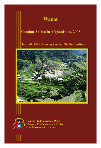
WanatCombat Action in Afghanistan, 2008The Staff of the US Army Combat Studies InstituteCombat Studies Institute PressUS Army Combined Arms CenterFort Leavenworth, Kansas
Front Cover: Aerial View of the Wanat Battlefield, 2008(Courtesy, Colonel William Ostlund)
WanatCombat Action in Afghanistan,2008The Staff of the US ArmyCombat Studies InstituteCombat Studies Institute PressUS Army Combined Arms CenterFort Leavenworth, Kansas
Library of Congress Cataloging-in-Publication DataWanat: Combat Action In Afghanistan, 2008The Staff of the US Army Combat Studies Institute, 2010.DS371.4123.W36W36 2010958.104’742--dc222010039932Combat Studies Institute Press publications cover awide variety of military history topics. The viewsexpressed in this CSI Press publication are thoseof the author(s) and not necessarily those of theDepartment of the Army or the Department ofDefense. A full list of CSI Press publications, manyof them available for downloading, can be found athttp://usacac.army.mil/CAC2/CSI/index.asp.The seal of the Combat Studies Institute authenticates this document as anofficial publication of the CSI. It is prohibited to use CSI’s official seal on anyrepublication without the express written permission of the Director of CSI.ii
ForewordOn 13 July 2008, nine American Soldiers perished while fighting apitched battle in the village of Wanat in Afghanistan’s Waygal Valley. Onthat day, the men of Company C, 2d Battalion, 503d Parachute InfantryRegiment, endured four hours of intense close quarters combat andmounting casualties. The contingent of 49 United States and 24 AfghanNational Army Soldiers valiantly defended their small outpost againsta coordinated attack by a determined insurgent force armed with rocketpropelled grenades and automatic weapons. Despite the initial advantageof tactical surprise and numerical superiority, it was the insurgents whoultimately broke contact and withdrew from Combat Outpost Kahler.Army historians recognized the need to better understand the Battle ofWanat and ensure those who followed learned from the experiences of thecourageous Soldiers who defended their outpost with such tenacity. Asinitial reports from the battle were received, the Combat Studies Instituteat Fort Leavenworth, Kansas began to prepare a historical analysis of thecircumstances of the Battle of Wanat, launching an exhaustive researcheffort that produced a comprehensive and compelling example ofcontemporary history.This study offers an objective narrative of the events surrounding theBattle of Wanat. It does not seek to draw final conclusions or to secondguess decisions made before or during the heat of battle. Rather, it is animplement of learning, allowing the reader to see the events of that daythrough the eyes of the leaders and Soldiers of Task Force Rock. It ismeant to provide context to the chaos and complexity of modern conflict,and to help the reader better understand and appreciate the nature ofoperations in an era of persistent conflict. Finally, this study serves tohonor and preserve the memories of the nine brave men who gave theirlives at Combat Outpost Kahler.Sean B. MacFarlandBG, US ArmyDeputy Commandant, CGSCiii
AcknowledgmentsMany people played significant roles in the development of this studyfrom its inception to its completion. Contract historian Matt Matthewsproposed the topic, conceptualized the study, initiated the research plan,and executed a number of key oral interviews with participants. WhenMr. Matthews transferred to a different project, contract historian DouglasCubbison took up the Wanat case study. After performing additionalresearch and oral interviews, Cubbison created a working paper upon whichlater revisions could build. Contract historian Gary Linhart and contracttechnician Dale Cordes contributed several visual representations of theterrain. Research historian John McGrath of the Combat Studies Instituteserved as the primary researcher and writer on the final manuscript, revisingboth text and citations, creating the final graphics, and incorporating newinformation derived from the documentary record of more recent inquiries.Dr. Donald Wright, CSI’s Research and Publications Chief, shared in thewriting duties for the final product and provided continuity and directionthrough various versions of the manuscript. Dr. William G. Robertson,Director of the Combat Studies Institute, provided overall guidance andquality control to the manuscript development process. Editor Carl Fischerworked diligently to see the final manuscript through the editing, layoutand publication process.CSI is indebted to the many officers and Soldiers who sat for interviewsand contributed documents in support of this study. These Soldiers includethe paratroopers of 2d Battalion, 503d Infantry (“The Rock”), as well asmembers of the 62d Engineer Battalion, USMC ETT 5-3, and the staffsof the 173d Airborne Brigade Combat Team and 101st Airborne Division(Air Assault), who participated in operations in Afghanistan in 2008.In preparing this study, the staff at CSI have been constantly remindedof the courage and sacrifice of all those who have served in Afghanistan indifficult circumstances. These thoughts have guided our work in producingwhat we hope is both a testament to the valor of those who served and avehicle for learning in the future.v
ContentsPageForeword . iiiAcknowledgements. vList of Figures. viiiSymbols Key. ixChapter 1. Historic and Campaign Background of the WaygalValley. 1Nuristan Province and the Waygal Valley. 1The Insurgents. 8The Coalition Campaign in Afghanistan, 2001-2008. 10US Operations in Nuristan and Konar, 2001-2007. 15The Deployment of the 173d Airborne Brigade CombatTeam (ABCT) to Afghanistan, 2007. 23Chosen Company and the Waygal Valley. 39The 4 July Attack on Bella. 50The Decision to Execute Operation ROCK MOVE . 53Chapter 2. The Establishment of COP Kahler, 8-12 July 2008. 69ROCK MOVE—The Plan. 70Planning and Preparation in Chosen Company. 83The Establishment of COP Kahler, 8-12 July. 86The Terrain at Wanat and the Configuration of the COP . 92The Configuration of OP Topside . 100Operations and Events at COP Kahler, 9-12 July. 104The Enemy, 9-12 July.115The Eve of the Attack.118Chapter 3. The Fight at Wanat, 13 July 2008. 141The Attack on COP Kahler. 141The Initial Defense of OP Topside. 152Reinforcing OP Topside. 157Arrival of Attack Helicopter Support . 163Arrival of 1st Platoon Quick Reaction Force. 167The MEDEVACs at Wanat . . 172The Consolidation at COP Kahler. 176The Withdrawal from the Waygal Valley. 180Aftermath. 182vii
Chapter 4. Conclusions. 195Overview. 195Counterinsurgency in Northeast Afghanistan,2007-2008. 200Enemy Disposition and Intent: Situational Awareness inthe Wanat Area. 203The Delays in Construction of COP Kahler. 212The Timing of Operation ROCK MOVE: The Relief byTF Duke . . 214Defensive Positioning. 215Summary. 223Closing Thoughts. 230Glossary. 239Bibliography. 243List of Figures1. The Waygal Valley. xi2. Theater Organization, Afghanistan 2008.113. Array of Forces, Regional Command-East, July 2008. 174. AO Bayonet, July 2008. 275. AO ROCK, July 2008. 296. Troops in Contact Incidents by Company, TF Rock, 2007-8. 317. COP Bella. 438. ROCK MOVE OPLAN 8-9 July 2008. 719. Wanat, Proposed COP. 8110. View of Wanat COP looking west from mortar position with 2dSquad position, the bazaar, and OP Topside’s later location in thebackground, 9 July 2008. 9311. COP Kahler, 13 July 2008. 9912. COP Kahler: Looking northwest. 10013. OP Topside, 13 July 2008. 10114. The Wanat Garrison, 13 July 2008. 10715. The Course of the Fight. 14316. OP Topside from the east following the engagement. 155viii
ix
SYMBOLS KEY (continued)BOUNDARIESUNIT SIZEXXXXXXregional commandsIIcorps division brigade battalionI company platoon section squadtask force (with size symbol)ElmtsElements–part of a unit( ) reinforced (-) reduced unitbattalionXIIcompanyIbrigadeprovincialNOTE: Unless otherwise indicated,provincial boundaries arealso AO boundariesindividual paratrooperABBREVIATIONS(as seen on PTOWxAfghan National Armybrigade support battalionCombined Joint Task Forcecombat outpostforward operating baseInternational Security Assistance Forcetype of optical surveillance equipmentlanding zonetype of medium machine gunRegional CommandRegional Command–Eastspecial troops battaliontraffic control pointtype of antiarmor missile
Major Darin Gaub, US ArmyFigure 1. The Waygal Valley.xi
Chapter 1Historic and Campaign Background of the Waygal ValleyAfghanistan’s history is one of strife and conflict. The people whohave lived in what is today Afghanistan have seen a succession of foreignand domestic rulers and conquerors. The first Western invader to enterthe region was Alexander the Great who overthrew the previous rulersof the Afghanistan region, the Achaemenid Persian Empire. Alexandercontinued east from Persia, entering the area from the southeast in 329 BCand operating throughout the region for three years. After passing throughthe current site of Kandahar (the Pashto equivalent of “Alexandria”), acity he founded, the Macedonian king wintered at “Alexandria in theCaucasus,” near the current site of Bagram Air Base. During the nextcampaigning season, Alexander crossed the Hindu Kush range through theKhawak Pass and conquered the Persian province of Bactria, establishinga Macedonian colony there and marrying Roxana, the daughter of a localnoble. The Macedonian then re-crossed the Hindu Kush in 327 BC, and,with part of his army, followed the Kabul River Valley to the Konar RiverValley where he came into conflict with local fighters who were probablythe ancestors of the modern Nuristanis. Alexander defeated these peoplebut was wounded in the shoulder in the process. He then turned east,crossed through the Nawa Pass into what today is Pakistan and rejoinedthe rest of his army in the Indus River Valley. There he fought his nextseries of battles. Although Nuristani folklore often portrays them as beingthe descendents of Alexander’s soldiers, modern scholarship and linguisticevidence indicates a far earlier origin of the Nuristanis. Still, the genes ofAlexander’s warriors remain alive in Afghanistan.1Nuristan Province and the Waygal Valley2Located in northeastern Afghanistan, Nuristan Province is just southof the highest peaks of the Hindu Kush range, with its modest populationof farmers found almost exclusively in steep valleys cut by small rivercourses between the mountains. This terrain and a lack of all but themost rudimentary infrastructure has historically marked the province asremote and primitive even by Afghanistan’s standards. Within Nuristanand Konar provinces, the Waygal River flows south from the Hindu KushMountains for 20 miles until it joins the Pech River at Nangalam. ThePech River, in turn, flows into the larger Konar River at Asadabad. Theregion is spectacularly rugged and divided into numerous small rivervalleys separated by steep mountain ridges, many in excess of 10,000feet. The Waygal Valley is located primarily in Nuristan Province but the1
southernmost five miles are in Konar Province. The provincial boundarywhich also marks the ethnic boundary between Nuristanis to the northand Safi Pashtuns to the south is located one half mile south of Wanat. Allof the valleys of Nuristan and Konar, to include the Waygal Valley, arerocky, deep, narrow, and steep-sided, most of them are classic examplesof geological V-shaped valleys. One international observer simply stated,“The terrain is mountainous indeed. This is one of the most topographicallyforbidding operating environments in the world.”3 Nine Nuristani villagesare located in the northern and central Waygal Valley.4While located on the Indian border, during its era of rule in India,the British colonial government rarely became involved with Konar andNuristan, although the British played a role in the appointment of the Amirof Pashat, the ruler of the eastern Konar region in the 1840s. IndividualEnglish explorers sometimes penetrated into the area. One such expeditioninto eastern Nuristan (then called Kafiristan) became the basis for RudyardKipling’s 1888 short story The Man Who Would Be King. In 1896, afterthe demarcation of the Durand Line solidified the political borders of hisrealm, the Afghan Amir Abdur Rahman Khan moved into Kafiristan andsubdued the population. As a price for his future protection, he required theKafiristanis to accept Islam and rechristened them Nuristanis, as they hadseen the light of Islam, nur being the Arabic word for light. This was partof the process by which Abdur Rahman, a grandson of renowned Afghanleader Dost Muhammad, who ruled in Kabul for 21 years, introduced astable central government to Afghanistan for the first time in its history.5The next great external intervention in the northeast of Afghanistanoccurred in December of 1979 when the Soviet Union sent troops toAfghanistan to rescue and buttress a weak Marxist government thathad assumed power the previous year in Kabul. Even before the Sovietintervention, Konar had been the scene of several early rebellions againstthe Marxist forces. After two successful early offensives along the PechValley in the spring of 1980, the Soviets restricted their operations inKonar and eastern Nuristan to the placing of garrisons along the KonarRiver at major population centers. Soviet successes and brutality in thePech and Waygal region were such that many mujahedeen families andmost of the leadership fled to Pakistan, not to return until the later yearsof the Soviet war. With that area pacified, most significant heavy fightingwas centered along the corridor of the Konar River connecting Jalalabadto Asadabad and Barikowt on the Pakistani border. The Soviets focused onrestricting the flow of anti Soviet insurgents and their arms and suppliesfrom Pakistan into Afghanistan through the Konar Valley. The mujahedeen2
returned to the Pech-Waygal valleys in the mid 1980s. The Soviets andAfghan Marxists executed a brief campaign in the Pech Valley that evenpenetrated to the Waygal Valley. During this period, Nuristan and Konarsaw other fighting between Communist proxies, local landowners andcommunities, and organized criminal organizations attempting to gaincontrol of the lucrative Kamdesh timber and gemstone interests within theregion.6During the civil war in Afghanistan following the Soviet withdrawaland the ensuing Taliban rule from 1996 to 2001, the Taliban maintainedonly a token presence in the Pech and Waygal Valleys. Nuristan’s remotelocation, its rugged, severely constrained terrain, limited road network,and proximity to the Northern Alliance power center in the Panjshir Valleymade a large presence unpalatable to the Taliban. The Nuristanis were alsoable to play the Taliban off against the Northern Alliance. Neither sideattempted to lay a heavy hand on the region out of fear of driving the localpopulation into the arms of its enemies.Central government influence within the Waygal Valley has historicallybeen limited although this has recently been changing. Similar to otherremote areas, there was no permanent governmental administrativepresence in the Waygal Valley until the post Soviet era (1993) when aseparate Nuristan Province was established and the Waygal Valley becamedesignated as a district within that province. Eventually a district centerwas established at Wanat which had been a traditional meeting place forthe Waygal Valley Nuristanis and the rough road linking the Pech Valleyto Wanat was improved sufficiently to allow motor vehicles to reach theadministrative center for the first time.7As previously mentioned, two ethnic population groups arepredominant in the Waygal Valley: the Nuristanis in the north and SafiPashtuns in the south. Because of the rugged terrain and steep ridgelinesthroughout northeastern Afghanistan, the majority of the communities areisolated and relationships between and within the various ethnic groupsare extremely complex. The Safi Pashtuns and Nuristanis speak distinctivelanguages and there are particular dialects within these languages. TheNuristanis especially have a large number of dialects, some of whichare so divergent as to constitute separate languages. For centuries, theNuristanis practiced their own polytheistic religion in a region otherwisedominated by followers of Islam. As previously mentioned, this culturaldistinctiveness changed only in the late nineteenth century when Nuristanfinally embraced Islam at the forcible demand of the Afghan ruler AbdurRahman. Nuristan was only established as an independent province in3
1993 when it was created from the northern parts of Konar and Laghmanprovinces.8The Nuristani people in the Waygal Valley differentiate themselvesfrom other Nuristanis by referring to themselves as Kalasha. Althoughthe Kalasha speak their own distinctive language, the people of the foursouthernmost villages further identify themselves as Chimi-nishey, whilethe dwellers of the northern villages call themselves Wai. The Nuristanipopulation of the Waygal Valley also differentiates itself between Amurshkara and Kila-kara. This refers to the type of cheese they make. This is notthe minor point that it appears. The type of cheese produced significantlyinfluences how a family organizes its pastoral and dairy activities andthis, in turn, reflects the differences between the amount and quality ofsummer pastures that the people of the northern half of the valley possesscompared to the southern half of the valley. Such complicated distinctionsvalidate the convoluted human terrain of the region. It must be noted thateven within the same ethnic group, tensions of various types and severityabound between adjacent villages, the majority of whose families areoften related. As Sami Nuristani, a resident of the Waygal Valley who iscurrently a college student in the United States noted, “Be prepared to hearcontradicting requests. Also, be open to see some sort of rivalry betweenthe inhabitants of different villages in the valley. You might hear one thingfrom one village and may hear completely the opposite from anothervillage. It has been there as long as Nuristan existed.”9Historically, the small population of Nuristan has depended on theisolation of their compact settlements for military defense. Vast tractsof trackless mountainous terrain surround their villages. These tractsserved as effective buffer zones for their communities and could onlybe exploited by well armed herders who could take their animals thereunder protection. The Nuristanis controlled the highlands along with theattendant forests, pastures, gem-rich mountains, and water for irrigationthat can turn a semi arid land into valuable agricultural fields. After AbdurRahman imposed peace on the region, the Nuristani population gingerlymoved into these buffer areas on the periphery of their settlements.They constructed irrigation systems and agricultural terraces and builtrudimentary shelters to use while tending their fields. Given populationgrowth and sustained security, over time these rudimentary shelters weregradually improved and became permanent hamlets. To the south, theSafi Pashtuns had expanded across the lowlands of the Pech and KonarValleys in the eighteenth and nineteenth centuries at the expense of theprevious Dardic speaking inhabitants. The Safis were unable to expand4
their agriculturally based livelihood into the highland areas adjacent toNuristani settlements. Accordingly, the lower Waygal Valley becamea buffer zone between the Safis and the Nuristanis that saw periods ofboth cooperation and confrontation. In the early twentieth century whenthe central Afghan Government unilaterally settled a group of nonSafi Pashtuns from the eastern frontier area of Konar onto traditionallyNuristani land on the west side of the Waygal Valley, the Safi Pashtunsand the Kalasha Nuristanis cooperated to eject the newcomers. The arearemains Nuristani to the present day. In 1945-1946 when the Pech SafiPashtuns revolted against the Afghan Government, the central governmentsuccessfully played the Nuristanis off against the Safis. However, in thejihad against the Marxists and Soviets, both groups cooperated successfully.Nevertheless considerable animosity exists within the valley and localizedstruggles both between the two ethnic groups and among several Nuristanicommunities are common today.10In Nuristan, the largest unit that has significance is what anthropologistsrefer to as the corporate community, a process in which a closelyinterrelated geographic community with common economic interestsshares in management and decision-making for the use and disposition ofscarce and valuable natural resources. Waygal Village, for example, thenorthernmost and largest population concentration in the valley, actuallyis comprised of two different corporate communities, Beremdesh andWaremdesh. Conflicts, usually over resources such as pasture, forests, orwater, were frequent between and within the corporate communities of theWaygal Valley and elsewhere in Nuristan. The potential for such conflictsbetween these distinct corporate communities was one reason why theNuristanis had an extremely strong exogamy rule. French AnthropologistClaude Lévi-Strauss developed the “Alliance Theory” of exogamy, thepractice of marrying outside a local entity such as a family, clan, tribe, orcommunity to build alliances with other groups. According to Lévi-Strauss’theory, such practices result in enhanced opportunities for cultural andeconomic exchanges and unite diverse organizations that would otherwiseengage in conflicts (either military or economic). Nuristani communityleaders recognized the need to create at least some bonds between othercommunities to have social and cultural links to resolve conflicts that mightarise, to engage in trade between craftsmen who specialized in productsin different communities, and to call on one another for mutual assistancewhen necessary. Within Nuristan, efforts to act in unity above the level ofthe corporate community have proven to be difficult and fragile. Some ofthe current conflict in the region can be traced to the recent dissipation ofsolidarity within the corporate communities.115
In general terms, Nuristani ethnic groups live in homes traditionallyconstructed into the sides of mountains to conserve limited arable land.The homes are constructed with wooden supports and bracketed in sucha manner that they are generally resistant to the frequent earthquakesthat plague the region. Families tend to use their first floor for storageand reside on the second floor. Walkways, terraces, and ladders connectfamilies and neighborhoods. Access to the ground or first floor is usuallyrestricted and the ladders that connect residences can be readily removed toenhance security. Structures tend to be clustered or concentrated, literallystacked atop each other, with an extended family living with other suchfamilies within a tightly knit community. The Nuristanis’ practice whatanthropologists refer to as mixed mountain agriculture, where their pastoralactivities are a key element that is integrated with their crop cultivation.Essentially, the Nuristanis are subsistence farmers of agricultural landconstructed as terraces cut into the hillsides that dominate the region,while livestock is raised on slopes that are too steep to be converted tofarmland.12The Safi Pashtuns of the Pech Valley typically reside in compounds.These compounds are enclosed by sturdy walls, sun dried over decades toassume the consistency and strength of concrete and with firing platformsand observation towers incorporated into their design. Each compoundhouses an extended family. Because the lowland Safi Pashtuns do not haveaccess to the summer pastures of the highlands, they could not maintaineconomically viable herds of goats or sheep. As a result, the Safi Pashtuns’economy is centered on agricultural cultivation, and the location andmaintenance of irrigation canals are extremely important.Ironically, while Nuristanis generally live in mountainside villagessuch as Kamdesh and Aranas and Safi Pashtuns live in fortified settlements,in the case of Wanat the opposite is the case. Wanat is located on relativelylow land at the junction of two streams and is surrounded by numerousfortified compounds. Meanwhile, the nearest sizeable Safi Pashtun townof Nangalam outside of Camp Blessing, was built on a hillside in a patternsimilar to that of Kamdesh and Aranas. This juxtaposition seems to reflectgeographical considerations rather than cultural ones in the building stylesof settlements.Nuristan is heavily forested with considerable timber of commercialvalue. Gem mining is now also a major source of commercial prosperitywithin both provinces. Criminal cartels control both industries and havefrequently exploited these resources to garner individual wealth. Thepeople of Konar and Nuristan have derived little benefit from either6
product. Within recent years, Konar and Nuristan provinces have seen theintroduction of opium poppies as a financially lucrative crop.13Both the Safi Pashtuns and Nuristanis have reputations as warriors. Onestudy noted, “Feuds are an important part of [the] culture and many culturalvalues are reflected in the feud. For example, masculinity and honor arestrong values and provide themes for many stories and songs. Men striveto be fierce warriors who are loyal to their kin, dangerous to their enemies,and ready to fight whenever necessary.”14 However, other anthropologistsassert that this reputation is exaggerated and reflects a misinterpretationof the recognition that those who successfully defend their families andcommunities are afforded. Communities have a tradition of being entirelyautonomous and independent, based on the isolation of individual valleysimposed by the rugged terrain. Controversies have traditionally beenresolved by the intervention of elders from the corporate community.Individual leaders who can peacefully resolve the inevitable conflicts thatarise over access to and the use of constrained resources are considerablyrespected within their communities. Still, given the poor and unsettledsecurity situation of recent decades, it is uncommon for a household notto have access to weapons for self defense. Although an overly simplisticgeneralization, it remains valid that Afghan traditional cultures, such asthose found in Nuristan, accept the simple physical premise of rule by thestrongest, either through rule of force, skill of negotiations, or fulfillmentof economic advantages. One anthropological study summarized theParun Valley as a subsidiary of the Pech River located to the north of theWaygal Valley, “The Parun Valley offers the picture of an encapsulatedKafir culture enclosed by high mountains an
Regiment, endured four hours of intense close quarters combat and mounting casualties. The contingent of 49 United States and 24 Afghan National Army Soldiers valiantly defended their small outpost against a coordinated attack by a determined insurgent force armed with rocket propelled gren