Transcription
UrbanStreetDesignGuideOVERVIEWOCTOBER 2012
New Orleans, LA
National Association ofCity Transportation Officials55 Water St., Floor 9New York, NY nts4Foreword5Urban Street Design Guide Outline6Five Principles of Urban Street Design8Streets and Intersections10Very Large Streets12Transit Streets14Medium Streets16Act Now!18Very Small Streets20Alleys & Passageways22Critical Issues24Speed and Safety26Design vs. Target Speed28Treatments & Elements30Moving the Curb32Low-Impact Design34Parklets, Pop-ups and Street Seats35AcknowledgmentsNACTO Urban Street Design Guide Overview3
ForewordDesigning Streets as Public SpacesNew York, NYThe NACTO Urban Street Design Guide charts the design principles and strategies thatcities are adopting to confront 21st Century demands on their streets. It is based on thefundamental idea that streets are spaces for people as well as arteries for traffic. The guideis rooted in on-the-ground, built projects and great streets, and reflects international bestpractices and research in urban design, planning and engineering.Many large cities across the United States have already changed the way they build streets.Roadways once conceived singularly as arterials for traffic have been recast and retrofittedas public spaces crucial to the economic success, safety and vitality of the city. Sidewalksare expanding to provide space for children playing, strollers, a growing population of olderpeople and people of all ages just out for a walk. City transportation departments are making space for bicycles and transit in the street, whether through bike paths, light-rail corridors or bus rapid transit.These innovations are at the center of improvements for urban roadways in the US, but theyare still often treated as marginal or exceptional by other national design guides. This guidewill fill that gap and give cities the tools they need as they strive to make the most of theirstreets.Janette Sadik-KhanNACTO PresidentCommissioner, New York City Department of Transportation4NACTO Urban Street Design Guide Overview
What’s to ComeThe NACTO Urban Street Design Guide has been organized to analyze the street from multiple perspectives,from the bird’s eye view to the granular details. Thisoverview is the first product in the development of adesign guide for urban streets. The chapters highlighted here illustrate some of the greatest street designpractices around the country and synthesize thesenational efforts.Street network design principles will be discussedmainly as they relate to the design of individual corridors. Materials, lighting and street furniture are deemphasized here due to their inherently local character and application.The NACTO Urban Street Design Guide is slated forrelease in Summer 2013.Outline for the 2013 NACTO Urban Street Design GuideItems highlighted in bold are discussed in this overview.Streets and IntersectionsCritical IssuesTreatments & Elements§§ Very Large Streets§§ Speed and Safety§§ Large Streets§§ Design vs. Target Speed§§ Medium Streets§§ Corner Design and TurningRadii§§ Small Street§§ Very Small Streets§§ Alleys and Passageways§§ Pedestrian Streets§§ Shared Streets and HomeZones§§ Parklets, Pop-ups & StreetSeats§§ Low Impact Design§§ Moving the Curb§§ Lane Width§§ Bus Stops§§ Transit Lanes§§ Stormwater Management§§ Crosswalks and Crossings§§ Parking§§ Level of Service§§ Sidewalk Configurations§§ Curbside Management§§ Transit Streets§§ Design and Control Vehicle§§ Complex Intersections§§ Functional Classification§§ Compact Intersections§§ One-way vs. Two-way§§ Reorganizing Intersections§§ Traffic Control Devices§§ Multi-leg Intersections§§ Visibility and Sightlines§§ Public Plazas§§ Clear Zones§§ Access Management§§ DrivewaysNACTO Urban Street Design Guide Overview5
Five Principles of Urban Street DesignDesigning world-class streets begins with a restatement of the problemand the means by which to understand that problem. These five principlesestablish a clear understanding of the primary goals, ideals and tenets ofworld-class street design.Streets are Public SpacesStreets are often the most vital, yet underutilizedpublic spaces in cities. Conventional highway designstandards tend to look at streets as thoroughfaresfor traffic and measure their performance in termsof speed, delay, throughput and congestion. In reality, streets play a much larger role in the public life ofcities and communities and should be designed toinclude public spaces as well as channels for movement.Washington, DCGreat Streets are Great for BusinessCities have realized that streets are an economic asset as much as a functional element. Well-designedstreets generate higher revenues for businesses andhigher values for homeowners.Santa Barbara, CA6NACTO Urban Street Design Guide Overview
Design for SafetyIn 2010, 32,885 people were killed in traffic crashes,which are also the leading cause of death amongchildren aged 5 to 14. These deaths and hundreds ofthousands of injuries are avoidable. Traffic engineerscan and should do better, by designing streets wherepeople walking, parking, shopping, bicycling, workingand driving can cross paths safely.Safety campaign in New York CityStreets can be ChangedTransportation engineers can work flexibly within thebuilding envelope of a street. This includes movingcurbs, changing alignments, daylighting corners andredirecting traffic where necessary. Many city streetswere created in a different era and need to be reconfigured to meet new needs. Street space can also bereused for different purposes, such as parklets, bicycleparking and pop-up cafes.New York, NYAct Now!Implementing projects quickly using temporary materials helps inform public decision making. Cities acrossthe US have begun using a stepped approach to majorredesigns, where temporary materials are used in theshort term, to be replaced by permanent materialsafter the public has tested the design thoroughly.Brooklyn, NYNACTO Urban Street Design Guide Overview7
STREETS & INTERSECTIONSConventional street design has historically favored the function of movementover that of place. The NACTO Urban Street Design Guide considers streetdesign as a balance of these two needs and safety as the driving parameter indesign.The Guide uses street width and dimension as a primary point of departure.Width is a limiting factor in design when considering the re-organization of agiven corridor. The guide has been organized accordingly, ranging from VeryLarge Streets to Very Small Streets.This organization deviates from conventional practice, which is limited byfunctional classification or an alternative classification scheme, usuallybased on context. Many local jurisdictions have established their own classification criteria. Using width as opposed to type or class allows for the streetto be analyzed foremost as a container and a public space, with context, landuse and traffic as forces that together shape that space. In select cases, theGuide will highlight special streets, such as shared streets and transit streets,which focus on specific street users and contexts.The Intersections portion of the Guide will highlight both spatial and temporal design strategies, focusing on how cities can make junctions safer foreveryone using the street.8NACTO Urban Street Design Guide Overview
StreetsStreets are critical arteries for transporting goods andpeople, but they are also the places where we live,work, play and interact. The design and managementof an urban street must reflect and accommodatethese diverse and competing uses. The layout and operation of streets can prioritize and enhance particularuses for the benefit of all.This chapter presents streets by width, from wide tonarrow. It illustrates innovative designs that meetthe varying and changing needs of urban streets. Thisincludes:§§ Fundamental safety and operational strategies§§ The spatial qualities of the street, from buildingline to building line§§ The relationship between land use and traffic§§ Management strategies for parking and othercurbside uses§§ Flexibility of street use during the course of a day,week or yearLos Angeles, CAIntersectionsAn intersection is any place where different users mixand compete for time within the same space. Intersections take many forms and shapes, ranging fromcomplex junctions to driveways to the meeting oftwo paths. They are often defined by their layout andoperations: traffic signals, roundabouts, T-junctions.Simplicity, compactness, low speed and eye contactare favored in intersection design.This chapter presents intersections as extensions ofstreets. It illustrates possibilities to safely, efficientlyand effectively manage urban intersections. Theseareas include:§§ Major nodes and meeting points§§ Principles of layout, design and operations§§ Opportunities for public spaceSan Francisco, CA
Very Large StreetsVery large streets support diverse uses, spaces andtraffic streams, yet also produce large, complexintersections that present unique operational challenges. For most cities, their very large streets arealso some of their most well-known, and are criticalto presenting a modern livable city to visitors.§1 § Trees are spaced to havetouching crowns whichforms almost an unbroken canopy parallelto the street. They areplanted right up to theintersections to breakdown the overall scaleof the street.Example: Octavia BoulevardThis section is based on Octavia Boulevard in SanFrancisco. Octavia Boulevard was redesigned as amulti-way boulevard following the removal of a majorhighway. Though only a few blocks long, it doubles asan important neighborhood entry point and as a thoroughfare that carries heavy loads of traffic to otherparts of the city.1342§§ There are two scales oflight fixtures, signageand other elements–larger in the center andsmaller on the sides.12’Side TO Urban Street Design Guide Overview
3§§ The width of the local accesslanes is as narrow as possible.Emergency vehicle accessis accommodated throughmountable curbs on the sidemedian.New York, NYVery Large Streets have the possibility for transit lanes, cycletracks and jogging paths. Tree-lined medians can separate trafficstreams and create spaces for pedestrian activity and recreation.4§§ All three medians providerefuge for pedestrians crossingthe street.5§§ Tree-lined sidewalks provideaccess to outdoor space foractive first-floor uses andother pedestrian ian18.5’LocalAccessLane12’Side WalkThe center roadway is signalized,while the side roadways are stopcontrolled. Drivers on local access lanes are allowed to make allmovements.Octavia Boulevard, San Francisco, CANACTO Urban Street Design Guide Overview11
Transit StreetsBus Rapid TransitTransit streets prioritize transit over general traffic,provide safe places for people to walk and accessthe stops and form the backbone of a larger localpublic transit network. Transit Streets are designedto make transit work better for everyone. Whetherbus rapid transit, light-rail transit, streetcar, or thelocal bus, for transit to live up to its billing, it shouldnot be stuck in traffic.From a street-management perspective, a Bus RapidTransit route is a transit street that prioritizes bustravel through dedicated running ways, traffic signalpre-emption (“green wave”) and off-board fare collection. The street is organized similarly to a light railcorridor, in that dedicated right-of-way is bounded bysafe and accessible stations. However, using buses asthe transit vehicle provides greater routing flexibilityand allows cities to use technology in coordinationwith geometry to speed transit riders towards theirdestinations.12Los Angeles, CAPittsburgh BuswayLos Angeles Orange LinePittsburgh’s Martin Luther King, Jr. East Busway wasthe first BRT-style system in the country, opening in1983. The city now has four busways, mostly locatedon former rail rights-of-way and completely separatedfrom other vehicle traffic.This 14-mile route opened in 2005 and operates in aformer rail alignment. This system closely mimics railservice, with stations located on platforms with offboard fare collection. The project included a significant upgrade to the traffic signal coordination alongthe route, which is controlled remotely to maximizeon-time performance.NACTO Urban Street Design Guide OverviewMetroPittsburgh, PABeyond DCIn the US, current practice ranges from fully separatedtransit lanes, with passing lanes and pre-paid boarding stations, to bus bulbs and signal pre-emption.
Best practices: Bus Rapid TransitNew York, NYNew York City Select Bus ServiceIn New York City, traffic and transit planners havecombined forces to use a range of improvements invehicles, ticketing, traffic signals and street layoutto create Select Bus Service corridors. Each projectis tailored to the space available and existing trafficpatterns, all in the interest of providing a faster, morepleasant experience for bus riders.Select Bus Service has now been deployed along fourcorridors in New York City, with more in final designand planning. The system on each corridor featuresbranded vehicles, red painted bus-only lanes, transit signal priority and pre-payment of fares to speedboarding times. To create a safe place to board, thebuses run along the existing curb lane or on an offsetlane with bus bulbs. Offset lanes preserve the curblane for parking and loading in commercial districts.Cameras are used to enforce the bus lanes from encroaching traffic.New York City’s first Select Bus Service corridor,Fordham Road in the Bronx, was launched in 2008.The treatment showed an immediate improvementin travel times of 19% and a 32% increase in weekdayridership over the limited service it replaced. 98% ofcustomers reported being “satisfied” or “very satisfied” with the new service.Cleveland, OHCleveland Health LineThe Health Line runs along a 6.8-mile route on EuclidAvenue, connecting two of the city’s major employerswith the downtown area. To improve speed and ontime performance, the buses are given fully dedicatedright-of-way with central, high-level stations and nextbus arrival boards. Since its opening in 2008, an estimated 4.2 billion in new real estate development hasoccurred along the corridor.Cleveland, OHNACTO Urban Street Design Guide Overview13
Medium StreetsNeighborhood commercial streets, residentialavenues and thoroughfares are magnets for neighborhood life and often medium-sized relative toother streets in the city. Medium-sized streets thattraverse the center of a neighborhood should beeasy to cross for pedestrians and vehicles alike,promoting the free flow of people between home,stores, offices and schools.Over the course of the 20th Century, the roadwaysof many of these medium-sized streets in neighborhoods were widened in an attempt to accommodatemore auto traffic. Sidewalks were narrowed, treesremoved, on-street parking restricted and signalscoordinated to process more cars. Cities are nowretrofitting these streets to support new development and to reinforce their neighborhood scale.5 1The previous 4-lanelayout was reconfigured as 3 lanes,including a turn lane.This reduces weaving movements andself-moderates autospeeds.§§ Bike lanes were in2stalled and the parkinglane widened. Thisprovides enough spacefor cyclists to ride justoutside the door zone.1420’9’5’10’10’Side WalkParking LaneBikeLaneMoving LaneCenter Medianwith 10’Turning Lane98’Right-of-Way14NACTO Urban Street Design Guide Overview
Example: Vanderbilt AvenueVanderbilt Avenue in Brooklyn, NY formerly consistedof four travel lanes, two in each direction, with parkingon either side. Between double-parking and left turns,through travelers were running a slalom course thatendangered everyone, from drivers and passengersexiting cars to pedestrians to cyclists. Speeding wasrampant.The City and the community worked together todevelop a solution. One travel lane was removed andone was converted to a center turn lane. The remaining space won through the road diet was given over towider parking areas and bicycle lanes on either side.Planted medians were installed to shorten the crossing distance for pedestrians.Below is an illustration of the road diet on VanderbiltAvenue, completed in 2009. Since implementation,vehicles have slowed down, cyclists increased by80% and injuries from traffic crashes have gone downsignificantly.Brooklyn, NY§§ Rush hour parking restrictions3were removed, providing moreparking for local businesses.3§§ Raised medians with pedes4trian refuge islands were installed wherever possible. Theone-way side streets facilitatethis.210’5’9’20’Moving LaneBikeLaneParking LaneSide Walk5§§ Trees were planted on themedian to visually narrow theroadway for drivers and beautify the street.Vanderbilt Avenue, Brooklyn, NYNACTO Urban Street Design Guide Overview15
Act Now!§§ Neighborhood Aesthetics – designs for temporary treatments can be selected together withlocal merchants and neighborhood organizations,and they can be involved in planting flowers andother ongoing activities.Philadelphia, PA16NACTO Urban Street Design Guide Overview§§ Health & Safety – a quick turnaround project canimmediately address unsafe conditions on streetsand at intersections.§§ Low-cost - materials like paint, glue, or gravel areinexpensive compared to asphalt and cementcurbs.§§ Changeable - if a pilot project has negative impacts on parking or traffic patterns, it is easy torestore the roadway to its original condition.University City DistrictThe use of temporary materials in street design hasexpanded in recent years as cities work to remaketheir streets using low-cost and innovative methods. Short-term improvements allow residents andvisitors to experience new street configurationswithout the commitment of major funding for newcurbs and other capital improvements. This methodhas many advantages:
Best Practice: New York City Public SpacesThe New York City DOT uses temporary materials toactivate public spaces and create better bikewaysthroughout the city. Planters, bollards, epoxied gravel,seating and striping provide a low-cost toolkit fordelineating these spaces and help to realize publicsupport for full-scale capital implementation.BeforeAfterUnion SquareBeforeAfterGansevoort PlazaBeforeAfterAllen StreetNACTO Urban Street Design Guide Overview17
Very Small StreetsVery small streets, less than 40 feet in width between buildings, are as much a part of a city’s streetnetwork as larger streets. While they may not carryheavy loads of through traffic, they provide accessto properties and are often integral parts of thenon-motorized street network. Many cities havemade them pedestrian-only, removed curbs, or created shared spaces for people walking, driving andcycling.Santa Monica, CABeforeExample: Longfellow Shared StreetThe cross-section on page 19 diagrams LongfellowStreet, a curbless “shared” residential street in theBorderline neighborhood of Santa Monica, CA.Longfellow Street was one of the first shared streetsin the United States. It codified and set a precedent inthe US for what is known as a woonerf in the Netherlands, a Verkehrsberuhigungzone in Germany and a“home zone” in the United Kingdom.18Previous attempts at establishing shared streets hadlimited success. Politicians often view low speedzones as speed traps. Without sidewalks, a systemmust be developed to guide those with limited sightand ensure that drivers yield to other street users.AfterThe success of Longfellow Street is owed in large partto the residents and the city. The two collaboratedto develop a “shared” space design for pedestrians,car parking and two-way traffic. In creating a legally“shared” space, the city paid particular attention toaccessibility concerns and signage.NACTO Urban Street Design Guide OverviewSanta Monica, CA
§1§14-foot wide shared roadway3§§ Stormwater is infiltratedthrough the use of permeablepaving systems, landscapeplanters and other purposelylocated pervious surfaces.2§§ 10 mph “warning” speed limitand “shared street” signs123Single FamilyHomePlantingStrip(beyond) ParallelParking(beyond)Private Garage4’8’8’4’12’14’13’Pathway toResidenceShared SpaceHead-In ParkingPlantingStripParallel (beyond)Parking(beyond)39’Right-of-WayLongfellow Street, Santa Monica, CALongfellow Street10’Solar-powered lightsShared StreetWheelchair-accessible mini-curbsSpeed tables at each of the intersectionsguide pedestrians with limitedsight. The “roadway” is consideredthe accessible route.NACTO Urban Street Design Guide Overview19
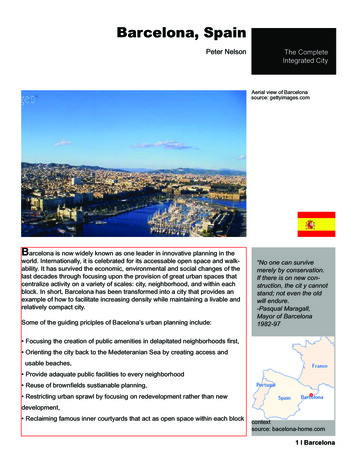
Alleys & PassagewaysAlleys present cities with special challenges, butalso opportunities. Typically built without standardstreet drainage, they tend to flood and many havenever been significantly improved since the neighborhood was built. Today, cities around the US arerealizing that alleys can be turned into communityspace and improved using green design.20Bardstown, KYFort Worth, TXNew Orleans, LASan Francisco, CANACTO Urban Street Design Guide Overview
Best Practices: Green AlleysChicago: Green AlleysBaltimore: Alley Gating and Greening ProgramChicago DOT spearheaded a “green alleys” programin 2006 to improve stormwater management withoutnew storm drains, reduce the heat island effect andincrease the use of recycled materials. The programbegan with materials research, six pilot projects andthe creation of the Green Alley Handbook. This handbook was a valuable tool used to educate the community. After the pilots were installed, the programexpanded to 32 alleys and is now a line item in thecity’s annual budget. Funding comes from the localalderman’s budget for capital improvements and fromdiscretionary funds.Administered by the non-profit Community Greens,the Baltimore alley program began in the early 2000swhen a group of neighbors sought to close theirnetwork of alleys, which were overrun with crime andtrash. After encountering legal resistance, the groupformed a coalition and drafted an ordinance thatwould allow alleys to be gated, which was passed in2007.Gated alleys are subject to the following regulations: The community leases the alley from the city,without the need for an easement. The city has the right to re-open th alley to thepublic. So as not to constitute a taking, 100% of residents must agree to its closure. Residents are responsible for maintenance.Baltimore, MDMetropolisChicago, ILChicago Green Alley HandbookBeforeAfterGreen Garage, a community-based business enterprise center in Midtown Detroit, began working withlocal businesses in 2008 to renovate a trash-strewnalley in the middle of the neighborhood. Togetherwith Wayne State University, the group was able tocompletely renovate the alleyway, installing gardens,permeable pavers and bollards to keep out throughtraffic. The renovated alley has become a vibrant greenway between buildings.Detroit, MINACTO Urban Street Design Guide OverviewGreen GarageDetroit: Green Alleys21
CRITICAL ISSUESStreets and sidewalks are shaped by many variables–some visible and somenot. While a new bike or bus lane tangibly alters the right-of-way, factors likesignal timing, functional classification and level-of-service constitute only asmall selection of the many invisible parameters that influence a street’s design and operation. Left unaddressed, these critical issues can prevent streetsfrom serving the needs of adjacent residents and businesses.A growing number of cities have overcome these obstacles and are improving their streets. An emerging catalogue of best practices, supported by anew body of research, is setting a better standard for city street design. TheCritical Issues section will help practitioners and decision-makers alike comprehend how to best integrate city traffic engineering principles into streetdesigns that balance the needs of residents with the realities of traffic.22NACTO Urban Street Design Guide Overview
New York, NY
Speed and SafetyVehicle speed plays a critical role in the cause andseverity of crashes. Lowering the frequency of injuries and fatalities remains a crucial public healthgoal for our cities. This section documents the relationship between speed and safety, looking at howappropriate street design can make our cities safer.Higher speeds Higher crash risk and severityThere is a direct correlation between vehicle speed,crashes and severity thereof.MassRisk of Pedestrian FatalityThe difference in mass between the two collidingbodies means the lighter of the two will bear the mostsevere injury.100Percent806040200203040Vehicle Speed (MPH)50Bus24,000 lbsCyclist/Pedestrian30 - 250 lbsReaction and Stopping DistanceProactive DesignThe amount of distance a driver takes to react andcome to a stop increases with increasing speeds.Conventional street design is founded in highwaydesign principles that favor wide, straight, flat andopen roads with clear zones that forgive and accountfor inevitable driver error. This is defined as “passive”design.Distance (Feet)Reaction & Stopping Distance vs. 0Vehicle Speed (MPH)Reaction Distance24Car2,000 lbs3540Stopping DistanceNACTO Urban Street Design Guide OverviewIn recent years a new paradigm has emerged for urbanstreets called proactive design. A proactive approachuses design elements to affect behavior and to lowerspeeds. Embracing proactive design may be the singlemost consequential intervention in reducing pedestrian injury and fatality. Since human error is inevitable,reducing the consequences of any given error or lapseof attention is critical. Cities around the country thathave implemented measures to reduce and stabilizespeed have shown a reduction in serious injuries anddeaths for everyone on the road, from drivers to passengers to pedestrians.
Vision ConeA driver’s visual focus diminishes as speed increases.Ridgewood, NJ15 mph20 mph25 mph30 mphNACTO Urban Street Design Guide Overview25
Design Speed vs. Target SpeedDesign SpeedConsequencesThe concept of design speed was originally defined in1936 as “the maximum approximately uniform speedwhich [can] probably be adopted by the faster groupof drivers, once clear of urban areas.” The definitionhas since evolved, and it is now used to select variousgeometric features of a roadway.Current practices accommodate and even encouragespeeding by designing streets where drivers may travelfaster than the intended speed limit. By applying ruraland suburban design practices to urban streets, agencies are actually creating streets that become dangerous to pedestrians and bicyclists. In basing the postedspeed limit on the 85th percentile, agencies allowspeeds to be normalized based upon how fast driversare actually driving, rather than establishing the speedat which drivers and other road users will be safest.Except in urban areas with hilly topography, designspeed is not a major factor in urban street design,although it may be included in street design guidelines. For example, many highway design manualsstipulate that the design speed be based primarilyupon a street’s functional classification, irrespectiveof context. Many manuals also suggest that designspeed should be 5 to 10 mph above posted speed. Thegeneral premise draws on the principle that roads designed for heavy traffic, such as arterials, should havehigher desirable and actual design speeds.Operating SpeedThe operating speed is the speed at which the majority of traffic on a given roadway operates. Operatingspeed is often defined as the 85th percentile vehiclespeed.RecommendationPosted SpeedDesign using target speeds–the speed you intend fordrivers to go–rather than operating speed, the speedat which drivers are going. Target speeds may fallbetween 15-30 mph on general streets, while alleys,shared spaces and pedestrian priority streets may beassigned target speeds as low as 10 mph. Many of theelements of great urban streets may then be incorporated into these lower speed streets, using benches,narrow lanes, trees, on-street parking, or small curbradii, which create a virtuous cycle that naturally encourages slower speeds.The posted speed is based upon the operating speedand local laws. In many circumstances, when routinespeed checks are conducted, if the 85th percentilespeed has increased since the last test, the postedspeed will in turn be raised.26Higher design speeds are deleterious to urban environments in mandating larger curb radii, wider trafficlanes, streets without on-street parking, guardrails,and clear zones. Accommodating higher speeds alsotakes up valuable land. By designing for a faster setof drivers, crashes increase due to the differential inspeeds between those traveling at the design speedversus the posted speed.NACTO Urban Street Design Guide OverviewTarget Speed Design Speed Posted Speed
Speed Control Mechanisms§§ Signals – signals can be timed to manage vehicle speeds or to prioritize other user groups likecyclists.§§ On-street parking and bike lanes – make driversaware of the presence of cyclists and entering/exiting vehicles.§§ Lane width – research shows that reducing lanewidths does not increase the frequency of crashes, even on suburban arterials. On urban streets,the impact of driver error is greater, creating evenmore of an imperative to manage speed. 10-footwide lanes are of sufficient width for target speedsof 40 mph or less. On bus and truck routes, onePortland, ORThe cycle track, on-street parking and trees along this streethelp reduce vehicle speed.Chicago, ILA mini traffic circle reduces speeding through this intersection.lane may be 11 feet wide.§§ Trees and landscaping – trees narrow a driver’sfield of vision and encourage slower driving.§§ Medians and curb extensions – narrow pedestrian crossing distances help to manage driver behavior and mutually improve drivers’
§ Level of Service § Curbside Management § Design and Control Vehicle § Functional Classification . Los Angeles, CA San Francisco, CA. 10 NACTO Urban Street Design Guide Overview Local Median Median Access Lane Local Access Lane Side Walk 12’ Side Walk 18.5’ 9’ 12’ Travel Lane Travel Lane


