Transcription
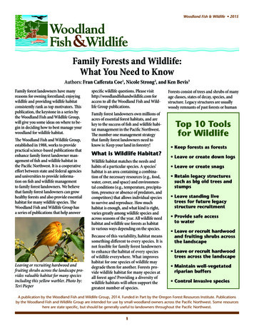
SPRING2021Windows to WildlifeYour support at work in Idaho’s landscapesThe Community Science IssueLEARN ABOUTUn-bee-lievable323Project WAfLSPHOTO: College of Western IdahoLending a Hand to Help Wildlife, HabitatConservation, and ResearchersCommunity (or citizen) science is an opportunity for anyoneto take an active role in scientific discovery. Regardless ofbackground, community scientists are people just like youwho voluntarily contribute time, effort, and resources to helpresearchers, biologists, and scientists collect meaningful anduseful data.people power. With the help of communityscientists, research can be done more quickly,information can be shared more readily, and ourknowledge can expand exponentially.Anyone, anywhere can be a scientist. Community sciencemakes the scientific research process accessible toeveryone by lowering the barriers to entry and raising theimpact of citizen or community engagement. Using simpletools and everyday technologies, community members withlittle expertise can make and share critical contributions toresearch. Over 200 community scientists with theMultispecies Baseline Survey (MBI) contributed2000 hours of labor by building slug traps,building radiation shields for climate monitoringstations, prepping bait for bait stations, andmaintaining bait stations in the field. With thehelp of community scientists, photo images andDNA samples were captured from two Speciesof Greatest Conservation Need - wolverine andfisher.By engaging with community members, researchers cancollect a larger amount of data, and often span moregeographic regions, in a shorter amount of time. In turn,this data informs larger conservation efforts. It’s also agreat opportunity for participants to learn more aboutspecies that interest them. It’s a win-win situation for all ofus—including Idaho’s wildlife!Collaborative efforts are mutually beneficial. The scope ofscientists’ research is often limited by time, budget, andIdaho’s Community Science in Action: Idaho Master Naturalists throughout the stateparticipate in community science researchsurveys for bats, roadkill, bumble bee, creel,moth, and waterfowl. They also help biologistswith gill netting, fire rehab photo monitoring, finclipping, water quality monitoring, and more!3Getting Started WitheBird4Global Big Day5Getting Started With4iNaturalist6City Nature ChallengeBoise7City Nature ChallengeBonner County8Pacific NorthwestBumble BeeAtlas9Western MonarchMilkweedMapper10On the Trail at RoswellMarsh WHA13
Community Science Project UpdateCommunity Science in Idaho: An Un-Bee-lievable Success!by Joel Sauder*, Wildlife Diversity BiologistClearwater Region, Idaho Department of Fish and GameIn 2018, the Pacific Northwest Bumble Bee Atlas was launched. The goal of thiscollaborative effort between Idaho Fish and Game, the Xerces Society, andWashington Fish and Wildlife was to harness the power of volunteer communityscientists to help map occurrences of bumble bees. Historically, much of theavailable data on bumble bees was centered near urban areas, particularly thosewith colleges or universities. One goal of the Atlas was to collect data more evenlyacross the three state area (ID, WA, and OR), which would help biologists gain abetter understanding how bumble bee populations were doing.The response of citizens to the Atlas has been nothing short of un-bee-lievable!Over three years, participants have submitted more than 20,000 observationsof bumble bees and conducted over 1,000 formal surveys! 24 species have beendocumented as part of the Atlas, including the first known observation of theAmerican Bumble Bee (Bombus pensylvanicus) in Idaho, and the second knownobservation of the High Country Bumble Bee (Bombus kirbiellus).2019 bumble bee training with citizen scientists.PHOTO: IDFGIn 2020 alone, in the midst of the coronavirus pandemic, volunteers donatedmore than 3,000 hours conducting surveys, and drove more than 50,000 miles,for a combined volunteer match value of 152,000! Without the contributions ofcommunity scientists there is no way biologists could have collected so much datain such a short period of time. Currently all that data is being analyzed to producea better understanding of the habitat associations, distribution, and populationstatus of bumble bees across the Pacific Northwest.However the best news it that the Atlas effort is not over! Over the winter, theU.S. Fish and Wildlife Service selected the Pacific Northwest Bumble Bee Atlasto receive another three years of funding. Over the next three summers (through2023), the Atlas will be looking to expand surveys where bumble bee data islacking, as well as start surveys intentionally targeting species like the WesternBumble Bee (Bombus occidentalis), Morrison’s Bumble Bee (Bombus morrisoni)and the Suckley Cuckcoo Bumble Bee (Bombus suckleyi). The Atlas will also beexpanding to include California for the first time.Bumble bee distribution data before the Atlas.PHOTO: Pacific NW Bumble BeeSo the opportunity and need for community scientist engagement in the PacificNorthwest Bumble Bee Atlas is as great as ever. In mid-April the Atlas will be“relaunched” on the project website with updated project goals, informationon how to participate, directions on how to sign up for training workshops, andinstructions on how to adoptsites to survey. Your participationcan contribute valuableinformation that will help directthe successful conservation ofIdaho’s bumble bees.Learn more about thePacific NW BumbleBee Atlas and how toparticipate on page 6!Bumble bee distribution data after the Atlas.PHOTO: Pacific NW Bumble Bee Atlas2Western Bumble Bee captured by the author. The bee was temporarily chilled so it could bePHOTO: IDFGphotographed and identified before being released alive.
Community Science Project UpdateProject WAfLS: The End of an Era, and a New Beginning!by Robert Miller*, Wildlife BiologistIntermountain Bird Observatory, Boise State UniversityShort-eared Owl populations have declined precipitously over the past 40 years in the western United States. However, until nowthe true magnitude and cause of the declines have not been well understood. Six years ago, the Intermountain Bird Observatorylaunched a landscape study of the owls, known as Project WAfLS (Western Asio flammeus Landscape Study), that started in Idahoand Utah and eventually expanded to a total of eight western states. We recruited partners in neighboring states and over 1,000community-science volunteers each spring to look for owls using a statistically rigorous survey method that we developed.We have found that the population of Short-eared Owls in recent years has been reasonably stable, but has shifted broadly fromstate to state, likely synchronizing with local prey cycles. This is great news if it remains stable, as we had suspected that the declinewas continuing. We have also confirmed that anthropogenic (human-altered) landscapes, while regularly used by short-eared owlsfor breeding, have higher turnover (less consistent use) than native landscapes. This suggests that anthropogenic landscapes maybe acting as an ecological trap for the species - meaning the habitat is attractive for breeding, but results in poor success. Duringthe six-year project we have discovered a large number of anthropogenic sources of mortality. These may be limiting the owls’population and be the cause of the ecological trap, as all of these sources occur in higher densities on anthropogenic landscapes.These sources of mortality include roadway mortality, aircraft strikes, agricultural harvest mortality, fence-line collisions, stock-tankdrownings, and solar farm mortalities.Our plan moving forward is to discontinue thebroad Project WAfLS surveys, although theymay still occur in some states through ourpartner organizations. We will instead shiftour efforts to the next stage of Short-earedOwl conservation by using our discoveredknowledge from Project WAfLS to seekanswers at the next level of detail. We arespecifically interested in the ecological trapquestion and if the sources of mortalityare additive (limiting the population) orcompensatory (would have occurred anywaythrough other means).We have launched a roadway mortalitypilot study in eastern Idaho (Project PROwl,partnering with Idaho Fish and Game andthe Upper Snake chapter of the Idaho MasterNaturalists). We have also launched a Shorteared Owl movement project (with AlaskaFish and Game, Owl Research Institute,Wyoming Game and Fish, and Teton RaptorCenter) tracking the nomadic movementsof individualsand their proximity to thePost-breeding movements of two Short-eared Owls fitted with transmitters during summer 2020.PHOTO: IBOmortality risks listed above. And, in the springof 2021 we will be launching an alfalfa harvestmortality mitigation project with the U.S. Fish and Wildlife Service, Idaho Fish and Game, and the Natural Resource ConservationService. Each of these new initiatives build on the results we collected through Project WAfLS and will provide critical data forfuture decisions.All of these projects will continue to depend on our fantastic network of committed community science volunteers.3
How to Get StartedGetting Started With eBirdeBird is the go-to platform for birders and scientists alikeeBird is a global database of birdobservations. It is an amazing tool for birdersto keep track of their sightings, but it isalso much more than that. It is a repositoryfor community science observations on anunprecedented scale, and by partnering withus to enable audio and photo upload, it hasnow become a key portal for the long-termarchival of rich media.If you want to get started with eBird, here arefive key steps to help you get eBirding faster(click any step to learn more).Get started with eBird1 - Create an accountTo save your bird observations in eBird, you’ll need to createa free Cornell Lab account. This account works across CornellLab projects including Merlin Bird ID, Bird Academy, ProjectFeederwatch, and the Great Backyard Bird Count.You will also be asked whether your checklist is complete. Acomplete checklist is a report of all the birds you could detectand identify by sight or sound. A checklist is incomplete if youidentified some birds but chose not to report them (e.g., a list of“highlights only”).4 - Explore sightingseBird is a powerful resource for finding target species anddiscovering new places to go birding. Below are some of theways you can explore eBird data. Species maps eBird Hotspots - popular birding sitesrecommended by other birders Regional summary pages with species lists, recentvisits, top birders, and more Bar charts of how frequently birds are reportedthroughout the yearVisit our Explore eBird Data info page for more information aboutthese and other ways to discover birds.If you already have an account for these other projects, you canuse it for eBird, too! No need to create a separate account.2 - Take the eBird Essentials CourseeBird Essentials is a free, self-paced course that will walk youstep-by-step through eBird’s most popular features. You’lllearn how to keep checklists, explore data, and make yourobservations more valuable for science and conservation - all onyour own time and all completely for free!5 - Follow eBird Best PracticeseBird gathers bird observations around the world and makesthem available to researchers, educators, and conservationistsworking to understand and conserve birds. Your eBirdobservations can power cutting-edge science like eBird’s statusand trend maps.(Information from: ebird.org)3 - Submit birding checklistsThere are two main ways to share your bird observations witheBird: submit them through the eBird.org website, or with thefree eBird Mobile app.eBird Mobile is our most popular way to report birdingchecklists. Easily keep a running list of the birds you see andhear in the field, even without wifi. When you’re done, eBirdMobile automatically calculates your time spent birding andhelps you calculate your distance - allowing you to focus on thebirds. You can even explore data and share checklists with yourfellow birders directly from the app!eBird Checklist Basics:Whether you submit bird observations on eBird.org or eBirdMobile, every checklist should include Where you went birding (a single map location) When you went birding (a single calendar date) How you went birding (an observation type) Which birds you observed and how manyindividuals (counting tips)With just a tap of your finger: using your mobile phone, you can access eBird during your birding trip to enter yourobservations.PHOTO: eBird NW4
Community Science OpportunityGlobal Big Day - May 8, 2021Be Part of Birding’s Biggest Team!(Cornell Press Release) Global Big Day is an annual celebration of the birds around you. No matter where you are, join us virtually on May 8and share the birds you find with eBird.Participating is easy—you can even be part of Global Big Day from home. If you can spare 5 or 10 minutes, report your bird observations toeBird online or with our free eBird Mobile app. If you have more time, submit checklists of birds throughout the day. You never know whatyou might spot. Your observations help us better understand global bird populations through products like these animated abundance mapsbrought to you by eBird Science.Last year, Global Big Day brought more birders together virtually than ever before. More than 50,000 people from 175 countries submitted astaggering 120,000 checklists with eBird, setting a new world record for a single day of birding. Will you help us surpass last year’s records?However you choose to participate, please continue to put safety first and follow your local COVID guidelines.How to participate Get an eBird account: eBird is a worldwide bird checklistprogram used by millions of birders. It’s what allows us tocompile everyone’s sightings into a single massive GlobalBig Day list—while at the same time collecting the data tohelp scientists better understand birds. Sign up here. It’s100% free from start to finish. Watch birds on May 8: It’s that simple. You don’t need tobe a bird expert or go out all day long, even 10 minutesof birding from home counts. Global Big Day runs frommidnight to midnight in your local time zone. You canreport what you find from anywhere in the world. Enter what you see and hear in eBird: You can enteryour sightings via our website or download the free eBirdMobile app to make submitting lists even easier. Pleaseenter your checklists before 11 May to be included in ourinitial results announcement. Contributing sightings is easy with the free eBird Mobile app. Download for iOS or AndroidWatch the sightings roll in: During the day, follow along with sightings from more than 170 countries in real-time on our Global Big Daypage.Global Big Day Pro Tips If you’re new to eBird or want to make your checklists more valuable for science andconservation, take our free eBird Essentials course.Get the Cornell Lab’s Merlin Bird ID app for help identifying tricky species, then useeBird to report them so your sightings are part of the Global Big Day totals.Use eBird Mobile Explore to find recently reported species or new places to go birdingnearby.Take photos and add them to your checklist—they might end up on the Global Big Daypage!Make your sightings more valuable: submit complete checklists, keep counts of thebirds that you see, and keep multiple checklists throughout the day.Share what you’re seeing on social media with #globalbigday!On May 8, we hope you’ll be a part of our global birding team. Have fun, enjoy the birds youfind, stay safe, and share your sightings on eBird. Because in our world, every bird counts.Mountain bluebird - Idaho’s state bird!(Information from: ebird.org)5PHOTO: Public Domain
How to Get StartedGetting Started With iNaturalistiNaturalist is an online social network of people sharing biodiversityinformation to help each other learn about natureOne of the world’s most popular nature apps, iNaturalist helps you identify theplants and animals around you. Get connected with a community of over a millionscientists and naturalists who can help you learn more about nature! What’s more,by recording and sharing your observations, you’ll create research quality datafor scientists working to better understand and protect nature. iNaturalist is ajoint initiative by the California Academy of Sciences and the National GeographicSociety.That’s the vision behind iNaturalist. So if you like recording your findings from theoutdoors, or if you just like learning about life, join us! It is also a crowdsourcedspecies identification system and an organism occurrence recording tool. You canuse it to record your own observations, get help with identifications, collaboratewith others to collect this kind of information for a common purpose, or access theobservational data collected by iNaturalist users.That’s the vision behind iNaturalist. So if you like recording your findings from theoutdoors, or if you just like learning about life, join us!Watch This Video to Learn More:6Photo: IDFGLookFor These iNaturalist Idaho ProjectsCity Nature Challenge 2021 - Boise (see page 7)City Nature Challenge 2021 - Bonner County (see page 8)Idaho Invertebrate ProjectIdaho Amphibian and Reptile iNaturalist ProjectBiodiversity of IdahoIdaho Mycofora ProjectHarriman State Park of Idaho Biodiversity ProjectNorth Idaho BiodiversityBirds of IdahoIdaho Species ObservationsIdaho FloraIdaho Roadkill
WANT TO PARTICIPATE?BOISE, ID – 2021Click on the picture towatch a webinar thatteaches you everything youneed to take part in thefun of the City NatureChallenge!CITY NATURECHALLENGEApril 30th – May 3rdMay 4th – 9thCOLLECTION: Take photos ofwild plants, animals and fungi.IDENTIFICATION: Identify whatwas found.HOW TO PARTICIPATE IN THE CITY NATURE CHALLENGEJoin in the global collaboration to document the biodiversity in cities across the globe by discoveringand recording the species in our neighborhoods, parks, downtown and open spaces.STEP 1: Mark your calendar to get outside April 30 – May 3.STEP 2: Download the iNaturalist app and create an account.STEP 3: Take photos of WILD plants, animals, and/or fungi anywhere in Boise or Garden City.Be sure to note the location of the creature or plant.STEP 4: Upload your observations (photos) to the app to share with the iNaturalist community.STEP 5: Help identify species or learn more as your discoveries get identified by the communityMay 4 - 9.VISIT: City Nature Challenge Website: citynaturechallenge.org CONTACT: kgnojewski@cityofboise.org or 208-608-7609BOISE AREA PARTNERS: College of Western Idaho Biology Department and Biology Club, Intermountain Bird Observatory, Land Trustof the Treasure Valley, Boise WaterShed, MK Nature Center, US Fish and Wildlife Service, Idaho Botanical Garden, Foothills LearningCenter, Boise Urban Garden School, Idaho Native Plant Society- Pahove Chapter, Ada County 4-H7
Participate in the Bonner County BioBlitz!April 30 - May 3May 4—May 9Take pictures of wild plants and animals.Identification of what was found.City Nature Challenge: Bonner County (CNCBC) is a BioBlitz event taking place in Spring 2021, engaging people todocument the biodiversity of Bonner County. A BioBlitz is a citizen-science, crowdsourcing effort to record as manyspecies within a designated location and time period as possible.VISIT: hallenge-2021-bonner-county-idCONTACT: imn.sandpoint@gmail.com OR Look for us on Facebook!8
How to Get StartedGetting Started With the Pacific NW Bumble Bee AtlasBumble bees are essential pollinators in wildlands and agricultureWhat?The Pacific Northwest Bumble Bee Atlas is a collaborative projectto track and conserve the bumble bees of Oregon, Washington, andIdaho. Our goal is to gain a better understanding of the distribution ofbumble bees throughout the region. This will help us to more effectivelyenact conservation measures that will benefit these important nativepollinators. We’ve divided the area up into priority grid cells to ensure abroad distribution of sampling in all of the unique habitats of the region.This project will help the researchers gain a better understanding ofwhere bumble bees are thriving in the Pacific Northwest, and gleaninformation about what habitat features are contributing to productivebumble bee communities. Ultimately we will better understand how tomanage lands throughout the region that will help to support a morehealthy ecosystem.Why? umble bees are essential pollinators in our natural landscapes, as well as in gardensBand on farms. Idaho, Oregon and Washington are home to nearly 30 species of bumblebees, and several of them face an uncertain future. The western bumble bee has declineddramatically - especially in the western portion of its range, and species like Morrison’sBumble Bee and the Suckley Cuckoo Bumble Bee are in decline. Conservation partners inOregon, Washington and Idaho have joined forces to support bumble bee conservationthrough a region-wide project to collect information on bumble bee species distribution.The missing partner is you - become a community scientist and join us!How?We aim to make this as fun and as inclusive as possible. As such, we’ve createdopportunities so that you can get involved at many different levels. The first thing youwill need to participate is a Bumble Bee Watch account. It’s easy to set up online andtakes about 5 minutes.Once you’ve done that, here are the different levels at which you can get involved:The Western Bumble Bee - Bombus occidentalis. This species has declined At a very basic level you can submit observations of bumble bees todramatically in the intermountain west. It is a Species of Greatest ConservationNeed in Idaho. Easily identified by its white rump.BumbleBeeWatch.org. You can share observations from your backyard, whereyou work, or on your travels around the region. If you are interested in getting more involved you can officially adopt a gridcell and participate in our more formal surveys: either Point Surveys or RoadsideSurveys. This takes a commitment to contribute to the project. At a minimumyou’ll need to: Familiarize yourself with project protocols and procedures. One of the best waysto do this is to attend one of our online training events - check the Atlas website inlate April for training dates (www.pnwbumblebeeatlas.org/events.html) Visit a location within your grid cell two times (at a minimum – more samplingis very welcome if you are willing) during the bumble bee season and use ourstandardized protocol to sample for bumble bees as well as the surroundinghabitat. To meet this requirement you can visit two different locations withinthe grid on the same day, or revisit the same location on two different days. Agree to submit your data online.If all of this sounds great and you’re ready to do all of this AND become a projectambassador, please visit us at pnwbumblebeeatlas.org or contact us atjoel.sauder@idfg.idaho.gov(Information from: Pacific Northwest Bumble Bee Atlas website)9Nevada Bumble Bee - Bombus nevadensis. This large bodied bumble bee is commonthroughout much of the eastern portion of the Northwest. The males have largebulbous eyes.
How to Get StartedGetting Started with the Western Monarch Milkweed MapperThe Western Monarch Milkweed Mapper facilitates the study andconservation of the monarch butterfly in western statesThe Western Monarch Milkweed Mapper (WMMM) is part of a collaborative effort to mapand better understand monarch butterflies and their host plants across the western U.S.Data compiled through this project will improve our understanding of the distribution andphenology of monarchs and milkweeds, identify important breeding areas, and help usbetter understand monarch conservation needs. Some of the key research questions thatthese data will help us answer include: Where are different milkweed species growing in the West?Where are monarchs occurring in the West?Where are monarchs breeding in the West?When is milkweed emerging and senescing (dying back) in the West?How does milkweed phenology (life cycle) differ by species?When is monarch breeding occurring in specific areas/regions of the West?What types of habitats are different milkweed species associated with?How Can You Help?Your help is critical to the success of this project! Because monarchs and their host plantsare found all across the western U.S., the best way to document them is to engage amultitude of volunteers and their cameras. You can participate in this effort by using thiswebsite to: Monarchs on milkweed.Photo: IDFGUpload your photos of monarchs and milkweeds;Identify milkweeds using our milkweed key, which profiles over 40 milkweed speciesfound in the west;Submit data which will help researchers determine the distribution, phenology, andconservation needs of monarchs and milkweeds in the west; andLearn about monarchs, their host plants, and ongoing conservation efforts for thesespecies.Participating in our project is simple and you can get started now by creating an accountvia the “sign in” tab at the top of the WMMM page. Once you have an account, go out andstart looking! Check your local parks, natural areas, gardens, and even roadsides. We’relooking for all stages of monarchs, so don’t forget to look at milkweed leaves and stemsto see if caterpillars or eggs are present. Snap a few photos (learn more about how tophotograph milkweeds and monarchs here) and then sign in and submit your data via ourMilkweed and Monarch Sightings forms. Have fun while learning more about monarchsand the special habitats they use in your area!Photo: Western Monarch Milkweed MapperData compiled through the WMMM will enhance State wildlife Action Plans (SWAP) byaddressing critical knowledge gaps on western monarch distribution, relative abundance,and habitat use within each state. In addition, this information will improve the quality andcomprehensiveness of SWAPs by enabling assessment of monarch conservation status,key threats, and actions needed for state and metapopulation viability. Information, data,and tools developed from this project will significantly enhance the utility and relevanceof WAPs. SWAP utility will also be advanced through improved networking and dataexchange with decision makers, land managers, researchers, and stakeholders to facilitateactions that support landscape-scale conservation of monarch butterflies and otherpollinator species.(Information from: Western Monarch Milkweed Mapper website)Photo: Xerces Society10
IDAHO NONGAMEWILDLIFE FUNDSpecies of Greatest ConservationNeed, like this Northern LeopardFrog, are on the decline. We’reworking hard to give them afighting chance so they’ll last forgenerations to come.Donate Today!Idaho Tax Form 40, Line 34Check It and Protect It!11
Bird IDAHOYour statewide birding adventure awaitsThe Idaho BirdingTrail is your guideto the best birdingand wildlifeviewing in Idaho!idahobirdingtrail.com
95OREGON63 164 262On The Idaho Birding TrailIDAHO BIRDING TRAIL958Roswell Marsh Wildlife Habitat AreaWeiser35661 54541059947757Cascade12Boise Sites78 43 7689 88 7951 17 8352 84 4680 75 8520 81 8286 53 4877 49 4544 42 4130845 Old Fort Boise Rd., Parma (208) 722-5888Pebble Lane, Parma (208) /hotspot/L23458355Site# in Home78Grandview2567295124 231884782730203126933433 Carey327528Glenns Ferry846667362684305126Shoshone68 35OREGONIdaho’smost Wildlifedependablefor thousandsofRoswell MarshHabitatlocationArea (WHA)is a680-acrewetland,meadow,and shrubGeesecomplexSnowandGreaterWhite-frontedduring spring.located fivenestersmiles southof theCinnamonBoise River.andTheBlue-wingedCommonincludeWHA provides nesting and winter habitat forTealandRed-tailedand Swainson’sLarge Greatuplandbirdsand waterfowland serves ryatimportant stopover location for migratory he west end. Areas adjacent to the Snake River arethousandsof Snow and Greater White-frontedopenyear-round.21221916EAST CENTRAL2114MurphyDIRECTIONS: I-84 Exit #26; W on US 20/26 to Parma;DIRECTIONS:I-84 townExit #26;W onUSon20/26to Parma;continue W throughand turnL (S)RoswellBlvd (ID 18)mi;mi;R (W)onto ID 18 for 2.7micontinueWforfor2.83.5at “Sportsman’sAccess”sign turnmarsh.Lto(W)on Old Fort Boise Rd; travel 2 mi to WMA.55169092Horseshoe Bend652SOUTHEASTSouthwest RegionOverviewSOUTHEASTLAT/LONG: 6942135052BOISESOUTHWEST9513 Fort Boise Wildlife Management AreaEASTCENTRAL55 60PayetteNORTH5571CambridgeMcCall Boise Nampa Twin Falls58Council11Southwest RegionMcCall24937471 72TwinFalls308437384073933970 69NEVADAU TA HGeese during spring migation. From mid-Marchthrough mid-April, there can be up to 60,000Snow Geese and 40,000 Greater White-frontedGeese at the WMA. Snow Geese fly out dailyto feeding sites on private land before dawn tofeed, usually on corn stubble several miles away.They fly back at mid-day to their resting areason the WHA. These geese spend their winters incentral California, fly up to Idaho to refuel, andthen continue to fly to their breeding grounds inthe Canadian Arctic, the north slope of Alaska, orWrangel Island in Russia!What Did You See at the WHA?Join the community science revolution and record your observations from Roswell viaeBird. eBird is a database of global bird observations. It is free to use and in 2020, 860million global bird observations from over 597,000 registered eBirders were collected!Snow Geese Fill the Air VideoSnow Geese in flight.13Photo: CC BY 4.0 mizmak on Flickr CCGreater White-fronted GoosePhoto: Shutterstock
Thank You for Your Support!Bumble Bee C
for community science observations on an unprecedented scale, and by partnering with us to enable audio and photo upload, it has now become a key portal for the long-term archival of rich media. If you want to get started with eBird, here are five key steps to help you get eBirding fast