Transcription
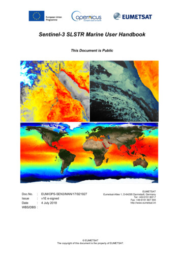
Sentinel-3 SLSTR Marine User HandbookThis Document is 17/921927v1E e-signed4 July 2018EUMETSATEumetsat-Allee 1, D-64295 Darmstadt, GermanyTel: 49 6151 807-7Fax: 49 6151 807 555http://www.eumetsat.int EUMETSATThe copyright of this document is the property of EUMETSAT.
EUM/OPS-SEN3/MAN/17/921927v1E e-signed, 4 July 2018Sentinel-3 SLSTR Marine User HandbookThis Document is PublicThis page intentionally left blankNamePrepared andreviewed by:FunctionSally WannopUser RelationsManagerGary CorlettEUMETSATcontractorBen LovedayEUMETSATcontractorReviewed by:Anne O‘CarrollRemote SensingScientistReviewed by:Jim FlewinQuality AssuranceEngineerApproved by:Joachim SaalmuellerHead UserSupport andClimate ServicesPage 2 of 39SignatureDate
EUM/OPS-SEN3/MAN/17/921927v1E e-signed, 4 July 2018Sentinel-3 SLSTR Marine User HandbookThis Document is PublicDocument Change RecordIssue /RevisionDateDCN.NoChanged Pages / ParagraphsV1B21 November 2017First issueV1E04 July 2018Changes to harmonise document with OLCI/SRALhandbooks.Updated to include Bayesian cloud flagginginformation.L1 flag information updated.Updated background and SST history sections.Improved information on SSES.Reflects L1/L2 product notices as of 04/04/2018.Page 3 of 39
EUM/OPS-SEN3/MAN/17/921927v1E e-signed, 4 July 2018Sentinel-3 SLSTR Marine User HandbookThis Document is PublicTable of Contents1INTRODUCTION. 61.1 Purpose. 61.2 Scope . 61.3 Document Structure .61.4 Applicable Documents .61.5 Reference Documents .71.6 List of acronyms and abbreviations .72BACKGROUND . 92.1 The Copernicus Programme .92.2 European Organisation for the Exploitation of Meteorological Satellites (EUMETSAT) .92.3 Sentinel-3 objectives .102.4 Disclaimer .102.5 Useful links.112.6 Limitations of the SLSTR SST Products .112.7 History of product changes .113SENTINEL-3 AND SLSTR.123.1 Sea surface temperature: a historical background .123.2 Complementarities with other SST missions .134SLSTR: GEOPHYSICAL VARIABLES, INSTRUMENTS AND PRINCIPLE .154.1 The SLSTR instrument.154.2 Coverage. 174.3 Measurement of SST from SLSTR .174.4 SLSTR products.174.4.1 Expected accuracy.174.5 Quality control and monitoring .184.6 Where to go for further information (ATBDs) .195PROCESSING LEVELS AND SCHEMES.205.1 Level-1 Processing Approach .205.1.1 Instrument grid processing.205.1.2 Instrument grid processing.215.1.3 Bayesian cloud detection .215.2 Level-2 Processing Approach .225.2.1 SST retrieval algorithms.225.2.2 L2P processor.226SLSTR PRODUCTS AND FILE TYPES .246.1 File naming.246.2 Data format .256.3 Level 1 Product Contents.256.4 Level 2 Product Contents.267HELPDESK, PRODUCT DISSEMINATION AND ARCHIVE .287.1 Helpdesk . 287.2 Data access routes .287.3 User Products Dissemination Concept.307.4 Software Tools .307.4.1 Sentinel-3 Toolbox .307.4.1.1 Installing the toolbox.307.4.1.2 Opening a Sentinel-3 product.307.4.1.3 Basic functionality.317.4.2 View the contents of a NetCDF file? .317.4.3 Cerbere and Felyx .32Page 4 of 39
EUM/OPS-SEN3/MAN/17/921927v1E e-signed, 4 July 2018Sentinel-3 SLSTR Marine User Handbook89This Document is PublicDATA QUALITY.33USER BEWARE! .349.1.1 Product Grids in RBT and WCT Products.349.1.2 Aligning the product grids in RBT and WCT Products .349.1.3 Mixed SST fields in WST Product.359.1.4 Quality level and SSES in WST Product.359.1.5 Data over all water bodies in WCT and WST Products .359.1.6 NeDT in WST product.369.1.7 Using flags in RBT and WCT Product.369.1.8 Converting from Brightness Temperature to Radiance in RBT Product .379.1.9 Converting from Radiance to Reflectance in RBT Product.389.1.10 Range of valid brightness temperatures in channels S7, S8 and S9.389.1.11 Bayesian cloud flagging caveats.399.1.12 VIS/SWIR radiometric calibrations versus OLCI.39Table of FiguresFigure 1: SLSTR swath coverage. Note that, unlike in AATSR, the oblique view in SLSTR is to the rear(e.g. behind the direction of flight) .16Figure 2: SLSTR Level 1 RBT instrument grid processing .20Figure 3: SLSTR Level 1 RBT image grid processing .21Figure 4: SLSTR file format .25Figure 5: Data access routes .28Figure 6: (Left) Example SLSTR product grids showing the tie-point (blue), nadir (green and oblique(red) geodetic coordinates. The SSP is indicated by the black line. .34Figure 7: (Left) Full swath WST SST image and (right) “sst algorithm type” showing the dual-view(cyan) and nadir-only (purple) regions. .35Figure 8: SLSTR SST image of the Amazon estuary in South America showing the scale of inland waterbodies provided in SLSTR data.35Figure 9: Example NeDT image for channel S8 .36Table of TablesTable 1: SLSTR Spectral Bands .15Table 2: Data access locations .29Table 3: SLSTR validation against drifters.33Table 4: SLSTR confidence bitmask.37Table 5: SLSTR cloud bitmask .37Page 5 of 39
EUM/OPS-SEN3/MAN/17/921927v1E e-signed, 4 July 2018Sentinel-3 SLSTR Marine User HandbookThis Document is Public1INTRODUCTION1.1PurposeThe Sentinel-3 Sea and Land Surface Temperature Radiometer (SLSTR) Marine Handbook isa guide that summarises the key information needed for an end-user (both general andspecialist) to gain a better understanding of the SLSTR marine Level 1 (L1) and Level 2 (L2)products. The handbook includes information on the components of the instrument system, thespecifics of measurement techniques used, details on applied corrections and processing stepsrequired to derive geophysical variables. The capability of the system is discussed in thecontext of its complementarity with, and improvements on, other sea surface temperature (SST)missions, with notes on existing limitations. A discussion of file formats, processing tools anddata-access routes precedes a presentation of available support resources. Where the detail isnot held in the handbook itself, the user is pointed to further (primarily web-based) resources.1.2ScopeAll current and potential users of the Copernicus Marine Data Stream that are interested in theSentinel-3 SST products for use in the open-ocean, coastal domain and inland waters, includingrivers and lakes.1.3Document StructureSection 1 General information (this section).Section 2Background information on EUMETSAT, Copernicus and Sentinel-3 missionrequirements.Section 3 Provides and overview of Copernicus and the SLSTR instrument.Section 4 Gives an overview of the SLSTR instrument, coverage, quality, capability andaccuracySection 5 Gives a description of SLSTR L1 and L2 marine processing.Section 6 Gives a description of SLSTR L1 and L2 marine products.Section 7 Explains how to download and visualise SLSTR data.Section 8 Summarises the data quality of SLSTR marine products.Section 9 Provides details of some unique features of SLSTR and SLSTR marine productsthat all users should be aware of.1.4AD-1Applicable DocumentsSentinel-3 Mission Requirements Document, v2.0Page 6 of 39EOP-SMO/1151/MD-md
EUM/OPS-SEN3/MAN/17/921927v1E e-signed, 4 July 2018Sentinel-3 SLSTR Marine User HandbookThis Document is PublicAD-2Sentinel-3 Mission Requirements TraceabilityDocument, v1.0EOP-SM/2184/CD-cdAD-3Sentinel-3 PDGS File Naming Convention, v1DEUM/LEOSEN3/SPE/10/00701.5Reference DocumentsRD-1Allison, L.J., and J. Kennedy, 1967. An Evaluation of Sea Surface Temperature asMeasured by the Nimbus I High Resolution Infrared Radiometer,” NASATechnical Note No. D-4078, National Aeronautics and Space Administration,Washington, D.C.RD-2Donlon C., N. Rayner, I. Robinson, D. J. S. Poulter, K. S. Casey, J. VazquezCuervo, E. Armstrong, A., Bingham, O. Arino, C. Gentemann, D. May, P.LeBorgne, J. Piollé, I. Barton, H. Beggs, C. J., Merchant, S. Heinz, A. Harris, G.Wick,B. Emery, P. Minnett, R. Evans, D. Llewellyn-Jones, C., Mutlow, R. W.Reynolds, H. Kawamura, 2007. The Global Ocean Data Assimilation ExperimentHigh-resolution Sea Surface Temperature Pilot Project, Bulletin of the AmericanMeteorological Society, Volume 88, Issue 8 (August 2007) pp. 1197-1213 doi:http://dx.doi.org/10.1175/BAMS-767 88-8-1197.RD-3P. Le Borgne, A. Marsouin, F. Orain, H. Roquet, 2012. Operational sea surfacetemperature bias adjustment using AATSR data, Remote Sensing of Environment,116, 93-106. doi:10.1016/j.rse.2010.02.023.RD-4Závody, A.M., Mutlow, C.T., and Llewellyn-Jones, D.T., 1995. A RadiativeTransfer Model for Sea Surface Temperature Retrieval from the Along-TrackScanning Radiometer. Journal of Geophysical research, 100, 937-952.RD-5Merchant, C.J., Harris, A.R., Murray, M.J., and Závody, A.M., 1999. Toward theElimination of Bias in Satellite Retrieval of Sea Surface Temperature 1. Theory,Modelling and Interalgorithm Comparison. Journal of Geophysical Research, 104,23565-23578.RD-6Bulgin, C.E., O. Embury, G. Corlett, C.J. Merchant, 2015. Independent uncertaintyestimates for coefficient based sea surface temperature retrieval from the AlongTrack Scanning Radiometer, Remote Sensing of Environment, 162, 396-4071.6List of acronyms and abbreviationsTable of key acronyms and ed Along-Track Scanning RadiometerAlgorithm Theoretical Basis DocumentCalibration and ValidationCopernicus Marine Environment Monitoring ServiceCopernicus Online Data AccessEuropean Centre for Medium-Range Weather ForecastsPage 7 of 39
EUM/OPS-SEN3/MAN/17/921927v1E e-signed, 4 July 2018Sentinel-3 SLSTR Marine User HandbookThis Document is PCMRDMRTDMWRNDVINeDTNetCDFNRTNTCNWPOSI WIRTIRTOAVISCALVNIRWCTWSTEarth ObservationEarth Observation PortalEuropean Organisation for the Exploitation of Meteorological SatellitesFile Transfer ProtocolGroup for High Resolution SSTGlobal Monitoring for Environment and SecurityInfraredLevel 1Level 2Land Surface TemperatureMatch-up DatabaseMonitoring and Evaluation of Thematic Information from SpaceSentinel-3 Mission Performance CentreMission Requirements DocumentMission Requirements Traceability DocumentMicrowave RadiometerNormalised Difference Vegetation IndexNoise Equivalent Differential TemperatureNetwork Common Data FormatNear Real-TimeNon-Time CriticalNumerical Weather PredictionOcean and Sea Ice Satellite Application FacilityPayload Data Ground SegmentProduct Dissemination UnitPrecise Orbit DeterminationRadiance Brightness TemperatureRadiative Transfer model for the TIROS Optical Vertical sounderSentinel-3 Validation TeamStandard Archive Format for EuropeSea and Land Surface Temperature RadiometerSeNtinel Application PlatformSynthetic Aperture Radar AltimeterSea Surface TemperatureScience Toolbox Exploitation PlatformShort-wave InfraredThermal InfraredTop of AtmosphereVisible CalibrationVisible Near InfraredInternal individual algorithms Sea Surface TemperatureGHRSST L2P format Sea Surface TemperaturePage 8 of 39
EUM/OPS-SEN3/MAN/17/921927v1E e-signed, 4 July 2018Sentinel-3 SLSTR Marine User HandbookThis Document is Public2BACKGROUND2.1The Copernicus ProgrammeCopernicus is the European programme for the establishment of a European capacity for Earthobservation and monitoring. The programme aims to deliver information services based onsatellite and in situ (non-space) components. The Copernicus Programme is coordinated andmanaged by the European Commission. It is implemented in partnership with the MemberStates, the European Space Agency (ESA), the European Organisation for the Exploitation ofMeteorological Satellites (EUMETSAT), the European Centre for Medium-Range WeatherForecasts (ECMWF), EU Agencies and Mercator Océan. The Copernicus programme providesusers with free, full and open access to environmental data.The satellite component of the Copernicus Programme encompasses the Sentinel satellitemissions, including Sentinel-3. Sentinel-3 is dedicated to providing high-accuracy optical,radar and altimetry data for marine and land services. EUMETSAT operates the Sentinel-3satellite series, with ESA support, and is responsible for delivering the Sentinel-3 marine datastream. Looking ahead, EUMETSAT will also will also operate and deliver products from theSentinel-4, and Sentinel-5 instruments, and the Sentinel-6/Jason-CS satellites.2.2European Organisation for the Exploitation of Meteorological Satellites(EUMETSAT)Founded in 1986, EUMETSAT is a European-based and globally-focussed, intergovernmentaloperational satellite agency. Its purpose is to gather accurate, reliable and timely satellite dataon weather, climate and the environment, and to deliver this to its Member and CooperatingStates, international partners, and to users world-wide. With a strategic goal to ensureimprovements in, and continuity of, satellite observations, EUMETSAT oversees thedevelopment and operation of a range of complex satellite systems that are in constant use inmonitoring weather, climate, the oceans and the atmosphere, and supports downstream servicessuch as meteorological forecasting, air-travel safety and shipping.EUMETSAT operates a fleet of satellites in geostationary and polar orbit from its MissionControl Centre (MCC), based at its headquarters in Darmstadt, Germany. The geostationaryMeteosat platforms provide regular imagery over Europe, Africa and the adjacent seas,(Meteosat-9, 10 and 11), and over the Indian Ocean (Meteosat-8). More detailed observationsof the global atmosphere, oceans and continents are provided by the polar orbiting Metop-Aand Metop-B satellites. In partnership with NOAA, CNES and NASA, EUMETSAT supportsthe operational phase of the Jason-2 altimeter and the Jason-3 reference altimeter, providingnear real-time ocean topography products to support ocean forecasting and climate analysis.Under the Copernicus Programme, EUMETSAT provides Earth Observation (EO) data,products and support services to the Copernicus information services and user communities,with a focus on marine, atmosphere and climate. In the marine context, this role encompassesoperating the Sentinel-3 and Jason-3 satellites, with future responsibility for Sentinel-6/JasonCS. The marine capability of the Sentinel-3 SLSTR instrument is the sole focus of thisdocument.Page 9 of 39
EUM/OPS-SEN3/MAN/17/921927v1E e-signed, 4 July 2018Sentinel-3 SLSTR Marine User HandbookThis Document is Public2.3Sentinel-3 objectivesSentinel-3 is a dedicated Copernicus satellite delivering high-quality ocean measurements. Inthe marine environment, the primary objective of Sentinel-3 is to determine sea-surfacetopography, sea-surface temperature and ocean-surface colour parameters; offering EO datawith global coverage every two days (with two satellites) in support of marine applications,and with near real-time products delivered in less than three hours.Sentinel-3A and 3B were launched in February 2016 and April 2018, respectively. Sentinel 3Bis currently in the commissioning phase, flying in tandem with Sentinel 3A, 30 seconds aparton the same orbital track. Sentinel 3B will complete transit to its final orbital track and moveto its operational phase in autumn 2018. In the longer term the Sentinel-3 mission will havefurther satellites (Sentinel-3C and Sentinel-3D), extend this global monitoring. Requirementsof the Sentinel-3 mission include: Sea surface temperature (SST) determined globally to an equivalent accuracy andprecision as that presently achieved by A/ATSR (i.e. 0.3 K), at a spatial resolution of1 km.Visible and Thermal Infrared radiances (’Ocean Colour’) for oceanic and coastalwaters, deter- mined to an equivalent level of accuracy and precision as MERIS datawith complete Earth cover- age in two to three days, and co-registered with SSTmeasurements.Sea surface topography (SSH) and, significant wave height (SWH) over the globalocean to an accuracy and precision exceeding that of Envisat RA-2.For more information, users should consult the specific objectives for the Sentinel-3 missions.These are defined in the Mission Requirements Document (MRD) [AD-1], which is adoptedin a traceable format through the Mission Requirements Traceability Document (MRTD) [AD2]. The Copernicus Marine Environment Monitoring Service (CMEMS) provides regular andsystematic core reference information on the state of the physical and biological oceans andregional seas to support marine applications. The products come from both EO data andnumerical modelling.2.4DisclaimerThe use of these products is granted to every interested user, free of charge. EUMETSAT isvery much interested in receiving your feedback, would appreciate your acknowledgement inusing and publishing about the data, and like to receive a copy of any publication about theapplication of the data. Your feedback helps us in improving product quality and maintainingthe resources for the EUMETSAT marine services.Page 10 of 39
EUM/OPS-SEN3/MAN/17/921927v1E e-signed, 4 July 2018Sentinel-3 SLSTR Marine User HandbookThis Document is Public2.5Useful linksEUMETSAT Copernicus rnicusResources/EUMETSAT Sea Surface Temperature emperature/index.htmlEUMETSAT YouTube nXVzIYFpaMwCopernicus YouTube playlist:https://www.youtube.com/playlist?list PLOQg9n6Apif1ODObv39j43j8IAvJDOAVYHow to access Copernicus sea surface temperature data:https://youtu.be/lKyUeN3uS0QSentinel-3 for oceans:https://www.youtube.com/watch?v T9WCWnk qN4Sentinel-3 playlist:https://www.youtube.com/playlist?list PLbyvawxScNbus9n8rmw0GElhPqrCwcsiD2.6Limitations of the SLSTR SST ProductsInformation on product status, quality and limitations can be found through the following rature/index.html)2.7History of product changesA history of changes to products can be found in the relevant product notice and specificationdocument via the following rature/index.htmlCurrent and previous Sentinel-3 mission reports can be found via the following missions/sentinel-3/mission-statusPage 11 of 39
EUM/OPS-SEN3/MAN/17/921927v1E e-signed, 4 July 2018Sentinel-3 SLSTR Marine User HandbookThis Document is Public3SENTINEL-3 AND SLSTRThe Sentinel-3 missions are low earth polar orbiting satellites, operating at an average altitudeof 815 km above the Earth’s surface with a repeat cycle of 27 days. Sentinel-3B is currently inin a "tandem orbit", occupying the same ground track as Sentinel-3A with a 30-seconddifference in observations, to enable close inter-calibration of the instruments. In autumn 2018it will be moved to a position 140o later in its orbit that will mean that the ground tracks ofSentinel-3B and Sentinel-3A are "interleaved", giving a more complete and even sampling ofthe Earth’s surface, so as to better fulfil the monitoring role of the Sentinel missions. Theycarry three sets of instruments focusing on high-accuracy optical, thermal and altimetry datafor marine and land services: Thermal: Sea and Land Surface Temperature Radiometer (SLSTR) for marine andterrestrial thermal measurements.Optical: OLCI for medium resolution marine and terrestrial optical measurementsAltimetry: SAR Radar ALtimeter (SRAL) together with the MicroWave Radiometer(MWR) and Precise Orbit Determination (POD) for topography measurements.The handbook is concerned with the thermal radiometry component, and covers applicationsin the marine domain (open ocean and coastal) and for inland water bodies, including riversand lakes.3.1Sea surface temperature: a historical backgroundThe first measurements of sea surface temperature (SST) from space were largely delivered asa bi-product of early efforts to remotely monitor, and forecast, weather. However, although thenominal goal of early missions such as the Nimbus series (Nimbus-1; launched in 1964) wasatmospheric and cloud characterisation, it soon became apparent to researchers that, in clearscenes, their radiometry data could provide information on surface temperatures, also. Sincethe early 1970s, data from the ever-improving Nimbus and ITOS satellites, began to provide aglobal picture of SST, albeit one that was sparsely populated (due to low coverage and shortinstrument life), coarse resolution, subject to substantial RMS errors, and subject to multiplesources of contamination. However, by the mid-1970s, the concept of infrared measurement ofSST had been sufficiently proven.In 1978, step-change in capability was achieved with the launch of the first advanced very highresolution radiometer (AVHRR), then a four-channel imager, aboard NOAA’s TIROS-Nsatellite. Since then, AVHRR has formed one of the mainstays of satellite-based SSTmeasurement, later upgrading to 5 (AVHRR/2) and 6 channel (AVHRR/3) instruments by1998, and still in orbit on NOAA-18, NOAA-19, Metop-A and Metop-B (both operated byEUMETSAT) today.Multiple other developments occurred in parallel, bring increased coverage in the IR spectrumand adding microwave capabilities. The 1998 and 2002 launches of the NASA Terra and Aquasatellites added not only the infrared imaging capability of the Moderate Resolution ImagingSpectroradiometer (MODIS, also an ocean colour sensor), but also the Advanced MicrowaveScanning Radiometer (AMSRE). The latter provided a new way to derive SST that wasimmune to cloud contamination, with the caveat of lower spatial resolution. The VisibleInfrared Imaging Radiometer Suite (VIIRS) aboard the Suomi-PP weather satellite has alsodelivered SST data since 2011.Page 12 of 39
EUM/OPS-SEN3/MAN/17/921927v1E e-signed, 4 July 2018Sentinel-3 SLSTR Marine User HandbookThis Document is PublicLife for the Along Track Scanning Radiometer (ATSR-1) radiometer, the historical precursorseries to SLSTR (which is on Sentinel-3) began with the 1991 ESA launch of ERS-1. This wasquickly followed by ATSR-2 on ERS-2 in 1995 and AATSR (which introduced the dual viewapproach, and of which SLSTR is the direct antecedent) on ENVISAT in 2002.Incremental improvements in sensor technology and a synergy between microwave andinfrared approaches have resulted in huge gains in measurement precision and thermal stability,ever increasing coverage and spatial resolutions, substantial improvements in correcting foratmospheric conditions, and, at lower resolution the ability to measure irrespective of cloudcover.3.2Complementarities with other SST missionsThe retrieval of sea surface temperature (SST) from satellite-based infrared (IR) radiometerswas first reported in 1967 [RD-1]. Since then many instruments have flown and the provisionof sea SST data for operational oceanography by the Group for High Resolution SST, GHRSST[RD-2], has grown to a mature sustainable and essential service. The GHRSST partners offera suite o
Sentinel-3 SLSTR Marinev1E e-signed,User Handbook 4 July 2018 This Document is Public Page 6 of 39 1 INTRODUCTION 1.1 Purpose The Sentinel-3 Sea and Land Surface Temperature Radiometer (SLSTR) Marine Handbook is a guide that summarises the key information needed for an end-user (both general and
