Transcription
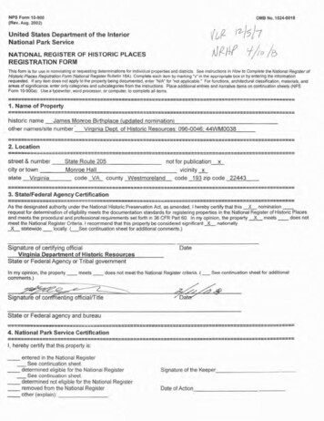
NPS F o 10-900 (Rev. Aug. 2002)OMB1No. 1024-00181United States Department of the InteriorNational Park ServiceNATlONAP REGISTER OF HISTORIC PLACESREG1'STRATIONFORMThis form is for use in nominating or requesting determinations for individual propert esand d trlcfs.See instruclions in How to Complete the Nafional Register ofHistoric Places ReqiPlBhon Form {Nat onalReoater Brsll tin16A). Complete each ltom by marking X in t k appropriate box or by entenng the lnformat onrequested. If any Item does not apply to the property bwng documented, enter " N I A for "no! appl cable.' For funetms, architectural class ticalon,rnalenak, andareas of srgniffmnce enter only categories and subcategories from the c slnretions Place add!t onalentries and narrative Items on contrnuat onsheets (NPSForm 10-900a) Use a typewr ter."uordprocessor, or p om puler, to complete all ------------T. Name of ----------- P I ----Y3----.-YP-CCL---historfc nameJames Momoe Birthplace (updated nomination)other namestsite numberVirq niaDept. of Historic Resources: ------2. --------1--1-11- 1 -------- ------------------street & numbercity or townstateVirginiaState Route 205not for publication xMonroe Hallvicinity xcode VA county Westmoreland code 193 zip code 224433.StateFederal Agency --------------- ---------------------As the designated authority under the National Historic Preservation Act. as amended. I hereby certify that this X nominationrequest for determination of eligibifitymeets the documentation standards lor registering properties En the National Register of Historic Placesand meets the pr oeduraland professional requirements set forth n 36 CFR Part 60. In my opinion. the property X meets -does notmeet the National Register Criteria, I recommend that this properly be considered significant&nat onallyXstatewide -loally. L S e e continuation sheet for additional comments.)-Signature of certifying officialDateVirqinia Department of Historic ResourcesState or Federal Agency or Tribal governmentIn my opinion, the p r o p e r t y meetscomments.)-does not meet the National Register criteria. (See continuation sheet for additional- i g n a t u rof' c o f i n t i n g oficial/TitleState or Federal agency and bureau-------I"Ic--l----------- '- e n -c -: ----,------,-----------------------------------4. National Park Sewice ---------dI------111114I -3 , hereby certify that this property is:-entered in ?he National Register-See continuation sheet.determined eligible for the National Register-See eontinuat onsheet.-determined not eligible for the National Regisfer-removed from the National Register-other (explain):Signature of the KeeperDate of Action
5. Classification Ownership of Property (Check as many boxes as apply)Category of Property (Check only one box)privatex istrictx sitestructureobjectNumber of Resources within PropertyContributing Noncontributing00 buildings03 sites10 structures03 objects16 TotalNumber of contributing resources previously listed in the National Register 1, main site already listedName of related multiple property listing (Enter "N/A" if property is not part of a multiple property listing.) N/A 6. Function or Use Historic Functions (Enter categories from instructions)Cat: Domestic Sub: single dwellingAgricultureagricultural outbuildingAgriculturestorageAgricultureanimal facilityAgricultureagricultural fieldFunerarycemeteryDomesticsingle dwellingDomesticsingle dwellingCurrent Functions (Enter categories from instructions)Cat: LandscapeSub: forestRecreation and Culturemonument/markerRecreation and Cultureoutdoor recreation [boat dock]Funerarycemetery 7. Description Architectural Classification (Enter categories from instructions)Late 19 th and 20th Century Revivals / Beaux ArtsMaterials (Enter categories from instructions)foundationroofwallsother [roadways]: other [gravel]Narrative Description (Describe the historic and current condition of the property on one or more continuation sheets.)
8. Statement of Significance Applicable National Register Criteria (Mark "x" in one or more boxes for the criteria qualifying the property for National Registerlisting)AProperty is associated with events that have made a significant contribution to the broad patterns ofour history.x BProperty is associated with the lives of persons significant in our past.x CProperty embodies the distinctive characteristics of a type, period, or method of construction orrepresents the work of a master, or possesses high artistic values, or represents a significantand distinguishable entity whose components lack individual distinction.x DProperty has yielded, or is likely to yield information important in prehistory or history.Criteria Considerations (Mark "X" in all the boxes that apply.)A owned by a religious institution or used for religious purposes.B removed from its original location.x C a birthplace or a grave.D a cemetery.E a reconstructed building, object, or structure.x F a commemorative property.G less than 50 years of age or achieved significance within the past 50 years.Areas of Significance (Enter categories from instructions)Social HistoryArchaeology: Historic---Non-AboriginalLandscape ArchitecturePeriod of Significance 1752–1783, 1952–1956Significant Dates 1758, 1952, 1956Significant Person (Complete if Criterion B is marked above) Monroe, JamesCultural Affiliation Euro-American, African-AmericanArchitect/BuilderGrigg, MiltonNarrative Statement of Significance (Explain the significance of the property on one or more continuation sheets.) 9. Major Bibliographical References (Cite the books, articles, and other sources used in preparing this form on one or more continuation sheets.)Previous documentation on file (NPS)preliminary determination of individual listing (36 CFR 67) has been requested.x previously listed in the National Registerpreviously determined eligible by the National Registerdesignated a National Historic Landmarkrecorded by Historic American Buildings Survey #recorded by Historic American Engineering Record #
Primary Location of Additional Datax State Historic Preservation OfficeOther State agencyFederal agencyLocal governmentUniversityx OtherName of repository:William and Mary Center for Archaeological Research; Virginia Department of Historic Resources 10. Geographical Data Acreage of Property approximately 74 acresUTM References (Place additional UTM references on a continuation sheet)Zone Easting Northing1 18-325890-4234549Zone Easting Northing2 18-326032-4234524Zone Easting Northing3 18-326048-4234384Zone Easting Northing4 18-326232-4234353x See continuation sheet.Verbal Boundary Description (Describe the boundaries of the property on a continuation sheet.)Boundary Justification (Explain why the boundaries were selected on a continuation sheet.) 11. Form Prepared By name/title David W. Lewes / Project Managerorganization William and Mary Center for Archaeological Research date January 16, 2008street & number 327 Richmond Road (P.O. Box 8795) telephone (757) 221-2580city or town Williamsburg state VA zip code 23185 (23187-8795) Additional Documentation Submit the following items with the completed form:Continuation SheetsMaps A USGS map (7.5 or 15 minute series) indicating the property's location.A sketch map for historic districts and properties having large acreage or numerous resources.Photographs Representative black and white photographs of the property.Additional items (Check with the SHPO or FPO for any additional items) Property Owner (Complete this item at the request of the SHPO or FPO.)name Westmoreland County (c/o Norm Risavi, County Administratorstreet & number Stratford Hall Road (P.O. Box 1000) telephone (804) 493-0130city or town Montross state VA zip code 22520 Paperwork Reduction Act Statement: This information is being collected for applications to the National Register of Historic Places to nominate properties forlisting or determine eligibility for listing, to list properties, and to amend existing listings. Response to this request is required to obtain a benefit in accordancewith the National Historic Preservation Act, as amended (16 U.S.C. 470 et seq.). A federal agency may not conduct or sponsor, and a person is not required torespond to a collection of information unless it displays a valid OMB control number.Estimated Burden Statement: Public reporting burden for this form is estimated to average 36 hours per response including the time for reviewing instructions,gathering and maintaining data, and completing and reviewing the form. Direct comments regarding this burden estimate or any aspect of this form to theNational Register of Historic Places, National Park Service, 1849 C St., NW, Washington, DC 20240.
NPS Form 10-900-a1024-0018(8-86)OMB No.United States Department of the InteriorNational Park ServiceNATIONAL REGISTER OF HISTORIC PLACESCONTINUATION SHEETSection 7James Monroe BirthplaceWestmoreland County, VAPage 1 7. DescriptionSummary DescriptionThe James Monroe Birthplace comprises the core of the plantation where the fifth president of the United Stateswas born in 1758 and spent his formative first 16 years. Located in rural Westmoreland County, a milesouthwest of Colonial Beach, the property’s immediate environs remain rural, though threatened by highdensity residential development. The 74-acre wooded tract extends southeastward from State Route 205 to theupper reaches of Monroe Creek. About 500 ft. southeast of the main road are the archaeological remains of theframe dwelling built in the early 1750s by the president’s father, Spence Monroe. Archaeological investigationson the property also have identified 18th-century activity areas and three additional, non-contributing housesites and a cemetery dating to the late 19th/early 20th century. Areas along the northeastern and eastern edgesof the property have been subjected to gravel mining. A clearing and open woods between the birthplace housesite and the main road contain a granite obelisk memorial and metal marker commemorating James Monroe,and a shrubbery outline of the dwelling’s footprint (to the west of the actual house remains). An elaborategravel road network on the property includes access roads, a roundabout, spurs, and a sinuous touring loop.Built by the State Department of Highways in 1956 and designated State Route 209 until the 1970s, thedistinctive roads were intended as the first stage of an ambitious but uncompleted site plan developed bycelebrated Virginia architect Milton Grigg (1905–1982).Site/Structure/Object Inventory(1) James Monroe Birthplace Site (44WM0038); 1750s-early 19th century, late 19th/early 20thcentury; Contributing(2) Site 44WM0287; Non-Contributing(3) Site 44WM0288; Non-Contributing(4) Stewart family burial ground; 20th century; Non-Contributing(5) Road Network; 1956; Contributing(6) Commemorative obelisk monument; 1993; Non-Contributing(7) Commemorative plaque; 1989; Non-Contributing(8) Commemorative garden and plaque; 2003; Non-Contributing
NPS Form 10-900-a1024-0018(8-86)OMB No.United States Department of the InteriorNational Park ServiceNATIONAL REGISTER OF HISTORIC PLACESCONTINUATION SHEETSection 7James Monroe BirthplaceWestmoreland County, VAPage 2 Detailed Descriptions(1) James Monroe Birthplace Site (44WM0038)The multi-component James Monroe Birthplace Site (44WM0038) contains the 18th-century structural remainsof the dwelling where James Monroe was born, associated activity areas and features, and the archaeologicalremains of a non-contributing late 19th-/early 20th-century house. The stump of a large locust tree marks thelocation of the Monroe dwelling remains. The site boundaries encompass 14.4 acres extending approximately650 west from Route 205 and 400 feet north and south of the entrance road. Currently, the setting consists oflawn, shrubs, and open pine woods crisscrossed by the network of gravel roads constructed on the property in1956. The level soils consist of deep, poorly drained loams and sandy loams.Since the late 19th century, documentary and oral history research by Judge Wat T. Mayo had indicatedthis was the probable site of Monroe’s birth.1 A detailed historical report completed by National Park Servicehistorian Dr. Charles W. Porter III in 1937 added weight to Mayo’s research, but Porter cautioned that onlycareful archaeological research could confirm the site as the birthplace.2 After local historian Virginia Shermanrediscovered the site’s location in the 1960s, her determined urging of county and state officials led to a 1974surface reconnaissance of the area by archaeologists from the Virginia Research Center for Archaeology(VRCA, now the Virginia Department of Historic Resources [VDHR]). In 1976, a VRCA excavation teamheaded by Keith Egloff uncovered the complete footprint of a 58 by 24 ft. domestic structure occupied from themid-18th through early 19th century. Despite damage to the northern end of the footprint area by roadconstruction in 1956, the exposure of brick foundation trenches, cellar fill, and chimney base trenches allowedthe archaeologists to extrapolate a detailed floor plan of the former structure. The result was a remarkable matchwith an engraving of the Monroe birthplace dwelling that appeared in an 1839 issue of The Family Magazine.As a result of this fieldwork, the Monroe birthplace was listed on both the National Register and the VirginiaLandmarks Register in 1979.3Based on the archaeological research and documentary information, the dwelling included a cellar withbulkhead entrance on the east end, two chimneys, and a two room addition on the west end. A 1780 newspaperadvertisement placed by James Monroe mentioned a passage, implying that the first floor of the original sectionwas divided into at least three rooms.4 The depth (3 in.), width, and straight sides of the trench features underthe original portion indicated a one-and-a-half course foundation. Shallower (2 in.) foundation trench featureson the west end of the house suggested brick piers supported the addition, while the main block had acontinuous brick foundation. All but three bricks had been removed in the early 20th century.The VRCA archaeologists uncovered a chimney base trench feature (8 by 5 ft. and 6 in. deep) with a 5 by 3ft. fireplace opening that heated the original portion of the house. Four 1 ft. 1 in. deep scaffold holes, containingbrick rubble and an 18th-century ceramic vessel sherd, formed a 13 by 8 ft. rectangle around the chimney. Theshape of the chimney base trench revealed a smaller fireplace in the west side of the chimney for heating thesouth room of the addition. Pier hole features north and south of the chimney cheeks marked the location of a
NPS Form 10-900-a1024-0018(8-86)OMB No.United States Department of the InteriorNational Park ServiceNATIONAL REGISTER OF HISTORIC PLACESCONTINUATION SHEETpartition wall between the house and addition.James Monroe BirthplaceWestmoreland County, VA
NPS Form 10-900-a1024-0018(8-86)OMB No.United States Department of the InteriorNational Park ServiceNATIONAL REGISTER OF HISTORIC PLACESCONTINUATION SHEETSection 7James Monroe BirthplaceWestmoreland County, VAPage 3 The cellar feature on the east end of the house originally measured 16 ft. 6 in. square. However, due to the1956 road construction, only the bottom 8 in. of a 7-ft.-wide swath of the fill in the road bank remainedundisturbed. An indentation in the east wall of the cellar suggested the location of the east chimney. Profiles ofthe cellar and bulkhead features revealed a soil deposit dating to the 18th-century construction of the house,with a gravel layer, occupation-related soil lenses, and destruction-related brick rubble above. At the base of theconstruction stratum in the cellar, a possible scaffold hole containing delftware most likely dated to the initialconstruction of the house ca. 1752. The cellar originally was dug to a depth of 4 ft. 6 in. into natural clay, had agravel floor for drainage, and was walled with brick. Artifacts recovered from the cellar fill confirm the ca.1752 construction date of the house. None of the ceramic artifacts in the rubble layer postdate 1770, while thegravel floor layer contained artifacts dating to the mid-18th century.In addition to the 100 ft.2 excavation block encompassing the dwelling footprint, 186 ft.2 of excavation area(consisting of four blocks and individual 10 by 10 ft. units) was opened around the perimeter of the main block.These areas were identified as having high potential during a preliminary surface reconnaissance of the propertyand environs (approximately 100 acres) by the VRCA in 1974. Drainage features and a post mold wereidentified east of the house and midden areas to the southwest. An excavation unit located 120 ft. east of thehouse uncovered a brick rubble and pebble surface that may represent a structure or walkway. Five scatters ofartifacts across the southern half of the property appeared to represent 19th- to 20th-century house sites. Anisolated find of three colonial period artifacts was located near the eastern end of the property.At the conclusion of fieldwork, Egloff’s team reburied the Monroe dwelling site leaving pieces of plastic tomark the base of their excavations. Portions of foundation trenches, the chimney trench, and the western portionof the cellar were left unexcavated for the benefit of future research.In 2003 the Center for Historic Preservation at Mary Washington College conducted an archaeologicalsurvey of portions of the birthplace parcel that could be affected by construction of a visitor’s center andparking lot.5 The survey area extended eastward from State Route 205 toward the Monroe house site. Two largeconcentrations identified within the proposed parking lot and in the vicinity of the 1976 excavation area date tothe mid-18th- through mid-19th-century period when the Monroe birthplace house was occupied. The parkinglot concentration was confined to a 100 by 100 ft. area adjacent to Route 205 and south of the southern accessroad. Diagnostic artifacts here dated mainly to the 19th century. The survey also revealed a circular area ofsheet midden extending up to 300 ft. to the east and west of the birthplace dwelling. North-south boundaries ofthe concentration were not determined due to the limits of the 2003 survey area.In 2006, the James Monroe Memorial Foundation (JMMF), with funding from the Jesse Ball DuPont Fund,sponsored a comprehensive, systematic survey of the 74-acre property by William and Mary Center forArchaeological Research (WMCAR). The purpose of the survey was to locate archaeological remains ofoutbuildings and activity areas associated with the Monroe birthplace dwelling. A survey strategy of shoveltesting at intervals of 50 ft. or less was considered the most appropriate on this forested property with very littleground surface visibility. Only areas that were waterlogged or sloped more than 10 percent were excluded. Todetermine the limits of artifact clusters and sites identified on the 50-ft. survey grid, “radial” shovel tests were
NPS Form 10-900-a1024-0018(8-86)OMB No.United States Department of the InteriorNational Park ServiceNATIONAL REGISTER OF HISTORIC PLACESCONTINUATION SHEETSection 7James Monroe BirthplaceWestmoreland County, VAPage 4 excavated in each grid direction at intervals of 25 ft. until at least two consecutive negative tests (withoutartifacts) defined the cluster or site limits. All soils were screened through quarter-inch wire mesh to ensureadequate recovery of artifacts. Although the WMCAR used a metric survey grid, for the sake of consistencyEnglish units are used in the description of those archaeological findings.Following the 2006 survey, the WMCAR team excavated three 3.3 by 6.6 ft. test units next to shovel testsor shovel test clusters with the largest numbers of diagnostic 18th-century artifacts. Test Unit 1, approximately75 ft. north of the Monroe dwelling, contained roughly 8 lb. of brick fragments, and 15 metal, ceramic, andglass artifacts dating to the 18th to early 19th century. Test Unit 2, located 25 ft. southeast of the dwelling,revealed complex stratigraphy (five strata above subsoil) related to both the dwelling and the 1956 roadways.The assemblage from Strata I through IV consisted overwhelmingly of 18th to early 19th century artifacts,including ceramics, window glass, bottle glass, wrought nails, oyster shell, and more than 4 lb. of handmadebrick fragments. A possible post hole identified in the wall of Test Unit 2 may date to the period of occupationof the dwelling, based on its position relative to the surrounding stratigraphy. Test Unit 3 was placedapproximately 60 ft. south of the dwelling, in the location of a probable midden area suggested by the VRCAand WMCAR surveys. Stratum I contained roughly 9 lb. of oyster shell, as well as handmade brick and 18th- to19th-century ceramics. Stratum II contained fewer artifacts but an equivalent amount of oyster shell.Based on the totality of the test unit results, the following conclusions were reached. It is likely that adependency once stood in the vicinity of Test Unit 1. The quantity of handmade brick recovered here was muchgreater than in the other two units. In Test Unit 2, a high density of ceramic fragments (80 percent of theassemblage from all three units) confirmed the domestic nature of activities just 25 ft. southeast of the houseand may indicate the presence of a kitchen nearby. The relatively large quantity of oyster shell in Test Unit 3was consistent with interpretation of this area as a midden. A small quantity of architectural materials alsosuggested proximity to an unidentified structure.Engineering drawings for the complex of roadways built on the property in 1956 locate an early well a fewyards south of the outer edge of the roundabout. This may be the location shown in Charles Porter’s 1930sphotograph of local youths standing next to an “old well.” The well’s proximity to the Monroe dwelling sitesuggests it could be contemporary.Survey and testing by the William and Mary Center for Archaeological Research delineated a much largersite area (14.4 acres) for Site 44WM0038 than previously documented, and this area includes a broad expanseof 18th-century deposits that retain integrity. Based on the 2006 shovel testing, the greatest concentration ofeighteenth-century resources is centered on an area immediately south of the footprint of the house. Thematerials recovered relate to the occupation of the dwelling itself, as well as from disposal activities representedby a midden identified by the VRCA archaeologists in 1976 and tested by the William and Mary Center forArchaeological Research in 2006-2007. This midden extends beneath the portion of the memorial road locatedsouthwest of the house footprint. Test units excavated in 2007 also resulted in the recovery of 18th-centuryceramics and window pane glass from an area within the circular portion of the memorial tour road, just to the
NPS Form 10-900-a1024-0018(8-86)OMB No.United States Department of the InteriorNational Park ServiceNATIONAL REGISTER OF HISTORIC PLACESCONTINUATION SHEETJames Monroe BirthplaceWestmoreland County, VAsouth of the house footprint. Clusters of artifacts are also located approximately 150 ft. to the northeast and
NPS Form 10-900-a1024-0018(8-86)OMB No.United States Department of the InteriorNational Park ServiceNATIONAL REGISTER OF HISTORIC PLACESCONTINUATION SHEETSection 7James Monroe BirthplaceWestmoreland County, VAPage 5 approximately 245 ft. to the south of the footprint. Based on the excavation of two test units, the northeasterncluster consists of an accumulation of brick, wrought nails, and 18th-century window pane glass suggesting astructure; and coarse earthenware, creamware, pearlware, and whiteware sherds, as well as 18th-century bottleglass suggesting a domestic component. The cluster located about 245 ft. south of the house footprint consistsof a diffuse scatter of creamware, cream-colored earthenware, and pearlware sherds, 18th-/19th-centurywindow pane glass, wrought nails, and brick. Intermingled with the 18th-century materials in the southernmostcluster are artifacts dating to the early twentieth century that represent the periphery of the Charles Stuartdomestic occupation. In addition to these two concentrations of 18th-century materials, there are severalisolated artifacts and the remains of a well that may be associated with the Monroe occupation (approximately245 ft. to the south of the house footprint).(2) Site 44WM0287 (Non-Contributing)Site 44WM0287 is a late 19th- to early 20th-century domestic occupation identified during the WMCAR’s2006 systematic survey of the property. It is located nearly 500 ft. south of the property entrance and measuresapproximately 345 by 460 ft. Egloff had previously identified this site as JM45 through surface reconnaissancein 1976.6 The site was defined by the WMCAR on the basis of a scatter of surface debris and 25 positive shoveltests. Soil profiles revealed two silt strata with a cumulative thickness of 0.8 ft. above clay-silt subsoil. Thesurface of the site is littered with enamel basins, glass bottles and jars, appliances, and automotive parts. Inaddition, a decorative iron wire fence is still extant in portions of the site.The assemblage of 330 artifacts consists mainly of miscellaneous glass fragments (135), iron scrap (74),and nails/nail fragments (63). Various diagnostic 19th- and 20th-century material includes window pane glass, adoorbell mechanism, asphalt siding, whiteware, porcelain, oil lamp chimney, and bottle glass. A singleporcelain doll part and other toys were observed. The assemblage is consistent with a domestic occupationdating to the turn of the 20th century, and is likely associated with a dwelling shown on a 1932 topographicmap of the area.7(3) Site 44WM0288 (Non-Contributing)This late 19th- to early 20th-century domestic occupation is located just inside the far end of the loop tour road,approximately 5,000 ft. east of Route 205. A fairly dense scatter of surface debris and positive shovel testsexcavated during the 2006 WMCAR survey delineated site boundaries measuring 250 by 200 ft. Egloff hadpreviously identified this site as JM48 through surface reconnaissance in 1976.8 Shovel test profiles revealedtwo strata, silty loam and sandy clay with a cumulative thickness of 0.9 ft., above silt-clay subsoil. Both gravelmining and road construction have adversely affected the site.Five of the 12 shovel tests at Site 44WM0288 were positive, yielding a total of 42 artifacts. Architecturaldebris included one cut, one wrought, and six unidentified nail fragments, 20th-century window pane glass, but
NPS Form 10-900-a1024-0018(8-86)OMB No.United States Department of the InteriorNational Park
The multi-component James Monroe Birthplace Site (44WM 0038) contains the 18th-century structural remains of the dwelling where James Monroe was born, associat ed activity areas and features, and the archaeological remains of a non-contributing late 19th-/early 20th-century house. The stump of a large locust tree marks the
