Transcription
The DefinitiveAIS HandbookIntroductionThe world of AIS can be both confusing to newcomers and experienced professionals alike. Whatactually is AIS? What data does it gather? How can it help my business? Do I need AIS if I don’thave a business? Class A or Class B transponders? Do I actually need it? There’s a plethora ofquestions from those looking to get the most out of their tracking tools, or from those lookinginto entering the maritime industry.We’ve compiled a comprehensive guide to AIS that covers a wide range of topics from specificAIS units to getting the most out of the data gathered. We’ve included some of the mostcommonly asked questions regarding the topic too. If you are ever in doubt, take some time toread through this document, if your question isn’t answered, feel free to contact BigOceanData.
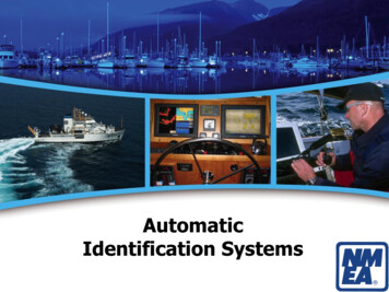
The Definitive AIS HandbookWhat is AIS?The Automatic Identification System (AIS) is a worldwide automatic positioning system basedon fitting small transponders to vessels that continuously transmits a signal. This alerts othervessels and shore stations with AIS receivers to the presence of that vessel. The positioninformation is supplemented with additional information about the vessel.The signals and accompanying information can then be received by any vessel, land station orsatellite fitted with an AIS receiver, and is then typically displayed on a screen using interactivechart-plotting software.Terrestrial vs satelliteAIS was developed as a short range, high intensity system with a line-of-sight range of 10-20miles between the transponders and terrestrial (shore and vessel based) receivers. Its primarypurpose then as now was to allow vessels to see who else is operating in their immediate vicinityso as to prevent collisions.2
The Definitive AIS HandbookWhat is less well known is that, thanks to improvements in technology, AIS signals can alsobe received by suitably equipped, low orbit, satellites. This has transformed the capability ofAIS, giving it a truly global reach and allowing users of AIS services to locate and track vesselsanywhere on the face of the earth from their desk or bridge.With services like BigOceanData the data from terrestrial and satellite feeds merge with eachother to give a seamless and uninterrupted service.Who has AIS?International maritime law requires AIS transponders to be fitted aboard international voyagingships with a gross tonnage of 300 tonnes or more, and on all passenger ships regardless of theirsize. Given its visibility and safety advantages many smaller vessels also voluntarily install AISunits. In many countries no license is required to purchase and operate either transponders orreceivers.The result is that AIS is used almost universally in the worldwide commercial maritime industryand increasingly so in the leisure marine sector. Not all vessels can be tracked by AIS. Naval andsecurity ships generally prefer not to be tracked when on active duty, and cases are regularlyreported of commercial vessels underway with their transponders turned off for unspecifiedreasons.3
The Definitive AIS HandbookA brief history of AISIt’s not entirely clear who it was that came up with the first AIS vessel tracking and identificationsystem, but like so much other technology that we take for granted these days, it came outof the introduction of GPS for civilian purposes, which achieved global coverage in the early1990s. It was then the integration of GPS time and position data with long-standing VHF radiotechnology that enabled the development of AIS.The early yearsIn its early years the primary use of AIS was as a ship-to-ship anti-collision system for use in poorvisibility and at night, in support of radar and conventional watch keeping. Over time the amountof information that could be transmitted in the VHF signal grew and its usefulness increased.In 2002 it finally went global when the IMO in its landmark SOLAS convention mandatedthat all passenger ships and other commercial vessels over 300 GT should carry Class-A AIStransceivers. At the time this affected around 100,000 ships, but since then use has expanded asthe cost of transceivers has fallen and both compulsory and voluntary adoption has increased.The final frontierOriginally developed as a short range identification and vessel tracking system, at the start of the21st century it was discovered that AIS transmissions could be received at ranges of up to 400kmabove the surface of the earth, whereas on the surface the maximum effective distance is aroundone tenth of that. This revolutionised AIS, taking it from a coastal and ship-to-ship trackingapplication to a vessel management system with global coverage. However, the challenge forsatellite operators looking to develop this opportunity now is managing the enormous volumesof data that this creates for individual satellites each monitoring thousands of square kilometresof ocean.4
The Definitive AIS HandbookFuture-proofingThe AIS format uses TDMA radio access that allows for just 4,500 time slots per minute.One time slot equates to a single vessel transmission. Any more than that and the individualsignals start to interfere with each other, corrupting the data held within. The terrestrial AISinfrastructure with its short range and higher density does not have the same capacity problems.The satellite developers are, however, working on ways of receiving and processing incomingdata at faster rates and rapid advances are being made.An important tool in the boxThere is no perfect vessel tracking system, but AIS is becoming increasingly effective as accuracyand refresh rates get ever better. Its ability to interface with other detection sources makes itan important component of integrated navigation and warning systems, and the addition ofsupplementary environmental and situational data makes it yet more versatile. Without a doubtAIS is now one of the most valuable information sources available for anyone involved in themaritime sector.5
The Definitive AIS HandbookAIS IN PRACTICEThere are two classes of AIS transponders: A and B. Broadly speaking, the higher specificationclass A is mandated for commercial vessels, while the lower specification class B is intendedfor smaller, mostly leisure, vessels. Capabilities and prices vary greatly between the two classes.Information from Class A units is also prioritised over that from Class B equipment.Class AClass A transponders are mandated under international SOLAS regulations for all internationalvoyaging ships with a gross tonnage of 300 tonnes or more, and on all passenger shipsregardless of size. They transmit continuously at 12.5 Watts and have a horizontal range of up to40nm. They use SOTDMA (Self-Organized TDMA) technology so that each automatically adjustsits transmissions to avoid interfering with others within range. In areas with high density shippingthe system also shrinks the area of coverage when necessary to ensure that the system isn’toverloaded.6
The Definitive AIS HandbookClass BClass B transponders were developed to give smaller vessels voluntary access to the benefits ofthe AIS system. They transmit every 30 seconds at 2 Watts and the horizontal range is line-ofsight. They use CSTDMA (Carrier Sense TDMA) technology that checks for Class A transmissionsbefore sending its own signal. Class B information is therefore only broadcast when there issufficient space on the AIS channel. Class B AIS capability is increasingly being included in lowcost chart plotters and multifunction displays so as to overlay the information on electroniccharts.7
The Definitive AIS HandbookWhat data does AIS provide?So now that we have explored the different types of AIS, and the history as to how it cameabout. Let’s delve a little bit deeper into the exact type of information each class provides.Class AProvides three types of information:Fixed, or static information, which is entered into the AIS on installation and need only bechanged if the ship changes its name or undergoes a major conversion from one ship type toanother. Includes data such as:l MMSI (Maritime Mobile Service Identity) Call sign and name of vessel IMO Number Length and beam Type of ship Location of position-fixing antennaDynamic information, which, apart from navigational status information, isautomatically updated from the ship sensors connected to AIS. Includes: Ship’s position with accuracy indication and integrity status Position Time stamp in UTC Course over ground (COG) Speed over ground (SOG) Heading Navigational status (e.g. underway by engines, at anchor, engaged in fishing etc) Rate of turn (ROT)8
The Definitive AIS HandbookVoyage-related information, which might need to be manually entered and updated.lSuch as: Ship’s draught Hazardous cargo (type) (e.g. DG (Dangerous goods), HS (Harmful substances)or MP (Marine pollutants) Destination and ETA Route plan (waypoints) (at the discretion of the master)Class BClass B transponders transmit only static information every six minutes. This should include: MMSI (Maritime Mobile Service Identity) Call sign and name of vessel Length and beam Type of vesselApplications of AIS data9
The Definitive AIS HandbookThe original purpose of AIS was to reduce the risk of vessels colliding with each other in poorvisibility.However, the combination of satellite AIS allowing near global coverage and the ability to accessAIS data online has now made it a valuable resource for anyone wishing to monitor individual orgroups of vessels, different classes of vessels, or volumes of total traffic in certain areas or thewhole world.As well as ships’ officers, AIS data feeds with mapping overlays are therefore used by vesselowners and operators to monitor and manage their fleets, as well as port managers and serviceproviders, shippers, maritime security providers, insurers, other maritime professionals, marineintelligence analysts, government agencies, economists, academics, and family and friends ofcrew members.Users vary greatly in how they use the information. Many vessels owners use it simply to seewhere their vessels are at any given time while sitting at their desks or indeed on the beach or athome. Port managers can use the information to view incoming vessels and their latest expectedtimes of arrival. Yachts off cruising or racing can be tracked by family and friends seeking peaceof mind that all is well. On a bigger scale, academics and economists can analyse AIS data on aglobal scale to identify patterns and changes in trade flows and volumes, while environmentalistscan use it to identify areas that might be at risk from excess marine traffic.AIS today provides anyone who wants to see it with the most complete view available ofthe activity that takes place 24/7/365 on the world’s oceans, seas and inland waterways,together with a treasure trove of information on the size, type and often cargoes of the vesselsthemselves. Its evolution over the years from a simple collision-avoidance system is trulyremarkable.10
The Definitive AIS HandbookHow to install AISAlmost all Class A AIS transponders and indeed many Class B units are integral parts ofintegrated bridge systems or multifunction displays. However, it is worth noting that an AISsystem is relatively simple in what it does and that the basic installation principles are the samefor integrated and standalone transponders.Any AIS system requires two inputs and one output to function at its most basic level. The inputsare a GPS feed, so that it can locate its position, and a VHS feed, so that it can receive incomingAIS signals from other vessels. The output is also a VHF connection, so that it can transmit itsposition and core vessel information. All that is needed then is power. Thereafter, additionalinformation from onboard sensors can be fed in through a data feed as required from othersystems.The installation of even standalone units for leisure use is therefore relatively straightforward.11
The Definitive AIS HandbookFrequently Asked QuestionsWho should install AIS?Any vessel fitted with electronic navigation equipment should have AIS so as to minimise therisk of collisions. Indeed, the smaller the boat, the more it should want to show up on the bridgedisplays of larger, faster vessels.Is AIS data publicly available?Yes, it is. There are a number of online suppliers that allow users to enter the names of vesselsand find their locations overlaid on maps together with varying amounts of vessel andenvironmental information. The free services offer only data collected by coastal receivingstations. Offshore positions collected via satellites is inherently more expensive and services thatprovide this generally have to be paid for.How does Satellite-AIS work?Since the mid-2000s suitably equipped low earth orbit satellites have been able to pick upand decode the signals directly from the vessels themselves and re-transmit the data backto receiving earth stations connected to the internet. The coverage offered by Satellite-AISproviders is continually improving and data accuracy is already very good. However, orbitpatterns and the need to download and process the data before it can be made available toservice providers means that there is latency between the time of the collection of a positionreport and its availability via AIS services. Visit BigOceanData.com for more information.How much does AIS cost?As a peer-to-peer service, there are no charges when it comes to broadcasting an AIS signal.There is a cost for the equipment required to do so but prices for basic Class B transpondersare now within the reach of anyone already operating even the smallest of vessels. Users shouldcheck regarding any licensing requirements within their relevant jurisdictions.12
The Definitive AIS HandbookWith regard to viewing the data on a screen, there are a wide number of providers that offeronline services that allow users to view the vessels on a selected area of ocean. The free servicesprovide data from terrestrial AIS receivers only and basic functionality such as tracking up to amaximum of five vessels. The more sophisticated services include satellite-AID data and a rangeof environmental and security overlays as well as fleet management tools. Visit BigOceanData.com for more information.Do I need a license?As AIS involves the transmission of information on a VHF frequency, many jurisdictions willrequire a license. Generally, however, AIS will be covered by the vessels standard ship stationVHF license. Users should check regarding any licensing requirements within their relevantjurisdictions when purchasing / installing AIS.Do I need to ever update my AIS software or hardware?Not for your transponder. You may however wish to reassess your vessel tracking serviceprovider on a regular basis to ensure that you are receiving the best possible service for yourparticular needs at the most competitive price.Useful links:BigOceanDataOnline AIS vessel tracking and monitoring serviceSOLAS Chapter V Regulations Annex 17 - AISInternational Maritime OrganisationAIS RegulationsMaritime Security13
The Automatic Identification System (AIS) is a worldwide automatic positioning system based . security ships generally prefer not to be tracked when on active duty, and cases are regularly . In its early years the primary use of AIS was as a ship-to-ship anti-collision system for use in poor visibility and at night, in support of radar and .