Transcription
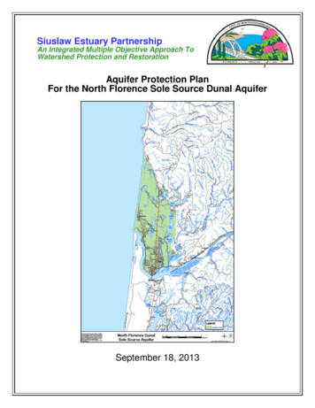
Siuslaw Estuary PartnershipAn Integrated Multiple Objective Approach ToWatershed Protection and RestorationAquifer Protection PlanFor the North Florence Sole Source Dunal AquiferSeptember 18, 2013
This Plan was adopted as part of the Florence Realization 2020 Comprehensive Plan through adoption of the following Ordinances. The Contingency Plan was adopted by the City, but was not adopted as part of theComprehensive Plan. City of Florence Ordinance No. 2, Series 2013 Lane County Ordinance No. PA 1299This Plan was certified by the Oregon Department of Environmental Quality(DEQ) on September 18, 2013. See letter on following page.
This page intentionally left blank.
Table of ContentsPageAcknowledgements iExecutive Summary . . iiiChapter 1: Introduction . 1*Purpose and BackgroundCommunity SketchNorth Florence Sole Source Dunal AquiferPublic Involvement and Technical Advisory CommitteeSiuslaw Estuary Partnership Guiding Principles and Measurable OutcomesChapter 2: Source Water and Drinking Water Protection Areas . 13City of Florence Water System InformationNature and Characteristics of the AquiferGroundwater Flow ModelFlorence Drinking Water Protection AreasOther Source Water AssessmentsChapter 3: Water Monitoring and Potential Contaminant Sources . 33*Surface and Groundwater Monitoring Process and ResultsSensitivity AnalysisPotential Contaminant Source Inventory: Existing Land UsePotential Contaminant Source Inventory: Planned Land UseSusceptibility of the Drinking Water SourceChapter 4: Management Goals and Strategies . 71*Aquifer-wide: Management Goals and StrategiesExisting Wellfield: Management Goals and StrategiesProposed Wellfield: Management Goals and StrategiesImplementation PlanChapter 5: Contingency Plan . 93Potential Threats to the Drinking Water SupplyProtocols for Incident ResponsePrioritization of Water UsageKey Personnel and Development of Notification RosterShort-term and Long-term Replacement of Water SuppliesShort-term and Long-term Conservation PracticesPlan Testing, Review and UpdatePersonnel TrainingProvisions for Public EducationLogistical and Financial Resources*Note: Portions of these sections of the plan apply aquifer-wide and are not intended for certification of a Source Water Protection Plan under OAR 340-040-0170.
Table of Contents (continued)PageChapter 6: New Well Site Analysis . 107Need for New WellsProposed New WellfieldSelection CriteriaAnalysisAppendicesABCDEFGHIJKLMSurface and Groundwater Monitoring Report and Secondary DataSiuslaw Estuary Partnership Public Involvement PlanOregon Water Resources Department construction logs and well reportsDrinking Water Protection Areas Delineation Report, February 15, 2012, GSI Water Solutions, Inc.Other Source Water Assessments: Confederated Tribes of the Coos, Lower Umpqua, and Siuslaw Indians, June 2007; and Heceta Water District, September 11,2001EPA-Approved Quality Assurance Project Plan2003 Florence Source Water AssessmentOptions for Responding to Contamination Threats in the North Florence SoleSource Dunal AquiferResource ListDEQ Hazardous Waste Technical Assistance for Businesses brochureFlorence Water Management and Conservation Plan, March 2010Mutual Emergency Water Agreement between City of Florence and Heceta Water District, July 6, 2010Springfield Drinking Water Protection Overlay Zone
AcknowledgementsThe City of Florence gratefully acknowledges the following City staff and consultants,Stakeholders, and Aquifer Protection Plan Technical Advisory Committee for their contributions to this Aquifer Protection Plan.City of FlorenceJacque Betz, City ManagerMike Miller, Florence Public Works Director, Project ManagerCarol Heinkel, Florence Planning Consultant, Project CoordinatorDennis Nelson; Suzanne de Szoeke, GSI Water Solutions, Hydrogeologist ConsultantsKelli Weese, GIS Technician, City Recorder, Interim Planning DirectorMichelle Pezley, Florence Assistant PlannerStakeholdersCommunity Stakeholder GroupAudubon Society and Local Birdwatcher Group: Adele DawsonCentral Oregon Coast Board of Realtors: Rob ShepherdFlorence Chamber of Commerce: Lisa Walter-SedlacekFisheries, Steelheader Group: David HunningtonFlorence Area Hospitality Association: Tiffany RogatoFlorence Planning Commissioners: Mark TiltonLane County Planning Commission: Nancy NicholsOregon Shores Conservation Coalition: Anne Caples and Sue NobleScuba Club/Divers: Clarence LysdaleSTEP (Salmon Trout Enhancement Program): Bill HennigSurfrider Foundation: Gus GatesVolkswalkers: Jean WhiteOcean Dunes Golf Links: Randy CurtolaCoast Village: Mary McGannSand Ranch: Deacon MathewsFlorentine Estates: Nola Xavier and Del PhelpsKoning and Cooper (business owners): Art Koning and Gary CooperRecycling and Solid Waste: Dave TwomblyElected Official Stakeholder GroupSiuslaw Watershed Council Leadership Board: Jim Grano, ChairFlorence City Council: Phil Brubaker, Mayor; Sue Roberts, CouncilorLane County Board of Commissioners: Jay Bozievich, CommissionerHeceta Water District Board: Jerry Nordin, Board MemberPort of Siuslaw Board: Joshua Green, Board MemberTribal Council of the Confederated Tribes of the Coos, Lower Umpqua, andSiuslaw Indians: Bob Garcia, Tribal ChairmanSiuslaw Soil and Water Conservation District Board: Fuzzy Gates, Board Memberi
Aquifer Protection Plan Technical Advisory Committee Jacqueline Fern, David Waltz, Mike Kucinski, Randy Trox, Oregon Department ofEnvironmental Quality (DEQ) Tom Pattee, Sean Stevenson, Oregon Health Authority, Drinking Water Program Dan Hurley and Kier Miller, Lane County Jason Kirchner, John Spangler, Bob Buckman, Oregon Department of Fish andWildlife Dave Perry, Amanda Punton, Oregon Department of Land Conservation and Development Bart Bretherton, Oregon Department of Transportation Michael Mattick, Oregon Department of Water Resources Seth Mead, Siuslaw Soil and Water Conservation District Liz Vollmer-Buhl, Siuslaw Watershed Council Howard Crombie, Natural Resources Program Director, Confederated Tribes ofCoos, Lower Umpqua, and Siuslaw Indians Janet Robbins, US Bureau of Land Management Jeff Young, National Oceanic and Atmospheric Administration, National MarineFisheries ServiceThis project has been funded in part by the United States Environmental ProtectionAgency under assistance agreement WC-00J04801-0 to City of Florence. The contentsof this document do not necessarily reflect the views and policies of the EnvironmentalProtection Agency, nor does mention of trade names or commercial products constituteendorsement or recommendation for use.ii
Executive SummaryThis Aquifer Protection Plan for the North Florence Sole Source Dunal Aquifer was prepared through the work of the Siuslaw Estuary Partnership, a collaborative effort by theCity of Florence and its federal, state, local, and tribal partners to protect and improvewater quality and fish and wildlife habitat in the lower Siuslaw River Watershed. Assuch, the plan incorporates the Partnership’s Guiding Principles, endorsed by the Cityand its partners. Portions of this plan also serve as the Source Water Protection Plan forthe City in accordance with the Oregon Department of Environmental Quality’s (DEQ)administrative rules for groundwater quality protection.This project was managed by the City’s Public Works Director. The plan was developedover the course of three years by the City of Florence’s Planning Consultant, togetherwith the City’s consulting Hydro-geologists, and the Interdisciplinary Team, particularlystaff from the Oregon Department of Environmental Quality and the Oregon Health Authority. The plan benefitted from the input of two Stakeholder Groups: the CommunityStakeholders and the Elected Official Stakeholders; and it was presented for public review and comment as part of an extensive public outreach program.Purpose and ScopeThe purpose of this Aquifer Protection Plan is to protect water quality within the City ofFlorence’s urban growth boundary (UGB) in the North Florence Dunal Aquifer, the solesource of drinking water for the Florence community. The scope of this plan is aquiferwide for three key reasons:1. The aquifer, designated “sole source” by the US Environmental Protection Agency(EPA) in 1987, is the only source of drinking water available in this area.2. Surface waters and groundwater are highly interconnected in the aquifer; they flowprimarily to the Siuslaw Estuary; and the estuary, with its surrounding watershed,provides significant habitat to many threatened and endangered species.3. The health of the natural environment is key to Florence’s economic vitality. As goodstewards of these resources, the City of Florence and its partners have determinedthat this plan should have an aquifer-wide focus.Source Water and Drinking Water Protection Areas (DWPAs)(Chapter 2) Florence’s drinking water is supplied by a single wellfield comprising 12 City-ownedand operated wells, with one additional well to come on line in the near future. TheCity’s municipal wellfield is located on 80 acres adjacent to the Ocean Dunes golfcourse on the eastern edge of Florence bordered by Willow Ridge Court to the southand 35th Street to the north. The wells produce water year round and serve as theCity’s sole water supply source. The City has four above-ground reservoirs: an elevated 250,000-gallon tank near theCity shop (currently offline and not in use); a 500,000-gallon steel tank on the easthills; and two 2,000,000-gallon tanks near the Sand Pines Golf Course. Water diverted under all of the City’s groundwater rights is treated at the City’s water treatment plant. Currently, the plant has a capacity of 4.6 cubic feet per second (cfs) or 3million gallons per day (mgd). This capacity is 1.24 cfs (0.8 mgd) less than the fulliii
value of the City’s existing groundwater rights. The City’s distribution system consists of four pressure zones served by three water storage reservoirs and threebooster pumping stations. Currently, the existing City wells do not have the capacity to produce the full amountof water authorized by the City’s water rights. Furthermore, the City’s population anddemand for water are increasing and are projected to exceed the existing watersupply within the 20-year planning period (2030) for the City’s Water Managementand Conservation Plan (WMCP). For these reasons, this plan contains a new wellsite analysis for a proposed wellfield to provide for water supply redundancy and expand water supply. The additional wellfield site is located northwest of the existingwellfield. It is likely that new water rights would be required for the additional wellfield. The Drinking Water Protection Areas (DWPAs) or “capture zones” for the existingand proposed wellfields, shown in Figures ES 1 and ES 2, outline the land surfacethat overlies that part of the aquifer that supplies groundwater to the well over agiven time period. The DWPAs in this plan show the capture zones for the 1, 2, 5,10, 20, and 30 year Time of Travel Zones (TOT). The TOT represents the length oftime it takes for a molecule of water entering the groundwater at a specific locationto reach the City’s wells. The Oregon Health Authority (OHA) has certified the DWPA delineation for the existing wellfield (see Appendix D). This certification assures that the delineations meetminimum requirements for the system size as outlined in OHA Oregon Administrative Rule (OAR) 333-61-0057 and that the delineation is a hydro-geologically reasonable representation of the capture zone of the well, wellfield, or spring. The delineation of capture zones for the proposed wellfield was not certified by OHAbecause the wells do not yet exist. OHA did approve the use of the delineation forthe proposed wellfield for protection of possible future drinking water resources (Appendix D). In general, the closer a contaminant source is to a well, the greater the risk of contamination, although some contaminants, namely dense non-aqueous phase liquids,or DNPLs, are a threat to the water supply regardless of distance traveled to thewell. This is because DNPLs, such as chlorinated solvents, are liquids that are bothdenser than water and do not dissolve in water. DNAPLs are extremely expensiveand difficult to remediate.http://en.wikipedia.org/wiki/Dense non-aqueous phase liquid - cite note0#cite note-0 This Plan also contains information about the Source Water Assessments conductedfor Heceta Water District and the Confederated Tribes of the Coos, Lower Umpqua,and Siuslaw Indians (see Appendices E-1 and E-2).Water Monitoring Program and Potential Contaminant Sources(Chapter 3)Surface and Groundwater Monitoring Program The Siuslaw Estuary Partnership includes a Surface- and Groundwater MonitoringProgram to protect the North Florence Sole Source Dunal Aquifer and to protect andimprove water quality in Munsel and Ackerley Creeks and the Siuslaw River.iv
The Siuslaw River has been classified as Water Quality Limited under the CleanWater Act and on the state’s 303(d) list of Impaired Water Bodies. Sixteen groundwater “test wells” are installed throughout the aquifer to monitor levels and quality; and stream gages, sondes, and grab sampling are used in Munseland Ackerley Creeks to monitor stream flow and water quality. The Surface andGroundwater Monitoring Program is operating under an EPA-approved Quality Assurance Project Plan (QAPP) (Appendix F). Data on water levels, fluctuation, and flow collected and analyzed through the City’sSurface and Groundwater Monitoring Program were used in the Groundwater FlowModel and all monitoring results have been reported in quarterly and annual reportsprepared by GSI Water Solutions, Inc., the hydro-geologists retained as consultantsto the Partnership. These reports are included in Appendix A of this plan along withreports from the Oregon Beach Monitoring Program.Potential Contaminant Source (PCS) Inventories Potential Contaminant Source Inventories were developed for both existing and future land use for both the existing wellfield and the proposed wellfield. The inventory is a very valuable tool for the local community in that it: Provides information on the locations of PCSs, especially those that present thegreatest risks to the water supply,Provides an effective means of educating the local public about potential problems, andProvides a reliable basis for developing a local management plan to reduce therisks to the water supply. Chapter 4 of this plan contains management goals and strategies to address potential contaminant source inventories, as summarized in the section below, Management Goals and Strategies.Management Goals and Strategies (Chapter 4)Chapter 4 of this plan contains management goals and strategies for the following threeareas:1. Aquifer-wide2. Existing Wellfield3. Proposed WellfieldManagement strategies for the existing and proposed wellfield are tied to the PotentialContaminant Source Inventories for existing and planned land uses. The Goals andStrategies are presented in Tables 4.1, 4.2, and 4.3 for the three categories and the priorities shown reflect the following:H (High):Begin to implement immediately or continue to implement, if already being doneM (Medium): Begin to implement in next two fiscal yearsv
L (Low):Implement as time and financial resources are availableThe priorities and implementing groups and their roles were determined through theteam and stakeholder processes. For all strategies, the City will take the lead role inimplementation, unless noted otherwise.Management goals are broad vision statements describing desired conditions or activities for the future. They provide direction for the development of management strategies. The management strategies more specifically describe a course of action for protecting the aquifer and Drinking Water Protection Areas (DWPAs).The implementation of management strategies is key to the ultimate success of thePlan. Following City and County approval of the plan and certification of the plan by theOregon Department of Environmental Quality (DEQ), the City will initiate amendmentsto the Comprehensive Plan and Code and begin to implement management strategies.Amendments that apply within city limits will be submitted for adoption by the CityCouncil; amendments that apply outside the City, within the UGB, will be submitted tothe County Board for adoption as well.1.Aquifer-Wide Management Goals and Strategies1Aquifer-wide management goals and strategies apply throughout the aquifer.They are presented in Table 4.1 with the implicated priority for implementationand implementing groups and their roles. Goals and strategies fall into four categories:1. Surface and Groundwater Monitoring (H)2. Public Education (H)3. Coordination with Public and Non-profit Partners (H)4. Integrated Pest Management (M)2.Management Goals and Strategies for the Existing WellfieldThree types of land uses have been identified in the DWPA for the existing wellfield:1. Residential2. Private Open Space3. PublicManagement goals and strategies and implementing priorities and groups/rolesare linked to these existing and planned land use types and associated high- andmoderate-risk potential contaminant sources in Table 4.2, starting with strategiesthat apply to all land use types in the DWPA.Goals and strategies fall into the following categories:1. Conduct targeted public education and outreach (M)2. Continue to monitor potential contaminant sources (H)1The aquifer-wide strategies in Chapter 4 apply aquifer-wide and are not intended for certification of a Source Water Protection Plan under OAR 340-040-0170, except as they are crossreferenced in the specific DWPA sections of this chapter.vi
3.4.5.6.7.8.3.Work with realtors (H)Target integrated pest management efforts to DWPA (M)Adopt comprehensive plan policies and code amendments (H)Work with home owners associations (H)Continue to work with golf course managers (H)Continue to monitor sewer lines (H)Management Goals and Strategies for the Proposed WellfieldFour types of land use have been identified in the DWPA for the proposed wellfield:1. Residential2. Commercial/Industrial3. Private Open Space4. PublicManagement goals and strategies and implementing priorities and groups/rolesare linked to these existing and planned land use types and associated high- andmoderate-risk potential contaminant sources in Table 4.3, starting with strategiesthat apply to all land use types in the DWPA.Goals and strategies are presented in Table 4.3 that fall into the following categories:1.2.3.4.5.6.7.Conduct targeted public education and outreach (M)Adopt comprehensive plan policies and code amendments (H)Continue to monitor potential contaminant sources (H)Work with realtors (H)Target integrated pest management efforts to DWPA (M)Adopt drinking water protection overlay zone (H)Inventory and rank chemicals used in the DWPA and prepare related responses (H)8. Provide business assistance (H)9. Continue to work with golf course managers (H)10. Continue to monitor sewer lines (H)Implementation PlanThe City will take the following actions to implement the management strategies:1.2.3.4.5.The City Council concurred by motion with the Plan on July 11, 2012; The LaneCounty Board concurred by Board Order on July 25, 2012.An initial draft locally accepted plan was submitted to the Oregon Department ofEnvironmental Quality (DEQ) and OHA for review in July 2012 and a reviseddraft was submitted in December 2012. The City will request certification prior tofinal adoption.City will initiate amendments to the Comprehensive Plan and Code, includingDrinking Water Protection Overlay Zone, and begin to implement managementstrategies: April 30, 2013 (target date).City will submit to Lane County, for co-adoption, Comprehensive Plan amendments that apply outside the City, within the UGB: to be scheduledCity will set up internal procedures and assign staff to develop and implementannual work programs to implement the management strategies. City has ob-vii
tained the assistance of a RARE program participant to assist in the administration of the strategies.Contingency Plan (Chapter 5)In the event contamination or loss of the water source should occur, the City needs tobe prepared to react to with a contingency plan. The Contingency Plan in Chapter 5 is adesigned response to the contamination or disruption of Florence’s current water supply. Procedures to deal with contamination threats are also outlined in Chapter 5.The Contingency Plan focuses on: Identification of the primary potential threats to the aquifer and water supply; Developing procedures that will be followed should the threats materialize.Florence’s contingency plan addresses ten elements required by the Oregon DrinkingWater Protection Program:1. Potential threats to the drinking water supply2. Protocols for incident response3. Prioritization of water usage4. Key personnel and development of a notification roster5. Short-term and long-term replacement of water supplies6. Short-term and long-term conservation measures7. Plan testing, review, and update8. Personnel training9. Provisions for public education10. Logistical and financial resourcesPrimary threats to Florence’s drinking water system are related to an interruption of water delivery or contamination of the aquifer used for the drinking water supply. The following types of events could cause an interruption in delivery and/or contamination ofthe water supply, in order of most likely events:1. Electrical/mechanical problems: power outage, broken pipeline, pump failure2. Spill in area surface waters, i.e., creeks, lakes, wetlands, beaches, stormwater systems that discharge to surface waters; stormwater contamination resulting in wellwater contamination; releases from a leaking underground fuel storage tank; chemical spill at a nearby business; or other hazardous materials spills (highway spills)3. Flooding4. Contamination at a wellhead5. Earthquakes or Tsumanis (see “City of Florence Multi-Jurisdictional Natural HazardsMitigation Plan”) The most likely threats to the drinking water supply are electrical/mechanical failure,contamination at or near a wellhead, a chemical release within the drinking waterprotection area (DWPA) or highway spills, a spill in area surface waters or in stormwater systems that discharge to surface waters. Of the identified risks, the one withthe most potential for serious contamination is a spill from a transport vehicle traveling on Highway 101 adjacent to the DWPA. The likelihood of this happening is low,but the potential for contamination, should a spill occur is high. Should an incidentlike this occur, the Siuslaw Valley Incident Command Team would respond immediately and work to contain the spread of the hazardous material as detailed in theirviii
Emergency Response Plan. The City Water Treatment Plant has an operations manual that provides detailedprocedures for containment of spills or other potential contaminant events. The pertinent portion of the Procedures Manual is located in Appendix K. Ocean DunesGolf Course also has a spill containment plan, as part of the requirement for certification for application of agricultural chemicals. Breaks or leakage in city sewer lines are repaired by City staff or by a contractor under City direction. Breaks are repaired under an emergency operations plan (seeAppendix K). Leaks are identified and repaired through the use of routine TV surveillance of all sewer lines and routine manhole cover surveillance. Prevention of contaminant incidents related to stormwater is the preferred option.The City’s stormwater system is a combination of piped and infiltration facilities. TheCity requires oil and silt separator catch basins in all development, and has a stenciling program for all storm drains. In the event of a contaminant incident in an infiltration system, standard containmentprocedures would be utilized according to the Florence Water Management andConservation Plan. In the event of a contaminant incident in a piped system, if identified soon enough, the contaminating substance would be isolated in the affectedarea of the piped system. If identified only at the time a contaminant was detectedat the outfall, standard containment procedures would be utilized. If the outfall werein the Siuslaw River, the Emergency Response Plan would provide for containmentof the contaminant to the smallest possible affected area. Lane County has established procedures for dealing with potential contaminant incidents at its facilities.New Well Site Analysis (Chapter 6) The 2011 Florence Water Master Plan recommends that the City expand the existing groundwater supply system by adding up to 4 new wells in a new wellfield to increase capacity by approximately 350 gpm (0.5 mgd) in order to provide a total supply capacity of 3.2 mgd at the end of the 20-year planning horizon in 2030. TheCity’s projected demand in 2020 will require all of the City’s existing 2.7 mgd supplycapacity, thus supply expansion is recommended between 2015 and 2020. The proposed new well field is located west of Highway 101 and immediately northof Sand Pines Golf Course (Figure ES 1 and ES 2). This site and its delineateddrinking water protection area (DWPA) are shown in Figures 6.1 and 6.2. ThisDWPA has been given “provisional” certification by OHA, as explained in their letterin the delineation report in Appendix D. It should be noted that the actual well locations will most likely be farther to the south and west of where they are shown inthese figures. The actual DWPA would also move accordingly to accurately reflectwell locations. The proposed site for this report was analyzed from a groundwater risk perspective.Selecting a preferred site from a groundwater risk view involves an analysis of various land use components such as property ownership and contamination risks associated with various land uses within that well’s delineated protection area.ix
Figure ES 1. Regional view showing the 30-year capture zones (DWPAs) of the existing wellfield (lower right) and the proposed wellfield (upper left). Shading indicates the TOT zones: red 10-yr, blue 20-yr, and green 30-yr TOT. Existing wellsone through 13 and proposed wells 1 through 4 are shown.x
Figure ES 2. Ten-year capture zones for Florence’s existing and proposedWellfields. Different Time of Travel (TOT) zones indicated by shading: red 1-yearTOT, orange 2-year TOT, blue 5-year TOT, and green 10-year TOT.xi
Chapter 1: IntroductionThis Aquifer Protection Plan protects water quality in the North Florence Dunal Aquiferwithin the City of Florence’s urban growth boundary (UGB), the sole source of drinkingwater for the Florence community. The scope of this plan is the North Florence SoleSource Dunal Aquifer. Portions of this plan serve as the Source Water Protection Planfor the City in accordance with OAR 340-040-170.2 The state certified Source WaterProtection Plan includes all sections of this document except portions of those sectionsmarked with an asterisk in the Table of Contents and footnoted as such in the body ofthis plan.This Plan is organized into six chapters. Chapter 1 outlines the plan’s organization andprovides the purpose and background of the Aquifer Protection Plan. In addition, thischapter provides an overview of the Florence community, natural environment, and solesource aquifer; the public involvement and Technical Advisory Committee; and theSiuslaw Estuary Partnership Guiding Principles and Measurable Outcomes that guidedthe development of this plan.Chapter 2 provides information about the City’s water system, the nature and characteristics of the aquifer, the Groundwater Flow Model, and Source Water Protection Areas.Chapter 3 describes the City’s Surface and Groundwater Monitoring Program methodology and results, and the Potential Contaminant Source Inventories for the DelineatedSource Water Protection Areas.Chapters 4 through 6 focus on solutions. Chapter 4 includes the goals and specificmanagement strategies for reducing contamination risks and for responding to contamination incidents within the drinking water protection areas and the aquifer. Chapter 5identifies the primary threats leading to disruption and/or contamination of Florence’swater system and details protocols to be used in the event of an emergency. Finally,Chapter 6 provides an analysis of new well sites based on criteria related to source water protection.Chapters 4, 5, and 6 are not intended to be exclusive “solutions.” Other solutions maybe identified and reviewed for potential implementation through the ordinance process.Further, not all of the solutions presented may be ultimately adopted through the ordinance process. The solutions to be implemented by ordinance will be selected after further examination, dialogue, and review between the City and its partners and Stakeholders. During that process, factors such as enforcement responsibilities and apportionment of costs will be discussed.Purpose and BackgroundPurposeThe purpose of this Aquifer Protection Plan is to update the December 2003 FlorenceDrinking Water Protection Plan and expand the scope to encompass the North FlorenceSole Source Dunal Aquifer within the Florence Urban Growth Boundary (UGB).The scope of this plan is aquifer-wide for several reasons. The aquifer is “sole source”meaning that there are no alternative drinking water sources available. In addition, sur2See certification approval letter from the Oregon Department of Environmental Quality (DEQ) in thefront of this plan.Page 1
face waters and groundwater are highly interconnected in the aquifer; so, contaminationof one can contaminate the other. Further, the Siuslaw estuary and surrounding watershed pro
Liz Vollmer-Buhl, Siuslaw Watershed Council Howard Crombie, Natural Resources Program Director, Confederated Tribes of Coos, Lower Umpqua, and Siuslaw Indians . water quality and fish and wildlife habitat in the lower Siuslaw River Watershed. As such, the plan incorporates the Partnership's Guiding Principles, endorsed by the City