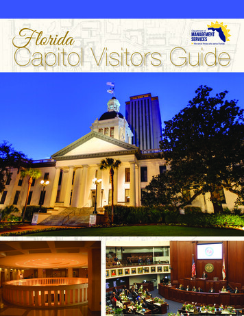
Transcription
CAPITOL COMPLEXMASTERPLANDENVER,COLORADOAppendix 2 - Urban Designa) Intersection Analysisb ) M u l t i m o d a l Tr a n s p o r t a t i o n A s s e s s m e n tc) West Lawn Report
Appendix 2 - Urban Designa) Intersection Analysis
Capitol Complex Master PlanIntersection Analysis and RecommendationsMEMORANDUMDate:4/16/2014To:RNL Design, Inc.th1050 17 Street, Suite A200Denver, CO 80265From:Emily Gloeckner, P.E., AssociateAndrew McFadden, E.I.T., Transportation EngineerSubject:Capitol Complex Master Plan –Intersection Analysis and RecommendationsDN13-0419INTRODUCTIONThe Capitol Complex Master Plan analyzes the feasibility of future improvements at the Colorado StateCapitol (Capitol Complex). Located in central Denver on the southeast corner of Lincoln Street and ColfaxAvenue, the Capitol Complex is on the cusp of the downtown central business district (CBD), leading toheavy volumes from all transport modes, including vehicles, transit, bicyclists, and pedestrians.Thismemo will provide an assessment of the pedestrian, bicycle, and transit circulation and recommendationsfor improving the multimodal experience around the Capitol.VEHICULAR NETWORKThe existing road network in the Capitol Complex study area is bordered by multiple arterial roadways.thThe 14 /13thAvenue couplet is located to the south of the Capitol, the Broadway and Lincoln coupletborder the west side of Capitol, the Grant and Logan couplet to the east, and Colfax Avenue to the north.Denver streets are based on an east-west/north-south grid, where roadways are parallel to the cardinaldirections. Downtown Denver is based on a diagonal street grid, where the roadways were plotted to beparallel with Cherry Creek and the South Platte River. The intersection of Broadway and Colfax Avenue iswhere the two grid systems meet, just one block west of the Capitol Complex. Daily traffic counts wereobtained from the City and County of Denver’s traffic count database and the Denver Regional Council ofGovernment (DRCOG) regional traffic count program. The annual counts were taken between 2002 and2011. Based on the information collected, the traffic volumes have been consistent through the years.Figure 1 shows the average daily traffic (ADT) counts for the surrounding roadway network.1
Intersection Analysis and RecommendationsCapitol Complex Master PlanFigure 1: Average Daily Traffic2
Capitol Complex Master PlanIntersection Analysis and RecommendationsMULTI-MODAL CIRCULATIONTransitWith a centralized site in downtown Denver, the Capitol Complex is in the core of several bus routes.Located one block away from Civic Center Station, there are multiple transit routes that access the site. Lincoln Street/Broadway: The one-way couplet of Lincoln Street and Broadway serves as aprimary bus corridor, facilitating multiple routes into and out of downtown Denver at Civic CenterStation. During peak hours, the corridor may see up to 17 bus routes, including express, limited,local, and regional services. Peak hour bus operations are accommodated by a reserved bus andthright-turning vehicle lane. The intersection of 13 Avenue and Lincoln Street, south of the CapitolComplex, has a bus priority signal allowing for buses to shift lanes in advance of other vehicles.The advance signal phase assists buses on Lincoln Street that make left-turns on Colfax Avenueand into Civic Center Station. Colfax Avenue: The Colfax corridor facilitates regular bus service throughout the day, providing akey connection between Denver, Aurora, and Lakewood. In the Capitol area, buses provide localand limited services. At the northeast corner of the Capitol site, a bus stop provides convenienttransit access to users of the Capitol. The following section describes details on two currenttransit studies for the Colfax Corridor. Grant Street: One local bus route runs on Grant Street, bordering the east side of the Capitol.Due to limited parking stalls within the Civic Center Bus Station, RTD buses have a designated on-streetdwelling zone on the west side of Broadway between Colfax and 16thAvenue. Buses ahead of schedulemust wait on Broadway until 3 minutes before their scheduled departure from the station. Although theeast side is not designated for bus dwelling, overflow parking can be seen there when buses have backedup into Colfax during peak hours. A number of issues result from these backups including blockedcrosswalks and lanes near the Colfax Avenue and Lincoln St. intersection. These blockages could be apotential safety concern as reversing buses and turning movements could result in pedestrian andautomobile conflicts.School buses also affect the local traffic around the Capitol Complex during the morning and afternoonhours. The official policy for school field trips visiting the Capitol is for school buses to park on both sidesof Broadway between Colfax and 14th Avenue. Tours are offered from 10 am – 3 pm on weekdays. Figure2 outlines the general location of both the school and RTD bus dwelling zones.3
Capitol Complex Master PlanIntersection Analysis and RecommendationsFigure 2: Bus Dwelling Zones near Capitol ComplexRTD has teamed with the City of Denver and has obtained funding to determine the future of the CivicCenter Station. This partnership is aimed to address the station’s existing limited capacity and seeks toimprove the way buses access the station.Bicycle FacilitiesMany of the roads surrounding the Capitol Complex area are designated to facilitate bicycle traffic.Sherman Street, which intersects the driveway surrounding the Capitol, features sharrows (shared bikethlane markings) in both directions. East-west bike traffic is facilitated by a bike lane on 16 Avenue andbike routes/sharrows on 12thAvenue. Connections into the CBD are provided by the bike lane on 16thAvenue and cycle track on Bannock Street, in front of the City and County of Denver building. The areaisshowninFigure3.4
Capitol Complex Master PlanIntersection Analysis and RecommendationsFigure 3 also includes improvements to the bicycle network within the area identified in the Denver MovesPlan, as well as, existing B-cycle stations which offer visitors and residents easy access to bicycles aroundthe Capitol Complex.Bicycle AccommodationsTo encourage bicycling to and from the Capitol, adequate bike parking facilities are recommended.Currently, employees working in the Capitol Complex are allowed to register for bike lockers. Appropriatelong-term bike parking should be included as covered parking. Long-term bike parking for employeesand visitors should provide controlled access, weather protection, and higher security. These facilities mayinclude bike lockers, an indoor cage, or a bicycle room. Additionally, short-term bicycle parking should beadded within 50’ of the entrances of the Capitol Complex, as it not only facilitates easier and faster bicycleaccess to the building, but also serves as an endorsement of multi-modal travel. Examples of short-termand long-term bike parking are shown below.Short Term Bicycle ParkingLong Term Bicycle ParkingIndoor Bike Cage (Seattle, Washington)Denver Standard Inverted U Bike RackBike Locker (University of Texas at Austin)6
Intersection Analysis and RecommendationsCapitol Complex Master PlanFigure 3: Existing and Proposed Bike Facilities5
Capitol Complex Master PlanIntersection Analysis and RecommendationsSignalized Intersections and Pedestrian FacilitiesAll of the intersections bordering the Capitol Complex are currently signalized. These include: thLincoln Street and 14 AvenueLincoln Street and Colfax AvenuethSherman Street and 14 AvenueSherman Street and Colfax AvenuethGrant Street and 14 AvenueGrant Street and Colfax AvenueIn order to focus the analysis on the intersections that were identified to have heavy pedestrian activityassociated with the State Capitol, pedestrian activity was observed on various days throughout the weekof March 17, 2014. The three intersections identified to have heavy pedestrian activities were determinedto be: Lincoln Street and Colfax AvenueSherman Street and Colfax AvenuethSherman Street and 14 AvenueThis initial analysis included an initial pedestrian flow count to understand the general spatial andtemporal patterns of pedestrian movements north of the Capitol Complex. The intersections focused on inthis initial study can be seen in Error! Reference source not found. with pictures of pedestrian facilitiesprovided alongside. The results of this initial Capitol Complex Master Plan pedestrian count observationindicate:Lincoln and Colfax Pedestrians seem to have a wider variety of origins and destinations when compared to theSherman intersection Pedestrian traffic is more variable with clear peaks between 12:00 and 1:00 and 4:30 and 5:30.School tour groups of roughly 25 students and teachers crossed Lincoln on the South side ofColfax to reach their buses parked on Broadway A number of mid-block pedestrian crossings occurred on Colfax between Lincoln and GrantStreet. Also a number of pedestrian crossings were seen just north of the Lincoln and Colfaxintersection.7
Capitol Complex Master PlanBaseline Multimodal Transportation AssessmentABABCCFIGURE 4: STUDY INTERSECTIONS AT THE CAPITOL COMPLEX8
Capitol Complex Master PlanBaseline Multimodal Transportation AssessmentSherman and Colfax A substantial portion of pedestrian traffic (especially North/South traffic) is associated with theCapitol Complex Traffic peaks earlier in the day near 11:45 and 1:00 pm due to several large groups of peopleheaded to/from the Capitol crossing at once. The exact time of this peak is subject to change,however, as it is dependent upon a number of factors including the adjournment of committeemeetings and tour groups Compared to Lincoln and Colfax, Sherman and Colfax has less variable pedestrian traffic,especially in the N/S directionCurrently, all of the intersections surrounding the Capitol have pre-timed pedestrian phases.Thesesignals allow for regular pedestrian movements, while accommodating vehicular traffic. Crosswalks areclearly marked in all of the intersections, providing a designated area for pedestrians to cross. Existingthpedestrian facilities at the intersections of Colfax and Lincoln, Colfax and Sherman, and 14 and Shermanare summarized in Table 1 below.Table 1: Existing Pedestrian Facilities at 3 study intersectionsIntersection Number DirectionLincoln andColfaxShermanand ColfaxShermanand 14th123N/SE/WN/SE/WN/SE/WWalk SignalFlashing(seconds)CrosswalkLength nWalk Signal N. Side OnlyIntactStripingPartial AudibleWalkSignalIndicatorPushButtonDetector This initial pedestrian observation was used to both inform and validate the formal vehicle and pedestrianturning movement counts performed at all three intersections on Tuesday, March 25, 2014. Figure 4below shows the pedestrian volumes collected during this study for AM, MID, and PM peak hour periods.9
Figure 4: AM Mid-Day and PM Peak Pedestrian Intersection VolumeBaseline Multimodal Transportation AssessmentCapitol Complex Master Plan10
Capitol Complex Master PlanBaseline Multimodal Transportation AssessmentThe intersection turning movement counts obtained on Tuesday, March 25, 2014 were also used to gain amore accurate and up-to-date analysis of intersection performance around the Capitol Complex,. Figure 5shows the morning (AM), afternoon (MID), and evening (PM) peak period turning movements for eachintersection.These volumes were inputted into a Synchro intersection network to understand the operationalperformance of each intersection under existing conditions. Relevant conflicting pedestrians and bicycles,signal timing, bus blockages, and parking activity were included in this analysis. Bus blockages oneastbound Colfax Ave. (west of Lincoln) were estimated based upon the headways of buses at the Colfaxand Broadway stop during peak periods. Parking activity was estimated as 10 parking maneuvers per peakhour (AM and PM) on the approaches across from the Capitol on Sherman St. Table 2 shows results ofthis analysis, specifying the level of service (LOS) and delay for the three intersections. The LOS results arealso included in Figure 5.Table 2. Intersection Level of Service (LOS) and Delay for AM, MID, and PM Peak PeriodsIntersectionControlAM Peak Hour7:30-8:301MID Peak Hour12:15-1:151PM Peak Hour4:30-5:301LOSDelayLOSDelayLOSDelayLincoln and ColfaxSignalizedE61.4C20.8C26.1Sherman and 9.2thSherman and 14Source: Fehr & Peers, April 20141The delay is reported as the average delay per vehicle in seconds.The results of this intersection analysis indicate that these intersections generally perform with limiteddelay, considering their location near Denver’s CBD and other downtown attractions. Only the intersectionof Lincoln St. and Colfax Ave. during the AM peak period operated at a level of service LOS E. Thisintersection’s excess delay is primarily caused by the northbound Lincoln approach, popular withcommuters traveling on the Lincoln St. corridor into the central city from south of Denver.11
Figure 5: AM Mid-Day and PM Peak Hour Traffic Volumes and Intersection LOSBaseline Multimodal Transportation AssessmentCapitol Complex Master Plan12
Capitol Complex Master PlanBaseline Multimodal Transportation AssessmentPedestrian Toolbox StrategiesBased upon the heavy pedestrian traffic associated with the intersection analysis, Fehr & Peers utilized aproprietary crosswalk tool that was created by Fehr & Peers based on research from the NationalCooperative highway Research Program and Federal Highway Administration. Each of the three targetedintersections was inputted into the crosswalk tool to determine the most appropriate intersectionpedestrian treatment based upon a given set of inputs. In addition to evaluating the warrants to install asignalized crossing at an intersection, the tool explores techniques such as high visibility crosswalks, curbextensions, median refuge, in-pavement and overhead flasher, and hawk signals. The results of applyingthis tool to this study’s intersections indicated that all intersections warrant a signalized crossing withpedestrian level of service F and are not capable of utilizing a median refuge island or road diet. Figure 6below shows an example of the inputs and outputs of this crosswalk tool for the intersection of Lincolnand Colfax.Figure 6: Fehr & Peers Crosswalk Tool Example13
Capitol Complex Master PlanBaseline Multimodal Transportation AssessmentWhile this analysis shows that each intersection is generally using the correct pedestrian crossingtreatment, to facilitate heavy pedestrian traffic the Capitol Complex Master Plan should consider furtherimprovements to the existing pedestrian facilities. The next pages outline several potential pedestrianimprovements that could enhance the Capitol Complex IONHigh-Visibility Markings and SignsImage source: www.walkinginfo.org/pedsafe/Image source: http://mutcd.fhwa.dot.govSetback Stop Bar A series of highvisibility markingssuch as “continental”,“Zebra”, and ladder. Increase drivers’expectations aboutimpending pedestrianactivity. High-visibility coloredsigns, includingadvance warning signswith flashing beacons(if necessary) postednear pedestriancrossings to increasedriver awareness ofthe pedestriancrossing. Solid white barsignaling driverswhere to stop is setback further from thecrosswalk Improves pedestrianvisibility Beneficial in areas wheredrivers might not expect apedestrian crossing orwhere a higher level ofdriver attention isrequired due to potentialpedestrian and bicycleconflicts. Continental markingshave the highest visibilityfrom the motorists’perspective. Useful in areas wherepedestrian visibility is lowand in areas withaggressive drivers. Addresses the multiplethreat collision on multilane roads.14
Capitol Complex Master PlanBaseline Multimodal Transportation DERATIONDetection Systems Offers visual andaudio feedbackgiven whenpedestrian pushbuttons are used Creates a betterpedestrianexperience Can be utilized tobetter accommodateelderly and disabledpedestrians longercrossing timesShows animatedeyes at the start ofa WALK indication Alerts pedestrians towatch out forvehicles Automatic detectionsystems are availablewhich utilize microwaveand infrared technologiesto detect pedestrianpresence and speed Useful in areas withfrequent vehicle ed Eyes ety/pedbike/05085/chapt23.cfm15
Capitol Complex Master PlanBaseline Multimodal Transportation DERATIONPedestrian Priority SignalsNo Turn on Red Gives pedestrians aWALK signal beforemotorists get agreen light. Can limit conflictsarising from turningvehicle Gives pedestriansincreased visibilityProhibit rightturning movementswhen pedestriansare crossing Limit turningconflicts LED signs indicatingwhen right turns areprohibited canimprove intersectionLOS and drivercompliance Most applicable to leftturn conflicts Can result in increasedcost when implementedon older traffic signals An assessment of theimpact on traffic gnalized/presentations/nchrp500 v12/FindingsVehicular NetworkBased on the findings of this traffic operations analysis, no vehicle network changes are recommended.The intersection of Lincoln Street and Colfax Avenue was found to operate at a level of service E duringthe AM peak period. This was the only intersection and peak period combination to operate below levelof service D.16
Capitol Complex Master PlanBaseline Multimodal Transportation AssessmentTransitExisting transit surrounding the Capitol Complex was reviewed as part of this analysis. Particular attentionwas paid to backups associated with capacity constraints in the Civic Center Bus Terminal. As this issueshould be studied in coordinated efforts between the City and RTD, further recommendations are to bedetermined with Civic Center Master PlanBikeThe Capitol Complex is located adjacent to an expansive and developing bike infrastructure network thatincludes B-cycle stations, bike lanes, and shared roadways. Future development at the Capitol Complexshould consider adding long-term and short-term bicycle parking where appropriate to facilitate multimodal access to and from the Complex for employees, residents, and visitors. The long-term parkingshould be covered and secure, and the short-term parking should be located within 50 of entrances.PedestrianThis analysis recommended several strategies specifically targeted to address the existing pedestrianenvironment around the Capitol Complex, including: High visibility markings and signsSetback stop BarsAdvanced detection systemsAnimated eyesPedestrian Priority SignalsNo turn on red signal improvementsWe recommend these strategies be considered as part of the Master Plan to create more walkable spaceswhere people will want to walk and bike. These improvements will require close coordination with Cityand County of Denver for implementation.17
Appendix 2 - Urban Designb ) M u l t i m o d a l Tr a n s p o r t a t i o n A s s e s s m e n t
Capitol Complex Master PlanBaseline Multimodal Transportation AssessmentSeptember 2013MEMORANDUMDate:September 10, 2013To:RNL Design, Inc.th1050 17 Street, Suite A200Denver, CO 80265From:Emily Gloeckner, P.E., AssociateLisa Truong, E.I.T., Transportation EngineerSubject:Capitol Complex Master Plan – Baseline Multimodal Transportation AssessmentDN13-0419INTRODUCTIONThe Capitol Complex Master Plan analyzes the feasibility of future improvements at the Colorado StateCapitol (Capitol Complex). Located in central Denver on the southeast corner of Lincoln Street and ColfaxAvenue, the Capitol Complex is on the cusp of the downtown central business district (CBD). The adjacentstreet network experiences high traffic volumes from a variety of modes.In the preliminary concepts for the Capitol Complex Master Plan, an underground parking garage isproposed to serve the Capitol Complex. Additionally, a sub-grade tunnel would be built on the block ofthLincoln Street between Colfax Avenue and 14 Avenue. On top of this roadway, the Capitol Complex westlawn will be extended to connect with the existing park space between Broadway and Lincoln, forming acontinuous open lawn and path.In order to understand how these improvements could affect future traffic operations in the CapitolComplex area, this memo will provide a baseline assessment of the existing transportation network.VEHICULAR NETWORKThe existing road network in the Capitol Complex study area is bordered by multiple one-way streetcouplets. Denver streets are based on an east-west/north-south grid, where roadways are parallel to thecardinal directions. Downtown Denver is based on a diagonal street grid, where the roadways were1
Capitol Complex Master PlanBaseline Multimodal Transportation AssessmentSeptember 2013plotted to be parallel with Cherry Creek and the South Platte River. The intersection of Broadway andColfax Avenue is where the two grid systems meet, just one block west of the Capitol Complex.RoadwaysDaily traffic counts were obtained from the City and County of Denver’s traffic count database and theDenver Regional Council of Government (DRCOG) regional traffic count program. The annual counts weretaken between 2002 and 2011.Based on the information collected, the traffic volumes have beenconsistent through the years. Figure 1 shows the average daily traffic (ADT) counts for the surroundingroadway network.Lincoln Street is a four-lane, northbound urban arterial that facilitates a substantial amount of traffic intothe downtown CBD. This one-way northbound road couples with Broadway to serve traffic betweenthdowntown and I-25. Between Colfax Avenue and 14 Avenue, Lincoln Street carries about 32,000 vehiclesper day (vpd). The posted speed limit is 30 miles per hour (mph) within the study area. During the peakperiod, the rightmost lane is reserved for buses and right-turning vehicles. On-street parking is permittedon either side of Lincoln Street, with an exception to the blocks between 14ththAvenue and 16 Avenue.The City and County of Denver oversees maintenance of the roadway.Broadway is a four-lane, southbound regional arterial that serves as a considerable volume of traffic outof the downtown CBD. Paired with Lincoln as a one-way couplet, Broadway serves southbound trafficthrough Denver. The roadway spans from Brighton Boulevard in north Denver through Highlands Ranch,including two segments designated as State Highway 75.Within the Capitol Complex study area,Broadway carries about 28,600 vpd. The posted speed limit is 30 mph. Similar to Lincoln Street, therightmost lane is reserved for buses and right-turning vehicles in the peak period. Depending on busstops and business access, on-street parking is allowed on certain sections of Broadway. The City andCounty of Denver oversees maintenance of the roadway.Colfax Avenue is a four-lane, east-west regional arterial that runs from Lakewood to Aurora, also servingas US Highway 40. It connects several communities and neighborhoods with downtown Denver, as wellas facilitating access throughout the Denver metro region. In the study area, the annual daily traffic (ADT)along Colfax between Lincoln and Grant is approximately 31,000 vpd. Moving west, traffic betweenBroadway and Lincoln increases to 50,000 vpd. West of Broadway, the volumes decrease to about 23,000vpd. Based on these volumes, it is evident that Colfax facilitates high turning volumes into and out of theCBD. The posted speed on Colfax is 30 mph. Currently, Colfax Avenue is being analyzed in two majortransit studies, Colfax Corridor Connections and 15/15L Transit Priority study; more details can be found inthe Transit Improvements section. Within the Capitol Complex study area, Colfax Avenue is the onlyroadway in which CDOT provides jurisdiction and maintenance.2
Capitol Complex Master PlanBaseline Multimodal Transportation AssessmentSeptember 2013Sherman Street is a two-lane, north-south local road that provides direct access into the Colorado StateCapitol. Segmented by the State Capitol building, Sherman Street accommodates movements into theCapitol’s current surface parking lot and drop-off zones from both the north and south ends. Shermanthspans from 20 Avenue through south Denver, connecting residential neighborhoods and communities.On-street parking is permitted on either end of the street. Maintenance is handled by the City andCounty of Denver.Grant Street is a three-lane, southbound urban arterial road that borders the east side of the ColoradoState Capitol. This one-way road couples with Logan Street to serve the neighborhoods and communitiesof Denver. Based on traffic counts, the ADT for Grant is approximately 10,500 vpd near the Capitol. Onstreet parking is permitted on either side of the road and the posted speed is 30 mph. The City andCounty of Denver oversee maintenance of the street.Logan Street is a two-lane, northbound urban arterial that serves residential neighborhoods andcommunities in Denver. It pairs with Grant Street as a one-way couplet. Vehicular traffic on Logan isapproximately 6,800 vpd. On-street parking is permitted on the east side and the posted speed is 30mph. The City and County of Denver oversee maintenance of the street.th14 Avenue is a three-lane, eastbound urban arterial that borders the south end of the Capitol. It pairswith 13thAvenue as a one-way couplet.In the Capitol study area, volumes on 14thAvenue areapproximately 14,800 vpd. The posted speed on the road is 30 mph. On-street parking is not allowed.The City and County of Denver oversee maintenance of the street.th13 Avenue is a three-lane, eastbound urban arterial that borders the south end of the Capitol. It pairswith 13thAvenue as a one-way couplet. East of Broadway, volumes on 13thAvenue is approximately12,000 vpd. Moving west of Broadway, vehicular traffic is about 10,500 vpd. The posted speed on theroad is 30 mph and on-street parking is allowed on the north side. The City and County of Denveroversee maintenance of the street.3
September 2013Baseline Multimodal Transportation AssessmentCapitol Complex Master PlanFigure 1: Average Daily Traffic4
Capitol Complex Master PlanBaseline Multimodal Transportation AssessmentSeptember 2013IntersectionsAll of the intersections bordering the Capitol Complex are currently signalized. These include:th Lincoln Street and 14 Avenue Lincoln Street and Colfax Avenue Sherman Street and 14 Avenue Sherman Street and Colfax Avenue Grant Street and 14 Avenue Grant Street and Colfax AvenuethththThe intersection of 13 Avenue and Lincoln Street, south of the Capitol Complex, has a bus priority signalallowing for buses to shift lanes in advance of other vehicles. The advance signal phase assists buses onLincoln Street that make left-turns on Colfax Avenue and into Civic Center Station.Trip GenerationthTrip generation for the underground parking garage was obtained from ITE Parking Generation, 4 edition(2010), where the Capitol Complex is classified as Land Use 730: Government Office Building. Ingress andegress percentages for the AM and PM peak hours are were obtained from Parking (Weant and Levinson,1990). Based on a parking garage with 190 spaces, the trip generation during the AM and PM peak hourswas determined, as shown in Table 1. As shown, most of the traffic is generated during the AM peakhour, with 158 trips. Due to the nature of a state government office, the PM peak generates fewer trips,with 133 vehicles.Table 1: Trip GenerationITE LandUse CodeLand UseDescriptionSize1Trip Generation RatesTrips GeneratedAM PeakPM PeakAM PeakPM Peak%%%% Trips TripsTrips TripsRate Enter Exit Rate Enter ExitTotalTotalIN OUTIN OUTProposed Parking Garage730Government OfficeBuilding190 spaces0.8370%30%0.7040%60%111471585380133¹ Values obtained from ITE Parking Manual, 4th Edition5
Capitol Complex Master PlanBaseline Multimodal Transportation AssessmentSeptember 2013Operational AnalysisA rough, preliminary traffic simulation in Synchro was used to gauge how the Capitol Complex parkinggarage could affect existing traffic patterns. To gain a more accurate understanding of traffic operations,updated vehicle counts and signal timing will need to be included in the model.Based on the preliminary Synchro model, a rough estimate shows that there may be some delays alongLincoln Street. Screen captures from the preliminary SimTraffic model are shown in Figure 2. In the AMthpeak hour, northbound traffic on Lincoln could queue from Colfax past 14 Avenue. This may limit theefficiency of vehicles entering and exiting the Capitol garage.During the PM peak hour, heavynorthbound traffic on Lincoln may create difficulties for vehicles exiting the garage. In particular, vehiclesheading for a left-turn onto westbound Colfax may struggle crossing over three lanes of traffic.AM Peak HourTraffic on Lincolnqueues past 14thAvenuePM Peak HourQueuing onLincoln blocksmerging intoleft-turn laneFigure 2: Preliminary Synchro Models (Need Verification)6
Capitol Complex Master PlanBaseline Multimodal Transportation AssessmentSeptember 2013INGRESS/EGRESS REQUIREMENTSThe underground garage at the Capitol Complex is expected to hold approximately 190 vehicles.Concept plans anticipate a majority of this traffic to be from employees, who will access the garage viagate entrance by coded card. Assuming the Capitol Complex classifies as an office building land use, theexpected number of lanes for the facility
Capitol (Capitol Complex). Located in central Denver on the southeast corner of Lincoln Street and Colfax Avenue, the Capitol Complex is on the cusp of the downtown central business district (CBD), leading to . (ADT) counts for the . This partnership is aimed to address the station's existing limited capacity and seeks to