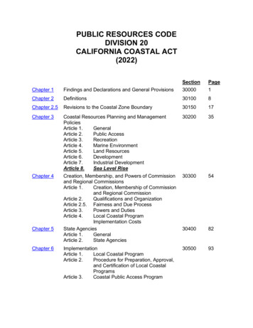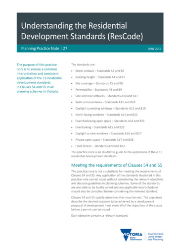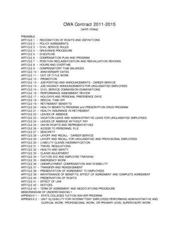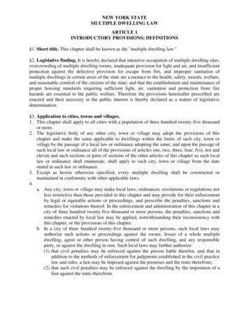
Transcription
ARTICLE 9TRANSPORTATION STANDARDS ANDSPECIFICATIONSTABLE OF CONTENTSSection TitlePageSECTION 9-100 GENERAL CRITERIA .49-110 TRAFFIC IMPACT ANALYSIS .49-120 APPROVAL OF TRAFFIC STUDY .59-120.1 STUDY AREA .69-120.2 DESIGN YEAR .69-120.3 TRAFFIC DATA REQUIREMENTS AND EXISTINGCONDITIONS .79-120.4 TRIP GENERATION .89-120.5 FUTURE TRAFFIC CONDITIONS .99-120.6 TRIP DISTRIBUTION AND ASSIGNMENT .99-120.7 ANALYSIS . 109-120.8 RECOMMENDATIONS . 129-130 APPROVAL OF TRAFFIC STUDY. 129-140 COORDINATION OF TRAFFIC STUDIES AND CONSTRUCTIONDRAWINGS . 13SECTION 9-200 STREET FUNCTIONAL CLASSIFICATIONS . 139-210 GENERAL CRITERIA . 139-220 STREET CLASSIFICATIONS . 149-230 STREET LAYOUT CRITERIA . 15SECTION 9-300 STREET DESIGN REQUIREMENTS . 169-310 GENERAL REQUIREMENTS . 199-320 CROSSOVER CRITERIA . 209-330 DESIGN PROCEDURES AND TABLES . 219-330.1 STOPPING SIGHT DISTANCE . 229-330.2 SIGHT DISTANCES ALONG MAJOR ROAD ATINTERSECTION WITH MINOR ROAD, CROSSOVERS,AND COMMERCIAL ENTRANCES . 239-330.3 TRIP GENERATION SCALE . 249-330.4 INTERSECTION IMPROVEMENTS . 24SECTION 9-400 PAVEMENT DESIGN REQUIREMENTS . 259-410 ROAD PAVEMENT SECTIONS . 25Last Updated: July 1, 2016
9-420 ACTUAL DESIGN . 289-430 ALTERNATE EQUIVALENT PAVEMENTS . 299-430.1 AIRPORT PAVEMENT STANDARDS . 30SECTION 9-500 SITE PLAN AND SUBDIVISION REQUIREMENTS ANDDESIGN STANDARDS . 319-510 CURB AND GUTTER. 369-510.1 UNDERDRAIN . 369-520 CURB CUT RAMPS . 379-530 GUARDRAILS AND HANDRAILS . 379-540 ENTRANCES ONTO THE PUBLIC RIGHT-OF-WAY . 389-540.1 ENTRANCE TYPES . 399-540.2 SPACING OF ENTRANCES . 419-550 SIDEWALKS . 419-550.1 UNDERDRAIN REQUIREMENTS. 429-550.2 SIDEWALK OVERHANGS . 439-560 TRAILS . 449-570 SHARED DRIVEWAYS. 449-570.1 ACCESS EASEMENTS . 459-570.2 DESIGN CRITERIA . 459-580 PARKING COURTS . 469-580.1 ACCESS EASEMENTS . 469-580.2 DESIGN CRITERIA . 469-590 PRIVATE STREETS & TRAVELWAYS . 479-5100 PAVEMENT RESTORATION . 509-5100.1 GENERAL . 509-5100.2 MATERIALS . 519-5100.3 EXECUTION . 519-5110 MISCELLANEOUS STANDARDS. 52SECTION 9-600 PARKING AND LOADING DESIGN STANDARDS . 549-610 OFF-STREET PARKING LOT DESIGN STANDARDS . 549-620 ACCESSIBLE PARKING REQUIREMENTS . 569-630 OFF-STREET PARKING LOCATION REQUIREMENTS . 579-640 SURFACING . 599-650 ALTERNATIVE PARKING STANDARDS . 599-660 OFF-STREET STACKING REQUIREMENTS . 609-670 OFF-STREET LOADING REQUIREMENTS . 629-680 GASOLINE STATION DESIGN REQUIREMENTS . 629-690 BICYCLE PARKING REQUIREMENTS . 639-6100 BUS PARKING REQUIREMENTS . 67SECTION 9-700 STREET, SITE, AND PARKING LOT LIGHTING . 689-2
9-710 GENERAL REQUIREMENTS . 689-720 LUMINAIRE AND POLE STANDARD . 699-730 LIGHT SOURCES . 709-740 DESIGN OF STREET LIGHT INSTALLATION . 709-750 DESIGN OF PARKING FACILITIES . 719-760 SUBDIVISION LIGHTING . 729-770 LIGHTING INFORMATION TO BE SHOWN ON DEVELOPMENTPLANS . 739-780 MAXIMUM ON-SITE LIGHTING FOR PARKING, SECURITY, ORSIGNAGE . 739-790 AIRPORT LIGHTING REQUIREMENTS . 73SECTION 9-800 STANDARDS FOR NEW STREET NAMES, ADDRESSES,SIGNS, AND MONUMENTS . 749-810 STREET NAMES . 749-820 STREET ADDRESSES . 769-830 SIGNS 769-830.1 STREET NAME SIGNS . 779-830.2 PRIVATE STREET DESIGNATION SIGNS . 77SECTION 9-900 SPECIAL STRUCTURES . 78SECTION 9-1000 PROCEDURE FOR WORK REQUIRED WITHIN EXISTINGPUBLIC RIGHT-OF-WAYS, AND EASEMENTS . 799-1010 GENERAL CRITERIA . 799-1010.1 WORK ZONE TRAFFIC CONTROL (WZTC) . 799-1020 REQUIREMENTS . 809-1020.1 SPECIAL REQUIREMENTS . 809-1030 SAFETY PRECAUTIONS . 839-1030.1 WARNING SIGNS AND LIGHTS . 849-1030.2 APPLICABILITY . 849-1030.3 FENCING . 849-1030.4 WAIVER . 849-1040 FINAL APPROVAL. 85SECTION 9-1100 TRANSPORTATION SYSTEM DETAILS . 869-3
ARTICLE 9TRANSPORTATION STANDARDS ANDSPECIFICATIONSSECTION 9-100 GENERAL CRITERIARequirements of this Article shall apply to all roadway construction in the City. Where nospecific roadway construction, or design standard, or specification is set forth in the thisManual, the requirements of the Virginia Department of Transportation (VDOT) Roadand Bridge Standards, Minimum Standards for Entrances to State Highways, RoadDesign Manual - Appendix A, the Virginia Supplement to the Manual of Uniform TrafficControl Devices (MUTCD), and the applicable Federal AASHTO standards shall beused. All streets shall be designed and built as set forth in this Manual or by the VDOTUrban Manual for Acceptance of Public Street into the State Maintenance System,whichever is more stringent. The review of all transportation systems shall be theresponsibility of the Public Works Department. All public streets will be, uponcompletion, accepted into the State system, but will be maintained by the City ofManassas.9-110 TRAFFIC IMPACT ANALYSISA. A Traffic Impact Analysis (TIA) shall be required for all developments, if the totalgenerated additional trips meet or exceed one (1) or more of the followingthresholds:1. One hundred (100) or more total site generated peak hour trips or 1,200 trips perday as defined by the current edition of the Institute of Transportation Engineers(ITE) Trip Generation Manual or by a trip generation study acceptable to the City.2. Anticipated new trip generation that uses any reserve roadway capacity to a pointwhich changes the existing level of service on a roadway or each lane group atthe intersection to "D" or below, based on the highway capacity manualthresholds.3. The study area contains a segment of roadway and/or intersection consideredunsafe. A location is considered unsafe when five (5) reportable accidents have9-4
occurred in the prior twelve (12) month period, or if it is on the City’s list of mosthazardous locations, provided by the Manassas City Police Department.4. The Department of Public Works deems that it is prudent to require suchassessment in the plan review process.B. If a TIA was submitted at the rezoning or special use permit review stage, and theassumptions used in the TIA are consistent with the submitted site plan, noadditional TIA will be required.C. The TIA shall be prepared and submitted in accordance with Section 9-120 of thisManual.9-120 APPROVAL OF TRAFFIC STUDYA. A TIA shall conform to all of the requirements of this section unless the requirementsof specific subsections are modified or deemed not necessary by the Department ofPublic Works as a result of the pre-application meeting. The applicant shall meetwith the Department of Public Works or designee prior to preparation of any TIA todetermine the scope of the TIA, which shall include the following:1. The study area.2. Size and phasing of the proposed development.3. Clarification, justification, and agreement for all assumptions and methodologiesto be used in the analysis.4. Submitted or approved plans, within the study area for estimation of backgroundtraffic.5. The future street construction/improvements in the study area which may impactthe subject site.6. The applicant shall provide a written summary of the pre-application agreementsof the proposed analysis before proceeding.B. The applicant shall provide three (3) copies of the TIA at the time of submission ofthe site development plan application. Two (2) copies of the TIA shall containcomputer disk(s) (CDs) containing computer files used in the analysis.C. If the applicant fails to comply with the technical requirements and the scope ofstudy outlined in the pre-application meeting, the applicant shall be advised that theTIA shall be revised.9-5
D. Each TIA shall contain a signed and sealed Certification of Statement of theresponsible person for the contents of the documents. The responsible person shallbe certified or licensed to do traffic engineering or planning (PE, PTOE, AICP)professional work in the Commonwealth of Virginia.9-120.1 STUDY AREAA. The study area shall be determined with staff during the scoping meeting. However,generally, the study area shall consist of the area containing and/or surrounding theproposed development within which the transportation network is impacted in one ofthe following ways:1. At a minimum, the study area shall include all site access driveways andintersections on adjacent roadways and all major internal intersections.2. At least five percent (5%) of the average daily traffic (ADT) or peak hour(s) trafficof the roadways and/or intersections within the study area is composed of thedevelopment's new trips.3. The generated trips from the proposed development changes the level of serviceof aroadway or intersection.4. An identified dangerous roadway or intersection within the area identified above.B. The study area shall also include any additional area deemed appropriate based onacceptable transportation engineering criteria.9-120.2 DESIGN YEARThe design year shall be in accordance with the following table:TIA GUIDELINES FOR STUDY DESIGN YEAR HORIZONSDevelopment CharacteristicSuggested Horizons1. Single-phase development( 500 peak hour trips)1. Anticipated opening year, assuming fullbuild-out and occupancy.2. Single-phase development(500 – 1,000 peak hour trips)1. Anticipated opening year, assuming fulldevelopment build-out and occupancy.2. Five years after opening date.9-6
TIA GUIDELINES FOR STUDY DESIGN YEAR HORIZONSDevelopment CharacteristicSuggested Horizons3. Single-phase development( 1,000 peak hour trips)1. Anticipated opening year, assuming fullbuild-out and occupancy.2. Five years after full build-out andoccupancy.3. Adopted transportation plan horizon year ifthe development is significantly larger thanthat included in the adopted ComprehensivePlan or travel forecasts for the area.4. Multiple-phase development (whenultimate road improvements are proposedto be phased)1. Anticipated opening years of each majorphase, assuming build-out and full occupancyof each phase.2. Anticipated year of complete build-out andoccupancy.3. Adopted transportation plan horizon year ifthe development is significantly larger thanthat included in the adopted plan or travelforecasts for the area.4. Five years after opening date if completedby then and there is no significant tripgeneration increase from adoptedComprehensive Plan or area transportationforecasts (e.g., at least 15%)Note: Peak hour trips based on the ITE Trip Generation Manual9-120.3 TRAFFIC DATA REQUIREMENTS AND EXISTING CONDITIONSA. All existing traffic counts used shall have been conducted within the prior twelve (12)month period. The Department of Public Works shall determine if and what growthrate factor shall be used to update the counts (i.e., utilizing historical traffic counts oravailable data from a transportation model).B. The peak hour(s) shall be determined using a minimum three (3) hour countingperiod on an average weekday (Tuesday - Thursday) not on a holiday, andconducted in favorable weather conditions or other period as deemed necessary. Allcount data, including daily traffic volumes, shall be presented in the study.C. Existing conditions of the study area shall be documented including some or all ofthe following:9-7
1. Roadway configurations (number and length of lanes and lane usage).2. On-street parking availability and regulations.3. Driveways serving developments on roadways adjacent to subject site.4. Transit stops.5. Posted speeds and current traffic count data.6. Substandard roadway design features.7. Adjacent land uses.8. Roadway geometrics and traffic controls such as traffic signals and stop andyield signs.9-120.4 TRIP GENERATIONA. The estimated trip generation for each land use shall be obtained by utilizing thecurrent edition of the Institute of Transportation Engineers (ITE) Trip GenerationManual, The appropriate land use code and independent variable units from themanual shall be indicated for each category.B. The fitted curve equation shall be used for all trip generation estimates. For thoseland uses for which the equation is not available, average trip rates shall be used.C. In addition to peak hour trip generation, the daily trip generation for all uses shallalso be included in the report.D. For commercial development (e.g., shopping centers), calculations for weekend tripgeneration, and capacity analysis shall be included in the report.E. The peak hour trip generation for single-family attached dwelling shall be calculatedby using the single-family detached housing category (land use category #210, ITETrip Generation Manual, current edition). If an adopted local trip generation rateexists for a specific category, it shall be utilized.F. A pass-by trip reduction factor up to fifteen percent (15%) may be considered forcommercial development, upon concurrence of the Department of Public Works priorto preparation of the report. Each case shall be considered individually. An internalcapture rate reduction up to fifteen (15) percent may be considered on mixed usedevelopment.9-8
G. Any trip reduction based on a mixed-use concept, pass-by trips, or transportationdemand management (TDM) program, etc., shall be considered during the preapplication meeting of the TIA. Only the following justifications shall be consideredby staff for the purpose of defining a trip reduction rate:1. Transit service (i.e., bus or rail service).2. Developments which provide for less than two thousand (2,000) feet ofuninterrupted walking or biking distance or uninterrupted pedestrian movementfacilities (such as, pedestrian bridge or signals) between non-similar uses (i.e.,residential to commercial or office to commercial).3. Any trip reduction rate based on the TDM program concept shall include aconcise binding plan/program and funding mechanisms for implementation of theproposed TDM program. Any study of a TDM program within the Washingtonmetropolitan area, which is similar in nature to the proposed development, maybe submitted to staff to assist them in evaluating the proposed TDM programprior to preparation of the TIA.9-120.5 FUTURE TRAFFIC CONDITIONSThe documented total future traffic in the report shall include the following:A. Background traffic that may be calculated using one or both of the followingtechniques.1. Existing traffic adjusted by an annual growth rate factor and based on the designyear(s), and the total estimated traffic generated at build-out of submitted andapproved development plans within the designated study area; or2. Projected traffic volumes from approved regional or local traffic forecastingmodels.B. Estimated generated trips to and from the site.9-120.6 TRIP DISTRIBUTION AND ASSIGNMENTA. Any one of the following trip distribution and assignment methodologies shall beacceptable with the concurrence of staff. Justifications for trip generation and9-9
assignment shall be discussed and approved by staff at the pre-application meeting.One of the following techniques shall be used:1. The gravity distribution model technique may be acceptable, but may requirecalibration prior to its use, particularly if utilizing an old gravity model for the studyarea.2. Metropolitan gnments. Portions of MWCOG's trip assignment report related to the studyarea shall be included in the TIA.3. Utilization of local and/or regional demographic data.4. The current directional distribution based on observed traffic counts is acceptableif justification is provided indicating the directional distribution will not changebefore the design year, due to future changes in the land use or transportationsystem improvements.B. Assignment of traffic to the network shall be in accordance with the agreed uponpercentage distribution and type of transportation facility. The Department of PublicWorks shall approve and may provide recommendations prior to preparation of thereport.C. Inbound/outbound traffic may not always have similar distribution or assignments;therefore, the approach and/or departure routes may be different. The calculationsfor inbound/outbound traffic are subject to discussion and concurrence of theDepartment of Public Works.D. The twenty-four (24) hour (daily) volume shall be distributed and assigned accordingto the method used for peak hour distribution and assignment.9-120.7 ANALYSISA. Capacity analysis shall be performed for all intersections, streets, ramps, weavingsections, internal circulation and access points as identified in the TIA scopingmeeting.B. The latest version of the Highway Capacity Software (HCS) operational module shallbe used. All worksheets indicating the inputs and outputs of the HCS program shall9-10
be presented in the study. Any deviation from the default values in the program shallbe proposed, documented and agreed to by the Department of Public Works.C. If approved by the Department of Public Works, Highway Capacity Manual (HCM)"planning procedure" may be used for any proposed intersections being analyzed,subject to the evaluation of ten (10) years or more into the future.D. A level of service (LOS) "D" or better is the minimum acceptable level of service onexisting or planned freeway segments, interchanges, signalized/unsignalizedintersections and ramp terminals, multi-lane, two-lane and urban roadways. A levelof service "D" also shall be maintained for the segment or link of roadways and allindividual movements at all analyzed intersections.E. A level of service (LOS) "C" or better is the minimum acceptable level of service forsubdivision streets.F. The Department of Public Works may require all intersections be analyzed foroff-site/on-site queuing (i.e., queuing analysis to determine the length of a left andright-turn lane(s) and storage area(s) to assess potential spill-back effects.G. The TIA shall include a capacity analysis for all identified locations within the studyarea before and after each phase of the proposed development to determine thedevelopment's impact and necessary improvements.H. If roadways and/or intersections within the study area are currently operating or areprojected to operate under hazardous conditions or unacceptable levels of service,the improvements needed to mitigate the conditions shall be noted in therecommendations.I. Use of any reserve capacity of a roadway or intersection resulting at a level ofservice "D" or below shall warrant recommendations in the study for futureimprovements.J. On-site traffic circulation analysis may be included in the TIA. The analysis shallinclude, but not be limited to, major internal intersections, access points, travelways,and parking circulation and queuing analysis.K. If required by the Department of Public Works, a progression analysis shall beperformed for arterials having two or more signalized intersections within a mile ofthe proposed development. Transportation/traffic computer software or programs9-11
such as Synchro, HCS or SIDRA may be utilized for the analysis. Other softwaremay be used when approved by the Department of Public Works.L. Diagrams included in the study should include and identify the existing and proposedspacing(s) of all intersections/entrances and/or crossovers of divided roadways.9-120.8 RECOMMENDATIONSA. At a minimum, the TIA shall include recommendations on the following items tomitigate the traffic impacts on the study area:1. Widening and/or construction of roadways and intersections.2. Intersection signalization, including but not limited to, signal warrant analysis,timing, phasing, and optimization and approved signal priority control equipment.3. Transportation demand management (TDM) programs which reduce the numberof vehicle trips being generated by the proposed development.4. Pedestrian, bicycle or transit facilities which reduce the number of vehicle tripsbeing generated by the proposed development.5. Transportation system management (TSM) techniques, such as traffic signalcoordination,which optimizes the capacity of the transportation network.B. The recommended improvements shall be achievable. The DCSM, HCS, VDOTstandards, and American Association of State Highway and Transportation Officials(AASHTO) manuals shall be utilized to design the recommended improvements.Whether or not the recommended improvements can be constructed shall notpreclude acceptance of the TIA.C. All recommended roadway improvements shall include the description, timing,funding, and source of the construction of said improvements.D. A traffic impact analysis (TIA) which does not contain specific recommendations tomitigate any noted negative impacts shall not be considered complete.9-130 APPROVAL OF TRAFFIC STUDYThe Department of Public Works shall approve the traffic study prior to approval of anysite plan or prior to recommending approval or denial to the Planning Commission of thepreliminary subdivision plat or generalized development plan.9-12
9-140 COORDINATION OF TRAFFIC STUDIES AND CONSTRUCTION DRAWINGSThe approved traffic study shall be submitted with the submission of the site plan, finalsubdivision plat, or generalized development plan, and such plat or plan submissionshall show that:A. All intersection improvements are supported by the traffic study;B. All street widths are supported by the traffic study;C. The construction drawings agree with the traffic study; andD. The minimum "Level of Service" requirements are satisfied.SECTION 9-200 STREET FUNCTIONAL CLASSIFICATIONS9-210 GENERAL CRITERIAFunctional classification is the process by which streets and highways are grouped intosystems according to the character of service they provide or are intended to provide. Itis a method of organizing the network of streets into hierarchies of travel movement forcomprehensive transportation planning. The hierarchy of functional classification in theCity of Manassas shall be: Limited access facilities. Major (principal) arterial streets. Minor arterial streets. Through collector streets. Local collector streets. Local streets.The urban functional classification is applied to the entire network of streets in the Cityof Manassas. Refer to Standard Detail TS-2.0 of this Article for a graphic illustration ofthese classifications.Limited Access Street System This system controls access by giving preference to through traffic by providingaccess connections with selected public roads only and prohibiting othercrossings at grade or direct private driveway connections.9-13
The Major Arterial Street System. The major arterial street carries the principal portion of the vehicular tripsentering and leaving urban areas as well as the majority of through travel andimportant intra-urban travel may be served by this class of facilities. Within the major arterial system, the concept of service to the abutting land issubordinate to the priority of travel service and major traffic movements.The Minor Arterial Street System The minor arterial street system interconnects and expands the principal arterialsystem and provides service to vehicular trips of moderate length at a somewhatlower level of travel mobility. This system serves intra-urban vehicular trips between smaller geographic areasthan those associated with the major arterial system.The Collector Street System The collector street system differs from the arterial systems in that facilities onthis system penetrate neighborhoods. Local collectors also may provide accessto abutting land use. The collector street distributes vehicular trips from the minor arterial through thearea to the ultimate destination, which may be on a local, or collector street.The Local Street System The local street system provides direct access to abutting land and access to thehigher order system and offers the lowest level of mobility. Through traffic on these facilities is deliberately discouraged. A local street system is further defined as a tertiary subdivision street, which forthe purposes of this Manual shall be a cul-de-sac, or small loop street.9-220 STREET CLASSIFICATIONSStreets shall be functionally classified to conform to the following:Projected VehiclesFunctionalPer DayClassificationCul-de-sacs, loops, and other streets of fixed vehicular generation.Up to 250 VPDLocal Street9-14
Projected VehiclesFunctionalPer DayClassificationCul-de-sacs, loops, and other streets of fixed vehicular generation.251-500 VPDLocal StreetTertiary subdivision streetsUp to 250 VPDLocal StreetMajor subdivision roads and streets251-400 VPDLocal Street401-2000 VPDLocal Collector2000 VPDThrough CollectorDetermina
B. If a TIA was submitted at the rezoning or special use permit review stage, and the assumptions used in the TIA are consistent with the submitted site plan, no additional TIA will be required. C. The TIA shall be prepared and submitted in accordance with Section 9-120 of this Manual. 9-120 APPROVAL OF TRAFFIC STUDY A.
