Transcription
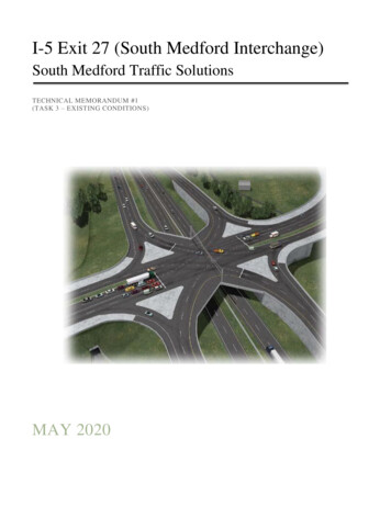
I-5 Exit 27 (South Medford Interchange)South Medford Traffic SolutionsTECHNICAL MEMORANDUM #1(TASK 3 – EXISTING CONDITIONS)MAY 2020
This page intentionally left blank
EXECUTIVE SUMMARYTechnical Memorandum #1 establishes the Year 2020 Baseline Conditions for the South MedfordTransportation Solutions Plan. It summarizes the best available information documented in the 2007 Exit27 Interchange Area Management Plan (IAMP), 2018 Medford Transportation System Plan (TSP) Updateand other supporting documents within the South Medford Interchange Influence Area. The ProjectManagement Team (PMT) reviewed this documentation and updated land use and transportationconditions that have changed within the study since Year 2007.TM #1 also summarizes Year 2010 and Year 2030 traffic conditions that were forecasted in the Exit 27IAMP prior to construction of the Exit 27 Single Point Urban Interchange (SPUI) on Garfield Street. The2007 Exit 27 IAMP traffic analysis forecasted that there would be no traffic problems at the SPUI. This isno longer the case in that existing traffic data shows that the SPUI currently experiences traffic safety andoperations issues during peak periods.The Exit 27 IAMP and 2018 Medford TSP Update background information are only intended to providestructure for comparison purposes to the updated traffic analysis being prepared for the South MedfordTransportation Solutions Transportation Plan. The Year 2020 and Year 2042 traffic analysis prepared forthe South Medford Transportation Solutions Plan will be incorporated into the Exit 27 IAMP to removeand update the outdated data and analysis.
OVERVIEWThis memorandum summarizes the 2007 I-5 Exit 27 Interchange Area Management (IAMP) and the 2018Medford Transportation System Plan Update (TSP) to establish Year 2020 base year conditions for the I-5South Medford Traffic Solutions (Project). It also summarizes 2019 Reboot Your CommuteTransportation Options Final Report.The Project’s study area is located within the existing Interchange Management Study Area (IMSA)established for 2007 I-5 Exit 27 IAMP. The Project’s study intersections include the interchange rampterminals and seven (7) local street intersections that affect interchange safety and operations (See Figure1).The Project’s study area centers on I-5 Exit 27 (South Medford Interchange) bordered by: Stewart Avenue/Barnett Road intersection to the northwest; Barnett Road/Ellendale Drive intersection to the northeast; and OR 99/Garfield Street intersection to the southwestFIGURE 1 - STUDY AREAExisting ConditionsPage i
2007 I-5 EXIT 27 IAMPThe 2007 I-5 Exit 27 IAMP is a planning document used to help protect the function of the I-5 Exit 27Single Point Urban Interchange (SPUI) at Garfield Street, and consequently the state’s investment in theSPUI. It identifies long-range needs, and management actions to protect the function of the SPUI over a20-year planning period.IAMP Goals and ObjectivesThe IAMP goals and objectives were based upon the OTC’s condition of approval specified in the 20062009 State Transportation Improvement Program (STIP).GOAL - Maintain the function of the interchange over the 20-year planning period to preserve theinvestment in the facility.Objective - Assess traffic operations at the SPUI using the most recent available data and most recentforecasts of year 2030 traffic, to determine whether the mobility standards prescribed in theOHP will be met for at least 20 years.Objective - Manage access, including devising an access management strategy in compliance withapplicable OAR 734 Division 51.GOAL - Minimize the need for future major improvements to the interchange.Objective - Identify whether future land uses might be inconsistent with the operation and safety ofthe SPUI and, if such land uses were identified, develop and recommend strategies forland use controls.Objective - Ensure ODOT is involved in future land use decisions that could affected the function ofthe interchange.Interchange FunctionThe Exit 27 SPUI functions as an urban interchange that serves primarily regional traffic. It also servessome local traffic movement between the north and south parts of Medford. It replaced the old Exit 27interchange at Barnett Road with Barnett Road remaining as an I-5 overpass to function as a local eastwest arterial with related bike and pedestrian improvements. The SPUI’s ramp terminals are classified asan interstate highway with a maximum volume-to-capacity ratio of 0.85. The Highland-GarfieldConnector (Connector 001WU) is classified as an Urban Other Principal Arterial with a maximum v/cratio of 0.90.The Exit 27 IAMP assessed whether, in light of recent development activity and new estimates of futuredevelopment in the south Medford area (in 2007), the SPUI could be shown to have an operational life ofat least 20 years. Traffic analysis confirmed that the SPUI would meet the Oregon Highway Plan (OHP)mobility targets of 0.85 v/c for at least the next 20 years, based on the assumptions made in 2007, andhelped assure that ODOT’s and local partners substantial investment made for the SPUI was protected.The Oregon Transportation Commission’s (OTC) conditions of approval for funding the SPUI requiredthe IAMP to provide for the protection of safe and efficient operation of the SPUI between connectingroadways and minimize the need for major improvements to existing interchanges.Exit 27 Traffic SolutionsDraft TM #1Page 2
The Exit 27 IAMP updated the analysis performed for the Final Environmental Impact Statement (FEIS)using new information compiled for population variables (i.e. number of households and population) andfor employment (i.e. number of employees by category). The population and employment informationwas updated as part of an effort to use the most recent data for the 2005-2030 Regional TransportationPlan (RTP). The base year population and employment data for the IAMP was from Year 2002. Thefuture year used for the Exit 27 IAMP was Year 2030, making it consistent with the 2005-2030 RTP.The City of Medford provided 2004 traffic counts as the basis for assessing base year traffic operationsfor the Exit 27 IAMP. The future year traffic analysis made use of the new population and employmentdata by using information developed by RVMPO staff in cooperation with local agencies. This data wasused in the regional transportation RVCOG forecasting model run by ODOT’s Transportation Planningand Analysis Unit (TPAU). The model, including the base year and future year data, was the same as thatused to analyze transportation needs, traffic operations, and the air quality analysis conducted for the2005-2030 RTP.Exit 27 IAMP Interchange Management Study Area (IMSA)The Exit 27 IAMP IMSA centered on the SPUI and included parcels along I-5, OR 99 and Barnett Road.The boundaries included Siskiyou Boulevard on the north, the city limits/urban growth boundary (UGB)on the south, Olympic Avenue/Murphy Road on the east, and the UGB and South Holly Street on thewest. It contained a mix of residential, commercial, industrial land and open space. The IMSA excludeddowntown, but encompassed a substantial portion of the commercial, industrial, and multi-familyresidential (MFR) land in south-central Medford.The Exit 27 IMSA matched the transportation analysis zone (TAZ) boundaries used to model the 20052030 RTP and the FEIS for the South Medford Interchange Design Project. It accounted for more than ten(10%) percent of the region’s total employment and about two (2%) of the region’s households. TheIMSA contained approximately 1,000 residences and a significant amount of single-family residentialdevelopment east of I-5.Employment comprised an important component of land uses, accounting for over 9,000 employees.Service and retail sector employment accounted for about 85% percent on the employment and includedboth big box retail and fast food restaurants, many of which were found along the Barnett Road and OR99 corridors. There was some vacant and under-utilized commercial land in the vicinity of Center Driveand OR 99. Land located in the south part of the IMSA, between I-5 and OR 99, which was designated asRegional Commercial, has been developed as a Regional Sports Park.Industrial employment accounted for about 10% percent of the employment within the IMSA. Industrialdevelopment could also be found along the OR 99 corridor. This area also featured some vacant andunder-utilized land with industrial zoning designations, with most of the vacant industrial land beinglocated on the west-side of OR 99. More industrial development along this corridor was expected.According to the forecasts of households and population used in the 2005-2030 RTP, a total of about 400new households were assumed to be developed within the IMSA by Year 2030. Employment forecasts forthe 2005-2030 RTP predicted that the IMSA would add about 1,500 employees by Year 2030 for a totalof approximately 10,600 employees in the IMSA.Exit 27 Traffic SolutionsDraft TM #1Page 3
Existing Conditions AnalysisAdopted transportation plans and land use plans were reviewed to help ensure consistency with applicableplans and regulations so that the Exit 27 IAMP would meet state and community goals for the area, and toidentify how local planning efforts, policies and regulations would protect the SPUI.The traffic analysis performed for the Exit 27 IAMP focused on making certain that the SPUI would havean operational life of at least twenty years. The analysis was based upon the population, employment andtraffic volumes developed for the RVMPO 2005-2030 RTP. The RTP assumptions were based on the landuses permitted under the City of Medford’s adopted comprehensive plan and Land Development Code. Atraffic analysis using the regional traffic forecasting model demonstrated that the SPUI wouldsubstantially meet ODOT’s mobility targets in Year 2030, with an overall v/c of 0.58.The traffic analysis also considered an Alternative Development Scenario developed to test what wouldhappen if traffic generation exceeded RTP assumptions. This alternative used higher traffic generatingemployment values than the RTP and also added additional dwelling units in the Exit 27 IMSA. Thetraffic analysis from this alternative scenario also indicated the SPUI would meet ODOT’s mobilitytargets in Year 2030, with a v/c of 0.70.The traffic analysis for both the RTP assumptions and the Alternative Development Scenario wereconducted using the same regional forecasting model that was used for the 2005-2030 RTP. This modelwas referred to as the “RVCOG” model. This model was used for the Exit 27 IAMP because it waspreviously used for the FEIS and therefore enabled the IAMP to be consistent with both the FEIS and theRTP.Projected Year 2010 Traffic VolumesThe Exit 27 IAMP year 2010 traffic volumes were developed from household, population, andemployment data in the RVMPO RTP and land use models. Due to the reconfiguration of the SPUI,traffic patterns in the area were considerably altered by the SPUI.One of the priorities of the Exit 27 IAMP was to update the traffic operations analysis performed for theFEIS. Updating the operations analysis for the SPUI required estimating the Year 2010 traffic volumes.Projected Year 2010 traffic volumes were developed by analyzing the actual traffic counts in the areafrom Year 2004, provided by City of Medford staff, and results of the runs of the regional model for thebase year and Year 2010. The regional model was also used to determine travel patterns of traffic usingthe SPUI’s northbound and southbound ramps (See Figure 2).Exit 27 Traffic SolutionsDraft TM #1Page 4
FIGURE 2 – EXIT 27 SPUI 2010 VOLUMESExit 27 Traffic SolutionsDraft TM #1Page 5
Predicted Year 2010 Traffic OperationsThe traffic operations for the Exit 27 SPUI were analyzed using the Synchro and SimTraffic analysispackages (See Tables 1 and 2). These analysis tools are based on the Highway Capacity Manual. Unlikethe regional model, which reports traffic volumes, the traffic operations analysis packages such asSynchro and SimTraffic show the v/c ratios, delay, and queues at intersections.TABLE 1 – EXIT 27 SPUI 2010 V/C AND LOSTABLE 2 – EXIT 27 QUEUE LENGTHSExit 27 Traffic SolutionsDraft TM #1Page 6
Forecast Year 2030 Population, Households and EmploymentSome vacant land was available in the Exit 27 IMSA for new households and for a variety of employmentgrowth. All assumptions about population, household and employment growth were the same as used inthe 2005-2030 RTP.Almost half the residential growth in the Exit 27 IMSA was predicted in TAZ 373 and only three others(TAZs 369, 372, and 380) were expected to add more than 50 households. Likewise, employment growthin the IMSA was expected to be concentrated (See Table 3).TABLE 3 – YEAR 2030 POPULATION, HOUSEHOLDS & EMPLOYMENT BY TAZExit 27 Traffic SolutionsDraft TM #1Page 7
TAZs 369 and 370 were expected to account for half the employment growth in the Exit 27 IMSA, witheach accounting for almost 400 new employees. Only two others (TAZs 380 and 382) were expected toadd more than 100 new jobs (See Figure 3).FIGURE 3 – SOUTH MEDFORD TAZSExit 27 Traffic SolutionsDraft TM #1Page 8
Projected Year 2030 Traffic VolumesThe traffic volumes were developed from household, population, and employment data in the 2005-2030RTP and land use models. Since the goal of the Exit 27 IAMP was to assess traffic operations for atwenty-year period, Year 2030 was used as the basis for future traffic operations analysis.Year 2030 traffic volumes were developed by analyzing the actual traffic counts in the area from Year2004 and results of the runs of the regional model for Year 2010 and Year 2030 (See Figure 4).FIGURE 4 – EXIT 27 SPUI 2030 VOLUMESExit 27 Traffic SolutionsDraft TM #1Page 9
Predicted Year 2030 Traffic Operations AnalysisThe traffic at the Exit 27 SPUI for Year 2030 was analyzed using the same methodology described forYear 2010 conditions. The configuration of the SPUI was identical, only the traffic volumes werechanged. Synchro and SimTraffic were also used for the Year 2030 analysis.The traffic operations analysis results for projected Year 2030 traffic volumes showed the SPUI to meetOHP mobility standards with a v/c of 0.58 (See Figures 5 and 6).FIGURE 5 – EXIT 27 SPUI 2030 V/C & LOSFIGURE 6 – EXIT 27 SPUI 2030 QUEUE LENGTHSThe results of this analysis were checked with the results from Final EIS and were again found to be verysimilar. The overall conclusion from this analysis is that the SPUI was expected to meet ODOT mobilitystandards through Year 2030.Exit 27 Traffic SolutionsDraft TM #1Page 10
POTENTIAL FUTURE MANAGEMENT MEASURESThe SPUI was predicted to continue to operate acceptably and meet ODOT mobility standards throughyear 2030 without any mitigation measures. Potential management measures were not consideredspecifically needed to meet mobility standards for the twenty-year plan horizon, but it was acknowledgedthat they could be implemented at some future time to extend the operational life of the interchangebeyond this timeframe.In addition to a description of these measures, Plan policies and ordinance language were cited todemonstrate that the City of Medford, as well as the MPO Region, acknowledged and supportedmanagement measures that would provide future protection to the Interchange. These future managementmeasures were described as follows:Transportation Demand Management (TDM) Strategies are designed to reduce vehicle miles traveled,especially in the peak periods. These strategies focus on the provision of services or facilities intended toshift travelers to different travel modes, or to travel at non-peak times, or to offer trip substitution choicessuch as telecommuting.Transportation System Management (TSM) Strategies are designed to make maximum use of existingtransportation facilities and include traffic engineering measures such as signal timing changes, provisionof turn lanes, turn restrictions, and restricting on-street parking to increase the number of travel lanes.Traffic operations affecting the study area will be refined after construction of the SPUI, to assure that itoperates safely and efficiently.Intelligent Transportation Systems (ITS) Management Strategies can enable agencies to monitortraffic, respond to traffic accidents faster and communicate with the motoring public in real time. ITS canalso be used to control traffic without adding traffic capacity in the vicinity of the interchange, andincludes transit signal priority, lane control signals and variable speed limit signs. The RVMPO hascompleted an ITS Architecture Plan for the Rogue Valley area, with the City of Medford assuming aprominent role in guiding plan development.Ramp Metering is typically used on the on-ramps to freeways and other limited access highways, tometer the rate of traffic flow entering the highway. Ramp meters can use a fixed-time signal to setminimum intervals between vehicles entering the freeway or they can adjust the rate of entering vehiclesin response to the actual, real-time flow on the freeway. The RTP contains policy language regarding thepotential use of ramp meters in the MPO area. Ramp meters are successful when deployed throughout thecorridor system, which means that to help alleviate congestion at the South Medford Interchange, rampmetering should be considered on all ramps entering I-5 over the entire MPO area.Adopt Revised Standards for Parking with Lower Minimums and a Maximum reduce parking helpsto discourage automobile use especially if combined with TDM measures, that provide positive incentivesfor people to use transit or carpooling for their trips.The City of Medford is required to develop a parking plan as a condition of DLCD approval of their TSP.This measure could be used for commercial and employment areas in the vicinity of the new interchange,to reduce traffic congestion.Exit 27 Traffic SolutionsDraft TM #1Page 11
Limiting New Trips or Land Use Changes in a Specific Study Area can be considered to limit theamount of additional traffic generated by new development in a specified management area. Although thistool was considered by the South Medford IAMP TAC for use in the study area, it was determined that itwas not warranted at this time. It was also noted that much of the traffic affecting the new interchangewas generated from beyond the interchange study area, which would make a trip budget within the studyarea less effective. Also, both the Transportation Planning Rule (TPR) and City code require ODOTreview of land use changes in the interchange area, with mitigations applied to assure facility adequacy.Although not necessitated at this time, these measures could be incorporated at a future time, if needed tocontrol trip generation.MEASURES RECOMMENDED IN THE IAMPBased on the analyses performed during this project, it was predicted that the SPUI would operateacceptably and would meet ODOT mobility standards throughout the twenty-year planning period.However, to protect the function of the new South Medford Interchange during and beyond the20-year planning period, two management measures were recommended for inclusion in the adoptedIAMP. These measures were as follows; The implementation of the Access Management Strategy – South Medford Interchange Project,2003.The inclusion of provisions in the IAMP from the Medford TSP and Land Development Code,that provide added protection for the function of the new interchange.Implement Access Management StrategyODOT developed the Access Management Strategy – South Medford Interchange Project in 2003, for thenew South Medford Interchange in compliance with the OHP, Division 51, the City of MedfordComprehensive Plan and other local plans and policies. The strategy, which the Medford staff was givenan opportunity to review, included access management recommendations that support the Projectobjectives of the South Medford Interchange Project balanced with the City of Medford’s land use, localstreet, and economic development goals. All were consistent with state access management requirementsfor safe and efficient highway operations.The Access Management Strategy provided a comprehensive inventory of all public and privateapproaches in the interchange area and identified strategies that meet or improve current conditions, bymoving towards the appropriate access management standards. The inventory identified all rights ofaccess between the adjoining properties and the state highway, including reservations and grants ofaccess. It contained findings for Division 51 requirements including deviations. The strategy alsodeveloped a basis for a future intergovernmental agreement to transfer access review responsibility (SeeFigures 7, 8 and 9).Key provisions of the Access Management Strategy are: Full access control along the Highland-Garfield Connector, a new facility that extends betweenRiverside Avenue and Barnett Road. The removal of the existing Barnett Road freeway ramps. Access changes to OR 99 including the closure of four existing access points and the conversionof some existing accesses to right-in, right-out only.Exit 27 Traffic SolutionsDraft TM #1Page 12
FIGURE 7 – EXIT 27 SPUI ACCESS JURISDICTIONSExit 27 Traffic SolutionsDraft TM #1Page 13
FIGURE 8 – EXIT 27 SPUI ACCESS LOCATIONSExit 27 Traffic SolutionsDraft TM #1Page 14
FIGURE 9 – EXIT 27 SPUI ACCESS LOCATIONSExit 27 Traffic SolutionsDraft TM #1Page 15
FIGURE 9 – EXIT 27 SPUI ACCESS LOCATIONS (CONTINUED)Exit 27 Traffic SolutionsDraft TM #1Page 16
FIGURE 9 – EXIT 27 SPUI ACCESS LOCATIONS (CONTINUED)Exit 27 Traffic SolutionsDraft TM #1Page 17
2018 MEDFORD TSPThe 2018-2038 Medford TSP is based on the City of Medford’s current Comprehensive Plan land usesand provides for a transportation system that accommodates the expected population and employmentgrowth resulting from development of the planned land uses.The TSP identifies existing and future transportation facilities located within the Medford City Limits andan additional 4,000 acres located within its Urban Growth Boundary (UGB). The UGB provides the Citywith a 20 year supply of land for future growth. Land use is a key factor in developing a functionaltransportation system; the amount of land planned for development, the types of land uses, and how theyrelate to each other have a direct relationship to the anticipated demands on the transportation system.Similarly, the makeup of the population influences the types of facilities and programs needed to movethe residents and visitors within the community.Existing Land UsesThe Comprehensive Plan provides a long-term guide for where and how future development will occur.Segregated, low-density land uses tend to limit transportation choices by separating trip origins anddestinations and increasing average trip lengths. This makes walking and bicycling less convenient andmakes transit less efficient, which could in turn result in more single occupancy vehicles traveling thesystem and inefficiencies in freight movement. Alternatively, mixed-land uses at higher densities tend tobring a larger number of origins and destinations close together, thereby shortening average trip lengthsand making walking, biking, and transit feasible for a larger number of trips (See Figures 10 and 11).Exit 27 Traffic SolutionsDraft TM #1Page 18
FIGURE 10 - CITY COMPREHENSIVE PLAN LAND USE MAPExit 27 Traffic SolutionsDraft TM #1Page 19
FIGURE 11 - CITY ZONING MAPExit 27 Traffic SolutionsDraft TM #1Page 20
Existing Traffic ConditionsThe existing traffic conditions analysis identifies how the study area’s transportation system operatestoday. This analysis includes an evaluation of traffic operations at key intersections in the city during theweekday evening peak period. There are several intersections that do not currently meet the City’s Levelof-Service standard. They are primarily located around the South Medford Interchange. The City ofMedford is changing the mobility standard to Level-of-Service “E” at two intersections; Stewart Ave & SPacific Highway and Barnett Rd & Highland Dr.South Stage Road ExtensionThe South Medford Interchange is one of the most congested areas of the City. Medford anticipatesgrowth in both southwest and southeast Medford. Providing an east-west connection between these twoareas is expected to help reduce congestion at the South Medford Interchange, provide access to MajorArterials including North Phoenix Road, Riverside Avenue, and Columbus Avenue, allowing for travelaround Medford without reliance on I-5 and the South Medford Interchange. This connection is alsoexpected to remove circuitous trips between areas of Medford and Phoenix. This new connection over I-5is assumed in the transportation analysis of the Year 2038 traffic forecast conditions. Further analysis isneeded to confirm these potential transportation benefits.South Medford Interchange (I-5/Garfield Street) and Garfield Street/Center DriveThese intersections are not projected to meet ODOT’s mobility standards even with the South Stage RoadExtension. These intersections need alternative mobility targets (Project I-83 and I-84) or to be evaluatedfurther as part of an update to the Exit 27 IAMP. This future IAMP should also incorporate analysis ofaffected City intersections including Highland Drive/Barnett Road and Riverside Avenue/PacificHighway/Stewart Avenue.Highland Drive/Barnett RoadThis intersection operates at an LOS “E” with a second northbound right-turn lane added (Project I-78).The city is adopting LOS “E” as the mobility standard for this intersection.Traffic responsive control uses data collected from traffic detectors to change signal timing plans forintersections. The system uses data collected from the detectors to automatically select a timing plan bestsuited to current traffic conditions. This system is able to determine times when peak-hour timing plansbegin or end, potentially reducing vehicle delays. Barnett Road is currently planned to be upgraded tohave traffic responsive control.Riverside Avenue/Pacific Highway/Stewart AvenueThis intersection operates at an LOS “E” with a second eastbound left and second southbound left added(Project I-17). The city has adopted LOS “E” as the mobility standard for this intersection.OR 99 Corridor PlanThe OR 99 Corridor Plan was adopted by ODOT in June 2015. The plan focuses on the section of OR 99that extends from Garfield Street in South Medford, through the communities of Phoenix and Talent, to S.Valley View Road at the north end of Ashland. This multimodal plan examines how the highway operatesboth now and over the next 20 years. It identifies strategies to preserve and improve highway safety andcapacity consistent with a District Highway classification and local policies. It also incorporatesimprovements for all travel modes.Exit 27 Traffic SolutionsDraft TM #1Page 21
FIGURE 12 – 2018 TSP ODOT INTERSECTION PROJECTS WITHIN STUDY AREAFIGURE 13 – 2018 TSP CITY INTERSECTION PROJECTS WITHIN STUDY AREANote: Future improvements that add lanes may make it more difficult to walk and bike through intersections.FIGURE 14 – 2018 TSP STREET CONNECTIVITY PROJECTS WITHIN STUDY AREAExit 27 Traffic SolutionsDraft TM #1Page 22
FIGURE 15 – 2018 TSP TRAFFIC OPERATION PROJECTS WITHIN STUDY AREAFIGURE 16 – 2018 TSP CAPACITY ENHANCEMENT PROJECTS WITHIN STUDY AREAExit 27 Traffic SolutionsDraft TM #1Page 23
FIGURE 17 – 2018 TSP SAFETY LOCATIONS WITHIN STUDY AREAFIGURE 18 – 2018 TSP BICYCLE NETWORK ROUTES WITHIN STUDY AREAFIGURE 19 – 2018 TSP BICYCLE PROJECTS WITHIN STUDY AREANote: Garfield does not meet ODOT standards for bike facilities, and that biking and walking in the area isuncomfortable at best (and connectivity to the Bear Creek Greenway is lacking).Exit 27 Traffic SolutionsDraft TM #1Page 24
2019 REBOOT YOUR COMMUTE TRANSPORTATION OPTIONS FINAL REPORTThe Reboot Your Commute campaign was designed to address safety and vehicle flow issues on I-5 inMedford, Oregon. Specifically, the campaign aimed to change the behavior of commuters traveling onweekdays to East Barnett Road. On many weekday mornings, excess traffic demand at the I-5 southboundExit 27, headed to East Barnett Road, caused backups of vehicles the entire length of the off-ramp andinto the freeway travel lane. Responding to the 2014 Oregon Transportation Options Plan (OTOP), ratherthan add travel lanes for vehicle capacity (a costly solution), ODOT instead piloted a new approach inpartnership with the Rogue Valley Transportation District (RVTD) to provide outreach, education, andencouragement about the suite of transportation options (TO) already available in the area.RESULTSSelf-Reported Travel BehaviorThirty-three of the 163 program participants responded to a post-program survey. Responses indicatedthat participants were more likely to be aware of congestion (and how to avoid it) than non-participants.Although self-reported travel during peak times increased among participants, one-third reported trying anew way to get to work (most of whom said they were “somewhat likely” or “very likely” to continueusing new modes). Drive-alone trips among participants decreased by 7%, replaced by carpool, transit,and telework trips. Over half of participants agreed that they changed their commute to find a lessstressful option.Traffic Pattern ChangesNo significant change in the Exit 27 backup was observed by the project team, survey respondents, oremployer interviewees. However, the program may have contributed in decreased southbound trafficturning right and left off the exit (i.e. towards the employers in the project area). Considering growth inthe target area, it is conceivable that conditions could have worsened without the program.Transit CountsRidership on Route 24 (which serves the project area) i
27 Interchange Area Management Plan (IAMP), 2018 Medford Transportation System Plan (TSP) Update and other supporting documents within the South Medford Interchange Influence Area. The Project Management Team (PMT) reviewed this documentation and updated land use and transportation conditions that have changed within the study since Year 2007.