Transcription
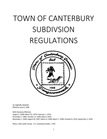
TOWN OF CANTERBURYSUBDIVSIONREGULATIONSAs originally adopted:Effective June 6, 1968With Revisions Effective:August 1, 1968; March 25, 1970; February 1, 1976;December 2, 1985; October 12, 2000; May 9, 2002;November 1, 2006; August 30, 2007, March 4, 2008; March 1, 2009; October 8, 2013; September 1, 2018Photo: John Carter House - 3 S. Canterbury Road c. 17651
SUBDIVISION REGULATIONSTable of ContentsSection tive Date4Section 2Definitions5Section 3CompliancePreliminary LayoutBoundary PlanSite Development Plans/E&S PlansApplication for ApprovalNotification of AdjacentCertificate of CompletionAdditional Studies/ReportsProcedure of Commission on Applications Boundary MarkersRight-of-Way BoundaryInspection and ApprovalLegal Documents8Section 4General RequirementsSubdivision of Land- Conventional SubdivisionsBuilding LineLot SizesLot WidthsInterior LotsLot LayoutRemaining LandCharacter of Land: FloodingLot Sizes: VariationsWater Supply & Sewage DisposalOpen SpaceWetlandsCompliance with Zoning RegulationsStreets/Roads142
LayoutStreet NamesStreet SignsDead-end, non-through streets, loop roads, cul-de-sacsGuard RailsDrainageTrees and BrushSchool Bus AccommodationDrivewaysShared DrivewaysExisting Town RoadsRequired DocumentationOptional DocumentationSoil and Erosion ControlsErosion and Sediment Control PlanMinimum Acceptable StandardsIssuance or Denial of CertificationConditions relating to Soil Erosion and Sedimentation ControlInspectionSection 5Bond, Supervision and Engineering Fees31Section 6Waivers31Section 7Enforcement313
Section 1ADMINISTRATION1.1PURPOSEThe rules and regulations governing the subdivision of Land in the Town of Canterbury,Connecticut have been enacted for the purpose of protecting the safety, convenience, andwelfare of the inhabitants of Canterbury by ensuring that the land to be subdivided shall be ofsuch character that it can be used for building purposes without danger to health for the safety ofthe public; and for ensuring sound community growth with minimum governmental costsconsistent with the encouragement of the appropriate development of land.1.2ENFORCEMENTA. CriminalSection 8-25 of the Connecticut General Statutes provides in part, “Any person, firm orcorporation making any subdivision land without the approval of the Commission shall be finednot more than five-hundred ( 500) dollars for each lot sold or offered for sale or so subdivided”.B. CivilThe Commission acting through its Chairman shall have full authority provided by law to enforcecompliance with these regulations, including instituting legal action for injunctive relief.1.3SEPARABILITYIf any section, subsection, sentence or portion of these regulations is for any reason held invalidor unconstitutional by any court of competent jurisdiction, such portion shall be deemed aseparate, distinct, and independent provision, and such holding shall not affect the validity of theremaining portions hereof.1.4EFFECTIVE DATEThese regulations shall become effective at 8:30 p.m., June 6, 1968; with revisions effectiveAugust 1, 1968; March 25, 1970; February 1, 1976; December 2, 1985; December 2, 1985; May 9,2002; November 1, 2006; August 30, 2007; March 4, 2008; March 1, 2009; October 8, 2012;September 1, 20184
Section 2DEFINITIONS2.1Agriculture: See Connecticut General Statutes Section 1-1, subsection q. as amended.2.2Applicant: The term “applicant” refers to the person proposing a subdivision or resubdivision orother decision by the Commission. Same as “Subdivider”2.3Application: A formal request for a subdivision or resubdivision or other decision by theCommission on a form prescribed by the Commission accompanied by all supporting andrequired information, maps, documents or reports as required by these regulations.2.4Block: A space enclosed by streets and occupied by or intended for buildings.2.5Board of Selectmen: The Board of Selectmen of the Town of Canterbury2.6Buildable Area: As defined in the Canterbury Zoning Regulations.2.7C.G.S.: Connecticut General Statutes as may be amended2.8Commission: The Planning & Zoning Commission of the Town of Canterbury.2.9Cul-de-sac: A dead end street having only one vehicular outlet.2.10Dead-end Streets: For the purposes of these regulations, dead-end streets shall include all roads,or combinations of roads, with a single entrance/exit point to a through street, including nonthrough streets, loop roads with a single entrance/exit point and any proposed dead-end streetoff of another dead-end street.2.11Driveway: Any access from a public highway used, designed, or intended to be used for vehicularingress and egress to a lot. Compare to Street.2.12Easement: A right established in deed or other legal means of a party or parties to use adesignated portion of another party’s land for a specific limited purpose.2.13Lot: The unit or units into which land is divided or proposed to be divided with the intention ofconveying it or them either as developed or undeveloped building sites.2.14Owner: The owner or owners of record of the land to be subdivided or re-subdivided.2.15Parcel or Tract: A piece of land under one ownership, bounded by other parcels or tracts or by anaccepted street.2.16Plan: Survey plans that comply with Sections 20-300b-1 through 20-300b-20 of the Regulationsof the State of Connecticut (effective June 21, 1996). These regulations specify the variousprecisions for horizontal accuracy, vertical accuracy, and topographic accuracy.5
In general subdivision plans should comply with the following standards:Boundary Information- A-2 horizontal accuracyTopographical Accuracy- V-2 for field generated topography; V-3 for aerial topographySection 3 of these regulations specify minimum monumentation requirements. The level ofaccuracy of the information presented on plans should be clearly noted on each plan.2.17Person: The term “person” as used in this regulation shall include individuals, firms, partnerships,limited liability companies, corporations, trusts, and other legal entities.2.18Public Improvements: Improvements as required by these Regulations made within the existing orproposed public right-of-way such as drainage, sightline or road construction. Any change oralteration to the existing conditions of the subdivision site for the purpose of complying with theseregulations; or, any approval granted hereunder; or, depicted on any Final Subdivision Planapproved hereunder; or, for rendering the site more suitable for development and/or habitation.As used in these regulations, Improvements include but are not limited to: construction andinstallation of roadways, paved streets, curbs, gutters, utilities, street signs, monuments, shadetrees and drainage facilities; erosion and sedimentation control measures; buildings; earth fillingor removal, seeding and grading; the establishment or construction of parks, playgrounds,recreational buildings, equipment, structures, fields, and similar facilities; and facilities designed todetain, redirect, store, or treat stormwater discharge.2.19Regulations: The Zoning Regulations for the Town of Canterbury, except for the phrase “theseRegulations” which shall denote these Subdivision Regulations.2.20Re-Subdivision: A change in a map or of an approved or recorded subdivision or re-subdivision ifsuch change (a) affects any street layout shown on such map, or (b) affects any area reservedthereon for public use, or (c) diminishes the size of any lot shown thereon and/or creates anadditional building lot, if any of the lots shown thereon have been conveyed after the approval ofsuch map in conformance with the definition “re-subdivision” as stated in Section 8-18 of theConnecticut General Statutes or as it may hereafter be amended.2.21Street: The term “street” as used in these Regulations shall include town roads and state highwaysaccepted for public use by lawful procedure and suitable for vehicular travel or a proposed streetshown on a subdivision plan approved by the Commission and suitable for acceptance at a dulywarned Town meeting. For the purpose of these regulations the words “streets” and “roads” shallbe interchangeable.2.22Subdivider: Person or party proposing the subdivision or re-subdivision. Same as “Applicant.”2.23Subdivision: The division of a tract or parcel of land into three (3) or more parts or lots for thepurpose, whether immediate or future, of sale or building development, expressly excludingdevelopment for municipal, conservation or agriculture purposes, and included re-subdivisions inconformance with the definition of “subdivision” as stated in Section 8-18 of the ConnecticutGeneral Statutes or as it may thereafter be amended.6
2.242.25Town Engineer: The engineer or engineering firm hired by or acting for the Town of Canterbury.Zoning Regulations: The Zoning Regulations of the Town of Canterbury.7
Section 3COMPLIANCENo subdivision of land shall be made and no land in any subdivision shall be sold or offered for sale until aplan of subdivision, prepared in accordance with the requirements of these regulations, has beenapproved by the Commission and duly recorded with the Town Clerk.3.1Preliminary layout subdivision plan proposal Procedures, Conditions, and Specification forSubmissionA.It is suggested a Pre-Application Conference with Town Staff be arranged to discuss theinitial conceptual design of any subdivision or re-subdivision. Requests for such meetingsare made through the Zoning Enforcement Officer at least five calendar days prior to thenext scheduled Planning and Zoning Commission meeting. Many problem areas can beidentified and helpful suggestions offered at a Pre-Application Conference with TownStaff. It is further suggested, following the Pre-Application Conference, applicants followthe Preliminary Layout Application Procedure. The purpose for using this procedure ispurely to look in more detail at the proposal and provide guidance to the subdivider toidentify areas of concern or further study, so as to minimize delay, expense andinconvenience to the public, the applicant, and the Commission upon the future receipt,if any, of a formal application for subdivision.1) Pre-application Conference: The Commission strongly recommends allproposals to subdivide or re-subdivide land should begin with a Pre-ApplicationConference with the Town Staff before any application to subdivide is made.2) Recommended Preliminary Layout Procedure: The Commission stronglyrecommends any proposed subdivision of five (5) or more lots to follow thePreliminary Procedure. This is a recommendation and not a requirement.3) Effect of Consideration of Preliminary Layout: Neither the applicant nor theCommission shall be in any way bound by any statement made during the PreApplication Conference or the Preliminary Layout Procedure, it beingacknowledged by the applicant that the Commission's responses, like the requestitself, are preliminary and subject to further change and refinement. There shallbe no vote or other formal action on any request for Preliminary Layoutconsideration, other than referrals to other Municipal, State, or Federal agenciesfor review and comment if deemed advisable by the Town Staff.4)Application: The applicant may present to the Commission or its designee arequest for the consideration of a Preliminary Layout in accordance with therequirements of Section 3.2, of these Regulations.5) Review by Town Staff: At the time of the filing of a request for theconsideration of a Preliminary Layout, the Commission or its designee shall checksuch request and Requirements.8
6) All physical features, such as existing structures, water wells and septicsystems, historical foundations, cemeteries, burial plots, all dumps, wetlands,watercourses, water bodies, ledge/bedrock outcroppings, bedrock within fortyeight inches (48") of the land surface, stone walls, wooded areas, trees ten inch(10") in caliper or more on proposed driveways and buildable land, and thepurpose and location of all existing easements. All features shall be identifiedwith appropriate labels.7) The approximate elevation contours of the existing land surface with intervalsto indicate surface water drainage and grades8) The location and approximate dimensions and area of all property proposed tobe set aside for open space.9) The location of any test holes dug, percolation tests conducted and theresulting data.10) Technical Reports as to the general feasibility of the proposed water supply,the proposed drainage plan and sewage disposal. It is recommended theapplicant obtain the services of a sanitary or civil engineer; licensed to dobusiness in Connecticut, to conduct testing and develop these technical writtenreports and drawings for submission to the Commission or its designee.B.No plan of subdivision shall be approved unless it is clearly drawn on sheets twenty-four(24) inches by thirty-six (36) inches, and at the following scales:Boundary Plan: 1” 100’ or larger; (1” 50’, 1” 40’, 1” 30’ and 1” 20’ would also beacceptable)Site Development Plans/E&S Plans: 1” 40’ or larger; (1” 30’ or 1” 20’ would also beacceptable)All maps submitted should be prepared in conformance with the State Regulations notedin Section 2.16 of these regulations.If multiple sheets are required for a subdivision, then clear match lines and a smallerscale key map should be provided which shows the entire proposed subdivision andsheet layout for ease of multiple sheet plan reviews.Said plan shall show the following:a.Name of owner of land of recordb.Name of subdivision, if anyc.Certificate and seal of a professional engineer registered in the State of Connecticuton all plans which include the design of roads, drainage systems, sanitary sewersystems, sewerage disposal systems and water supply and distribution systems and9
the certificate and seal of a land surveyor registered in the State of Connecticut onall plans which include land contours and the delineation of the boundary lines ofthe outside perimeters as well as the interior lots and streets of a subdivision.However, where subdivision plans include the design of non-engineered septicsystems and no significant site grading is required, the seal of a land surveyorregistered in the State of Connecticut shall be satisfactory.d.Wetlands or watercourses must be delineated by a soil scientist, duly qualified inaccordance with Standards set by the Federal Office of Personnel Management.e. North point, scale of map, original date, and dates of all revisionsf.The boundary lines on a subdivision plan should be shown with bearings anddistances meeting the standards for Class A-2 Horizontal Accuracy per current StateRegulationsg. Name of all abutting property owners within one hundred and fifty (150) feet of theentire tract of land including property located across any town road or state highwayfrom the land and list the adjoining municipalities within five hundred (500) feet ofthe project.h. Layouts of lots, showing accurate bearings, dimensions, angles and building lines;buildable area as outlined by Section 5 of Canterbury’s Zoning Regulations; and, thelocations of the monuments or markers indicating the lot boundariesi.The location of street monumentsj.Non-tangent curves should be avoided whenever possible. Curves, radius, centralangle and arc lengths should be described by the chord bearing and distance.k.Wells and septic systems on adjacent properties limiting the development potentialof a proposed lot or within 75 feet of the proposed development on a proposed lotshould be field located and shown on any subdivision plan submitted for reviewl. As part of the subdivision plan, separate maps shall be filed, which shall contain anddelineate the following:1.A general site or location map at a scale of one (1) inch equals onethousand (1,000) feet indicating the lots and streets as proposed and therelation of the proposed streets in the subdivision to the existing streets inthe vicinity of the proposed subdivision, and the zoning in the area within aone-thousand (1,000) foot radius surrounding the proposed subdivision.2.Plans must show proposed grading on all lots of a subdivision necessary todemonstrate that the lots can be developed and that the associated impactsare in accordance with the Town of Canterbury’s regulations andordinances, health code standards, and sound engineering practices.10
3.The location of all existing and proposed, sanitary and storm water sewers,catch basins, manholes, bridges, and culverts, with invert elevations of alldrainage structures.3.2APPLICATION FOR APPROVALApplication for approval of either a subdivision or resubdivision plan shall be made in writing tothe Commission on a form provided by the Commission and accompanied by all fees as requiredunder Section C, Item 1 of these regulations and all supporting maps, information and data asrequired by local, state and/or federal law. Such application shall be submitted to theCommission and received at the next regularly scheduled meeting following the day ofsubmission.3.3NOTIFICATION OF ADJACENT PROPERTY OWNERSa. After making application and being given assignment for public hearing thereon, theapplicant shall prepare a list of the names and addresses of the owners adjacent to theboundaries of the property which is being either subdivided or re-subdivided, all as shown onthe latest grand list of the Town of Canterbury in the Assessor’s Office (or the actual ownersof record if otherwise known to the applicant). The applicant shall mail notifications of saidpending application and public hearing to at least one (1) owner of each such property beforethe date set for public hearing. These notices shall be sent by First Class mail. Evidence ofsuch mailing shall be submitted, with the aforementioned list, in the form of United StatesPost Office Certificate of Mailing, to a member of the staff of the Land Use Office, Town ofCanterbury not less than seven (7) days prior to the hearing date.b. At least fifteen (15) days prior to the Public Hearing, applicants must post a “Notice of PublicHearing/Meeting” sign in front of the property on each road offering frontage to the propertyto allow persons not being notified by mail to be aware of a pending application. The signmust include the place of public hearing/meeting with a number to call for information andmust be clearly visible. The Town of Canterbury shall supply this sign and a twenty-dollar( 20.00) deposit for each sign shall be taken to assure its return. The applicant will beresponsible for posting.3.43.5CERTIFICATE OF COMPLETIONNo bond, or any portion thereof, shall be released as to any work for which the same is requiredhereunder until after the Commission has received a certificate of a professional engineerregistered to practice in the State of Connecticut indicating that all such work has beencompleted in accordance with the subdivision or resubdivision plan and all requirements of thesesubdivision regulations. Such certificate shall be provided to the Commission by the applicantand any costs for obtaining such certificate shall be borne by the applicant.ADDITIONAL STUDIES/REPORTSThe applicant may be asked to provide additional information or studies as requested by theCommission or its agents. These studies and/or reports may include, but are not limited to:traffic studies, archaeological survey, environmental reviews and hydrologic reports.11
PROCEDURE OF COMMISSION ON APPLICATIONS3.6HEARINGSThe Commission shall hold a public hearing regarding any subdivision proposal or re-subdivisionproposal. Notice of the public hearing shall be given by publication in a newspaper of generalcirculation in the municipality at least twice at intervals of not less than two (2) days, the first notmore than fifteen (15) days, nor less than ten (10) days, and the last not less than two (2) daysnor more than ten (10) days prior to the date of such hearing. A copy of the subdivision proposalor plan of re-subdivision shall be placed on file at the Land Use Office not less than seven fifteen(15) days before public hearing. Distribution of all plans for timely review by town staff,commission members and the public is required and therefore may result in the need foradditional copies of the submitted plan.3.7ACTIONThe Commission shall approve, modify and approve, or disapprove any subdivision or resubdivision application or maps and plans submitted therewith, including existing subdivision orre-subdivisions made in violation of this section, within sixty-five (65) days after the publichearing thereon, or, if no public hearing is held, within sixty-five (65) days after the submissionthereof. Notice of the decision of the Commission shall be published in a newspaper having asubstantial circulation in the municipality and address by certified mail to any person applying tothe Commission under this section, by its Secretary or Clerk, under their signature in any written,printed, typewritten or stamped for, within fifteen (15) days after such decision has beenrendered.3.8ENDORSEMENTSIf the Commission approves a plan, approves a modified plan, its approval with the date thereof,together with a statement of any modifications applying to such approval, shall be endorsedthereon and the plan shall be signed by its Chairman; or, in his absence, the Vice Chairman. Inaddition, plans shall include the signature block for the Inland Wetlands & WatercoursesCommission (if applicable) to be signed by its Chairman; or in his absence, the Vice Chairman.Also, a signature block “Reviewed by Town Engineer”, to be signed by the Town Engineer or hisrepresentative, to ensure all deeds, easements, monumentation and final plan details conform tothe approval granted; and, the signature block “Town of Canterbury, Board of Selectmen” to besigned by a representative of the Board of Selectmen to address their jurisdiction over roads anddriveways.3.9ESTIMATEWhenever any proposed subdivision or resubdivision plan shall involve the grading andimprovement of streets in accordance with the Public Improvements Specifications (April, 1998),as amended; open spaces; items which will impact the public at large including any work withinthe Town right-of-way; any on or off-site drainage improvements, erosion and sedimentationcontrol, monumentation of the street line(s) and lot line(s); the installation of public utilities andservices; and, construction inspections and administrative costs associated with supervision ofPublic Improvements or if a bond is “called”, the applicant shall file with the Commission anadequate and detailed estimate of the cost of said work and improvements. Such costestimate(s) shall be prepared by a professional engineer and shall be reviewed and approved, ormodified and approved by the Town Engineer.12
3.10FEESThe fees for the processing of subdivision and re-subdivision applications and inspection ofsubdivision improvements shall be in accordance with the current Land Use Fee Schedule. Inaddition, all applicable State fees per CGS 92-235 shall be included in the cost. Engineering feesshall be at cost to the applicant and include all work and expenses to the Town of Canterburywhich go into the review, evaluation and processing of an application, the site or site activitywhich is the subject of the application.Engineering fees are payable in full upon receipt. Payment is made to the Town of Canterbury.All outstanding engineering fees must be paid in full prior to final endorsement of the mylars/finalplan.Application fees shall be payable to the Town of Canterbury. Payment shall be made at the timeapplication is filed. Failure to pay all application and engineering fees may be deemed groundsfor denial by the Commission or grounds for refusal to endorse the mylars/final plan.3.11RECORDINGPer Section 8-25 of the General Statutes, any plan for a subdivision or resubdivision shall, uponapproval, or when taken as approved by failure of the Commission to act, be filed or recorded bythe applicant or his representative in the Office of the Town Clerk of Canterbury within 90 days ofthe expiration of the appeal period. In the case of an appeal, the subdivision or resubdivisionshall be filed or recorded within 90 days of the termination of such appeal by dismissal,withdrawal or judgment in favor of the applicant. Any plan not so filed or recorded within ninety(90) days will be considered null and void, except the Commission may extend the time for suchfiling for two additional periods of ninety (90) days and the plan shall remain valid until theexpiration of such extended time.No plan may be recorded by the Town Clerk of the Town of Canterbury until the approval of theCommission has been endorsed thereon. Recording of any plan without such approval is void.3.12BOUNDARY MARKERSMarkers indicating lot boundaries shall be furnished and set by the applicant at such locations asshall be required by the Commission. Except where a lot boundary may be marked by a streetmonument as herein required, and except where rock or ledge formation renders the use of thesame impractical, such markers shall be either three-quarter inch ( ¾”) pipe or five-eighths inch(5/8”) rebar and between thirty inches (30”) and thirty-six inches (36”) in length. In rock or ledgeformations, boundaries shall be permanently marked in accordance with good engineeringpractice and subject to the approval of the Commission.All boundary monumentation, including street line monuments, shall be set and properly labeledas such on the mylar to be endorsed by the Commission or properly bonded. The bond shall notbe released until the Commission receives a signed and sealed letter from a Licensed LandSurveyor certifying that the monumentation has been set in accordance with the approved plan.All street line monumentation should be set in accordance with Section 2.2.6 of the PublicImprovement Standards.3.13RIGHT-OF-WAY BOUNDARY13
All street line monumentation should be set in accordance with Section 2.2.6 of the PublicImprovement Standards.3.14INSPECTION AND APPROVALThe work of constructing any street, or of installing any public utilities or services, or ofconstructing any storm or surface water drainage installation shall be subject in all respects to theinspection and approval of the authorized officials of the Town of Canterbury having properjurisdiction.3.15LEGAL DOCUMENTSAll warranty deeds, bonds, and other legal documents submitted pursuant to these regulationsshall be subject to the approval, as to form and content, of the Land Use Attorney for the Town ofCanterbury.All deeds for street line dedications, easements, open space, or conservation easements shall bepresented for review and approval and then presented in final executed form for filing to theAgent of the Commission prior to endorsement of the final mylar by the Commission and shall befiled by the Applicant at the same time as the filing of the mylar.14
Section 4GENERAL REQUIREMENTSSUBDIVISION OF LAND4.1BUILDING LINEThe building line shall be as required by the Town of Canterbury Zoning Regulations.4.2LOT SIZESIn order to control the possibility of danger to health or the public safety, particularly withrespect to water, drainage, and sewage, minimum lot sizes shall be those established in the Townof Canterbury Zoning Regulations for the district in which the subdivision located.4.3LOT WIDTHSMinimum lot widths at the building line shall be in accordance with the requirements of the Townof Canterbury Zoning Regulations.4.4INTERIOR LOTSA. Interior lots are allowed in accordance with the Zoning Regulations, limited as follows:Subdivisions/Resubdivisions of ten (10) lots or less – 1 interior lot*Subdivision/Resubdivision over ten (10) lots – 1 interior lot per every ten (10) lots**The interior lot shall be included in the total of the ten (10) lots. For example, if yoursubdivision consists of 10 lots, nine (9) shall have at least 200’ of street frontage and thetenth lot may be the interior lot with 50’ of road frontage.)B. All interior lots shall have a minimum of fifty (50) feet of street frontage and be at least twicethe size of a minimum lot; the access strip must be at least fifty (50) feet wide at all pointsand shall not be included in calculation of the lot area. Any access strip (to an interior lot)shall be at least four hundred feet (400’) from any other access strip measured along thestreetline, from any other access strip serving an interior lot as defined in these regulations,where such interior lots are located on land which was a single parcel of land on the effectivedate of these regulations (April 5, 1974).C. No access drive shall be over one thousand feet (1,000’) in length. Each driveway over onethousand (1000’) shall contain emergency vehicle turnouts at each 500 feet (500’) of length.However, this condition may be waived in accordance with Section 6 of these Regulations.The Commission must receive a written request for a waiver, explaining the specialcircumstances.4.5LOT LAYOUTAll lots shall front on a street and contain the minimum lot frontage required by the Town ofCanterbury Zoning Regulations. Where practical, side lot lines shall be at right angles to thestreet on which the lot fronts or radial to curved street lines.4.6REMAINING LANDAfter any subdivision or resubdivision of land the remaining property, exclusive of open space,shall be designated as a dwelling lot on the Land Records of the Town of Canterbury. There shallbe no “other land” of the Subdivider not contained with a lot.15
4.7CHARACTER OF LAND: FLOODINGThe Town of Canterbury is a participant in the National Flood Plan Program and as such, FEMARegulations 44 CFR, Chapter1, Section 60.3(b)(3) require that the developer(s) of all subdivisionsdetermine the Base Flood Elevation for all subdivisions over 50 lots or over 5 acres, whichever islesser.The ap
2.6 Buildable Area: As defined in the Canterbury Zoning Regulations. 2.7 C.G.S.: Connecticut General Statutes as may be amended 2.8 Commission: The Planning & Zoning Commission of the Town of Canterbury. . All physical features, such as existing structures, water wells and septic systems, historical foundations, cemeteries, burial plots, all .