Transcription
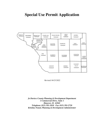
Special Use Permit L HILLVINEGAR HILLTOWNSHIPTOWNSHIPAPPLERIVERTOWNSHIPSCALES PVALLEYTOWNSHIPRevised: 04/25/2022Jo Daviess County Planning & Development Department1 Commercial Drive, Suite 1Hanover, IL 61041Telephone (815) 591-3810 -- Fax (815) 591-2728Kristina Tranel, Planning & Development AdministratorBERREMANTOWNSHIP
Instructions for Special Use ApplicationsBefore You Apply: Talk with the Planning & Development Staff regarding the feasibility of the proposeduse. Is your plan compatible with existing County plans and ordinances? Will yourapplication meet the standards for approval as required under the Zoning Ordinance?What type of requirements and/or restrictions would apply? Are there other local,state or federal agencies that may have jurisdiction? Determine the amount of land you will need to accommodate your plan(s). Don’tunderestimate the amount of land needed. For commercial or industrial uses, youneed to consider land necessary for screening/landscaping/pervious surface, off-streetparking, storm water management facilities, building setback and yard areas, sewagedisposal area(s), etc. For a dwelling, consider setback and yard area requirements,septic system area(s) and well location (100' separation between well and septicsystem absorption field), the size of house being contemplated, and future plans(deck, sunroom, porch, swimming pool, detached garage/storage building, etc.) Investigate the area. Find out if there are existing land uses in the area that may not becompatible with your plans, such as a race track (which may not be in operation whenyou visit the site, but can create considerable noise and traffic on race days), ananimal feeding operation, etc. Even if adjoining land or land in the area is currentlyvacant, find out what the potential uses are. Don’t open yourself up to a surprisedown the road. Check with the appropriate highway authority (IDOT, County Engineer or TownshipRoad Commissioner) to determine if safe access to a public highway or road ispossible. Also, ask the appropriate highway authority about any future roadwayimprovement plans. A major road/highway project could create an inconvenience fora period of time, limit access to your site, or require a portion of your site to be soldfor road/highway purposes, even if you do not wish to sell. Check the Jo Daviess County Soil Survey to determine the general condition of soilson the site and if the soils are compatible with the intended use(s) of the site. Youmay seek assistance in interpreting the Soil Survey from the Jo Daviess County Soil &Water Conservation District. Check the Jo Daviess County, IL Flood Insurance Rate Maps (published by theFederal Emergency Management Agency [FEMA] and maintained at the ZoningDepartment) to determine if the site is located in a FEMA-designated “Special FloodHazard Area”. Flood insurance may be required as a condition of obtaining amortgage if even a portion of the site is located in a “Special Flood Hazard Area”.1
If the site is within 1.5 miles of the boundary of an incorporated city or village andthe city/village has an adopted Plan (“master plan” or “comprehensive plan”), it mayexercise its extra-territorial jurisdiction. Therefore, you should check with thecity/village to determine if your plan(s) are compatible with the city/village plan(s),and if any additional requirements may apply. If subdivision approval is necessary,the city/village may also enforce its subdivision regulations within its 1.5 mile extraterritorial planning area. Make sure that adequate public services (including, but not necessarily limited to fire,ambulance and police protection, schools, water supply and sewage disposal) areavailable or can be reasonably supplied to serve the proposed use(s). Contact the neighbors and let them know your plans. Their feedback can be veryhelpful. They may even know important details about the site that you would nototherwise have known.The Application Process:1) DO YOUR HOMEWORK, using the above as a guide.2) The land area for which the application is being made, unless it is an entire parcel ofrecord, must be defined in a standard, recognizable manner. This is called a “legalland description”. The description can be a “rectangular land description” or a“metes and bounds land description”. An attorney or surveyor can prepare a legaldescription of land. It is not necessary to have an actual physical survey at this time;however, it will be necessary if the application is approved by the County Board. It isimportant that a reasonably accurate legal description be provided and that the legaldescription describes what you want. A “sketch plat” is also helpful, which is simplya graphic representation of a legal description - not a “plat of survey”. When itcomes time for the actual survey, the legal description may change somewhat due tothe accuracy of modern surveying equipment, but any difference(s) should benegligible.3) Complete the required forms provided in the “Special Use Application” packet.Please either type or print legibly.Sign the application form and complete the address, city, state, ZIP code and phonenumber information. The application must be signed by the owner(s) of record of theproperty. In the case of property under purchase contract, the owner(s) of recordmust sign and the contract purchaser or petitioner shall also sign the application assuch purchaser is usually the person who will eventually establish the use proposed.Owner and contract purchaser or petitioner must include both address and phonenumber in petition.Whenever applicable, the following disclosures must be made:2
Pursuant to the Land Trust Beneficial Disclosure Act (765 ILCS 405/et seq), ifproperty involved is listed under a “Trust”, a notarized certification, signed by theTrust Officer, giving names, addresses and percentage of interest of allbeneficiaries, is to be filed with all petitions for rezoning and special use.When the applicant is a corporation, the applicant shall include the correct names,addresses and percent interest of all stockholders or shareholders owning interestin excess of 20% of all outstanding stock of such corporation. If the corporationhas no shareholders, a statement to that effect shall be submitted. When the applicant is a business entity doing business under an assumed name,the application shall include the names and addresses of all true and actual ownersof such business or entity. When the applicant is a partnership, joint venture, syndicate, or an unincorporatedvoluntary association, the application shall include the names and addresses of allpartners, joint ventures, syndicate members, or members of the unincorporatedvoluntary association.4) Provide a Concept Plan that meets the requirements of the “Concept Plan Checklist”.A. Complete the “Concept Plan Checklist” cover sheet.B. Following the example Concept Plan provided in the application packet, prepare aConcept Plan” that meets the size and scale parameters, and contains all of theinformation requested in the checklist. Concept Plans may be prepared bysurveyor/engineer or staff assistance is available upon request in preparing aConcept Plan.TIPS: A plat of survey is the best base map for a Concept Plan. If a plat of surveyis not available, consider having a surveyor prepare a “sketch plat”or contact theGeographical Information Services (GIS) office for a map of your parcel. Ifpreparing a Concept Plan on your home computer using a simplified CADprogram, make sure that your output is at a standard scale and not “fit-to-page”output. If you prepare your Concept Plan by hand, print neatly. Consider typingyour text on a word processor, printing your text on a separate page, cutting thetext out with a technical knife or scissors, and gluing, pasting or taping the text onthe Concept Plan (the “cut-and-paste” technique).Use different line types or widths for property lines, road right-of-way lines orcenter lines, section lines, etc.Have the Planning & Development Administrator review and comment on theConcept Plan before making the required number of copies in case anychanges/additions are required. Remember who you are preparing the Concept3
Plan for and tailor it to their needs (which are what the checklist and exampleConcept Plan are intended to do, if followed). The Concept Plans are sent by thePlanning & Development Department to: the members of the Zoning Board ofAppeals, County Board liaison, the County Health Department, County HighwayDepartment, Geographical Information Services Office, States Attorney’s Office;and, the township planning commission (if any), Community (if within 1 ½miles), road commissioner or Illinois Department of Transportation.5) If the application is to change the use on currently zoned AG-1, complete theapplication form titled “Application for Natural Resource Inventory Report” on theJo Daviess County Soil & Water Conservation District (SWCD) letter head. Take thisapplication directly to the SWCD office (227 N. Main St., Elizabeth IL) along with acopy of the submittal requirements. This report must be procured from the SWCDand submitted with the Map Amendment application to the Planning & DevelopmentDepartment.The Zoning Process:The zoning process involves, typically, two meetings which occur in the following order:1) Zoning Board of Appeals (ZBA).The ZBA conducts public hearings at which any citizen is afforded theopportunity to speak in favor of, in opposition to, or simply comment on anapplication. For more information on the ZBA, please read “Product/Serviceinformation, subdividing and/or rezoning”. The ZBA makes findings of facts anda recommendation to the County Board. Its decision is advisory only and does notconstitute a final, binding decision.2) County Board (final decision).The County Board’s decision is final. Typically, no opportunity for publiccomment is given prior to a decision. However, it is up to the Chairman’sdiscretion.Upon receipt of an application, the Planning & Development Department beginsprocessing of said application and preparing the file. Letters of notification are preparedand sent to all adjoining property owners (certified mail), township officials, countyagencies (health, highway and sheriff), county board members, school district(s), firedistrict(s), and any city or village within 1.5 miles. A public notice is prepared andpublished in a local newspaper at least fifteen (15) days prior to the public hearing withthe Zoning Board of Appeals. A Staff Report is completed prior to the meeting of theZBA. From the time of filing to a decision of the County Board usually takes about twomonths. However, in some cases the ZBA may continue the hearing to another date, orthe County Board may refer the case back to the ZBA for further hearing, which wouldprolong a decision.4
Note: It is solely the responsibility of the applicants to make sure that allinformation submitted, including the legal and general description of the property,is accurate as the information will be used for publication of the legal noticerequired by statute and ordinance. The County of Jo Daviess disclaims allresponsibility if any of the information submitted by the applicants is inaccurate orin error. The required filing fee must accompany the request. Regardless of the finalaction, all fees are non-refundable.Note: It is the sole responsibility of the applicant to provide a complete submittalpackage at time of submission. (If petitioner submits additional information eitherby their own accord or by the direction of the Planning & DevelopmentAdministrator or Zoning Board of Appeals, then the additional information must besubmitted no later than five (5) business days prior to the Zoning Board meeting towhich they will be appearing.)5
APPLICATION FOR SPECIAL USE PERMITOwner (All beneficiaries if property is held in a land trust. All stockholders holding over 20% ofthe stock if owner is a corporation.)Name:Address: City: State: Zip:Phone: Email:Petitioner if other than Owner:Name:Address: City: State: Zip:Phone: Email:Contract Purchaser or developer if other than Owner:Name:Address: City: State: Zip:Phone: Email:Subject Property:PIN: 43- - - -1. Common address:2. Describe location:3. Acreage or dimensions:4. Brief legal description:5. Attach legal and site plan/aerial photo/preliminary plat if subdividing/other submissions.6
6. Describe use requested:7. Describe facilities that have been/will be provided for the subject use:8. Describe possible effects on surrounding properties and action to be taken to lesson saideffects:I hereby swear that the information given herein is true and igned and sworn to before me this day of .Notary Public*Submit evidence of Title (Deed or Title Insurance Policy).- 1 Copy* Submit photos/site plan if appropriate. - Sixteen (16) Copies*Please Submit sixteen (16) Copies of the application and any supporting documents7
CONSENT TO ON-SITE INSPECTIONYour petitioner(s), , respectfully represent to the PlanningName(s)Commission of Jo Daviess County, as follows:That , are the owners of record of the real estateOwners Name(s)which is the subject of this petition and more commonly known asAddressCityTownshipThat the Petitioners are requesting a Public Hearing for the subject property.That the petitioners of the described real estate do hereby freely and voluntarilyconsent to inspection of the site of the parcel in question for purposes of determining theappropriateness of the pending proposed zoning petition by the Jo Daviess CountyPlanning Commission and hereby release such persons from any liability based in wholeor in part on the inspection of the parcel in question.That in exchange for the above actions by the Petitioner(s), Jo Daviess Countyagrees that at least one (1) member of the Planning Commission will inspect the parcel inquestion prior to considering the evidence presented upon the above petition.(Owner) Signature(Owner) SignatureSUBSCRIBED and SWORN to before methis day of , 20 .NOTARY PUBLIC8
LIVESTOCK AFFIDAVITState of Illinois))County of Jo Daviess )RE:after being first dulysworn on oath depose(s) and say(s):I (We) hereby certify that to the best of my (our) knowledge, the site that is subject of the aboveapplication is not within one-quarter mile (1,320') of a “livestock management facility and/orlivestock waste handling facility” with more than fifty (50) animal units pursuant to the IllinoisLivestock Management Facilities Act.AffiantAffiantAcknowledgmentState of Illinois))County of Jo Daviess )I, , Notary Public in and for the State and County aforesaid, dohereby certify that , ,personally known to me to be the same person(s) whose name(s) are subscribed to the foregoingaffidavit, appeared before me this day in person and signed and delivered the said affidavit for theuses and purposes therein set forth as his or their free and voluntary act.Giver under my hand and notarial seal this Day of , 20 .Notary Public(Seal)9My Commission Expires
Jo Daviess County Planning & DevelopmentKristina Tranel, Planning & Development Administrator1 Commercial Drive Suite 1Telephone: (815) 591-3507 or (815) 591-3810Email: buildingandzoning@jodaviess.orgHanover, IL 61041Fax: (815) 591-2728Website: www.jodaviess.orgCONCEPT PLAN CHECKLISTProject Name (if applicable):Parcel Identification Number(s):Location (1/4 Section, Township, Range):Current Zoning:Proposed uthorized Agent:Address/City/State/Zip/Telephone ne #:Sixteen (16) copies of a “Concept Plan” must be submitted. The “Concept Plan” must beclearly labeled as such and may be any scale so long as the scale is an increment of tenfeet (10') or one hundred feet (100'), shall be on a not larger than 30" x 36" sheet, foldedto approximately nine inches by twelve inches (9" x 12") and shall contain the followinginformation: The boundary and dimensions of the site. Existing interior and adjacent road/street rights-of-way, railroad rights-of-way, and/oreasements of any kind. Existing structures on the site10
Existing and proposed zoning of subject property. A note describing the proposed use of the site. Existing land use(s). Areas shown on the Jo Daviess County, Illinois Flood Insurance Rate Maps asbeing in “Zone A” or “Zone AE”. Low areas subject to occasional over-flow flooding, sheet flooding or ponding. Wetlands (refer to the U.S.D.A. Preliminary Wetlands Inventory available fromthe Jo Daviess County Field Office of the U.S.D.A., Natural Resources ConservationService). General surface water drainage patterns, drainage divides, and high and low elevationsites. Names of adjacent subdivisions and owners of adjacent property. Zoning on adjacent property. A notation indicating whether or not the site is located within 1.5 miles of anincorporated city or village. Any political boundaries on or adjacent to the subject site (i.e. corporate, township,school district, etc. boundaries) and a list of all known taxing districts the parcel fallsunder. Parks, preserves and/or public open spaces within 200 feet of the site. Any proposed dedications/reservations for open space, natural area, historicbuilding(s)/structure(s), and storm water management facilities. Proposed sketch layout of roads/streets (with right-of-way widths). Proposal for water source and sewage disposal.The “Concept Plan” shall be accompanied by the following supportingdocuments/information: Evidence of ownership, or proof of legal interest in, the subject property. Natural Resource Inventory Report from the Jo Daviess County Soil & WaterConservation District, if applicable. (1 hard copy & electronic copy emailed to us)11
A completed “Concept Plan Checklist”. A completed map amendment or special use permit application. (16 copies) Legal Description – complete legal description applying only to the parcel beingzoned. Application Fee Any other information requested by the Zoning Officer.I, , certify that all informationpresented herewith is complete and accurate.Signature of Applicant DateNotice to Applicants:The intent of the “Concept Plan” is to provide information to help both the applicant andthe Jo Daviess County review agencies/decision makers evaluate the feasibility of aproposed land use change according to development plans, policies, existing andprojected development activities, and zoning and/or subdivision regulations.The “Concept Plan” should encourage the discussion of basic problems and questionsrelated to the proposed land use change prior to approval and expenditure of funds fordetailed development plans by the applicant.The information required of a “Concept Plan” is such that applicants may prepare a“Concept Plan” at little or no cost. If technical assistance is needed by an applicant inpreparing a “Concept Plan”, an applicant may also choose to have a “Concept Plan”prepared by a surveyor, engineer, land planner or architect.12
(Purposely left blank)13
TO: Applicants for a "map amendment" (change of zoning) or Special UsePermit FROM: Eric Tison, Jo Daviess County Plat OfficerRE: Subdivision plat approval processPlease be advised that any property split/land division may be subject to the requirements of the Plat Act(765 ILCS 205/0.01 et seq.) and the Jo Daviess County Land Subdivision Regulations (Chapter 12,Article 2 of the Jo Daviess County Code).Please take notice and be aware that zoning approval is not a subdivision plat approval, and a"Concept Plan" or Plat of Survey is not a subdivision plat. Subdivision plat approval is a requiredprocess that is separate from zoning approval. An application for plat approval may, however, runconcurrently with a map amendment application, but most persons wish to make sure that the zoningchange will be approved prior to expenditure of funds for a preliminary subdivision plat.The following defines a subdivision, as well as what land/deed divisions are exempt:SUBDIVISION: The partitioning or dividing of a parcel or tract of land by the subdivider thereof or by hisheirs, executors, administrators, or legal representation, any of which is less than five (5) acres in area. Theprovisions of this Act (Ordinance) shall not apply and no subdivision is required in any of the followinginstances:A. The division or subdivision of land into parcels or tracts of five (5) acres or more in size whichdoes not involve any new streets or easements of access;B. The division of lots or blocks of less than one (1) acre in any recorded subdivision which does notinvolve any new streets or easements of access;C. The sale or exchange of parcels of land between owners of adjoining and contiguous land;D. The conveyance of parcels of land or interests therein for use as a right-of-way for railroads orother public utility facilities and other pipe lines which does not involve any new streets oreasement of access;E. The conveyance of land owned by a railroad or other public utility which does not involve anynew streets or easements of access;F. The conveyance of land for highway or other public purposes or grants or conveyances relating tothe dedication of land for public use or instruments relating to the vacation of land impressed witha public use;G. Conveyances made to correct descriptions in prior conveyances;H. The sale or exchange of parcels or tracts of land following the division into no more than two (2)parts of a particular parcel or tract of land existing on July 17, 1959 and not involving any newstreets or easements of access;I. The sale of a single lot of less than five (5) acres from a larger tract when a survey is made by aregistered surveyor; provided, that this exemption shall not apply to the sale of any subsequent lotsfrom the same larger tract of land as determined by the dimensions and configuration of the largertract on October 1, 1973, and provided also that this exemption does not invalidate any localrequirements applicable to the subdivision of land.Any questions relating to any of the above may be directed to:Kristina Tranel, Jo Daviess County Plat OfficerJo Daviess County Planning & Development Department1 Commercial Drive Suite 1, Hanover IL 6104114815-591-3810buildingandzoning@jodaviess.org
Jo Daviess County Planning & DevelopmentKristina Tranel, Planning & Development Administrator1 Commercial Drive Suite 1Telephone: (815) 591-3507 or (815) 591-3810Email: buildingandzoning@jodaviess.orgHanover, IL 61041Fax: (815) 591-2728Website: www.jodaviess.orgFee ScheduleZONINGLESAWhen done outside of arezoning request -------------------------------------------------- 50.00Special Use Permits:Per request ------- 500.00Subdivision:0-10 Acres ------ 500.0011-20 Acres ----- 750.00Over 20 Acres (each additional acre) ------------------------ 20.00ACTION TO CORRECT A VIOLATIONWhen any action is taken to correct a violation of any kind the fee will be increased by 50%.Special Use Permits:Per request ------- 750.00Subdivision:0-10 Acres ------ 750.0011-20 Acres ----- 1125.00Over 20 Acres (each additional acre) ------------------------ 30.00The Jo Daviess County Planning & Development Fee schedule can be viewed in itsentirety by visiting our website www.jodaviess.org or a copy may be requested.15
Article 2d: Special Uses8-2d-1 Definition:Special uses may include, but are not limited to, public and quasi-public uses affectingthe public interest; uses that have a unique, special, or unusual impact upon the use orenjoyment of neighboring property; and uses that affect planned development. A use maybe permitted in one or more zoning districts and may be a special use in one or moreother zoning districts.8-2d-2 Notice:A special use may be granted only after a public hearing conducted by the Board ofAppeals. There must be at least fifteen (15) days notice before the hearing. The noticemust include the time, place, and date of the hearing and must be published in anewspaper published in the township or road district where the property is located. Ifthere is no newspaper published in the township or road district where the property islocated, the notice must be published in a newspaper of general circulation in the county.The petitioner or applicant must pay the cost of the publication of the notice required bythis Section. The notice must also contain:A.the particular location of the property for which the special use is requested bylegal description and by street address, or if there is no street address, by locatingthe property with reference to any well-known landmark, highway, road,thoroughfare, or intersection;B.whether the petitioner or applicant is acting for himself or herself or as an agent,alter ego, or representative of a principal and the name and address of theprincipal;C.whether the petitioner or applicant is a corporation, and if so, the correct namesand addresses of all officers and directors of the corporation and of allstockholders or shareholders owning any interest in excess of 20% of all of theoutstanding stock or shares of the corporation;D.whether the petitioner or applicant, or his or her principal, is a business or entitydoing business under an assumed name, and if so, the name and residence of allactual owners of the business or entity;E.whether the petitioner or applicant, or his or her principal, is a partnership, jointventure, syndicate, or an unincorporated voluntary association, and if so, thenames and addresses of all partners or members of the partnership, joint venture,syndicate, or unincorporated voluntary association; andF.a brief statement of the proposed special use8-2d-3 Additional Notice:In addition to any other notice required by this Section, the Board of Appeals must giveat least fifteen (15) days notice before the hearing to:A.any municipality whose boundaries are within one and one-half (1 ½) miles ofany part of the property proposed as a special use andB.the owner or owners of any land adjacent to or immediately across any street,alley or public right-of-way from the property proposed as a special use.16
8-2d-4 Necessity to Meet StandardsA special use may be granted only upon evidence that the special use meets the standardsestablished for that classification in the ordinance. The special use may be subject toconditions reasonably necessary to meet those standards. In addition to any standards orconditions that may be applicable to a specific special use, the following generalstandards shall apply to all special uses;A.The establishment, maintenance or operation of the special use will not bedetrimental to or endanger the public health, safety, or general welfareB.That the special use will not be injurious to the use and enjoyment of otherproperty in the immediate vicinity for the purposes already permitted orsubstantially diminish and impair values within the neighborhoodC.That the establishment of the special use will not impede the normal and orderlydevelopment and improvement of surrounding property for uses permitted in thedistrictD.That adequate utilities, access roads, drainage, and/or other necessary facilitieshave been or are being providedE.That adequate measures have been or will be taken to provide ingress and egressdesignated to minimize traffic congestion in public streets8-2d-5 Additional ComplianceThat the special use shall in all other respects conform to the applicable regulations of thedistrict in which it is located. In addition, the Special Use shall meet any applicablestandards set forth in this ordinance which specify additional standards to that specificspecial use as defined in this ordinance.8-2d-6 Action by the Zoning Board of Appeals and County BoardThe Board of Appeals shall report to the County Board a finding of fact and arecommendation as to whether the County Board should deny, grant, or grant subject toconditions the special use. The County Board may, by ordinance and without a furtherpublic hearing, adopt any proposed special use on receiving the report, deny the requestfor special use, or it may refer the proposal back to the Board of Appeals for furtherconsideration.8-2d-7 Duration of the Special Use PermitNo ordinance granting a special use permit shall be valid for a period longer than one (1)year from the date of such ordinance unless the erection of a building or structure isstarted or the use is commenced within such a period, unless such time period is extendedthrough appeal to and approval by the Zoning Board of Appeals. If no appeal is made, orno extension of time is received or granted, the permit shall immediately terminate uponexpiration of the one (1) year period. Upon granting of a special use permit, the CountyBoard may stipulate a period longer than one (1) year to commen
2) The land area for which the application is being made, unless it is an entire parcel of record, must be defined in a standard, recognizable manner. This is called a "legal land description". The description can be a "rectangular land description" or a "metes and bounds land description". An attorney or surveyor can prepare a legal